Find A Trail. Start Your Search Here:

Tuesday, May 16, 2023

Big Bang Trail

BIG BANG TRAIL

San Francisco Peaks seen from Big Bang Trail

Being loved to death is a slow and complicated process. Whether self-inflicted or enabler enriched, initially, it feels good. But before long, the halo wears off and reality pitches a swift, hard slap. It’s kind of like scarfing down tacos five nights a week only to wake up one morning “surprised” with a love handle hangover.

The first mile of Big Bang Trail is easy

Swapping out tacos for unauthorized trail building, this is a good  analogy for what has been happening in Flagstaff’s Mount Elden/Dry Lake Hills (MEDL) area for decades.
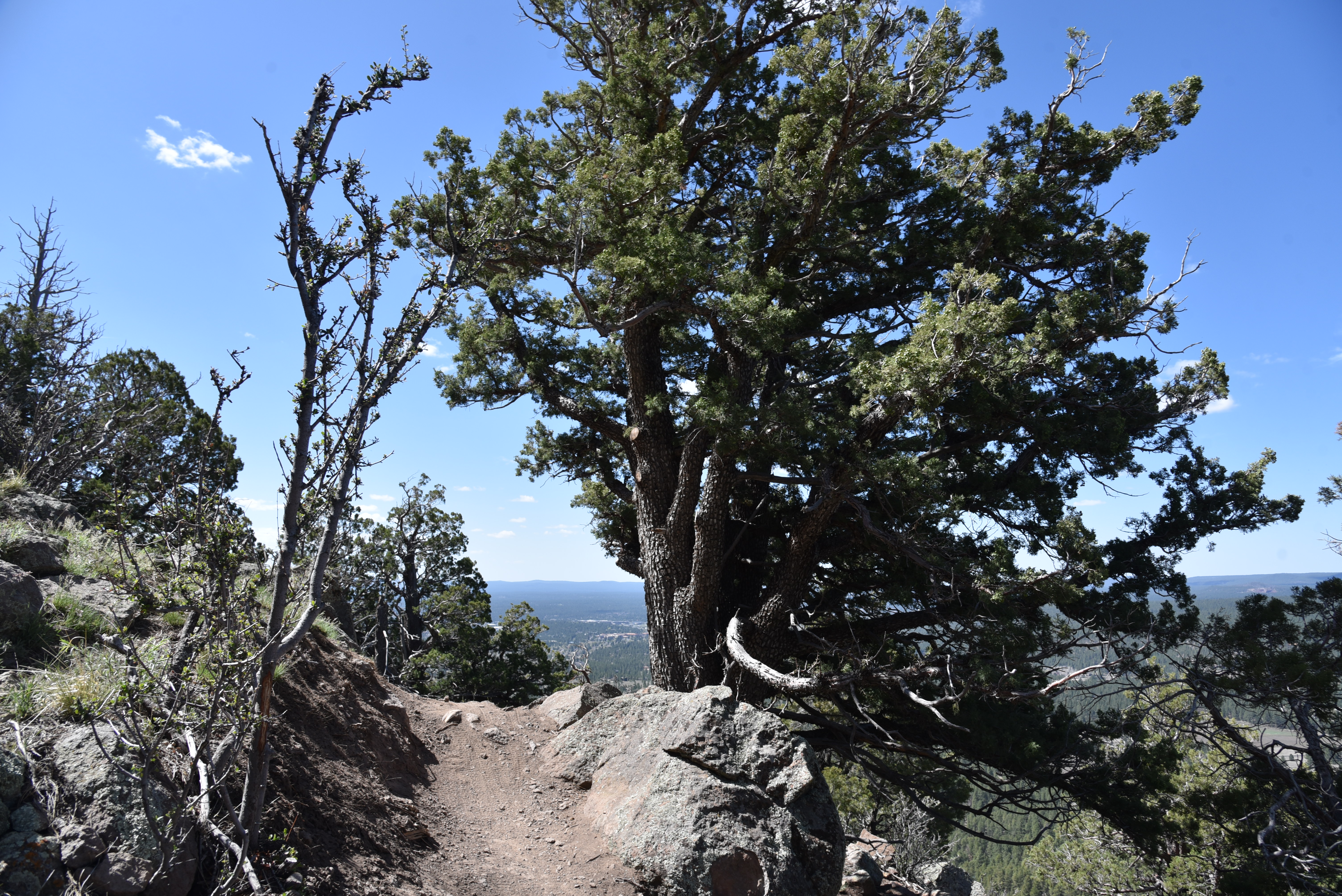
An alligator juniper anchors a bend in Big Bang Trail

While it might feel good to buck the system and blaze user-created paths, they cause environmental damage, disrupt wildlife and can lead to trail users getting lost or injured. This should come as no surprise to any outdoor enthusiast. While the slap has been stinging for quite some time, it’s only been in the last few years that efforts to rehabilitate the popular recreation area have  materialized.
Schultz Creek flows near the trailhead

The MEDL trail system, which includes popular old-standards like Brookbank, Sunset, Oldham and a segment of the Arizona National Scenic Trail, was originally dedicated in 1987.

Wing Mountain and Kendrick Peak on horizon

Because of its proximity to town, multiple access points and scenic qualities, the MEDL area in Coconino National Forest suffered from deteriorating conditions due to overuse, a confusing maze of unauthorized “social or wildcat” trails and recent human-caused wildfires.  The negative impacts on natural resources were palpable. Now, a joint effort between the forest service and local outdoor organizations is taking action to mitigate the damage, disperse pressure off the old standards and improve sustainability in the area.

Much of the trail hugs exposed edges

One of the first of the new breed of routes to be completed is the Big Bang Trail.

Creeping barberry blooms April - June

The 4.4-mile singletrack is outstanding not only for its smart design but also for its panoramic vistas, oscillating levels of difficulty and variety of terrain.  The serpentine path climbs over 1,200 feet along the natural contours of the Dry Lake Hills northeast of 9,299-foot Mount Elden.  
Mount Elden seen from Big Bang Trail

The trail may be accessed from the Schultz Creek trailhead by following the Rocky Ridge Trail (also part of the Arizona National Scenic Trail)  0.2-mile to the signed junction. The first mile takes it easy, twisting among Ponderosa pines, alligator junipers and oaks with glimpses of 8,578-foot Wing Mountain standing out to the west.  Spots of damage from the 2010 Schultz Fire and the 2022 Pipeline Fire are evident along the way as are slash piles and other signs of restoration efforts.
Boulders line a section of the Big Bang Trail

Where the route makes a northeast bend, views of the San Francisco Peaks  that soar to over 12,000 feet, break through the cover of a mixed-conifer forest. Right about where the mountains views show up, the trail becomes moderate in difficulty, dodging boulders with hairpin turns.
Fendler rose scent the trail June - August

 
Next, the route takes on a more aggressive, edgy ascent along stony cliffs with steep drop offs overlooking Flagstaff.  As the coniferous forest thins and gradually morphs into a drier, more exposed mountain clime. Views of 10,428-foot Kendrick Peak pop out on the northwest horizon and Sedona’s 7,122-foot Wilson Mountain can be seen to the south.  
Flagstaff visible below the Big Bang Trail

Right around where it meets the 8,000-foot point, the trail bends north among sun-loving cliff-rose shrubs, yucca, and scrub oak, hitting its highest point and concluding the major climbing before winding through woodlands and meadows to its terminus at the Brookbank Trail.  
Big Bang spins off the Rocky Ridge Trail

If the Big Bang Trail is any indication of what’s in store for MEDL as trail realignments, and more connectivity roll out, hikers, bikers and equestrians can look forward to a greatly improved recreational experience. And if trail users heed the slap and stick to designated trails instead of disrupting natural resources, this environmentally-sound system will last for generations.
Mixed conifir forests frame the San Francisco Peaks

LENGTH: 9.2 miles roundtrip/out-and-back

RATING: moderate-difficult

ELEVATION: 7,147 – 8,404 feet

GETTING THERE:

Schultz Pass Trailhead:

In Flagstaff, go 3 miles north on U.S. 180 (Humphreys Street) and turn right on to Schultz Pass Road (Forest Road 420). Continue 0.5-mile on FR 420 and make a hard left at the Elden Look Road (Forest Road 577) and go another half-mile to the  parking area on the right.

There are no fees or facilities at the trailhead.

2023 ROAD CLOSURES:

During 2023, the Schultz Creek restoration project, which will mitigate damage to the Schultz Creek watershed caused by the 2022 Pipeline Fire, will result in temporary road and trail closures in the area. During construction, Schultz Pass Road beyond the Coconino National Forest boundary will be closed to motorized vehicles, but will remain open to hikers, bikers and equestrians. There’s limited parking at the forest boundary located a few yards south of the Schultz Creek trailhead, and more parking at the “Schultz Y” at the corner of Schultz Pass Road and Elden Lookout Road.  Phase 1 will begin on May 22 and run through June. Phase 2 will happen in late 2023.

FOR NEWS & UPDATES:

https://www.fs.usda.gov/detail/coconino/news-events/?cid=FSEPRD1106239

Monday, May 8, 2023

Higher Learning-Extra Credit Loop

HIGHER LEARNING-EXTRA CREDIT LOOP

Blowout Wash Trail System is well signed

Situated in the foothills below Mingus Mountain a couple of miles south of the Town of Cottonwood, The Blowout Wash Recreation Area trail system offers an airier alternative to crowded Sedona-area hike destinations. 

Yucca bloom on the Extra Credit Trail

The 15+-mile system in Prescott National Forest is made up of flowing singletrack loops that are easy to customize for both challenging day hikes and easy strolls. 
View of Mingus Mountain from Bullseye Trail

The loops run through a scenic mix of  high desert terrain. 
Barestem larkspur bloom March - May

The varied terrain and microclimates of water-scoured washes, a chiseled stone-walled canyon, edgy ridgelines and high desert grasslands are the backbone and soul of this always entertaining non-motorized maze.  An excellent, moderate-rated introduction to the area links up four trails for a tour of some of the system’s sweet high point vistas. 
Desert Four O'Clock bloom April - September

Beginning at the main trailhead along Forest Road 493, the loop begins with a 0.2-mile walk on Blowout Canyon Trail. 
Trail cut visible on knoll from Higher Learning

Right out of the chute, the hike delivers amazing 360-degree vistas, dominated by 7,818-foot Mingus Mountain in the west and the sprawling Verde Valley to the north. 
Thistle frame a view on Extra Credit Trail

The route then veers right onto the Bullseye Trail where it begins a leisurely mile-long climb through a corrugated landscape dotted with junipers, common hop trees, velvet ash, yucca and cacti.
View of Sedona Red Rocks from Bullseye Trail

At 1.2 miles, the circuit connects with the Higher Learning Trail. 
Bear grass on the Higher Learning Trail

This segment offers the best views of Sedona Red Rocks, the twisting, green channel of Oak Creek and the geometric layout of vineyards in the valley below.
Strawberry hedgehog cactus bloom March - May

But the views are temporarily swallowed up where the trail slides into a minor canyon before swinging back uphill.
Silverleaf nightshade bloom April - November

Higher Learning Trail ascends a ridgeline

The hike encounters a breezy lookout point at the Extra Credit Trail junction-- a treeless ridgeline with a fringe of yucca and prickly pear cactus anchoring an expansive grassland flush with wildflowers like Barestem larkspur, sego lilies, Four O'Clock, antelope horns, tufted evening primrose, silverleaf nightshade, thistle, prickly poppies, Blackfoot daisies, scarlet beeblossom and miniature wool star--to name a few. 
Range ratany shrubs bloom April - October

At the junction, hikers may opt for a longer, 6.7-mile loop by continuing straight ahead, or a 4.9-mile-miler by turning left at the sign. Either way, Higher Leaning reconnects with the Extra Credit Trail that makes an easy, half-mile descent to reconnect with the Blowout Canyon Trail.
Scarlet beeblossom bloom April - September

Along the Blowout Canyon segment, peeks at the steep-walled, eponymous canyon and an impressive community of ocotillo and blooming cactus enter the fray.
A short trail climbs Blowout Butte

Over this half-mile leg, distant mountain peaks hover over the southern horizon while flowering shrubs like range ratany vie for attention underfoot.  Back at the Bullseye Trail junction, the route doubles back to the trailhead where a colorful map kiosk shows the entire trails system layout and more ways to enjoy the quieter side of Verde Valley hiking. 
Blowout Wash trailhead

Wing-like seeds on a common hoptree


LENGTH:

Short Loop: 4.9 miles

Long Loop:  6.7 miles

RATING:

Short Loop: moderate

Long Loop: moderate

ELEVATION:

Short Loop:  3,806 – 4,318 feet (926 feet of accumulated elevation change)

Long Loop: 3,806 - 4,675 feet. (1,129 feet of accumulated elevation change)

GETTING THERE:

From Interstate 17 north of Camp Verde, take the Cornville Road/County Road 30 exit 293. Continue 17.7 miles west on Cornville Road, which will turn into Mingus Avenue and then Forest Road 493, to the Blowout Wash Recreation Area trailhead on the right. For reference, the trailhead is 1.5 miles south of the Cottonwood airport. Roads are paved except for a short section of rough dirt that’s suitable for all vehicles.There are no fees or facilities at the trailhead.

INFO:

Prescott National Forest

https://www.fs.usda.gov/recarea/prescott/recreation/recarea/?recid=84363&actid=50

Tuesday, May 2, 2023

Black Mountain Canyon

BLACK MOUNTAIN CANYON

Parsons Tank on FR 9243B in Prescott NF

It’s just 582 feet downhill from the paved byway of State Route 260 to the rocky course of Black Mountain Canyon but hiking the dirt back road to get to get to it is deceptively more complicated. Located in a hilly section of the Upper Verde River Volcanic Field in Yavapai County 15 miles east of Camp Verde, Forest Road 9243B cuts through dramatic terrain with a backstory of lava flows, ash deposits, water-scoured canyons and countless geological disruptions. 

The rocky course of Black Mountain Canyon

The rough two track heads north from a dirt pull out along SR 260 in Prescott National Forest on a roller coaster style course that challenges hiking legs with over 1,000 feet of elevation change and delights the eyes.
Bill Williams Mountain on far right horizon

Cliff-rose bloom April - September

The sparsely shaded road wastes no time delivering outstanding vistas and a tour of the area’s diverse eco-zones.  The trailhead is bolstered by two volcanic land forms one being Thirteenmile Rock Butte (5,515 feet) a prominent basalt-topped formation that served as a waypoint on the historic 200-mile General Crook Trail built in the 1800s to connect a chain of military forts that ran from Eastern Arizona along the Mogollon Rim to the Prescott area.
Yucca bloom April - July

 
FR 9243B goes between two volcanic buttes

The other geological standout is an unnamed 5,283-foot volcanic pinnacle with a broken east flank that exposes a base of red and black cinders. Forest Road 9243B begins with a run right between the two stony massifs.
Exposed red cinders tumble from a volcanic butte

Open to off-road vehicles, hikers, bikers and equestrians, the road is a scenic destination for any type of travel, although, the many details along its course are best observed on foot.
Velvet ash trees line the road near Black Mtn Canyon

 
Within the first quarter mile, the road hits a high point overlooking the Verde Valley. On clear days, the distant silhouette of Bill Williams Mountain near the City of Williams can be seen standing over green valleys and red rocks on the northwest horizon.  
Rabbit thorn blooms April - June

The route then makes the first of several dips-and-climbs passing by the exposed cider pit before rounding uphill again for another big vista moment before it begins an undulating downhill spiral. 
FR9243B traces the edge of Black Mountain Canyon

At the 0.8-mile point, the route continues straight ahead where an unmarked dirt road (FR9243C) veers to the left.  Vegetation along the first mile is of the typical high desert variety.  Yucca, junipers, rabbit thorn, cliff-rose, scrub oak, skunk bush and cacti dominate the landscape with an understory of primrose, lupines, lilies, wild carrot and other wildflowers coloring the loose cinder-strewn substrate.
Thirteenmile Rock Butte

Following a steep downhill section, the water of Parsons Tank comes into view in a juniper-ringed depression.

Verde Valley view from FR 9243B

The road swings around the tiny pool where the footprints of skunk, bobcats, deer and raccoons signal the importance of this created waterhole to wildlife. Yet another uphill section lands hikers at a gorgeous vista point above the final descent to Black Mountain Canyon.
Delicate American carrot bloom March - May

Verde Valley viewed from Parsons Tank

On the last edgy plunge, vegetation gradually changes from desert to riparian with ash trees and fruit-bearing shrubs entering the mix. 
Pursh plantain bloom February - July

The road meets the canyon bottom at the 2-mile point.  Marked by a tree-lined boulder crossing, the major drainage makes for a good turnaround point. But the hike may be extended on a maze of dirt roads shown on the Prescott National Forest map.
Strawberry hedgehog cactus bloom Mar - May

LENGTH: 4 miles round trip

RATING: moderate

ELEVATION: 4,374 – 4,956 feet (1,077 feet of accumulated elevation change)

GETTING THERE:

From Interstate 17 in Camp Verde, take the State Route 260 exit 287 and continue 15.7 miles east (toward Payson) to Forest Road 9243B on the left just past milepost 234. Pass the gate (close it behind you) and park in the turn outs along the road.

INFO:

https://visitcampverde.com/general-crook-trail/

Monday, April 24, 2023

White Spar Loop Trails

WHITE SPAR LOOP TRAILS

Apple Blossom trail crosses Banning Creek

In the gullies and hills of the Granite Creek watershed northwest of the Goldwater Lakes, a maze of short, interconnected trails offer access to a diverse pocket of Prescott National Forest.  

Banning Creek Trail

Pine forests, riparian corridors, historic relics, and a strangely out-of-place garden of fruit trees contribute to a continual sting of eye candy in the Central Arizona hike hub.
Water pools in Banning Creek

Collectively known as the White Spar Loop Trails, the shaded singletracks may be explored by way of the White Spar Campground located just a couple of miles south of Prescott’s historic Whiskey Row.
Apple blossoms on April 21, 2023.

Well signed and maintained, the loops are a mash up of newer trails and old standards that also link up with the 50-mile, city-circumnavigating Prescott Circle Trail.  While there are dozens of ways to use the White Spar Loops to cobble together a day hike or backpack trek, a short circuit using the Goldwater Lake #396, Banning Creek #81 (the old standards), Apple Blossom #373 and Twist & Shout #372 (new kids on the block) trails is a perfect introduction to the area’s many faces.
Tall pines on Goldwater Lake Trail

From the dirt trailhead parking lot before the campground entrance, the circuit begins with a 1.5-mile walk on Goldwater Lake #396. This leg climbs easily through stands of Ponderosa pine, alligator junipers and oaks passing by the Hidden Valley trail junction.  

Old water pipeline on Banning Creek Trail

The hike hits its highest elevation (5,920 feet) at the one-mile point, where nice views of iconic Thumb Butte and Granite Mountain peek through coniferous tree cover.  The route then begins a gradual, half-mile  descent to the course of Banning Creek. 
White Spar Loops are well-signed & maintained

The Banning Creek trail #81 junction can be a little confusing. Hikers may head left (north) and follow the wide dirt road that traces the creek’s west banks or go right at the “81” sign and slingshot around to get on the east bank trail. Either way, the two options converge less than a half-mile north where the creek crosses the dirt road.
Golden currant blooms along Granite Creek

Adding notes of history to the hike, an old, elevated water pipeline—a relic of  early 20th century water supply technology-- can be seen following the course of the creek. 
Goldwater Lake Trail is part of the Prescott Circle Trail

Vegetation along this watery leg includes classic riparian species like willows, cottonwoods, boxelder, and golden currant shrubs growing in mucky shallows and boulder-bound bends. At the 2.2-mile point, the route heads left onto Apple Blossom trail #373 among magnificent cottonwoods that stand along a trickling creek crossing.  Within a few yards, the trail comes to another junction where it veers right to meet the eponymous apple blossoms. 
Common mullein is a familiar plant along the trails

Several small, spindly fruit trees line the trail, looking sort of lost among towering pines.  In spring, creamy flowers scent the air and attract pollinators.  Beyond the blooming trees, the route continues straight ahead and uphill the somewhat befuddling  #373/#374 junction.  Now back in pine-oak woodlands, the trail passes by a forested subdivision before meeting the Twist & Shout  trail #372 junction for the loop’s final leg.  
Granite Mountain seen from Goldwater Lake Trail

True to its name, the path winds among oak canopies, making hairpin turns around ravines before rejoining Goldwater Lake trail for the return trip to the trailhead.

LENGTH:  3.7 miles

RATING: moderate

ELEVATION: 5,517 – 5,920 feet

GETTING THERE:

From Courthouse Square in historic downtown Prescott, go 2.8 miles south on Montezuma Street (U.S. 89/White Spar Road) and turn left into the White Spar Campground.  Trailhead parking in on the right before entering the campground. No fee or facilities.

INFO:

Prescott National Forest, Bradshaw Ranger District

https://www.fs.usda.gov/recarea/prescott/recreation/recarea/?recid=75171