Find A Trail. Start Your Search Here:

Monday, April 11, 2022

Forest Road 502 to East Verde River

FOREST ROAD 502 to EAST VERDE RIVER

A calm bend in the East Verde River near Payson

From sweeping mountain vistas, to rolling, juniper-dotted rangeland and a leafy river canyon, a walk along Forest Road 502 delivers a packed agenda over its short, hilly course. 

View of North Peak from FR 502

Adopted by the Tonto Recreation Alliance, a non-profit, volunteer partner of Tonto National Forest that works to keep hundreds of miles of forest trails open and maintained for motorized off-road use, the dirt two-track a few miles west of downtown Payson offers a quick, lightly trafficked route to the East Verde River.
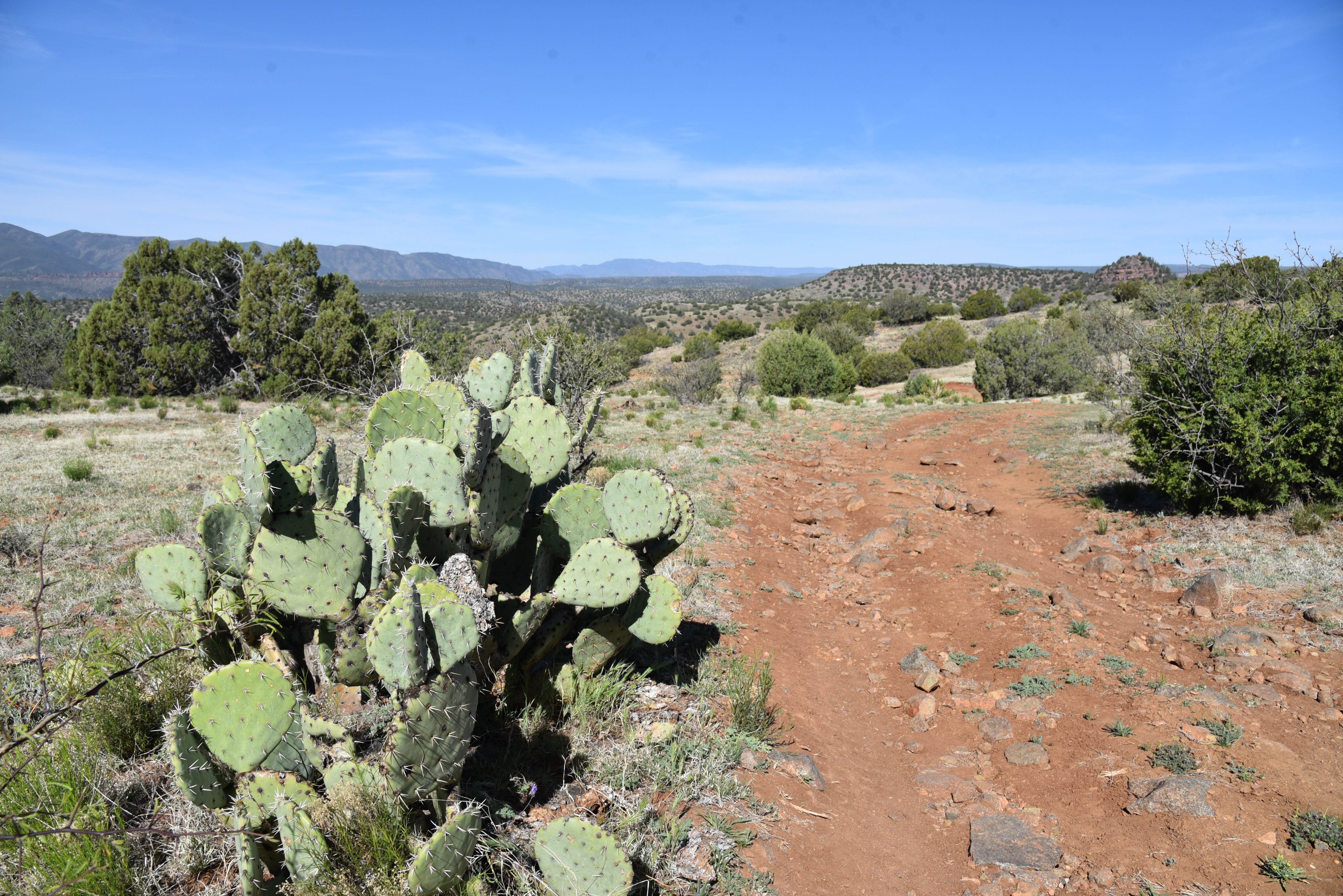
High desert valley vistas abound on FR 502

Sego lilies bloom Apr - July

Located a few miles south of Tonto Natural Bridge State Park east of Pine Creek, the road, which is open to hikers, equestrians and OHV use is a sweet find for those who appreciate a simple trek peppered with many points of visual interest.
You might encounter livestock on FR 502


From a dirt pull out along Doll Baby Ranch Road, the hike begins by passing through a barbed wire gate (close it behind you) where visitors are immediately smacked with breathtaking views of  Mazatzal Wilderness peaks including 7,449-foot North Peak, the northernmost  prominent peak in the Mazatzal Range.

Goodding's verbena blooms Feb - Oct

Barberry shrubs bloom Feb- May

The road veers left at an unsigned fork at the 0.1-mile point. After that, all junctions are signed “502”.  As the road makes an easy push through sunny juniper-pinon open range, views of a landscape rife with landforms with imagination-stoking names like Polles Mesa, Whiterock Mesa, White Hills, Horsethief Bench, Limestone Hills and Pilot Knob roll out in all directions.
Milkvetch is a common spring bloomer

Majestic land forms all around.

The largely unshaded route is flanked by a fringe of flowering shrubs, yucca and a colorful understory of classic high-desert wildflowers including delicate sego lilies, purple Goodding’s verbena, milkvetch, Blackfoot daisies and flame-red paintbrush. 

Velvet ash trees huddle around East Verde River

At just over the one-mile point, the road begins a series of gradual ups-and-downs that land hikers at the East Verde River. The final,  descent into the river canyon is somewhat rocky and steeper, but not too difficult.
Paintbrush bloom Mar - Sep

The road meets the water at 1.8 miles where hikers may explore along the rocky banks and spindly velvet ash trees to spy trout swimming in deep pools.
Trailhead on Doll Baby Ranch Road

Road ups and downs total over 780 feet in elevation change

While the river makes for a good turnaround point, hikers may consult the Tonto Recreation Alliance downloadable maps to extend the trip by way of several connecting roads.
Blackfoot daisies bloom Mar- Dec


LENGTH: 3.6 miles roundtrip (to the river and back)

RATING: moderate

ELEVATION: 3,717 – 4,058 feet (781 feet of accumulated elevation change)

GETTING THERE:

From State Route 87 in downtown Payson, go 6.3 miles west (go left at the light) on Main Street which will turn into Country Club Road and then Doll Baby Ranch Road (FR 406) to the trailhead on the right.  Park in the dirt turn outs by the gate and the “502” sign.

INFO & MAPS:

Tonto Recreation Alliance

tralaz.org


Tuesday, April 5, 2022

Black Canyon Trail: Windmill Valley Segment

BLACK CANYON NATIONAL RECREATION TRAIL: WINDMILL VALLEY SEGMENT

Cactus close in on the Black Canyon trail near Lake Pleasant

Registering somewhere between a honk and a howl, the vocalizations of the feral burros that roam around Lake Pleasant are as gritty and unbridled as the beasts themselves.

Wild burros roam the Windmill Valley segment

Sturdily built and resilient,
the desert-adapted, North African imports first arrived in Arizona in the 1600s carrying supplies with Jesuit priests.
Bradshaw Mountain vistas early in the hike

Valued for their strong backs and hardy work ethic, the burros soon found additional employment with prospectors. During boom times, they hauled ore but when the mines went bust, they either wandered off or were released into the wild where they thrived in the arid territory. 
Cholla cactus bloom April through May

Make no mistake, these docile-looking vegetarians are not to be messed with. Unlike their cousins the horse, these rough-around-the edges members of genus Equus are hardly the type to stride elegantly before feathered fascinators at a racetrack.

They can be scrappy and so it’s smart to observe them from a distance. Hikers can almost bet on seeing the free-roaming wild donkeys, that average about 350 pounds when full grown, in the Bureau of Land Management’s Lake Pleasant Herd Management Area which is located 25 miles north of Phoenix, west of Interstate 17, north of Carefree Highway (State Route 74) and northeast of the lake.

Desert snow blooms March through May

American carrot grows in a fire scar along the route

Much of the Black Canyon National Recreation Trail passes through this swath of Upper Sonoran Desert in the hilly backcountry of the Agua Fria River watershed.
Mesquite trees color a wash bright green

New River Mountains viewed from a high point

The 3.5-mile Windmill Valley segment, which is just a few miles east of the lake, is a scenic trek that winds through prime burro habitat. 
Bladder sage bloom March through June

The hike begins across the road from the Table Mesa trailhead with an easy walk among huge saguaros with majestic views of the Bradshaw Mountains to the north and a flank of flat-topped mesas near the north coves of Lake Pleasant.
Brilliant magenta Strawberry hedgehog cactus

Table Mesa (far right) seen from the trail

The trail quickly descends into a wash area and fire scar.  Torched trees and ashen cacti stumps belie an understory of resurgent shrubs and wildflowers. It’s in this short section of trail where the most species are found.

Buckwheat is a common find February through June

Look for desert marigold, chia, owl clover, desert snow, scorpion weed, globemallow, woolly daisy, white ratany and frilly American carrot.
White ratany blooms April through October

Beyond the fire damage, the trail traces a network of washes, bouncing between ridges and drainages as it gradually climbs 500 feet.  High points showcase vistas of the New River Mountains, Table Mesa and acres of scrubland where springtime color breaks in colorful cactus blooms, golden brittlebush, buckwheat and rare specimens of bladder sage.
Wide open rangeland on the Black Canyon Trail

The remainder of the route twists around stone pinnacles, rolling hills and rangeland ending at the Doe Springs Segment 7.7 miles (on trail)  north of the Emery Henderson trailhead on New River Road.

Low growing woolly daisies bloom Feb - May

While the Doe Springs junction makes for a good turnaround point, hikers can opt to customize the hike length by way of a car shuttle or tying in with the popular Boy Scout Loop for a more rigorous out-and-back trek through burro land.
Miniature wool star bloom March - June


LENGTH: 3.5 miles one-way

RATING: moderate

ELEVATION: 1,921 – 2,450 feet

GETTING THERE:

Table Mesa Trailhead. From Interstate 17, 36 miles north of Phoenix, take the Table Mesa Road exit 236.  At the end of the off ramp, turn left, go a few yards, and then veer right onto Frontage Road (the unsigned west end of Table Mesa Road).  Continue to the large “Table Mesa West” sign, turn left, and continue to the Table Mesa trailhead at kiosk No. 5 on the right, 3.1 miles from I-17.   To reach the start of the hike, walk a few yards farther down Table Mesa Road to the BCT sign on the left.

Roads are maintained dirt/gravel, suitable for all vehicles.

NOTE: While the Black Canyon Trail is not open to motorized travel or shooting, the surrounding area is popular with OHV riders and recreational shooters. Dust and noise may be noticeable.

INFO: Black Canyon Trail Coalition https://bctaz.org


Tuesday, March 29, 2022

Goldwater Lake Park

GOLDWATER LAKE PARK

A leafy inlet on Upper Goldwater Lake

Maybe the ducks are on to something. 

Waterfowl glide on Upper Goldwater Lake

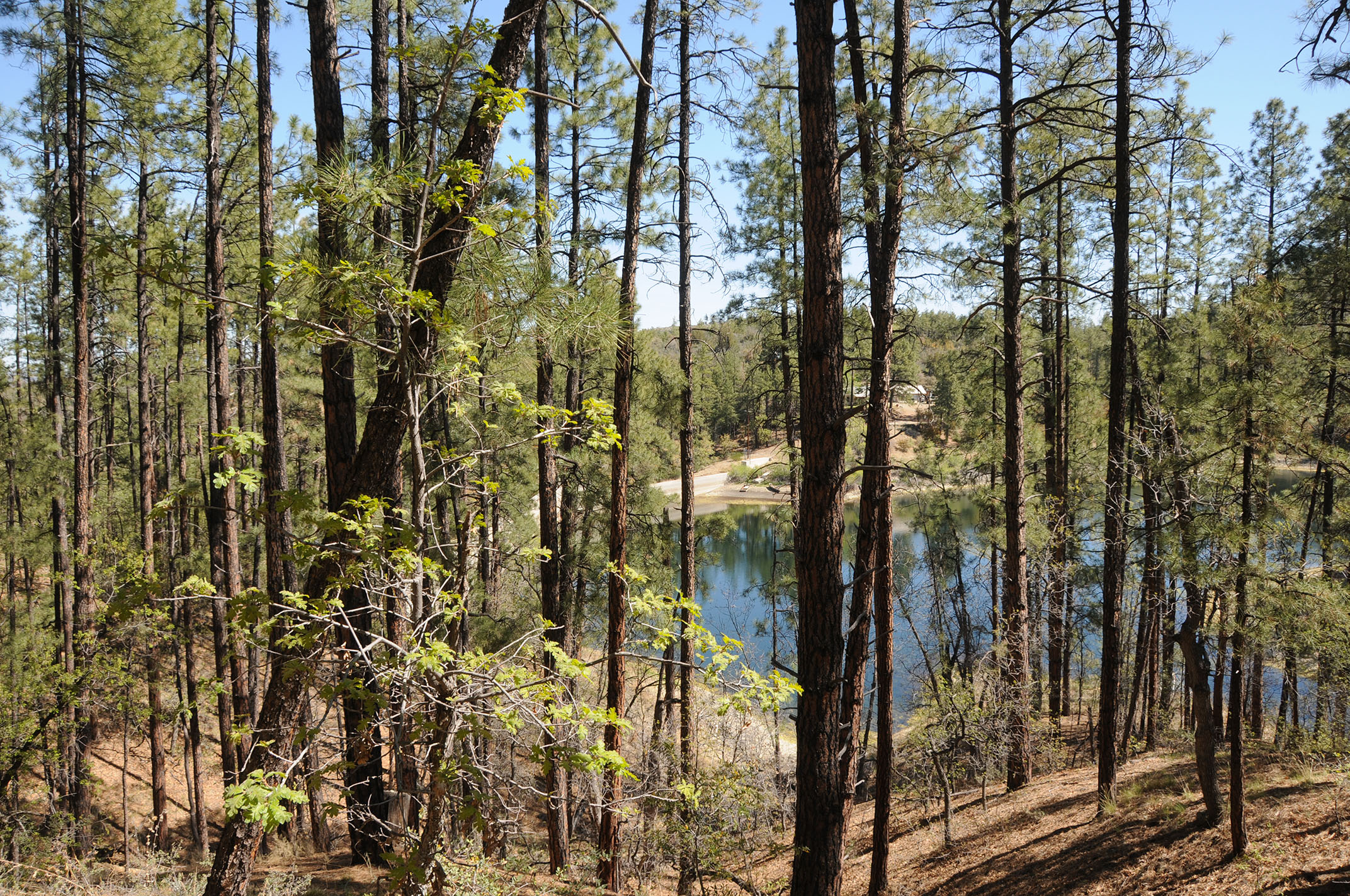
Whether gliding among reeds or preening and sunning on a pine-shaded jetty, the waterfowl seem to have mastered the art of taking it easy at Goldwater Lake. 
Goldwater Lake Park trail connects with Prescott Circle Trail

It’s a noteworthy cue. After all, isn’t kicking back what a day at the lake should be all about?  The City of Prescott Goldwater Lake Park is home to two smallish bodies of water: Upper and Lower Goldwater lakes. Both lakes are contained by dams on Bannon Creek in the Granite Creek watershed just a few miles south of Prescott’s historic downtown Whisky Row district.
Take it easy at Goldwater Lake Park

Dam on Bannon Creek contains Upper Goldwater Lake

The park is a popular destination for fishing, kayaking, picnicking and hiking.  A 2.37-mile loop trail circles both lakes, but at this writing, the connector trail between the Upper and Lower lakes is closed for construction and additional day use facilities will be installed around the Lower lake in the near future.

A boggy inlet on Upper Goldwater Lake

However, the Lower lake may still be seen by way of the connecting Prescott National Forest Goldwater Lake Trail No. 396 which is part of the 56-mile Prescott Circle Trail.
Willow catkins bloom in a moist riparian zone

Lower Goldwater Lake viewed from Prescott Circle Trail

The Upper lake hike can be done as out-and-back segments for a total of 2.7 miles. Surrounded by pine-oak woodlands with a fringe of water-loving willows, cottonwoods, boxelders, the alpine lake attracts swarms of waterfowl and wild birds.

Wild candytuft is a springtime bloomer

 
Waterfowl lounge on a pine-shaded jetty

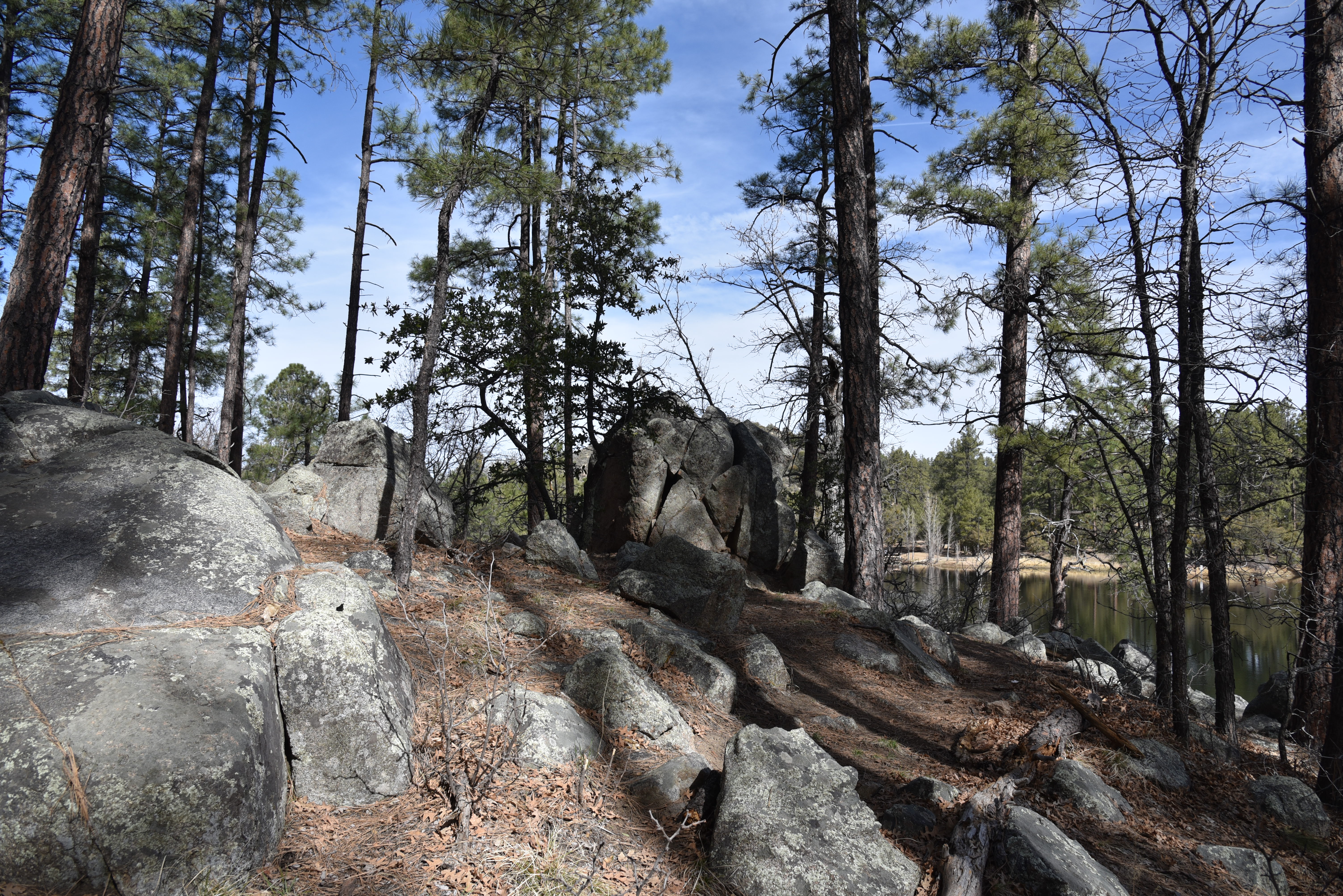
The trail follows the shore on a serpentine route that traces scenic finger coves, inlets and peninsulas passing through shaded, boulder-lined forests and moist riparian zones.
The lake is a productive bird watching site

 
The lake is popular for fishing and boating

This is a hike to take at a leisurely pace with eyes and ears tuned to the tree canopy and cattail reeds swaying in boggy inlets.  It’s there where a cacophony of bird songs, including the distinctive cry of red-winged blackbirds, and a supporting cast of paddling ducks advance the theme of wallowing in a lazy day at the lake.
A boulder-lined passage of trail around Upper Goldwater Lake

LENGTH: 2.7 miles out-and-back (Upper Goldwater Lake only). When completed, the 2-lake loop trail will be 2.37 miles.

RATING: easy-moderate

ELEVATION: 5,882 – 6,004 feet

GETTING THERE:

2900 S. Goldwater Lake Rd., Prescott.

From State Route 69/Gurley Street in Prescott, go 3.4 miles south on Senator Highway, turn left at the Goldwater Lake Park sign and follow the road to the parking area.

FEE: $3 daily fee per vehicle

SPRING HOURS: 7 a.m. – 8 p.m. (hours vary by season)

FACILITIES: restrooms, picnic ramadas, boat launch, fishing docks, playground, watercraft rentals.

No swimming allowed.

INFO:

City of Prescott

https://www.prescott-az.gov/recreation-area/goldwater-lake/


Tuesday, March 22, 2022

Lost Dog Wash Trail

LOST DOG WASH TRAIL

Yellow brittlebush bloom along Lost Dog trail

With ample winter rain, the desert in springtime can be an enchanting place.

Brittlebush entwined in cholla

Moisture coaxes the color out of myriad wildflowers, blooming shrubs and trees.
Desert hyacinth "blue dicks" bloom Feb. - May

Chuparosa blooms sporadically in washes year-round


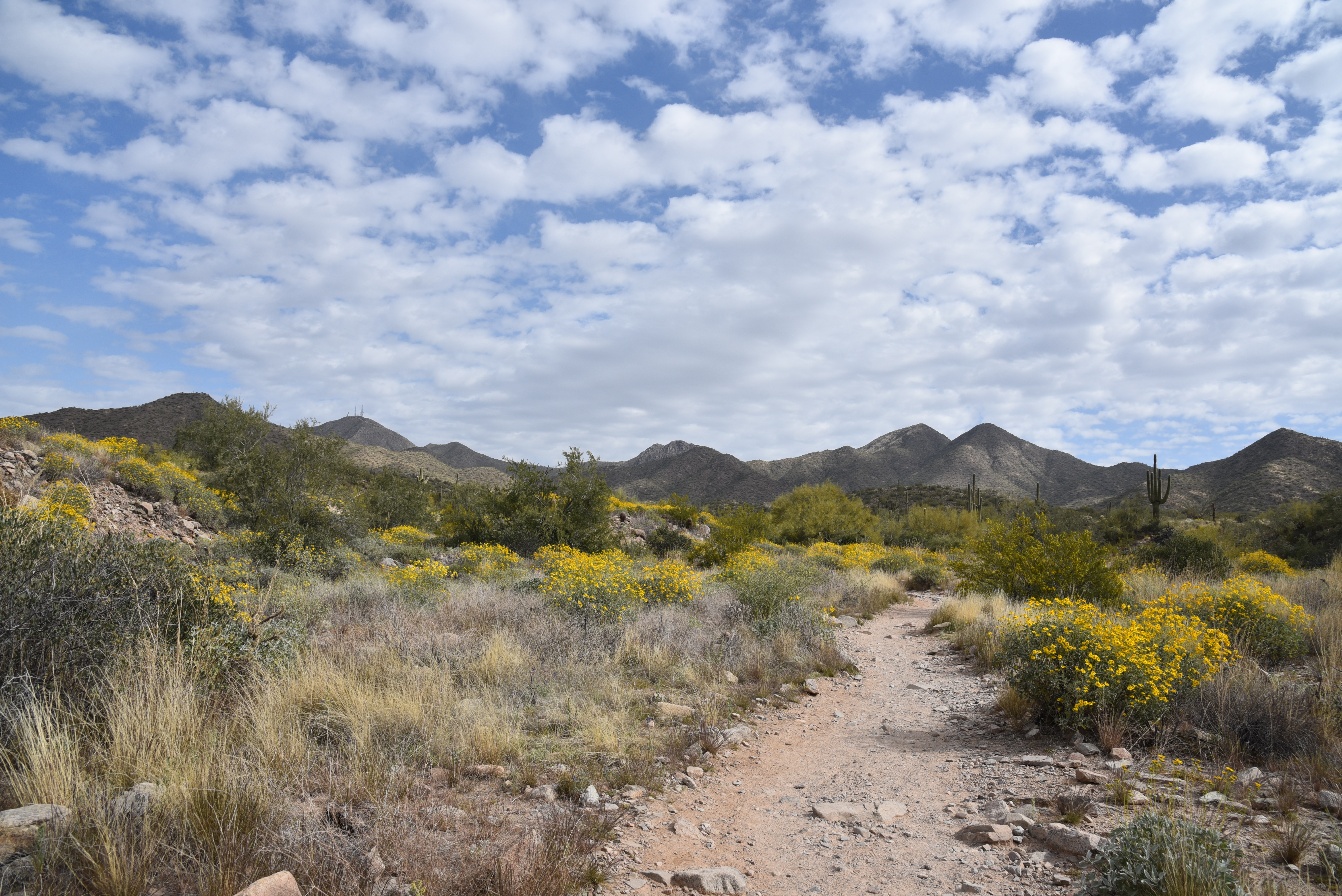
While this past winter offered sporadic showers, it wasn’t quite enough to deliver a “super bloom” year. Yet, even in drier conditions, wildflowers still manage to make a moderate showing in the wash-riddled hills of Scottsdale’s McDowell Sonoran Preserve.
Lost Dog Wash trail winds through McDowell Mountain foothills

 
Desert chicory blooms Feb. - May

The preserve’s southern region is a study in the power of water and the Lost Dog Wash Trail gives a tour of how flash floods and storm runoff have shaped the foothills of the McDowell Mountains range in the northeast Valley.
Scorpionweed grows among shrubs and blooms Feb. - May

A Northern mockingbird serenades hikers

Delicate Desert wishbone blooms Mar.- Oct.

In addition to carving the terrain into a landscape of corrugated gullies, ravines, and ragged washes, running water that pools in disturbed soils and rock crevasse stokes colorful blooms year-round.

Brilliant magenta strawberry hedgehog cacti bloom Mar.-Apr.

Although the showy blooms are sparse this year, the trail is flanked by numerous specimens.
Sweeping views on the Taliesin Overlook

Lupine, scorpionweed, desert chicory, chuparosa, fiddleneck, desert hyacinth and wolfberry shrubs make a fair showing among acres of hardy and prolific brittlebush.
Wolfberry shrubs thrive in moist drainage areas


The moderate-rated Lost Dog trail makes a steady ascent alternating between palo-verde-lined washes and open fields punctuated with huge saguaros and ironwood trees. 

Vegetation thrives along Lost Dog Wash

Throughout the hike, views the McDowell Mountains and 3,969-foot, antenna-topped Thompson Peak dominated the eastern horizon. As the route gains elevation, the distinctive tip of Red Mountain peeks out above an urban-suburban valley. 
Coiled fiddleneck bloom Mar. - May

At the 2-mile point, a short spur path leads to Taliesin Overlook, a scenic ledge with views of the north and west valley. 
Thompson Peak stand out over a wash-riddled landscape

Cholla buds about to flower

The rolling terrain of McDowell Sonoran Preserve

The trail continues downhill for another half mile to meet the Quartz Trail which connects with the preserve’s popular Gateway Area.  Many hikers make the overlook their turnaround point for a quick workout and walk through a natural desert botanical garden.
Big sky views on the approach to Taliesin Overlook

LENGTH: 2.6 miles one way or 4 miles roundtrip to the overlook and back

RATING: moderate

ELEVATION:  1,755– 2,092 feet

FACILITIES: restrooms, water, shade ramadas, horse hitching posts 

HOURS: sunrise to sunset

GETTING THERE:

LOST DOG WASH TRAILHEAD:

12601 N. 124th St., Scottsdale.

From the Loop 101 in Scottsdale, take exit 41 for Shea Blvd., turn east (right) and go 4.2 miles to 124th Street. Turn left (north) on 124th Street and go 1 mile to where the road dead-ends at the trailhead.

INFO & MAPS

https://www.scottsdaleaz.gov/preserve