Find A Trail. Start Your Search Here:

Friday, January 14, 2022

Tortuga-Spur Cross Loop

TORTUGA-SPUR CROSS LOOP

The pachyderm profile of Elephant Mountain


A quick loop hike in Spur Cross Ranch Conservation Area north of the town of Cave Creek  yields a heart-stirring trip through canyons, saguaro-fleeced slopes and a rare desert waterway, all backed with outstanding mountain views.

Saguaros cling to slopes below the CaveCreek Mountains

 
The short, but steadily challenging hike ties together two of the Maricopa County Regional Park’s trails into one stunningly tour of Sonoran Desert diversity.

From the trailhead, begin by hiking northwest (go right and downhill) on the Spur Cross Trail which is also part of the Valley-circling Maricopa Trail.  In less than a half-mile, the trail crosses Cave Creek.
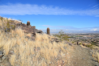
Skull Mesa viewed from the Tortuga Trail

 
Fed by storms and snowmelt, water runs sporadically through the rocky channel and is usually at its height during the winter and spring months.  A few yards past the creek crossing, continue north on Spur Cross from the Metate trail junction keeping an eye out for the foundations of the defunct Spur Cross dude ranch crumbling among cholla and creosote shrubs.
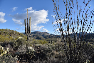
Sun-lit saguaros glow on the Tortuga trail

Over the next 0.6-mile, the route climbs easily, opening views of the creek gorge below and the flat-topped tableland of Skull Mesa and Sugarloaf Mountain to the northeast. One mile in, pick up the Tortuga Trail  which signals the beginning of a steady ascent on a degraded dirt track that hangs on the cusp of a ravine flush with acres of saguaros, prickly pear, ocotillo and cholla that glow in thorny halos when backlight by the sun.

A crossing of Cave Creek comes early in the hike

The 1.1-mile uphill section is heralded by a sign warning of primitive conditions ahead. 
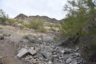
The as-advertised primitive trail

While the route is indeed rough, it’s not too difficult to follow. Soon, more vistas open to the south. 
Benches for viewing at the top of the loop

Look for Cave Creek classic, Black Mountain, the Cave Creek Mountains, the long profile of the McDowell Mountains and singular Pinnacle Peak on the horizon.
Sugarloaf Mountain (left) seen from Tortuga trail

 
This hike uses the Spur Cross & Tortuga trails

The circuit tops out at the Elephant Mountain trail junction where the best glimpses of the 3,926-foot massif’s pachyderm profile command attention.  A couple of benches overlooking the mark the spot where the Tortuga trail begins a 0.6-mile downhill trek toward the leafy cut of the Jewel of the Creek Preserve. 
Tortuga trail is rough but not hard to follow

To finish up this loop hike, head left at the Dragonfly trail junction and follow the Spur Cross trail as it switchbacks through a deep gully on its way back to the trailhead.

LENGTH: 5.3 miles

RATING: moderate

ELEVATION:  2,340 -2,615 feet

GETTING THERE:

44000 N. Spur Cross Road, Cave Creek

From Loop 101 in Phoenix, take Cave Creek Road north to Spur Cross Road (on the left just as you enter the downtown area) and go 4.5 miles north to the parking area. 

FEE: $3 per person daily fee. Bring exact change.

INFO:

https://www.maricopacountyparks.net/park-locator/spur-cross-ranch-conservation-area/


Monday, January 10, 2022

Walnut Spring Canyon

WALNUT SPRING CANYON

Cottonwoods herald the approach to Walnut Spring

There are more than seven springs in the Seven Springs Recreation Area.  The Tonto National Forest site which offers a picnic area, primitive camping and trailheads anchored by the Cave Creek Trail No. 4 is home to dozens of seeping water sources.

Humboldt Mountain rises over desert scrub

In addition to the eponymous Seven Springs, Maggie May, Mashakattee, Quien Sabe, Walnut, CP and Cottonwood springs spill water into the area’s creeks and washes.

Big vistas on the hike's high points

 
The route crosses Walnut Spring Canyon several times

A quick review of the national forest map reveals the locations of numerous other springs tucked into the mountainous backcountry north of Cave Creek.  While some of the springs are located along roads and trails, most trickle in oblivion among catclaw-riddled ravines.
The hike begins with a crossing of Seven Springs Wash

A lone sycamore grows in a moist pocket of Walnut Spring Canyon

 
Among the lot, Walnut Spring is easy to visit by hiking along a dirt two-track that roughly traces the gorge of Walnut Spring Canyon.  
A canyon-bound section of FR 1094

The trip begins on Forest Road 254 with an immediate crossing of Seven Springs Wash.  Right from the start, charred tree stumps stand as reminders of the 2005 Cave Creek Complex Fire and the 2020 Sears Fire, both of which took a heavy toll in the area.  Still, plenty of hardy junipers, sugar sumacs and cacti patches have survived and resurgent vegetation is gradually filling the charred voids.  At the 0.3-mile point, the road meets a cattle guard where the route splits.  Veer right onto Forest Road 1094, a rough route that’s open to motorized use, which serves as the trail for the remainder of the hike. 
Yuccas grow in a canyon cove

The road passes under some power lines where there’s a muddy wildlife water hole that reflects nice views of 5,175-foot Humboldt Mountain, the prominent, FAA “golf ball”-tower-topped peak to the east.  An easy ascent opens up vistas of the Cave Creek Mountains and the long, flat structure of New River Mesa to the west before the road meets the cut of Walnut Spring Canyon at the 1.2-mile point and begins a moderate descent to the first of several crossings of the sinuous, boulder-cluttered course.  Sheer rock faces with clinging cacti and yuccas dangling from damp crevasses gradually close in on the road and create shallow, sandy pools in abrupt bends.  The residual puddles foster a tiny community of water-loving sycamore, seep willows and cottonwood trees. 
A metal tank captures water from Walnut Spring

After a short traverse of the canyon floor, the road heads uphill, hanging close to the edge as it undulates through water-ravaged gullies and drainages.  The approach to Walnut Spring is heralded by a pair of cottonwood trees poking up through a tangle of junipers and a glassy slip of water running over the road.  At 2.6 miles, a metal tank tucked into a slim, heavily-wooded nook, captures Walnut Spring water through a quagmire of pipes and hoses.
Sugar sumac grows along the route

  While the spring makes for a good turnaround point, a short stroll up to the ridge above it rewards with excellent mountain views of Bronco Butte and Butte Peak to the south.
New River Mesa on the west horizon

 
A view of the Cave Creek Mountains from FR 1094

To add length to the hike, consult the forest map for roads and trails open for exploration.
Cottonwood trees thrive around Walnut Spring

The road passes by a wildlife water hole

LENGTH: 5.34 miles roundtrip

RATING: moderate

ELEVATION: 3,440 – 3,946 feet (1,012 feet of accumulated elevation change)

GETTING THERE:

From the Loop 101 in Scottsdale, take the Pima/Princess Road exit 36 and go 13 miles north on Pima to Cave Creek Road.  Turn right (east) and go 11 miles on Cave Creek Road (a.k.a Forest Road 24 and Seven Springs Road) to Forest Road Road 254 on the right. For reference, this is about 1.5 miles south of the Seven Springs Picnic Area. Park in the dirt turnoff or, for those with high-clearance vehicles, there are several dirt parking aprons farther up FR254.  Access roads are a mixture of pavement and good dirt passable by passenger cars when dry. Two minor creek crossings on cement are require. Do not attempt after heavy rains as the roads and trails are prone to flooding.

INFO:

Tonto National Forest, Cave Creek Ranger District

https://www.fs.usda.gov/tonto

Wednesday, January 5, 2022

Axle Grease Trail

AXLE GREASE TRAIL

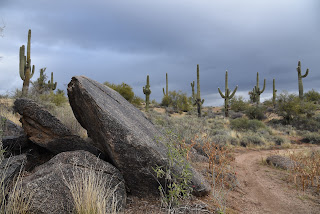
A winter storm brews over Axle Grease trail

Long and rambling, the Axle Grease trail is a serpentine route that slips through granite outcroppings fleeced with acres of yucca and cacti in the northwest sector of the Scottsdale McDowell Sonoran Preserve.

Black Mountain viewed from Axle Grease trail

The twisty, single track debarks from the new Pima Dynamite trailhead which was dedicated on November 13, 2021.

Cave Creek Mountains seen from Axle Grease trail

Running northeast in the space between Pima Road and the sandy, horsey course of Rawhide Wash, the route features a sequence of tight bends, unobstructed lines-of-sight and fluid runs, that support a made-for-speed atmosphere.

Granite boulders surround the trail

Indeed, hikers and bikers zip through this lush desert path like well-oiled machines.

Tight bends slingshot hikers through the route


And, speaking of oiled machines, the trail name derives from the buckets of grease that hung from horse-drawn wagons that rumbled through the area in the 1800s.  The grease was used to lubricate wheels and axles to keep the rickety vehicles running smoothly. 

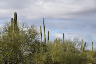
A raven croaks from atop a saguaro

The 4.5-mile trail is not a loop, but many connecting trails may be used to customize hikes for length and preferred points of interest.  Excellent map kiosks at the trailhead show several suggested routes including the locations of scenic viewpoints, geological landmarks and an impressive crested saguaro.

The trail parallels Rawhide Wash

 
Saguaro skeletons add botanical interest along the way

While the hum of traffic on Pima Road is present over the first couple of miles where the trail traces the property boundary, the din loses its punch as the trail swings farther into the core of the preserve.  Soon, the sounds of 21st century lubricated vehicles are absorbed by vast boulder fields, saguaro forests and the songs of woodpeckers, ravens and raptors moving among thick stands of paloverde trees and fragrant creosote.

Pima Dynamite trailhead was dedicated in Nov. 2021

There are many ways to loop up with the Axle Grease trail

LENGTH: 4.5 miles one way

RATING: moderate

ELEVATION: 2,310 – 2,563 feet

GETTING THERE:

Pima-Dynamite Trailhead

28777 N. Pima Road, Scottsdale.

There are two access roads near the corner of Pima and Dynamite Roads. One is on Pima just north of the traffic signal and one a few yards east on Dynamite.

There are restrooms at the trailhead.

INFO:

Scottsdale McDowell Sonoran Preserve

https://www.scottsdaleaz.gov/preserve

Tuesday, January 4, 2022

Hau’pal Loop

HAU 'PAL LOOP

Sierra Estrella Mountains peek over Ma Ha Tauk range


Situated in the northwest sector of South Mountain Park in Phoenix, the Hau’pal trail fixes a couple of things.

Camelback Mountain has some competition in the Hau'pal Trail

First, the 3.2-mile loop which debuted in 2020 replaces a quagmire of confusing, terrain-damaging park (remember the T-Bone Trail ?) and sloppy user-created paths.  Newly aligned, signed and cleaned up, the route is now a safer, more sustainable trek.

Difficult-rated Hau'pal trail is well signed

Second, it provides swift attitude adjustment for anybody who thinks a short loop hike located a mile south of downtown Phoenix can’t deliver a heart-pumping-- and sort of scary--hike.

Piestewa Peak rises above downtown Phoenix

The route is steep, edgy and rocky

The 3.2-mile loop, which is named for the O’odham word for red-tailed hawk, progresses in three distinct episodes.  Heading counterclockwise from the trailhead (go right), the hike begins with an immediate uphill haul that gets gradually steeper as the dirt single track gains over 1000 feet twisting over clipped shelves and stony folds in the far edge of the park’s Ma Ha Tauk Range. 

Mountain & urban views on Hau'pal trail

Act two involves a breath-taking walk over a sheer ridgeline with vistas that span the entire Valley and reach into the mountain peaks of the Tonto National Forest and farmlands south of Ahwatukee. 
First leg of the hike gains elevation gradually

Narrow, steep and, in places, very close to sheer drop offs, the ridge leg of the hike is not for acrophobics. 
The trail replaced old and unauthorized paths

The final segment is preceded by a short scramble through a rock chute before the trail calms down and swings downhill on gully-riddled foothills with scenic lookout points that frame views of city grids, urban landmarks and the distinctive humps of Camelback Mountain—another short, steep hike destination that might lose its “ultimate city hike” panache once Hau’pal catches on.
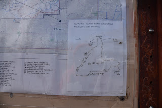
Map at the trailhead shows the loop layout

LENGTH: 3.2-mile loop

RATING: difficult

ELEVATION:  1,320 – 2,359 feet

GETTING THERE:

Form Phoenix, travel south on 7th Avenue to Baseline Road.  Turn right (west) and continue on Baseline to 19th Ave. Turn left (south) and follow 19th Ave to the trailhead.  No facilities.

INFO:

https://www.phoenix.gov/parks/trails/locations/south-mountain


Monday, January 3, 2022

Crest Summit

CREST SUMMIT

Mine site on the Quartz Mine trail

Situated in at the southern end of the White Tank Mountains, Skyline Regional Park in Buckeye offers an enticing mix of hiking, biking and equestrian trails.  
Big Valley views from Crest Summit

T
he 8,700-acre park has nearly 20 miles of interconnected trails that wrap around a stronghold of mountain peaks, scoured washes and lofty ridgelines. 
Crest Summit trail is short but very steep

With trail choices that range from barrier-free interpretive strolls to difficult, vertigo-inducing climbs, there’s something for everybody in this West Valley recreation hub. 
Quartz Min trail passes through washes

While all the park trails frame outstanding vistas, there’s one edge-teetering route that skims the roof of the park and even ties in an optional summit side trip.  
Lichens color rock outcrops in Skyline Regional Park

The circuit, which uses the Quartz Mine, Lost Creek and Skyline Crest trails, wanders through the park’s east sector with a sequence of twists, dips and ascents that provide continual panoramic views. 
Challenging Skyline Crest trail traces a ridgeline

Begin on the Quartz Mine trail near the number 3 picnic ramada.  Head east (go left) follow the moderate single track through gullies and washes as it descends along stony escarpments above desert plains. 
Steep switchbacks on Skyline Crest trail

At the 1.4-mile point, the route meets the Skyline Crest junction. For this trip, continue uphill on Quartz Mine. Now steeper and more precipitous, the trail curves north, topping out near a mound of chipped white stone spilling from what appears to be a filled in prospect—the Quartz Mine. 
Trail menu at Skyline Regional Park

The trail traverses a ridge for another 1.1 miles to where it connects with the Lost Creek trail. Turn left, hike less than a half-mile and hang another left onto the Skyline Crest trail.  This leg of the circuit is a real treat. Rated difficult, the rocky, undulating path hugs a knife-edge ridgeline with steep drop offs and jaw-dropping views all around.  After a mile, a set of switch backs winds downhill to land hikers on a saddle where the optional Crest Summit trail presents an optional add-on.  
Park trails are well signed

The short, vertical side trip tacks on only 0.34-mile to the hike, but the additional 200 feet of elevation gain rolls out in aggressive, straight-up style.  The extra effort pays off with unobstructed, 360-degree vistas of the Sierra Estrella Mountains to the northeast, Gila Bend Mountains in the southwest and the Big Horn Mountain Wilderness and the Hassayampa Plain in the northwest.  
Quartz chunks line the trails

From this high-point lookout, the trail descends through a saguaro-cluttered ravine to reconnect with the Quartz Mine Trail where hikers retrace their steps to the trailhead.

LENGTH: 5.94 miles as described here

RATING: difficult

ELEVATION: 1,345 - 2,130 feet

GETTING THERE:

2600 N. Watson Road, Buckeye.

From Interstate 10 in Buckeye, take the Watson Road exit and continue 2 miles north to the park. Roads are paved.  There are restrooms, water, picnic ramadas and camping by reservation at the trailhead.

HOURS: sunrise to sunset daily

INFO & MAPS:

Skyline Regional Park

https://www.buckeyeaz.gov/community/skyline-regional-park/about-the-park