Find A Trail. Start Your Search Here:

Thursday, August 19, 2021

PHOENIX magazine The Hike Book

The Hike Book

Back by popular demand!  

When it was first published in April 2020, PHOENIX magazine, The Hike Book sold out within weeks.  Now in its 2nd printing, the original book featuring 228 hikes is back along with a 2021 companion volume with 100 new trails. Both are now available for pre-order.  Pre-ordered books will deliver in October.

Reserve your copies:

https://cities-west-publishing.square.site/product/HikeBook/295


Monday, August 16, 2021

Stone to Steel Dam Trail

STONE TO STEEL DAM TRAIL

Ash Fork-Bainbridge Steel Dam

Between the sleek lanes of Interstate 40 that connect the City of Williams and the town of Ash Fork, and the fading tracks of the Atchison Topeka and Santa Fe Railroad to the north, the space from hot pavement to rusty iron tracks is separated by sprawling grasslands, pinyon-juniper woodlands and about a hundred years.  Leaving the freeway in this airy divide is like slipping into a Twilight Zone of fringy places where defunct travel corridors live on in repurposed relevance.

Ash Fork Stone Dam

Long before the interstate highway system transformed tedious Point A-to-Point B hauls into a national obsession with recreational road tripping, travel in western states was all about railroads and the iconic Mother Road, Route 66.  

The Stone to Steel Dam Trail traces Johnson Canyon

The strip of land just a mile north of the I-40 Welch exit is unique in that all three transportation corridors are stacked and packed into a hike-bike-drive exploratory opportunity that culminates with a short trail that visits two historic dams.  Getting to the Stone to Steel Dam Trail is half the fun and sets the mood for a trip back in time.
Masonry Number Two Reservoir

The adventure begins with a two-mile cruise on Historic Route 66, which parallels the interstate.

View from Lookout Point spur trail

The decommissioned byway which now serves as a recreational route for motorized vehicles and bikes, snakes its way through hilly backcountry of the Kaibab National Forest on the Colorado Plateau.  The crumbling Mother Road is a potholed sequence of concrete, asphalt and futile patch jobs of random this-and-thats.  
Historic Steel Dam was built in 1895

Alternately dipping into weedy drainages and ascending to tree-speckled high crests, the road drive unpacks a mix of heart-thumping vistas and a taste of the isolation and unnerving hazards that early-to-mid 20th century travelers would have encountered.  The surreal atmosphere is so pervasive that modern visitors would hardly flinch if Tom Joad, the protagonist in John Steinbeck’s 1939 novel The Grapes of Wrath came chugging by in a make-shift truck.
Stone to Steel Dam Trail was dedicated in 2015

Just past a rickety cattle guard, a degraded dirt Jeep road descends a half-mile to Ash Fork Stone Dam and Masonry Number Two Reservoir.  The 600-foot-wide sandstone structure that spans Johnson Canyon was constructed in 1911 by the Atchison Topeka and Santa Fe Railroad to create a backup water supply for steam-powered locomotives.  The lake behind the dam is a popular fishing spot that’s open to the public and is a stocked with trout and bass by the Arizona Game & Fish Department.

View of Bill Williams Mountain from Historic Route 66


To find the hiking trail from the parking apron and kiosk above the water, follow the designated access route to the water and follow the shore to the dam.

Atchison Topeka & Santa Fe Railroad pulled water from the reservoirs

A few yards west of the dam along a dirt road, a sign and bench mark the trailhead for the Stone to Steel Dam Trail.  Dedicated in 2015, the 0.87-mile single track, non-motorized path that tethers Ash Fork-Bainbridge Steel Dam with Stone Dam was constructed through the joint efforts of Kaibab National Forest, Ash Fork Development Association and local volunteers.  The trail traces the edge of Johnson Canyon, showcasing a green riparian zone and tiny pools within the stony corridor.  A few yards in, a short Lookout Point spur trail leads to a scenic ledge with great views of the dam and distant mountains.  The mostly level trail jogs among junipers and cacti before ending at a kiosk overlooking the steel dam.  The impressive 184-foot rusted metal wall contains Steel Dam Reservoir. 
According to the forest service, the dam was built in 1895 (some sources say 1897 and 1898) and is one of only three steel dams ever built in the U.S. 

The back side of Steel Dam shows ingenious construction

The other two are located in Montana and Michigan, so this is truly an Arizona treasure.  Like the Stone Dam, this one was constructed to provide a water source for steam locomotives and the town of Ash Fork.
Stone Dam is 600 feet wide

Goodding's verbena is a common plant along the trail

The dams, the road and myriad hazy tales of coal-fueled cross-county trips and Dust Bowl migrations are relics of an era when the first tentacles of infrastructure opened up the West for settlers, adventurers, dreamers and the first generation of automobile culture.

LENGTH: 2.4 miles round trip as described here

RATING: easy

ELEVATION: 5,641 to 5,400 feet

GETTING THERE:

From Williams, go 11 miles west on Interstate 40 to the Welch exit 151.  Drive a few yards north from the offramp on a dirt access road and make a hard right onto Forest Road 6.  Follow this dirt two track for a half mile to a “T” intersection and turn left onto Historic Route 66 which is signed as Forest Road 6E.  Continue 2 miles to an easy-to-miss turn off for Ash Fork Stone Dam.  This is located 0.2-mile past a cattle guard and there’s a sign posted a few yards in from the turn off.  The dam access road is rough dirt and requires at least a high-clearance vehicle.  The road is reasonably passable to the 0.2-mile point where there’s a parking apron for fishing access.  The trailhead is another 0.3-mile downhill but the road gets steep and dicey so it’s best to park at the apron and follow the designated access route to the dam.

FACILITIES: portable restroom

INFO:

Kaibab National Forest

https://www.fs.usda.gov/recarea/kaibab/recarea/?recid=82006

Monday, August 9, 2021

Escudilla National Recreation Trail

ESCUDILLA NATIONAL RECREATION TRAIL

Apache Sitgreaves National Forest

Escudilla Mountain seen from U.S. 191/180

In a world replete with competition and obsessions about number-ones, nobody remembers who or what came in third.  Same goes for hikers seeking to bag all of Arizona’s loftiest peaks.  Hardly a hiker in the state isn’t familiar with the number one spot, Humphreys Peak, the highest point on San Francisco Mountain (the USGS official summit benchmark says “Frisco” not Humphreys), an extinct stratovolcano north of Flagstaff.

Much of the lower trail escaped the Wallow Fire

One sure way to start an argument among hikers is to breech the topic of which Arizona mountains are the highest. So we don’t trip over semantics, it’s important to distinguish between a mountain and a peak.

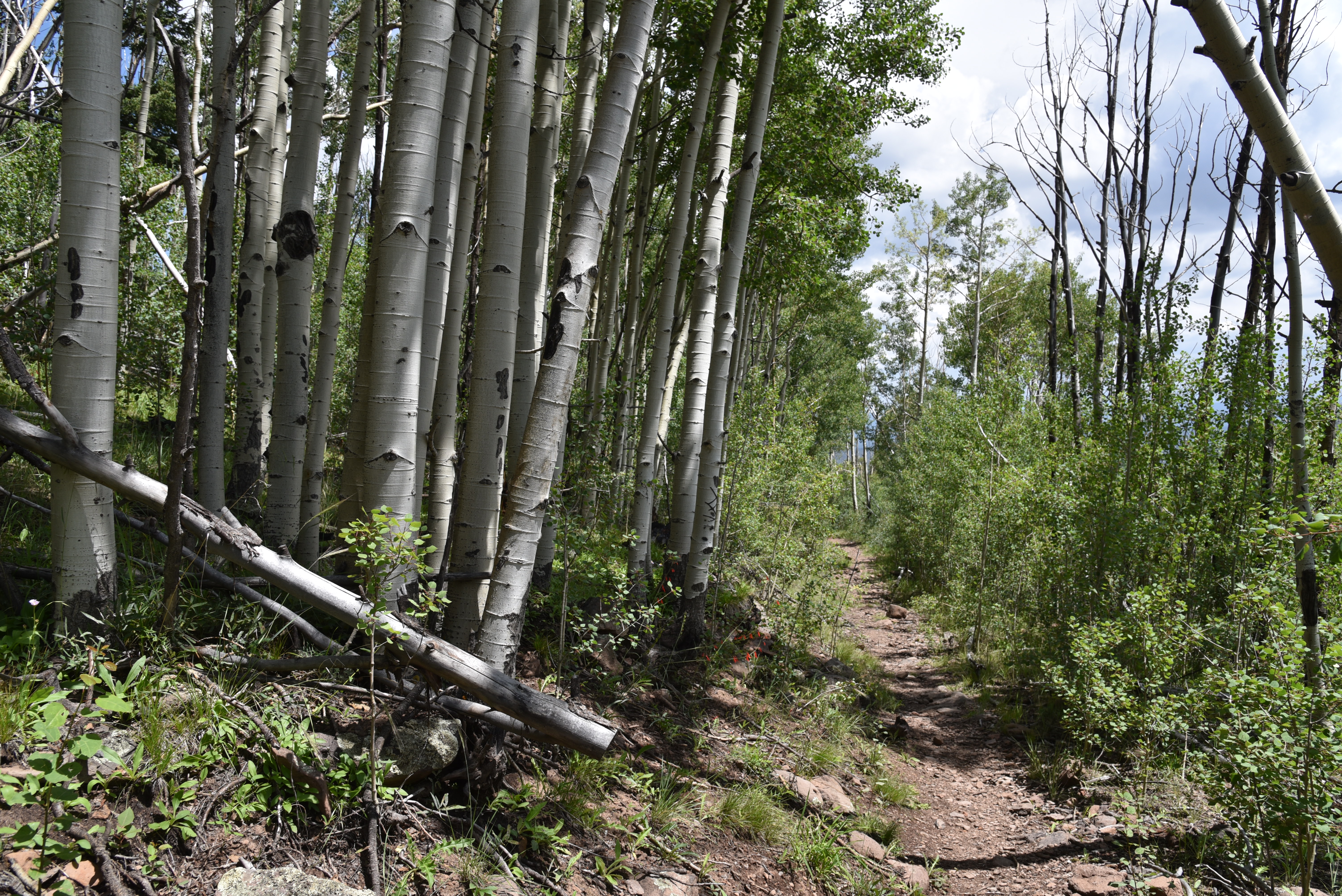
Aspens line the trail near the head of Toolbox Draw

San Francisco Mountain has seven of the state’s highest peaks—Humphreys, Agassiz, Abineau, Doyle, Fremont, Rees and Schultz- but they are peaks on the same mountain.  

Fireweed blooms July - Sept on Escudilla Mtn.

So, it’s a collective number one.  Here are the state’s top five highest mountains, all of which have trails to their summits.
Escudilla lookout stands above fire damaged slopes

Humphreys Peak 12,633 feet, Mount Baldy 11,420 feet, Escudilla Mountain 10,912 feet, Mount Graham 10,720 feet and Kendrick Mountain 10,418 feet.

For Arizona “peak-baggers”, the rush to the top inevitably begins with an elbow-to-elbow slog up Humphreys Peak for bragging rights and the requisite Instagram moment. 

Big sky and green valley views on Escudilla Mtn

Lush woodlands near the trailhead

But, in this hiker’s opinion, it’s the mountain that lags in third place that delivers the gold-medal alpine experience. 

Brushing the clouds at 10,912 feet in elevation, Escudilla Mountain located off U.S. 191 in Eastern Arizona’s White Mountains is a much less congested route with a pronounced “out-there” ambiance.

Final aspen glen before fire damage dominates

The isolated, dome-shaped massif sits just over three miles from the New Mexico state line in Apache County and cuts a distinctive profile that’s visible for miles.

Summit view in 2006

The Escudilla National Recreation Trail No. 308 lies almost entirely within the Escudilla Wilderness Area where only foot and equestrian travel is allowed. 

The mountain was touched by another type of first--the unenviable kind- when the largest wildfire in Arizona history roared up its slopes.  The 2011 Wallow Fire charred more than a half-million acres around the communities of Alpine, Nutrioso and Greer. 

Shrubs & flowers grow among downed trees

Even though Escudilla Mountain sat at the eastern edge of the fire’s reach, much of the terrain escaped severe damage.
Harebells are classic alpine wildflowers

But some areas were devastated.

While the Wallow Fire certainly changed the mountain’s look, miraculously, much of the aspen and mixed conifer woodlands on the lower part of the trail are intact. 

Summit view in 2006

Summit view looking east toward New Mexico

The first half-mile of the hike was largely untouched and remains thick with white-barked aspen glens.  The ravages of the blaze become apparent at the 1.1-mile point where the trail exits pristine forests and emerges on a crest at the head of Toolbox Draw.  The previously fir-and-spruce draped passage is now an environment of bald rolling hills punctuated with a few stalwart Douglas firs. 
How the severely damaged area looked in 2006

Damaged summit fire tower is closed to the public

The upside is newly exposed mountain vistas.  The trail hangs close to the edge of draws and ravines, passing through patches of survivor trees, fruit-laden shrubs and fields of colorful wildflowers. 
Summer-ripening orange gooseberries

One last aspen passage at the 1.7-mile point heralds the entrance into the severely burned side of the mountain. 
Looking southwest from the summit

The fire took no prisoners here.  Ten years removed from the fire, the landscape is one of toppled tree skeletons and torched snags. 
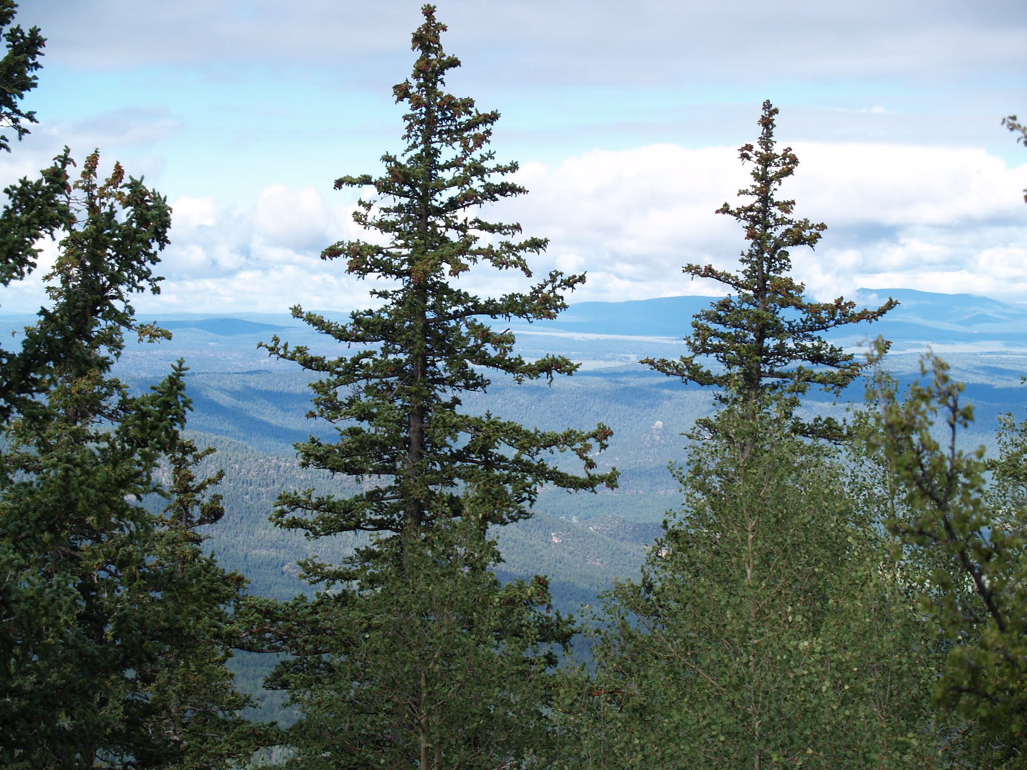
Survivor fir & spruce trees on the upper slopes

Above it all, the battered metal frame of the former summit fire lookout stands on a scorched knob that denotes the destination. Among the downed trees, an under story of blooming shrubs, saplings, and alpine flowers hint at resurgence. Over the final mile to the summit, the trail dodges among deadfall and woodchips left from when the trail was cleared of obstacles.  
Denuded flanks of Escudilla Mountain

Spindly, head-high aspens fill spaces formerly occupied by enormous old-growth conifers on the last leg of the trek that ends at the fire tower on the 10,877-foot pinnacle.
Richardson's geranium grow among pine needles

 
Trail condition on the summit ridge

The wooden cabin that once stood below the lookout is gone and the tower is fenced off for safety.  Gone too is the fringe of trees that limited views so it’s now easy to see all the way into New Mexico and the green valleys of the Blue Range Primitive Area.  The 10,912-foot true summit resides a half-mile off-trail beyond the lookout, for those to whom 35 feet matters in the quest for a memorable third-place victory.

LENGTH: 6.3 miles roundtrip

RATING: moderate

ELEVATION: 9,560 – 10,877 feet

GETTING THERE:

From Springerville, go south on U.S. 191/180 for about 20 miles to Forest Road 8056 on the left between mileposts 420 and 421which is signed for Hulsey Lake and Terry Flat.  Follow FR 8056 4.5 miles to the trailhead.  FR 8056 is maintained gravel suitable for most vehicles.  Several hairpin turns and steep drops off may not be suitable for RVs.

INFO:

https://www.fs.usda.gov/recarea/asnf/recreation/hiking/recarea/?recid=45293&actid=50


Thursday, August 5, 2021

Kinder Crossing

KINDER CROSSING

East Clear Creek 

When dogs dream about hiking, images of Kinder Crossing dance in their heads. Tucked into a picturesque canyon with a perennial stream, the trail that leads to an idyllic water-carved passage packs every imaginable doggie delight into a single hike. Scampering rock squirrels, taunting blue jays, jumping fish and leaping frogs give chase, inciting primitive stirrings in even the most sophisticated of city dogs.  Sandy beaches along East Clear Creek beckon dig-happy hounds and a plethora of swimming holes stoke the canine “inner wild” into overdrive. Humans too will find much to admire along historic Kinder Crossing Trail No. 19 in Coconino National Forest.  Originally used to drive sheep through the rugged canyons of the Mogollon Rim, the steep, rocky trail descends nearly 500 feet along the crumbling, fossil-laden limestone walls of Yeager Canyon.

Damage from the Tinder Fire seen from the trail

Like many forested areas in Arizona, the difficult-to-access backcountry surrounding East Clear Creek was recently damaged by wildfire.  

Parts of the trail sustained only light fire damage

In 2018, the human-caused Tinder Fire that began with an illegal campfire set during stage one fire restrictions which ban campfires anywhere other than in a developed campsite or picnic area, went on to char over 16,000 acres of mixed-conifer woodlands and critical watershed terrain east of C.C. Cragin (Blue Ridge) Reservoir.  
Limestone escarpments line East Clear Creek

All told, the blaze cost nearly $7 million in suppression costs, endangered the lives of first responders and destroyed 33 homes in communities along State Route 87.  That was quite an expensive campfire.  The unknown perpetrators live with that.
Wild geranium grow along the route

Three years post fire, the viewscape from the top of the trail is one of teetering ashen matchsticks, spots of half-cooked pines and sheets of toppled trunks cascading over scorched-earth ridges and exposed stone knobs previously obscured by tree cover. 

The creekside path is very overgrown

But, the depressing start belies what lies below.  A few yards into the trail,  ledges dangling over sheer escarpments serve as a platforms for first glimpses of a meandering green riparian zone hugging the twisted stream.
Beware of sharp New Mexico locust thorns 

Rife with loose rock and tangled roots, the newly sun-exposed slopes have morphed from a previously dank mushroom-and-moss alcove into emergent plots of common mullien and fragrant cliff-rose shrubs that pull nutrients from deadfall and disturbed soils.  The first half-mile is a relatively easy traipse with a barely noticeable descent, but that changes where a primitive rock cairn signals where the trail goes full tilt into a switchback-mitigated spiral to the creek.  

Cliff-rose shrubs scent the upper trail

As the trail inches closer to the stream, the bleakness of the burn scar spills into a canyon-bound corridor lush with moisture-hungry willows, alders, brambles, wild geraniums and penstemons.

A toppled pine lies over the trail


Once at the creek, footpaths trace the flow as it winds through high grasses, sandbars and still pools that lap at colorfully-layered canyon walls. 

Limestone slabs on the switchbacks

It’s just a three-quarter mile descent to the creek, but the trail continues downstream (go left at the bottom of the trail) for just under a mile to the crossing where the route head up the opposite embankment to Forest Road 137. 
Wild potato is a rare find on the trail

At this writing, the creekside trail was overgrown, mucky and difficult to navigate.  
Tinder Fire scar visible from a trail overlook  

Thickets of thorny New Mexico locust make bloody work of getting through the quagmire.
Before fire canyon overlook July 2007

The trailhead is 0.2-mile from the parking area

 
Stay alert while hiking in the Tinder Fire scar

The hike along the creek reveals tiny waterfalls and slickrock cascades spaced among rockfall and tall survivor pines.  
Common Mullien bloom in the ashes of the Tinder Fire

Elk, deer and black bears might be spotted wallowing in perennial swimming holes--that is, if visiting dogs didn’t get there first.
Before fire creekside, July 2007

A quiet pool in East Clear Creek

LENGTH: 1.5 miles round-trip

RATING: moderate

ELEVATION: 7,000 – 6,417 feet

GETTING THERE: From Payson, go north on State Route 87 to Forest Road 95, which is located roughly 10 miles north of Clints Well between mileposts 299 and 300. Turn right onto FR 95 and continue 4.5 miles to the turn off on the left for Forest Road 95T and follow the signs 0.6-mile to the parking area. The official trailhead is another 0.2-mile down the road. A high clearance vehicle is required on FR 95T. Those with low clearance vehicle should park along FR 95 and hike FR95T. 

INFO: Coconino National Forest

https://www.fs.usda.gov/recarea/coconino/recarea/?recid=54998