Find A Trail. Start Your Search Here:

Thursday, August 5, 2021

Kinder Crossing

KINDER CROSSING

East Clear Creek 

When dogs dream about hiking, images of Kinder Crossing dance in their heads. Tucked into a picturesque canyon with a perennial stream, the trail that leads to an idyllic water-carved passage packs every imaginable doggie delight into a single hike. Scampering rock squirrels, taunting blue jays, jumping fish and leaping frogs give chase, inciting primitive stirrings in even the most sophisticated of city dogs.  Sandy beaches along East Clear Creek beckon dig-happy hounds and a plethora of swimming holes stoke the canine “inner wild” into overdrive. Humans too will find much to admire along historic Kinder Crossing Trail No. 19 in Coconino National Forest.  Originally used to drive sheep through the rugged canyons of the Mogollon Rim, the steep, rocky trail descends nearly 500 feet along the crumbling, fossil-laden limestone walls of Yeager Canyon.

Damage from the Tinder Fire seen from the trail

Like many forested areas in Arizona, the difficult-to-access backcountry surrounding East Clear Creek was recently damaged by wildfire.  
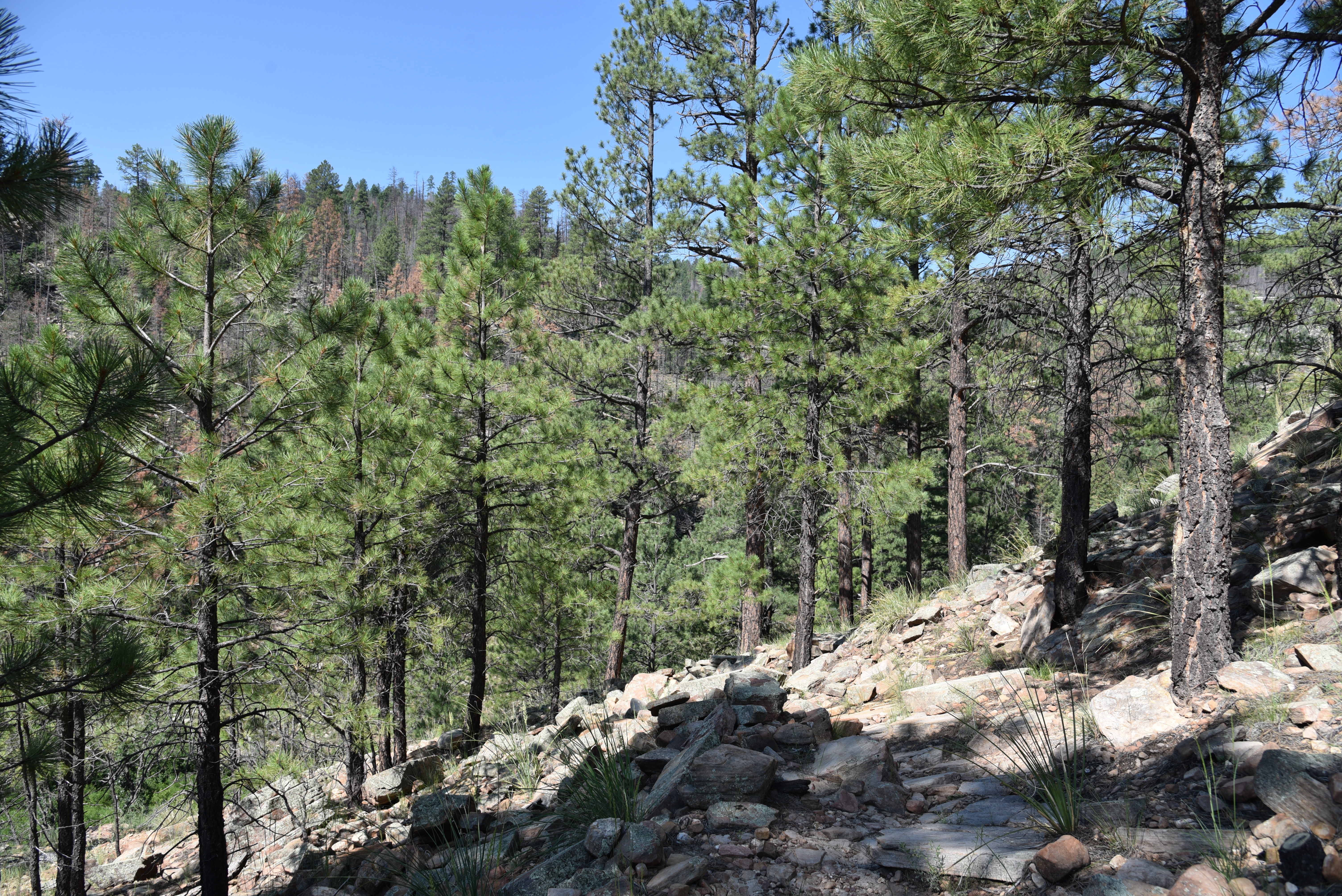
Parts of the trail sustained only light fire damage

In 2018, the human-caused Tinder Fire that began with an illegal campfire set during stage one fire restrictions which ban campfires anywhere other than in a developed campsite or picnic area, went on to char over 16,000 acres of mixed-conifer woodlands and critical watershed terrain east of C.C. Cragin (Blue Ridge) Reservoir.  
Limestone escarpments line East Clear Creek

All told, the blaze cost nearly $7 million in suppression costs, endangered the lives of first responders and destroyed 33 homes in communities along State Route 87.  That was quite an expensive campfire.  The unknown perpetrators live with that.
Wild geranium grow along the route

Three years post fire, the viewscape from the top of the trail is one of teetering ashen matchsticks, spots of half-cooked pines and sheets of toppled trunks cascading over scorched-earth ridges and exposed stone knobs previously obscured by tree cover. 

The creekside path is very overgrown

But, the depressing start belies what lies below.  A few yards into the trail,  ledges dangling over sheer escarpments serve as a platforms for first glimpses of a meandering green riparian zone hugging the twisted stream.
Beware of sharp New Mexico locust thorns 

Rife with loose rock and tangled roots, the newly sun-exposed slopes have morphed from a previously dank mushroom-and-moss alcove into emergent plots of common mullien and fragrant cliff-rose shrubs that pull nutrients from deadfall and disturbed soils.  The first half-mile is a relatively easy traipse with a barely noticeable descent, but that changes where a primitive rock cairn signals where the trail goes full tilt into a switchback-mitigated spiral to the creek.  

Cliff-rose shrubs scent the upper trail

As the trail inches closer to the stream, the bleakness of the burn scar spills into a canyon-bound corridor lush with moisture-hungry willows, alders, brambles, wild geraniums and penstemons.

A toppled pine lies over the trail


Once at the creek, footpaths trace the flow as it winds through high grasses, sandbars and still pools that lap at colorfully-layered canyon walls. 

Limestone slabs on the switchbacks

It’s just a three-quarter mile descent to the creek, but the trail continues downstream (go left at the bottom of the trail) for just under a mile to the crossing where the route head up the opposite embankment to Forest Road 137. 
Wild potato is a rare find on the trail

At this writing, the creekside trail was overgrown, mucky and difficult to navigate.  
Tinder Fire scar visible from a trail overlook  

Thickets of thorny New Mexico locust make bloody work of getting through the quagmire.
Before fire canyon overlook July 2007

The trailhead is 0.2-mile from the parking area

 
Stay alert while hiking in the Tinder Fire scar

The hike along the creek reveals tiny waterfalls and slickrock cascades spaced among rockfall and tall survivor pines.  
Common Mullien bloom in the ashes of the Tinder Fire

Elk, deer and black bears might be spotted wallowing in perennial swimming holes--that is, if visiting dogs didn’t get there first.
Before fire creekside, July 2007

A quiet pool in East Clear Creek

LENGTH: 1.5 miles round-trip

RATING: moderate

ELEVATION: 7,000 – 6,417 feet

GETTING THERE: From Payson, go north on State Route 87 to Forest Road 95, which is located roughly 10 miles north of Clints Well between mileposts 299 and 300. Turn right onto FR 95 and continue 4.5 miles to the turn off on the left for Forest Road 95T and follow the signs 0.6-mile to the parking area. The official trailhead is another 0.2-mile down the road. A high clearance vehicle is required on FR 95T. Those with low clearance vehicle should park along FR 95 and hike FR95T. 

INFO: Coconino National Forest

https://www.fs.usda.gov/recarea/coconino/recarea/?recid=54998


Monday, July 19, 2021

Munds Wagon Trail

MUNDS WAGON TRAIL

Monsoon water lingers in Bear Wallow Canyon

Sedona classic, Munds Wagon Trail, follows the course of an historic cattle trail that was used to drive herds and move goods from Sedona to summer pastures and markets south of Flagstaff.  The dirt wagon road was an essential, albeit dicey, transportation corridor used from the late 1800s to the 1930s when it was replaced by Schnebly Hill Road, which makes a precipitous, bumpy climb up red rock canyon walls to connect with modern-day Interstate 17.

Basket cairns mark the Munds Wagon Trail

Years after its demise, the route was relocated and repurposed into a non-motorized recreational trail.  The path slips through gullies and ridges between the road that traces the edge of Munds Mountain Wilderness Area and Bear Wallow Canyon. 

The route traces the edge of Munds Mtn Wilderness

From the Huckaby-Munds Wagon Trail trailhead, the hike begins with a slight dip over slickrock, roughly paralleling the road for excellent views of Sedona’s iconic Capitol Butte and Mitten Ridge formations.  
View of Munds Mountain Wilderness

The route is muddled with confusing paths-of-use, so be sure to follow the baskets cairns to stay on the official trail.  
Goodding's verbena blooms April - September

After two road crossings, the route begins the first of several dives into the canyon.  Shaded by cypress, juniper, pinion pines and pops of willows and hop trees, the rock-bound course of Bear Wallow Canyon harbors an ephemeral stream with dozens of tiny pools and rivulets that fill during snow melt runoff and summer monsoon rains. 
Yuccas & agaves line the high-desert route

Extend the hike on the Hangover Trail

The trail stays close to the canyon bottom for most of its 3.8-mile length, passing by waterfalls and shallow caves with stony traverses overlooking the gorge and an abrupt wall of sheer wilderness mountains. Where the trail ascends the agave-lined rims above the canyon, the rumble and roar of tour company Jeeps transporting boisterous groups up Schnebly Hill Road are clearly visible inching their way up the rutted, dirt passage.
Inside Bear Wallow Canyon

Evidently, passengers enjoy calling out and waving to hikers walking on the adjacent trail, which adds to the singular nature of the trek.  A group of picnic tables at the 1.3-mile point are something to keep in mind for a return trip lunch break. 

Catclaw acacia blooms April - October

Tadpoles scramble in the ephemeral canyon stream

At 1.8-miles, the trail meets the Hangover Trail junction. 

Trail crosses Schnebly Hill Road several times

For a longer and more difficult option, pick up this trail and follow it 3.6 miles to where it reconnects with Munds Trail at the Cow Pies trailhead. This detour involves much slickrock and exposure, so it’s not for the faint-of-heart. 
A shallow cave above Bear Wallow Canyon

To bypass the scary stuff, continue hiking on Munds Trail, as it crosses the road two more times before it leaves the canyon and heads uphill to its north terminus near the top of Bear Wallow Canyon and colorfully-layered Merry-Go-Round Rock on Schnebly Hill Road.

LENGTH:

To Hangover Trail Junction: 1.8 miles one way

To Cow Pies Trail junction: 2.8 miles one way

To end of trail: 3.8 miles one way

RATING: moderate

ELEVATION: 4,640 - 5,591 feet (on Munds Trail only)

GETTING THERE: From traffic circle located at the Oak Creek bridge on State Route 179 in Sedona, turn right onto Schnebly Hill Road and go one mile to the trailhead on the left. Roads are suitable for all vehicles. There is a restroom at the trailhead.

FEE: A Red Rock Pass or equivalent is required at the Schnebly Hill trailhead. There is a permit kiosk at the trailhead.

INFO: Coconino National Forest

https://www.fs.usda.gov/recarea/coconino/recarea/?recid=74313

Monday, July 12, 2021

KINNIKINICK LAKE

KINNIKINICK LAKE

Scrub land surrounds Kinnickinick Lake

Fishing and hiking share a common component--hoofing it to get to the good stuff.  Anglers typically trudge miles along streams and lake shores in search of the ideal spot to cast a line, while hikers will go out of their way to explore quirky, out-of-the-way sights.

Kinnickinick Lake, located 38 miles south of Flagstaff, is one place where anglers and hikers can unite in purpose.

Reeds grow around the lake's dam

The small trout fishery is situated on a desolate plateau, dotted with scraggly junipers a few miles southeast of Mormon Lake in Coconino National Forest.  Vast grasslands where domestic cattle browse among sporadic stands of Ponderosa pines and water tanks define the dusty, 9-mile drive in on kidney-jarring back roads.

Calliopsis bloom along the water Jun-Sept


At approximately 100 surface acres in size, the lake sits at 7,000 feet in elevation and is open for day-use  fishing, hiking, wildlife viewing and boating.  
Pines and junipers provide spotty shade along the hike

Largely shade-less with an eerie kind of allure, Kinnickinick, which is a Native American word used to describe plant-based mixtures for smoking, makes for an unusual trek.

The 2-mile circumference hike around the water involves following faint paths-of-use along a mix of mucky fringe, jumbled boulders and pine-shaded shores. 

The rocky fringe of Kinnickinick Lake

The route passes several barbed wire fences—close all gates and never cut or alter any parts—alternating among low bluffs above the lake and shoreline scrambles. 
The airy terrain of Kinnickinick Lake

The lake is bound by a dam at the head of Grapevine Canyon where acres of reeds serve as camouflage for waterfowl like ospreys, Great Blue herons and ducks and well as the herds of elk and pronghorn that roam the area.  
The lake is a haven for birds and waterfowl

A fun way to hike the lake is to do a hybrid kayak-walk trip.  This option circumvents the barbed wire and much of the loose-rock footing while providing better opportunities to view wildlife.
Poison milkweed attracts pollinators


Either way, this off-the-beaten-path, primitive destination offers an alternative to the typical party atmosphere of spending a day at the lake.

The hike follows faint paths-of-use

Curly dock flourishes in muddy areas around the lake

LENGTH:  2-mile circumference hike

RATING: moderate

ELEVATION:  7,010 – 7,095 feet

GETTING THERE:

From Flagstaff go 24 miles south on Lake Mary Road (County Road 3) to Forest Road 125 on the left signed for Kinnickinick Lake.  Go 5 miles on FR 125 to Forest Road 82, veer right and continue 4.5 miles to the lake.  Forest roads 125 and 82 are rough dirt but passable by most carefully-driven vehicles.  The lake is open for day use only and there are no fees. There is a restroom near the boat ramp and picnic tables are spread out along the shore.

INFO: Coconino National Forest

https://www.fs.usda.gov/recarea/coconino/recarea/?recid=55002

Friday, June 25, 2021

CHILL ON THESE COOL, KID-FRIENDLY VALLEY TRAILS

CHILL ON THESE COOL, KID-FRIENDLY VALLEY TRAILS

There's lots of shade at Gilbert Riparian Preserve

In Arizona, a summertime trifecta of wildfires, forest closures and excessive heat can challenge even the most determined hikers.  While escape to the high country and cooler mountain climes is often not an option, the scramble to find suitable hike destinations that are close by, offer a little shade, are entertaining for antsy kids and satisfying for adult hikers can be challenging.

But it is still possible hike safely during the Phoenix inferno months by hitting local trails

early in the morning (we’re talking, be done by 9 a.m.), take plenty of water, don a hat, sun-protective cloths and sturdy footwear and always tell somebody where you are going and when you expect to return.  Here are a few gems that are great choices for quick escapes.


CENTRAL PHOENIX

Rio Salado Habitat Restoration Area

A restored section of the Salt River flows through the site

Just two miles south of downtown Phoenix, where the Salt River once flowed, a former dumping ground has been transformed into a thriving 595-acre oasis in the desert.

Dozens of species of dragonflies live by the river

With the cooperation of the Army Corps of Engineers, the Flood Control District of Maricopa County and droves of volunteers, tons of waste were cleared out of the Salt River channel and replaced with ponds, waterfalls and tens of thousands of indigenous plant species. Although the revitalized strip of riparian habitat looks as if it occurred naturally, it’s a “demonstration wetland” that was created by tapping into the groundwater beneath the river channel and pumping more than 2.65 million gallons of water per day to sustain the habitat.
Birds and waterfowl are easy to spot on the hike

Trail segments are organized to feature specific desert habitats such as Cottonwood-Willow, Lower Sonoran, Mesquite Bosque and Palo Verde. The area is flush with native plants that were harvested from seeds or cuttings within a half-mile of the Salt River. Snowy egrets, raptors, toads and dozens of other species have settled into the reedy shores and shaded coves.  

LENGTH: 13.8 miles of trails

RATING: easy and informative

GETTING THERE:

Northeast 7th Ave. Trailhead: 2801 S. 7th Ave.

Northeast Central Ave. Trailhead: 2439 S. Central Ave.

Southeast Central Ave Trailhead: TEMPORARILY CLOSED

Southwest 7th Ave. Trailhead: 3212 S. 7TH Ave.

16th St. Trailhead: 3203 S 16th St.

HOURS: Sunrise to 7 p.m. or sunset, whichever comes first.

FACILITIES: restrooms at some trailheads

City of Phoenix

https://www.phoenix.gov/parks/trails/locations/rio-salado-habitat-restoration-area


EAST VALLEY

Gilbert Riparian Preserve at Water Ranch

Waterfowl thrive in the preserve's 7 ponds

The sound of waterfowl is deafening.  Even with its proximity to U.S. 60 and a busy community center, a hike in this wetland complex of seven ponds and a fishing lake mimics a stroll in a wilderness marsh.  These created groundwater recharge basins are surrounded by massive, green riparian vegetation attracting thousands of shorebirds, making for a cool, shady hike, even in warm weather.  

Over 4 miles of shady trails wind through the site

Great blue herons, Snowy egrets, long billed dowitchers, mallards, grebes, killdeer, warblers and hummingbirds are extremely easy to spot.  Short loop trails with interpretive signs weave among flower gardens, mesquite bosques, nesting sites and feeding grounds.  For hard-core birders, viewing blinds are set up along the shores. 
Trails are easy and barrier-free

In addition to the hiking trails, the site features a kiddie playground with educational (dinosaur dig, anybody) opportunities, an observatory and a hefty events calendar.

LENGTH: 4.5 miles of trails

RATING: easy, barrier-free

ELEVATION: 1,200 feet

DOGS:  Leashed dogs are allowed, and owners must clean up after their pets.

GETTING THERE:

2757 E. Guadalupe Rd.

HOURS: 5:30 a.m. – 10:00 p.m.

Trails open dawn to dusk

FACILTIES: restrooms

City of Gilbert

https://www.gilbertaz.gov/departments/parks-and-recreation/riparian-preserve-at-water-ranch


WEST VALLEY

Skyline Regional Park, Turnbuckle Trail

View from the top of Valley View Trail

Anchoring the maze of paths that wind through 8,600-acre Skyline Regional Park, the Turnbuckle Trail offers an excellent introduction to the park’s mix of easy strolls and challenging mountain climbs among the washes and foothills of the southern White Tank Mountains. Although it's located just 2 miles north of Interstate 10, the blissfully quiet site has a wild yet accessible feel to it.

Desert vistas abound on Turnbuckle Trail

Like most hikes in the park, Turnbuckle begins with a stroll across a graceful, oxidized bridge spanning Mountain Wash. It loops around a prominent mountain peak and connects with Valley Vista Trail for an optional 0.33-mile, difficult climb to a vertigo-inducing summit. This short hiker-only trek involves some steep, narrow sections with drop offs.  Begin at sunrise to get up and back before the heat of day sets in.

LENGTH: 4 miles round trip

RATING: moderate

ELEVATION: 1,500 - 2,300 feet

FACILITIES: Restrooms, picnic tables, campsites

HOURS: Trails open sunrise to sunset. Gates close at 10 p.m.

GETTING THERE:

2600 N. Watson Road, Buckeye

INFO: City of Buckeye

https://www.buckeyeaz.gov/residents/skyline-regional-park-trails


NORTH VALLEY

Jewel of the Creek Preserve, Cave Creek

A desert oasis along Cave Creek

Showcasing the desert foothills and thriving riparian environment surrounding the “Jewel of the Creek” area of perennial Cave Creek, this unexpected strip of lush creek-side willows, alders, walnut trees and cattails is hemmed in by rugged Upper Sonoran Desert terrain making for a breathtaking hybrid desert-wetland hike. While there, you’ll also wander through a mesquite bosque, the 5th rarest eco-system on earth. Although most hikers prefer to grab a map at the trailhead and head out on their own, the park ranger, Kevin Smith—who knows just about everything about the local flora, fauna, geology and human history of the area, conducts regular guided tours for those who would like an educational experience.

Many eco-zones are represented on the hike

There's year-round water at Jewel of the Creek

Check out the link below to find out when the next one is happening. We can thank the efforts of the Desert Foothills Land Trust for securing the preservation of this delicate eco-system and for also raising the funds needed to plan for and build the trail.
Rare desert water runs through the preserve

LENGTH: 1.9 miles for the creek loops only

RATING: moderate

ELEVATION: 2,400 -2,150 feet

FEE: $3 per person (exact change is required)

FACILITIES: portable toilets at Spur Cross Ranch trailhead

SUMMER HOURS: 5 a.m. – 9 p.m.

GETTING THERE:

44000 N. Spur Cross Road

Desert Foothills Land Trust

https://www.dflt.org/

Spur Cross Ranch Conservation Area

https://www.maricopacountyparks.net/park-locator/spur-cross-ranch-conservation-area/