Find A Trail. Start Your Search Here:

Tuesday, March 30, 2021

Sugarloaf Circuit

SUGARLOAF CIRCUIT

Coffeepot Rock (left) from Sugarloaf Summit


How sweet do you take your hikes; one lump or two?  The choice is yours in Sedona’s North Urban Trails System. 

Chimney Rock seen from Andante Trail

Boasting two confectionery hill climbs that can be done either alone or as a barbell-shaped double loop, the system also showcases many iconic Red Rock Country landforms and great mountain vistas.  Located just 3 miles west of Uptown Sedona, Sugarloaf and Little Sugarloaf, two russet sandstone lumps that sit below 6,355-foot Capitol Butte (a.k.a. Thunder Mountain), anchor a network of scenic suburban paths less than a mile north of busy State Route 89A. 
Little Sugarloaf seen from Thunder Mtn Trail

While neither loaf climb is particularly difficult, each has its own character. 

Several trailheads offer easy access to the system, but for this double-header, start at the Thunder Mountain trailhead off Dry Creek Road.  To tackle the more difficult climb first, follow the Lower Chimney Rock trail 0.1-mile, head left at the Thunder Mountain junction and continue hiking on Lower Chimney Rock.  The hulking mound of 4,872-foot Little Sugarloaf looms to the south as the trail makes an easy ascent to its base.  Although Little Sugarloaf is not as tall as its companion to the east, it’s the wilder of the two. 

Sedona's North Urban Trails System, East

The climbing starts at the Chimney Rock Pass/Summit junction where the route makes a steep, exposed 222-foot crawl up the mountain’s north face.  The narrow, rough-hacked, 0.2-mile summit path hangs close to the edge for unobstructed views of the Sedona area and distant Mingus and Woodchute Mountains across the sprawling Verde Valley.  When done ogling the sights, descend to the junction and head left to follow Lower Chimney Rock for 1 mile tour around the base of the hill.  You’ll pass the trailhead and then pick up the Thunder Mountain trail heading east (right) where amazing up-close looks at iconic Chimney Rock stand out above crumbling russet sandstone walls.  Soon, the buff-colored flanks of Capitol Butte come into view and the trail dips into one of the route's many deeply wooded drainage areas before emerging at the Andante trailhead.  Follow the Andante trail 0.6-mile to where it reconnects with the Thunder Mountain trail, then follow the signs to the Sugarloaf Loop and Summit trails. 

Urban landscape viewed from Sugarloaf

Compared to Little Sugarloaf, hiking up 4,911-foot Sugarloaf “regular” is a walk in the park.  
It's a steep, edgy climb up Little Sugarloaf

The 0.2-mile trail is wide and well-worn, ascending 201 feet straight up the middle with no precipitous exposure or very steep spots.  A series of slickrock passages and natural red-rock stairs glide hikers up the hill, revealing a decidedly urban landscape below. 
Route traces the sandstone walls of Capitol Butte

To the west, streets and houses roll out in familiar grids while to the north, the form of Coffeepot Rock protrudes from a rock jetty off of Capitol Butte.  On the bald, pine-and-yucca- rimmed top, views stretch south for glimpses of Courthouse Butte and Airport Mesa.
High desert vegetation on Sugarloaf hill

 
Capitol Butte (right) is a commanding presence

Descend and make a 0.7-mile swing around Sugarloaf Loop before retracing your steps back to the trailhead.
The route crosses several drainage areas


LENGTH:  5.3 miles

RATING: moderate

ELEVATION:  4,560 - 4,911 feet

GETTING THERE:

Thunder Mountain Trailhead:

From the State Route 179/89A traffic circle in uptown Sedona, go 3.2 miles west (toward Cottonwood) on SR 89A to Dry Creek Road.  Follow Dry Creek Road 0.5-mile, turn right on Thunder Mountain Road and continue 0.6-mile to the trailhead on the left. There are no fee or facilities at this trailhead.

May also be accessed by the Andante Drive and Sugarloaf trailheads.


INFO: Coconino National Forest

North Urban Trail System, East

https://www.fs.usda.gov/recarea/coconino/recreation/hiking/recarea/?recid=72038&actid=50


Tuesday, March 23, 2021

Clay Mine Trail

CLAY MINE TRAIL

Beautiful mountain and valley views on Clay Mine Trail

In the ubiquitous quest for health and beauty, the promise of a quick fix seduces better than the long game.  For those rare few who won the beauty and longevity genes lottery (I’m looking at you Sophia Loren and Cicely Tyson) having a great face and physical fortitude without investing in a whole lot products is an enviable characteristic.  The rest of us use mud.

Join a ranger-led hike to explore inside the mine

While luxurious, earthy promise-in-a-jar blends available at health-and-beauty counters everywhere from discount stores and late-night infomercials to indulgent destination spas provide a feel-good boost and a surface glow, they rarely cure anything.  Still, dangling carrots endure, and people have made billions selling muddy treatments promoted as healthful and youth-restoring.  Thus, was the case of Leila P. Irish.

Creosote shrubs bloom even in drought conditions

In the 1930s, the entrepreneurial woman saw the potential in marketing a buff-colored clay found among the tailings of an abandoned, dud gold prospect in what is now Cave Creek Regional Park.  For reasons unbeknownst to modern science, Irish envisioned a miracle cure in the otherwise unremarkable, chalky rock.  She transformed the common earth into a marketable gold mine of another type by grinding the soft sediments into a fine, talc-like powder and selling it at premium prices as a calcium, iron and silica rich health supplement and basic elixir for building strong teeth and nails and enriching blood.  The product took off, making Irish and her Pearl Chemical Mine very wealthy.

Clay mine treasure: miracle cure or snake oil?

When Irish’s dreams of further cashing in on the magic muck by establishing a nearby health resort complete with therapeutic mud baths didn't pan out, she sold the claim in 1949 and the mine and its sensational issue of debatable value fell into oblivion. 

Today, the clay mine lives on as a curiosity site in Cave Creek Regional Park.  To get a close-up look at the mine’s innards and learn more about the history and science behind the bizarre bit of Arizona lore, sign up for a tour led by park rangers.  But if you’re fine with just a look in from behind a locked gate that protects the cave, grab a park map and head out on your own. 

Benches are placed at scenic spots on the trail

The 1.5-mile Clay Mine Trail may be accessed from either the Overton or Go John trailheads near the park nature center and can easily be looped into longer, more difficult hikes. 
Big valley views on the way to Clay Mine

Rock outcroppings line the route

As a standalone trek, the route rolls through desert hills and high passes with outstanding views of the Valley and surrounding mountain ranges.  With the ongoing drought, wildflowers are scant this year.  But hearty, desert plants like creosote, brittle bush and desert marigolds have mastered the long game and push through with spots of beauty along the way.
There are many ways to extend the hike

LENGTH: 3 miles round trip

RATING: easy

ELEVATION:  2,000 -2,300 feet

GETTING THERE:

Cave Creek Regional Park, 37900 E. Cave Creek Parkway, Cave Creek.

Take Interstate 17 north to Carefree Highway (State Route 74). Head east (right) and continue 7 miles to the park entrance at 32nd Street.  Follow the main park road to the Overton or Go John trailheads at the nature center.

There are restrooms and water at the trailhead.

PARK HOURS: 6 a.m. to 8 p.m. daily

FEE: There’s a $7 daily fee per vehicle.

INFO & MAPS:

https://www.maricopacountyparks.net/park-locator/cave-creek-regional-park/

Tuesday, March 9, 2021

Spence Basin Trail System

SPENCE BASIN TRAIL SYSTEM

There's excellent signage throughout the hike

Populating the space between the Thumb Butte and Granite Basin recreation sites in Prescott National Forest, the new Spence Basin Trail System adds nearly 30 miles of hiking options to the area’s already packed menu. 
Granite Mountain seen from Vista Trail

The routes, which were adopted and developed over that last few years, are located less than 5 miles northwest of historic downtown Prescott and are accessible by way of paved roads.  While the trails can be reached through connecting routes that extend north from Thumb Butte, the Spence Springs trailhead that opened in 2019 offers direct access to the heart of the system.

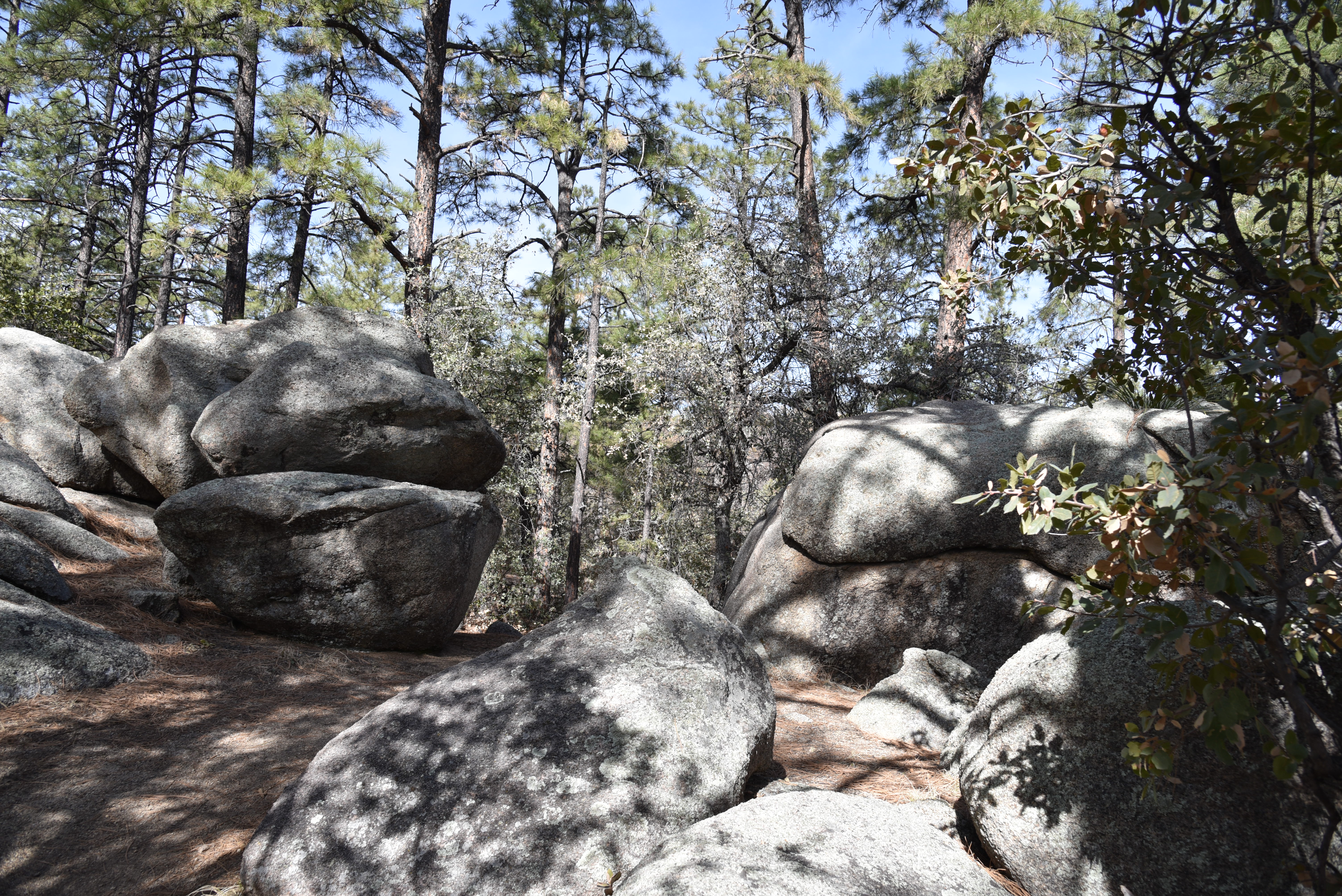
A boulder passage on Juniper Gate Trail

Ponderosa pines shade the Noodle Loop


The nearly 30-mile maze of Spence Basin’s loopy, hilly single tracks speak to their mountain-biker origins.  Tightly woven, with dozens of ways to customize both length and difficulty levels, the trails roll out in the varied terrain around Spence Creek.  The signage along the routes is among the best you’ll find anywhere, making it simple to find your way around.  Junctions are outfitted with you-are-here-style map signs that show mileages, connecting routes, GPS coordinates, emergency location codes and smart phone app codes.  Deciding where to begin exploring the convoluted trail cluster is the only dilemma.  For first-timers, an introductory loop using the Noodle, Vista, BLM and Juniper Gate trails is a great way to experience some of the best bits.  Here’s how.

Snowy Sierra Prieta Mtns seen from Vista Trail

From the trailhead, cross the road and begin with a short walk on Noodle Loop #760.  At the first junction (emergency marker sign SB03), turn right onto the Vista Trail #706.  This leg of the hike starts by delving into a sunny juniper-dotted drainage area with patches of shady ponderosa pine and oak woodlands.  Vista Trail makes an easy climb on slopes at the northern edge of the system.  Exposed highpoints reveal views of Thumb Butte and the Sierra Prieta Mountains to the south and fleeting glimpses of Granite Mountain and Williamson Valley to the north. 

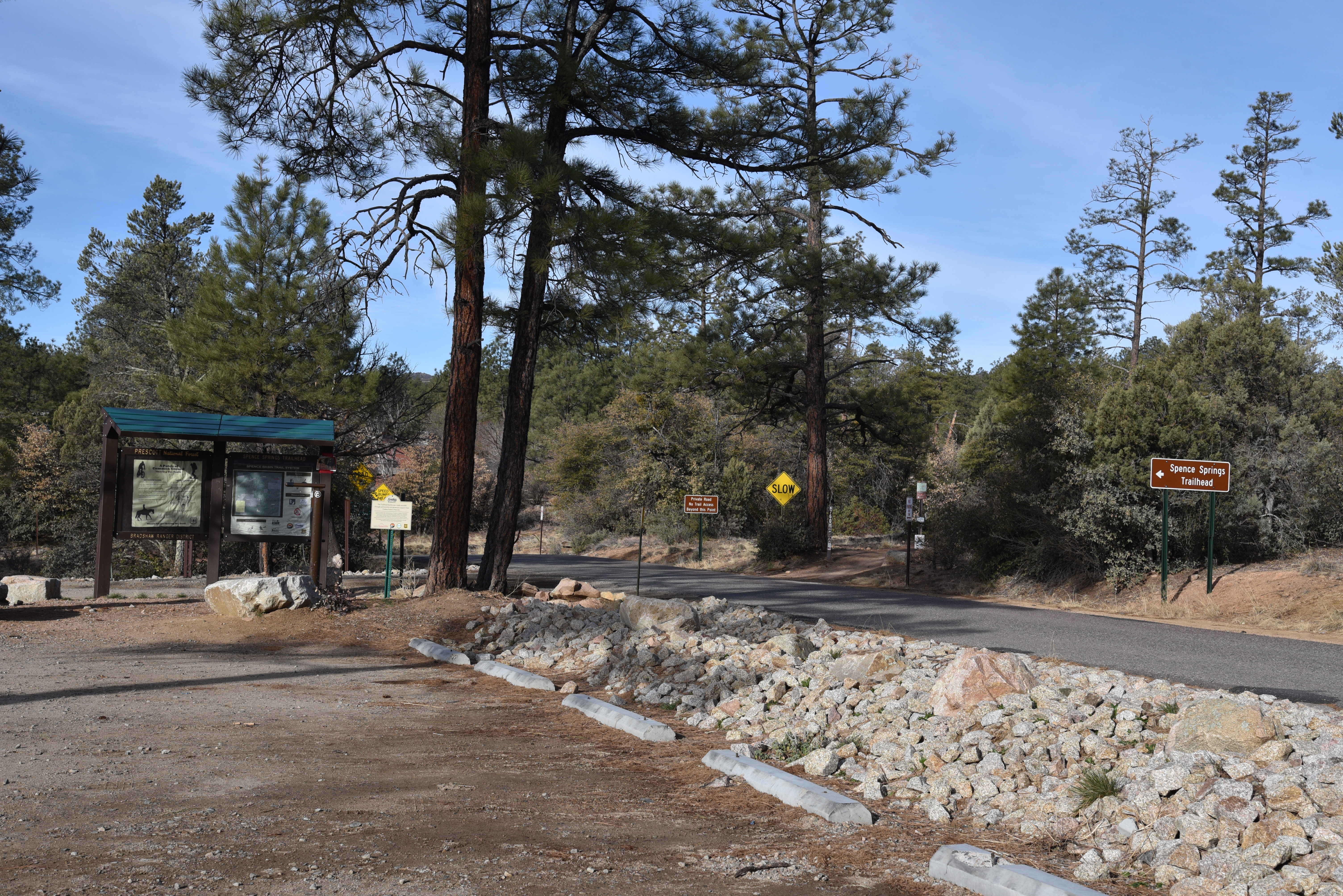
Spence Springs Trailhead opened in 2019

BLM Trail cross a drainage in Spence Basin

At map sign SB18, pick up the BLM trail #729 which spirals off the high ledges into the rough-cut drainages of Spence Creek. 
Alligator junipers are abundant along the trails

Tracing the creek and major runoff areas, this segment of the hike winds through forests thick with water-loving shrubs and soaring pines.  Next up, connect with the Juniper Gate trail #714 at map sign SB05 and get ready for yet another flavor thrown into the mix.  True to its name, this leg is heavy on the junipers with a side of edgy traverses and cool boulder passages above the rocky creek bed. 
Snow lingers in crevases in Spence Basin

Follow Juniper Gate back to the Noodle Loop, which spools out like limp fettuccine with hairpin turns wrapping around inclines and scoured ravines, and follow the signs back to the trailhead.  
Trails cut through coniferous woodlands

After scratching the surface with this sampler hike, download the map app to see more ways to enjoy one of Prescott’s newest hiking hubs.
Thumb Butte seen from Vista Trail

LENGTH: 4.6-mile loop as described here

RATING: moderate

ELEVATION: 5,490 – 5,936 feet

GETTING THERE:

Spence Springs Trailhead:

From Courthouse Square in downtown Prescott, go north on Montezuma Street which will turn into Whipple Street then Iron Springs Road (County Road 10) for 4.8 miles to Spence Springs Road on the left.  This is located just past the turnoff for Granite Basin Recreation Area.  The trailhead is on the left a few yards down the road. 

At this writing, the trailhead has a port-o-potty and map kiosk but no water.

Future plans include the addition of a vault restroom and picnic tables.

INFO & MAPS:

https://www.prescott-az.gov/wp-content/uploads/2016/12/Trails-and-Outdoor-Recreation-Map-Back-Side.pdf

https://www.avenzamaps.com/maps/851151/spence-basin

Tuesday, March 2, 2021

Tortolita Preserve

TORTOLITA PRESERVE

Candelabra saguaros are the preserve's icons

The saguaro cactus is one of the most iconic plants of the Sonoran Desert.

They thrive in Arizona’s warm, low desert areas and their creamy white blooms are the state’s official flower.  Growing up to 50 feet with lifespans of 150-200 years, the signature cacti take on many forms.  They exist as single columns, many-armed giants and sometimes develop elaborate contorted crests.  But in the sandy washes of the Tortolito Preserve in Marana, the elegant branching specimens are known as candelabra saguaros. 

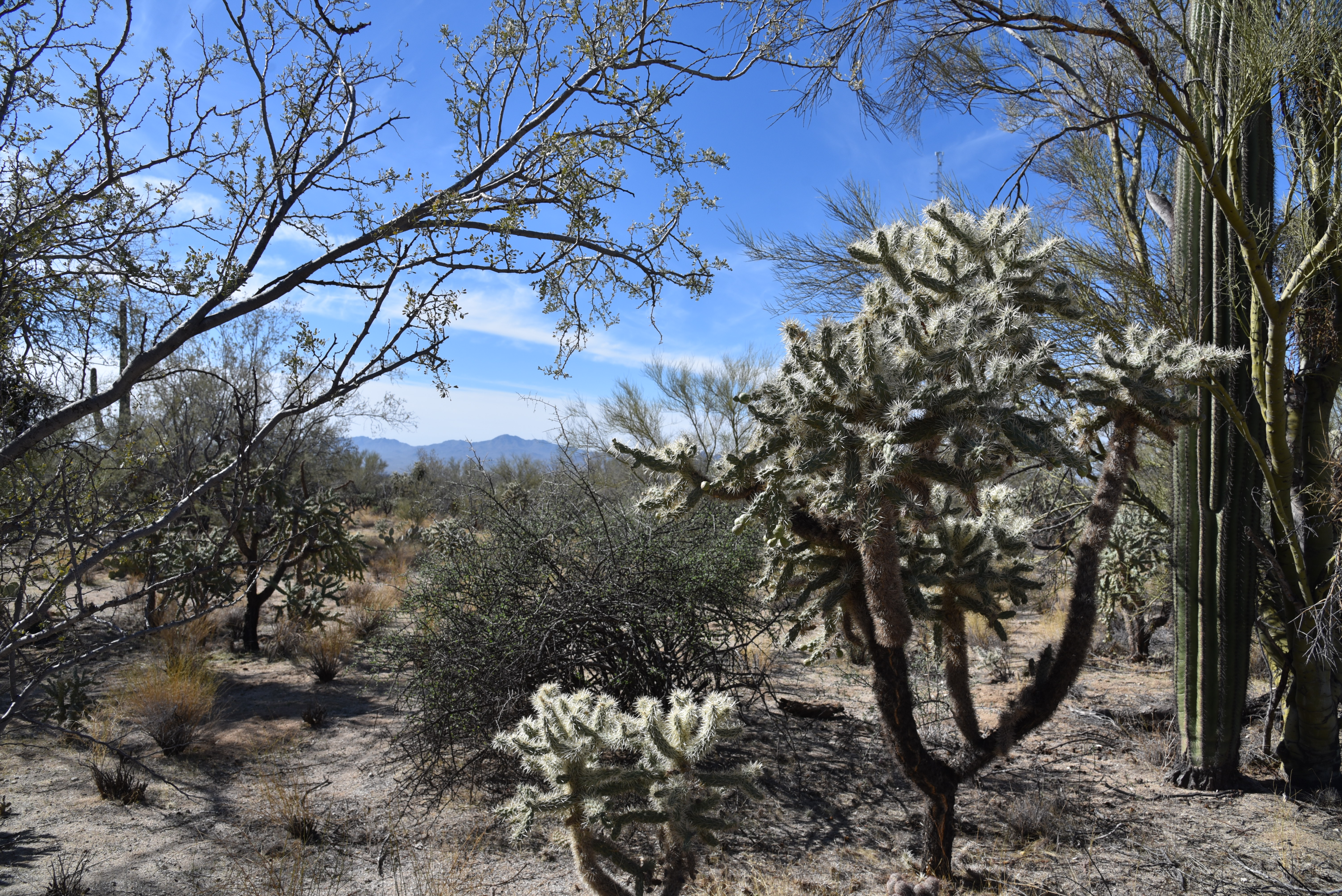
The hike has a posh, botanical garden feel

It makes sense that the thorny cacti would take on a moniker that mirrors the area’s posh vibe.  Surrounded by golf greens in the foothills of the Tortolito Mountains a few miles north of Tucson, the preserve bumps up against one of Arizona’s most luxurious resorts, the Five-Star, Five-Diamond Ritz-Carlton Dove Mountain. 
Twin Peaks (c: horizon) seen from the preserve

Hiking in the 2,400-acre preserve is more like a stroll through a botanical garden than a backcountry hike.  Established in 2009, the desert expanse is outfitted with a 9.2-mile ,non-motorized trail that traces the preserve’s perimeter for a tour of rich desert plant life and gorgeous mountain vistas. 

The "Old-Timer" ironwood

Flat, easy and maintained to resort-class standards, the trail passes among dozens of impressive “candelabras” as well as palo verde “tunnels”, acres of chain fruit cholla and several ancient, gnarled ironwood trees (including the famous "Old-Timer") known for their frothy, pea-like pink blooms that color the desert in springtime.
Tortolito Mountain views

The 9.2-mile perimeter trail is well-signed

Mountain views are a hallmark of the preserve’s appeal.  To the north, the Tortolita Mountains that rise to 4,300 feet, are home to more than 30 miles of more difficult trails can be accessed by way of the Wild Burro trailhead near the resort. 

Cholla ribs display a honeycomb pattern

Gnarly, ancient ironwoods are common on the trail

To the west, the distinctive form of Twin Peaks is a dominant presence.
A palo verde "tunnel" along the route

While the mountain routes might be beyond the skill sets of casual visitors, the preserve trail offers an alternative way to appreciate the desert-mountain natural space in a tamer, leisurely fashion.

Tortolito Preserve trailhead

Post hike, treat yourself to some of the area’s top-shelf dining, shopping and hotel accommodations. Or, for the full star treatment, splurge with a weekend at the Ritz with a gemstone healing massage, poolside cocktails and a candelabra-lit gourmet meal. 

Signs mark points-of-interest along the way

LENGTH: 9.2 miles total

RATING: easy

ELEVATION: 2,300 – 2775 feet

GETTING THERE:

State Land /Moore Road Trailhead

6250 W. Moore Road, Marana.

From Interstate 10 in Marana, take the Tangerine Road exit 240. At the bottom of the off ramp, go 5 miles east on Tangerine Road to Dove Mountain Blvd.  Turn left, go 1 mile to Moore Road, turn left and continue 1 mile to the trailhead.  Pass the state land gate (close it behind you) and park in the large dirt lot.  The hike begins at the map kiosk.  There are no restrooms or water at this trailhead.

The preserve is on State Trust land, but a permit is not required.

No facilities

INFO:  Town of Marana
https://www.discovermarana.org/directory/tortolita-preserve-and-trail-system/

Thursday, February 18, 2021

Brown's Mountain

BROWN'S MOUNTAIN

Brown's Mountain seen from the Brown's MtnTrail


The can’t-ignore centerpiece of Scottsdale’s McDowell Sonoran Preserve is a magnet for hikers.  When viewed from the miles of trails that weave around its base, the prominent mound might appear slightly intimidating, but if you’re like most trekkers, sooner or later you’ll climb it.

Switchbacks on the Brown's Mountain Trail

Whether you use a direct approach or long loop to access the preserve’s loftiest perch, the effort rewards with outstanding views and if you’re lucky, a peek at an aerial bird show.

Ravens soar around Brown's Mountain

The distinctive flat-topped mountain with colorfully-layered flanks sits in the preserve’s north sector among acres of yucca, cacti and desert trees.  Hikers aren’t the only ones that are attracted to this place.  Ravens have claimed the craggy cliffs below the mountain’s summit as prime nesting territory.

Ocotillo and cholla on the summit spur trail

The large, croaking and glossy jet-black birds are easy to hear and see against ocher cliffs and blue skies along the hike up the mountain.

A rocky section on the summit spur trail

While common ravens sometimes build nests in trees, they tend to favor jagged rock walls like those on Brown’s Mountain.  February through May is the best time to observe the birds’ dramatic mating rituals that include aerial dances with males and females swooping, diving and roosting to preen before building platform nests in stony cracks. 
Ravens mate for life and share parenting chores.  Females incubate eggs for 3 weeks while males provide care and feeding.  Chicks take flight about five weeks after hatching.

View of Pinncle Peak & Cone Mtn from summit

The most direct route to view the ravens in action and get to the summit begins at the Brown’s Ranch trailhead with an easy 0.6-mile walk on Brown’s Ranch Road.  Take a left onto the Brown’s Mountain Trail, and follow the moderate route as it ascends 0.7-mile along the mountain’s geologically-complex flanks where the ravens play around the rugged stone jetties that protrude from the mountain’s northeast slopes.  Once through a bare-rock chute, the route meets a saddle with a scenic overlook where the summit spur heads up the hill’s east face. 

The rock chute on Brown's Mountain Trail

The 0.2-mile summit spur ascends in tight, steep switchbacks with a short segment of blocky rock scrambling near the top.  All but the shortest hikers can get through this jumble without the need for a handhold.  The small, rocky summit offers unobscured, 360-degree views of the Valley, the preserve layout and distant mountain peaks. 

Hikers on the scenic overlook below Brown's Mtn

Several artifacts including concrete slabs inscribed with names from 1958 and a chopped wood power line pole add elements of history to the isolated peak that stands 550 feet above the desert floor.  From this high platform, the air antics of ravens take center stage. 
The saddle below Brown's Mountain

Sometimes swooping closely overhead or croaking from nearby outcroppings, they serve as loud, convincing reminders to stay on trails and not disturb nesting habitats and fragile terrain. 
Nearing the saddle below Brown's Mountain

View from the summit of Brown's Mountain

While on top, review the preserve map to scope out your return route or simply retrace your steps for a second look at the cliff-side raven drama.

LENGTH:  3 miles round trip to the summit and back

RATING: moderate

ELEVATION:  2,703 – 3,253 feet

GETTING THERE:

Brown's Ranch Trailhead: 30301 N. Alma School Pkwy., Scottsdale.

From Loop 101 in Scottsdale, take the Pima/Princess exit 36. Go 6.5 miles north on Pima to Dynamite, turn right and continue 2.7 miles to Alma School.  Turn left and go 1 mile to the trailhead. There are restrooms, water and maps at the trailhead.  The preserve is open from sunrise to sunset daily. No fees.

INFO:

https://www.scottsdaleaz.gov/preserve