Find A Trail. Start Your Search Here:

Tuesday, March 9, 2021

Spence Basin Trail System

SPENCE BASIN TRAIL SYSTEM

There's excellent signage throughout the hike

Populating the space between the Thumb Butte and Granite Basin recreation sites in Prescott National Forest, the new Spence Basin Trail System adds nearly 30 miles of hiking options to the area’s already packed menu. 
Granite Mountain seen from Vista Trail

The routes, which were adopted and developed over that last few years, are located less than 5 miles northwest of historic downtown Prescott and are accessible by way of paved roads.  While the trails can be reached through connecting routes that extend north from Thumb Butte, the Spence Springs trailhead that opened in 2019 offers direct access to the heart of the system.
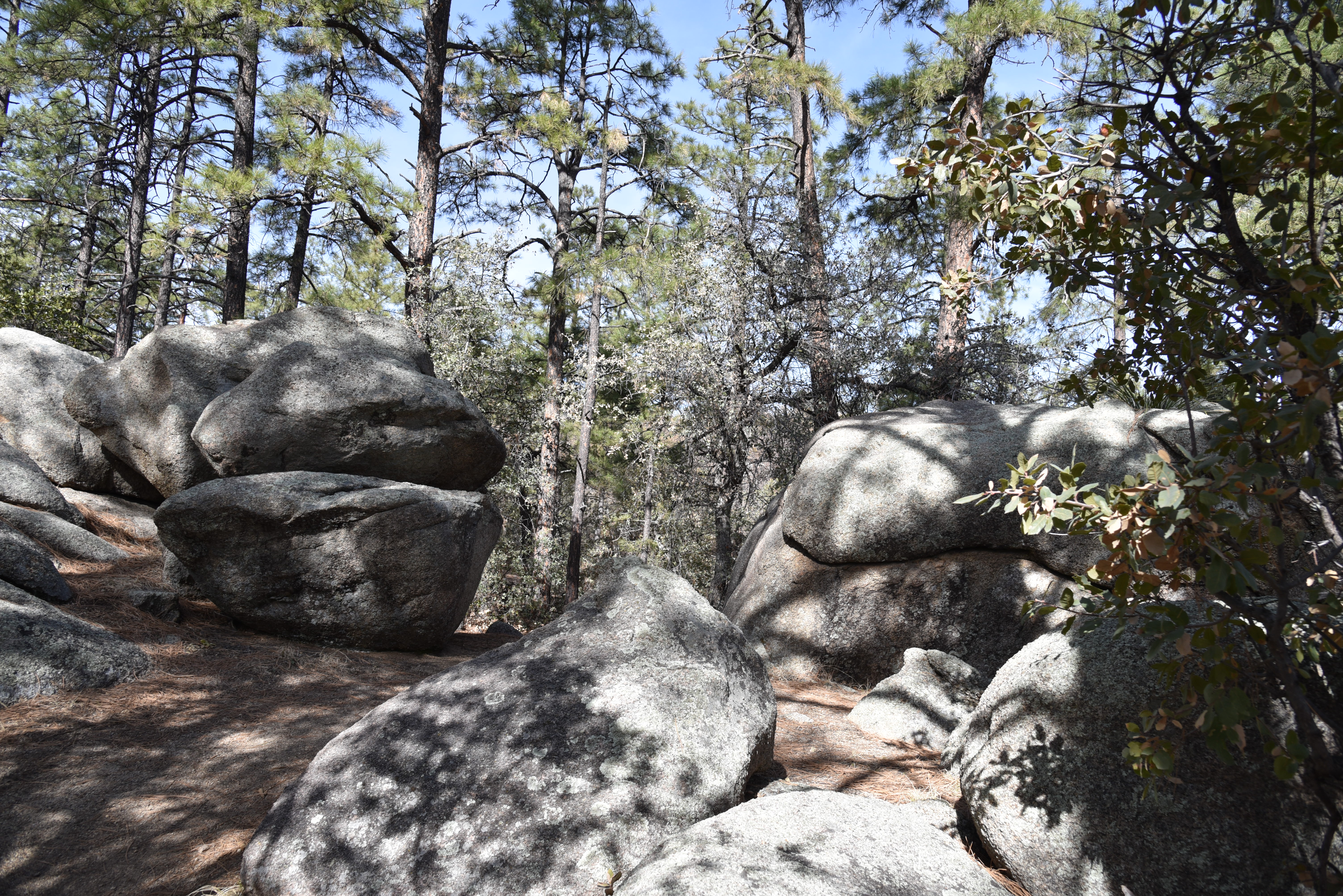
A boulder passage on Juniper Gate Trail

Ponderosa pines shade the Noodle Loop


The nearly 30-mile maze of Spence Basin’s loopy, hilly single tracks speak to their mountain-biker origins.  Tightly woven, with dozens of ways to customize both length and difficulty levels, the trails roll out in the varied terrain around Spence Creek.  The signage along the routes is among the best you’ll find anywhere, making it simple to find your way around.  Junctions are outfitted with you-are-here-style map signs that show mileages, connecting routes, GPS coordinates, emergency location codes and smart phone app codes.  Deciding where to begin exploring the convoluted trail cluster is the only dilemma.  For first-timers, an introductory loop using the Noodle, Vista, BLM and Juniper Gate trails is a great way to experience some of the best bits.  Here’s how.

Snowy Sierra Prieta Mtns seen from Vista Trail

From the trailhead, cross the road and begin with a short walk on Noodle Loop #760.  At the first junction (emergency marker sign SB03), turn right onto the Vista Trail #706.  This leg of the hike starts by delving into a sunny juniper-dotted drainage area with patches of shady ponderosa pine and oak woodlands.  Vista Trail makes an easy climb on slopes at the northern edge of the system.  Exposed highpoints reveal views of Thumb Butte and the Sierra Prieta Mountains to the south and fleeting glimpses of Granite Mountain and Williamson Valley to the north. 
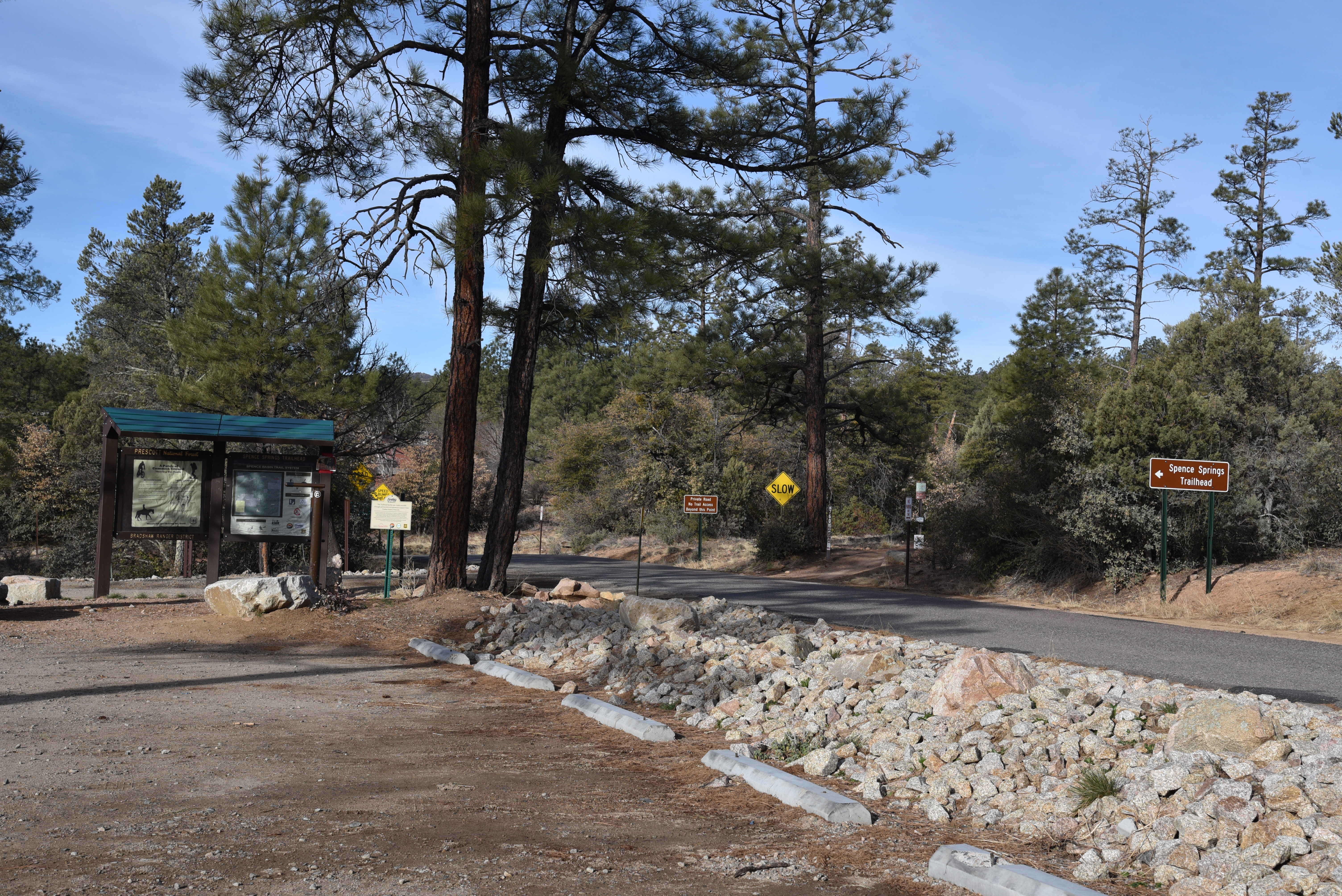
Spence Springs Trailhead opened in 2019

BLM Trail cross a drainage in Spence Basin

At map sign SB18, pick up the BLM trail #729 which spirals off the high ledges into the rough-cut drainages of Spence Creek. 
Alligator junipers are abundant along the trails

Tracing the creek and major runoff areas, this segment of the hike winds through forests thick with water-loving shrubs and soaring pines.  Next up, connect with the Juniper Gate trail #714 at map sign SB05 and get ready for yet another flavor thrown into the mix.  True to its name, this leg is heavy on the junipers with a side of edgy traverses and cool boulder passages above the rocky creek bed. 
Snow lingers in crevases in Spence Basin

Follow Juniper Gate back to the Noodle Loop, which spools out like limp fettuccine with hairpin turns wrapping around inclines and scoured ravines, and follow the signs back to the trailhead.  
Trails cut through coniferous woodlands

After scratching the surface with this sampler hike, download the map app to see more ways to enjoy one of Prescott’s newest hiking hubs.
Thumb Butte seen from Vista Trail

LENGTH: 4.6-mile loop as described here

RATING: moderate

ELEVATION: 5,490 – 5,936 feet

GETTING THERE:

Spence Springs Trailhead:

From Courthouse Square in downtown Prescott, go north on Montezuma Street which will turn into Whipple Street then Iron Springs Road (County Road 10) for 4.8 miles to Spence Springs Road on the left.  This is located just past the turnoff for Granite Basin Recreation Area.  The trailhead is on the left a few yards down the road. 

At this writing, the trailhead has a port-o-potty and map kiosk but no water.

Future plans include the addition of a vault restroom and picnic tables.

INFO & MAPS:

https://www.prescott-az.gov/wp-content/uploads/2016/12/Trails-and-Outdoor-Recreation-Map-Back-Side.pdf

https://www.avenzamaps.com/maps/851151/spence-basin

Tuesday, March 2, 2021

Tortolita Preserve

TORTOLITA PRESERVE

Candelabra saguaros are the preserve's icons

The saguaro cactus is one of the most iconic plants of the Sonoran Desert.

They thrive in Arizona’s warm, low desert areas and their creamy white blooms are the state’s official flower.  Growing up to 50 feet with lifespans of 150-200 years, the signature cacti take on many forms.  They exist as single columns, many-armed giants and sometimes develop elaborate contorted crests.  But in the sandy washes of the Tortolito Preserve in Marana, the elegant branching specimens are known as candelabra saguaros. 

The hike has a posh, botanical garden feel

It makes sense that the thorny cacti would take on a moniker that mirrors the area’s posh vibe.  Surrounded by golf greens in the foothills of the Tortolito Mountains a few miles north of Tucson, the preserve bumps up against one of Arizona’s most luxurious resorts, the Five-Star, Five-Diamond Ritz-Carlton Dove Mountain. 
Twin Peaks (c: horizon) seen from the preserve

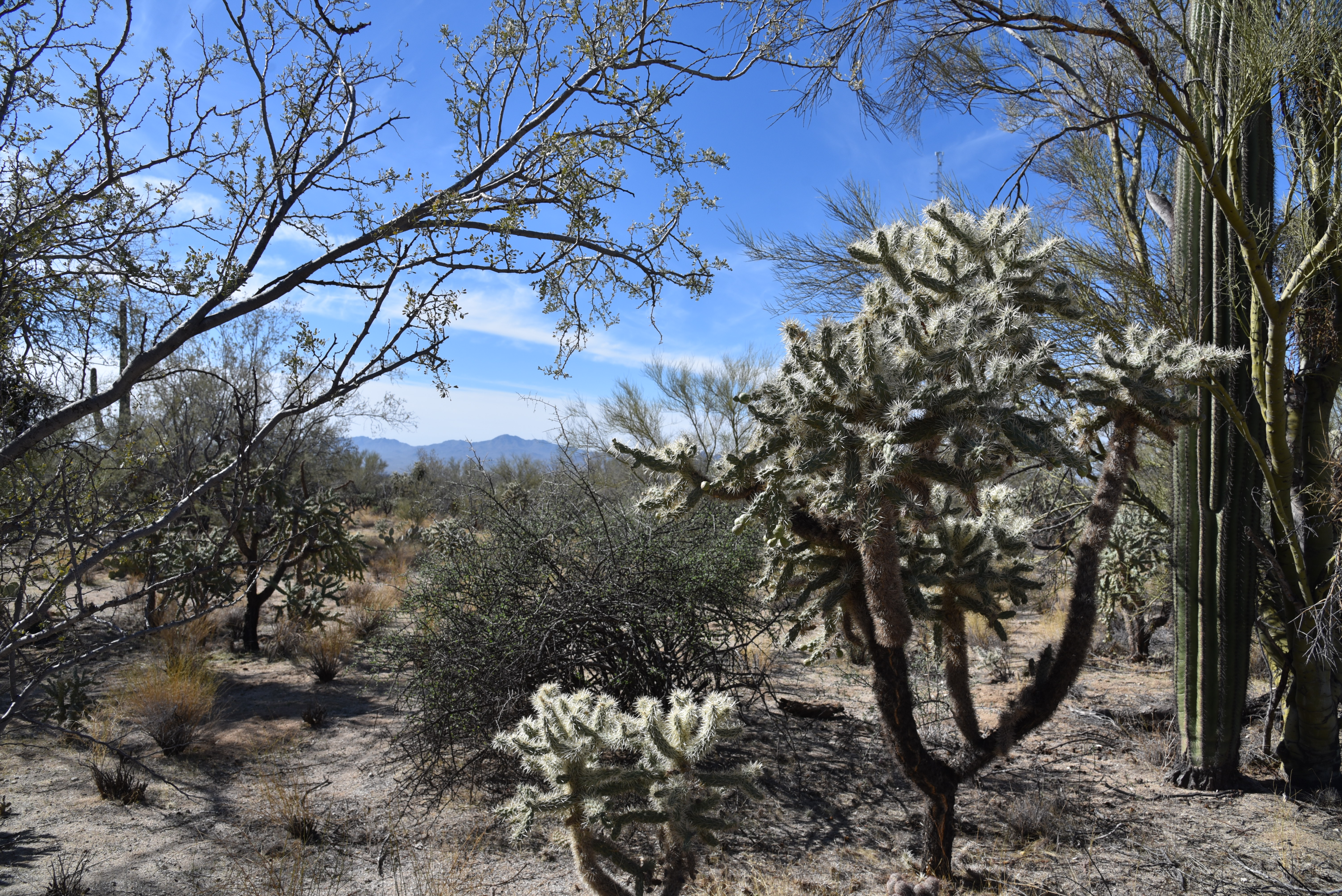
Hiking in the 2,400-acre preserve is more like a stroll through a botanical garden than a backcountry hike.  Established in 2009, the desert expanse is outfitted with a 9.2-mile ,non-motorized trail that traces the preserve’s perimeter for a tour of rich desert plant life and gorgeous mountain vistas. 

The "Old-Timer" ironwood

Flat, easy and maintained to resort-class standards, the trail passes among dozens of impressive “candelabras” as well as palo verde “tunnels”, acres of chain fruit cholla and several ancient, gnarled ironwood trees (including the famous "Old-Timer") known for their frothy, pea-like pink blooms that color the desert in springtime.
Tortolito Mountain views

The 9.2-mile perimeter trail is well-signed

Mountain views are a hallmark of the preserve’s appeal.  To the north, the Tortolita Mountains that rise to 4,300 feet, are home to more than 30 miles of more difficult trails can be accessed by way of the Wild Burro trailhead near the resort. 

Cholla ribs display a honeycomb pattern

Gnarly, ancient ironwoods are common on the trail

To the west, the distinctive form of Twin Peaks is a dominant presence.
A palo verde "tunnel" along the route

While the mountain routes might be beyond the skill sets of casual visitors, the preserve trail offers an alternative way to appreciate the desert-mountain natural space in a tamer, leisurely fashion.

Tortolito Preserve trailhead

Post hike, treat yourself to some of the area’s top-shelf dining, shopping and hotel accommodations. Or, for the full star treatment, splurge with a weekend at the Ritz with a gemstone healing massage, poolside cocktails and a candelabra-lit gourmet meal. 

Signs mark points-of-interest along the way

LENGTH: 9.2 miles total

RATING: easy

ELEVATION: 2,300 – 2775 feet

GETTING THERE:

State Land /Moore Road Trailhead

6250 W. Moore Road, Marana.

From Interstate 10 in Marana, take the Tangerine Road exit 240. At the bottom of the off ramp, go 5 miles east on Tangerine Road to Dove Mountain Blvd.  Turn left, go 1 mile to Moore Road, turn left and continue 1 mile to the trailhead.  Pass the state land gate (close it behind you) and park in the large dirt lot.  The hike begins at the map kiosk.  There are no restrooms or water at this trailhead.

The preserve is on State Trust land, but a permit is not required.

No facilities

INFO:  Town of Marana
https://www.discovermarana.org/directory/tortolita-preserve-and-trail-system/

Thursday, February 18, 2021

Brown's Mountain

BROWN'S MOUNTAIN

Brown's Mountain seen from the Brown's MtnTrail


The can’t-ignore centerpiece of Scottsdale’s McDowell Sonoran Preserve is a magnet for hikers.  When viewed from the miles of trails that weave around its base, the prominent mound might appear slightly intimidating, but if you’re like most trekkers, sooner or later you’ll climb it.

Switchbacks on the Brown's Mountain Trail

Whether you use a direct approach or long loop to access the preserve’s loftiest perch, the effort rewards with outstanding views and if you’re lucky, a peek at an aerial bird show.

Ravens soar around Brown's Mountain

The distinctive flat-topped mountain with colorfully-layered flanks sits in the preserve’s north sector among acres of yucca, cacti and desert trees.  Hikers aren’t the only ones that are attracted to this place.  Ravens have claimed the craggy cliffs below the mountain’s summit as prime nesting territory.

Ocotillo and cholla on the summit spur trail

The large, croaking and glossy jet-black birds are easy to hear and see against ocher cliffs and blue skies along the hike up the mountain.

A rocky section on the summit spur trail

While common ravens sometimes build nests in trees, they tend to favor jagged rock walls like those on Brown’s Mountain.  February through May is the best time to observe the birds’ dramatic mating rituals that include aerial dances with males and females swooping, diving and roosting to preen before building platform nests in stony cracks. 
Ravens mate for life and share parenting chores.  Females incubate eggs for 3 weeks while males provide care and feeding.  Chicks take flight about five weeks after hatching.

View of Pinncle Peak & Cone Mtn from summit

The most direct route to view the ravens in action and get to the summit begins at the Brown’s Ranch trailhead with an easy 0.6-mile walk on Brown’s Ranch Road.  Take a left onto the Brown’s Mountain Trail, and follow the moderate route as it ascends 0.7-mile along the mountain’s geologically-complex flanks where the ravens play around the rugged stone jetties that protrude from the mountain’s northeast slopes.  Once through a bare-rock chute, the route meets a saddle with a scenic overlook where the summit spur heads up the hill’s east face. 

The rock chute on Brown's Mountain Trail

The 0.2-mile summit spur ascends in tight, steep switchbacks with a short segment of blocky rock scrambling near the top.  All but the shortest hikers can get through this jumble without the need for a handhold.  The small, rocky summit offers unobscured, 360-degree views of the Valley, the preserve layout and distant mountain peaks. 

Hikers on the scenic overlook below Brown's Mtn

Several artifacts including concrete slabs inscribed with names from 1958 and a chopped wood power line pole add elements of history to the isolated peak that stands 550 feet above the desert floor.  From this high platform, the air antics of ravens take center stage. 
The saddle below Brown's Mountain

Sometimes swooping closely overhead or croaking from nearby outcroppings, they serve as loud, convincing reminders to stay on trails and not disturb nesting habitats and fragile terrain. 
Nearing the saddle below Brown's Mountain

View from the summit of Brown's Mountain

While on top, review the preserve map to scope out your return route or simply retrace your steps for a second look at the cliff-side raven drama.

LENGTH:  3 miles round trip to the summit and back

RATING: moderate

ELEVATION:  2,703 – 3,253 feet

GETTING THERE:

Brown's Ranch Trailhead: 30301 N. Alma School Pkwy., Scottsdale.

From Loop 101 in Scottsdale, take the Pima/Princess exit 36. Go 6.5 miles north on Pima to Dynamite, turn right and continue 2.7 miles to Alma School.  Turn left and go 1 mile to the trailhead. There are restrooms, water and maps at the trailhead.  The preserve is open from sunrise to sunset daily. No fees.

INFO:

https://www.scottsdaleaz.gov/preserve


Thursday, February 11, 2021

Poston Butte Preserve

POSTON BUTTE PRESERVE

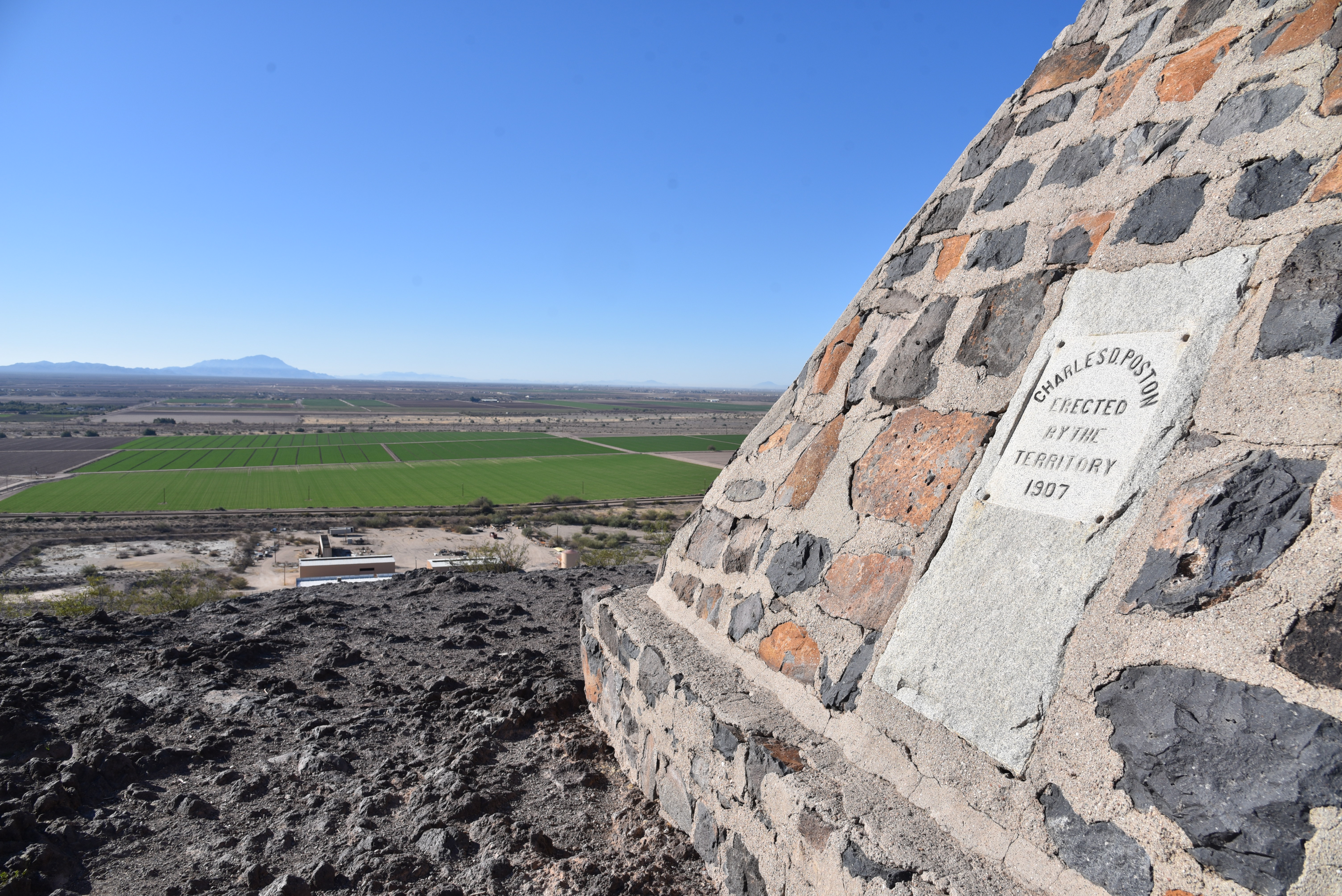
The monument on the summit of Poston Butte


Renaissance man or odd ball?  It can be argued that Charles Debrille Poston (1825 -1902) was a little of both.  The man who became known as the “Father of Arizona” lived a storied and colorful life before being laid to rest (in a roundabout way) on a volcanic mound beside the railroad tracks outside of historic downtown Florence.

Poston Butte was known as F Mountain


Over the course of his life, he was a Republican Congressman, world traveler, explorer, writer, mineral entrepreneur, follower of Zoroastrianism-- a monotheistic Persian religion founded in 6th century B.C.--and register of the U.S. land office in Florence from 1877 to 1879.  During his tenure in Florence, he constructed a Zoroastrian temple on a prominent local hill that went by the names of Primrose Hill and F Mountain before gaining its current moniker of Poston Butte. 

A short steep section isn't too difficult

The trail up Poston Butte is rough but moderate

The preserve is undergoing upgrades

Poston earned his “Father of Arizona” designation by successfully arguing for an Arizona Territory separate from the Territory of New Mexico and in 1864 he was elected as the new territory’s first delegate to the U.S. House of Representatives.  He spent his career moving in and out of Arizona before passing away, nearly penniless, in Phoenix. 

Today, almost 200 years after Poston’s birth, a roadside monument in his honor is getting some renewed love.  Travelers and locals alike have long enjoyed the short hike up Poston Butte.  Recognizing the site’s significance and potential as a recreation hub and tourism draw, the Town of Florence recently officially designated it Poston Butte Preserve with plans to expand, protect and enhance it with hiking trails and amenities. 

Superstition Ridgeline seen from Poston Butte

While it undergoes improvements, the preserve is open to hikers from sunrise to sunset daily.

Volcanic outcroppings on Poston Butte

A dirt pull out on Hunt Highway north of the Gila River serves as a trailhead. To reach the summit trail, walk under a wood railroad overpass and follow the well-worn, but as yet unsigned route.  At first glance, the preserve is kind of a desolate place.  Anchored by a lone hill in a sprawling desert valley cut with dirt roads, railroad tracks and grazing cattle, the property becomes more interesting when viewed from the high slopes of the butte.

Approaching the top of Poston Butte

The inky black, ash-infused knobs of Poston Butte are barren save for a few scattered palo verde trees, some scraggly creosote and dry tufts of grass.  Rough and unswept, the wide path makes a half-mile uphill plod.  There’s a short segment where the trail gets steep but it’s nothing vertical enough to knock the wind out of you.  On the way up, vistas include a mix of flat desert valleys, farmlands, distant mountain ranges and a full-frame look at the Superstition Ridgeline bolstered by the iconic Flatiron formation in the Superstition Wilderness near Apache Junction.

Green fields below Poston Butte

Nearby, the footprints of the Arizona state prison complex, mining operations and historic downtown Florence round out the sights.  Situated among several geological survey markers and mounds of ragged basalt boulders, a stone-masonry pyramid marks the summit.  Beneath the artful structure, lie the bones of Charles D. Poston.
Flatiron on the left horizon.


Despite the 1907 date on the monument, Poston’s body was exhumed from a paupers grave in Phoenix and re-interred here in 1925, exactly 100 years after his birth.

It’s going to be fun watching this quirky Pinal County roadside attraction with a heavy Arizona territorial lilt evolve into a genuine hiking destination. 

Fittingly, the Town of Florence plans a 2025 observation of the 100-year anniversary of Poston’s post-mortem return to one of his favorite Arizona destinations.

LENGTH: 1.2 miles to the top and back

RATING: moderate

ELEVATION: 1,450 -1,748 feet

GETTING THERE:

From Interstate 10 south of the town of  Sacaton take the State Route 187/387 exit 185.

Go left at bottom of off ramp and connect with State Route 387. 

Follow SR 387 to SR 87, go right and continue (SR 87 turns into 287 Florence-Coolidge Hwy) to the major intersection at Main St in Florence.  Veer right and then left to pick up Florence Heights Dr.  Continue less than a mile to SR 79, turn left (north) and go to Hunt Highway at milepost 136. Turn left and continue to the trailhead on the right to the trailhead on the right.

As of this writing, there are no facilities at the trailhead.

HOURS: sunrise to sunset daily

INFO: http://www.florenceaz.gov/parks-and-recreation/

Monday, February 1, 2021

Enchanted Peak

ENCHANTED PEAK

Rincon Peak (center) seen from ElGrupo Trail

From the Enchanted Hills Trails Park trailhead in Tucson, Enchanted Peak, a prominent, 2,795-foot hill, stands out to the northeast.  From this vantage point, its steep slopes appear insurmountable, yet the trails that lead to its summit are surprisingly manageable.  

The summit of Enchanted Peak

Occupying a 356-acre natural area within the east side of Tucson Mountain Park, the tiny parcel at the edge of suburbia packs in 7 miles of non-motorized use trails. 

A crested saguaro on the El Grupo Trail

Winding around the eponymous Enchanted Hills Wash, the interconnected network of trails showcases rich Sonoran Desert vegetation and huge mountain vistas. 
Tecolote Trail circles the base of the peak

There are many ways to enjoy trekking within the park, but, if you’re like some hikers, that peak will be an irresistible destination.  To get to the prize, begin by hiking east on the park’s arterial El Grupo Loop. 
The slopes of Enchanted Peak appear insurmountable

While the trails are well-designated with map posts, some junction signs are offset from the turnoffs, so pay attention.  Numerous shortcut trails and add-on loops lend themselves to customized treks, but if you just can’t get that peak out of your head, here’s the quickest route.

Fire 7 Trail approaches the base of the peak

Follow El Grupo to 1-mile through wide open country and boulder passages where an impressive crested saguaro stands just north of the trail.  Turn left onto the High Noon Trail, hike 0.3 mile, turn left and pick up the Fire 7 Trail which switchbacks up to the base of the peak. 

Tumamoc Hill seen from High Noon Trail

Where the trail meets the peak-circling Tecolote Trail, head right and hike 0.2-mile to the Enchanted Peak Trail.  This final, 0.3-mile path makes a sinuous ascent over bare rock and edgy clefts with outstanding views of high mountain ranges to the east. 

Stone passages are common on the route

For experienced hikers, the climb is only moderate in difficulty until the last few yards where it makes an abrupt and very vertical assault on the summit.  
Summit sign names prominent peaks

On top, an interpretive sign mounted on the small, rocky pinnacle shows the names, distances and heights of prominent mountains in the Tortolita, Santa Catalina and Rincon ranges visible on the near and far horizons.  Look for Mount Kimball (7,258 feet), Mount Lemmon (9,157 feet), Mount Bigelow (8,450 feet), Rincon Peak (8,284 feet) and nearby Tumamoc Hill (3,108 feet), all destinations near trails that get some serious height and present inspiration for more ambitious mountain adventures.
Tortolita Mountains seen from the summit trail


To complete this trek, descend and hike the opposite way around Tecolote Trail and El Grupo Loop or use the excellent signage to wander at will.

Park trails are well signed

LENGTH:  4.1 miles as described here

RATING:  moderate

ELEVATION:  2,479 – 2,795 feet (717 feet of accumulated elevation change)

GETTING THERE:

From Interstate 10 in Tucson, take the Starr Pass Blvd. exit 259.  At the bottom of the offramp, turn right, follow Starr Pass Blvd. 0.5 mile and turn right on Mission Road.  Go 1.3 miles on Mission Road to 36th Street, turn right and continue 2.1 miles to the trailhead.

HOURS: the park is open daily from dawn until dusk. No fees.

INFO:

Enchanted Hills Trails Park

3280 W. 36th Street, Tucson

https://webcms.pima.gov/cms/one.aspx?portalId=169&pageId=578991