Find A Trail. Start Your Search Here:

Monday, September 14, 2020

Red Mountain Trail #43

RED MOUNTAIN TRAIL #43

In the space between Lynx Lake Recreation Area and State Route 69 in Prescott Valley, a mountainous back country laced with trails provides a diverse haven for shared-use recreation.
View from the switchbacks on Red Mountain

Although it’s lodged between two busy areas, the canyons and hills adjacent to the communities of Dewey-Humboldt have a remote feel, rugged character and more appeal than the view from the highway suggests. 

Red Mtn. trail traces Green Gulch

One of the most scenic hikes in the area is the Red Mountain Trail #43, an internal trail which can only be accessed by way of connecting routes that begin either near Lynx Lake to the west or at the Green Gulch trailhead which provides access to the Blue Hills Trail System at the east boundary of Prescott National Forest.  The less crowded and more direct option is the latter.  From the roomy parking area, begin hiking on the Charcoal Gulch Trail #9419 which is open to hikers, equestrian and ATV use.  At first, the terrain looks dismal, but conditions quickly improve as the trail moves west.

Skunk bush that grow in drainages blush red in fall

Hike begins on the Charcoal Gulch trail #9419

Charcoal Gulch was damaged by the Goodwin Fire that was reported on June 24, 2017 and went on to burn over 28,500 acres of brush, grass and pinion-juniper woodlands 14 miles south of Prescott.  Three years after the blaze, the area has been raked and cleared and shrubs and tree saplings are emerging from the stubble.  With great views of the Red Mountain destination jutting above the forests to the north, Trail #9419 follows a rocky dirt road that makes its way to where the heads of Charcoal and Green Gulch intersect and tree cover gradually increases.

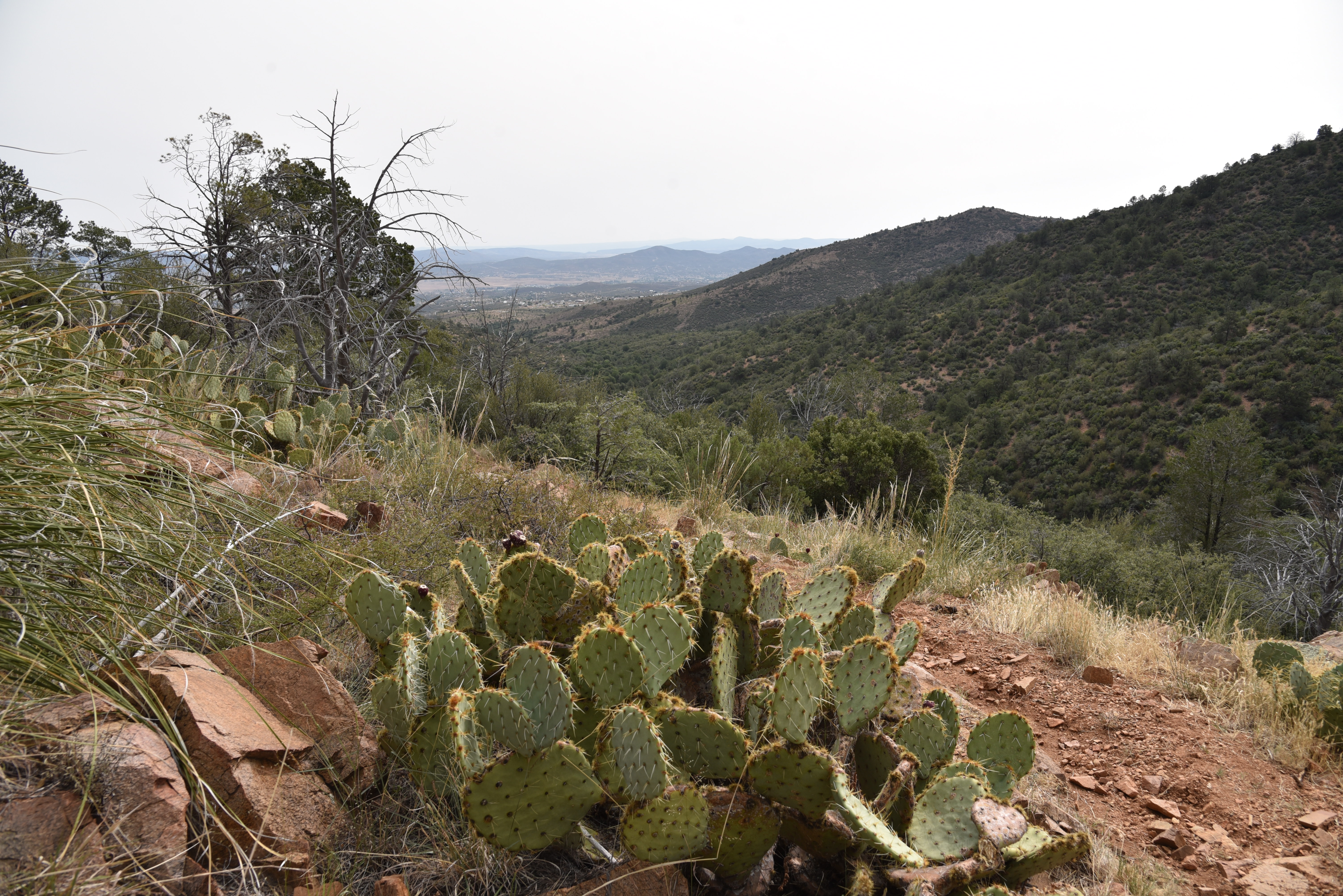
View of Prescott Valley from Red Mountain


Watch for peeks at impressive deep ravines and rugged cliffs off to the left along the next quarter mile. At the 0.9-mile point, Red Mountain Trail #43 spins off to the right at an easy-to-miss junction.
Green Gulch trailhead in Dewey

 
Much of Red Mtn trail passes through forests

After hopping a berm and passing through a crooked road cut, the nature of the hike takes on a whole new character.  Trail #43 immediately enters a thick forest of Gambel oak, alligator junipers and pinion pines that sits above the course of Green Gulch. 
Boulders line Red Mtn trail #43

Part of Red Mtn trail is canyon bound

The route crosses drainages several times, gaining elevation gently as it works its way through oak thickets and boulder outcroppings to the base of Red Mountain. 
Some sections of Red Mtn trail are rocky & steep

Never straying far from the gulch, the trail brushes by stands of water-loving Arizona walnut, willows, alder-leaf mountain mahogany and fruit-bearing shrubs, justifying the “green” part of its name.  
Hike passes through rangeland--close all gates.

After a mile of forest hiking, the trail leaves the woodlands and enters a dryer clime replete with cacti, yucca and junipers and begins an uphill assault in earnest.  The climb segment of the hike is compact and aggressive.
Scar of the Goodwin Fire on Charcoal Gulch trail

An AZ walnut tree shows fall color on 9-12-20

A set of tight, steep switchbacks with loose rocks land hikers on high ridges above the gulch where big views of Prescott Valley appear at the bottom of the V-shaped gorge. 
Oak trees shade Red Mtn trail #43

The stony gorge of Charcoal Gulch

The route flattens out for a bit before making a minor decent into a canyon-bound corridor along an edge-hugging path.  Spots of extreme green in the drainages below betray the location of springs that feed tiny riparian niches.  A few more ups and downs lead to the junction with the Prospectors Trail #42 at the outskirts of the Lynx Lake trails complex where you can opt to call it the turnaround point or use the forest service map to continue about 5 miles (on trails) to the lake or create a longer loop back to the trailhead. 
Red Mtn trail junction is easy to miss

Whether done as an out-and-back or complex loop, Red Mountain trail bridges the space between lakeside commotion and open prairies with beauty, challenge and plenty of variety.
Alderleaf mountain mahagony grows along the route

Arching oaks on Red Mtn trail #43

LENGTH: 5.2 miles round trip as described here

RATING: moderate

ELEVATION:  5,299 – 6,245 feet

GETTING THERE:

From the State Route 169/69 junction in Dewey-Humboldt, go 1 mile north on SR 69 to the next stop light and turn left on Kachina Place.  Follow Kachina Pl to the “T” intersection at Pony Place, turn left and follow the signs to the Green Gulch trailhead, approximately 3 miles from SR 69.  The parking lot is designed to accommodate both trailers and cars, so mind the parking protocols.

INFO:

Prescott National Forest

https://www.fs.usda.gov/recarea/prescott/recreation/recarea/?recid=67481

Tuesday, September 1, 2020

Antelope Mountain

ANTELOPE MOUNTAIN

View from the saddle of Antelope Mountain near Greer

A drive along State Route 260 in the White Mountains between Pinetop-Lakeside and Springerville is a tour of extremes.
Fish Creek Corral frames a view of Antelope Mountain

The scenic byway begins in dense woodlands replete with lakeside retreats that comes to an abrupt end near the turn off for the town of Greer where the landscape jumps from piney to pastoral. 

Ellis Wiltbank Reservoir sits at the base of Antelope Mtn.

Like a splash of cold water, the terrain suddenly changes into sprawling grasslands and isolated pine-covered knolls. Figuring prominently in the landscape are hundreds of lumps, bumps, slumps and conical hills--welcome to the complex geology of the Springerville Volcanic Field.  This swath of cinder cones and lava flows sits at the southern edge of the Colorado Plateau, a roughly 130,000 square mile collection of some of the country’s most remarkable landforms (think: Zion, Capitol Reef and the Grand Canyon) that covers the four corners region of Utah, Colorado, New Mexico and Arizona.
A monsoon storm builds over Antelope Mountain

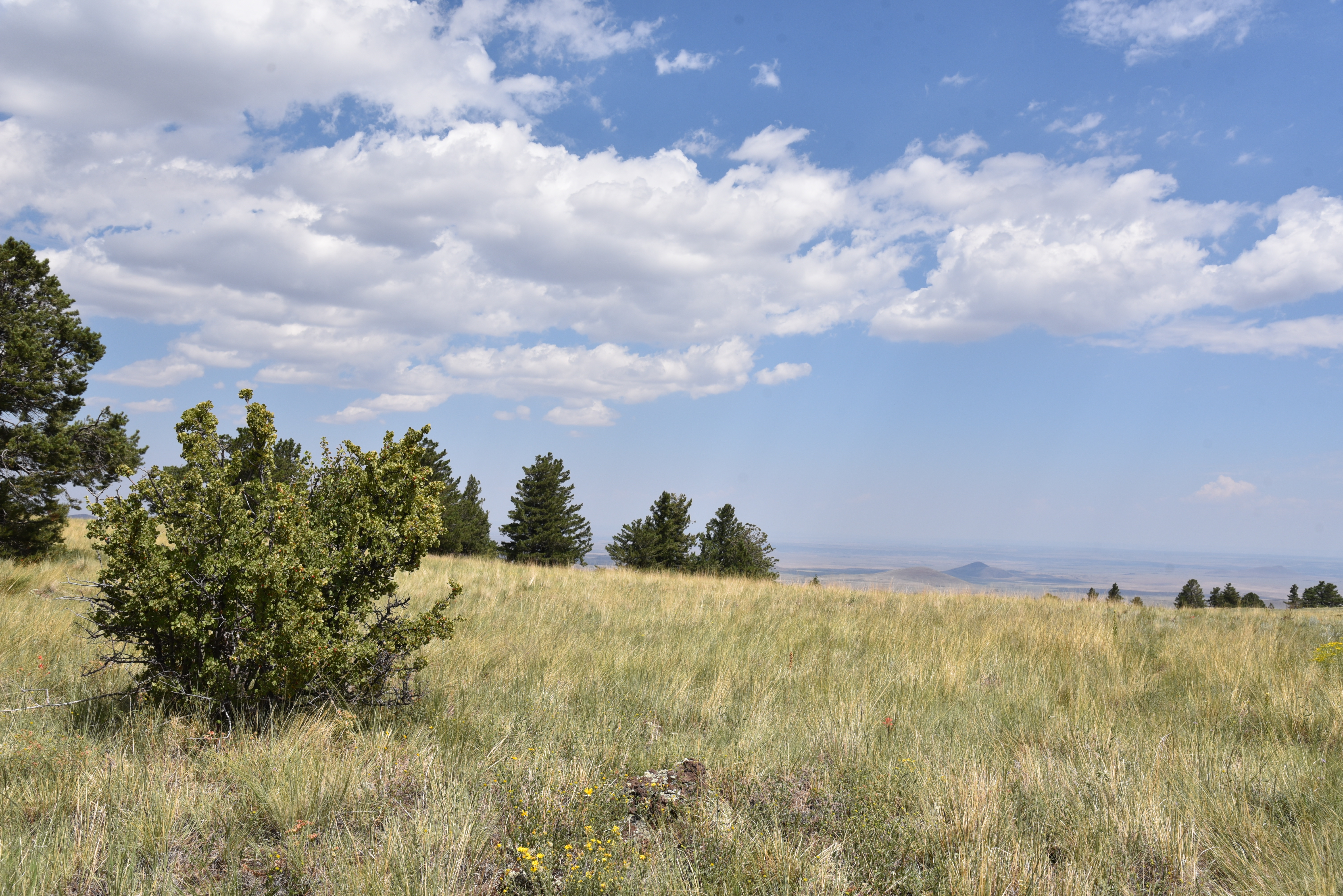
Springerville Volcanic Field seen from Antelope Mtn.

Sparsely vegetated, the sunny plains sit just north of the course of the Little Colorado River and its tributaries that drain into the Mount Baldy Wilderness area where a mass of lakes, marshes and moist riparian zones stand in stark contrast to the shrubby, windswept volcanic highlands.

Insects feed on a Mountain tail-leaf bush on Antelope Mtn.

Hiking in this bizarre area is both challenging and rewarding.

A textbook-perfect cinder cone seen from Antelope Mtn.

While 10,134-foot Greens Peak, the highest point in the field, is easily accessible on national forest land, many of the other notable volcanic features in the area are located along rough back roads that pass through a patchwork of national forest, state trust, tribal, municipal and private lands, so it’s important that you trek in sync with the laws.

Pollinators alight on New Mexican vervain blooms


One such place to explore is Antelope Mountain, a fascinating cinder cone which is on State Trust Land.  A permit is required to hike the rough dirt road to its 9,003-foot summit. State Trust Land Recreational permits are inexpensive, easy to obtain online and most, including the one for individual hiking access, are good for a full year.  In some cases, such as where Passage 30: Coconino Rim of the Arizona Trail crosses State Trust land north of Flagstaff, a permit is not required as long as you stay within the 15-foot corridor of the trail. That is an exception, though. If you’re recreating on State Trust land, you’ll need a permit.

Antelope Mountain is a cinder cone volcano

Steep approach to the saddle of Antelope Mountain


The deceptively easy-looking road that climbs Antelope Mountain begins at a nondescript turnout off State Route 260 six miles north of the town of Greer.  The first mile is a simple traipse among spotty trees and the wire-and-wood complex of the Fish Creek corrals where the first of two road gates marks the warm up section to the steep climbing ahead. From this segment, the road cut that snakes up the nearly treeless mountain is clearly visible. While it may not look that imposing from a distance, it makes a steady, 30-degree ascent with no breaks. It’s all up, all the way.

A hazy view of Escudilla Mtn on the far right horizon

Road cut visible on the barren south slopes of Antelope Mtn.

Soon, glimpses of Ellis Wiltbank Reservoir, which is on private property, appear in a shallow basin to the left of the road. Look carefully and you might spot domestic cattle, elk and big horn sheep roaming around its mucky perimeter.  At near the 1.5-mile point, pass a second gate that marks the State Trust Land boundary (per state land regulations, leave the gate as you found it, either open or closed) and get ready for the uphill grind.  One hairpin switchback at the 8,500-foot point is all you get in terms of climb-mitigating road engineering.  The rest of the hike makes a straight shot up the mountain’s south flank to the top with the final quarter-mile to the saddle below the summit ridge being the steepest. But great vistas of Escudilla Mountain on the New Mexico border, Mount Baldy, Pole Knoll and White Mountains grasslands take the sting out of the effort. 

Late summer is the best time to see sunflowers in the White Mtns.

Defunct communication equipment on Antelope Mtn.

Looking west from the lone switchback on Antelope Mtn.

On the saddle, the road splits. The left fork goes to the summit proper while the right one leads to scenic overlooks and a heap of defunct equipment, including what appears to be old analogue TV antennas.  A smattering of wind-tortured fir trees standing among outcroppings of basalt boulders and scree line the summit spur. Visible between the trees, a textbook-perfect cinder cone with a symmetrical crater sits 500 feet below the mountain’s north face while dozens of other more lopsided and eroded specimens are scattered on the prairies below.

Forest Road 558 leads to the top of Antelope Mountain

Looking east from the summit of Antelope Mountain

A wild geranium blooms among buckwheat flowers

The road tops out on a bald knob where a huge cairn made of cinders denotes the mountain’s highpoint.  On the top, the tower-clutter summit of Greens Peak can be seen to the west while the diverse mix of forests and open plains of east-central Arizona roll out all around making the quad burning hike well worth the effort.

View from the saddle of Antelope Mountain

Greens Peak (far R horizon) seen from Antelope Mtn

A permit is required to hike on Arizona State Trust Land


LENGTH:  6 miles round trip

RATING: moderate

ELEVATION:   8,149 – 9,003 feet

GETTING THERE:

From Show Low go 45 miles east on State Route 260 (White Mountain Blvd.) to Forest Road 558 on the left.  This easy-to-miss road is located 0.7-mile past the State Route 373 turn off for the town of Greer, just past a big Leaving Apache National Forest sign. There’s a parking turnout a few yard in and additional parking farther up the road near a corral. Hike the road to the summit.


AN ARIZONA STATE LAND TRUST RECREATIONAL PERMIT IS REQUIRED FOR THIS HIKE. GET ONE HERE:

https://land.az.gov/applications-permits/recreation


INFO on the Springerville Volcanic Field

http://azgs.arizona.edu/azgs-photo-tags/springerville-volcanic-field

Tuesday, August 18, 2020

A Quirky, Quiet Place in Sedona

A QUIRKY, QUIET PLACE IN SEDONA

Looking west from the trail.

Serene, solitary walks in Arizona’s high desert are good for the soul.  Even in times like these when conditions require us to distance ourselves from others, an occasional escape from the din of civilization can refresh a stressed body and mind. 

The route traces the west flank of Bear Mountain
Revered for its scenic beauty and restorative powers, Sedona is a go-to destination for mental and physical renewal. 
A corral near Robinson and Red tanks
Miles of hiking trails offer escape into gorgeous red rock canyons and cacti-studded mountaintops where the soothing sounds of ravens and digeridoos echo from russet escarpments. When times get tough or just plain confusing, it’s only natural you’d want to make a road trip to Sedona.
Silverleaf nightshade blooms along the route
Yet, once at the gateway to deliverance, you’ll likely discover that everybody else kind of had the same idea.
There's plenty of solitude on this who-knew hike
Miles-long traffic jams, packed trailheads and noisy crowds are the norm in the magnetic northern Arizona town.
 But, if all you want is a head-clearing walk in the desert, there’s a little-used route tucked among some of the area’s most popular hiking trails.  
 Beginning of the non motorized part of the hike  
Manzanita shrubs grow along the route
The satisfying little trek is surprisingly easy to find and mostly ignored in favor of its big-draw neighbors.
  Located off Boynton Pass Road in northwest Sedona not far from the hyper-popular Bear Mountain, Doe Mountain and Fay Canyon trails, the dusty, deceivingly dull-looking Forest Road 152E provides access to a quiet back country stroll below the western flanks of 6,541-foot Bear Mountain.
The hike follows old roads and rugged paths
From the dirt turnout that serves as the trailhead for this hike, follow FR 152E for 0.3-mile and turn left onto FR 9600.
 
A mesquite tree frames Bear Mountain views
Lightly shaded by junipers and cypress, the route curves through sunny rangeland just outside of Red Rock Secret Mountain Wilderness in Coconino National Forest.  
Looking north toward Loy Butte
After a half-mile of hiking on dirt roads, the route meets a fenced roundabout where a gate at the west end signals the hike’s transition from road to path. To protect wildlife, only non-motorized traffic is allowed beyond the gate.  Off to the left, a conspicuous stand of cottonwoods and a dilapidated corral marks the site of Robinson and Red Tanks, important wildlife water sources.  
The no-name trail welcomes hikers
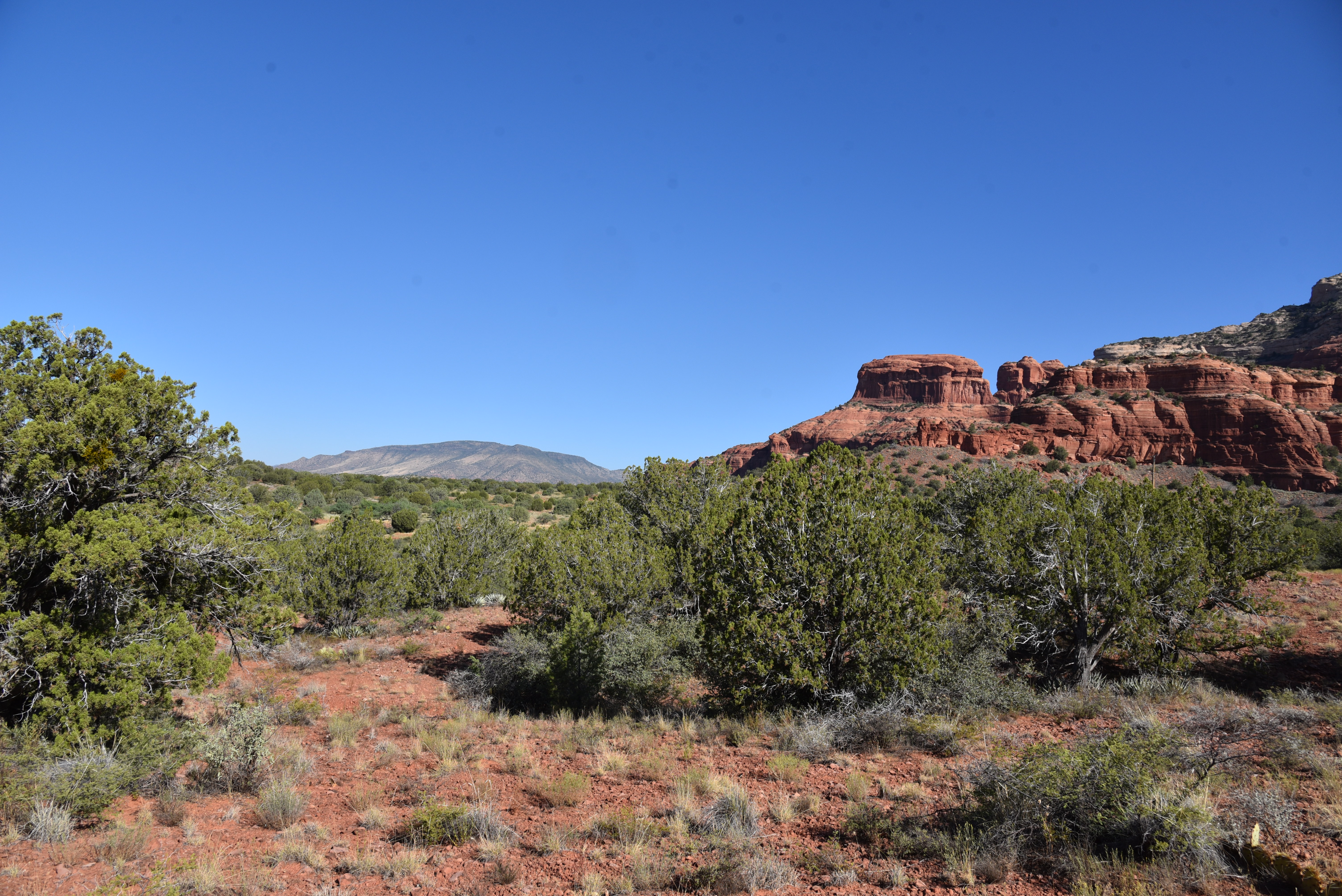
The unnamed trail, which is part degrading two-track and part scrappy path, passes over and through several drainage areas with wonderful views of 5,700-foot Loy Butte to the north, the famous Cockscomb formation to southeast, the mountains around Jerome and Cottonwood to the west and seldom seen geological layers of the back side of Bear Mountain. Airy and wide open to the sky, this off-the-main-drag gem delivers a healthy dose of refreshing isolation. 
Part of the hike follows FR 9600
The unassuming trailhead
At the 1.3-mile point, the trail narrows and gets more difficult to follow as it ducks into gullies and cacti-tangled manzanita shrubs.
 Unless you’re dressed in protective long pants and sleeves and willing do some searching to pick up the trail beyond the scrubby barriers, make the tree-ringed clearing that sits outside the quagmire the turnaround point for the hike.
Cockscomb (R) and Doe Mtn (L) seen from the trail

LENGTH: 2.7 miles roundtrip

RATING: easy

ELEVATION:  4,487 – 4,564 feet

GETTING THERE:

From the State Route 179/89A traffic circle in uptown Sedona, go 3.2 miles east (toward Cottonwood) on SR 89A to Dry Creek Road. Turn right and continue 4.5 miles to Boynton Pass Road, turn left, go 1.9 miles and park in the dirt turnout at Forest Road 152E on the right. For reference, this is 0.7-mile past the Doe Mountain/Bear Mountain trailhead. There are no fees.