Find A Trail. Start Your Search Here:

Monday, June 8, 2020

Mount Baldy Crossover Trail


MOUNT BALDY CROSSOVER TRAIL

Mount Baldy Wilderness.
Mt.Baldy Crossover trails moves through forests & meadows
Tethering the West Baldy and East Baldy trails that make grueling ascents to a saddle near the 11,403-foot summit of Mount Baldy at the edge of the White Mountain Apache Indian Reservation, the Mount Baldy Crossover trail No. 96 is much more than a means to an end.
Crossover Trail is in the Mt. Baldy Wilderness
The woodsy 3.5-mile connector route is often used as part of the 16.7-mile three-trail loop that traces the slopes of the extinct stratovolcano that’s been silent for 2 million years, but it also delivers a classic White Mountains experience when done alone as an out-and-back trek. It’s a great way to get acquainted with the high country terrain and acclimate before taking on the mountain.
Although this trail trifecta isn’t especially difficult in terms of technical challenge, the thinner, high elevation air can cause huffing and puffing that slows down progress. That’s a good thing, though, because you’ll want to take this one at a leisurely pace to enjoy the variety of scenery and rich biodiversity.
Delicate prairie smoke sprout feathery plumes in summer
Brilliant magenta American vetch flowers stand out underfoot
Forest and meadows collide on Crossover trail
Orange gooseberry shrubs are common on the route
Ferns grow hip-high in sunny spots
Marsh marigolds grow in moist areas on the Crossover trail
A feeder stream cuts through a meadow on Crossover trail
Many-flower stickseed is a fun find on the trail
Aspens flourish in sunny glens on the Crossover trail
False hellebore grows in wet meadows along the route
Rocky Mountain irises thrive in wet meadows
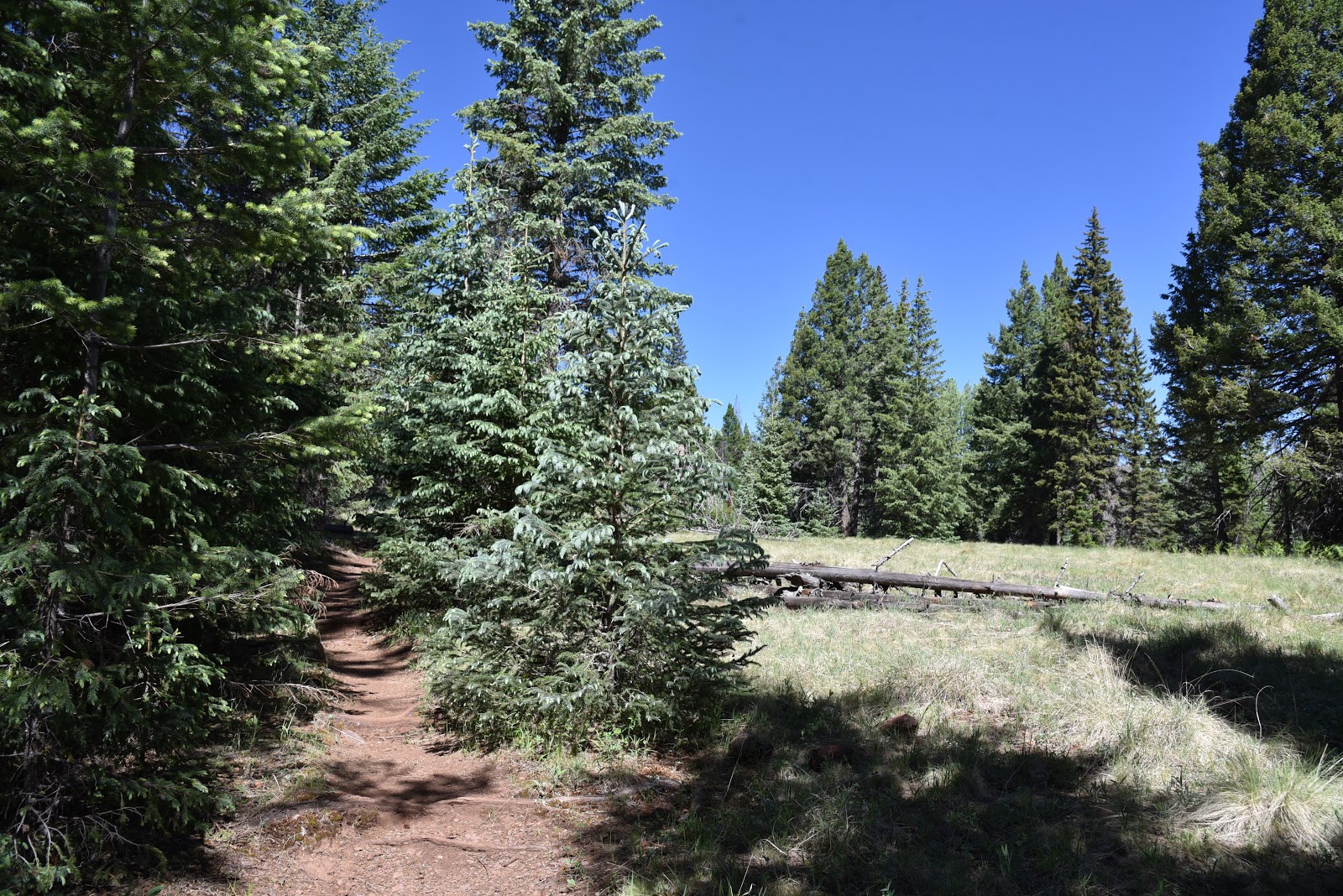
The quickest access to the Crossover trail is from the East Baldy trailhead where the route follows the East Baldy trail for 0.2-mile to a junction where it swerves north and away from the channel of nearby East Fork of the Little Colorado River.  Bouncing among various ecozones within the Mount Baldy Wilderness area in Eastern Arizona, the trail kicks off with a stroll through aspen glens with glimpses of mountain foothills. Soon, the aspens are swallowed up in mixed conifer woodlands of Douglas firs, Ponderosa pines and Engelmann and Blue Spruce. 
There's lost of scenic variety on the Crossover trail
Cloaked in a crisp atmosphere tinged with the smell of moss and damp earth, the forest is so thick in some places that sunlight barely lights the way, while in other spots, gaps in the tree cover let in enough sunshine to sustain spreads of ferns, wild strawberries, Canada violets and spotted coralroot--a complex and odd-looking ground dweller in the orchid family.  Interspersed throughout the hike are open-to-the-sky wet meadows replete with their own community of moisture-loving plants. Where the ground is mushy and damp, look for frilly bundles of false hellebore that sprout head-high flower stalks in summertime and the delicate blooms of marsh marigolds, aquatic buttercups, prairie smoke and berry-laden shrubs.
Spotted coralroot grow among pine needles on the forest floor
The route begins with a short hike on the East Baldy trail
A segment of mixed conifer woodlands  on the trail
Except for where fallen trees slumped over the trail require some mild scrambling to get over, the trail is easy to follow and, even with the diluted oxygen, not too much of a challenge. The trail ends at the junction with the West Baldy trail. Turn around here, or if you parked a shuttle vehicle at the West Baldy trailhead, head right and hike a half-mile to complete the journey.
LENGTH: 7.4 miles round trip
RATING: moderate
ELEVATION: 9,275 – 9,400 feet
GETTING THERE:
From Pinetop-Lakeside, travel 20 miles east on State Route 260 to State Route 273 which is just past mile post 377 and signed for Sunrise Ski Area. Turn left and go 11 miles south to the East Baldy trailhead on the right.
INFO:

Monday, June 1, 2020

Deep Lake

DEEP LAKE
The woodsy approach to Deep Lake
Located roughly 20 miles southeast of Flagstaff, the windy plains of Anderson Mesa are home to a cluster of Arizona’s rare natural lakes. Conspicuous among the bodies of water that are collectively known as the plateau lakes are Ashurst, Kinnikinick and the massive, yet sometimes dry Mormon Lake—the state’s largest organic puddle. Along with nearby Upper and Lower Lake Mary, these high-county lakes are popular with anglers, boaters, campers and hikers trekking the adjacent Arizona Trail Passage 30.
A residual puddle in Als Lake attracts wildlife

Besides the obvious behemoths, dozens of smaller much less crowded lakes are scattered across the dynamic landform in Coconino National Forest.
Storm clouds build above Anderson Mesa
These secluded natural basins formed between 1 and 5 million years ago when subterranean hollows caved in to form surface depressions that fill with snowmelt water during high-precipitation years.
Turkey vultures and ravens soar above Als Lake
A livestock exclosure protects Post Lake
Vacillating between shallow ponds and mucky swales these ephemeral wetlands serve as important nesting habitat for waterfowl. 
If you’re lucky enough to have snagged a campsite in the area during the busy summer season, and want to escape the masses, take a stroll to one of the most impressive and surprising of the mesa’s lesser-known lakes.
Snags on the rim of Deep Lake
The out-and-back hike to Deep Lake is actually a three-fer because the route, which follows Forest Roads 9117F and 82D, passes by three plateau lakes.  The trip begins with a half-mile walk on a rough two-track with great views of the San Francisco Peaks to the north before the road bends east. Here, where FR 9117F becomes FR 82D, the first of several livestock exclosure fences installed to protect the sensitive ecosystem from marauding cattle surrounds the reedy, birdy marsh of Post Lake.
Butter & eggs bloom in sunny meadows
After tracing the lake’s wildflower-rimmed perimeter, the road swings north through an airy, open-to-the-sky landscape with standout views of 8,449-foot Mormon Mountain peeking out over golden flatlands. At the 1.1-mile point, the road begins its fly-by of Als Lake.
Field bindweed grows along the roads on Anderson Mesa
A favorite haunt of turkey vultures and ravens, the elongated swale usually harbors a few residual pools where waterfowl and resident pronghorn can sometimes be seen lurking among clumpy grasses.
The impressive crater-like depression of Deep Lake
The next mile is a simple walk through fragrant juniper woodlands where rabbits and deer might dart by as you work your way to the junction with Forest Road 9484D at 2.3 miles.
For an optional side trip, FR 9484D leads to Potato Lake, another sizeable yet moisture-challenged natural lake. (NOTE: I did not take this side trip, but my map program indicates the road to the lake is about a half-mile long).
Continue another quarter mile north on FR 82D and soon the gated entry to the Deep Lake exclosure area comes into view. To preserve the terrain and minimize wildlife disturbance, travel beyond the gate is open to foot traffic only.  A few steps beyond the gate, the trail enters the enchanting realm of Deep Lake.

Junipers provide sparse shade and wildlife habitat
San Francisco Peaks seen from Deep Lake
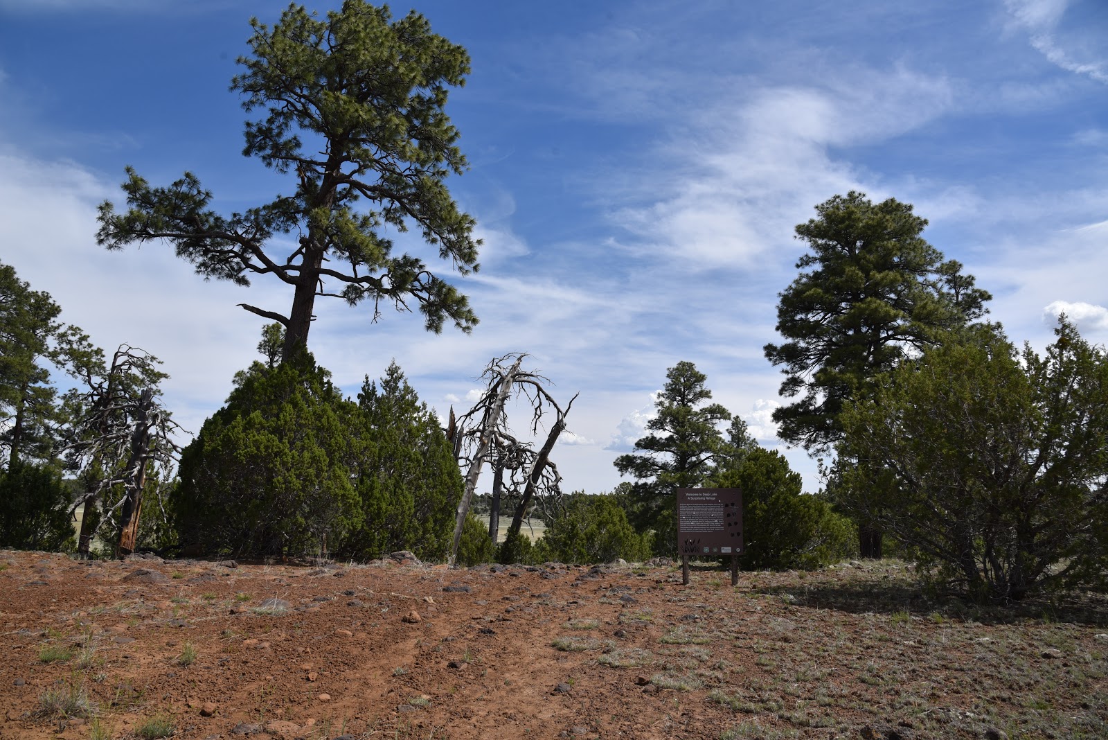
 Surrounded by Ponderosa pines, Gamble oaks, volcanic outcroppings and a community of snags (dead trees used by wildlife for food and shelter), the crater-like depression of the lake takes your breath away. Even without water, as it was on my recent visit, the yawning bowl that provides refuge for over 100 bird species is a standard-bearer for an increasingly rare and fragile ecosystem.   A short footpath leads down the lake’s edge for a close-up view of a tenacious landscape that continually adapts to unpredictable, sometimes harsh conditions.
While visiting the lake, please tread lightly and quietly. Leave no trace and respect efforts being made to protect this fragile, natural treasure.
Ponderosa pines shade parts of the hike
A gate marks the entrance to the Deep Lake exclosure area
Approach to Deep Lake
LENGTH: 6 miles round trip
RATING: easy
ELEVATION: 6,964 – 7,131 feet
GETTING THERE:
From Interstate 17 just south of the Interstate 40 interchange, go right on Lake Mary Road (County Road 3). Continue 17 miles south and turn left on Forest Road 82E for Ashurst Lake just past mile post 327 across from the turn off for Pinegrove campground.
Drive 1.7 miles on FR 82E to Forest Road 9117F on the left. Park in pull outs along the road.
Forest Road 82E is washboard gravel suitable for all carefully driven vehicles.
MORE INFO:Audubon Arizona https://www.audubon.org/important-bird-areas/anderson-mesa-coconino-national-forest


Tuesday, May 19, 2020

“I didn’t know,” is a sorry, ignorant excuse.

Be informed, take responsibility for your actions and respect our public lands.
 
There's a state-wide fire ban. (Billy Creek, White Mountains)
Over the past weeks, there have been multiple reports of monkey-see-monkey-do behaviors on public lands.
Just because you see somebody doing something doesn’t mean it’s okay for you to do it too.
“I didn’t know,” is a sorry, ignorant excuse.  

CAMP FIRES
Campfires and charcoal are BANNED in ALL national forests through June 30, 2020.

WILDFIRES
‘Tis the season. Check this website for up-to-date info on fire activity and STAY OUT of closure areas so first responders can do their jobs.
 
Don't trash our public lands. (Campbell Mesa, Flagstaff.)
TRASH
Trash attracts trash. Just because somebody left a bag of trash on the side of the road DOES NOT mean it’s okay to add to it. There is NO trash service on most forests. Resources are stretched thin so that dump pile will likely sit there for a long time. Trash is not only unsightly, it pollutes the environment and contaminates watersheds. Also it attracts wildlife like bears which can lead to unfortunate outcomes for them when they learn to associate human activity and waste dumps with free food. You might have blood on your hands for leaving trash behind. https://lnt.org/why/7-principles/dispose-of-waste-properly/
 
Know before you go! (Easy Breezy Trail, Sedona)
CLOSURES
Know before you go. Just because somebody removed a barrier and entered a closed area or posted social media photos of themselves  defying closures (and they should be embarrassed, not boastful)  DOES NOT give you permission to do the same.
Don’t be the clueless one. It takes only a few minutes to Google your planned destination to check current conditions.
Check before you go. Here are links to the holiday weekend hot spots.

Tonto National Forest:
Coconino National Forest:
Apache-Sitgreaves National Forest:

Monday, May 18, 2020

The Pocket

THE POCKET. Coconino National Forest
Not long before the mantra of social distancing surfaced to dominate the way we interact with our surroundings; another experiential movement had been catching fire. Forest bathing, the belief that immersing in nature can boost well-being, was la mode de jour that first gained traction with the masses around 2017. 
Hike follows a forest road to the lip of two tributary canyons
   
Promoted not so much for its physical exercise benefits but as a spiritual renewal technique, the hype dovetailed nicely with concurrent self-help therapies like mindfulness, wellness and meditation.
Regarding the idea that forests and natural environments have special powers, we hikers say, “Duh!”
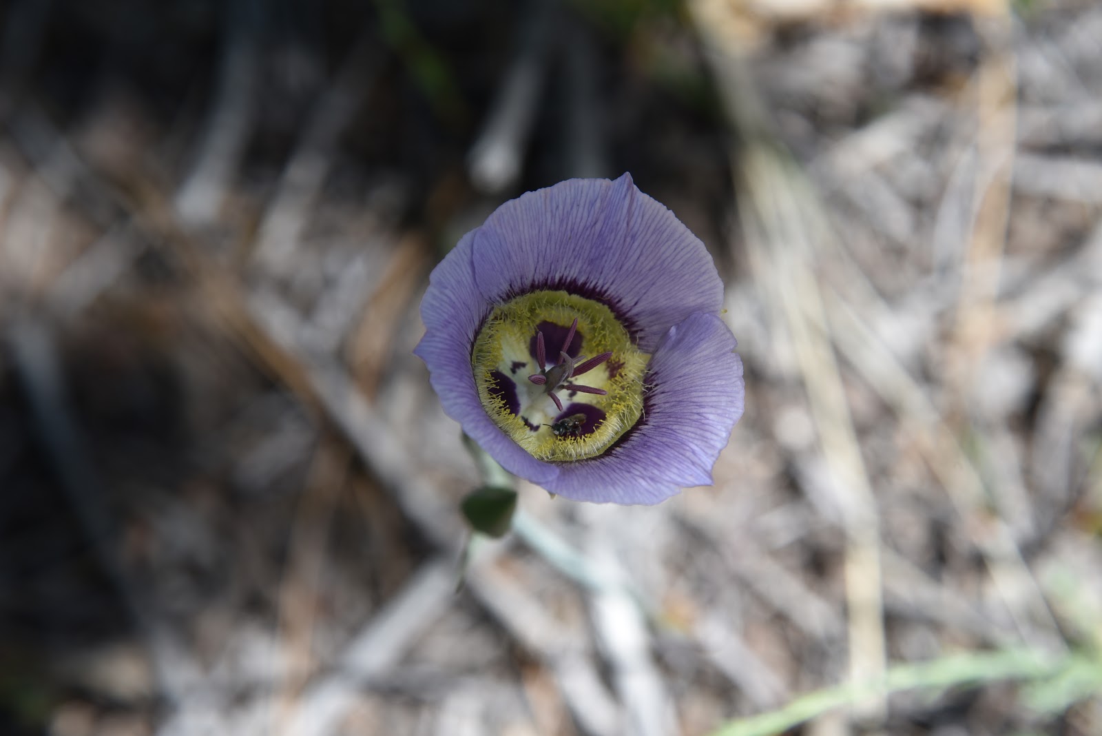
Sego lilies bloom May - July
Of course, being outside in nature makes you feel good. Yet, like anything else, what constitutes a feel-good outdoor experience varies by individual tastes.
Certainly, one might forest bathe on a popular trail where there are yoga classes in the parking lot, chatty gaggles and meditation circles at trail’s end, but if that doesn’t ring “power cleansing” to you, then take a detour.  Look for an outwardly boring place without crowd-drawing summits, water features or comfort facilities to ditch the distractions and turn your attention inward.
Silver puff gone to seed.
This stock tanks sits at the crest of Calf Pen Canyon
Near trail's end, high desert vegetation takes over
Tree cover obscures views of Calf Pen Canyon
Wild onions bloom through late summer
Run (into the) Forest! Run!
Fossils weather out of limestone pediments
Domestic cattle congregate around a water hole
Western wallflower bloom March - September
Gambel oaks and ponderosa pines shade the route 
A walk along the backroads of The Pocket offers a near-perfect forest bathing experience.  Located roughly 10 miles north of the town of Strawberry in Coconino National Forest, the stony peninsula juts out over the eastern edge of Fossil Springs Wilderness. The hike begins at a dirt pullout near Twentynine Mile Lake, an ephemeral wetland just off State Route 260 and follows the rough course of forest road 9366R where there are several dispersed campsites within the first mile.
For hikers, finding serenity in the forest is nothing new.
Wrapped in tall pines, the road is wide and simple to follow making it easy to focus on immersing in the experience rather than route-finding.
Sego lilies can be white, pink or purple
At first, the hike feels about as sweetly monotonous as a 1980s prom ballad. Trees block all views and each bend in the road is like another stanza in a familiar tune. Here is where the “bathing” part comes in. First, although it’s not immediately obvious, you are walking on a promontory 1000 feet above two remote tributary canyons in the wilderness area. About a third of the way through the hike, glimpses of Calf Pen Canyon to the south begin to tease the imagination. Several primitive roads veer off the main route heading to the edge if you want a queasy look into the feral end of the popular water-centric destination.
Wildflowers color the forest understory
The route dissolves into sandstone slabs near The Pocket
Second, this is an opportunity to tune in to beautiful details hiding in plain sight. Underfoot, fossils weather out of ancient limestone while lizards, squirrels and wild turkeys dart among an understory of blooming shrubs and wildflowers. Stop and breath in the fresh mountain air and the sweet fragrance of pine.
Savor the delicate beauty of a Larkspur flower
Contemplate the intricate structure of a meadow larkspur flower and listen for the calls of ravens and the mournful bellows of domestic cattle that congregate near water holes situated along the road.
Manzanita is a common blooming shrub on the route
Toward the end of the route, the forest changes from dense stands of Ponderosa pine and Gamble oaks to a more arid zone dominated by alligator juniper, pinion and cacti growing among slabs of red sandstone. The road fades into the nose of The Pocket where the jagged walls of Sandrock Canyon merge with Calf Pen Canyon before disappearing completely among yucca and high desert scrub.
In this rarified air at a canyon convergence, solitude and wonderment punch through the veneer of whatever glossy catchphrase might attempt to label, style or brand feelings that are so intrinsically human.
LENGTH: 8 miles roundtrip
RATING: moderate
ELEVATION: 6,000 - 6,990 feet
GETTING THERE:
From Interstate 17 in Camp Verde, take the State Route 260 exit 287
heading east toward Payson.
Continue 32.5 miles on SR 260 (Zane Grey Hwy) to Forest Road 9366R a dirt road on the right about a quarter-mile past milepost 250 at Twentynine Mile Lake. This is 1.2 miles north of the State Route 87 junction for those coming north from the Payson area. Park in pullouts. There are several dispersed campsites along the road.  No facilities.