Find A Trail. Start Your Search Here:

Monday, April 20, 2020

Dogs & Dilemmas


Dogs & Dilemmas

Rowdy hikes in the McDowell Sonoran Preserve

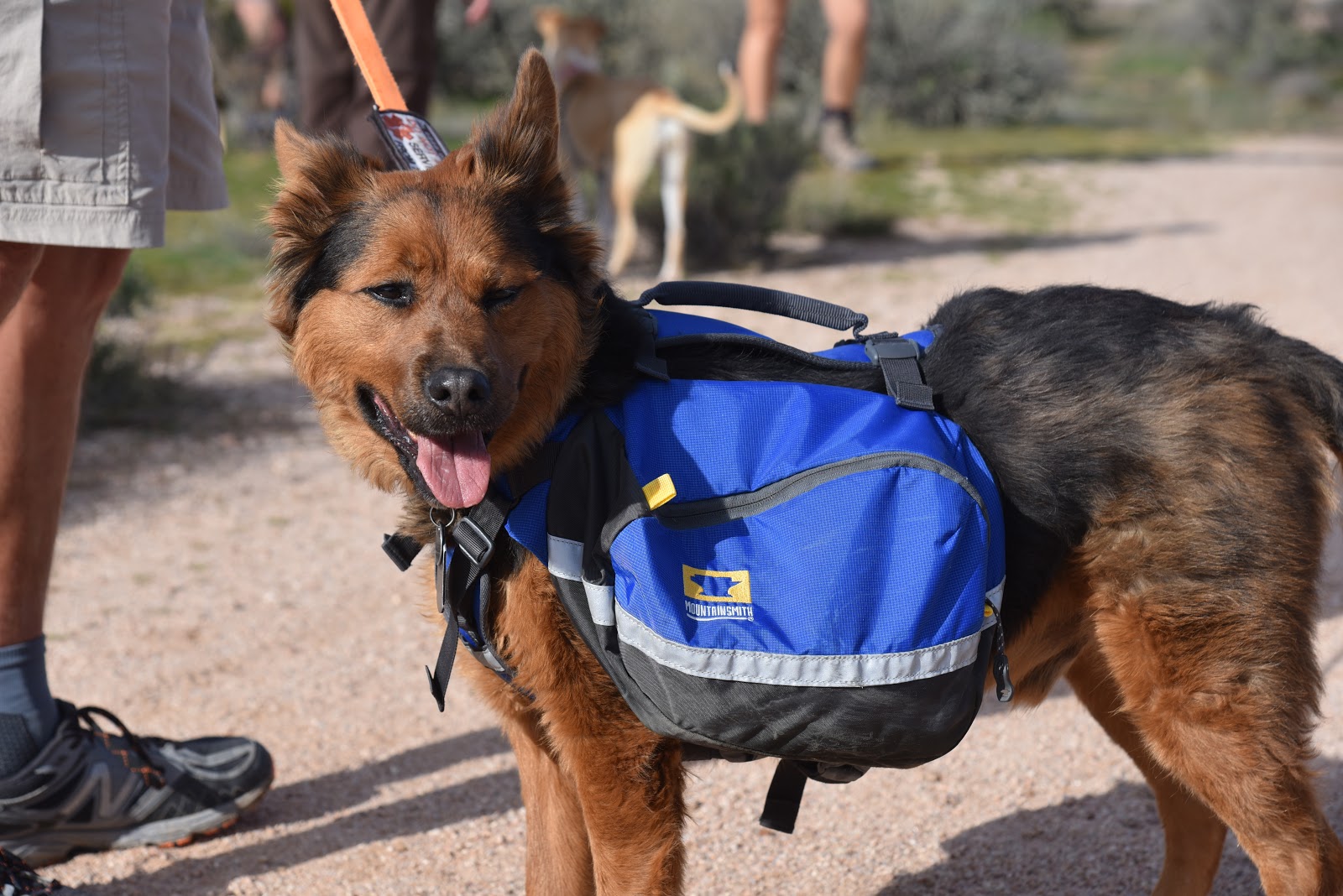
Living with a rambunctious pack of dogs helps one develop a sense of humor and an ability to appreciate the lighter side of life. If you take yourself too seriously you might see an occasional poo-poo in the kitchen or a butt-sniffing incident in front of company you’re trying to impress as disasters instead of the disarming stagings of canine Commedia dell’Arte that they are.  Dogs throw a wrench in our most cherished routines and possessions.
Layla takes a break on a Scottsdale trail
The peed-on pillow, the dug-up garden and the change in plans brought on by a trailside skunk encounter are disruptions made to bolster our resilience.
Dogs make good pilots during times of crisis.
Ironically, through their inconsistency, dogs send a consistent message: the only thing we can control is our own behavior.  That’s a good concept to embrace during a global pandemic.

Sophia Maria hikes Dixileta Trail in Scottsdale

Because of conflicting messaging, coronavirus stay-at-home orders have been particularly trying and confusing for hikers.
We’re being told to both stay home and go out and hike because it’s “safe”.
The mantra of “practicing social distancing” is proving to be just a catch phrase as parking lots at popular trailheads are crammed full while vehicles circling like vultures wait for available spaces.  Social media is replete with visuals of large groups congregating and cars parked bumper-to-bumper along forest service roads near “remote” trails where “nobody goes”.

Chessy at the Silly Mountain Park in Apache Junction

Trail closures and restrictions that began as precautions are now necessities to protect public health. For instance, Arizona State Parks had to temporarily close several parks for day-use this past weekend due to overcrowding.

Kleiden loves hiking in Flagstaff

My personal decision to avoid hiking hot spots has been met with ambivalence. 
It’s not lost on me that many hikers refer to my reviews when researching trail destinations and I am well aware that that comes with responsibility.  These past weeks, I’ve been overwhelmed with requests for suggestions about where to go to escape the crowds and questions about why I have not posted any new hike reviews. Truth is, I’m in a sort of Catch 22 situation.  Here’s why.
Maddie on the Aspen Loop Trail in Flagstaff


Like many regular bloggers, I get dozens of pitches from marketers offering me free products and services in exchange for promoting everything from trail foods and gear to free trips to outdoor vacation destinations. (I do not accept any of these perks, preferring to keep this blog non-commercial.)
The coronavirus stay-at-home orders have changed the tone of the messages that land in my inboxes. A few weeks ago, the drift was all about “stay home and stay safe”, “we’re in this together”, “let’s care for each other” and “please stay away from small towns to stem the spread of the virus.” But this weekend, the love fest took a disturbing turn.  My email was rushed with pleas from small businesses and communities to “send hikers to them” and a swell of “we’re open for business” reminders.  Clearly, the novelty of the novel virus has lost its panache.
Dogs make fine pilots in times of crisis

   
Rocco and Jasmine play on the Badger Springs Trail
All this at the end of a week where I watched two of my favorite restaurants shut down for good and heard that one of the services I use for my dogs is on the verge of going under as well.  It’s heart wrenching.  The Catch 22 is this: If I start directing hikers to the small communities that depend on tourism to survive in a time when friends are fomites and visitors are vectors of disease will it be welcome relief or a health hazard?  There is not yet enough data to decide. 

In retrospect, there might be some humor to be found in this historic episode of pandemonium.
But right now, even when surrounded by six dogs vying for lap time, it’s not funny. It’s just confusing.

Since dog is my co-pilot, I’ve decided that the best way to bring the pandemic to heel is to sit and stay.


Tuesday, April 7, 2020

Post Apocalypse. Slow Ahead.


There’s a feeling you get during the last mile of a long hike.
Sweaty, tired and hankering for something to eat other than trail mix, the final leg of a hike—the light at the end of the tunnel-- holds the promise of relief, celebration and maybe a cold beer.
Hike progressions can be sort of like the ubiquitous bell curves and graphs that have become lifestyle tracking devises—the GPS—of the novel coronavirus reality we’ve been experiencing during these past weeks.
Solitude on the Sycamore Point Trail, Kaibab NF

Like those charts and graphs, hikes roll out on a curve. First, there’s the warm up followed by acceleration and pace-finding. Well-designed trails usually crescendo at a summit, high point, crux junction or vista point before winding down for the home stretch.
Sedona's Carroll Canyon area trails are less crowded options

But, unlike following a mapped trail with a pre-determined outcome, tracking a novel virus is a whole other matter. Being the insufferable nerd that I am, I know bell curves and projections are rooted in probability. They are code for researched guesses to help us make decisions and feel like we have some control over outcomes.  But, they are just tools for modeling  the what-ifs that drive decisions about which trajectories to ride through the crisis.

Over the past few days, reports that physical distancing efforts have been helping and the worst may soon be over hint that the light might flip on sooner than later.

The promised light at the end of the tunnel may indeed be flickering but caution is still advised.

Perhaps stay-at-home orders will be lifted in May. Maybe June. Until then we continue to optimistically interpret the slightest downward twitch in the curve as a sign we might be creeping back to normality.
Apache Maid Mountain near Sedona hike ditches the crowds
Creeping is the key word here.  As parks and trails begin to open back up, let’s not take that as a checkered flag but as a flashing red traffic signal.
Instead of racing out to usually swamped trailheads (Devils Bridge in Sedona, I’m looking at you), consider exploring less crowded destinations for a change.
 
Fine space on the Davenport Hill trail near Williams
Across the world, countries are slowing beginning to open back up. One news report showed images of people swarming formerly closed recreation sites in what looked like ridiculously uncomfortable and potentially hazardous conditions. Let’s not do that. Instead, once the all-clear is issued, resist the temptation to besiege popular trails and instead find solitude on the thousands of miles of lesser-used city, county, state and national trails we are so fortunate to have here in Arizona. 


Monday, March 30, 2020

Urban Wilderness


Urban Wilderness
Dreaming of Doe Mountain in Sedona, but staying home.
Fay Canyon in Flagstaff is on my post-crisis to-do list
Four blocks from my house, there’s a yard with the most gorgeous hollyhocks.  I must have walked my dogs past the little bungalow dozens of times on our 5 a.m. and 9 p.m. walks, but the hollyhocks never caught my attention.  A few homes down the street, chickens scratched the ground behind a non-descript brick home. African daisies bobbed among aloe vera plants in a weedy space between an alley and a median.  For the more than 20 years I’ve lived and walked in my Central Phoenix historic neighborhood, these details were lost among doggie poop pick up stops, rogue chihuahua encounters and occasional chats with neighbors who happened to be out and about at my fringy walking hours.  Most of the homes in my corner of Downtown are old, some coming up on 100 years in age, and encompass architectural styles that include, among others, Tudor, Hacienda, Territorial, Art Moderne, English bungalows and a few new-builds that made attempts at replicating the neighborhood’s historic vibe with varying degrees of success.
Dreaming of Bill Williams Mtn Trail, but not now.
It took the COVID-19 pandemic for me to fully appreciate the diversity and weathered beauty of where I live. 
Billy Creek in the White Mountains, can't wait to get back.
Prior to the new reality of social distancing, my weeks were defined by a full time, Monday through Friday job, a Saturday hike and Sundays doing house and yard work, and those dawn-dusk walks.  Things have temporarily changed.
Even though most hiking trails are open for business, I’ve made the decision to forfeit my weekend excursions to avoid adding to the headaches of our already overburdened healthcare workers and first responders.  Of course, missing my weekly trips to explore new trails and places across Arizona has been tough. I miss it terribly. It’s as if a part of my brain shut down.
The void is blacker than I ever expected. Hiking is a big part of my life and its abrupt removal from my weekly rhythm feels like losing a limb.
As a hiker, risk-taking is part of my world view. And yet, these are not normal times. Choices are no longer individual, they are collective. I’m not willing to put others risk for my personal satisfaction.
To keep my wanderlust under control, I’m hiking familiar sidewalks close to home, crossing streets when others approach and not worrying that I’ll get lost or seriously injured while doing so. It’s the same fresh air and mental health benefits I’d get on a trail. While sidewalks may not provide the challenge of trails, rediscovering the treasures of my urban wilderness has been enlightening.  Also, I made some really bad paintings from some of my old trail photos.

Wednesday, March 25, 2020

I'll Be Back. Later.

View from Crater Lake trail, Flagstaff
In all my decades of hiking, I've never been off the trails for more than a few days. Now, I'm going on my second week without stepping foot on a hiking trail. My choice to avoid trails for the time being is not only because of the ongoing pandemic and the unprecedented (and reckless) surge in trail visitation but because I do not want to strain our already overburdened first responders and healthcare workers. What if I fell, got a snake bite or suffered a medical crisis while hiking? That would pull resources (assuming they would even be available) from where they should be focused.   Also consider that when you travel to off-the-beaten trails, you will likely make rest stops, use public facilities, get fuel or pick up some supplies thus risking unnecessary exposure in small communities where resources and medical services  may be in short supply.
Little Elden Trail, Flagstaff
It’s true that many popular hiking destinations have not yet closed. But "open" and "okay" are not the same thing.
I am spending my time researching and planning hikes for when the crisis is over and looking forward to returning to Arizona’s high country and smelling the pines.
Please use good judgment and stay safe. 

Sunday, March 22, 2020

Stay Home.

This week there's been a lot of media coverage about how hiking is the one last "safe" thing we can do in the new reality of social distancing. Predictably, popular trails are now experiencing heavy visitation. Unless you're out in the middle of nowhere, hiking is not a guaranteed safe space.  With this in mind, I will not be responding to requests asking for recommendation about less crowded trail destinations. My best advise is to stay home and spend time researching trails you will do once this crisis ends.
And it will end. Please don't take unnecessary risks. Staying off crowded trails for awhile isn't the end of the world.
Need some inspiration? I've been writing about under-the-radar hikes for years. Here's a compilation of a few of my favorites:
https://cities-west-publishing.square.site 

Monday, March 16, 2020

Ground Control Trail

GROUND CONTROL TRAIL
Ground Control trail traces the cliffs below the Cockscomb
Kudos to whomever came up with the name for one of the newest trails in Sedona. The Ground Control trail, which opened in January 2020, delivers exactly what the aerial-themed moniker implies, lots of exposure and terrific fly-over views.
Fog covered Bear Mountain seen from Outer Limits trail
The compact but complex trail is located in the still-evolving, 29-mile Western Gateway Trails system that spins off from the old standard Girdner Trail in the Dry Creek area on the western edge of Sedona. The 0.7-mile Ground Control trail is situated in the middle of the system and can only be accessed by way of connecting routes. The quickest way to get to is from the north at the Aerie trailhead off Boynton Pass Road not far from the hyper-popular Bear Mountain and Doe Mountain trails. From this relatively under-the-radar trailhead, a 3.8-mile loop using the Cockscomb, Outer Limits and Ground Control trails gets to the good stuff post haste but also has options for building longer circuits.
Begin by hiking 1 mile on the Cockscomb trail then hang a right at the Ground Control junction.
Doe Mountain seen from Cockscomb trail
Agaves and cacti on the Cockscomb trail
Pinnacles of the Cockscomb formation on Ground Control
Blackfoot daisies bloom in sunny spots on the trails
Ground Control trail opened in January 2020
The freshly re-aligned single track was adapted by the forest service from a user-created bike route that traces on the edgy west face of the iconic Cockscomb rock formation. While the trail begins with an easy, twisting climb, its wonky character take hold once it reaches a deck-like passage of sandstone shelves.
Ground Control trail begins with a mild ascent
    
Lodged between the towering red rock escarpments of the Cockscomb and miles of open plains 300 feet below, the slick rock path hangs close to the brink and in places, walking the uneven exposed ledges mimics the rolls and bumps of a small aircraft flying through turbulence. 
Gregg's ceanothus is a common shrub on the route
Tight turns, abrupt down steps and glimpses of Sedona landmarks Capitol Butte and Courthouse Rock define the final quarter-mile of the trail that slips off the rocky flanks landing on calmer tread for the next leg of the hike. At the base of the Cockscomb formation, the route meets the Outer Limits trail. For the loop hike, head right. Otherwise, consult the trail maps posted at every junction to create a longer trip or car shuttle hike using the Cultural Park trailhead off State Route 89A.
View of Thunder Mtn (Capitol Butte) from Ground Control
Continue on the Outer Limits trail through beautiful high desert terrain accented with junipers, cypress, scrub oak, yuccas, cacti and acres of ocotillo. With its ample sunshine and watery drainages this 0.8-mile path is a productive destination for spring wildflower viewing in March and April.
Lots of ocotillo on the Outer Limits trail
Back at the Cockscomb junction, head left and retrace your steps back to the trailhead to complete the hike.
LENGTH: 3.8 mile loop
RATING: moderate
ELEVATION: 4,454 – 4,714 feet
GETTING THERE:
Aerie Trailhead (described here):
From the State Route 179/89A traffic circle in Sedona, head 3.2 miles west (left toward Cottonwood) on SR 89A to Dry Creek Road. Turn right and go 2.9 miles to Boynton Pass Road (FR152C), make a left and continue 1.5 miles to a “T” junction and veer left to stay on FR152C. Continue 1.4 miles to Aerie Road, turn left and go 0.4 mile to the turn off for the trailhead on the right.  There are no fees or facilities at the trailhead.
Cultural Park trailhead (optional south access):
From the State Route 179/89A traffic circle in Sedona, head 4.2 miles west on 89A Cultural Park Place on the right at the traffic signal. Go north 2.2 miles to the parking area. Follow the Outer Limits trail north to connect with Ground Control. There is a
picnic ramada and interpretive displays at the trailhead. No fees.

INFO:


Monday, March 9, 2020

Yellow Jacket Trail 524

YELLOW JACKET TRAIL

Prescott National Forest.
Mesquite and juniper trees ring Cottonwood Tank
The most striking characteristic of the Yellow Jacket Trail 524 is the silence. Located a mere 4 miles from Interstate 17 near the Yavapai County town of Dugas in a hilly corner of Prescott National Forest, the shared-use path cuts through sprawling open spaces where the sounds of civilization are muffled by a landscape of mesas, buttes, creeks and ragged drainages.
Estler Peak is a prominent feature along Yellow Jacket trail
At first glance, the largely treeless terrain flanked by volcanic bluffs and bald, isolated peaks appears intimidating and harsh. Within a few yards of hiking, though, the trail reveals bucolic rangeland, epic vistas and hidden pockets of greenery.

The out-and-back trek begins at a tiny trailhead near the leafy confluence of Little Ash Creek and Yellow Jacket Creek where sycamores and cottonwoods create a conspicuous ribbon of color against the muted tones of desert chaparral.
Sycamores & cottonwood trees in Yellow Jacket Creek


A cow grazes along Reimer Spring Road
Trail 524 is described by the forest service as a 1.4-mile route, but a 0.8-mile hike is required to get to the trailhead proper. The access path is a fading two-track that parallels the boulder-strewn course of Yellow Jacket Creek. The path makes many mild dips and climbs on breezy plains dotted with junipers, cacti and wildflowers. 
Cattle graze at the base of Yellow Jacket Mesa
A rustic corral at Gyetta Tank
To the west, great views of 4,263-foot Estler Peak, a prominent pinnacle along the drive in on Dugas Road, dominate the horizon.
Extend the hike on the Cottonwood Trail 9709


Cottonwood Tank attracts resident cattle and wildlife
At the signed junction for trail 524, the route begins its journey into stunning back country with the first of several creek crossings. The rocky, but usually dry crossings are fringed with scrappy stands of scrub oak, willows and catclaw. 
Part of the route follows the Great Western Trail
Soon, the dual landmarks of Yellow Jacket Mesa (4,751 feet)  and Cottonwood Mesa (4,577 feet) appear as intersecting plateaus on the eastern skyline standing out above the rustic corrals of Gyetta Tank.  Rusty barbed wire and sun-bleached posts circle the watering hole where herds of cattle can usually be seen grazing the surrounding grasslands.

At the end of the corrals, hop a bright green rollover gate to follow the trail to its terminus at Reiner Spring Road (Forest Road 68D) which is also part of the Great Western Trail, a 3,000+-mile shared-use historic route from Mexico to Canada that runs through five Western states, 800 miles of which are in Arizona.
Roll over gate at Gyetta Tank
The unsigned junction is the official end of the Yellow Jacket Trail and makes for a satisfying 4-mile round trip hike. But the adventure doesn’t have to end there. For a sweet taste of the Great Western Trail, head left at the junction and hike up the road watching as beautiful views of the Bradshaw Mountains open up to the west.

The road crosses the gorge of Cottonwood Canyon before emerging on an expansive rangeland at the mouth of a pass that flows between the two mesas.
At the 2.7-mile point, a sign for Reiner Spring and Cottonwood Tank marks yet another scenic transition.  Take the first right beyond the sign and follow the degraded road that plows though a draw where the mesas gradually pinch the path. 
Yellow Jacket (L) and Cottonwood Mesas 

The half-mile hike leads to Cottonwood Tank. Tucked into a gully at the convergence of the mesas, the glassy, mesquite-cluttered pond reflects vertical cliffs that top out 300 above the water.
Wandering cattle, flocks of doves and swarms of pollinators frequent the remote water source. Judging from footprints along the tank’s muddy rim, bobcats, deer, javelina and raccoons are regular guests as well.
Just a few yards east of the tank, a cattle guard and sign post for the Cottonwood Trail 9709 signals the beginning of an optional continuation of the hike.
Trail 9709 goes up and over Cottonwood Mesa and is 3.5 miles long, but it’s just a mile to the high point which serves as a nice turnaround point for an even 9-miler.
It's a 0.8-mile hike to the trailhead proper

LENGTH:
Yellow Jacket Trail: 4.4 miles round trip
Yellow Jacket Trail + Cottonwood Tank: 7 miles round trip
Yellow Jacket Trail + Cottonwood Trail to the top of the mesa: 9 miles round trip
RATING: moderate
ELEVATION: 3,883 – 4,235 feet to Cottonwood Tank
(4,524 feet to the top of the mesa)
GETTING THERE:
From the Cordes Junction interchange on Interstate 17, continue  5.5 miles north to the Orme Road/ Dugas Road exit 268. Go east (right) at the bottom of the off ramp and follow County Road 171 (Dugas Road) 4 miles to the trailhead on the left. The trailhead is an unsigned gravel lot across from Forest Road 9650N and a “narrow bridge” sign. Roads are paved up to the last 2 miles which are on sedan-friendly dirt. The hike begins at the 524 sign.
INFO: Prescott National Forest

Sunday, March 1, 2020

Balancing Rock-Surprise Spring Loop


BALANCING ROCK-SURPRISE SPRING LOOP

Granite Basin Recreation Area, Prescott.
Balancing Rock teeters on its host boulder along trail 349
Situated in a pocket of pine-oak woodlands at the south edge of Granite Mountain Wilderness seven miles northwest of Downtown Prescott, Granite Mountain Recreation Area offers
over 40 miles of interconnected trails, camping, picnicking and boating.
Drainage area near Surprise Spring on Balancing Rock trail
Area trails feature incredible views of the craggy escarpments of 7,295-foot Granite Mountain and varied terrain that runs through boulder-strewn back country.
Manzanita bloom in sunny spots along the route
For a taste of why this easy-access recreation hub is so popular, take a hike on the Balancing Rock and Surprise Spring trails. The circuit uses 3 trails to make a 3.8-mile loop.
An oak thicket on Balancing Rock trail
Begin at the trail 350 sign behind the pay station, hike 0.1-mile and turn left at the West Lake Trail 351 junction. Hike 0.7 mile on trail 351 passing several pretty stands of cottonwoods growing near moist drainages and turn left at the Balancing Rock Trail 349 junction. This 1.7-mile leg of the loop passes among thick stands of Ponderosa pines, oaks, alderleaf mountain mahogany and junipers with occasional fringes of agave and cacti that cling to life where sun leaks through the forest canopy. The eponymous rock formation appears on the left roughly 0.2-mile from the junction.
San Francisco peaks seen from Balancing Rock trail
The lopsided stone perched precariously atop a massive granite boulder is secure for now, but even a minor tectonic hiccup could bump it off its host. While this stone oddity is the centerpiece of the trail’s geological sites, it  isn’t the only one. Look for a “turkey gobbler” rock, xenoliths (chunks of material like quartz crystals embedded in boulders) and knife-edge slabs that have flaked off walls of granite.
Cottonwoods thrive along the West Lake trail
 About halfway through trail 349, the drainage area surrounding Surprise Spring appears as scoured channels, trickling runoff and sand bars.
Agaves and cacti sprout in sunny spots on the trail
Some of the land around spring is private property, so be sure to stay on the trail. Beyond the spring, the trail swings north, making a mild ascent on the ledges above the spring drainage. Soon, views of the Williamson Valley, Verde Valley and mountain peaks of Flagstaff appear above acres of scrub.
Granite Mountain seen from Surprise Spring trail
Alderleaf mountain mahogany
The route is well-signed and maintained
One of many stone oddities on Balancing Rock trail
Granite Mountain stands out above West Lake trail
The forest thins out where the trail meets the Surprise Spring trail 350 junction.  The final leg of the hike on trail 350 was damaged by the September 2019 lightning-caused Surprise Fire. Ash, burnt trees and patches of scorched earth are just minor distractions on the still-beautiful path.
The easy-moderate hike has many ups-and-downs
The 2019 Surprise Fire scorched parts of the trails
The trail has been trimmed and swept and thickets of blooming manzanita shrubs soften the harsh plots of charred debris. More gorgeous vistas of Granite Mountain and sprawling valleys vie for attention before the route spirals off its sunny high ridge descending among mixed conifer woodlands on its way back to the trailhead.
LENGTH: 3.8-mile loop
RATING: easy-moderate
ELEVATION: 5,640 – 6,070 feet
GETTING THERE:
From downtown Prescott, go north on Montezuma Street (which turns into Whipple Street and then Iron Springs Road) and continue 4.5 miles to N. Granite Basin Road at milepost 3.
Turn right and continue 3.1 miles to the Wekuvde trailhead on the right.
 Roads are paved and there are restrooms, picnic tables and grills at the trailhead.
FEE: There’s a $5 daily fee per vehicle. Bring exact change for the self-serve pay station/ Free with a Golden Age/Access of Interagency Senior/Access Pass. Wednesdays are free to everyone.
HOURS: March-April hours are 7 a.m. to 7 p.m. Hours vary by season.
INFO: