Find A Trail. Start Your Search Here:

Thursday, January 2, 2020

MORMON TRAIL-HIDDEN VALLEY LOOP

MORMON TRAIL-HIDDEN VALLEY LOOP: South Mountain Park.
The Natural Tunnel is a key attraction in Hidden Valley
Theoretically, hikers should be the last people who’d succumb to not being able to see the forest for the trees. The ubiquitous expression describes a common affliction of missing the “big picture” in a haze of minutia.
Lush desert vegetation on the National Trail
Hikers are not immune from its soul-sapping vortex.
Tethered to fitness apps and ear buds, some hikers detach from their surroundings in pursuit of faster times and harder, longer, more remote trails while buying into the assumption that the “best” trails exist in a faraway ether dripping in unattainability and mystique.  
Although few would argue against the benefits of setting and achieving goals, what constitutes a “best” trail is debatable.
Fat Man's Pass is the gateway to Hidden Valley
When approached from a see-the-forest perspective, even oft-maligned, old standard trails can qualify as top destinations. Take, for instance, the Mormon Trail-Hidden Valley Loop in South Mountain Park.  Because it’s located close to town, the route can get very busy.  Social media is replete with negative comments about noisy groups, irresponsible hikers, food scraps, dog poo and painted rocks meant as inspirational gifts left in trees and clefts.  But it’s a mistake to let these spoilers suck all the air out of the room. 
The classic Phoenix circuit has many of the positive components on hiker check lists. Some moderate climbing. Check. Epic views. Check. Heritage sites, gnarly rock passages and hidden finds. Check, check, check. 
The Mormon Trail climbs 700 feet up Neighborhood Can.
Watch for Hohokam rock art on the trails.
Adding to its appeal, this iconic route gets the climbing out of the way at the beginning while legs are still fresh.  The uphill portion on the Mormon Trail crawls 700 feet up Neighborhood Canyon dodging among massive boulders, slickrock corridors and desert flora adapted to South Mountain’s craggy environs. Weathered rock slabs that hang from cliffs form odd sculptures and that frame views of the Valley and surrounding mountain ranges.
Far-reaching vistas on the National Trail
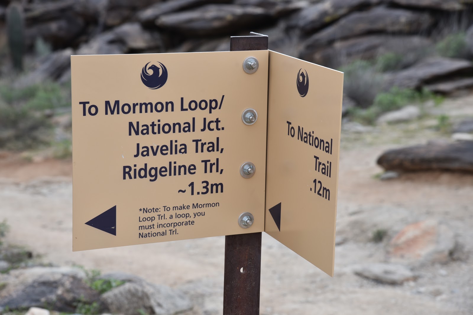
At the 1.2-mile point, a sign marks the junction of two connected loops. To start with the shorter Hidden Valley Loop, continue straight ahead on Mormon Trail and head right on the National Trail.  In just under a half mile, the trail encounters Fat Man’s Pass. A tight squeeze through a slim but short crack between boulders serves as a gateway to Hidden Valley.
Petroglyph panel at the Natural Tunnel
The enchanting half-mile walk in a secluded corridor ends with a passage through a natural tunnel well-known for its rock overhangs, sandy substrate, a petroglyph panel and lush drainage-fed vegetation. Beyond the tunnel, go right at the National Trail junction and follow the route 1.4 miles to the Mormon Loop Trail. Hang a left and walk the 1.1-mile return leg that traces a ridgeline where a major rock art site as well and a wash with many more petroglyphs etched into the rock veneer by the ancient Hohokam people who were active in the area from roughly A.D. 450 to 1450 embellish the trail.
This double loop hike is well-signed throughout.
To protect these irreplaceable heritage sites as well as sensitive vegetation and wildlife habitats, it’s important to stay on trails and not touch or alter anything.
Snow-covered Mt. Ord seen from Mormon Loop 12-31-19
Photographs are encouraged, though.  
A lone Palo verde tree anchors a curve on the National Trail
The big picture take away here is that the Mormon Trail-Hidden Valley Loop is a wonderful hike just a few miles from Downtown Phoenix.  It would be terrible to let distractions asphyxiate its virtues.
Triangle-leaf bursage adds a minty fragrance to the trails
Once we lose our sense of wonder and the ability to see beyond loud, immediate things on a hiking trail, what’s left are rote progressions chronicled on Instagram. 
LENGTH: 6.2 miles
RATING: moderate
ELEVATION: 1,280 – 2,080 feet
GETTING THERE:
From central Phoenix, go south on 7th Avenue to Baseline Road. Turn left (east) and continue to 24th Street. Turn right (south) and to Euclid, turn left and continue a few yards to the trailhead on the right.
INFO & MAPS:

Tuesday, December 24, 2019

Transept Trail

TRANSEPT TRAIL
Many slick rock passages define the Transept Trail
Forming a natural divide between State Route 179 and the hyper-busy trails that loop around iconic Bell Rock in the Village of Oak Creek, the north-south running ridgeline known as the Seven Warriors is home to a pair of trails known for their edge-hugging exposure. 
Transept Trail traces the cliffs of the Seven Warriors ridge
The Hiline Trail that’s part of the Yavapai Vista Trail System, scoots along the ridgeline’s eastern slopes while the newer Transept Trail traces the less congested western side. There are several ways to access the user-created route that was adopted by the forest service in 2018. The most direct way to is begin at the small trailhead along Verde Valley School Road. 
Mayan Maiden formation is a must-see feature along the trail
This less aggressive approach offers a more gradual, smoother gradient than its east side counterpart as well as equally heady views.  The first half-mile makes a steady but mild ascent through cypress-juniper woodlands and jumbled drainages. At the 0.2-mile point, keep an eye out for the Mayan Maiden rock formation that stands at the base of a mass of russet pinnacles to the south. The conspicuous natural sculpture looks convincingly like an elegantly- dressed woman emerging from the stone.
Looking south on the Transept Trail
Views of Cathedral Rock from the Transept Trail
Hardy agaves line the trail
Beyond the Mayan Maiden, the easy walk transitions into a more moderate haul defined by slickrock passages and high-step climbs over crumbling sandstone shelves. Although some slippery loose rock, tricky turns and short sections with stomach-churning deep drop offs require extra effort and steady nerves, the payoff of hiking close to the edge is unobstructed vistas of Cathedral Rock, House Mountain and the flood plains of Oak Creek.  The Transept Trail ends at the 3.2-mile point where is connects with the Hiline Trail. From this high point junction on the nose of a beveled rock jetty with 360-degree views, there are several ways to extend the hike or make a long loop.  Consult the forest service map for details. 
Juniper trees shade the lower part of the trail
High desert woodlands on Transept Trail
Transept Trail is an adopted user-crated route
LENGTH: 6.4 miles out-and-back
RATING: moderate-difficult
ELEVATION:  4,200 – 4,570 feet
GETTING THERE:
From State Route 179 in the Village of Oak Creek, go 2.1 miles west (left through the traffic roundabout ) on Verde Valley School Road to the parking area on the left. The trail begins across the road.
INFO & MAP:


Saturday, December 14, 2019

RED CLIFF

RED CLIFF
Hassayampa River, Wickenburg
Red Cliff is a dominant feature along the Hassayampa River
 Striking in its simplicity, the hike to Red Cliff slips through a spare, water-ravaged landscape just a few miles south of the town of Wickenburg.  Surrounded by the oddly formed peaks of the Vulture and Harquahala Mountains, railroad tracks and acres of shadeless plains, the route is a stomping ground for ATV riders, roaming livestock and a disturbingly robust community of turkey vultures.

Flood debris in the Hassayampa River

Nothing about the dirt staging area at the mouth of Little Domingo Wash screams “gateway to an epic hike”.  
Mud flats define the course of the Hassayampa River
A scraggly fringe of spindly willows, mesquite and invasive tamarisk survive among tire tracks, cow pies and horse apples.  

One of many gates beyond Red Cliff help contain cattle
Small aircraft sometimes glide into a nearby backcountry landing strip and occasional 4x4s hauling trailers rumble over a maze of dusty dirt roads that lead to abandoned mines and homesteads. As stark and unpromising as it appears, this is the start point of an interesting walk that explores the anatomy of a major desert waterway.
Lush desert vegetation grows along the river

This section of the Hassayampa River is a recreational hub
Over its 100-mile length, the Hassayampa River flows through a variety of eco-zones and amazing topography. From its humble source in the pine-covered Bradshaw Mountains south of Prescott to where it empties into the Gila River southwest of Phoenix, the river runs through mountain woodlands, gorges, plains and riparian corridors.
Desert marigolds bloom in the dry river bed.
Except in a few places like the Hassayampa River Preserve at Vulture Mountain Recreation Area along U.S. 60 where water flows above ground year-round, the waterway runs underground.   In this area of the river that’s located about 28 miles north of Interstate 10 and roughly 40 miles north of the Gila River, surface water exists in the form of flash floods and fugitive puddles.  
Invasive tamarisk (salt cedar) is common along the river
Volcanic cliffs flank the Hassayampa River bed
Rain water and snowmelt deposits that roar through the river’s wide corridor are quickly absorbed into the porous ground.  Within hours to days, the only signs of recent water works are debris piles and mud flats.  But water has shaped the character of this rugged desert back county for thousands of years. Running water has scoured channels, chiseled cliffs and leached precious minerals from the area’s volcanic and sedimentary rocks thus attracting mining operations and ranchers to this otherwise desolate land 30 miles west of Phoenix.
Water disappears quickly in this desert waterway
The trek begins where Little San Domingo Wash merges with the course of the Hassayampa River.  Because water is constantly altering the terrain, this is a hunt-and-peck sort of hike.  Head left (south) from the wash and follow the riverbed. Although there’s no standard path, it’s 
advisable to dodge your way around the willows and debris and hike close to the cliffs on the west bank of the river.  
Many gates along the way remind that this is cattle country
At roughly the half-mile point, a gate near a huge saguaro marks where a rough dirt road parallels the river, it’s a short but scenic diversion and a nice change from walking in sand and mud.  At the 1.5-mile point, first glimpses of Red Cliff come into view.  
The scoured course of the Hassayampa River

The brilliant red-orange escarpment soars to 2,091 feet--360 feet above the river.  Mesquite, Palo verde and ironwood trees huddle at its base while raptors and vultures roost in its many nooks and shallow caves.
Many dirt roads weave through the hills around the river
Although this stony piece de resistance is the main objective of the hike, the trek may be extended by passing a barbed wire gate at the 2-mile point (the first of several that control the roamings of domestic cattle) and continuing south as far as you like.
Desert trees and shrubs thrive at the base of Red Cliff

LENGTH: 4 miles to Red Cliff and back
RATING: easy
ELEVATION: 1,710 – 1,771 feet
GETTING THERE:
From Phoenix, go north on Interstate 17 to State Route 74 (Carefree Highway).  Take SR 74 west (toward Wickenburg) for 30 miles to U.S. 60. Turn left and go 0.8-mile on U.S. 60 to Gates Road at milepost 121, turn right and continue 2.3 miles to the trailhead at Little Domingo Wash. Do not park within a quarter-mile of the livestock water tank and respect private property in the area. Access roads are paved.

Monday, December 2, 2019

GOLDFIELD MOUNTAIN VIEWPOINT

GOLDFIELD MOUNTAIN VIEWPOINT
Snow-covered Superstition Mtns seen from Bulldog Canyon

Brittlebush bloom along the roads
 Tucked into a rumpled space at the fringe of suburbia, the Goldfield Mountains north of Apache Junction are rife with exploratory hiking opportunities. 
Destination (center on ridge) visible from the trailhead
This rugged slice of the Tonto National Forest located south of Saguaro Lake and the Salt River is hemmed in by State Route 88, the Superstition Wilderness, Four Peaks Wilderness, Usery Mountain Recreation Area and the Fort McDowell Yavapai Nation Reservation.  It’s a strangely beautiful place of mostly volcanic origins.
Magnificent rock formations in Bulldog Canyon
Wildly contorted buffs, welded ash pillars, eroded hills and natural arches hover over jumbled washes and acres of gorgeous Sonoran Desert vegetation.
Although there are few designated hiking trails in the area, old roads cut by defunct mining operations and ranches serve just as well.  Venturing within the Goldfields is not for inexperienced or directionally-challenged visitors.  But within the heavily-used Bulldog Canyon section, finding your way around isn’t too difficult.
Snow on Four Peaks and Sierra Ancha Mountains 11-30-19
One simple starter hike in the Bulldog Canyon area leads to a small peak at the end of a ridge with panoramic vistas that provide a tempting  overview of the lay of the land. The tour begins at the Dome Mountain Trailhead where a gate marks the entrance to the Bulldog Canyon OHV recreation area. The destination, marked by FAA communication towers, teeters on a high crest the to the west.  Start hiking north on the dirt road (Forest Road 10) which is open to motorized traffic, equestrians, bikers and hikers. Follow the cholla-lined track to the 0.3-mile point where Forest Road 1356 head off to the right. For this trip, veer left and stay on FR 10. Ahead, magnificent views of Dome Mountain (3,381 feet), the highest point in the Goldfields soars above the hilly terrain while the hulking form of the Flatiron and Superstition Ridgeline loom to the southeast.  At just under a mile, where two sign posts mark where FR 10 swerves east (right), make note of an unsigned road heading downhill on the left. This is the optional return route. As the road makes a gradual ascent, views of the Four Peaks and Sierra Ancha Mountains begin to peek out over ridges and mesas to the east.
A short, steep climb leads to high point vistas
Flatiron is a commanding presence on the hike
To reach the peak, continue another 0.1-mile straight ahead, veer left at a 3-way junction and pass a white road gate. Here’s where the route begins a moderate climb on long switchbacks. Soon, gaps in the volcanic terrain frame views of the Salt River Valley and distant Mount Ord to the north.  After few more bends in the road, the peaks of the Superstition Wilderness can be seen to the east.
Horses and ATVs climb the summit ridge
 At the top of the road, an FAA station built into the base the ridgeline’s southern promontory, marks the beginning a short, steep climb to a highpoint with wind-sculpted shallow caves and 360-degree views of the Valley and beyond. On clear days, you can see as far away as the mountains near Tucson and the Mogollon Rim. 


Rich Sonoran Desert plants grow in Bulldog Canyon
North views extend to Mt Ord and the Mogollon Rim
When done ogling the landscape, head back down the hill to the double-signed FR 10 junction. For an optional, more difficult return route, take the road going downhill to the right which roughly follows the overhead powerlines. This option has more ups-and-downs and is steeper than FR 10. Otherwise, just retrace your steps on FR 10 back to the trailhead. Both options are nearly the same length.

An FAA site sits below the hike high point.
LENGTH:  3.6 miles roundtrip
RATING: moderate
ELEVATION: 2,011 – 2,490 feet       
GETTING THERE:
Dome Mountain Trailhead
From U.S. 60 in Apache Junction, take the Idaho Road exit 196 and go 4.4 miles north to McKellips Road.
Turn right (east) on McKellips and continue 0.4-mile to Wolverine Pass Road, turn left (north) and go 0.8 miles to Tonto Street  where the pavement ends.  Turn right and go 0.2-mile to Cactus Road, turn left and continue 0.2-mile to the parking area. 
INFO:
Arizona Geological Survey
-->

Monday, November 25, 2019

MARICOPA TRAIL: WHITE TANK-GRAND AVENUE SEGMENT

MARICOPA TRAIL: WHITE TANK-GRAND AVENUE SEGMENT

MULE DEER TRAIL

White Tank Mountain Regional Park
Hikers traverse a ridge on the Maricopa Trail
Most succinctly stated, the Maricopa Trail is a microcosm of the Valley of the Sun.
Over its 317-mile course, the non-motorized recreational trail connects 10 county parks, wanders through open desert and farmland, tethers to suburbs and urban centers and passes by the canals, dams and lakes that deliver water to the one of the largest and fastest-growing areas in the Southwest.
Beautiful White Tank Mountains
Hikers pass among ironwood trees along the Maricopa Trail
If you want a walking tour of the Valley’s diverse nature, this is your hike.
The Maricopa Trail represents decades of planning, development and construction in partnership with Maricopa County, Maricopa Board of Supervisors, Maricopa County Parks and Recreation Department and dozens of volunteer organizations and individuals that contribute time and resources to build and maintain the trail.  Phase 1 of the project (completion of the Valley-circumnavigating loop) was completed earlier this year. Phase 2 will roll out this year with designs for a spur trail that will connect with the planned 70,000-acre Vulture Mountain Regional Park in Wickenburg that’s on track to open in 3-5 years.  The trail is a huge accomplishment that few communities across the country can match.
“I talk with many county park directors across the country and they are envious of what we have in the Maricopa Trail,” said R.J. Cardin Director, Maricopa County Parks and Recreation Department. 
Board members of the MT + Park Foundation at MuleDeer TH
The trail is organized into 20 segments, each with multiple trailheads and walk-in access points that tie together existing trails, roads and fresh-built paths.
Every section presents a unique snapshot of every corner of the county. From the rugged backcountry of the far north Valley that runs through Tonto National Forest to easy water-centric strolls at Lake Pleasant and easy family favorites like the sandy trails in San Tan Mountain Regional Park.  No matter where you live in the Valley, chances are, you’re not too far from the Maricopa Trail.
“To me, the Maricopa Trail is a fast and easy way to escape the city and be one with nature,” said Bill Klewer, Volunteer Coordinator, Maricopa County Parks and Recreation Department.
“I really appreciate that the trail can be accessed in so many locations throughout the county.”
Kiosks similar to this one are being installed on the trail
With so many options, where do you start?  The county parks are a good choice for those just getting to know the trail.  Well-signed and impeccably-groomed, the sections of the trail that run through parks are low-risk, amenity-rich gateways.  One west valley segment to try is the where the trail shares space with the Mule Deer Trail in White Tank Mountain Regional Park in Waddell. The park map shows multiple ways to incorporate the trail into a day hike or long-distance trek. 
A scenic spot on the Mule Deer segment of the MT
A pleasant out-and-back suggestion begins at the Mule Deer trailhead. Head south and follow the dirt single track that traces the park’s southeast boundary through rumpled washes and lush stands of ironwoods and Palo verde trees that clutter moist drainages.  A brief uphill climb lands hikers on a ridgeline with vistas of patchwork grids of cotton fields and subdivisions, agricultural flatlands and distant city high rises.  All around, a fringe of mountain ranges circles the Valley.
Far-reaching vistas are a signature feature of the MT.
Up close, the White Tank Mountains, bolster the trail’s western edge while the Sierra Estrella, Cave Creek and Bradshaw Mountain appear as hazy mounds on the distant horizons. 
Saguaros tower over a wash on the Maricopa Trail
The route drops back down to the desert floor slipping among picnic sites in an unassuming gnarled path. At the 2.25-mile point, the trail meets a junction where a spur path leads to the nature center, a must-see stop when visiting the park.  For a quick sampler hike, the nature center makes for a good turn around point, unless, this snippet of a larger entity has inspired you to tackle the entire trail.  Fall through spring is the perfect time to explore the Maricopa Trail. And with new kiosk signs designed by the nonprofit Maricopa Trail + Park Foundation and manufactured with a grant from REI Co-op being placed at new access points across the Valley in the coming weeks, navigating the course will be easier and more attainable than ever.  
The trail traces the park's southeast edge
The nature center at White Tank Regional Park
The Maricopa Trail connects 10 county parks
LENGTH: 4.5 miles out-and back as described here, 17.2 miles entire segment.
RATING: moderate
ELEVATION:  1,506 – 1,377 feet
GETTING THERE:
White Tank Mountain Regional Park
20304 W. White Tank Mountain Road, Waddell, AZ
From Phoenix, take Interstate 10 west to the Loop 303 North exit.  Go north on Loop 303 and exit at Northern Avenue. Go left (west) at the off ramp and continue west on Northern to Cotton Lane. Turn right (north), go 1 mile to Olive Avenue, turn left (west) and go 4 miles to the park entrance.
FEE: $7 daily fee per vehicle
FACILITIES: restrooms, water, picnic areas, horse staging, nature center, camping (fee)
INFO:
Maricopa Trail + Park Foundation