Find A Trail. Start Your Search Here:

Monday, April 29, 2019

Kendrick Park Watchable Wildlife Trail

Kendrick Park Watchable Wildlife Trail
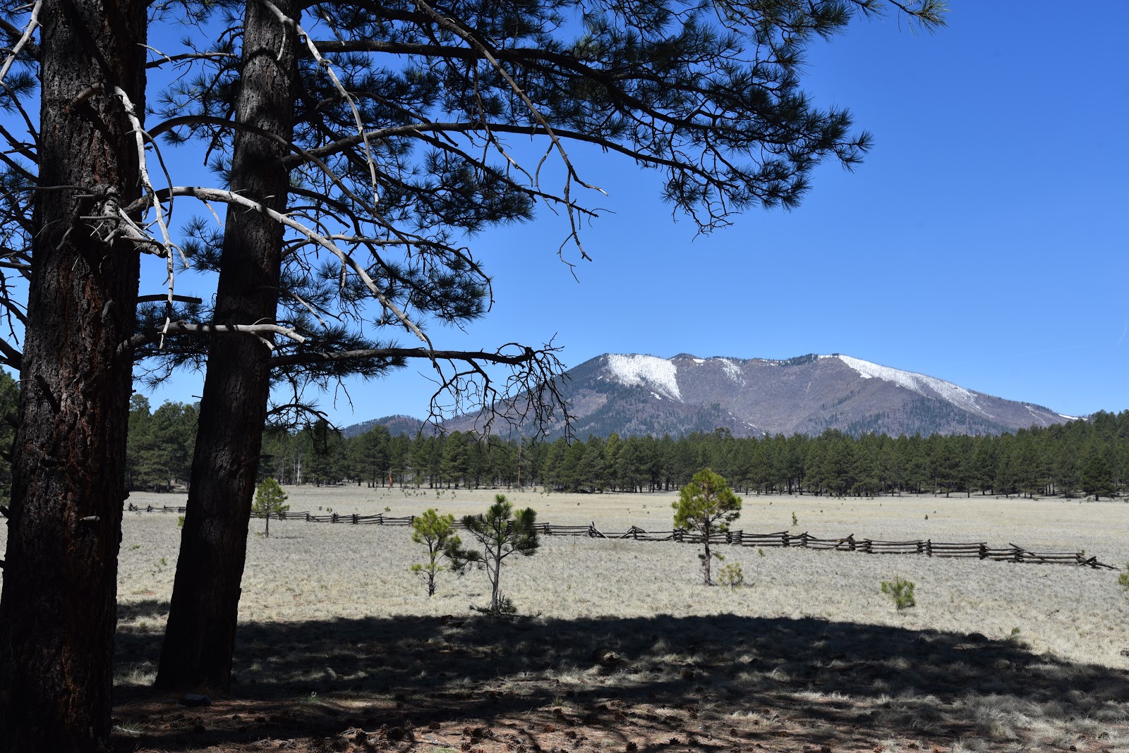
Kendrick Peak seen from Kendrick Park
To young children, traveling the stretch of U.S. 180 that runs between Flagstaff and the south rim of the Grand Canyon can feel like being trapped in a careening container with few sights that appeal to kiddie sensibilities.
A  Ponderosa pine tree provides cover for wildlife viewing
Electronic devise-enabled distractions only last so long before cries of ‘are we there yet’ and ‘I have to go potty’ demand a break from the drive that flows between pine forests and the desert plains of the Colorado Plateau. 
Aspen regeneration project along the outer loop.
The fix is a stop at Kendrick Park Watchable Wildlife Trail.  Complete with walking paths and a restroom, the site that sits on 2000 acres roughly 20 miles north of Flagstaff offers a chance to stretch legs, decompress and maybe learn a thing or two.   The U.S. Forest Service property has two short loop trails that explore biologically diverse spaces in alpine meadows, pine woodlands and aspen glens with excellent views of the San Francisco Peaks (12,633 feet) and Kendrick Peak (10,418 feet).  The quarter-mile short loop is paved and suitable for strollers and wheelchairs while the 1.2-mile outer loop follows a flat dirt trail. 
The San Francisco Peaks soar to 12,633 feet.

Many teaching moments punctuate the hike.
Both paths are outfitted with interpretive signs that describe fascinating facts about the area’s plants, animals and history. 
Two easy loop trails explore the property.
The compact system is packed with points of interest. An abandoned potato field, corral and campsite document some of the surprising ways people have used the land in the past.  Along the outer loop, an aspen recovery area at the edge of sprawling grasslands and signs that explain how wildfires have impacted the landscape illustrate the complex forces that continually shape the delicate ecosystems.  Of course, the big draw here is the opportunity for real-time wildlife viewing.  To optimize your chances of seeing animals wandering in their natural habitats, experienced viewers recommend the following tips.
Fremont barberry grows along the trails.
The outer loop passes through a beautiful aspen grove.
The family-friendly 0.24-mile short loop is barrier-free.
Signs invite visitors to immerse in the experience.
Interesting relics at an abandoned camp site.
• Plan your timing. Wildlife is most active at dawn and dusk.
• Be invisible. Stay quiet, wear neutral colors and avoid using scented products like perfume, lotion and strong laundry additives.
• Be patient.  Sit quietly behind a tree or rock and wait for animals to appear.
• Observe from a distance. Keep wildlife wild by giving them their space. Never harass, feed, or handle wildlife.
When explored quietly and with respect, the trails at Kendrick Park extend a rest stop into an entertaining, educational tour of a northern Arizona wildlife stomping ground with tantalizing backstories and myriad mini lessons built in.
LENGTH: 1.5 miles for two loop trails
RATING: easy, the short loop (.25-mile) is barrier-free
ELEVATION: 7862 - 7915 feet
GETTING THERE:
From Flagstaff, go 20 miles north on U.S 180 to the trailhead located between mileposts 235 and 236 on the west side of the road.
There is a restroom, but no water at the trailhead.
INFO:
Arizona Watchable Wildlife Experience:
Coconino National Forest:
--> -->

Monday, April 22, 2019

CEDAR MESA

Cedar Mesa, Tonto National Forest.
Mogollon Rim seen from Forest Road 322
Cedar Mesa is the kind of place you just don’t stumble upon. The desolate, flattop spread resides at the end of a ridiculously undulating road at the base of the Mogollon Rim south of the community of Pine.  
Gate on Cedar Mesa
It takes effort to get to it but the payoff is a pleasant, uncrowded diversion from the old standard hikes in the area.
Milk Ranch Point, a prominent nose on the Mogollon Rim
The hike follows Forest Road 322 that begins at a dirt pullout along heavily-travelled Control Road (Forest Road 64) near where numerous trailheads and cliff-climbing routes provide connectivity with major travel corridors.
Hikers walk the rough road to Cedar Mesa
The road is an easy snare for curious hikers wondering where the heck it goes. Open to both motorized and foot travel alike, the rough dirt two-track in Tonto National Forest reveals its colors immediately with a steep ascent to a crest where visitors are treated to the first set of magnificent views and a welcome breath-catching moment.
The hike’s ubiquitous landform is the imposing rock jetty of Milk Ranch Point, that towers to over 7400 feet. Patches of vivid green foliage clinging to its escarpments expose the locations of Red Rock and Pine springs that serve as reliable water sources along Highline Trail which is part of the state-traversing Arizona Trail. From here, the climb continues on a milder slope, gradually exposing bigger and better vistas of the Mogollon Rim--a wall of uplifted rock that spans roughly 200 miles from New Mexico to the Sedona area.
Follow the fence line on Cedar Mesa to extend the hike
Although the difference between the hike’s high and low points is only 358 feet, the out-and-back route’s constant ups-and-downs adds up to more than 1000 feet of elevation change. As the road moves southeast through forests of cypress, pinion pine and a fringe of manzanita, the peaks of the Mazatzal Mountains appear as hazy purple mounds on the western horizon.
A baby horned lizard blends in with the local rocks.
At the 1.2-mile point, the route heads left at a 3-way junction where the road narrows as it descends through a rocky corridor fringed with scrub oak, Alligator junipers and a smattering of Ponderosa pines.
Mazatzal Mountains on the horizon
This is where the first good glimpses of the destination come into view---a low slung mesa fleeced in conifers with three quad-burning dips-and-climbs in between. From here, the Payson airport, a brush pit and the chiseled watershed of the East Verde River and its tributaries are visible to the south. Once over the last major hump, the trail emerges on Cedar Mesa proper, encountering a gate at the 2.6-mile point.
Hikers contemplate the undulating route.


The hike features beautiful Rim Country views
 Although the road disappears beyond the fence, it’s possible to extend the hike by exploring on the irregular-shaped mesa that’s just over a mile across.  Vegetation on the sparse, breezy plateau is a homogeneous labyrinth of junipers, so a good sense of direction or GPS skills are essential to avoid getting lost. An easy way to wander and stay found is to follow the barbed wire fence line that encloses the summit for more spectacular Rim views from a seldom-visited, hard-won platform.
The route has many ups and downs.
LENGTH:  5.2 miles roundtrip
RATING: moderate
ELEVATION: 5495 – 5853 feet (1183’of accumulated elevation change)
GETTING THERE:
From the junction of State Routes 87/260 in Payson, go 12 miles north on SR 87 to milepost 265 (2 miles north of Tonto Natural Bridge State Park), turn right on Control Road (Forest Road 64) and continue 0.8-mile to the parking pull out at Forest Road 322.   


Monday, April 8, 2019

Cibola Pass-Jordan Trail Loop

Cibola Pass-Jordan Trail Loop
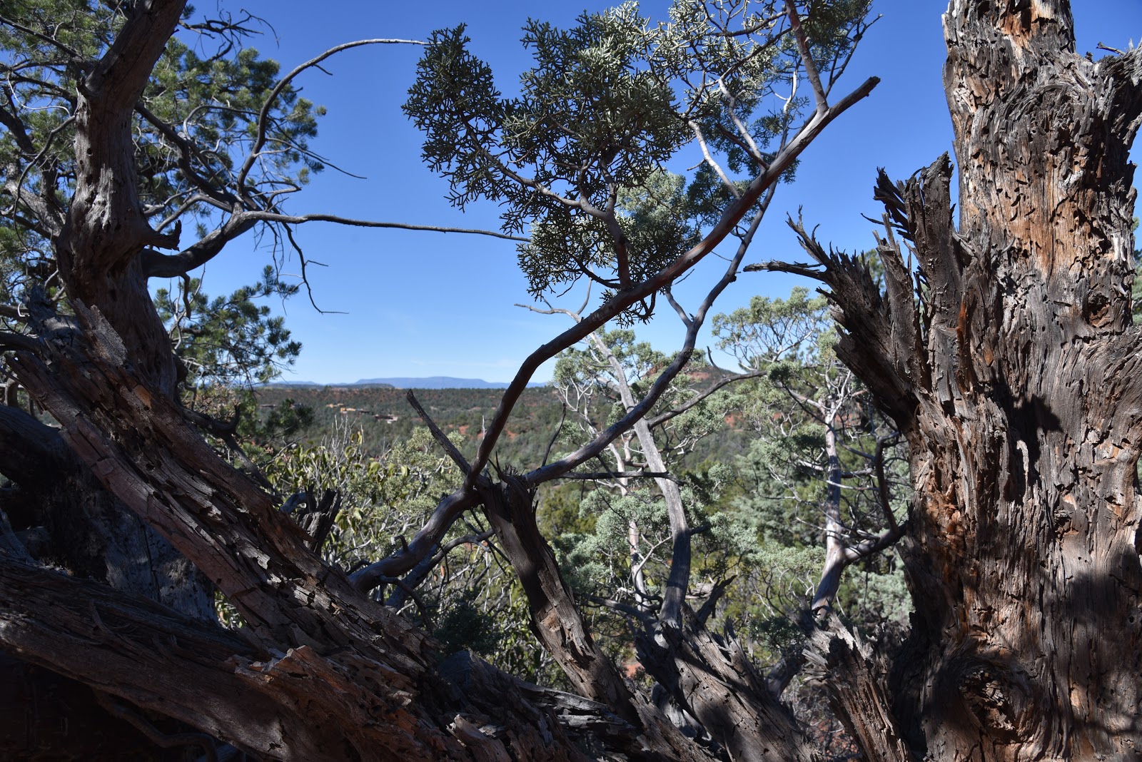
A juniper-framed view on Cibola Pass Trail

Mitten Ridge formations seen from Cibola Pass Trail.
As implausible as it may seem, some people driving through Sedona are in a hurry. It happens, though, but it’s no excuse to forfeit a hike in order to beat the traffic or catch a flight.  Many of Sedona’s trails offer drive-up-and-hike convenience and clever connectivity that accommodates those who have only a couple of hours to indulge in a picture-perfect jaunt.  Take, for instance, the Cibola Pass-Jordan Loop.
Sugarloaf and Chimney Rock seen from Jordan Trail.
When hiked from the Jim Thompson trailhead that’s located just a short drive from Uptown Sedona, this heavenly trek that slices through forests at the southern edge of the Red Rock Secret Canyon Wilderness, gets you in-and-out of the good stuff pronto.  
Huge agaves grow along the route.
As the average hiker moves at about 2-3 miles per hour, it’s possible to whip through this 2.2-mile circuit in just over an hour—provided you can limit ogling and photo stops. The hike scrimps on length but splurges on scenery and workout value.  From the parking area, start hiking at the Cibola Pass post near the fee pay station. Continue a few yards to a three-way junction and continue straight ahead on the Cibola Pass trail. Hiking the loop in this direction gets the steep climbing out of the way within the first half-mile.
A shady spot on the Jordan Trail
The abrupt but not-too-difficult climb is a mashup of switchbacks and flat rest areas overlooking the deep cuts of Mormon Canyon and layers of sheer wilderness mesas.  The signature feature along this section is the hand-shaped, russet stone tower that caps Mitten Ridge.
A scenic point on the Jordan Trail
The route makes a brief passage though the wilderness area on slickrock slopes with stunning juniper-framed views before dipping into a shady drainage.  At the 0.7-mile point, the circuit meets the Jordan Trail junction.
A slick rock passage on the Jordan Trail
Time permitting, take an optional 0.6-mile roundtrip venture, by heading right to see Devil’s Kitchen—an impressive sandstone sinkhole.  To stick with the quick-trip plan, go left at the junction and make a swift ramble on the Jordan Trail through a 1.5-mile pocket of fragrant cypress, giant agaves and oak-fringed bluffs. You’ll be back at the trailhead in a flash with dusty boots and time to spare.
Goodding's Verbena blooms April through September.

LENGTH: 2.2 miles
RATING:  moderate
ELEVATION:  4520 – 4682 feet
GETTING THERE:
Jim Thompson Trailhead:
From the State Route 179/89A traffic circle in Sedona, go right onto 89A and continue 0.3-mile to Jordan Road on the left. Go 0.8 mile on Jordan Road, turn left onto Park Ridge Dr. and continue 0.5-mile to the trailhead on the right. The last half mile is on a gravel road with potholes but is suitable for all carefully driven vehicles. A $5 Red Rock Pass is required.  There is a restroom and a pay station at the trailhead.
INFO:  Coconino National Forest
Red Rock Pass Information:
-->

Monday, April 1, 2019

MOUNT UNION

Mount Union: Prescott National Forest
 View of Mt. Davis seen from 7979-foot Mt. Union
Where as the thrill of reaching a mountain summit usually comes with a wham-pow jolt of pride, gaining the high point of the Bradshaw Mountains in Yavapai County kind of creeps up on you instead. 
Snow on the Dandrea Trail No. 285, 3-30-2019.
The hiking trails that lead to the 7979-foot pinnacle of Mount Union are neither technical nor precipitous.
The fire lookout on Mt. Union was built in 1933
Unlike other Arizona peaks, there are no false summits, no cliff-dangling passages and no obvious risks to life and limb. Regardless of its lack of adrenaline rushes, the straightforward route is not without its challenges.
Big views on the Yankee Doodle Trail No. 284
It’s only a two-mile hike to the top, but working through the rough, rocky course is an exercise in balance and tenacity. It’s a real ankle-twister, so sturdy footwear and hiking poles are essential. Located southeast of Prescott near the mountain community of Potato Patch, the Dandrea Trail No. 285 and the Yankee Doodle Trail No. 284 combine for a short but tricky route to the peak. The trails are signed only by their numbers, not their colorful monikers which, along with nearby landform names, were assigned by miners working for competing factions during the Civil War.  

The bare bones trailhead straddles a drainage where the headwaters of the Hassayampa River—spilling from the spring-laden slopes between Mount Davis (named for President of the Confederate States, Jefferson Davis) and Mount Union-- begin to gain momentum.  Hop the chugging stream and head toward the “285” sign, which marks the first leg of the circuit. Trail No. 285 is an old mining road that was built long before the concept of sustainability gained traction and thus has not held up well. Thrashed by the forces of nature, the road has devolved into a quagmire of loose rock and debris. Sometimes paralleling the Hassayampa drainage, sometimes swamped by its overflow, trail conditions vacillate between poor and treacherous. But, picking your way though is part of the adventure. Also, several unmarked spur paths that spin off the main road can be confusing. To stay on track, always head right at these junctions. 
The summit road was snow-covered on 3-30-2019.
 
View from a high section of the Dandrea Trail
Between keeping an eye to the ground to avoid falls, be sure to take time to appreciate the thick coniferous forest that surrounds the trail. The canyon-bound lower mile of the route is wrapped in thick, moss-draped woodlands dominated by Douglas and white firs plus spotty stands of aspens struggling to find the sunlight they need to survive. 
A typical scene on the rocky Dandrea Trail
As the trail gains elevation, airy stands of Alligator junipers and Gamble oaks take over, opening up views of distant Granite Mountain.
Big Bug Mesa (mid field right) seen from Trail No. 284
At the 1.2-mile point, the route emerges from the forested canyon at a gate and 4-way junction on the saddle between Mount Davis and Mount Union. Here, Trail 285 continues 1.6 miles downhill to the abandoned Dandrea Ranch site--a pretty side trip if you’re so inclined. But if your eyes are on the summit prize, head right (southwest) and follow the Yankee Doodle Trail No. 284.  Although still rocky, this 0.6-mile leg is much less hazardous and more exposed than the canyon segment.  Climbing through an oak-fringed corridor, Trail 284 features peeks of the fire lookout and communication towers on the summit and grand mountain vistas.  To the east, the long form of Big Bug Mesa stands out among minor ridgelines and pine-covered foothills. Where the trail meets the dirt summit road, head left (remember this spot because it’s easy to miss on the way back) and make the final 0.2-mile slog to the top.   
Trail 285 climbs through the headwaters of the Hassayampa
A fire lookout that was built by Civilian Conservation Corps workers in 1933 stands 30 feet above the bald, boulder-cluttered apex.
The saddle junction
At its base, the names of CCC workers etched into a cement slab add a note history and humanity to the creaky metal structure and its companion cabin.  The tower is still in active service and is occupied during fire season.  
View from the summit of Mount Union
A walk around the tiny peak reveals 360-degree vistas that validate this mountain as the standard-bearer of the Bradshaws while demonstrating that a summit trek doesn’t have to be the hardest, highest or most inaccessible to deliver a rewarding experience.
Douglas fir trees dominate the canyon segment of the hike
Mount Union is high point of the Bradshaw Mountains
Trailhead at the edge of the Potato Patch community.
LENGTH: 4 miles roundtrip
RATING: difficult
ELEVATION: 6849 – 7979 feet
GETTING THERE:
From State Route 69 in Prescott, turn south on Walker Road (intersection with the stoplight near the Costco center) and continue 10.5 miles to the “T” intersection at Poacher’s Row that’s marked by sign for the Potato Patch community. Turn left and continue 0.7 miles to where the road ends at the 285 trailhead. There’s parking for about two vehicles at the trailhead and there are additional spaces along the road, but be respectful of the private property in the area and do not block driveways. 
Summit marker.
High-clearance vehicles are recommended as the last few miles of the access roads are on rough dirt with potholes. There are no fees or facilities at the trailhead.
INFO: Prescott National Forest

Wednesday, March 27, 2019

Get Involved to Guide Fossil Creek's Future

Fossil Creek Wild & Scenic River Draft CRMP and DEIS ~ 125-day Comment Period: 
A Summary of the Alternatives
Dec. 1, 2018 – April 4, 2019
Hikers, paddlers, campers---ALL outdoor enthusiasts with in interest in how recreation in Fossil Creek will be managed should check out the resource links below and WEIGH IN. The public comment period ends April 4, 2019.  You MUST comment before the deadline to be eligible to participate any post-decision discussion or lodge objections.
To Participate in a Public Meeting and to Comment:
Comment Period: A 125-day comment period is occurring from Dec. 1, 2018, to April 4, 2019.
Online Project Information: Go to http://tinyurl.com/FossilCreekCRMP
Online Planning Documents: Go to http://tinyurl.com/FossilCreekDocuments
To Submit Comments: Please submit comments in writing through one of several methods:
Email: to comments-southwestern-coconino-redrock@fs.fed.us (include “Fossil Creek CRMP” in the subject line)
Mail: to Coconino National Forest, Attention: Fossil Creek CRMP, P.O. Box 20429, Sedona, AZ 86341
Fax: to (928) 203-7539
In person: to Red Rock Ranger District Office, 8375 State Route 179, Sedona, AZ 86351.
Comments should clearly articulate the reviewer’s concerns and contentions and provide the Forest Service with information that will be helpful in making a decision on the Fossil Creek CRMP and DEIS. For example, are there components of an alternative that you believe will result in effects (good or bad) that are not adequately described in the DEIS? Be as specific as possible and support your statements with facts and references. Consider whether your comments are solution-oriented. Do more than just provide an opinion or a vote. Remember that comments are not counted as votes where the alternative that is most referenced is the selected alternative. Also, remember that identical comments submitted (as a form letter, for example) will be treated as one comment.
Names and physical and/or e-mail addresses that are submitted during the comment period will be included in the official record for the Fossil Creek planning project and may be available for public inspection.
Public comments collected during the 2016 scoping period and during earlier comment periods serve as the basis for the range of alternatives presented now in the draft environmental impact statement (DEIS). All previous comments, since 2010, have helped the Forest Service understand the issues important to people who visit or are interested in Fossil Creek, namely how people are able to recreate in Fossil Creek, the impacts that use has on natural and cultural resources and the recreation experience, the amount and type of recreational development in the Fossil Creek corridor, and public health and safety. Comments submitted in earlier phases of planning for the Fossil Creek CRMP need not be re-submitted.
Contact Us: If you have a question about the Fossil Creek CRMP or want to know how to get involved, contact:
Fossil Creek Project Coordinator Marcos Roybal: (928) 203-2915 maroybal@fs.fed.us
Red Rock Ranger District NEPA Planner Elizabeth Munding: (928) 203-2914 elizabethamunding@fs.fed.us

Monday, March 25, 2019

Legends of Superior Trails: Arnett Canyon Trail segment

Legends of Superior Trails: Arnett Canyon Trail segment
Arnett Creek is a key feature of the LOST system
Picketpost Mountain looms over the LOST 
The new LOST trail segment connects with the AZT
“When I first hiked the Legends of Superior Trails, I had no clue how awesome they are,” says Mila Besich, Mayor of the Town of Superior.  “After the hike, I felt like crying but I wasn’t sure if it was because of the overwhelming beauty or because I had gone nearly nine miles,” Besich laughed. 
Hikers descend a steep section of the new Arnett Canyon Trl. 
Speaking at the March 24, 2019 inauguration of the new Legends of Superior Trails (LOST) Arnett Canyon segment, Besich acknowledged the many individuals and organizations that contributed to the planning and construction of the fresh-cut, 1.5-mile trail section that connects with the Arizona Trail at the Picketpost Trailhead off U.S. 60. 
A steep, narrow section of the trail.
Arnett Creek flows through volcanic terrain.
While leaders at the Tonto National Forest, Resolution Copper, Arizona Trail Association and the Town of Superior did the governmental and land management red-tape wrangling, young American Conservation Experience workers did much of the shoveling and sweating to build the singletrack path that can be hiked as a loop or a one-way trek to the historic Pinal Townsite that’s part of the LOST system of interpretive routes that explore the town’s history and mining heritage.
Hikers in Arnett Canyon
Wildflowers grow among outcroppings of volcanic ash.
Although the mountain-bound community sits in the heart of the mineral-rich Copper Corridor just an hour east of Phoenix where mining is a core industry, Besich is quick to point out that the area’s treasures extend beyond its ore.
Mila Besich, Mayor of the Town of Superior in Arnett Can.
“We’re not a mining town. We’re a town with a world-class mine,” she emphasized.  Cognizant of the boom-and-bust nature of the mining business, the town ranks its natural outdoor assets as being as important as any commercial enterprise. The improvement and expansion of the LOST hiking hub is part of the town’s diversification objectives to boost the economy while staying true to their roots.  “The project is a marathon,” Besich said. “LOST is a start, and we envision Superior becoming home to the next best hiking destination in Arizona.”  This ambitious goal includes plans for a 110-mile stacked-loop trail system that will wind through rugged back country and the Queen Creek-Arnett Creek watersheds south of town. The project—which will use the LOST system as an anchor-- is currently in the planning and permitting process and if all goes well, construction could begin in the next couple of years.  In the meantime, hikers can enjoy the many miles of outstanding existing trails in Superior. 
Situated at the crux of two of the state-traversing Arizona Trail’s most spectacular desert passages that meet at the base of volcanic Picketpost Mountain, the newly completed Arnett Canyon Trail segment is a segue to a landscape of amazing biodiversity, history and complex geology. 
Globemallow bloom along the trails.
The segment begins near the site host campsite with an uphill walk and views of the Superstition Wilderness. Other than a short section where the trail descends steeply on a narrow, rocky ridge that’s not recommended for bike or equestrian use, the hike is effortless.
Hikers on the LOST loop approach the Picketpost TH 
Where the route brushes the flanks of Picketpost Mountain, hikers might be inspired to climb to its 4375-foot summit by way of a sketchy and difficult spur path off the Arizona Trail.  At the 0.6-mile point, turn right and pass through a gate to complete the 1.5-mile loop. Or, to extend the hike, continue straight ahead into Arnett Canyon for a drop-dead-gorgeous, out-and-back creekside trek smothered in greenery and pillars of petrified volcanic ash.  It won’t take too many miles of hiking to understand why Besich says this enchanting trail system is, “a dream come true” and a key inspiration for the reimagination of a desert town.
LOST is just the beginning of a planned hiking hub.
Volcanic rock formations in Arnett Canyon
Superstition Wilderness vistas seen from LOST
LENGTH: 1.5-mile loop
RATING: easy
ELEVATION:  2461 – 2342 feet
GETTING THERE:
Picketpost Trailhead:
From U.S. 60 just before entering the Town of Superior between mileposts 221 and 222, turn right at the Picketpost Trailhead sign and continue 1 mile to the parking area. Roads are paved and maintained dirt suitable for all vehicles. There is a restroom at the trailhead. The trail begins near the site host campsite.
INFO:
Legends of Superior Trails
Arizona Trail