Find A Trail. Start Your Search Here:

Monday, January 21, 2019

Massacre Grounds Trail

Massacre Grounds Trail
Weaver's Needle on the horizon seen from Massacre Grds.
It’s curious that even though geologists say that the Superstition Mountains are an unlikely source for rich deposits of gold, myths and legends of finding, loosing and raiding the precious mineral in the unforgiving back country persist. 
Hill 2636 is a distinctive feature along the trail.
From territorial times to the present day, people have been fascinated by the strike-it-rich rumors and tales of ill-gotten gains that ring as loudly and off-key as cymbals in the hands of a restless kid.
Rock pinnacles (L) above Lost Dutchman SP.
Exposure, accidents and violence have claimed the lives of many who followed the lure of greed toward the proverbial mother lode.  For those who believe in ghosts, Massacre Grounds is a good place to find them. 
This rough chute is the most difficult part of the hike.
If you could pick a place to meet your maker, the yucca-studded volcanic mesa surrounded by rolling grasslands, abrupt canyons and sheer cliffs would make for a glorious sendoff.  
The hauntingly beautiful spot at the far northwestern edge of the Superstition Wilderness near Apache Junction is the site of a legendary 1848 ambush where a group of Spanish miners met their demise at the hands of a band of irate Apaches.  Hazy historical accounts suggest that the Apaches took the miner’s pack animals but left the gold—further stoking the quest for hidden treasure.  A good place to tease out the vague, conflicting but always intriguing history of the area’s rough-and tumble past is the Superstition Mountain Museum. The small, but packed space located along State Route 88 not far from major trailheads has regular educational events and exhibits. 
Hikers on the saddle. (R) beneath Hill 2636.
The museum’s new exhibit “The Gold Seekers” uses photos and artifacts to give an overview of the area’s infamous fortune hunters while adding incentive to take a hike into them thar hills.
Gory history notwithstanding, Massacre Ground Trail is a real treat to explore.
Yucca and agaves at the massacre grounds.
View from Massacre Falls
Volcanic structure of the Massacre Grounds site.
Climbing gently along a well-defined path, the route cuts through the remnants of 35-million-year-old volcanic activity. Contorted lava flows, volcanic necks and rugged washes shaded by desert trees and shrubs complement wide-open views of the surrounding wilderness. 
Desert holly grows in  moist drainages on the trail.
The first mile makes a mild ascent of the foothills at the base of craggy mountains. Acres of chain fruit cholla cover the flats that provide a platform for viewing the Four Peaks on the northern horizon and the colorfully layered mounds of the Goldfield Mountains to the west. 
Chain fruit cholla frame views of Four Peaks.
Once past the wilderness boundary fence, the climbing intensifies as the route swings over the saddle of Hill 2636—a dominant conical butte. 

From this point, the distant urban profile of Downtown Phoenix is barely visible to the southwest. 
Four Peaks are visible throughout most of the hike.
Goldfield Mountains on the western horizon.
After a dip into a damp, shady corridor, the trail meets its most difficult challenge—a 0.1-mile slick rock chute. The loose rock and high-steps of this short section look intimidating but getting through isn’t too tough for anybody with nubby footwear and the smarts to take it slow.  
A primitive trail leads to the base of Massacre Falls.
With the climbing mostly in the rear view, the final trudge to the massacre site is a breathtaking journey up a sloping mesa to a junction above a precipice that meets a hoodoo-topped wall of stone. To the south, the signature stone pinnacles of Lost Dutchman State Park appear as giant slabs falling away from the massive cliffs that encompass the Massacre Falls. Dark stains on the rock veneer show where waterfalls cascade over the cliffs after heavy rains. A well-worn path to the right heads down the escarpment to the base of the falls. To the left, a slender footpath traces the edge of the mesa’s broken brim, culminating at the purported location of the miners’ bloody last stand.  Trail’s end is a desolate platform at the cusp of sky and stone with no signs of conflict and no pot of gold.  But the site’s aura resonates in eerie canyon echoes and the calls of ravens passing overhead.
View from Massacre Grounds.
The trail to the massacre site.
LENGTH: 6 miles round trip (including side trip to the falls)
RATING: moderate
ELEVATION: 2116 – 3185 feet
GETTING THERE:
From U.S. 60 in Apache Junction, take the State Route 88 (Idaho Road) exit 196 and continue 7.5 miles on SR 88 to First Water Road (Forest Road 78) located just past Lost Dutchman State Park on the right.  Go 0.5 mile on FR78 to the signed Crosscut-Massacre Ground Trailhead on the right.  FR 78 is rough dirt passable by carefully-driven sedans.
INFO:
Tonto National Forest
-->

Monday, January 7, 2019

The Back Roads to Tonto Creek

The Back Roads to Tonto Creek
The pebbly fringe of Tonto Creek north of Roosevelt Lake.
Occupying a few dusty acres between nowhere and Roosevelt Lake, the blink-and-you’ll-miss-it community of Jake’s Corner is a popular waystation for outdoor enthusiasts.
A rustic gate along Forest Road 184D
Its outwardly ramshackle appearance and come-as-you-are ambiance are big draws for anglers, hunters, boaters, bikers and ATV riders.  Sometimes, hikers find the place, too. 
Located 22 miles north of the lake along State Route 188 in Gila County, the iconic watering hole is the northern outpost of a string of RV parks, creeky-floor honky-tonks, bait shops and general stores.
The back roads around Jake's Corner are rough but scenic.
The scenic stretch of SR 188 runs through the Tonto Basin—a drainage gorge that separates the wilds of the Mazatzal Wilderness and the Sierra Ancha Mountains.  Dozens of creeks and streams in the area flow off the foothills into the major course of Tonto Creek which feeds Theodore Roosevelt Reservoir.  Although recreation in this hilly, watery back country usually involves a motorized vehicle, there are plenty of places to hoof it along dirt roads.
Paper Flowers bloom year-round above Tonto Creek. 
Tonto Creek
Other than the state-traversing Arizona Trail which makes a grueling climb through the mountainous terrain to the west, there aren’t many non-motorized routes nearby unless you go 20 miles north to Payson.  But, hiking on shared-trails can be just as enjoyable when common courtesy is applied.  Directly across from Jake’s Corner Bar, a maze of forest roads offer miles of boots-on-the-ground exploratory options.  Like the adjacent community, the walkabouts here harbor no pretense. They are simply-signed and retain a raw, non-nonsense air. Many of the routes are championed by the Tonto Recreation Alliance--a volunteer organization that works with government agencies to maintain and promote off-highway vehicle access and educate recreators about public access issues in the Tonto National Forest.  
Cacti and mesquite frame Mazatzal Mountains views.
One circuit to try is a rough-cut route to Tonto Creek.  From a dirt parking area a half-mile from the bar, follow Forest Road 184A a few yards, then head left at Forest Road 184D. The first mile is a wobbly trek through wide-open high desert with great views of the Mazatzal Mountains.  After a series of dips and climbs on choppy two-tracks, pass a gate at the one-mile point and hike up to a knoll where a faint road curves to the left.
Glimpse of Tonto Creek from the difficult downhill hike.
From this highpoint, head right and continue to the Forest Road 184D/951 junction.  Ahead, to the left, is “hell’s half mile”. 
Mazatzal Mountains on the western horizon.
Primitive FR951 descends nearly 500 feet with take-no-prisoners aggression toward the creek.  A hiking stick is essential to work through the loose rock and uneven trenches.  Expect to pick up some mud and grit on this half-mile plunge. There’s no mercy until the messy road meets the sandy edge of Tonto Creek.
Sycamore and willow saplings grow in flood plains.
Rapids in Tonto Creek.
Lined with cottonwoods, sycamores and willows, this beautiful bend in the creek features white-capped rapids, calm reflecting pools and optional miles of streamside exploring. 
Tiny waterfalls in Tonto Creek.
Take time to watch for waterfowl and spy the footprints of deer, raccoons and bobcats pressed into sandbars before heading back the way you came.
The descent to Tonto Creek is steep and rocky.
Short in miles but with an overall elevation change of 917 feet, the effort warrants a post-hike beer and burger reward at Jake’s. Dressed in dusty boots and trail garb, you’ll blend.
A calm bend in Tonto Creek
A snowy bank where FR951 meets Tonto Creek.
LENGTH: 4 miles round trip
RATING: moderate-difficult
ELEVATION: 2607 – 3101 feet
GETTING THERE:
From State Route 87 (Beeline Highway) south of Rye just past milepost 235, go 3.2 miles south on State Route 188 to the community of Jake’s Corner.
Across from Jake’s Corner Bar, turn left onto Forest Road 184 (not signed) and continue 0.5-mile to Forest Road 184A (utility poles) and park.  Roads are paved and sedan-friendly dirt.
INFO: Tonto Recreation Alliance

-->

Wednesday, January 2, 2019

Metate-Spur Cross Loop

Metate-Spur Cross Loop

Spur Cross Ranch Conservation Area
Snow-covered Skull Mesa reflects in Cave Creek
A wet autumn and snowy start to 2019 has boosted the benefits of hiking in Spur Cross Ranch Conservation Area in Cave Creek. 
Located just a few clicks north of Metro Phoenix, the 2,154-acre preserve has a surprisingly remote feel, a variety of hiking trails and a plethora of native vegetation that bursts with color when infused with a little extra precipitation.
Saguaros on the Metate Trail
The site, which is part of the Maricopa County parks system, bumps up against the foothills of Tonto National Forest where mountain-borne moisture flows through the area’s creeks, washes and drainages in year-round fits and spurts.
Tonto National Forest peaks seen from Spur Cross Trail
Spur Cross Trail
Sometimes the water arrives in a rage such as during spring snow melt season and monsoon rains, but mostly, the water that spills over the site’s hiking trails passes through in lazy trickles.  Getting around the water-centric park rarely means getting your feet wet, though. When water levels are high, the park ranger places plank bridges to assist crossings of Cave Creek.
Skull Mesa had a dusting of snow on January 1, 2019.
There's a bumper crop of wolf berries this season.
This year, ample moisture has coaxed out the greenery in a big way making a hike on the classic Metate-Spur Cross loop a botanical smorgasbord.  This short, moderate-rating hike is a perfect place to introduce winter visitors to area trails. Desert newbies will be awed by the medley of ecosystems and even locals will likely gain wider appreciation for the rare cocktail of vegetation living in this tiny plot. 
Although the preserve is the smallest of the ten county parks, it has the most diverse and profuse collection of Sonoran Desert plant species growing within its hilly space. 
Cave Creek flows across the Spur Cross Trail.
Recent storms have caused the desert to bloom.
To optimize the plant tour, begin hiking northwest (go left at the main trailhead kiosk) on the Spur Cross Trail.  The wide path makes a gradual descent among acres of brittlebush, jojoba and multiple species of cacti.  Most prominent here are wolfberry shrubs dripping in ripe orange fruits and a demonstration garden of agaves. 
Tiny Desert rock peas bloom along the trails.
In less than a half-mile, the ragged floodplain of Cave Creek hosts a riparian community of cottonwoods, willows and bunches of desert marigolds sprouting from the sandy corridor.  Cross the creek and head right on the Metate Trail for a walk through a massive saguaro forest and an enchanting mesquite bosque—a streamside gallery forest .
Wild cucumber vine on the Towhee Trail
Be sure to make a stop at the solar oasis, a wildlife water hole and an ancient Native American metate or grinding stone. A detour on the 0.2-mile Towhee Trail reveals a damp, birdy enclave entwined with wild cucumber vines and desert hackberry shrubs.
Plank bridges aid creek crossings.
After a second creek crossing, the trail heads up an embankment where ocotillo, cholla and prickly pear cacti dress the walk on a ridge high above the water while sweet views of New River and Skull Mesas stand as imposing bastions on the horizons.  
Brittlebush colors the Metate Trail
At the 1.3-mile point, head right on the Spur Cross Trail for the final leg back to the trailhead.  For a longer trek, consult the park website for maps or to join a ranger-led hike to the many hidden gems within the preserve.
Ancient Native American grinding stone (metate). 
New River Mesa seen from Metate Trail
LENGTH: 2.2 mile loop
RATING: moderate
ELEVATION: 2179 – 2250 feet
GETTING THERE:
Spur Cross ranch Conservation Area:
37622 N Cave Creek Road, Cave Creek.
From Loop 101 in Phoenix, take Cave Creek Road north to Spur Cross Road (on the left just as you enter the downtown area) and go 4.5 miles north to the parking area. 
FEE: $3 per person daily fee. Bring exact change for the self-serve kiosk.
INFO & MAPS:
-->

Sunday, December 30, 2018

Indian Spring Wash

Indian Spring Wash
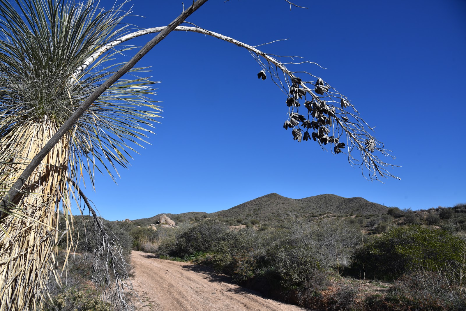
Indian Butte framed by last season's yucca sprouts.
By way of Forest Road 532, it’s a six mile hike from Bartlett Dam Road to the Verde River. The road is neither the most efficient nor the easiest way to get there, but it offers a pleasant backcountry trek over varied terrain with outstanding views.  The road is part of a cluster of recently restored shared-use routes in the hills between Horseshoe Reservoir and Bartlett Lake northeast of the Valley. 
The first mile is a sandy slog in Indian Spring Wash.
Overlooking the Verde River Valley
Open to ATVs, bikes, horses and hikers, the roads wind through a part of the Tonto National Forest Cave Creek Ranger District.   
Desert honeysuckle bloom in the wash.
A map at the trailhead gives an overview of the system, which at first glance, can be intimidating. However, Forest Road 532 is well-signed and easy to follow. The hike begins in the sandy spillway of Indian Wash. Deeply rutted and softened by motorized traffic and periodic flooding, the first mile is tantamount to walking on a beach. The washy walk dodges among giant granite pillars, sandbars and a 
robust showing of desert hackberry, mesquites, turpentine bushes, desert honeysuckle and blooming wildflowers. At the 1.9 mile point, the road moves out of the wash and into the hills as it head up to the saddle between Indian Butte (3745 feet) to the east and Saint Clair Peak (4230 feet) to the west. The first rise provides amazing vistas of landscape of rolling foothills trees, cholla, yucca and shrubs, but the big story here is the mountain vistas. Silhouettes of the Four Peaks, Sierra Ancha and McDowell Mountains form a seamless, peak-centric horizon.  The road tops out where Forest Road 1104 head off toward St. Clair Peak and FR 532 begins its 1500-foot dive down to the river. Take a moment here to scope out wall of wilderness peaks backing the Verde River Basin ahead. It’s a long way down (and it feels even longer on the way out) but the wide road mitigates the struggle with passes by rugged cliffs, scenic overlooks and reed-addled riparian areas down in the wash. 
Just beyond the 5-mile point, heavily-used Forest Road 42 bisects the route signaling the final approach to the river. The road ends roughly halfway between the two lakes near a primitive camping area called Devil’s Hole. If you didn’t pack for an overnighter or arrange to have somebody with an ATV pick you up, enjoy the sights before trudging back the way you came.
Point where the route leaves the wash.
Saint Clair Peak
McDowell Mountains on the horizon.
Forest Road 532 ends at the Verde River
Trailhead map shows the system of shared-use roads.
LENGTH:
To the river: 5.8 miles one-way
To the highpoint: 2.4 miles one-way
RATING:  moderate-difficult
ELEVATION:
Trailhead: 2725 feet
Highpoint: 3303 feet
River: 1800 feet
GETTING THERE:
From the Pima Road/Cave Creek Road intersection in Carefree, go 4.1 miles north on Cave Creek Road to Bartlett Dam Road. Turn right and continue 9 miles to the trailhead on the left where there’s a gate and map kiosk. There’s plenty of parking along the road.