Find A Trail. Start Your Search Here:

Tuesday, September 4, 2018

SHEEP CREEK POINT

SHEEP CREEK POINT
View from Sheep Creek Point.
It has been argued that hiking isn’t always about the destination—it’s the journey that matters most. Still, objective-oriented hikes like those that culminate on mountain summits or in secluded, special places have their merits.
A marsh along Merzville Road
But, their wham-pow payoffs can eclipse what’s stuffed between the trailhead and the goalpost. Depending on your point-of-view, the stuffing can be viewed as either a means-to-an-end or the savory sweet filling between cookie wafers. 
Western dayflowers bloom through September.
When compared to interest-packed nearby Mogollon Rim trails, the “stuffing” on Merzville Road that runs between State Route 260 and Sheep Creek Point near Forest Lakes smacks of mediocrity. Its narrow, nondescript course is a mix of graded dirt and rutted, rocky passages. As a hiking route, the road has some obvious gigs. First, it’s open to motorized use and is used frequently by ATV and dirt bike riders. Second, with no spectacular natural features like those peppered throughout traditional hiking trails, everything great about this journey happens where it dead-ends at Sheep Creek Point.
Canyon Creek Hatchery 900 feet below the point.
Historical OW Ranch (mid-center) seen from the point.
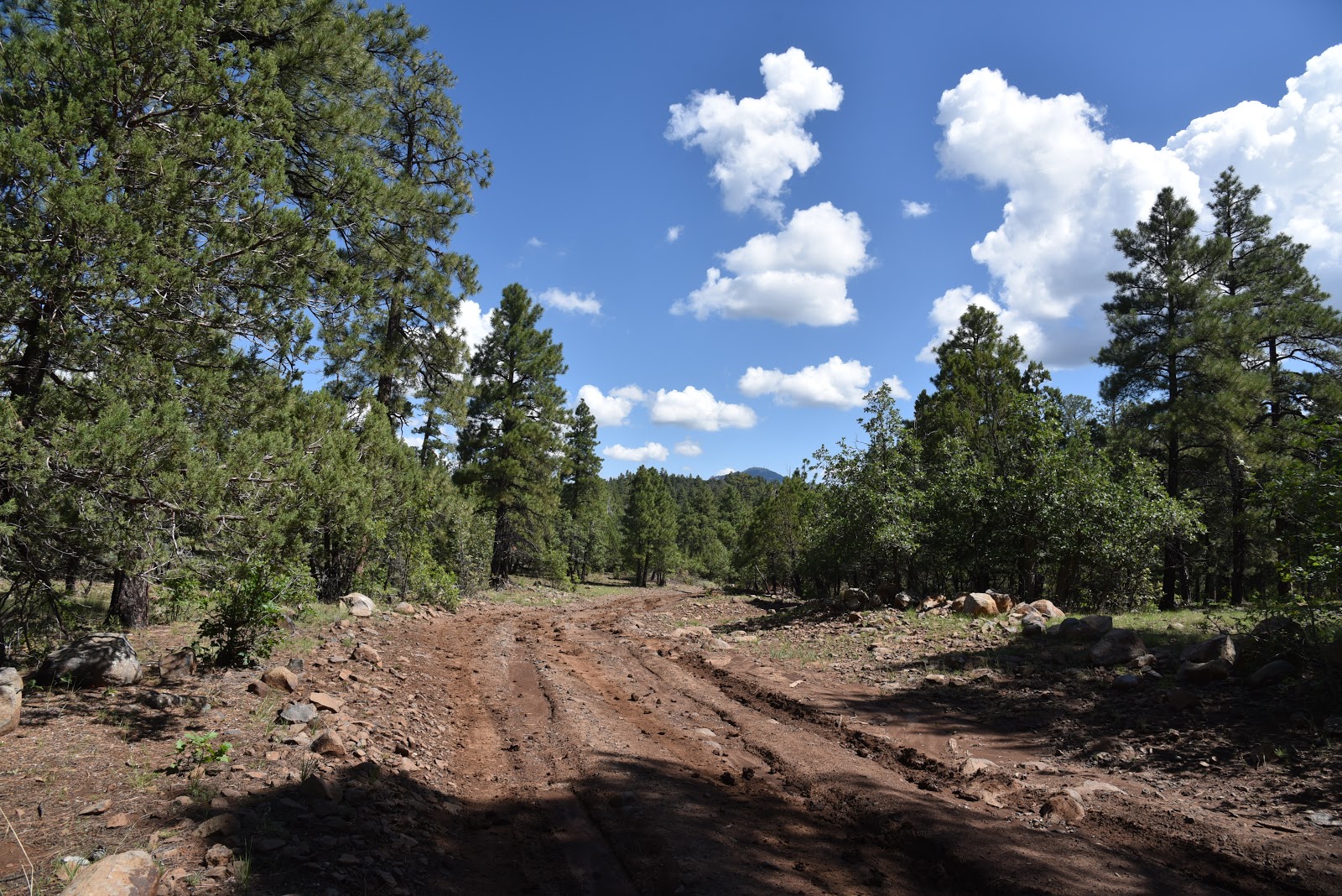
Ponderosa pines dominate the forests that flank the road.

It’s not as if the road hike is terrible. There are oak-shaded wet meadows teeming with wild turkeys and a beautiful section where mature Ponderosa pines and a fringe of saplings create a sort of “green tunnel” that smells of butterscotch and fresh sap. Ravens roost and crackle in the gnarly snags. Under the coniferous canopy, wildflowers and mushrooms color the forest floor. The only obstacles along the road that makes a straight shot south through patchy woodlands are occasional mud puddles and uneven footing. Depending on where you parked along the road, the hike to Sheep Creek Point is about 2 miles one-way. You’ll know you’re close when canyon winds pick up and a broad mesa appears directly ahead.
Canyon Creek Hatchery supplies 20% of AZ's game trout.
A few more minutes of walking brings you to a precipice at the border of the Apache-Sitgreaves and Tonto National Forests.  The exposed nose of the point hovers above Valentine Canyon with views of historical OW Ranch and the Canyon Creek Hatchery situated along green creek corridors 900 feet below. Across the chasm, the ragged, vertical cliffs of Mule Creek Point to the east and OW Point to the west appear as flat-topped jetties with sporadic stands of pines that survived the 2002 Rodeo-Chedeski Fire.
The fragrant "green tunnel".
 
Aspen fleabane bloom through October.
A stroll along the point’s margins reveals intriguing glimpses of the hatchery complex.  Managed by the U.S. Forest Service (Tonto National Forest), the site’s water “raceways” produce an average of 80,000 pounds of trout annually that are used to stock Arizona’s lakes and streams.
Most of the trout that end up in White Mountains waterways and 20% of the statewide supply begin their journey here.   This wind-in-your-face edge is the turnaround point of a modest trek with a pretty sweet special place in the middle.
Shared-use Merzville Rd is a popular ATV route.
Puddles and uneven footing are the hike's only obstacles.
LENGTH: Depends on where you park, but it’s 2.7 miles one way from SR 260 to the point.
RATING: easy
ELEVATION:  7530 – 7400 feet
Sheep Creek Point overlooks Canyon and Sheep Creeks.
GETTING THERE:
From the State Route 260/87 junction in Payson, go 35.5 miles east on SR 260 to the community of Forest Lakes. Just before milepost 289, turn right (south) on Merzville Road (Forest Road 260B) and park in one of the many dirt turnouts within the first half-mile.  The road is open to motorized use and turns into a very rough 4x4 track after about a mile.

Monday, August 27, 2018

PUMPHOUSE WASH TRAIL

PUMPHOUSE WASH TRAIL
The north leg of the trail overlooks a sprawling marsh.
Pumphouse Wash is a tributary gorge of Oak Creek Canyon that runs between Sedona and Flagstaff, roughly paralleling State Route 89A.
The trail wanders through moist meadows.
Its rugged, lower channels—that can be accessed from SR 89A just south of the switchbacks 12 miles north of Sedona –are popular destinations for backcountry hiking and technical canyoneering. From the looks of the tangled corridor’s boulder-choked base, vertical walls, slots and pools of dubious depths, it’s difficult to imagine that its headwaters are located 600 feet uphill in unassuming meadows around the tiny community of Kachina Village.
Four O'Clock flowers are plentiful in summer.
Located 9 miles south of Flagstaff off Interstate 17, the mountain hamlet is an idyllic residential area of log cabins, A-frame summer homes and a hub of nature trails in the Pumphouse Wash County Natural Area.
The trail stays on the brown and out of the green.
 Less than a mile from the freeway, Raymond Park and Pumphouse Nature Trail offer short, effortless walks outfitted with observation decks overlooking acres of wet meadows that help with natural flood control and groundwater recharge while providing rich wildlife habitat. Just steps off the pavement, these two easy-access sites provide excellent opportunities to view elk, foxes, waterfowl and deer. For a longer hike, farther away from the asphalt and parking lots, the Pumphouse Wash Trail dives deeper into the woods, following damp swales that drain into Oak Creek and the Verde River.  This venture into the softer side of the wash doesn’t challenge hikers with harsh terrain navigation, rock scrambling or water obstacles.  Instead, the smooth, designated trail that traces vivid strips of sensitive wetlands is all about low-impact travel.
Late summer sunflowers in Pumphouse Wash.
The last thing delicate riparian plants and aquatic species need is human boots and loose dogs trampling their precious environments. The Coconino County Parks & Recreation Department, which oversees the site, advises visitors to “hike on the brown, stay out of the green”.
Limestone cliffs seen from the north leg of the trail.
Sticking to designated trails is always a good idea, but staying out of the weeds is especially important to help protect the health of rare watershed areas like this one.
Moth Mullein grows in most areas along the route.
From the roomy trailhead, the route departs in two directions. The 0.3-mile north segment follows a closed road above a scenic marsh area, but it’s the 1.4-mile south leg that leads to the best parts. 
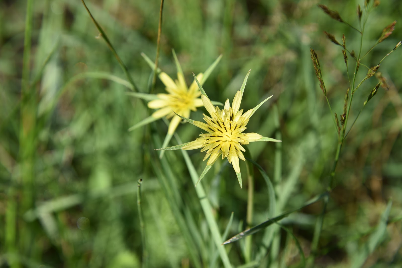
Yellow Salsify (silver puffs) are common meadow bloomers.
The trail narrows as it moves south.
Just beyond the rustic fence entry, a sunny field flanked with limestone cliffs glows with summer wildflowers. 
Morning dew on New Mexican Checkermallow.
Showy sunflowers, blue flax and fleabane bloom among tall grasses and fruit-laden wild rose and currant shrubs.  The trail stays on the pine-shaded high banks of wide greenway as it twists past scoured embankments and spongy cienegas with water-loving patches of New Mexican Checkermallow, Shrubby cinquefoil and Moth Mullein. At about the 1-mile point, the wash corridor begins to narrow and thickets of willows and oaks gradually close in on the path.
Shrubby cinquefoil grows near marshes.
The route ends where the meadows morph into a jumbled, overgrown watercourse where Woody Wash comes in from the northwest.  Underbrush, log jams and thorny brambles preclude further exploration. 

If you need further incentive to hike on the brown and return the way you came; most of the green stuff ahead is poison ivy.
Fence at the beginning of the trail's south leg.
LENGTH: 3. 4 miles roundtrip
RATING: easy
ELEVATION: 6670 – 6600 feet
GETTING THERE:
From Interstate 17 just south of Flagstaff, take the Kachina Village exit 333. At the bottom of the off ramp, turn left onto Kachina Blvd. and go 0.1-mile to Kachina Trail. Turn right, go 0.3-mile, turn left onto Ancient Trail and continue 0.9-mile to the trailhead on the left located across from Oraibi Ovi. Dogs must be on leash.
INFO:


Monday, August 20, 2018

STAGE STATION LOOP

STAGE STATION LOOP
Cow Tank on the Stage Station Loop
Long before the Atlantic and Pacific Railroad, Route 66 and ultimately, Interstate 40 drastically altered the travel corridors of Northern Arizona, a maze of backcountry dirt wagon roads south of Williams connected the town with surrounding communities. Although they’re no longer used as primary routes, the roads that remain now mostly lead to ranches and popular recreational sites.
Ruins of an historic stage coach rest stop. 
Stage Station Loop, a rough 4x4 road that spins off the Bill Williams Mountain Loop—a 30-mile scenic drive that’s also called Forest Road 108—gives a taste of what long distance travel was like back in the late 19th and early 20th centuries.
Natural water tanks near the stage station site.
Kaibab National Forest calls it a bike route and its rutted, crooked course tests the skills of Jeep enthusiasts, but the shady trail that follows old Forest Road 41 also makes for a moderately challenging hike with subtle sights that speedier users might miss. 
Buffalo bur bloom around Cow Tank.
Passing among pine-oak woodlands, vivid green seep areas and juniper-dotted meadows splattered with random growths of cacti and agaves, the ever-changing scenery offers glimpses of 9256-foot Bill Williams Mountain and crusty volcanic outcroppings.
From the main (west) trailhead, the route--which is also known as Cow Tank Road—descends gently for 3.5 miles on an often-muddy, red-earth passage to the loop’s midpoint where Grindstone Wash feeds into a beautiful pasture with waterholes. This sunny open area that's signed as "Cow Tank", is peppered with dilapidated corrals and acres of rusty barbed wire coiled around rough-cut fence posts.
A rustic corral at Cow Tank.
Two large earthen stock tanks that sit amid fields of Buffalo bur, sunflowers and tree stumps sustain wildlife and the domestic cattle that roam adjacent rangelands. 
Monsoon clouds build above Wild Steer Mesa.
About a mile farther up the road, the barely-discernable remains of the eponymous stage coach rest stop that served travelers enduring the bumpy ride between Prescott and Williams is perched at the edge of a gorge where natural stone tanks capture rain water.
Stage Station Loop connects with Bill Williams Mtn. Loop.
Green meadows and coniferous woodlands along FR 41.
Rusty cans, bent nails, bits of beat up metal and piles of fragile, weather-worn planks lie scattered in a clearing among weeds and wildflowers. (Please leave all artifacts as you found them). Two sets of crumbling, dovetailed timbers hint at what were once corners of a log structure. Other than these faint relics, the footprint of the station has been lost to time. Southeast of the historic site, the imposing form of Wild Steer Mesa hovers over tall Ponderosa pines. 
The Stage Station site sits at the edge of a stony gorge.
From this point, it’s a 2.6-mile uphill trudge back to where the route heads left on FR 108 for the final 1.2 mile walk back to the trailhead.
Bill Williams Mountain on horizon seen from rutted FR 41.
Artifacts like this one are strewn around the stage stop site.
LENGTH: 8-mile loop
RATING: moderate
ELEVATION:  6200 – 6700 feet
Sunny meadows surround Cow Tank.
Barbed wire fences at Cow Tank.
GETTING THERE:
From Railroad Road and Fourth Street in downtown Williams, go 6.5 miles south on Fourth Street (Fourth Street will turn into Perkinsville Road/County Road 73) to Forest Road 108. Turn right and go or 8.3 miles to the east trailhead or 9.5 miles to the “official” west trailhead.
NOTE: The trail can also be accessed via the Devil Dog exit 157 on Interstate 40. However, the westbound exit ramp was closed as of this writing, so you’d need to swing around at the Welch exit 151 and backtrack. From the exit, go 8.8 miles south on Forest Road 108 to the main trailhead.
Forest Roads are good gravel/dirt suitable for passenger vehicles.
INFO:

Monday, August 13, 2018

ANT HILL LOOP

ANT HILL LOOP
A shady spot on the Ant Hill Loop Trail
For a few precious days each summer, monsoon rains cool the air just enough to make hiking in Sedona bearable. 
A slick rock bend on Ant Hill Loop
Although sweltering temperatures rarely scare determined hikers away from Red Rock Country trails, the exposed, stony terrain of the high-desert trekking hub amplifies heat, making for an uncomfortable and potentially dangerous journey.  After a good monsoon soaking, though, lingering moisture offers brief respite.
Newborn frogs emerge from a monsoon puddle.
Summer is also an ideal time to try some of Sedona’s shorter, lesser-used trails.  The Ant Hill Loop resides in a shady pocket south of the hyper-popular Soldier Pass-Brins Mesa route that features a set of famous natural arches, the Seven Sacred Pools and Devils Kitchen sinkhole. 
Desert frogs & toads grow from eggs to fledglings in days
With nearby attractions like those diverting traffic, it’s likely you’ll encounter little company on the Ant Hill Loop.  Tethered to the north end of the Adobe Jack trail system northwest of town, the mini circuit can be hiked as a quick out-and-back trip or combined with dozens of linked routes for an all-day outing.
Puddles serve as frog nurseries in monsoon season.
To find the obscure path, begin on Soldier Pass Trail and hike 0.2-mile to the Jordan Trail junction at Devil’s Kitchen.
   Head right (east) and follow Jordan Trail 0.5-mile to the signed turnoff. 
Red rock spires seen from the Jordan Trail
The half-mile-long loop swoops through cypress woodlands and shrubby drainages with excellent views of iconic rock formations like Chimney Rock, Coffee Pot Rock and Airport Mesa. 
The trail is part of the Adobe Jack System in NW Sedona.
A favorite side-trip for mountain bikers, the trail is replete with slick rock traverses and edgy bends. This highly textured trail is a mashup of smooth rock, spiked agaves, peeling bark, knotty wood grains and tiny quartz crystal nodules glinting from russet sandstone. 
Pine and cypress trees shade Ant Hill Loop.
The Grand Central Trail---one of the backbone routes of the Adobe Jack system—bisects the loop. Use the map signs at each junction to customize your trek or simply go full circle and swing back the way you came. 
Agaves are plentiful along the trail.
In addition to giving hikers a bit of relief, monsoon rain creates fugitive water sources critical in the life-cycle of desert critters.  Standing pools like those found in cracks, sandy rivulets and potholes along rocky Sedona trails can become pop-up nurseries for frogs and toads that grow from egg to tadpole to adult in just days.  Some never make it out of their nursery before the life-giving water evaporates. The lucky ones live to adapt and survive in rhythm with the rains. Just like hikers.
Crystals in sandstone.
Artistic natural textures. 
LENGTH: 1.8 miles as described here.
RATING: easy
ELEVATION: 4315 - 4520 feet
GETTING THERE: Use the FREE SEDONA SHUTTLE: 928-203-5252, SedonaShuttle.com
Soldier Pass Trailhead:
From the State Route 179/89A traffic circle in Sedona, go 1.25 miles west (left, toward Cottonwood) to Soldier Pass Road. Turn right and drive 1.5 miles to Rim Shadows, turn right and continue 0.1-mile to the trailhead on the left. Trailhead gate is open 8 a.m. to 6 p.m. daily.
A Red Rock pass is NOT required to park at this trailhead.
INFO & MAP:

Monday, August 6, 2018

LAND OF THE PIONEERS TRAIL #651

LAND OF THE PIONEERS
This box canyon is a highlight along the north leg of the trail.
The bucolic pastures and quiet backwoods of Vernon, Arizona--population 122--is the last place you’d expect to be the scene of a vile triple homicide. It happened, though and the sad story is standard fare in local lore.
Ruins of a pioneer homestead.
Pioneers began settling the rural community in the eastern White Mountains in the 1890s, making a living on the surrounding lumber-rich forests. 
The ruins of an infamous pioneer cabin.
Legend has it that among the early pioneers were three women who lived in a log cabin just south of town.
Section 31 Tank attracts swarms of dragonflies.
Back-fence chatter about the women hiding a large amount of money on their property eventually reached the ears of criminals.  The women were murdered and their homestead ransacked. No riches were found.  Today, all that remains of the tragic scene are crumbling stone foundations and piles of rusty-nail planks.  
Delicate Torrey's Crag Lily bloom in sunny spots.
The historic homestead is one of many points of interest on the Land of the Pioneers Trail #651 that’s located 5 miles south of Vernon.   Constructed in a customizable, triple-loop format, trail No. 651 wanders through a mix of deep pine-oak woodlands and airy, juniper-dotted meadows. The most scenic elements of the hike are found on the north leg of the 8.7-mile circumference loop.
Beautiful White Mountains views from Ecks Mountain.
Bright red paintbrush wildflowers stand out along the paths.  
From the trailhead, the north leg departs at the kiosk following a dirt road. Just past the first of several cattle gates, the trail bends left onto a single track.
A sunny section of the circumference loop.
Like all White Mountains Trail System routes, this one is very well maintained and outfitted with location markers placed roughly every quarter-mile.
Approaching the box canyon.
The markers correspond with downloadable maps, so you’ll always know where you are on the trail. White diamond tags denote the main outer loop while yellow dots indicate shortcuts for the three inner loops.  The hike to the cabin site is just over a mile. The first ruins appear at location marker L30 and the main cabin ruins are a quarter mile farther at maker L29. This is also where the shortcut for Loop 1 veers off for a 3.5-mile option. Next up on the big loop, look for a short spur path on the left near marker L26 that leads to Section 31 Tank. The secluded water hole reflects the sky and teems with multi-colored dragonflies. 
Yellow dots indicate shortcut routes.
After another 0.75-mile, the trail traces the edge of rocky box canyon with steep drop offs and first glimpses of dozens of eroding cinder cones in the Springerville Volcanic Field. This is one of the prettiest spots on the trail.  Beyond the canyon, the trail begins its ascent up the flanks of Ecks Mountain.
One of several rustic gates along the route.
To bypass this challenging section, take the signed shortcut for a 6.8-mile moderate trek. Sweat expended on Ecks Mountain and an optional short spur that leads to a vista point pays off with excellent panoramic views of Greens Peak and rolling prairies that stretch into New Mexico.
Pink Windmills bloom through September.
A set of tight switchbacks mitigate the vertical descent down to the south leg of the loop. The final miles back to the trailhead undulate through boulder-studded ravines, moist drainages and fields of wildflowers shaded by the afternoon clouds that roll in like clockwork during White Mountains summers.
Be prepared for afternoon summer storms.
LENGTH:
Circumference Loop: 8.7 miles
Loop 1: 3.5 miles
Loop 1-2 combo: 6.8 miles
RATING:
ELEVATION: 7220 – 7864 feet
Section 31 Tank is located along the north leg of the big loop
GETTING THERE:
From the junction of US 60 and State Route 260 in Show Low, go 19.4 miles east on US60 to County Road 3140 (Vernon Road/Forest Road 224). Turn right and continue 5 miles south, turn right onto Forest Road 5 and drive 0.5-mile to the trailhead on the left.  Forest roads are gravel and dirt, suitable for passenger vehicles.
INFO: White Mountains Trail System