Find A Trail. Start Your Search Here:

Monday, July 30, 2018

THE BACK ROADS TO POTATO LAKE

THE BACK ROADS TO POTATO LAKE
Thistles around Potato Lake attract pollinators.
Whether called crayfish, crawfish, crawdads or aquatic cockroaches, there are two sure things about the prolific freshwater crustaceans--they harm native species and they love bacon.
With few natural agents to control them, the population of non-native crayfish released into Arizona lakes and streams via bait bucket dumps or other means, has exploded.
Potato Lake is surrounded by pine forests.
Their voracious appetites and territory-hogging talents are decimating indigenous aquatic wildlife. They consume the eggs and larvae of native fish, amphibians and reptiles and gobble up critical food supplies.
Invasive crayfish threaten native species.
Plus, their nearly year-round reproductive cycle means they can commandeer a waterhole in no time flat. They need to go.
Forest Road 9362T serves as the trail.
The best way to help eradicate them is to prevent their introduction in the first place. The second-best way is to catch them with a dangling wad of raw bacon and cook them up for dinner.
Tree huggers embrace an aspen.
If you’re inclined to the later, pack a net, a propane cook kit with your favorite seasonings and hike out to Potato Lake.
Although you could drive to the tiny lake located off Forest Road 300 on the Mogollon Rim, a hike along two old roads that have been closed to motorized use offers quieter, alternative access.
From the parking area in a primitive campsite 2.5 miles southwest of the lake, hike 0.3-mile north to a “road closed” sign. This is Forest Road 9362T which is open to foot traffic, bikes and equestrian use only.  Following the remains of a rocky two-track, the route descends toward the lake on a barely noticeable incline. The 650 feet of elevation loss will be apparent on the way back.
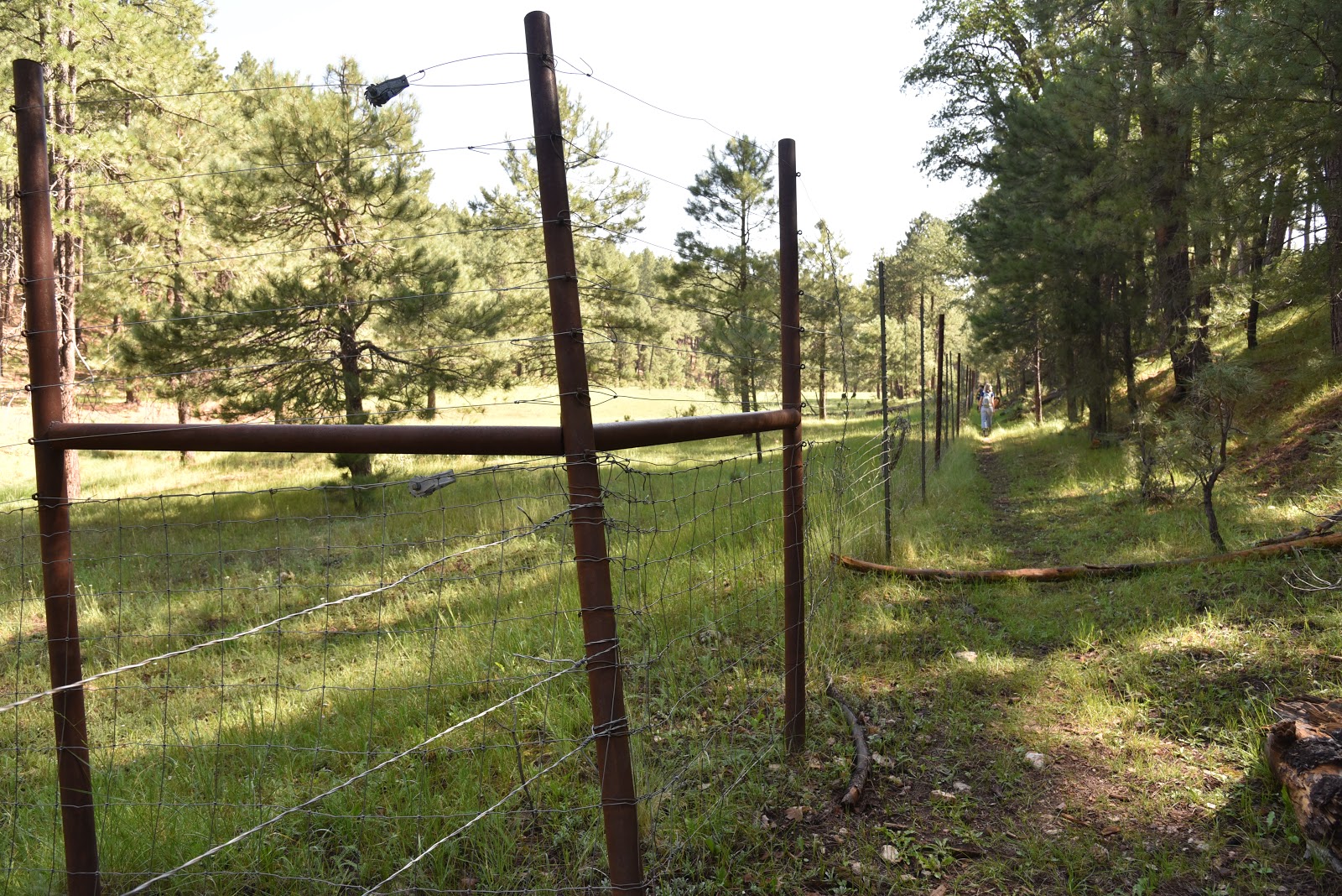
Fences protect sensitive habitats.
This lovely path curves northeasterly through woodlands of Gambel oaks, conifers, New Mexican locust and a smattering of aspens.   Except for a few spots where a healthy understory of ferns and brambles spill over its uneven course, the road is easy to navigate.
A hummingbird moth sips nectar.
At the 1.5-mile point, take the less-obvious left fork where two metal poles mark a Y junction.  Make note of this swerve as it’s easy-to-miss on the way back. From here, the route vacillates between shaded woods and dewy meadows with roaming herds of grazing cattle.
At 1.8 miles, veer right onto Forest Road 147B. This segment flanks yawning draws, sunny pastures, waterways and pristine canopies that provide habitats for the endangered Little Colorado spinedace and the Mexican spotted owl. 
A sunny spot on the way to Potato Lake.
Please respect these pristine ecosystems by staying on the roads and not cutting or jumping fences.
Bellowing bovine graze in meadows near the lake.
Non-motorized backwoods roads are open to hikers.
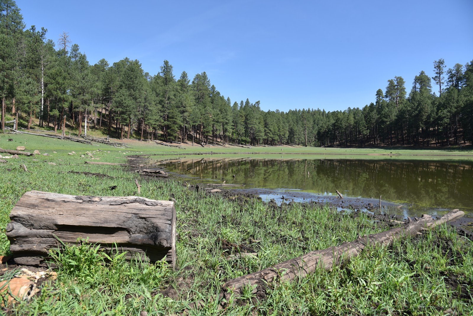
At 2.3 miles, a cattle gate marks the beginning of the final 0.2-mile walk to the lake. Ringed with pines, the lake’s water level ranges from puddle to sizable pond depending on rainfall.
Potato Lake is a tiny pool on the Mogollon Rim.
A 0.7-mile walk around the lake’s perimeter reveals clumps of common silverweed and aquatic buttercups growing from its muddy banks and fields of purple thistle that attract swarms of pollinators including hummingbird moths that sip nectar though long curved feed tubes.
Hikers on Forest Road 147B.
Diverse ecosystems around the lake support myriad wildlife.
Beneath the lake’s glassy surface, crayfish--which resemble mini lobsters-- stir up mud and are easy to spot congregating under semi-submerged logs.  
Approaching Potato Lake.
If you follow Arizona Game and Fish Department rules regarding their capture and transport, you may harvest as many of these villainous invertebrates as you like. Boil them lobster-style for a protein-rich entree that tastes like crab. They’re great with garlic, peppers and corn. Beer helps.
LENGTH: 5.7 miles out-and-back
RATING: moderate
ELEVATION: 7234 – 7888 feet
GETTING THERE:
From Payson, go 27.7 miles north on State Route 87 to Forest Road 300 (Rim Road) located near milepost 281.  Go 1.7 miles on FR300 to Forest Road 9362T on the left.  If you have a high-clearance vehicle, descend about 0.1 mile on the rough dirt road and park in the primitive campground.  The hike begins at the “road closed” sign at the north end of the site.  
INFO:
Coconino National Forest
Arizona Game & Fish Crayfish information:

Monday, July 23, 2018

MILITARY SINKHOLE TRAIL

MILITARY SINKHOLE TRAIL
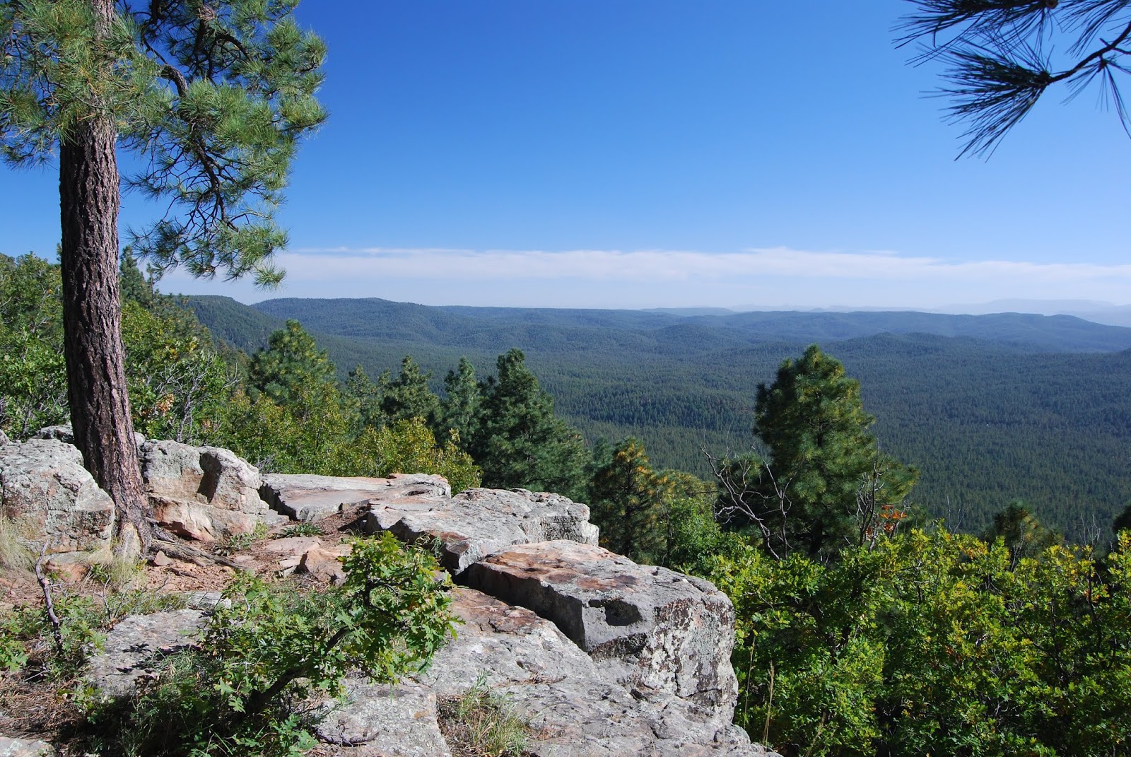
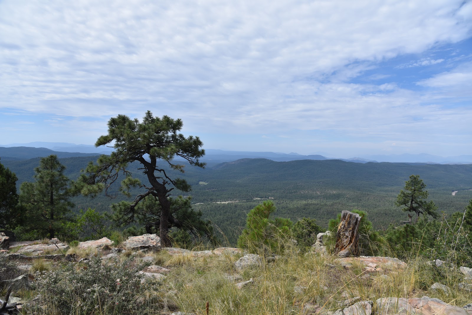
View from the Rim Lakes Vista Trail
About halfway up the Military Sinkhole Trail, I thought of Michael Corleone. In a memorable scene from the 1972 film The Godfather, protagonist Corleone rebuffed a ride as he approached his ancestral Sicilian village for the first time, deciding to savor the experience by walking to it instead. I get it.
Mixed conifer woodlands on Military Sinkhole
There’s a sort of reverence associated with trekking to special places. A slower, boots-on-the-ground pace syncs well with epic experiences. Like the village of Corleone, the Mogollon Rim is a place best crept up to on foot.
Arizona Thistle grow in Rim-top meadows
The Rim is a roughly 200-mile escarpment at the edge of the Colorado Plateau that runs east-west across central Arizona.  It’s easy enough to drive right up to its precipitous cliffs and take an edgy, 40+-mile motor tour along Rim Road 300, but to get a better sense of the scale and structure of this geological wonder, you need to climb it from base-to-ceiling.
Shady forests define the Military Sinkhole Trail
One of the most convenient ways to do this is to hike up the Military Sinkhole Trail. 
One of many soulful sights on Rim Lakes Vista Trail.
Located 27 miles east of Payson on State Route 260, the historic route makes an aggressive, 850-foot ascent to scenic ledges on the top of the Rim. The multi-faceted route begins with a walk through deep, mixed-conifer woodlands of the Tonto National Forest. Shaded by enormous Douglas firs with their characteristic barbed cones, spruce and pines, the first mile is a cool and gentle climb.
There's little shade, but great views, on parts of the trail.
Top of the Drew Trail
Where the trail dips into drainages, canopies of Bigtooth maples cast filtered sunlight on moss-embellished boulders and mushrooms popping through carpets of pine needles and cracks in decaying logs. (Keep this one in mind for a fall foliage hike.) Beyond the maples, the forest thins out, emerging onto an exposed ridge to merge with an abandoned military road built by General George Crook in the 1870s.  Like many old roads in the area, this one plows uphill without the benefit of climb-calming switchbacks. 
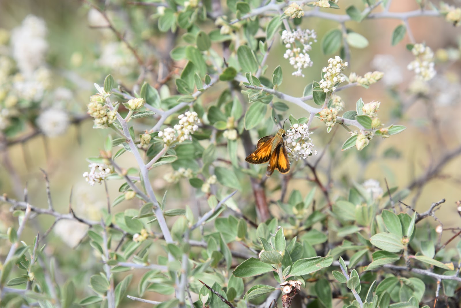
Butterfly on Gregg's Ceanothus shrub.
It’s a rocky, quad-burning segment with little shade, but great views of the Mazatzal Mountains and green valleys mitigate the pain.
Defunct military road built by Gen. George Crook.
The ankle-twisting road gradually levels out as it enters a corridor of arching Gambel oaks and fields of bracken ferns.  At this point, vertical walls start to flank the trail, hinting at the enormity of thrills that follow. 
Bigtooth maples thrive in moist drainages.
With the hardest parts over and the jumbled cliffs of the Rim’s edge hovering above, the trail enters the Apache-Sitgreaves National Forest for the final slog to the top.  At a signed junction just below Rim Road, Trail No. 179 continues straight ahead on a not-very-interesting path that connects with the General Crook Trail.
Limestone escarpments flank the final slog to the top.
 To reap the rewards you came for, head west (left) at the junction and follow Rim Lakes Vista Trail No. 622.
Keep this trail in mind for fall foliage hiking.
After a short traipse through a flowery meadow, breathtaking vistas and refreshing mountain breezes overwhelm the senses. 
Ferns grow waist-high in damp spots below the Rim.
The tough pilgramage culminates at scenic overlooks that frame wildland views. Here, hordes of camera-toting visitors stream from parked vehicles to stroll a few yards from the road for the same result.  However, regarding this experience; hiking is to driving as a clarinet is to a kazoo.  
Hooker's Evening Primrose blooms close by noon.
After savoring your hard-won eye candy, head back the way you came, or make an 11.7-mile loop by continuing 3.3 miles on Trail No. 622 to the Drew Trail No. 291.  Head 1.8 miles downhill to Highline Trail No. 31, turn left and hike 4.1 miles back to the trailhead.
A particularly fragrant section of the Military Sinkhole Tr.
A distinctively-barbed Douglas fir cone
LENGTH: 5 miles up-and-back or 11.7-mile loop.
RATING: moderately difficult
ELEVATION: 6750 – 7600 feet
GETTING THERE:
Two-Sixty Trailhead (SR260):
From Payson, go 27 miles east (right) State Route 260 to the “Two Sixty” trailhead turn off on the left. Follow the good gravel road for a quarter-mile to the trailhead parking area where there is a restroom and a corral.
Rim Lakes Vista Trailhead (Rim Road): For an optional top-down hike. From Payson, go 30 miles east (right) on State Route 260 Rim Road (Forest Road 300). Go 2 miles on FR300 to the trailhead on the left.
INFO:

Monday, July 9, 2018

VISHNU TRAIL

VISHNU TRAIL: A Tiny Trek on the Edge of the Grand Canyon.
A hiker on the Vishnu Trail approaches G.C. views.
Whether hiked as an inspirational appetizer, warm up walk or add-on trek while exploring around the South Rim of the Grand Canyon near the town of Tusayan, the Vishnu Trail is a quick and easy diversion with tantalizing views and opportunities to engage with the Arizona Trail.  
Vishnu Trail connects with the Arizona Trail
The hike begins directly under the Grandview Lookout Tower, where the well-marked path heads north through wildlife-rich pine-oak woodlands and shrubby enclaves.  After roughly a quarter-mile, glimpses of the hazy, russet chasm begin to appear through the trees.
Grandview Lookout under stormy skies. Yes, we got soaked!
An oak-shaded passage on the Vishnu Trail.
As the trail progresses to its overlook spur, scenic vistas unwrap like unexpected gifts that surprise and thrill. 
Vishnu Temple (right) seen from the trail overlook.
A metal gate marks the threshold to the best sights of the hike. Beyond the gate, canyon vistas take center stage, culminating at a boulder ledge above a sea of pinion and ponderosa pines that creeps up to the colorfully-layered walls of the canyon.  Views of dramatic rock formations, fog-veiled depths and the distant highlands of the Kaibab Plateau tease the imagination and seed ambitions for more canyon hiking.   Seasoned Grand Canyon hikers might find these peek-a-boo vistas underwhelming, but for first-timers or those who appreciate alternate points-of-view, they are stunning.  
The lookout residence cabin was built in 1936.

Coconino Rim in distance.
The prominent cone-shaped formation in the mid-ground is 7829-foot Vishnu Temple. Named for the Hindu god who protects the universe, the majestic landmark is one of the highest points in the gorge’s east end.
Grandview Lookout survey marker.
But the ooh-ahh photo opps don’t end here.  To the southeast, an imposing, elongated landform marks the convergence of the Coconino Plateau, the Colorado and Little Colorado Rivers and the pastel flatlands of the Painted Desert. 
To complete the loop, backtrack to the spur junction and follow the return leg to where it connects with Passage 36 of the Arizona Trail and the Dwarf Mistletoe Interpretive Area.  Head left here for a short walk outfitted with educational signs that provide information on the invasive parasite, forest health, plants and wildlife. 
Sign in the Dwarf Mistletoe Interpretive Area
This worthwhile diversion adds just under a mile to the trek.  For a longer option, continue hiking south on the Arizona Trail through thick woodlands of the Kaibab National Forest that hover above expansive desert plains. This 4.7-mile section is also referred to as the Coconino Rim Trail. Replete with scenic viewpoints, the shaded, easy stretch gives a tiny taste of the 800-mile route that runs north-south through the state from Mexico to Utah.  
Vishnu Trail links to the Arizona Trail.
Back at the trailhead, gird your acrophobia and check out the Grandview Lookout.
Built by the Civilian Conservation Corps in 1936, the 80-foot-tall tower capped with a seven-foot-square metal cab soars above the trees at the lip of the canyon.  When a forest service worker is on duty and not engaged with a fire incident, visitors are welcome to climb the narrow, creaky stairs for predictably grand views.  Nearby, a cozy two-room cabin, also built in 1936, serves as home base for the lookout workers and adjacent camping spots allow hikers to pitch a tent and hang out for a few days of adventure.
Beautiful woodlands at the edge of the Grand Canyon.
LENGTH:
Vishnu Trail: 1.1-mile loop (2 miles with the interpretive trail)
Coconino Rim: 9.7 miles out-and-back
RATING: easy
ELEVATION: 7400 - 7529 feet
GETTING THERE:
From U.S. 64 in Tusayan, turn right on Forest Road 302, which is located just past the traffic circle when entering town from the south.  Go 14.1 miles east on FR 302 to Forest Road 310, turn left and continue 1.3 miles to the trailhead at the tower. Forest roads are good dirt/gravel suitable for passenger vehicles. There's a vault toilet at the trailhead.
INFO:

Wednesday, July 4, 2018

WALNUT CANYON NATIONAL MONUMENT

Cultural Heritage Hikes at Walnut Canyon National Monument
View from a "shady side" dwelling
Walnut Canyon is one of Northern Arizona’s most fascinating natural wonders.  Over its 20-mile course, the 400-foot-deep gorge cuts through pine-studded plateaus and eons of Earth’s history.  
Sinagua cliff dwellings
Located just a few miles southeast of Flagstaff, the chasm’s wavy course was created over millions of years by a complicated series of geological events. The canyon’s tilted layer-cake appearance is partly made up of eroded limestone deposits and the lithified remains of ancient coastal sand dunes. 
Edible mahonia (barberry) also has medicinal qualities.
Although you’d need a Ph.D. to thoroughly understand its geological anatomy, the canyon’s more relatable human element is the focus of a hike along the trails of Walnut Canyon National Monument. 
240 stairs descend to the Island Trail
The park was established in 1915 to protect and preserve the cultural artifacts of the Sinagua people who built and occupied cliff dwellings in the canyon’s ledges and shallow caves between 1100-1250.  Two educational hikes offer lessons in biodiversity, geology, traditional farming methods and human history.  The Island Trail begins with a steep, 185-foot descent on a stone staircase with dizzying views. The trail swings around a rock jetty where dozens of stone-and-mortar rooms are built into crags and overhangs. Interpretive signs provide information about the structures as well as native plants and animals. 
View of Walnut Canyon from the Rim Trail
Dwellings on the Island Trail
The west or “shady side” of the jetty is smothered in towering Douglas firs, ponderosa pines, mahonia and Arizona walnut trees that thrive in the cooler, wetter microclimate.  Around the bend, the path emerges onto the “sunny side” -- an exposed ledge where the plant life reflects dryer, warmer conditions. Cacti, yucca and pinion pine cling to chiseled escarpments.  From here, views of the visitor center high above, reminds that there’s a strenuous 240-step climb out to get to the next trail.  
Pueblo on the Rim Trail
Back up on the brow of the gorge, the Rim Trail makes an easy half-mile loop to scenic overlooks, a pit house, pueblo and demonstration garden. Once done with the hikes, stop by the visitor center to augment your experience by viewing displays of archeological finds and a beautiful video about the area’s natural history.
Stairs descend 185 feet to the Island Trail
LENGTH:
Island Trail: 1-mile roundtrip
Rim Trail:  0.7-mile roundtrip
RATING:

Island Trail: difficult
Rim Trail: easy, partially paved.
ELEVATION: 6690 – 6505 feet
GETTING THERE:
From the Interstate 17/40 intersection in Flagstaff, go 7.5 miles east on I-40 to exit 204, turn right and continue 3 miles to the site.  There is an entrance fee.
NOTE:  Temporary closures of the Island Trail may be implemented during fire season when red flag warnings are issued by the National Weather Service.
INFO:

Wednesday, June 27, 2018

ROGERS TRAIL

ROGERS TRAIL
Rogers Lake Natural Area
Southwest of Flagstaff, two recreation areas with divergent personalities are now linked.  The recently completed 5.4-mile Rogers Trail tethers the event-centric, party atmosphere of Fort Tuthill County Park with the subdued wilds of Rogers Lake Natural Area.
Switchbacks on Rogers Trail
The non-motorized, flowy trail that straddles the open space between the two Coconino County properties has several access points and many opportunities to create short day hikes, long loops or car shuttle excursions. 
A bee harvests nectar from Butter and Eggs
One convenient out-and-back circuit begins at a trailhead on Forest Road 532.  From the roomy dirt parking lot, pick up the Flagstaff Loop Trail heading west and follow it 0.9-mile to the beginning of Rogers Trail.  Roughly paralleling Woody Mountain Road, the meandering, single track holds steady at around 7100 feet, sweeping easily through wildflower meadows, and shady glens. 
The San Francisco Peaks seen from Rogers Trail
Watch for swarms of butterflies and bees drawing nectar from Butter and Eggs, New Mexican vervain and field bindweed blooms.  After passing by the Arboretum at Flagstaff, where there’s a short access path, the trail turns southwest heading toward the pine-smothered mound of 8045-foot Woody Mountain.  Near the four-mile point, a set of syrupy switchbacks take on the southeast flanks of the mountain. The smartly constructed trail eliminates much of the huff-and-puff of the 600-foot ascent. (I ran into several volunteer forest service workers who were improving drainages on this section.  It’s important that trail users don’t cut switchbacks because doing so will cause the path to degrade and create dangerous conditions.) 
Gambel oaks are common along the trail
The uphill segment winds through thick stands of Gambel oak, New Mexican Locust and Ponderosa pines.  Even with the dense tree cover, glimpses of the San Francisco Peaks can be seen through breaks in the foliage. Trailside basalt boulders, an understory of pine cones and clumpy grasses plus the rustlings of ravens, hawks and mountain blue birds in the canopies complement the trail’s pleasant, away-from-it-all feel.  The route levels out as it approaches its high point at the natural area border. 
New Mexican Vervain attracts pollinators
Continue hiking past the boundary to enjoy vistas of Rogers Lake rolling out 400 feet below.  The sprawling, high-elevation wetland is an important refuge for wildlife and native plant species and it’s common to sight pronghorn and elk skulking around the fringes and domestic cattle converging around puddles.
Acres of pinecones 
At the 6.1-mile point, a metal post marks the spot where Rogers Trail connects with the natural area system. Two Spot Trail heads off to the left while Gold Digger Trail takes the right fork.  For a satisfying 12-mile roundtrip day hike, turn around here.
View of Rogers Lake from the trail's high point
Otherwise, go either way at the junction for a two-mile downhill trek to viewing decks at the edge of the lake.
LENGTH: 5.4 miles one-way (6.1 miles one-way as described here)
RATING: moderate
ELEVATION:  7030 – 7680 feet
GETTING THERE:
EAST ACCESS (as described here):
From Flagstaff, go west on Historic Route 66 to Woody Mountain Road (Forest Road 231) on the left.  Go 1.8 miles south to Forest Road 532, turn left and go a few yards to the parking area on the right.  Follow the Loop Trail 0.9 mile to connect with Rogers Trail.
Woody Mountain Road is washboard-rough but passable by sedan.
Rogers Trail links Ft. Tuthill Park with the Natural Area
ALTERNATE MIDWAY ACCESS POINTS:
There’s a 0.3-mile spur path directly across from the entrance to Flagstaff Arboretum (3.7 miles south of Route 66 on Woody Mountain Road) and parking aprons where the trail crosses FR 390A and FR 9026 south of Woody Mountain Road.
WEST ACCESS at ROGERS LAKE:
Go 7.8 miles south on Woody Mountain Road to the Gold Digger trailhead.
The Two Spot trailhead is located another mile down the road.
INFO:
TRAIL MAP: