EXCESSIVE HEAT WARNING FOR THIS WEEKEND
Hikers,
Due to a statewide excessive heat warning for this weekend, I'll be staying off the trails. There's really no place to hike without encountering high temperatures. If you plan to hit the trail, please be extra cautious. Hike early in the day. Take at least a gallon of water. Eat foods with sodium and potassium to keep hydrated. Lightweight, long sleeve shirt and long pants will actually keep you cooler than shorts and tanks because they help contain your body's natural cooling moisture on your skin as well as protecting against sun burn. Know the signs of heat exhaustion and heat stroke and what to do if you feel them. Stay safe.
MAYO CLINIC INFO ON HEAT EXHAUSTION:
http://www.mayoclinic.com/health/heat-exhaustion/DS01046
Friday, June 28, 2013
Wednesday, June 26, 2013
Step out at Aspen Corner
ARIZONA TRAIL PASSAGE #34
Aspen Corner to Bismarck Lake
| Aspens on the Arizona Trail, June 22, 2013 |
There's something incredibly calming about aspen trees. Populating mountain climes through
subterranean colonial root systems, the elegant white-barked beauties sway in
tight-knit groves above alpine meadows.
On the western slopes of Flagstaff’s San Francisco Peaks, canyon-born
winds whip canopies of heart-shaped leaves into a symphony of whistles and
whirs that only nature could score. It's usually on frantic summer Thursday
afternoons when I start dreaming about hiking among the aspens on the
weekend. When I'm really in need
of aspen overload (the same self-indulgent malady as a salsa binge or trip to the $30 shampoo store) there's one place that always satisfies---Passage 34 of the Arizona Trail. Although the
entire passage--which begins at Schultz Tank and ends at Cedar Ranch--- is just over 36 miles long,
the very best aspens live in the 4-mile swath between Aspen Corner and the
murky swale of Bismarck Lake. For
years, the meadows surrounding Bismarck Lake have been my go-to place to unwind
and get a quick dose of brain-clearing high country air. So, this week, I decided to hike to the
lake by way of a slightly different route. Aspen Corner is a small stop off marked by a split rail fence
near the top of Snowbowl Road. For
years, hoards of visitors on summer drives have been pulling over to take in
the sights, and since the completion of the San Francisco Peaks segment of
Arizona Trail (AZT), this spot is now also a access point for the state's most
iconic trek. The trickiest part of this hike is getting started. Here's how: From the fence, take the
wide trail heading north (go right).
Within 0.2 mile, go left (heading downhill) at an unsigned junction.
Follow this closed 2-track roughly 0.1 mile to the AZT junction, turn right
(heading north) and follow the AZT markers to the lake. Well-signed and easy-to-follow, passage
34 features sweeping vistas, breezy open air fields, wildflowers galore and a
mixture of aspen glens and pine-fir woodlands. Bismarck Lake--which is all that remains of an extinct
volcanic crater---was bone dry on our visit this week. A wilderness "crime scene" of
elk bones along the normally dusty banks whispered of either drought death or
mountain lion encounter. However,
after summer monsoon rains, the shallow depression transforms into a glassy
reflecting pool and (living) wildlife magnet.
| View with Alfa Fia Tank |
| Local wildlife |
LENGTH: 8.2 miles round trip (9 miles with optional Nature Loop)
RATING: moderate
ELEVATION: 9020' - 8780'
GETTING THERE:
From Phoenix, travel north on Interstate 17 to Flagstaff. Connect with US180 (Humphreys St), drive 7 miles
north to Snowbowl Road and go 5.2 miles uphill to Aspen Corner. There's a parking apron on the left near
a split rail fence.
INFO:
Flagstaff Ranger District, Coconino National Forest,
928-526-0866
http://www.fs.usda.gov/recarea/coconino/recreation/hiking/recarea/?recid=55064&actid=50
Arizona Trail Association:
MORE PHOTOS:
Sunday, June 23, 2013
Left turn to Little Spring
LITTLE SPRING
Flagstaff
| Little Spring |
Some of the best hiking places are stumbled-upon gems like
Little Spring. Although this trail is too short to justify a drive from the
Valley, it makes for a sweet add-on trek when combined with Bismarck Lake
Trail, or, as we did this past weekend, a detour from the Arizona Trail. Either way, the hike revolves around Bismarck Lake---which, on June 22,
2013, was bone dry. In the
eleventy-nine times I’ve hiked here, there’s always been at least some damp
mud---not so this week. Anyway, to
find the Little Spring trail from the lake, just continue hiking on the slim,
established footpath as it bends around the lake’s north berm, heads into a
meadow (go left at all forks) and then makes a steep dive along an overgrown
path-of-use. Be prepared for a lot
of log hopping, some route-finding and a short section of steep stuff before
emerging into the lush green environ fostered by a tiny puddle aptly named,
Little Spring.
| Approaching the spring |
LENGTH: 4 miles
roundtrip from Bismarck trailhead
OR 2.8 miles roundtrip from No-Name trailhead
RATING:
moderate
ELEVATION:
8300’- 8800’
GETTING THERE:
BISMARCK LAKE TRAILHEAD:
From Flagstaff, go 10 miles north on US180 to Hart Prairie
Road (FR 151) near milepost 225.
Turn right and continue 5.6 miles to Bismarck Lake Road (Forest Road
627), turn right and go 0.6 mile to the trailhead. HIKE DIRECTIONS:
Follow the Bismarck Trail one mile to the signed turnoff for
the lake. Veer left and hike to
another Bismarck Lake sign near a group of boulders. From here, continue hiking north (straight ahead) on the
footpath, which will swerve around the lake’s north berm. Within a few hundred feet, the path
will fork---go left. At a second
fork, go left again. Now, follow
the rudimentary trail downhill to the spring.
NO-NAME TRAILHEAD:
From Flagstaff, travel 19 miles north on US 180 to the upper
loop of FR 151 (Hart Prairie Road) near milepost 235. Turn right and drive 1.6 miles to FR418, veer right to stay
on FR151, set your odometer and continue 2.4 miles to an unmarked road on the
right. You can drive it up to 0.2
mile, but it’s narrow and nasty.
HIKE DIRECTIONS: Find a place to park, pass the “road closed” gate and
hike 0.4 mile to where there’s a split rail fence on the right. Here, leave the road and hike into the
meadow aiming for a pair of fallen logs lying parallel on the ground. There’s a rough 2-track leading first
to the historic marker and then the spring. To pick up the trail to Bismarck Lake, climb above the
washout directly behind the spring and hike 1 mile uphill to the lake.
| uphill |
INFO: Flagstaff Ranger District, Coconino National Forest,
928-526-0866
MORE PHOTOS:
Wednesday, June 19, 2013
Some Kaibab National Forest trails temporarily closed
HIKING TRAILS ON BILL
WILLIAMS MOUNTAIN TO CLOSE JUNE 19, 2013
| View from Bill Williams Mountain summit |
Fire season is in full-swing and again this year, due to extremely dry
conditions and escalating fire dangers, Kaibab National Forest will
close public access to the Bill Williams Watershed beginning at 8
a.m. Wednesday June 19. This temporary closure will be in effect
until conditions improve enough to reduce the risk of human-caused
fires.
Closure boundaries are
between 4th St/CR73 (Perkinsville Road) on the east, FR122 to the
south, FR 108 on the west and I-40 to the north. This means that the
hiking trails on and directly around Bill Williams Mountain including
Benham Trail , Bixler Saddle and the Bill Williams Trail are off
limits until further notice. Additionally---if we do not get monsoon rains soon, Arizona national forests may be temporarily closed to public entry. So, always do you homework before heading out for a summer hike.
INFO:
Kaibab National Forest Fire
Information Line: 928-635-8311
Forest website:
http://www.fs.usda.gov/kaibab
Tuesday, June 18, 2013
Hike above Arizona's plateau lake country
HUTCH
MOUNTAIN-GOOSEBERRY SPRING
Coconino
National Forest
A quiet little place with a surprisingly in-your-face outdoor
experience, the Hutch Mountain trail showcases amazing views of
Northern Arizona’s plateau country. This adventure consists of two
parts: the visit to the tower and the trail hike. To find the trail,
start at the gate near the parking area and hike up the dirt road for
.12 mile to a point where the road swerves sharply to the right. From
here, you’ll see the unmarked trail heading downhill. Along the
trail, big views of Anderson Mesa dominate the first half-mile before
the steep, narrow path dips into a shadowy canyon embellished with
rich red earth and bold green swaths undergrowth splattered with
blood-red berries and lemony daisies. The path ends at Gooseberry
Springs campsite---a grassy depression in an airy mountain valley
where there’s a spring that flows nearly year-round. To visit the
tower, hike back up the trail to the main road, go left and continue
uphill. Built in 1936, the 31-foot-tall tower hovers over a blanket
of close-knit forests of fir, spruce and pine trees that melt into
Northern Arizona’s volcanic highlands.
LENGTH:
4 miles roundtrip RATING:
moderate ELEVATION:
8,535 – 8,000 feet DRIVING
DISTANCE FROM PHOENIX:
180 miles one-way GETTING
THERE:
From Phoenix, go north on I-17 to exit 339, Lake Mary Road (FR3). Go
33 miles south on Lake Mary Road to Forest Road 135 near milepost
311. Go 2.6 miles on FR 135, bear left at an unsigned junction and
then left again onto Forest Road 135B. Go 2 miles on FR 135B to the
parking area where an access gate sometimes bars vehicles from
driving to the tower. No worries, though. Hikers can continue beyond
the gate on foot. A high clearance vehicle is required. INFORMATION:
Flagstaff Ranger District, Coconino National Forest: (928) 526-0866
Monday, June 17, 2013
Fire restrictions at Secret Canyon & Loy Canyon trails
SECRET FIRE TEMPORARILY CLOSES TWO POPULAR SEDONA TRAILS
Coconino National Forest
The lightning-caused Secret Fire which ignited on Saturday June 15th is burning 30 south of Flagstaff in the Red Rock Secret Mountain Wilderness. As of this morning it is 40 percent contained, however access to the Loy Canyon, Secret Canyon and other trails in the immediate area are temporarily closed. Although it's usually too hot to hike there this time of year, be sure to check with the forest service before planning a visit to the area.
INFO & MAP:
http://www.fs.usda.gov/detail/coconino/news-events/?cid=STELPRDB5424426
Coconino National Forest
| Secret Canyon area |
The lightning-caused Secret Fire which ignited on Saturday June 15th is burning 30 south of Flagstaff in the Red Rock Secret Mountain Wilderness. As of this morning it is 40 percent contained, however access to the Loy Canyon, Secret Canyon and other trails in the immediate area are temporarily closed. Although it's usually too hot to hike there this time of year, be sure to check with the forest service before planning a visit to the area.
INFO & MAP:
http://www.fs.usda.gov/detail/coconino/news-events/?cid=STELPRDB5424426
Thursday, June 13, 2013
Scottsdale's Brown's Ranch Trailhead now open!
BROWN'S RANCH TRAILHEAD NOW
OPEN!
McDowell Sonoran Preserve
The long awaited Brown's
Ranch Trailhead in north Scottsdale was opened for public use on Monday June 10, 2013.
Fifty-five miles of new and rebuilt non-motorized trails are now
signed and ready to explore----and many more are planned as work continues to expand the system to the north and west. I'll be heading out there
this weekend, so stay tuned for photos and a trip report.
Grand opening ceremonies are planned
for Saturday October 19, 2013.
HOURS: gates are open
roughly sunrise to sunset daily---a specific time schedule is
available online.
FACILITIES: 200-car parking
lot, restrooms, water, shade ramadas, equestrian staging area.
GETTING THERE:
30301 North Alma School Parkway,
Scottsdale.
From Loop 101 in Scottsdale, take the
Pima/Princess exit 36 and head north on Pima to Dynamite Road. Turn
right (east) and go 2.9 miles to Alma School Pkwy, turn left (north)
and drive less than a mile to the trailhead.
MAP:
INFO:
Wednesday, June 12, 2013
Challenging decent to West Clear Creek
HEADWATERS TRAIL
Mogollon Rim
Looking for a challenge? This
discombobulated, demolition zone of a trail offers a dour dose of
adventure for denizens of danger. Perhaps that’s why, on any given
weekend, droves of adrenaline junkies flock to this primitive route,
which drops into the wild upper reaches of West Clear Creek.
The “trail” starts at an old,
non-descript wood post at the northwest end of the parking area
progressing downhill through an insanely steep quagmire of dead
trees, moss-encrusted boulders and scree -- for a memorable, vertical
plunge. The difficult climbing ends at the bottom of the canyon where
the waters of West Clear Creek lap up against contorted, towering
cliffs and slender sandbars. Beyond this point, wading, swimming and
bushwhacking are required to continue exploring either up or
downstream. Head left to see the famous “hanging gardens”—limestone
cliffs imbedded with drooping green plants---or, go right and follow
the waterway to a gallery of ancient rock art.
LENGTH: 1-mile roundtrip (from the rim
to the creek)
ELEVATION: 6,600 – 5,950 feet
RATING: insane
DOG RATING: only very experienced dogs
should attempt this trail
DISTANCE FROM PHOENIX: 113 miles
one-way
GETTING THERE:
From Payson, go north on AZ 87 (toward
Pine-Strawberry) to AZ 260. Turn left (west) and follow 260 3.1
miles to Forest Road 144, near milepost 249. Turn right (east) and
go 1.8 miles to Forest Road 149, turn left (north) and continue to a
3-way junction at Forest Road 142. Go right onto FR 142 and drive
0.9 miles to Forest Road 142E on the left---this is an easy-to-miss
unmarked road—if you reach Forest Road 142F, you’ve gone too far.
Follow FR 142E 2.7 miles to a large, unsigned parking area.
INFORMATION: refer to the Coconino
National Forest map, USGS map, Calloway Butte
Tuesday, June 11, 2013
I.D. that tree
A HANDY REFERENCE FOR TRAIL-SIDE TREE IDENTIFICATION
One of the great things about hiking is that it gets us out
of the concrete jungle and into the natural world. And, if you're anything like me, you enjoy learning about
the plants, animals and geology decorating the trails. Princeton University Press recently
sent me a complimentary review copy of The Illustrated Encyclopedia of Trees
(Second Edition) by David More and
John White.
The hefty, volume features more than 2000 species
accompanied by 5000+ illustrations of many of the most common trees that grow
along northern Arizona hiking trails.
Tree descriptions are written as concise, approachable entries with
adjacent, skillfully rendered watercolors of leaves, seed stages, bark, full
plant scales and depictions of seasonal changes. This is a comprehesive, user-friendly tool for identifying mid-to-high
elevation trees in Arizona.
Although it's lacking in the desert species (specifically, our legumes
like ironwood, Palo verde, mesquites) coverage is good for the trees we encounter on summer hikes: pines, firs, maples,
willows and junipers. It will become available on June 19, 2013.
| The section on aspens---my favorite tree |
INFO: Jessica
Pellien, Princeton University Press
jessica_pellien@press.princeton.edu
THE ILLUSTRATED
ENCYCLOPEDIA OF TREES
Second Edition
David More & John White
Cloth | 2013 | $49.95
| ISBN: 9780691158235
832 pp. | 7 x 10 | 5,000+ color illus.
Pub date: June 19, 2013
Monday, June 10, 2013
Safe hiking in summer heat
SUMMER HIKING SAFETY
| Beautiful. Hot. Deadly. |
And so the 2013 summer hiking season
begins---one hiker dead near Hoover Dam, a 21-year old dies from the
heat at the White Tank Mountains and another was rescued with heat
exhaustion in the Castle Dome mountains. And it's only June. These
tragic heat-related hiking accidents should remind us that we must
take extra precautions when recreating outdoors during summer. It
doesn't take long for even the most physically fit hikers to succumb
to heatstroke, heat exhaustion or hyponatremia. Now's the time to
study up, plan your treks and hit the trail prepared to survive. Heat COULD kill YOU. Have you ever heard a news report in which the victims were not "experienced hikers"? Think on it.
The national park service
has an excellent checklist for summer hiking:
NATIONAL PARK SERVICE SUMMER
HIKING-HIKE SMART:
Sunday, June 9, 2013
A cool creekside hike
HORSE CROSSING TRAIL
A leisurely amble through the pristine and complex canyon
system of upper East Clear Creek reveals wonders that even the most well
traveled Arizona hikers will find astounding. There’s the epic views from the
coniferous forest rim, a scenic drop into the canyon along a fossil-encrusted
limestone trail, and an emerald-green riparian environment along the water.
Sandwiched between two reservoirs, East Clear Creek slices
into soft sedimentary pediments leaving behind a meandering sheer-walled
canyon. This 50-mile-long ribbon
of life-giving water flows northeast from Blue Ridge Reservoir to Clear Creek
Reservoir near Winslow where it merges with the Little Colorado River. Although traversing the entire length
of this gorge would involve technical climbing skills, swimming and rafting,
all that’s needed to hike the Horse Crossing trail #20 is a pair of boots and a
day pack. Exploring the
mid-section of the creek, Horse Crossing is hemmed in by hard scramble rock escarpments. At the bottom of the canyon, running
water sculpts sandstone walls that look like
dunes tilted on their sides in layer-
cake formation. Tens of millions of years ago, the landscape surrounding East Clear Creek was part of a vast ocean and the fossilized remains of sea-dwelling algae, coral and brachiopods are strewn about like scattered bones. Like all of the “crossing” trails on the Mogollon Rim, this one continues up the opposite side of the canyon. However, it’s more fun to bush whack and wade for several miles up or downstream where clouds reflected in mirror-like pools in the worn sandstone gives the impression of walking on the sky.
LENGTH: 3 miles round-trip (on trail)
RATING: moderate
ELEVATION: 6,900’ – 6,400’
DISTANCE FROM PHOENIX: 170 miles one-way
GETTING THERE:
From Payson, travel north on AZ87 (Beeline Hwy) to Clints Well. From there, continue on AZ87 for
another 9.4 miles to the turn off for Forest Road 95 (between mileposts 299
and 300). Turn right (east) on FR 95 and drive 4
miles to Forest Road 513B. Go left
(east) on FR 513B and continue 2 miles to the trailhead. A high-clearance vehicle is required on
FR 513B.
INFO: Mogollon Rim Ranger District, Coconino National Forest, (928) 477-2255
http://www.fs.usda.gov/recarea/coconino/recreation/hiking/recarea/?recid=54988&actid=50
Tuesday, June 4, 2013
Wander down Dirtyneck Road
DIRTYNECK ROAD
Near Clints Well
| Ferns galore |
While attempting a less-than-successful exploratory hike on
the Mogollon Rim this past week, we stumbled upon this easy dirt road hike on
the western lip of Dirtyneck Canyon (see separate blog entry for the canyon hike).
Because it's situated in an area that gets lots of moisture runoff and
lingering snow, the route is smothered in healthy oaks and oceans of whispering
ferns. A stock tank roughly halfway
in is the pub of choice for local forest beasts that leave their impressions
along its muddy fringes. Look for signatures of elk, raccoon, possum, skunk, rabbit, squirrel, deer, and the meandering
scribbles of traveling caterpillars on the "critter dance floor". Beyond the tank, the road dips downhill to emerge in the impossibly
green meadows of Fortynine Canyon---it’s an unsigned junction where FR6089 goes
right. This is easy to miss---look
for a 4x4 road going up a steep embankment on the left, the route heads right
(northeast) directly across and continues for just under a mile to AZ87. However, if you want an extra treat,
head left into Fortynine Canyon. Here, the road follows a moist drainage leading to a spring
and a group of old cabins resembling a tiny pioneer hamlet. If you go this way, the road bends
north near the cabins and ends at AZ87.
LENGTH: 6 miles roundtrip
RATING: easy
ELEVATION:
7385' - 6923'
DISTANCE FROM PHOENIX: 90 miles 1-way (from Shea Blvd. &
AZ87)
GETTING THERE:
From Phoenix, go north on AZ87 (Beeline Hwy) to Payson. Continue north on AZ87 past
Pine-Strawberry to the junction with AZ260. Set your odometer.
From here, north on AZ87 to FR 613 on the right--this is
roughly 2.5 miles north of FR300 Rim Road and between mileposts 282 and
283. Turn right and follow FR
613 0.8 mile (veer left at
the Fortyfour Canyon sign) to
where there are signs for "Dirtyneck Canyon" and FR6089 on the left.
Park in the pullout and hike north on FR 6089.
MORE PHOTOS:
https://www.facebook.com/media/set/?set=a.4170806247190.1073741854.1795269672&type=1&l=c94d2d5bed
MORE PHOTOS:
https://www.facebook.com/media/set/?set=a.4170806247190.1073741854.1795269672&type=1&l=c94d2d5bed
Monday, June 3, 2013
No Tonto Pass required on June 8, 2013
WATER HIKES WITHOUT THE FEES
Tonto National Forest
| Lower Salt River |
Tonto National Forest announced today
that the Tonto Pass, which is required at more than 50 day-use
recreation sites including Salt and Verde River locations, will be
waived on Saturday, June 8, 2013. Here's your chance to explore
waterside trails at Bartlett Reservoir, Saguaro Lake and the Lower Salt
River sites---like Coon Bluff, Butcher Jones, Jojoba Trail, Pipeline Canyon and the Palo Verde Trail. (See my trail index for individual hike details).
The Tonto Passes, which are required at
certain developed, high-impact, day-use areas like lakes and rivers,
usually sell for $6 and are good for 24-hours. This fee waiver does
NOT apply to campgrounds.
| Pipeline Canyon |
INFO:
http://www.fs.usda.gov/detail/tonto/news-events/?cid=STELPRDB5422617
TONTO PASS INFO:
Friday, May 31, 2013
Flagstaff's Waterline Road re-opened
WATERLINE ROAD-TUNNEL TRAIL
Coconino National Forest
| the famous tunnel |
Closed since the June 2010 Schultz Fire, this popular non-motorized Flagstaff trail has been RE-OPENED as of May 31, 2013. Although firefighters and recreation staff have spent more than 3600 hours removing hazards like burned trees, hikers are advised to be constantly aware of their surroundings and remain on the lookout for risks while using Waterline Road.
The wide route, which is used by forest service workers to maintain springs on the
northeast slope of San Francisco Peaks, makes for a
pleasant stroll with exceptional views of northern Arizona’s cinder
cone fields. The gradual ascent is a cinch to follow and can be
hiked in segments using maps available on the Forest Service Web
site. Although ambitious trekkers can opt to sprint the entire length
in a day, a popular alternative is to make an out-and-back hike to a
25-foot-long tunnel blasted out of a rampart of volcanic rock.
LENGTH: 14 miles one-way or
4 miles roundtrip to the tunnel and
back
ELEVATION: 8,000-10,400 feet or 9,400
to the tunnel
RATING: easy
DISTANCE FROM PHOENIX: 155 miles
one-way
GETTING THERE: From Flagstaff, go north
on US 180 to milepost 218.6 and turn right onto Schultz Pass Road
(Forest
Road 420). Continue 6.5 miles to Forest Road 146, turn left
and go 0.7 miles to a locked gate. Park in the pullouts long the
road. Roads are maintained dirt/gravel and passable by sedan,
however high clearance is recommended.
INFORMATION: Peaks Ranger District
(928) 526-0866,
www.fs.fed.us/r3/coconino/recreation/peaks/waterline-tr.shtml
Tuesday, May 28, 2013
Upcoming fee-free days and work events in Red Rock Country
RED ROCK PASS FREE DAYS
| Palatki Heritage Site |
Just in time for National Trails Day
and Get Outdoors Day, the Coconino National Forest Red Rock Ranger
District has announced that they will WAIVE FEES at most trailheads
and day-use sites in the Sedona area on Saturday June 1 and Saturday
June 8, 2013. This includes the archeological sites Palatki,
Honanki, and V Bar V. Areas NOT included are Call of the Canyon
(West Fork of Oak Creek), Grasshopper Point and Crescent Moon Ranch.
ALSO, more fee-free day are coming up for National Public Lands Day
(Sept 28) and Veterans Day weekend (Nov 9-11)
INFO: Red Rock Ranger District,
928-203-2900
| Boynton Canyon |
PUBLIC TRAIL WORK EVENTS on
JUNE 1, 2013
Forest service personnel are
recruiting volunteers to assist with light trail maintenance at the
Boynton Canyon and Cathedral Rock trailheads. Those who wish to
participate should come prepared with helmet, gloves, protective
eyewear, long-sleeved top, long pants, boots, water and sunscreen.
Meet up time is 9 a.m.
CONTACT: Forrest Saville
928-203-7509.
Sunday, May 26, 2013
Marginalized mountain gets some love
O'LEARY PEAK
Flagstaff
| Destination: O'Leary Peak in background |
Hiding in plain sight between Sunset Crater National
Monument and Arizona's loftiest mountain is O'Leary Peak--- a dormant lava dome
volcano with a character unlike its geological neighbors. Normally, this trail sees only
little-to-moderate hiking traffic, but this week was different. First, the annual Arizona Highways Summer Hiking Guide hit newsstands and features O'Leary as one of its favorite
destinations (nice pick, Robert!). And, I selected this trail for my
contribution to the Grape-Nuts Summit Sampler event. So, good 'ol O'Leary is suddenly getting the recognition it deserves. What turns hikers off about
this route is that it's on a closed gravel road (no, you cannot drive to the summit unless you're with the forest service) all the way to the top. However, it's a big mistake to discount
this hike because of that. In
fact, because this no-route-finding-no-worries trail eliminates the need for
maps and GPS, hikers are freed up for unrestricted gawking at the surrounding
San Francisco Volcanic Field. It’s
helpful to dust off your Geology 101 textbook prior to hitting this trail. That's because you'll be treated to a
mélange of volcanic formations included lava flows, cinder cones, a strato
volcano (San Francisco Mountain/Humphreys Peak) and of course O'Leary itself
which is comprised of mostly an igneous rock called dacite. The climb is an
unmitigated haul up the mountain's south face. Switchbacks transition from wide and gradual to short and
abrupt near the summit. The effort
pays off though with birds eye views of Sunset Crater National Monument that could otherwise only
be seen by helicopter. As the
trail reaches its high point, there are terrific views of the Painted Desert,
Grand Canyon and the more than 600 volcanoes that populate the southern edge of
the Colorado Plateau. On the summit, an official elevation sign beneath a fire
tower makes for the perfect way to commemorate the climb with photos. The tower is not ordinarily open to
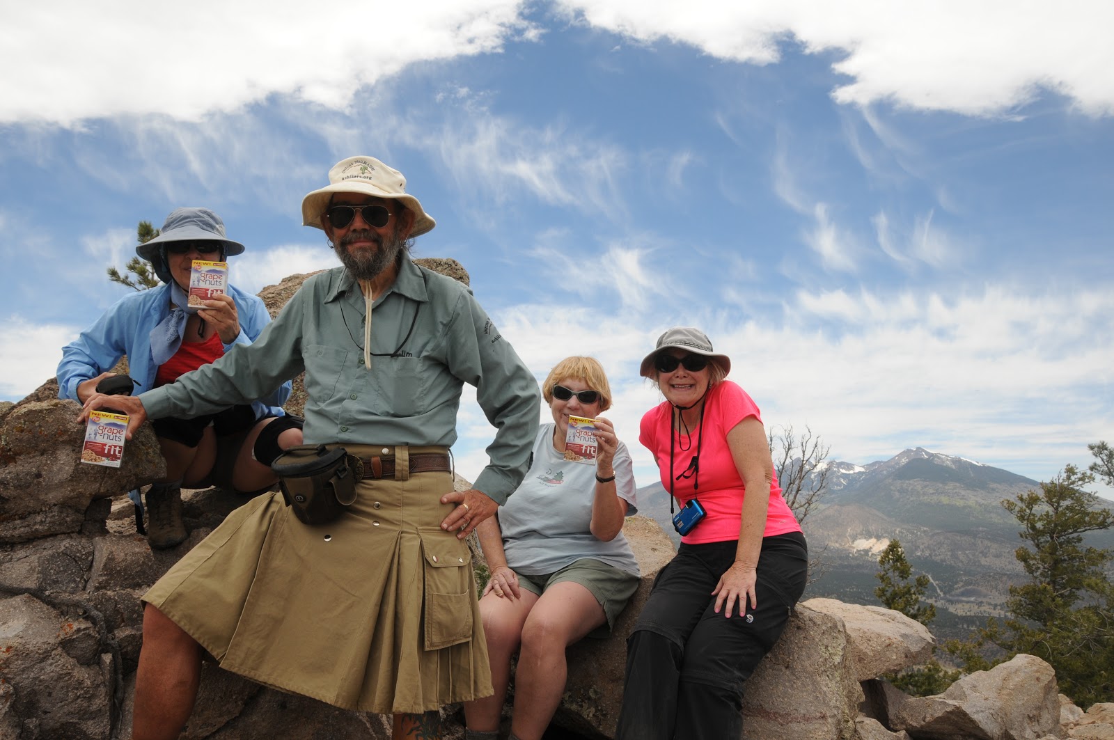
visitors, however on our visit, the forest service worker invited us up--and we, of course, handed her some Grape-Nuts Fit samples!
| Taking a break on the summit |
LENGTH: 10 miles roundtrip
RATING: difficult
ELEVATION: 6956' - 8916'
GETTING THERE:
From Phoenix, go north on I-17 to the junction with I-40
just south of Flagstaff.
Head east (right) on I-40 and continue to the junction for
AZ89 NORTH at exit 201.
Follow AZ89 north to the entrance for Sunset Crater at
milepost 430.3.
Turn right onto Sunset Crater Road (FR545) and go 1.7 miles
to FR545A, which is signed for O’Leary Group Campground. Turn left on FR545A
and go 0.25 mile to the parking area on the right near the gate for O’Leary
Lookout.
| View of San Francisco Peaks from the trail |
INFO: Flagstaff Ranger District, Coconino National Forest,
928-526-0866
MORE PHOTOS:
Wednesday, May 22, 2013
Reminder: come out and climb a mountain with me this Saturday
FREE SAMPLES ON THE MOUNTAIN THIS SATURDAY MAY 25, 2013
| actual product |
Hikers---just a reminder that I'll be handing out free samples of Post Grape-Nuts Fit cereal on Flagstaff's O'Leary Peak this Saturday. In addition to the goodies, this trail features over-the-top views of Sunset Crater National Monument. So---what's keeping you at home?
DATE: Saturday, May 25, 2013. NO RSVP---just show up and start hiking.
TIME: we'll be on the mountain from approx. 10 a.m. - 2 p.m.
LENGTH: 10 miles roundtrip
ELEVATION: 6956' - 8916'
RATING: moderate-difficult (you are responsible for your own gear and safety, this is not a sponsored hike)
GETTING THERE:
From Phoenix, go north on I17 to the I40 interchange in Flagstaff. Head east (go right) on I40 to exit 201 for US89 north. Go roughly 10 miles north on US89 and turn right at the sign for Sunset Crater National Park (FR545). Follow this road 1.5 miles and turn left at FR545A for O'Leary Campground. Continue 0.3 mile to a free parking apron at the summit road gate. Do not park in the campground---unless, of course, you plan to camp there and pay the fee.
ABOUT THE EVENT:
http://www.grapenutssummitsampler.com/
ABOUT O'LEARY PEAK:
http://www.fs.usda.gov/wps/portal/fsinternet/!ut/p/c4/04_SB8K8xLLM9MSSzPy8xBz9CP0os3gDfxMDT8MwRydLA1cj72BTJw8jAwjQL8h2VAQAzHJMsQ!!/?ss=110304&ttype=recarea&recid=55146&actid=24&navtype=BROWSEBYSUBJECT&position=BROWSEBYSUBJECT&navid=110000000000000&pnavid=null&cid=FSE_003741&pname=Flagstaff+RD+-+O'leary+Peak+Trail
ABOUT THE EVENT:
http://www.grapenutssummitsampler.com/
ABOUT O'LEARY PEAK:
http://www.fs.usda.gov/wps/portal/fsinternet/!ut/p/c4/04_SB8K8xLLM9MSSzPy8xBz9CP0os3gDfxMDT8MwRydLA1cj72BTJw8jAwjQL8h2VAQAzHJMsQ!!/?ss=110304&ttype=recarea&recid=55146&actid=24&navtype=BROWSEBYSUBJECT&position=BROWSEBYSUBJECT&navid=110000000000000&pnavid=null&cid=FSE_003741&pname=Flagstaff+RD+-+O'leary+Peak+Trail
Tuesday, May 21, 2013
Road to West Clear Creek to close May 23
FOREST ROAD 215 TO BULL PEN TO CLOSE ON THURSDAY
UPDATE: Bull Pen will reopen for day use only (6 a.m. - 10 p.m.) on November 2, 2013.
If you're headed out to the West Clear Creek area this holiday weekend, please read this new release before planning your route.
From: "Smith, Brady -FS" <bradysmith@FS.FED.US>
Date: May 21, 2013 12:45:13 PM PDT
To: <USDA-FS-NEWS@NEWSBOX.USDA.GOV>
Subject: SOUTHWESTERN-NEWS-RELEASE: Coconino National Forest
NEWS RELEASEU.S. Dept. of AgricultureU.S. Forest ServiceCoconino National ForestFor Immediate ReleaseMay 21, 2013Public Affairs Contacts:Brady Smith, Coconino National Forest, 928-527-3490Brienne Magee, Flagstaff Ranger District, 928-527-8290Hazard trees prompts temporary closure of Bull Pen area
Flagstaff, AZ – The Bull Pen area, located about 10 miles east of Camp Verde off Forest Road 215, will be closed temporarily beginning Thursday (May 23) due to a large number of trees that pose a hazard to the public.“Forest Service personnel have discovered hanging dead limbs and hazardous trees in areas frequently used by visitors for camping,” said Heather Provencio, district ranger for the Red Rock Ranger District. “We take the safety of the public seriously and the closure will last until the Forest Service can complete a formal risk assessment, mitigate the hazard and deem the area safe for public entry.”This closure prohibits all public entry into the area including camping, day use, hiking, and access to West Clear Creek via Forest Road 215.Due to the large number of hazardous trees in the area and the flood potential at areas used by visitors for camping near the creek, Forest Service personnel will be considering management options that may include designated camping locations and designated parking.Bull Pen is a popular camping and picnicking area along West Clear Creek during the summer with visitors camping under the towering sycamores and cottonwood trees.Violation of this closure is subject to a maximum fine of $5,000 or six months jail time.For more information about the Bull Pen area and closure, please contact the Red Rock Ranger Visitor Center at 928-203-7500. Members of the public who want to provide comments on future management of the area should do so by submitting a comment form via http://go.usa.gov/b3aX.###Respectfully,Brady--------------------------------------Brady Smith, MBAForest Public Affairs OfficerCoconino National ForestTel: (928) 527-3490
Monday, May 20, 2013
To the pit
LE PETIT VERDON
Flagstaff
| Rim above Sandy's Canyon and the pit |
Let's call this one Sandy's Canyon with a twist. I happened to be in the area of Mormon
Lake last week and decided to make a quick run into the canyon on my way back
just to take a peek at the recent
damage from the Fisher Fire. At the trailhead, I got distracted by that pesky
sign where Sandy's Canyon/AZ Trail goes left and Canyon Vista heads right. As I wasn't really on a schedule, it seemed
like to perfect time to make the detour to satisfy my curiosity about the Canyon Vista trail. As it turns out-- what is an appetizer for hikers is the main course for
rock climbers. Canyon Vista trail
dips downhill to Le Petit Verdon---a popular climbing area better known as
"the pit". Here, soaring
limestone walls with bolted routes provide dozens of ways to explore the crags
in vertical format. Although it's an enjoyable side trip for hikers, this is the
domain of sport climbers, so be respectful when passing near them, or better
yet, observe their spiderman-like athletics from a distance. Once done marveling at the climbers,
head back up (and down again) for a trek into Sandy's Canyon. The fire damage isn't too bad.
LENGTH: 1 mile roundtrip or 3.8 miles with Sandy's Canyon
RATING: easy (uneven, rocky surfaces)
ELEVATION: 6800' - 6600'
GETTING THERE:
From Phoenix, go north on I17 to just south of I40 in
Flagstaff and turn right onto exit 339 for Lake Mary Road (FR3). From the bottom of the off ramp, turn
right continue 5.5 miles south to Canyon Vista Campground on the left near
milepost 300. There's a small
no-fee parking area
| Climbers in the pit |
INFO: Flagstaff Ranger District, Coconino National Forest
928-526-0866
MORE PHOTOS:
Thursday, May 16, 2013
Hike with me on Saturday May 25, 2013
Hi Hikers, As one of 60 hikers selected from across the USA to participate in the 60th anniversary celebration of the first ascent of Mt. Everest, the folks at Post cereals have provided me with FREE SAMPLES of Grape-Nuts Fit to give out during a commemorative climb up Flagstaff's O'Leary Peak. Sir Edmund Hilary and Tenzing Norgay ate Grape-Nuts on their historic 1953 trek. Look for me (or my volunteer sherpas) and claim your goodie. Hikers who make it to the summit have the option of appearing in photos (or not) with the official summit flag which I'll post here after the event. Hope to see you on the mountain! Mare
DATE: Saturday, May 25, 2013. NO RSVP---just show up and start hiking.
TIME: we'll be on the mountain from approx. 10 a.m. - 2 p.m.
LENGTH: 10 miles roundtrip
ELEVATION: 6956' - 8916'
RATING: moderate-difficult (you are responsible for your own gear and safety, this is not a sponsored hike)
GETTING THERE:
From Phoenix, go north on I17 to the I40 interchange in Flagstaff. Head east (go right) on I40 to exit 201 for US89 north. Go roughly 10 miles north on US89 and turn right at the sign for Sunset Crater National Park (FR545). Follow this road 1.5 miles and turn left at FR545A for O'Leary Campground. Continue 0.3 mile to a free parking apron at the summit road gate. Do not park in the campground---unless, of course, you plan to camp there and pay the fee.
ABOUT THE EVENT:
http://www.grapenutssummitsampler.com/
ABOUT O'LEARY PEAK:
http://www.fs.usda.gov/wps/portal/fsinternet/!ut/p/c4/04_SB8K8xLLM9MSSzPy8xBz9CP0os3gDfxMDT8MwRydLA1cj72BTJw8jAwjQL8h2VAQAzHJMsQ!!/?ss=110304&ttype=recarea&recid=55146&actid=24&navtype=BROWSEBYSUBJECT&position=BROWSEBYSUBJECT&navid=110000000000000&pnavid=null&cid=FSE_003741&pname=Flagstaff+RD+-+O'leary+Peak+Trail
ABOUT THE EVENT:
http://www.grapenutssummitsampler.com/
ABOUT O'LEARY PEAK:
http://www.fs.usda.gov/wps/portal/fsinternet/!ut/p/c4/04_SB8K8xLLM9MSSzPy8xBz9CP0os3gDfxMDT8MwRydLA1cj72BTJw8jAwjQL8h2VAQAzHJMsQ!!/?ss=110304&ttype=recarea&recid=55146&actid=24&navtype=BROWSEBYSUBJECT&position=BROWSEBYSUBJECT&navid=110000000000000&pnavid=null&cid=FSE_003741&pname=Flagstaff+RD+-+O'leary+Peak+Trail
Subscribe to:
Posts (Atom)