Find A Trail. Start Your Search Here:

Thursday, February 21, 2013

GPS withdrawal at Skunk Tank

SKUNK TANK-CAVE CREEK LOOP
Tonto National Forest
Cave Creek Trail

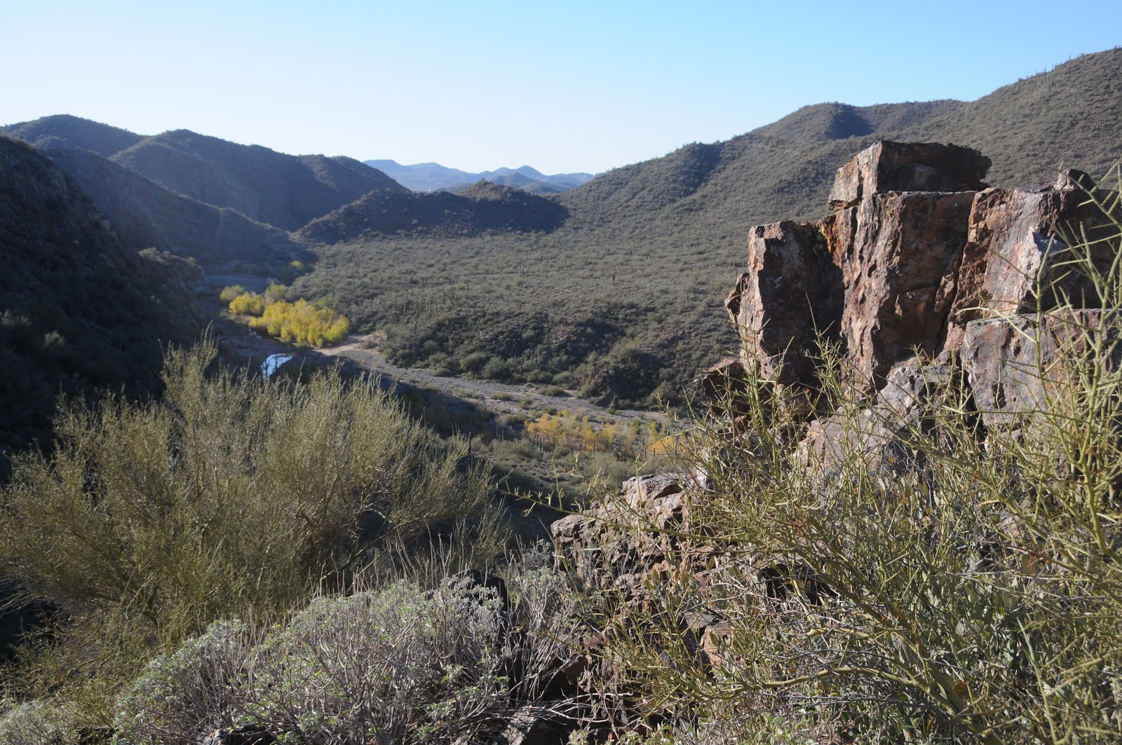
New River Mesa as seen from Skunk Tank Trail
Except for an A minus I once achieved in a grad school statistics class, I've never been particularly gifted with numbers.  This might explain my befuddlement over the actual length of Tonto National Forest’s Skunk Tank-Cave Creek Loop hike.  Additionally, inconsistent signage and conflicting published reports didn't help rectify the numbers.    It's pretty common knowledge that forest service trail signs are rounded up or down to convenient fractions.  Trail segments that are actually 0.3 mile might well be posted as .25 mile and 0.6 mile as 0.5 mile.   Yup, that's me splitting hairs for no good reason, and yet, over 10 miles or more, with 5 trail junctions, the discrepancy can add up and escalate into a hot topic especially along that last mile which always feels longer than its advertised range.  A check of various hike books, maps and web sites declare this trail length at anywhere from 9.2 miles to 12 miles.   So, I geared up for a 12-miler, grabbed my GPS and stepped out to get my own read.  Now, I wasn't about to place too much trust in my GPS either.  That's because on past hikes, GPS-totting trekkers in my group have all come up with different mileage reads on their devises----BIG differences, like 2-3 miles.  But, since my devise is brand new and set up to acquire all those extra Russian satellites, I figured, why not give it a try.
But, I refuse to be a GPS junkie---checking moving speed and elevation profiles every half-mile and robotically announcing the results to bored travel companions as if it mattered.  Nope. Set up, hit track, waypoint when necessary and don't look again until trail's end.  We began the loop hiking counterclockwise to take on Skunk Tank Trail #246 (note: some trail signs mistakenly say Skunk "Creek").  This open-to-the-sky segment makes a steady climb over rolling desert hills dotted with cactus and the sprouts of what may be a good wildflower season .  At 1.4 mile from the 246 junction, run off from Quien Sabe (means: "who knows") Spring spills down a narrow gully.  The spring itself is 0.3 mile up the gully, but it's a bushwhack to get there, and frankly, not worth the effort.  Skunk Tank Trail tops out at a 4100' lookout point with dizzying views of New River Mesa, Humboldt Mountain and Quien Sabe Peak. 
From here, the route plunges downhill toward Skunk Tank on a slim path cut into sloping, exposed (not for acrophobics) hillsides.  The tank is a lovely willow-ringed oasis where swarms of birds and other local wildlife---like mountain lions and deer---gather to quench their thirsts and maybe score a meal. Pass through the tank's rustic barbed wire fence and soon the junction with Cave Creek Trail #4 comes into view signaling the final leg of the hike.  This is also the best part because trail #4 moves among the waters of Cave Creek, lofty canyon walls, a lush riparian ecosystem and two rare crested saguaros.  Back at the trailhead, my GPS read 10.385 miles.  I'm gonna call it 10.4-miles, and "who knows" if it's really 10.6 or 10.2. Who cares?
Cave Creek water: Feb. 16, 2013

LENGTH:  10.4 loop
RATING:  moderate
ELEVATION:  2980'-4100'
FEES: a Tonto Pass is NOT required at the hiker trailhead, but may be required if you park at other recreation sites in the area.
GETTING THERE:
Cave Creek Trailhead (as described here): From the Loop 101 in Scottsdale, take the Pima/Princess Road exit 36 and go 13 miles north on Pima to Cave Creek Road.  Turn right (east) and go 12.5 miles on Cave Creek Road (a.k.a FR 24 and Seven Springs Road) past Seven Spring Recreation Area to Cave Creek trailhead on the left located between MCDOT mile markers 12 and 13.  Roads are a mixture pf pavement and good dirt passable by passenger cars when dry. Two minor creek crossings on cement are required—do not attempt after heavy rains.

HIKE PLAN:
From the trailhead, pick up Cave Creek Trail #4 and hike 0.6 mile south to the Cottonwood Trail #247 junction.  (NOTE: winter 2013 flooding has washed out much of this area.  Cairns and red trail tape have been placed have been placed as temporary navigation tools).  Follow #247 less than a mile to the Skunk Tank Trail #246.  Follow #246 to Cave Creek Trail #4, turn right and follow it back to the trailhead.
INFO:
Cave Creek Ranger District, Tonto National Forest, 480-595-3300

MORE PHOTOS:


Wednesday, February 20, 2013

Snow! Snow!

Snow on the McDowell Mountains: Feb 20, 2013
Doesn't  this make you wanna ditch work and go hiking?  Here's the view from my office window in Scottsdale this afternoon.  Rare desert snow on a sunny afternoon. Oh to be on a McDowell Sonoran Preserve trail right  now!

Tuesday, February 19, 2013

Take your best shot at the McDowell Sonoran Preserve


McDowell Sonoran Preserve 2013 Photography Contest

If you've been reading this blog for more than 15 seconds, you already know I'm a huge fan of Scottsdale's McDowell Sonoran Conservancy. We hikers have them to thank for preserving irreplaceable desert land on the outskirts of our suburbs and also for building a stunning network of trails for our enjoyment. And, the work continues with plans to expand recreational opportunities in the Brown' Ranch area this year. Haven't been there yet? Now is the perfect time. Spring wildflower season is here and the McDowell Mountains area's rich biodiversity makes it a premier location for bloom spotting.  May I suggest the Bell Pass and Gateway Loop Trails.....
As an extra incentive to draw visitors to the preserve, the Conservancy has launched its 2013 Focus on Conservation photo contest. This year's categories are biodiversity, sustainability, families and fitness. So grab your camera and submit your best shot for a chance to be featured in an online gallery.
Whether you head out on your own or as part of one of the organization's guided hikes, it's a great way to get to know all about this North Valley jewel of a hiking destination.

DEADLINE: May 31, 2013

CONSERVANCY INFO:
PHOTO CONTEST INFO:

Sunday, February 17, 2013

Hike to Devil's Kitchen and the Seven Sacred Pools


SOLDIER PASS-BRINS MESA-CIBOLA PASS-JORDAN TRAIL LOOP
Coconino National Forest, Sedona
Devil's Kitchen

Seven Sacred Pools
For a short trek, this little loop packs in plenty of variety.  First up, is Devil's Kitchen---Arizona's largest sinkhole. Formed by a series of catastrophic geological events, the hole will continue to grow over time and the AZ Geological Survey considers the area unstable and hazardous. Although it might look tempting, the sinkhole is just not safe to explore beyond the trail. A link below leads to an AZGS article about Devil's Kitchen and includes lots of interesting maps and data.   Beyond the slump, head left and hike less than a mile  to see the "seven sacred pools", a chain of shallow ponds scoured from red sandstone that reflect both blue sky and colorfully-layered canyon walls.  Once done exploring the pools, follow the trail through a calming landscape of cypress, juniper and yuccas to the sign for Red Rock Secret Canyon Wilderness.  Here, an unsigned, but obvious footpath heads right for a mildly steep quarter-mile side trip to the Soldier Pass Arches. Past the arches, the route makes its final ascent to the Brins Mesa Trail junction.  At just under 5,000' the views here are breathtaking and breath saving as it's all downhill trekking from here.  Continuing southeast on the Brins Mesa Trail, the route dives into a canyon land of Paleozoic-age sandstones singed by the 2006 Brins Fire.  A haunting landscape of blackened stubble mixed in with healthy high desert flora splatters the gorges in earthy shades of green.  A mid-segment lookout point provides unobstructed vistas of Sedona, and sometimes, graceful waterfalls can be seen washing over distant crags. 
HIKE DIRECTIONS:
From the trailhead, follow the access path 0.2 mile to the first junction and turn left to pick up the Soldier Pass Trail.  Hike roughly 0.7 mile to the wilderness sign where an optional side path leads to a series of natural arches.  This side trip will add 0.5 mile to the hike.  Continue another 1.0 mile on Soldier Pass to Brins Mesa Trail.  Turn right here and hike 2.0 miles to the Cibola Trail, turn right and go 0.6 mile to Jordan Trail, turn right again and hike 0.3 mile to the Soldier Pass junction, turn left and hike 0.2 mile back to the trailhead.

LENGTH:  5-mile loop (5.5 with arches detour)
RATING: moderate
ELEVATION:  4,450'- 4,930'
FEE: A Red Rock Pass is required.  $5 daily fee per vehicle.
http://www.redrockcountry.org/passes-and-permits/index.shtml
HOURS: the Soldier Pass trailhead is gated and open only from 8 a.m. to 6 p.m. daily.
There's alternate access off Jordan Road.
GETTING THERE: Use the FREE SEDONA SHUTTLE: 928-203-5252, SedonaShuttle.com
From Phoenix, go north on I17 to exit 298 for Sedona/Oak Creek. Turn left (west) onto SR179 and continue to the traffic circle intersection at SR89A.  Veer left through the circle heading toward Cottonwood on SR89A.  Between milepost 372 and 373, turn right onto Soldier Pass Road, drive 1.5 miles to Rim Shadows, turn right and continue 0.25 mile to the short drive to the trailhead on the left.
INFO: Coconino National Forest, Red Rock Ranger District ,928-203-2900
GEOLOGY ARTICLE


Thursday, February 14, 2013

A waterfall for all


WATERFALL CANYON
White Tank Mountain Regional Park
Pool at the base of Waterfall Canyon: Feb. 12, 2013

Approaching the slot canyon
How many people can fit into the 12' x 12' box canyon at the end of White Tank Mountain Park's Waterfall Trail?  By my observations, at least 16--while a constant que waits on deck to rotate in.  Perhaps a better question might be; what on earth could possibly be so interesting that 16 people would want cram into such a place?  Welcome to one of Arizona's premier mostly-barrier-free hiking destinations. This extraordinary trail's popularity is bolstered by its wide, flat surface which is advertised as suitable for strollers, wheelchairs and walkers for at least the first 0.6-mile.  However, I've seen wheeled trekkers make it all the way up to the final 300 yards where a set of stone stairs leads to the box canyon---and beyond with a little assistance.  This is a beautiful thing.  Because so many of Arizona's special hiking trails require physical stamina and equipment lists beyond the scope of casual day trippers, it's good to know that Waterfall Canyon offers a glimpse of desert splendor to anyone willing to get out of  their car.  Besides the sometimes-flowing-sometime-not waterfall, galleries of ancient rock art line the entire route. "Petroglyph plaza"--an open-air amphitheater with benches--displays several major design panels with trailside signs explaining their significance.
Just below the waterfall, another considerable heritage site includes an eclectic mix of astronomical, hunting and magical designs tapped into boulders.  Here, the trail meets stone stairs for a short climb to the waterfall box canyon.  Inside, a trio of  stone walls, worn smooth by a million rainy seasons, jut vertically skyward from a  white sand beach and plunge pool echoing a serinade of digital camera clicks and whizzes.
Crowd in Waterfall Canyon

LENGTH: 2 miles round-trip
RATING: easy, barrier-free up to the last 300 yards.
ELEVATION:  1500' - 1700'
DOGS: leashed dogs are allowed
FACILITIES: restrooms
FEE: $6 daily fee per vehicle


GETTING THERE:
From Phoenix, go 18 miles west on I10 Loop 303.  Go north and contnue on 303 to Olive.  Turn left (west) on Olive and proceed 4 miles to the park entrance. Once in the park, follow the main road (White Tank Mountain Rd) 2 miles to Waterfall Canyon Road.  Turn left and go 0.4 mile to the signed trailhead on the left.  NOTE: 2013 road construction plans may cause detours.  Visit the  park web site or call ahead for details.


Art in "petroglyph plaza"
INFO: White Tank Mountain Regional Park, Waddell AZ 623-935-2505
MAP:

MORE PHOTOS:

Monday, February 11, 2013

A beautiful suburban treadmill trail


PINNACLE PEAK TRAIL
City of Scottsdale
Winter storm over Pinnacle Peak Trail: Feb. 9, 2013

Traversing the north face of one of Scottsdale’s signature geological wonders, Pinnacle Peak trail is as manicured and swanky as the tony golf communities lapping at its base.  It's a beautiful trail for sure, but don't expect solitude—this suburban route is the north Scottsdale equivalent of Piestewa Peak---replete with elbow-to-elbow crowds and buff bodies intent on maintaining target heart rates.  More of an outdoor tread mill than a hiking trail—most people come here for a workout---except for me, who comes to take photos and indulge in a post-hike beer at nearby Greasewood Flat saloon. The trailhead is nicely outfitted with restrooms, drinking water, visitor center and picnic tables.  An informative sign marks the start point followed by mileage posts every quarter mile and lots of little plaques identifying points of interest like plants and landmarks visible from the trail.  Like a sky island jutting above an emerald sea of country club homes, the trail gets just high enough above civilization for a decent desert experience  but stays close enough for comfort when hiking alone or with winter visitors. 
View of the final mile  from near the trail's high point

LENGTH: 3.5 miles out-and-back
RATING: moderate
ELEVATION: 2,366' – 2,889' (trails climbs both on the way in and out)
DOGS: not allowed
BIKES: not allowed
HOURS: dawn to dusk and variable---check web site before going
GETTING THERE:
From Loop 101 in Scottsdale, take the Pima/Princess Drive exit 36 and go 4.5 miles north on Pima Road to Happy Valley Road.  Turn right (east) and go 1.8 miles to Alma School Road, turn left (north) and continue 1 mile to Pinnacle Peak Parkway turn left and follow the signs to the park.  Turn left (west) on PPP and go 0.5 mile to the park.

INFO: City of Scottsdale 480-312-0990

MORE PHOTOS:

Friday, February 8, 2013

Take the Sedona Hike Challenge

Hike in Sedona for a chance to win prizes.

No doubt---Sedona is a world-class hiking destination. So, why aren't you getting out there more?  Perhaps the Sedona Hike Challenge will inspire you to make a couple of trips to Red Rock Country this winter.  Sponsored by The Hike House, Sedona businesses and hiking equipment companies, the challenge is easy and some lucky winners will walk away with an AWESOME prize package just by hiking 2 Sedona trails.  Plus, its PRIME hiking season---so, this is a win-win challenge.
Here's how it works:
1.  Go to http://www.sedonahikechallenge.com to learn about the event and prizes.
2.  Bring your camera and hike 2 Sedona trails.
3.  Upload your hike photos to http://www.facebook.com/SedonaHikeChallenge to be entered into the prize package drawings.
Event runs through March 15, 2013.  Check the web site for deadlines and details.  Good luck!

The Hike House
431 SR 179 #B-1
Sedona, AZ 86336
928-282-5820
http://thehikehouse.com
http://www.sedonahikechallenge.com/

The author is not participating in this event and has not received trade or payment for this blog mention....it's just a cool opportunity worth a mention. :)

Tuesday, February 5, 2013

An "upside down" river ramble


HASSAYAMPA RIVER PRESERVE
The Nature Conservancy, Wickenburg
River Ramble Trail


Palm Lake
Tucked between  US60 and  BNSF railroad tracks on the outskirts of Wickenburg, an enchanting forest thrives in a rare riraprian corridor of an "upside down" river. Like many desert waterways, the Hassayampa River--which runs 100 miles from Prescott to the Gila River southwest of Buckeye--flows underground except in only a few places, thus earning its Yavapai moniker "upside down" river. One place in the river's course  where water flows year-round is The Nature Conservancy's Hassayampa River Preserve. More than two miles of hiking trails wind through this 700+- acre property.  The paths range in difficulty from barrier-free (Palm Lake Trail) to mildly challenging (Lykes Lookout) and each showcases a particular aspect of the site's ecological diversity.  The most wild of the trails is River Ramble  which  wanders along the waterway in a tangle of gigantic cottonwoods and Goodding willows with a carcophony of bird songs drifting through the canopy.  Here, it's easy to spot herons and other water fowl lurking among cattails. Along the muddy banks, a frenzy of racoon, opossum, skunk and fox prints betray the critters skulking in the underbrush.  Other preserve trails focus on endangered mesquite bosques and a spring-fed lake replete with water-loving vegetation.  It's no wonder this place is a magnet for birds both common and rare.  In February, Cedar Waxwings and Yellow-rumped Warblers splatter flicks of lemony color through trees and shrubs.  More common aboreal winged creatures like brilliant scarlet  Northern Cardinals and vociferous Curve-billed Thrashers add familiar sounds to the bird convention.  February is a terrific month for viewing either on your own or as part of a guided tour.  Either way, plan on spending several hours exploring this incredible roadside gem.

LENGTH: 2.54 miles (6 short trails)
RATING:  easy-difficult
ELEVATION: 1900'- 1980'
FEES:  $5 per person ($3 for members). Kids 12 & under get in free.
DOGS: pets are not allowed in the preserve
HOURS:  Sept - May: 8 a.m - 5 p.m. May - Sept 7 a.m. - 11 a.m.. Hours/Days vary by season, so visit the website or call ahead. Closed on Mondays,Tuesdays and most major holidays.
GETTING THERE:
From Phoenix, go north on I17 to Carefree Highway (AZ74)  at exit 223.  Turn left (go west toward Wickenburg) and continue 30 miles to US60.  Turn right (north) and go 6 miles to the Conservancy turn off on the left near milepost 114.


MORE PHOTOS:

Sunday, February 3, 2013

Mountain lions and waterfalls


DOUGLAS SPRING to BRIDAL WREATH FALLS
Saguaro National Park, Rincon Mountain District
Bridal Wreath Falls: Feb. 1, 2013


Douglas Spring Trail
Sometimes, timing is everything.  This is particularly true in the desert where spectacular waterfalls appear like raging liquid phantoms after periods of rain, only to dissolve into trickles and knat-loving muddy drop pools within days.  One of the most accessible transient water shows happens in Saguaro National Park East.  Almost anybody with a pair of decent hiking shoes, a few liters of drinking water and a spare afternoon can marvel at the wonder of an ephemeral desert water chute by way of the Douglas Spring Trail to Bridal Wreath Falls.  Because it's so easy to access, the trailhead is a busy place, especially on weekends.  A shaded kiosk marks the trail gateway into a sunny land of cactus and scrub backed with views of Tucson’s Rincon and Santa Catalina Mountains, which tower to over 8,000 feet.  The route is tantamount to a 2.5-mile staircase. It’s a constant and sometime steep climb through a landscape that morphs from classic desert into a massive grassland with the feel of an African savannah.  Although there are no wildebeasts or giraffes roaming these plains, it’s prime habitat for mountain lions.  A sign posted at the trailhead warns of numerous recent mountain lion sightings and as of January 30, 2013, the Three Tanks Trail, which connects with Douglas Springs, is closed due to their high activity in that area.  In addition to the big cats, javalina, rabbits, and deer share the wilds with gila monsters, raptors and desert tortoises.  The turn off for the short hike to the falls shows up at the 2.3-mile point. Here, surrounded by miles of shadeless, mesquite-dotted prairie, the only clue that a waterfall is nearby is the park service sign pointing the way.  A mild descent leads to a grotto of polished stone where a mild boulder scramble is required to get to the 50-foot cascade plunging over bare rock like a wind blown ribbon.  Alas, the falls were more like a dripping faucet on our February 1, 2013 visit, however, they are known to rage like a white water river after heavy rains and during high snow-melt season.
Snow on the Rincon Mountains

LENGTH:  5.2 miles roundtrip
RATING: moderate
ELEVATION: 2745' - 3827'
DOGS: sadly, canine hikers are not allowed on Saguaro NP trails.
FACILITIES: none
FEE: no fee at this trailhead
DISTANCE FROM PHOENIX:  137 miles one way
GETTING THERE:
From Phoenix, travel south on I10 to Tucson.  Take exit 257 at Speedway Blvd and head east (go left).  Follow Speedway Blvd 17.5 miles to where it dead-ends at the Douglas Spring Trailhead.  Roads are paved all the way.
INFO & MAP: Saguaro National Park
MORE PHOTOS:

Thursday, January 31, 2013

Winter water clears the weir


WEIR TRAIL
Wet Beaver Creek Wilderness
Wet Beaver Creek near the weir

Near the weir
Finding “Bell Trail Virgins” isn’t easy.  Ranking high on the flagpole of fabulous Arizona hikes, Bell Trail is a destination most seasoned trekkers have visited at least once.  "Virgins" are those who have somehow managed to miss this blaring giant of a trail.  As for me, I’ve hiked this trail so many times it cycles in my brain like an viral video over, and over, and over……again.  Yes, the beauty, the water, the juxtaposition of cactus-studded savannah with lush, streamside greenery and, oh yeah---those pool-wallowing naked people.  Never again.  I said.  Until a friend emailed me about introducing not one, but TWO “Bell Trail Virgins” to this iconic, Red Rock Country route, the anticipation of seeing the smiles on their faces was just too good to pass up so, I was on board, but with a twist that included a wander down the Weir Trail which branches off the Bell at the 2.5-mile point.  For years, I’ve had a hankering to explore this short diversion, however, since it seems to be a favorite haunt of the aforementioned skin-clad hordes, I never got around to it.  Alas, our hike this week amidst residual snow and 40-degree temperatures meant the weir was clear.  Turns out, the Weir Trail is a beautiful little trek that winds gently down to a concrete dam (the weir) and a gauging station that transmits flow data to---I don’t know.  Densely wooded with cottonwoods, sycamores, alders and willows, the creek near the weir is bolstered by rusty sandstone cliffs and sandy beaches.  One advantage of visiting this trail in winter is that the creek flows fast and wild, more so than in springtime when snowmelt wanes, the water warms and the nudists return to their wallows.
Water rages over the weir: Jan. 31, 2013

LENGTH:  7 miles roundtrip
RATING: moderate
ELEVATION:  3860' - 3760'
FACILITIES: restroom
FEES: none.  A Red Rock Pass is NOT required here.
BEST SEASON: October - April

GETTING THERE:
From Phoenix, travel north on I17 to exit 298 for Sedona-Oak Creek.  At the bottom of the off ramp, turn right onto FR618 and continue 2.2 miles to FR 656 where there's a sign for “Beaver Creek Work Station” and the trailhead.  Turn left and go 0.1 mile to the Bell Trail parking lot. 
HIKE DIRECTIONS:  Follow Bell Trail 2.75 miles (past the White Mesa and Apache Maid junctions) to a large metal sign at the wilderness boundary. The Weir Trail #85 veers right while the Bell Trail continues straight ahead.  Follow Weir Trail .75 mile to its end, and then backtrack.

INFO: Red Rock Ranger District, Coconino National Forest, 928-203-2900

MORE PHOTOS:

Sunday, January 27, 2013

Rain check hike


KIWANIS TRAIL 
South Mountain Park, Phoenix 
If it hadn't rained this weekend, this was to have been my hike....

This sweet little traipse up a desert gully, has been entertaining Phoenicians since the 1920s.  The Kiwanis Trail #62 is an easy way to hike high enough in the hills to get excellent views of the Valley without breaking a sweat. Of all the trails in South Mountain Park, this is perhaps the best groomed— there’s little loose rock underfoot and even the shrubs and trees are trimmed. Stone steps and strategically placed railroad ties make the ascent effortless. In addition to the view, the trail features a healthy population of ironwood trees, which explode with pink pea-like blooms in spring. Also, keep an eye out for petroglyphs. Some are pecked into the cliffs while others embellish stones that flank the trail. The trail tops out at Summit Road where you can pick up the National Trail or hike another quarter-mile uphill to visit the Telegraph Pass lookout. LENGTH: 2.2 miles roundtrip RATING: easy ELEVATION: 1,570' – 2,070'  BEST SEASONS: October - April
DOGS: must be on leash
KID FRIENDLY?: yes   GETTING THERE: From Phoenix, go south on Central Ave. all the way to the end to where it enters the park south of Dobbins Road. Pass the guard gate and continue straight on the main road (San Juan Road) through a second gate at the old stone park administration building---where there are restrooms. At the 4-way intersection just past the admin site, turn left and follow the signs to the Kiwanis trailhead/picnic area. INFO: City of Phoenix Parks & Recreation: http://phoenix.gov/parks/trails/locations/south/hiking/index.html
MORE PHOTOS:
https://www.facebook.com/media/set/?set=a.1378713806624.44871.1795269672&type=1&l=911dcf38f7

Wednesday, January 23, 2013

Help document a National Historic Trail


JUAN BAUTISTA DE ANZA
National Historic Trail
Anza's 1775-1776 route

From 1775-76 Juan Bautista de Anza lead 240 emigrants 1200 miles from Mexico to California and this National Historic Trail established in 1990 preserves the route in a collection of driving/hiking recreational paths. Much of the trail passes through Maricopa, Pima, Pinal, Santa Cruz and Yuma counties in little known "who-knew" pockets of history.
The national park service has posted a very cool interactive mapping tool online and is asking you to assist in documenting and drawing attention to the Anza Trail. Just go to the MapCollaborator site and upload your photos, data and comments. An online tutorial shows how.  Once approved by NPS staff, entered data will be shared on the web.
CHECK IT OUT:


Monday, January 21, 2013

SYCAMORE CANYON WILDERNESS


DOGIE TRAIL
Sycamore Canyon Wilderness
Descent into Sycamore Canyon: Jan. 19, 2013

Big enough to awe but small enough to conquer, Arizona's second largest canyon is no simpering runner-up.  Whereas our #1 gorge, the Grand Canyon, is sculpted into over a million acres of  knotted cliffs and soft bends by Colorado River water, its little sibbling looks like a 55,937-acre, rough-hacked slice of geological layer cake. From it's head on the forested plateaus and prairies near Williams to its spring-fed riparian oasis outlet in the Verde River Valley near Cottonwood, the canyon's diverse terrain spans three national forests (Kaibab, Prescott and Coconino) and two wilderness areas (Red Rock and Sycamore Canyon).  One of dozens of routes leading into the wilderness, the Dogie Trail #116 accesses the canyon's midsection in the heart of Sedona's red rock country and is a convienient entre for backpackers setting out on the Taylor Cabin Loop circuit.  For a location sandwiched less than 10 miles from two busy towns, the Dogie Trail exudes a  primitive "out-there" kind of feel.  The trail's geological confection is one of blaze-red sedimentary sandstone and buff-colored limestone with a frosting of inky-black, volcanic basalt.  Wind and water working over 290 million years have etched bizarre works of art on the canyon walls while shaking loose a mixture of sand,  marine fossils and chunks of glitzy quartz which have spilled  down gullies to settle  underfoot along the route.  The pinion pines, scrub oaks and junipers bursting from the trail's  ancient rock pediment offer  little shade, which is why the best window of opportunity to enjoy a nice cool outing here is from November through March. Temperatures topped out in the high 50s when we hiked here this weekend, but it felt much warmer. This repurposed cattle trail (a "dogie" is an orphaned calf)  is maintained in an respectful, unobnoxious kind of way, which is to say that the path is clear but not overworked and signs are posted only at important junctions to preserve the wilderness experience.  When used for an out-and-back day trip, keep in mind that you'll be hiking down on the way in and up on the way out and even though 400' of elevation change may not sound like much, the constant dips and rises over loose-pebble ledges and rocky creek beds will test your stamina more than expected.
Doggies on the Dogie Trail

LENGTH: 5.4 miles one way
RATING:  moderate
ELEVATION: 4850' - 4450'
BEST SEASONS:  spring, fall, winter
FACILITIES: none
DISTANCE FROM PHOENIX: 117 miles one way 
GETTING THERE:
From Phoenix, travel north on I17 to the McGuireville exit 293.  Go left onto Cornville Road and continue 13 miles to AZ89A.  Turn right and go 7 miles on  89A  to FR 525 just past milepost 364 on the left.  Turn left and go 2.8 miles on 525 to a fork in the road with a sign for "Palatki", turn left here to get on FR525C---which is not signed.  Continue 8 miles on FR525C, there are many side roads but 525C is  well signed and dead ends at the trailhead.   ROAD CONDITIONS: The access roads are good dirt with just a few moderately rough spots and a short section of mountain grades.   Although high-clearance is preferable, carefully-driven passenger cars can get thru just fine.   Call ahead, though,--the forest service sometimes closes the access roads due to weather. 
INFO:
Red Rock Ranger District, Coconino National Forest, 928-203-7500, 928-203-2900 
MORE PHOTOS:

Wednesday, January 16, 2013

Hike a Sedona volcano

HOUSE MOUNTAIN VOLCANO via TURKEY CREEK TRAIL
Coconino National Forest, Sedona
view from the top

on the rim of House Mountain volcano
Unlike the name implies, turkeys and creeks are rare sights along this route. Yet, for what this trail lacks in terms of running water and wild fowl--it more than makes up for in scenery and geological interest. The trek starts out on a wide, closed road with numerous unmarked junctions and side paths. To stay on track, be sure to follow the piles of rocks wrapped in wire known as “basket cairns”. If you loose your way, just backtrack to the last cairn and spot the next one to correct your bearings. At roughly the 1.5-mile point, the trail passes Turkey Tank, a tiny cottonwood-ringed oasis. From here, the route begins its gradual climb along a juniper and cypress shaded path to the rim of House Mountain volcano. On the way up, views of Red Rock country get progressively better with the piece de resistance occurring on a scenic saddle where views of Sedona, Mingus Mountain and the gaping, eroded volcanic vent collide for an overwhelming carnival of visual delights.
Turkey Creek Trail

LENGTH: 7 miles out-and-back
RATING: moderate
ELEVATION: 4,000 – 5,100 feet
DISTANCE FROM PHOENIX: 125 miles one-way
FEE: a Red Rock Pass is required---$5 daily fee per vehicle.

GETTING THERE: From Phoenix, go north on I-17 to the Sedona exit 298—located just north of Camp Verde. Turn left and follow AZ 179 to Verde Valley School Road---this turnoff (part of a traffic circle) will be on the left past milepost 306---the street sign is difficult to see when traveling north. Go west on Verde Valley School Road 4 miles to Forest Road 9216B where there’s a sign for Turkey Creek trailhead. From here, the road degrades from decent dirt to a rut-and-pot-hole riddled mess. However, just before the road turns bad, there’s a small parking area for those driving low-slung sedans. Park here and hike another half-mile to the signed trailhead. Those with high-clearance vehicles may opt to drive this miserable last half-mile to the parking circle.

Monday, January 14, 2013

Hiking for your health

Two weeks into the new year and------who needs to jumpstart those resolutions to get more exercise? 
McDowell Sonoran Preserve

Staying motivated can be a challenge, and having a go-to solution can help.  An easy way get fit and make new friends while hiking in gorgeous desert terrain is to participate in the McDowell Sonoran Conservancy's  group hikes.  Next up:
WHAT: Hiking for your health 3-mile loop hike.
WHEN: Sunday, January 20, 2013
TIME: 8:45 a.m.
WHERE: Lost Dog Wash trailhead in Scottsdale
INFO & DIRECTIONS:
http://mcdowellsonoran.org/event/displayEvent/245#sthash.ackvnXgS.dpbs

Wednesday, January 9, 2013

A hike among picnic tables and dance floors


T-BONE-MAX DELTA-CROSSCUT-MA HA TAUK LOOP
South Mountain Park, Phoenix
NOTE: as of 2020, these trails have been rerouteded and/or incorporated into the Hau'pal and Ma Ha Tauk Perimeter trails. See park website for updates. 
What to do?  It was Christmas morning and I found myself without a hiking partner---they were all sleeping in, wrestling wrapping paper or prepping for guests. Given that I was not about to waste a day off by not going for a hike, I decided to take a traipse on a heavily used trail located in a very busy part of South Mountain Park (SoMo).  That way, if I became incapacitated, someone would see me---or the brand new fluorescent green shirt from Wal-Mart that Santa brought me.  The southernmost edge of suburban Phoenix dead-ends at the park boundary, and T-Bone Trail flanks a subdivision for most of its 1-mile length.  It then connects with Max Delta Trail, which weaves among picnic ramadas, outdoor dance floors and paved roads.  In terms of scenic quality when compared to other SoMo routes, this trail is more gristle than T-bone, but for a quick solo hike or leg stretch while picnicking, it makes for a satisfying journey.
entrance to a dance floor

HIKE DIRECTIONS:
The start of the T-Bone trail is not signed.  It’s located at the far east side of the parking lot at the break in the curb next to a no parking sign. From here, hike 1 mile east on T-Bone Trail to the Max Delta junction.  Turn right (south--toward the road) and go 0.25 mile to the Crosscut Trail junction.  Turn left and follow Crosscut 0.5 mile to Ma-Ha-Tauk Trail, turn right and hike 1 mile back to the trailhead.


LENGTH: 2.75-mile loop
RATING: moderate
ELEVATION:  1300' - 1770'
PARK HOURS: 5 a.m. - 7 a.m.
FACILITIES: restrooms at the big picnic ramada
INFO:  City of Phoenix Parks & Recreation, 602-262-7393
GETTING THERE:
Form Phoenix, travel south on 7th Ave to Baseline.  Turn right (west) and continue on Baseline to 19th Ave. Turn left (south) and follow 19th Ave to the end where there's a small parking lot and trailhead sign.  The hike begins at the east end of the parking area (not at the Ma-Ha-Tauk sign) where a dip in the curb provides access. There's no "T-Bone" sign here, but you'll begin to see them in about 0.2 mile. MORE PHOTOS:

Monday, January 7, 2013

Wet & winding segments of the Black Canyon Trail


BLACK CANYON TRAIL: K-MINE SEGMENTS
Near Rock Springs
Agua Fria River, January 5, 2013

"bridge" over Slate Creek
our crossing point
Running from the flat desertland near Carefree Highway in north Phoenix to the foothills of Prescott’s Bradshaw Mountains, the entire course of the 70+-mile Black Canyon National Recreation Trail is a scenic wonder.  In its former lives, the trail served as a wagon road and cattle drive route before being repurposed into its current status as a non-motorized hiking, biking and equestrian trail.  Although an end-to-end trek would be a worthy endeavor, the segments that run through the Agua Fria River Canyon are, in my opinion, the "jewels in the crown" and therefore, the best place to sample the trail.   In a nod to this attraction, the good folks of the Black Canyon Trail Coalition and the BLM created a large, easy-access trailhead right in the heart of the trail's glorious, watery mid-section.  A 0.8-mile spur path leads directly to the Horseshoe Bend- K-Mine segment junction.  Go south (left) for Horseshoe Bend (see separate blog entry) or north (right) for K-Mine as described here. Either segment will get you to the river gorge goodies in a jiff. The spur path is so immaculately groomed it looks as if it was landscaped----gigantic saguaros and a rich under story of brittlebush, ironwood and Palo Verde seem impossibly lush for a ridge located less than a mile from I-17.  The junction appears at the top of  the ridge, and then traverses a geological Garden of Eden.  Snowy-white quartz, ancient metamorphics and massive outcroppings of crumbling stone decorate an ever-changing roller coaster ride of twists, turns, dips and climbs.  Once over the crest, get ready for jaw-dropping views of the Agua Fria River and it's scoured floodplain rolling out hundreds of feet below. Here the trail begins its descent along skinny hairpin coils carved from the cliff face.   At the bottom of the canyon, the trail meets the boulder strewn sandy shores of the river where the path is swallowed up in a riparian corridor of Gooding willows, reeds and salt cedar.  To stay on track, look carefully across the waterway and you'll spot trail signs for a clue about how best to navigate the quagmire.  Agua Fria water levels vary from barely there to raging torrents, but as long as you plan to avoid peek snow melt season or the days after heavy rains, you should be able to hop the river with just muddy soles. Beyond the water, the trail jogs up-and-down through the bluffs surrounding Slate Creek (no water on our trip) then follows an old Jeep road to segment's end. 
overlooking the Agua Fria from K-Mine segment

LENGTH:  8.4 miles out-and-back
Access path: 0.8 mile
K-Mine South: 2.0 miles
K-Mine North: 1.4 miles
RATING: moderate  (creek crossing)
FACILITIES: restroom at trailhead
ELEVATION: 1680' - 2070'
GETTING THERE:
From Phoenix, travel north on I17 to exit 242 for Black Canyon City/Rock Springs.  Go West (left) and continue to the stop sign.  Turn north (right) here and proceed about 300 feet to Warner Road on the left.  There's also a sign for Black Canyon Trail here.  Follow Warner Road roughly 0.2 mile, turn right onto the first crossroad and follow it to the trailhead a few hundred yards ahead.  Warner Road is good dirt, passable by sedan.

INFO: Black Canyon Trail Coalition
MAP: International Mountain Bicycling Association:
MORE PHOTOS: