Find A Trail. Start Your Search Here:

Friday, November 23, 2012

Under the radar canyon hike


MASHAKATTEE CANYON
Tonto National Forest, Seven Springs Area

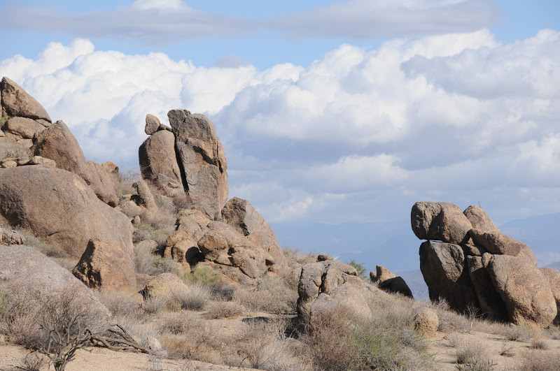
The seeds for this exploratory trek in the Seven Springs area north of Carefree were sown last year when we viewed the rambling course of Mashakattee Canyon from the summit of Humboldt Mountain--the prominent peak with the  big white "golf ball"  FAA radar station on top . From above, the sinuous juniper-lined sliver was a beautiful sight, and I vowed to someday get down into it.
Visualizing the route from our mountaintop vantage point, it appeared to be straightforward ---more or less, just follow the drainage, which cuts a downhill gash to merge with Seven Springs Wash.  And, we could see that the canyon bisected Cave Creek Road (FR24), so theoretically, access would be easy.   However, as with any off-trail trek, even the best-laid plans can be thwarted by unexpected kinks.
We showed up at the "trailhead" with my GPS loaded with NatGeo topos.  Turns out, we were the only ones in the area armed with such innocuous technology.  Everybody else had guns.  Kink number one.  As we knew that the area is popular with target shooters and hunters, we wore bright colors and planned our hike time frame to miss the prime dawn/dusk stalking hours. (I'm writing this, so, we survived).  Kink number two:  never underestimate the slowing down power of an off trail hike.  The entire length of the canyon is a major drainage full of boulders and slick rock.  The advantage of this is that the stone keeps scratchy shrubs mostly at bay, but also makes for a constant game of finding stable footing—taxing your stair-climbing muscles.  Kink number three: obstacles.  Toppled trees, boulder jams, cliff scrambles and a fence we had to crawl under, added elements of fun, but also slowed the pace considerably.  The canyon grows narrower and more cluttered as it approaches its terminus below Humboldt Mountain.  So, just know your limits and turn back when you've had enough. Still, for an under the radar station  kind of hike, Mashakattee Canyon is easy to follow, has great views, seasonal water and interesting geology.  

LENGTH:  2.35 miles one way
RATING:  moderate--100% on rocks with  obstacles. Sturdy footwear and hiking stick required.
ELEVATION:  3,517' - 4,256'
GETTING THERE:
From Loop 101 in North Scottsdale, take the Pima/Princess Road exit 36 and go 13 miles north on Pima Road to Cave Creek Road.  Turn right (east) and continue on Cave Creek Road (a.k.a. FR 24, Seven Springs Road) to FR 254 located just past MCDOT mile marker 10 on the right (0.6 mile past Humboldt Mtn Rd. FR 562).  If you have a high clearance vehicle, turn onto FR 254 cross the wash and continue 0.2 mile to a turnout on the right with a fire ring.  Park here and make an easy scramble into the canyon veer left and hike the gorge northeast toward Humboldt Mountain.  Alternately, you can enter the canyon where FR 254 crosses a wash at about 0.15 mile from FR24.  Those without high clearance should park along FR24 and make the short hike up the road.
MORE PHOTOS:

Wednesday, November 21, 2012

Arizona Trail "Cyber Monday" gifts for hikers


CELEBRATE THE HOLIDAYS WITH GIFTS FROM THE ARIZONA TRAIL ASSOCIATION

If you've got a hiker on your nice (or naughty) list this holiday season, then give a gift that benefits the Arizona Trail Association. These items are available year round, not just during the frenetic Black Friday-Cyber Monday shopping weekend.  Of course, giving an annual membership which includes access to tons of online resources is a no-brainer, but additionally:

DVD: THE WALK ACROSS ARIZONA: This documentary by Trevor Arwood chronicles his 60-day AZT journey from Mexico to Utah. Only $12 or $5 for the digital download.

ARIZONA TRAIL MAPS:
An absolute must for thru-hikers, backpackers and day trekkers alike. The DVD is loaded with details like topos, elevations, mileage waypoints, GPS data, water sources and re-supply points. Spend a measly $13 and never get lost again.

ARIZONA TRAIL LOGO GEAR:
Shirts, socks, buckles, patches and such are available at the AZT online store:
http://www.aztrail.org/store/at_store.php

DISCLAIMER:  the Arizona Trail Association has not provided payment or gifts in exchange for this blog post---the author is just a fan of this very worthy organization.

Monday, November 19, 2012

Hike off that extra slice of pie


THANKSGIVING DAY HIKE: MORE PIE PLEASE
McDowell Sonoran Preserve, Scottsdale

Preventive healthcare starts on the trail---at least when it comes to burning off excess feast calories. Join the stewards of McDowell Sonoran Conservancy for their annual salute to culinary indulgence: the "More Pie Please" Thanksgiving morning hike. Steeped in festive energy, this popular event makes for a healthy way to start the holiday season and also enjoy a guilt-free little extra something at dinner. Registration is NOT required. Just show up on time with water and closed toe shoes, and you're in!
WHEN: Thursday, Nov. 22, 2012
TIME: 7:45 a.m. sharp
LENGTH: 3 mile loop
RATING: easy, suitable for ages 5 and up
ELEVATION CHANGE: 300'


EVENT INFO:

Thursday, November 15, 2012

Jewel of the Creek event Saturday, Nov. 17

DESERT DISCOVERY DAY AT JEWEL OF THE CREEK PRESERVE


Join representatives from the Arizona Archeological Society, AZ Audubon, Wild at Heart, Southwest Wildlife and Maricopa County Parks & Recreation for a day of interactive outdoor activities and learning.  Here's your opportunity to immerse yourself in Sonoran Desert eco-education and gain a better understanding of what makes Cave Creek's Jewel of the Creek area so precious. Registration is NOT required.  FREE snacks, too!

DATE: Saturday, Nov 17, 2012
TIME:  10 a.m. - 2 p.m.
WHERE: Spur Cross Ranch Conservation Area
INFO & MAPS:
http://www.maricopa.gov/parks/spur_cross/EventsDetailPublishers.aspx?EventID=18779
http://www.dflt.org

Monday, November 12, 2012

Edge of the suburbs desert hike


ROCK KNOB-PEMBERTON-BOULDER-MARCUS LANDSLIDE LOOP
McDowell Sonoran Preserve-McDowell Mtn. Regional Park
Boulders near Rock Knob

With a glinty grainy tread way of decomposing granite underfoot and haze-muddled views of the Mazatzal, Superstition and McDowell Mountain ranges hugging the horizon, this spectacular loop hike in a shadeless basin of Sonoran Desert showcases a lot of what we love about our local landscape.

Cradled between a preserve area and a county park, this swath of boulders and cholla is a stubborn holdout amidst garrisons of swanky golf communities lapping at its fringe.  Thanks to the foresight and persistence of concerned citizens, this precious local gem remains closed to development and open for climbing, hiking, biking and equestrian activities.  Although its proximity with the red-tile-aqua-pool suburbs of Scottsdale and Fountain Hills puts a mild pox upon the wilderness experience, the up side is easy access to the great outdoors.  My favorite part of this thrown together trek is the geology and the big-sky views.  The route passes by the jumble of granite known as Rock Knob, the lower end of Marcus Landslide and numerous stone "sculptures" and "mushroom" rocks.  As the terrain is rather flat, there are unobstructed vistas---look for Superstition Wilderness landmarks Weaver's Needle and the Flatiron in the east and, if you hit the trail at the right time, you'll get a peek at the famous waterspout in Fountain Hills. A spur path on the return leg of the loop leads to a lookout spot with an interpretive sign identifying these key features.
Saguaros on the Boulder Trail

HERE'S THE HIKE PLAN:  from the trailhead, hike 0.3 mile east on the Marcus Landslide Trail to the junction for Rock Knob Trail.  Follow Rock Knob 0.5 mile to the McDowell Mtn Park boundary where you'll need to deposit $2 and secure your permit.  Continue another 0.6 mile on Rock Knob to Pemberton Trail, turn right (southeast) and hike 1.1 miles to Boulder Trail.  Pick up Boulder and continue 1.1 mile to Marcus Landslide (back in the preserve), turn right (north) and trek 1.4 miles back to the trailhead.

LENGTH:  5 miles according to park maps; 5.4 miles by my GPS track
RATING:  moderate
ELEVATION: 2,800' - 2,280'
FACILITIES: restroom at trailhead, no water
FEE: $2 per person to enter McDowell Mtn Regional Park (exact change req)

GETTING THERE:
Tom's Thumb Trailhead:
From the loop 101 in Scottsdale, take the Pima/Princess Road exit 36 and continue 5 miles north on Pima to Happy Valley Road.  Turn right (east) and go 4.1 miles on Happy Valley to Ranch Gate. Turn right on Ranch Gate, follow it 1.2 miles then turn right onto 128th St. and continue 1 mile on 128th to the signed trailhead. Roads are paved all the way.
INFO:

MORE PHOTOS:

Wednesday, November 7, 2012

Loopy Sedona hike with fall color


BALDWIN TRAIL
View of Oak Creek from Baldwin Trail

Cathedral Rock, Nov 4, 2012
An aerial view of Sedona's network of trails reveals a very loopy web.  Most of Red Rock Country's short trails are interconnected, allowing hikers, bikers and equestrians to customize their treks.  The Baldwin Trail loop anchors the far west end of the Bell Rock-Cathedral Rock cluster of paths.  Beautiful as both a standalone or combo hike, Baldwin makes a scenic swoop near the base of world-famous Cathedral Rock, topping out at a sunny highpoint with great views of Sedona and the Bradshaw Mountains before dipping down to graze the wooded fringes of Oak Creek.  A map kiosk at the trailhead details the route and its connecting trails, including a (highly recommended) diversion to a vortex (place known for its spiritual energy) site on Oak Creek via the Templeton Trail.
The diversity of this trail is a wonder.  Hikers wander through flood plain grasslands, over slabs of bare rock dotted with cypress and agaves and among enormous creek side sycamore-cottonwood riparian forests flanked by soaring red walls of sedimentary stone.  All this variety makes it a good "appetizer" trail to get a little taste of all the goodies of hiking in Sedona.

LENGTH:  2.1 mile loop (according to my calculations--FS says its 1.6 miles)
RATING:  easy
ELEVATION:  4020' - 4150'
FEE: a Red Rock Pass is required.  $5 daily fee per vehicle. http://www.fs.usda.gov/main/coconino/passes-permits/recreation
FACILITIES: restroom
GETTING THERE:
From Phoenix, travel north on I17 to exit 298 for Sedona AZ 179.  Turn left (west) and continue 6 miles on AZ 179 to the Verde Valley School Road traffic circle. Veer left and drive roughly 5 miles to the Baldwin Trailhead. Last few miles are rough dirt, but passable by sedan.  Alternate access:  a point on the right side of Verde Valley School Rd just before FR 9829 where a 0.3 mile spur path connects to the trail.  Also connects to the Templeton Trail.
INFO: Red Rock Ranger District, Coconino National Forest, 928-203-2900
MORE PHOTOS:

Sunday, November 4, 2012

Sedona fall color update: Nov. 4, 2012


TEMPLETON TRAIL
Sycamores on Oak Creek, Nov. 4, 2012

Oak Creek, Nov. 4, 2012
Although the crowns of the sycamores and cottonwoods surrounding Oak Creek have turned to crispy brown toast, there’s still plenty delicious autumn color to be seen along Sedona’s favorite stream.  One way to get to the color quickly is to hike the Templeton Trail which can be accessed several ways including from Bell Rock Pathway (which takes you through 2 tunnels under SR179) and a road pull out at milepost 308.7 on SR 179.  However, since this is a fall color update, my hike takes off from the Cathedral Rock trailhead, which is closest to the water.  From the trailhead, follow a 0.3 mile access path along a combo of constructed rock stairs and slick red sandstone marked by basket cairns to the Cathedral Rock/Templeton junction sign.  Straight ahead is a short (0.4 mile), semi-technical rock scramble leading to two nice vista points----optional, but not this hike.  Instead, head right and follow Templeton, which clings to a rugged, yucca cluttered slope.  After about a half-mile, the path swerves for first views of Oak Creek and its flood plains.  Here, the route makes an easy but edgy descent to the forested color frenzy along the waterway. A kaleidoscope of massive  sycamore, cottonwood, of alder, sumac, willow, walnut and countless shrubs (beware of poison ivy) glow like beacons among cypress and junipers with a backdrop of rusty cliffs to boot.  Along the next half-mile, the trail stays by the water exposing countless root tangled coves and shady spots to relax in this high-desert oasis.
overlooking Oak Creek
/
LENGTH:  3.4 miles one way
RATING: moderate
ELEVATION:  3970’ – 4330’
FEE: a Red Rock Pass is required.  There’s a permit kiosk at the trailhead that takes cash and plastic.  Daily fee is $5. http://www.fs.usda.gov/main/coconino/passes-permits/recreation
GETTING THERE:
From Phoenix, travel north on I17 to exit 298 for Sedona  SR179.  Go left (west) and follow SR179 11 miles to Back O’ Beyond Road at the traffic circle near milepost 310.  Veer left and go 0.6 mile on Back O’ Beyond to the Cathedral Rock trailhead on the left.
INFO: Red Rock Ranger District, Coconino National Forest, 928-203-2900
MORE PHOTOS:

Thursday, November 1, 2012

Bee attack preparedness for hikers


SHIRK THE SWARM!
Bee on cereus cactus

Attention trekkers, unless you've been hiding under a rock this week, you know that the hiking hazard du jour is bee attacks. Just as with snakes, bears, rabid racoons and toxic plants, it's smart to know how to avoid the perils and also what to do should you find yourself swarmed. Avoidance is the preferable option. In fact, I noticed a "bees active" sign on the Marcus Landslide Trail two weeks ago, so we avoided a rocky crevasse where the stingers are known to congregate. The link below leads to a U of A document about bee preparedness---read it all, but basically, if swarmed, you should RUN, RUN, RUN and not try to fend off the buzz by waving your arms, as this will exacerbate the attack.

Tuesday, October 30, 2012

Ranger led desert oasis hike this Saturday


GUIDED HIKE OF CAVE CREEK'S DRAGONFLY TRAIL

Join Spur Cross Ranch Conservation Area park ranger Kevin Smith on an informational tour of the Dragonfly Trail. This lush route winds through a riparian habitat on Cave Creek where an amazing assortment of plant, animal and insect (dragonflies!!!) life thrives in a shallow ravine surrounded by enormous saguaro cactuses. Ranger Smith will also point out a prehistoric rock art site that many hikers stroll right past without ever nowing it was there. Here's a chance to really gain an understanding of this rare desert jewel.
WHEN: Saturday, Nov 3, 2012. 9:00 A.M. registration is NOT required.
LENGTH: 3.5 miles
RATING: moderate
ELEVATION: 2,400' - 2,200'
FEE: $3 per person.
GETTING THERE:
From Loop 101 in Phoenix, exit at Cave Creek Road and drive 15 miles north to Spur Cross Ranch Road.  Here, you’ll turn left, then right, then left again through a tricky intersection to stay on Spur Cross Ranch Road.  Continue 4.2 miles north to the dirt parking area on the right just past the Spur Cross Stables (SCS) gateway.

INFO: Ranger Kevin Smith, 480-488-6623, kevinsmith@mail.maricopa.gov

Saturday, October 27, 2012

Payson fall color update: October 27, 2012


HORTON CREEK TRAIL # 285
Payson
Maple color below Horton Spring: Oct. 27, 2012

Fall color along the Horton Creek: Oct 27, 2012
I know, I know, we've all hiked this trail a million times, and yet, (unbelievably) I have never visited it during fall foliage season.  This gaping hole in my hiking repertoire was rectified today.  Issuing from a spring that gushes from a jumble of moss-embellished stone at the base of the Mogollon Rim, Horton Creek spills downhill through a mix of scrublands and deep coniferous-deciduous woodlands.  Fall color flaunts its best where trail #285 parallels the waterway.  Typically, in October, the creek is dry for the first mile or so, but then runs in cool, shallow cascades for the remainder of the hike.  Today, we were delighted by a rich display of mustard-colored boxelders, blaze-red maples and tawny orange sycamores.  Although peak color is days away for the lower trail, the high portion of the route is near prime right now.
Arizona sycamores along trail #285
The foliage is especially vivid near a series of tiny cataracts along the second and third mile  which are accessible via numerous spur paths leading to the stream where color bearing trees and shrubs dangle over liquid riffles mirroring  the warm palette in churning watercolor whorls. Don't skimp---explore along creek because in another week or so, the color show will be done for another year.
LENGTH: 8 miles roundtrip (to Horton Spring and back)
RATING: moderate---rocky grade, loose footing
ELEVATION:  5,360' - 6,420'
DISTANCE FROM PHOENIX: 105 miles
TRAILHEAD FACILITIES: restroom
GETTING THERE:
From Phoenix, travel north on AZ87 (Beeline Hwy) to the intersection with AZ 260 in Payson.   Head east (go right) on AZ260 and continue 17 miles to Tonto Creek Road (a.k.a. Fish Hatchery Road and FR 289) on the left near milepost 268.  Follow FR 289 1 mile, cross the creek bridge and park in the Horton Picnic Site lot to the left.  Roads are paved all the way.  To find the trailhead, hike back down the road, cross the bridge and turn left onto a dirt road, hike the road a few yards to the sign for trail #285.
Cataracts on Horton Creek

FEES:  none for day hiking.
INFO:  Payson Ranger District, Tonto National Forest, 928-474-7900

MORE PHOTOS:

Tuesday, October 23, 2012

Sedona fall color update: late October 2012


A. B. YOUNG TRAIL #100
Oak Creek flows at the base of A.B. Young trail
Sedona
This hike has everything --water, high-desert ridges, a grueling climb and a pleasant traipse through a pine/oak forest to the historic East Pocket fire lookout.  Also, from late October through early November, the sycamores lining the lower part of the trail along Oak Creek come alive in vivid shades of amber and rusty gold.
The trail begins in the Bootlegger Day Use Area near site number two.  From there, descend the flagstone stairs to Oak Creek and follow the generic trail markers to the creek. Boulder-hop the water and head toward the stone retaining wall where there’s a metal “A.B. Young #100” sign.  The ascent begins immediately through a cool, creek-side environment that quickly transcends into a pine forest. After about the half-mile point, the trail leaves the shade and begins switch backing up steep sun-drenched cliffs on its way to the 7,196-foot West Rim of Oak Creek Canyon.  Many spectacular rock formations and great views of the narrow canyon open up as the trail gains elevation.  Once on the rim, follow the carins into the forest to the wooden “A.B. Young/Oak Creek” sign that marks the official end of the trail. To reach the East Pocket fire lookout, continue for just under a mile following a series of huge rock cairns. Staffed by a USFS worker during the fire season, visitors are welcome in the funky old 1930s-style wooden tower.

Submerged foliage
LENGTH:  6 miles round trip
RATING:  difficult
ELEVATION: 5,100’ – 7,196”
FACILITIES: restroom
FEE: a Red Rock Pass is required: there’s a permit kiosk at the trailhead that takes paper, plastic and coins. http://www.redrockcountry.org/passes-and-permits/index.shtml
GETTING THERE:
From Phoenix, take I-17 north to the Sedona-Oak Creek exit 298 for SR179.  Head left (west) on SR179 and continue to the Sedona “Y” intersection of SR 179 and US89A. Veer right (north) through the traffic circle and continue 8.8 miles to the Bootlegger Day Use Area near milepost 383. Roads are 100% paved.
INFO:  Red Rock Ranger District, Coconino National Forest, 928-282-4119

Saturday, October 20, 2012

New trail in the McDowell Sonoran Preserve


MARCUS LANDSLIDE TRAIL
McDowell Sonoran Preserve
Marcus Landslide Trail: Oct. 20, 2012

approaching some "mushroom" rocks
A little bit of history was made this morning as stewards of Scottsdale’s McDowell Sonoran Preserve stepped out on the inaugural guided hike of the brand new Marcus Landslide Trail.  Freshly cut, the new route is an homage to the complex geology of the north side of the McDowell Mountains.  Colorful signs along the trail enlighten hikers about the surrounding terrain---including an explanation of how the area’s signature “mushroom” rocks formed.  But of course, the main attraction is the ubiquitous landslide.  I must add that, to really appreciate this trail, take one of the steward-led hikes.  Our leader today was steward Don, and I was blown away by all his knowledge and professional speaking skills.  Learn about upcoming guided hikes here: http://mcdowellsonoran.org/content/pages/guidedHiking
If you didn't know it was there, you'd probably never even notice this massive slump in the mountainside. Discovered in 2002 by a pair of local geologists, the nearly mile-long wreckage  is comprised of an estimated 25.8 billion pounds of rubble---that's enough material to fill Sun Devil Stadium six times.  The slide occurred during the  Pleistocene Ice Age about a half-million years ago when a colder, wetter climate may have instigated the slide which shaved 1,200 feet off the ridgeline releasing energy equivalent to an atomic bomb blast.   The trail, which is named for former ASU geography professor Melvin Marcus, loops among the slide's components giving a comprehensive overview of the magnitude and scope of the event. The hike takes off from the new Tom's Thumb Trailhead (officially opened Oct. 18, 2012) following an easy grade through typical desert scrub with views of the Fountain Hills area, Verde River and Superstition Wilderness.  Incredibly, the preserve receives no tax dollars and is funded entirely by contributions to the McDowell Sonoran Conservancy from hikers like you (and generous major contributors). This is pretty amazing when you consider the impressive facilities, quality of staff and meticulous trail maintenance.  So, when you’re checking out upcoming hikes, leave a donation to help ensure ongoing protection of our Sonoran Desert hiking trails.
Preserve steward, Don talks geology

LENGTH: 3.7-mile loop (4.2 miles with optional side trips)
RATING:  easy
ELEVATION: 2800’ – 2,500’
HOURS: sunrise to sunset daily
FACILITIES: restrooms, NO water
DOGS: leashed dogs are allowed on trails but not on guided hikes
FEE: NONE-- unless you take a connecting trail into adjacent McDowell Mountain Regional Park.  Then, it’s $2 per person---exact change required for the self-pay permit station.
GETTING THERE:  Tom's Thumb Trailhead:
From the loop 101 in Scottsdale, take the Pima/Princess Road exit 36 and continue 5 miles north on Pima to Happy Valley Road.  Turn right (east) and go 4.1 miles on Happy Valley to Ranch Gate. Turn right on Ranch Gate, follow it 1.2 miles then turn right onto 128th St. and continue 1 mile on 128th to the signed trailhead. Roads are paved (finished just this past week!) all the way.
Tom's Thumb trailhead

INFO:
McDowell Sonoran Conservancy: http://mcdowellsonoran.org/home
480-998-7971
McDowell Sonoran Preserve
Earthly Musings: the blog of geologist Wayne Ranney
Arizona Geological Survey

MORE PHOTOS:

Thursday, October 18, 2012

New Tom's Thumb trailhead opens today.

Tom's Thumb: iconic pinnacle in the McDowell Mountains 
The long awaited Tom's Thumb trailhead was officially opened this morning.  In addition to providing convenient access to hiking and climbing in the northern reaches of the McDowell Sonoran Preserve, the trailhead also serves as a gateway to the park's newest attraction--the Marcus Landslide Trail.  Sure to be a big draw for geology buffs and casual hikers alike, the 4-mile interpretive route explores Arizona's second largest landslide.  A special grand opening event is planned for this Saturday, Oct. 20, 2012 beginning at 8 a.m.. There will be guided hikes, climbing demos and lots of fun things to do in celebration of the return of "hiking weather" to the Valley.

INFO & MAP: http://mcdowellsonoran.org/trailhead/displayLocation/8
TOM'S THUMB HIKE: http://arizonahiking.blogspot.com/2010/02/toms-thumb.html

Wednesday, October 17, 2012

Off the beaten path Sedona fall color hike


BEAR SIGN TRAIL #59
Red Rock Secret Canyon Wilderness, Sedona

Although not apparent from the trailhead, the remote upper reaches of Bear Sign Trail host surprisingly rich woodlands of deciduous trees that transform into a canopy of color in early autumn. To find these hidden thickets, hike on the juniper-and-scrub-lined Dry Creek Trail to the Bear Sign junction, veer left and pick up the trail heading uphill. Much of the path parallels boulder-filled ravines lined with sycamore, willows and cottonwoods eking out a living where water collects among gigantic bounders. Throughout the hike, haphazard webs of Canyon grape vines sprawl in viral abundance forming delicate veils of diffused sunlight. An especially photo-worthy section of the route passes through a concentrated stand of Arizona cypress trees. The spindly trunks and shaggy bark of this tenacious species are marred by claw marks, scat and gnawed stumps-- the “bear signs” for which the trail is named. No worries though, the black bears that roam this area are shy creatures and will usually skulk off unnoticed when roused by approaching hikers. To learn more about hiking in bear country, visit: Southwest Be Bear Aware: http://www.bebearawaresw.org/

LENGTH: 3.5 miles one way
RATING: moderate
ELEVATION: 4,800 -5,450 feet
BEST TIME FOR FALL FOLIAGE:  mid-to-late October
DISTANCE FROM PHOENIX: 135 miles
GETTING THERE:
From the "Y" intersection of AZ 179 and AZ89A in Sedona go left (toward Cottonwood) and continue 3.2 miles to Dry Creek Road. Turn right, go 2 miles to Vultee Arch Road (Forest Road 152), hang a right and continue 4.5 miles to the Dry Creek #52 trailhead located past the Vultee Arch parking loop on the left. A high clearance vehicle is required on FR 152.

FEE: Red Rock Pass--$5 per vehicle is required
INFO: Coconino National Forest, Red Rock District 928-203-2900

Saturday, October 13, 2012

Sedona fall color update: Oct. 13, 2012


WEST FORK OF OAK CREEK
Sedona
West Fork of Oak Creek: Oct. 13, 2012

Now that autumn's first freeze and snowfall have snuffed Flagstaff's aspen show, Arizona's annual fall foliage spectacular has migrated  south into Red Rock Country.  Brilliant color is blooming now in Sedona’s most famous canyon.  Today, we hiked under a canopy of blaze-red maples, tawny oaks and boxelders dripping in honey gold.  But, there’s still plenty of green getting ready to turn, so it looks like (frosty weather not withstanding) this week will be primo for autumn color. The rocky, but easy trail  is packed with 13 creek crossings (...that's 26 for a roundtrip hike) on stepping stones and logs. Shoes with good traction are a must and a trekking pole is helpful.  Also, plan to arrive early at the trailhead or else be prepared to wait for parking, as this world-celebrated trek attracts thousands of casual walkers (who rarely go more than a mile), day hikers and hard core canyoneers.  We even encountered a wedding party in full regalia---and hiking boots!

Oct. 13, 2012
LENGTH:  3.3 miles one-way (on trail) OR up to 14 miles (with wading, swimming & climbing)
ELEVATION:  5,280’ – 5,520’
RATING:  easy (on trail), moderate –difficult beyond trail’s end
GETTING THERE:
From Phoenix, go north on I-17 to exit 298 (Oak Creek-Sedona) for SR 179.  Go left (west) on SR179 and continue to the “Y” intersection with SR89A in Sedona.  Veer right (northeast) on 89A and go 10.5 miles to the Call of the Canyon Day Use Area (between mileposts 384 & 385) on the left (west) side of the road.  Roads are 100% paved.
Green woodland starting to turn, Oct. 13, 2012
FEE: $9 daily fee per vehicle. $2 per-person-daily-fee for walk-in or bike-in.
HOURS:  9 a.m. to 8 p.m. (summer), 9 a.m. to dusk (winter). The gate usually opens around 8 a.m.. Use the self-pay kiosk if an attendant is not available. The parking lots fills up quicky on weekends and high seasons---so arrive early.
INFO: Coconino National Forest, Red Rock Ranger District
MORE PHOTOS:
Tuesday, October 9, 2012

Maple color this week on the Mogollon Rim 2012

Bigtooth maple trees are turning red on Rim Road 300, connecting forest  roads and trails this week.  They fade fast, so get out there before this weekend's cool weather snuffs the show.
Maples along FR 139 on the Mogollon Rim
 
It's a good time to check out these trails:
Barbershop, U-Bar, Fred Haught, See Canyon, Horton Creek, Houston Brothers.

Saturday, October 6, 2012

Flagstaff fall color update, Oct. 6, 2012: HURRY!


Flagstaff fall color has arrived fast and furious for 2012.  What a difference from 2011 when peak foliage color dilly-dallied until mid-October.  Not so this year.  The high elevations (above 10,000')  are already past peak in many spots, while mid-high locations (8,000'-9,000') are at peak NOW.  We drove Hart Prairie Road (7,000') today and observed that it's approaching peak color.  Hurry.
Bear Jaw Trail, 8,600', Oct 6, 2012

ABINEAU-BEAR JAW LOOP
Flagstaff
Past prime aspens at 10,000', Oct 6, 2012
An October drive up Flagstaff's Highway 180 reveals views of golden aspens on the lofty slopes of the San Francisco Peaks.  Yes, the first showings of autumnal color bloom up high, so to hike among leaves that blaze like day-glo paint you must climb the north face below Humphreys Peak.  There's a, app trail for that---Abineau-Bear Jaw Loop.  This rugged route begins in an innocuous alpine meadow but soon enters avalanche-scarred coniferous-aspen woodlands for a steady climb (unmitigated by switchbacks) that leads to a both-kinds-of-breathtaking ridge (10,280') below Arizona's tallest peak.  Here, the wind-addled tundra-like landscape is dotted with stands of white firs framing views of Northern Arizona's volcanic highlands. Beyond this highpoint, the route follows the serpentine path of Waterline Road where willowy aspens rustle and flourish along its flanks.  Whereas the Abineau leg of the loop is mostly about pines, spruce and fir, the Bear Jaw return is all about aspens, with glens so thick they mimic whiteout conditions. Here, on the downhill trek, mountain-borne breezes kick up flurries of heart-shaped leaves from the canopies into eddies of gold that tickle the air and carpet the forest floor.  It's really an awesome spectacle. 
HIKE DIRECTIONS:
Hike 0.4 mile on the access trail and turn right to begin on the Abineau Trail---which gets the climbing over quickest. Hike 1.9 miles uphill to the junction with Waterline Road (sign says no access to Humphreys Peak). Turn left here and hike 2.1 miles to the signed turn off for Bear Jaw Trail on the left.  Follow Bear Jaw 2.4 miles back to the first junction and retrace your steps 0.4 mile back to the trailhead on the access path. 
Bear Jaw Trail, 8700', Oct. 6, 2012

LENGTH:  7.2-mile loop
RATING: difficult
ELEVATION:  8530' - 10,280'
GETTING THERE:
From Flagstaff, travel north on US180 (Fort Valley Rd) to milepost 235.2 and turn right onto FR 151 (Hart Prairie Road, north access).  Continue 1.6 miles on FR 151 and connect to FR 418.  Drive 3.1 miles on FR418 to FR9123J  (signed for Abineau-Bear Jaw), turn right and go 0.6 mile to the trailhead.
Roads are semi-okay dirt, passable by carefully driven sedans. 
Near the top of Abineau Trail, Oct. 6, 2012
INFO:  Flagstaff Ranger District, Coconino National Forest, 928-526-0866
FALL COLOR INFO & UPDATES:
MORE PHOTOS:

Thursday, October 4, 2012

Fall color update: Mogollon Rim, Oct 4, 2012


Fall foliage is just beginning to emerge on the Mogollon Rim.  Today we noted lots of sulfur yellow in Boxelders, spotty groves of amber oaks and gold-kissed aspens on..... 
Oak color, October 4, 2012

HOUSTON BROTHERS TRAIL #171
Mogollon Rim
Wild geranium
The densely wooded terrain of the Mogollon Rim is riddled with water-sculpted canyons and bizarre fossiliferous limestone formations.  The fractured earth makes for an interesting mix of flat-floored forests and steep gorges where water collects and cool air settles in pockets of perennial, mossy dampness.  These secluded, moist microclimates feed communities of Big-tooth maples, willows, boxelders and oaks that burst out in flaming color palettes when nudged by the cool nights and low light of early autumn.  The Rim’s Cabin Loop system of trails wiggles among spring-fed meadows and water harboring draws that play host to autumnal splotches of honey-and-crimson-colored foliage. The best part about Rim country fall color is its relative rarity---it pops up willy-nilly  among the pines and firs making each "find" feel more special than the last.  Cabin Loop trails Barbershop, U-Bar, Fred Haught and--as we visited today---Houston Brothers--all dole out visually delicious color spots that add elements of treasure hunting thrills to the routes.
Fall color at Aspen Spring, Oct 4, 2012

LENGTH:  7 miles one-way
RATING: easy. follow the tree blazes where the path is faint.
ELEVATION: 7,000'-7,774'
GETTING THERE:
TRAVEL ALERT 10-5-2013: FR95 is closed between FR139G and 139A to repair the culvert over Houston Draw.  Do NOT attempt to drive thru---it's a major wreck.  You can park at FR139G and hike 0.5 mile on FR95 to the Fred Haught Trailhead or drive in from Rim Road instead.
From Payson, travel north on AZ87 (Beeline Hwy) to Clint's Well.  From here, continue 9.4 on AZ87 to just before milepost 300 and turn right onto FR95.  Follow FR95 6.5 miles to a bridge over East Clear Creek and veer right to stay on FR95.  Continue 4.5 miles to FR139A (a few yards past a sign for Houston Draw), turn left and go 0.2 mile to the trailhead marked by a sign for Fred Haught Trail.   Roads are good gravel/dirt with winding mountain grades—sedans okay.
INFO: Mogollon Rim Ranger District, Coconino National Forest