Find A Trail. Start Your Search Here:

Friday, October 28, 2011

SEDONA FALL COLOR UPDATE 2011: SECRET CANYON

SECRET CANYON TRAIL #121
Red Rock Secret Canyon Wilderness, Sedona

A community of pinion pines, juniper and assorted cactuses at the trailhead belie what lies ahead on Secret Canyon Trail. Epic views of Sedona’s red rock landscape dominate the first 1.75 miles of this hike before the trail makes a sharp westward swerve at the mouth of the canyon. From here, the route leaves the shade-less chaparral plunging into a streambed where torrential spring water runoff and blowing dust have carved bizarre sculptures in the sandstone escarpments flanking the path. Residual pools of water stand at the bases of moisture-hungry cottonwoods with heart-shaped, lemony leaves.
Near the 5-mile point, the trail enters “the narrows”, a series of slick-rock corridors hemmed in by a vertical fortification of sandstone with clusters of blood-red maples and rusty-orange oaks bursting from the rubble-strewn canyon floor. Beyond this point, the trail degrades into a quagmire of scree and undergrowth, which is why most hikers make the narrows their turnaround point. However, those with good route-finding skills can opt to scramble, squeeze and scoot along a sketchy footpath for another half-mile.

LENGTH: 5.5 miles one-way
RATING: difficult
ELEVATION: 4,500 – 5,100 feet
DISTANCE FROM PHOENIX: 134 miles
GETTING THERE:
From the “Y” intersection of SR179 and SR 89A in Sedona, go left through the traffic circle (toward Cottonwood) and go  3.2 miles west on 89A to Dry Creek Road. Turn right and go 2 miles to Vultee Arch Road (Forest Road 152). Turn right and follow FR152  3.4 miles to the trailhead on the left. A high clearance vehicle is required on FR 152.
FEE: Red Rock Pass--$5 per vehicle is required. http://www.redrockcountry.org/passes-and-permits/index.shtml
INFO: Coconino National Forest, Red Rock District, 928-203-2900


Tuesday, October 25, 2011

HART PRAIRIE FALL COLOR UPDATE 2011

Just heard from Neil Chapman, Hart Prairie Preserve Program Manager.  Aspen color on Hart Prairie is just about over for this year.  By this weekend, it's done.  

Saturday, October 22, 2011

SEDONA FALL COLOR UPDATE 2011: HUCKABY TRAIL

Fall color is arriving later than usual along the US 89A strip of Oak Creek this year. Although we found sprigs of blazing red sumac and some nice golden sycamores, willows and common hop trees, peak color has yet to arrive. The next couple of weeks will be splendid. 
Crossing Oak Creek--you WILL get wet

HUCKABY TRAIL
Sedona
Arizona sycamore
Ever drive up US89A to the spot near Grasshopper Point and Midgley Bridge?  Yup—it's a madhouse, especially in autumn when the sycamores, cottonwoods and willows lining Oak Creek take on gorgeous tawny hues.  Swarms of visitors scramble for coveted parking spots along this scenic and precipitous curve in US89A in order to hike, bike or simply take in the views from the road.  An alternative way to get to the sweet color spots under the bridge with (somewhat) less congestion is to begin hiking three miles downstream at the Schnebly Hill trailhead and follow the Huckaby Trail to the creek.
This relatively new trail (est. 1998) starts out in classic Sedona, yucca-and-cypress-studded, high-desert terrain, then dips into the shady, riparian corridor of Oak Creek Canyon via a series of moderately challenging twists and turns.  Near the 2.3-mile point, the route meets the creek where you’ll have to rock-hop or do a knee-deep wade to the west bank in order to complete the final 0.3-mile  uphill leg to US89A and the north end of Midgley Bridgley.

LENGTH:  5.2 miles roundtrip
RATING:  moderate
ELEVATION:  4,500' – 4,300'
FACILITIES: Huckaby Trailhead: restroom, picnic tables.  None at Midgely Bridge trailhead.
FEE: A Red Rock Pass is required: $5 daily fee per vehicle. The permit kiosk at Huckaby trailhead was not working on 10-22-11.  That's why it's smart to purchase your pass at  local vendors like Circle-K, cuz, the trailhead kiosks seldom work (at least in my experience). We also saw a ranger checking windshields for passes today. Check out this link to learn more about the Red Rock Pass Program:
DISTANCE FROM PHOENIX: 125 mile one-way
GETTING THERE:
SCHNEBLY HILL TRAILHEAD:
From Phoenix, go  north on I-17 to exit 298 (SR179 for Sedona-Oak Creek).  At the bottom of the offramp, turn left (west) and follow SR179 to Schnebly Hill Road in Sedona, located at the  traffic circle/bridge over Oak Creek (and before the Talaquepaque center).  Veer right thru the traffic circle, and go 0.8 mile  on Schnebly Hill Road to the trailhead (signed for Margs Draw, Munds Wagon and Huckaby) on the left.  Roads are 100% paved.
MIDGELY BRIDGE TRAILHEAD:
From I-17, follow SR179 to the “Y” junction with US89A in Sedona. Veer right through the traffic circle and go 1.9 miles north on 89A to the parking area on the northwest side (left) of the bridge.  The trail begins under the bridge.  Roads are 100% paved.

INFO: Red Rock Ranger District, Coconino National Forest, 928-282-4119

MORE PHOTOS:

Wednesday, October 19, 2011

PAYSON FALL COLOR REPORT 2011: MOGOLLON RIM

BARBERSHOP TRAIL #91

LENGTH: 4.5 miles one way
RATING: moderate
ELEVATION: 7,200 – 7,600 feet
PEAK COLOR: early to late October
GETTING THERE: From the intersection of SR87 and SR260 in Payson, go east (right) on SR260 and drive 30 miles to Rim Road (Forest Road 300, which is located across from the Rim Visitor Center). Follow FR 300 for 23 miles to Forest Road 137. Turn right on FR 137 and drive 4 miles to the trailhead, which is located across the road from Buck Springs Cabin. FR300 is maintained dirt--usually ok for passenger cars but with a few dodgy spots.
INFO: Coconino National Forest, Mogollon Rim Ranger District, (928) 477-2255,
http://www.fs.fed.us/r3/coconino/recreation/mog_rim/barbershop-tr.shtml

Typical view along Forest Road 300 "Rim Road"

Sunday, October 16, 2011

SEDONA FALL COLOR UPDATE 2011: WEST FORK OF OAK CREEK

Just got back from Sedona where fall color is really starting to show.  The next two weeks should be primo.  These photos were taken yesterday. 
WEST FORK OF OAK CREEK
Sedona

Combining all of what makes Arizona's Red Rock Country great, this trail through a wilderness of rock, water and wetland vegetation really draws the crowds.  Soaring walls of buff-and-salmon-colored sandstone squeeze the trail into a sliver-like break in the landscape where the chilly waters of Oak Creek cascading over slick rock have sculpted stony bends and bizarre overhangs in the soft stone.  Perennial water feeds a rich strip of trees, shrubs and grasses forming a stunning contrast with the surrounding high desert where cypress, yuccas and cactuses put down tenacious roots in the arid, sandy soils.

Because of its extraordinary beauty,
everybody knows about this place. Every. Body.  And not just Arizonans---it's common to hear fellow hikers on this world-famous trail chatting in Japanese, Dutch, Russian, Farsi and countless other languages.  Seriously, people come from everywhere to experience this rare pocket of paradise in the high desert---especially in fall.  You'll see why about 10 minutes into the hike. 


LENGTH:  3.3 miles one-way (on trail) OR up to 14 miles (with wading, swimming & climbing)
ELEVATION:  5,280’ – 5,520’
RATING:  easy (on trail), moderate –difficult beyond trail’s end
KID FRIENDLY:  yes
DOGS: must be on leash
GETTING THERE:
From Phoenix, go north on I-17 to exit 298 (Oak Creek-Sedona) for SR 179.  Go left (west) on SR179 and continue to the “Y” intersection with SR89A in Sedona.  Veer right (northeast) on 89A and go 10.5 miles to the Call of the Canyon Day Use Area (between mileposts 384 & 385) on the left (west) side of the road.  Roads are 100% paved.
FEE: $9 daily fee per vehicle. $2 per-person-daily-fee for walk-in or bike-in.
HOURS:  9 a.m. to 8 p.m. (summer), 9 a.m. to dusk (winter). The gate usually opens around 8 a.m.. Use the self-pay kiosk if an attendant is not available. The parking lots fills up quicky on weekends and high seasons---so arrive early.

INFO: Coconino National Forest, Red Rock Ranger District

MORE PHOTOS:

Thursday, October 13, 2011

SEDONA FALL COLOR

BEAR SIGN TRAIL #59
Red Rock Secret Canyon Wilderness, Sedona

Although not apparent from the trailhead, the remote upper reaches of Bear Sign Trail host surprisingly rich woodlands of deciduous trees that transform into a canopy of color in early autumn. To find these hidden thickets, hike on the juniper-and-scrub-lined Dry Creek Trail to the Bear Sign junction, veer left and pick up the trail heading uphill. Much of the path parallels boulder-filled ravines lined with sycamore, willows and cottonwoods eking out a living where water collects among gigantic bounders. Throughout the hike, haphazard webs of Canyon grape vines sprawl in viral abundance forming delicate veils of diffused sunlight. An especially photo-worthy section of the route passes through a concentrated stand of Arizona cypress trees. The spindly trunks and shaggy bark of this tenacious species are marred by claw marks, scat and gnawed stumps-- the “bear signs” for which the trail is named. No worries though, the black bears that roam this area are shy creatures and will usually skulk off unnoticed when roused by approaching hikers. To learn more about hiking in bear country, visit: Southwest Be Bear Aware: http://www.bebearawaresw.org/

LENGTH: 3.5 miles one way
RATING: moderate
ELEVATION: 4,800 -5,450 feet
DISTANCE FROM PHOENIX: 135 miles
KID FRIENDLY?: sorta. Trail is rocky and you have to hike 2 miles before getting to the best color, some kids might melt down.
GETTING THERE:
From the "Y" intersection of AZ 179 and AZ89A in Sedona go left (toward Cottonwood) and continue 3.2 miles to Dry Creek Road. Turn right, go 2 miles to Vultee Arch Road (Forest Road 152), hang a right and continue 4.5 miles to the Dry Creek #52 trailhead located past the Vultee Arch parking loop on the left. A high clearance vehicle is required on FR 152.

FEE: Red Rock Pass--$5 per vehicle is required
INFO: Coconino National Forest, Red Rock District 928-203-2900


Wednesday, October 12, 2011

GRIFFITH’S SPRING CANYON

GRIFFITH’S SPRING CANYON
Flagstaff

Located 23 miles north of Sedona along scenic highway 89A, Griffith Canyon itself is is only mildly impressive.  However, this "little canyon that could"  makes it mark on the map by collecting and funneling water downhill into two of Sedona's major gorges--Pumphouse Wash and Oak Creek Canyon.   From the trailhead, the route seems kind of ho-hum, but hang in there-- good stuff lies ahead if you know how to explore.  The official trail is wide, flat and easy-to-follow, tracing the edge of the cliffs above the marshy-green canyon.  Where the route bottoms out, several obvious spur footpaths leave the main trail and head into a steep-walled riparian corridor.  Richly lined with wildflowers, Virginia creeper, wild roses and  plenty of poison ivy, the exploratory paths wind through a mucky swale dotted with shallow pools, trickling channels and a tiny wetland ringed with cattails before it dead-ends in about 0.25 mile in a bog near a fenced stand of aspen sprouts.  
LENGTH:  1.2 mile loop (plus 0.5 more with optional canyon explore)
RATING: easy
ELEVATION:  6,919’
FACILITIES: restroom, picnic table
DISTANCE FROM PHOENIX:  152 miles one way
KID FRIENDLY?  Yes
TRAILHEAD OPEN: April – October.  Trailhead is closed in winter.
GETTING THERE:
From Phoenix:  go north on I-17 to exit 337 for US 89A south (located roughly 7 miles south of downtown Flagstaff).  From the end of the off ramp (at the entrance to Fort Tuthill Park), turn left (south) and continue 2.4 miles on 89A to the signed turnoff for Griffith’s Spring.  The short, dirt/gravel road to the parking area is rutted but passable by sedan.
From Flagstaff: go south on I-17 to exit 337 and follow directions above.
INFO: Flagstaff Ranger District, Coconino National Forest, 928-526-0866

Friday, October 7, 2011

FLAGSTAFF FALL COLOR 2011: Peaks are Peaking

Just called the Forest Service Fall Color Hotline.  They report COLOR IS PEAKING in the Coconino National Forest mountains---that means Flagstaff, folks.

FALL FOLIAGE HOTLINE: 1-800-354-4595
(hotline updated once a week on Fridays)

FLAGSTAFF FALL COLOR 2011: LAMAR HAINES MEMORIAL WILDLIFE AREA

These photos were taken October 14, 2010.  I'll be heading up to Flagstaff tomorrow to see how the color is progressing this year.  Stay tuned. 


LAMAR HAINES MEMORIAL WILDLIFE AREA
“Two springs run here”. Although it’s impossible to know for sure, that’s the popular interpretation of the cryptic pictographs painted on the cliffs above the source of Veit and Canadian Springs on the southwest slope of Flagstaff’s Agassiz Peak. The ancient artwork is just one of many interesting sights along this woodsy trail, which is why it buries the needle on the kid-pleasing scale. Allow plenty of time to explore the ruins of homesteader Ludwig Veit’s 1890s cabin, an historical marker commemorating the work of conservationist Lamar Haines and a concrete well and pond for collecting spring water along this aspen rich, 160-acres of wet meadows and old growth forest.
LENGTH: 1.6-mile loop
RATING: easy
ELEVATION: 8,600’ – 8,800’

KID FRIENDLY: yes!!
DISTANCE FROM PHOENIX: 158 miles one way
GETTING THERE: From Flagstaff, go 7.5 miles north on US180 to milepost 223, turn right onto Snowbowl Road and drive 4.5 miles to the Lamar Haines Memorial Wildlife Area trailhead on the right. Parking is very limited.
SITE ADMINISTERED BY: Arizona Game & Fish Department
pictographs above the springs

FOREST SERVICE FALL COLOR HOTLINE: 800-354-4595
Updated weekly from mid-September through mid-
November.
FLAGSTAFF FALL COLOR PRIMER:

PRESCOTT FALL COLOR 2011: NORTH MINGUS MOUNTAIN

View from the top of Mingus Mountain, Oct. 10, 2009.
Surprise!  Flagstaff got snow this week.  Six inches on the peaks and a dusting at the lower elevations.  Although warmer temperatures today and through the weekend are likely to melt the white stuff; for those who prefer hiking without encountering snow, try the Prescott area.  Here's one very scenic fall color hike with excellent views of the Verde Valley, Jerome and Sedona:
Oaks and maples converge on the trail 
Near the top, the trail hugs rock escarpments and crosses a volcanic rock fall
NORTH MINGUS MOUNTAIN,Prescott National Forest An eclectic mix of scenery and forests are the highlights of the North Mingus Trail No.105. Although there are two trailheads for this route, most hikers choose to start at the top of Mingus Mountain and hike downhill. That’s because the route is easier to follow when hiked in this direction. Right from the start, this popular trail will “wow” you with magnificent views from atop a pine-shaded hang glider launch pad. Here, the rugged Verde Valley rolls out 1,600 feet below. The hike begins with a pleasant stroll across the mountain summit under a canopy of warm gold Gambel oaks huddling beneath enormous confirs. After this short “warm up” section, the trail dips downhill along the north face through colorful corridors of Bigtooth maples, boxelders and velvet ash. Soon, the path enters an enchanting passage where a mass of volcanic boulders cascade down a slender slot canyon where vertical stony walls and a stand of aspens thrive in the cooler microclimate. Past the aspen grove, the trail enters a more arid clime with intermittent sections of grasslands, fields of agave and ridgelines studded with whispy mountain mahogany. An abandoned mine marks the point where the trail merges with an old Jeep road that leads downhill to Mescal Spring, the turnaround point for the hike. This trail also can be hiked one-way using a car shuttle at each trailhead. LENGTH: 8.5 miles roundtrip RATING: moderate ELEVATION: 6,000 – 7,800 feet GETTING THERE: Mingus Mountain trailhead: From Jerome, go 7 miles southwest on Highway 89A to Mingus Mountain Road (Forest Road 104). Turn left and continue on FR 104 for 2.4 miles to where it ends at a “T” intersection in the campground. Turn left here and go uphill to the trailhead near the hang glider launch pad. This option starts at the summit and goes downhill-- you'll climb up on the way out. Mescal Spring trailhead: From Jerome, go 4 miles southwest on Highway 89A. Just before sign for Prescott National Forest, between mileposts 339 and 338, turn left onto an unmarked dirt road (Forest Road 338). FR 338 is a very rough 4x4 road so those without appropriate vehicles should park in the turnouts along the highway.  Continue down FR 338 for a half-mile to the cement tank that marks Mescal Spring. From here, veer right (southwest) and go uphill. Bear left at all unmarked junctions until you reach the signed turn off for trail No. 105 on the right. This route adds one mile to the hike description above. This option starts at the bottom of the mountain. INFORMATION: Verde Valley Ranger District, Prescott National Forest, 928-567-4121, http://www.fs.fed.us/r3/prescott/recreation/trails/verde/nomingus105.shtml

Tuesday, October 4, 2011

FLAGSTAFF FALL FOLIAGE 2011: ASPEN NATURE LOOP

Nice crisp weather in Flagstaff over the past few days will coax out the color below the peaks making this  a perfect week for leaf-peeping! Got kids in tow?  Try this short, easy fall foliage trek:

ASPEN NATURE LOOP
Flagstaff
A dusting of snow covers the San Francisco Peaks

For those who want to experience Arizona’s fall foliage on foot but don’t have much time or hiking experience; this scenic loop trail at the base of Flagstaff’s Snowbowl ski area is just the ticket. Although short in length, this trail packs its dance card with views of the San Francisco Peaks and Kendrick Mountain, yawning vistas reaching all the way to Williams, lush meadows and, of course, brilliant aspen “conga lines” adorned in wispy honey-colored crowns.

The view on October 14, 2010
LENGTH: 1.8-mile loop
RATING: easy
ELEVATION: 9,270’ – 9,540’

KID FRIENDLY?: yes!
DISTANCE FROM PHOENIX: 160 miles one way
GETTING THERE:
From Flagstaff, go 7.5 miles north on US180 to milepost 223, turn right onto Snowbowl Road and continue 6.2 miles to the Humphreys trailhead on the left. Hike begins on the northwest side of the parking lot. Roads are paved up to the parking lot.
INFO: Flagstaff Ranger District, Coconino National Forest: 928-526-0866

FOREST SERVICE FALL COLOR HOTLINE: 800-354-4595
Updated weekly from mid-September through mid-
November.
FLAGSTAFF FALL COLOR PRIMER:

Saturday, October 1, 2011

REI PRESENTATION OCTOBER 4th, 2011

Ever wonder what motivates the geek behind this blog?  Want some insider tips on where the best FALL COLOR hikes will be this year?  Then sign up to hear me gab about my hiking-blogging passion at the Paradise Valley REI this Tuesday, October 4th!  P.S. FREE GIFTS!!!
SIGN UP HERE:
http://www.rei.com/event/29038/session/35901

ABINEAU-BEAR JAW LOOP

ABINEAU-BEAR JAW LOOP
Flagstaff

Known for its carousel of changing views and ecosystems, the Abineau-Bear Jaw loop is among the most popular hikes in the Flagstaff area. The trail’s multiple personalities can be experienced several ways, although most hikers prefer to tackle the tougher part first by beginning on the Abineau trail. From the signed trailhead, the path heads 2.3 miles up Abineau Canyon climbing steeply on rugged terrain through dense woodlands, passing the scar of a February 2005 avalanche that scoured a large portion of the upper trail. At the two-mile point (10,400 feet), the trail meets the talus slopes below Humphreys Peak and the junction with Abineau Canyon Road (FR 126, which appears on some older maps as Waterline or Pipeline Road). From here, a barren, volcanic landscape spills north melting into a pastel horizon. To connect with the Bear Jaw trail, follow the dirt road 2 miles to the (easy-to-miss) trail sign on the left. Along this segment, the pine-spruce-fir woodlands give way to alpine meadows and enchanting colonies of white-barked aspens. The trail is a bit treacherous in spots, so, proceed with care and enjoy the fact that the final 2.5 miles are all down hill back to the trailhead.
Near the trail's highest point
Waterline Road
LENGTH: 6.8-mile loop
RATING:  difficult
ELEVATION: 8,500’ – 10,400’

DISTANCE FROM PHOENIX:  170 miles one way
GETTING THERE:
From Flagstaff, go 19.5 miles north on US 180 to milepost 235.2, turn right onto Hart Prairie Road (north access of FR 151), go 1.6 miles to FR 418, turn left and continue to the signed turn off for Bear Jaw (FR9123J) on the right near the 3-mile marker and follow the signs 0.6 mile to the trailhead. FR 151, 418 and 9123J are maintained dirt, suitable for sedan, but high clearance is recommended.
INFO: Flagstaff Ranger District, Coconino National Forest
Fall Color Info:
Fall Color Hotline:
The final climb section--Humphreys Peak on the horizon

Wednesday, September 28, 2011

WILSON MEADOW

WILSON MEADOW
Flagstaff
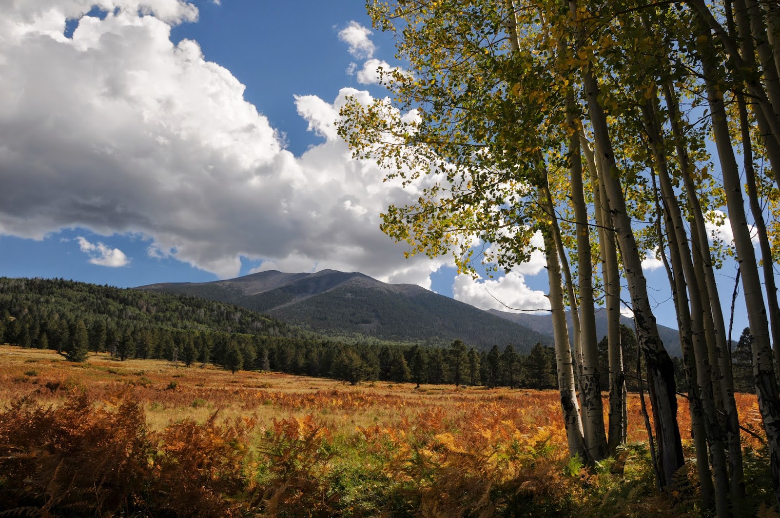
On the western face of Flagstaff’s San Francisco Peaks, vast grasslands of wild roses, ferns and berries lap up against pine-studded slopes beneath an airborne tide of golden aspen leaves. This patchwork of wet meadows--collectively known as Hart Prairie--is home to some of the most beautiful aspen glens in the state. However, over the past 50 years Arizona’s aspen communities have been in decline. Non-native flora and fauna, altered hydrology and fire suppression have compromised their health and without help, these elegant clonal propagators will likely disappear completely. That’s where the Hart Prairie Fuels Reduction and Forest Health Project comes in. To save the aspens, the project seeks to restore the area to a more natural state through the use of forest thinning, sprout protection and prescribed burns. Wilson Meadow gives a glimpse of what the goal results might look like---lots of open space with clumpy grasses and thickets of rare Bebb willows sharing the landscape with loosely woven stands of pines, firs and aspens.
LENGTH: 2 miles roundtrip
RATING: easy
ELEVATION: 8,500’ – 9,000’
DOGS: This is a very sensitive area. Dogs must be on leash and owners must pack out all waste.
KID FRIENDLY?: yes
DISTANCE FROM PHOENIX: 163 miles one way
GETTING THERE:
From Flagstaff, go 10 miles north on US180 to milepost 225, turn right onto Hart Prairie Road (south access of FR151) and continue 4.2 miles to FR9007T on the right. Hint: if you reach the Nature Conservancy entrance, you’ve gone too far. Follow FR9007T 0.2 mile to the trailhead. FR 151 is maintained dirt passable by sedan. FR 9007T requires a high clearance vehicle.
SUDDEN ASPEN DECLINE INFO:
Flagstaff Ranger District, Coconino National Forest: 928-526-0866
Friends of Northern Arizona Forests: http://www.friendsofnazforests.org/
Aspen Delineation Project: http://www.aspensite.org/index.html

THIS HIKE IS THE "COVER GIRL" FOR THE OCTOBER 2011 ISSUE OF PHOENIX MAGAZINE.

Monday, September 26, 2011

GROOM CREEK-ISABELLA LOOP

GROOM CREEK-ISABELLA LOOP
Prescott National Forest

Located just a few miles south of downtown Prescott’s main drag, this loop trail is a premier hiking destination in the Bradshaw Mountains.
The trailhead is easy to find and--with minimal application of common sense—it’s nearly impossible to get lost along the route. Unlike other nearby trails, this one is closed to noisy motorized vehicles like dirt bikes and ATVs---a high-value treat for those in search of a calming outdoor experience.  It’s easiest to hike the loop in clockwise fashion—beginning on the Groom Creek trail #307, which heads north (left) from the trailhead sign.

A substantial but steady ascent follows natural drainages through a wonderland of mica-flecked granite boulders flanking the path in sentry-like formation. 
Woodlands flush with broadleaf and coniferous trees shade the way framing continually changing vistas including glimpses of Prescott’s Granite Mountain.  Near the half-way point, a small clearing with picnic tables, restroom and a short spur trail to Spruce Mountain fire tower makes for a handy place to take a lunch break and do some exploring.  From here pick up the Isabella trail #377—to find it, stand with your back toward the restroom so that the fire tower is to your left. You’ll see a road directly ahead (this is NOT the trail), and two other roads off to the right.  Take the narrow middle road (go right) which is signed 377---if you do not see the sign, you’re on the wrong path.  Follow 377 back to the trailhead.
Oak trees cluster along Isabella Trail
LENGTH:  8.7-mile loop
ELEVATION: 6,400’ – 7,750’
RATING:  moderate
BEST SEASON: year round
DISTANCE FROM PHOENIX: 120 miles one-way
GETTING THERE:
From Phoenix, go north on I-17 to Cordes Junction.  Exit onto SR 69 west and proceed through the towns of Mayer, Dewey and Prescott Valley to the town of Prescott.  Continue on SR 69/Gurley Street through Prescott to Mt. Vernon Ave.  Turn south (left) onto Mt. Vernon Ave. (which will turn into Senator Highway) and continue 6.4 miles to the Groom Creek Trailhead on the left.  Roads are 100% paved.
INFO: Bradshaw Ranger District, Prescott National Forest, 928-771-4700

Friday, September 23, 2011

NATIONAL PUBLIC LANDS DAY 2011


Superstition Wilderness
SATURDAY SEPT. 25
Looking for a way to give back to the great outdoors?  Check out the links below to learn about many opportunities to pitch in.  Or, just get out and HIKE to show your support of Arizona's diverse public lands. BONUS:  many places like state and national parks will WAIVE FEES this day!


Mazatzal Wilderness

Tuesday, September 20, 2011

LENOX CRATER & LAVA FLOW TRAIL

LENOX CRATER & LAVA FLOW TRAIL
Sunset Crater Volcano National Monument
San Francisco Peaks from Lava Flow Trail

Stranded at the trailhead.  That was me last Saturday when ALL of my hiking pals opted out on a planned hike in a remote area north of Flagstaff.  As we all know, it's not a real good idea to hike alone in seldom-traveled territory (see the movie 127 Hours) so, given that I still wanted to hike up north, I decided to alter my plans and solo hike a couple of the little touristy trails festering on my “some day” list.  That way, if I broke a leg or something, there would be several dozen people milling around ready to assist (or gawk).
O'Leary Peak from Lava Flow Trail
The new destination became Sunset Crater Volcano National Monument and two easy lava-themed trails within the park. First up, Lenox Crater.  This short, up-and-back scenic trail climbs on crumbly volcanic ejecta to the top of an eroded cinder cone. The summit vent of this extinct fire spitter has long since worn way, but nice views of the eastern slopes of the San Francisco Peaks make up for the loss.  From this 7,000-foot vantage point, damage from the 2010 Schultz Fire appears as a massive swath of ash-brown stubble across the foothills.  At the trailhead, there's a fenced viewing area overlooking the rough-hewn geology of the Bonito Lava Flow—a fractured sea of basalt issuing from the base of Sunset Crater. It's a popular stop for people taking car tours of the park---so beware of rubbernecking drivers!  In terms of geological time, this volcanic event is very young, so the inky-black lava retains the sharp-edged rawness of new-borne rock.   Just up the road is the Lava Flow Trail.  This turned out to be much more enjoyable hike than I had anticipated.  The stark volcanic terrain is a mesmerizing maze of jagged Aa flows, acres of eerily fused pyroclasts and taffy-like rivers of Pahoehoe.  In addition, there's an ice cave, a splatter cone “mini volcano” and sweet glimpses of nearby 8,916-foot O'Leary Peak (a lava dome volcano).   Booklets available at the trailhead coordinate with numbered points-of-interest along the trail, providing a substantial dose of learnin' about the local geology, flora fauna and human history. Sadly, the day's (whopping) two miles of hiking went by in a flash--I was done by noon.    That provided the perfect excuse to squander the afternoon buying candles and coffee in historic downtown Flagstaff.
Lenox Crater Trail

LENGTH: Lenox Crater: 1 mile roundtrip
Lava Flow Trail: 1 mile loop and a 0.25 barrier-free interpretive trail
RATING: easy-moderate (uneven footing and loose rock)
ELEVATION: Lenox Crater: 6,940'-7,240'. Lava Flow: 7,000'-7,050'
DISTANCE FROM PHOENIX:  166 miles one way
BEST SEASON: year round (may be snow in winter)
GETTING THERE:
Summit of Lenox Crater
From Phoenix, go north on I-17 to the I-40 junction in Flagstaff.  Follow I-40 east to the US89 north exit.  Continue north on US89 to the turn off for Sunset Crater (FR545), located  just past milepost 430.  Turn right onto FR 545 and follow the signs 2 miles to the park entrance.  From the fee station, continue 1.3 miles to the signed Lenox trailhead.  The Lava Flow trail is another 0.5 miles farther up the road--can't miss it. 

FEES: $5 fee per vehicle.  Pass is good for 7 days.
FACILITIES: restrooms, water, visitor center
INFO: http://www.nps.gov/sucr/index.htm, Visitor Center phone: (928) 526-0502
MORE PHOTOS: Lava Flow Trail:

MORE PHOTOS: Lenox Trail:

Saturday, September 17, 2011

SUMMIT MOUNTAIN


Looking east toward Bill Williams Mountain
Kaibab National Forest
overlooking Garland Prairie and the San Francisco Peaks
Aptly named, Summit Mountain delivers a quintessential peak-conquering experience—but without the pesky sore muscles and taxed lungs.  Ascending through thick broadleaf-coniferous woodlands, the trail is a cinch to follow, gaining elevation gradually via long, easy switchbacks.  Trees lining the path seem to know when it's time to move aside to reveal sigh-worthy views of the surrounding landscape, treating hikers to a continually-changing menu of eye candy. Near the top, the trail flattens out as it emerges on a windy mesa with two excellent viewpoints.  The first is a precipitous shelf of volcanic boulders teetering above the colorful and tumultuous gorge of Sycamore Canyon Wilderness.  Here, a mixed bag of raw geological features spills out in a 180-degree arc resembling the frenzied canvas of a tortured artist.  After exhausting your camera batteries (photo ops abound), proceed toward the communication towers and a second (even more precipitous) cliff overlooking a pine-fleeced basin laced with dirt roads and railroad tracks in the shadow of Bill Williams Mountain.
Because it's a long drive to the trailhead for us Phoenicians—consider combining this hike with nearby Benham, Dogtown Lake, Davenport Hill or Overland Road trails for a greater return on investment. (see separate blog entries)
The only downside of this hike is the obnoxious ATV cinder track located adjacent to the trailhead.  When we visited on Labor Day weekend, the place was a manic mash pit cocktail of gas-fume-spewing machines and screaming kids with a chaser of beer-and-cigarette-wielding adults---behind the wheel, mind you, in a TINDER. DRY. FOREST. Grrrrrrr! However, I'm gonna suck up my angst and attribute this booze-addled mayhem to the end-of-summer holiday weekend festivities and not let it sway me from highly recommending this trail. Also, although the Summit Mountain Trail #68 is off limits to motorized traffic, a dirt vehicle road comes up from the opposite side of the hill, so you may encounter ATVs, quads and motorcycles on the summit.  Hug a tree and take a deep, cleansing breath.....
a "Kodak moment" at the first viewpoint

LENGTH: 2.2 miles round trip
RATING: moderate
ELEVATION: 7,147' -7,797'
BEST SEASON: May - October
DISTANCE FROM PHOENIX: 180 miles one way
GETTING THERE:
View of Sycamore Canyon Wilderness
From Phoenix, go north on I-17 to the I-40 junction in Flagstaff.  Travel 27 miles west on I-40 to exit 165. At the bottom of the offramp, veer left and follow Railroad Road 2.6 miles through Williams to 4th (Fourth) Street on the left.  Drive 8.3 miles south on 4th Street (a.k.a. Perkinsville Road, CR73) to milepost 177 and turn left onto FR110. Continue 2 miles on FR110 to the signed turn off for “Summit Mountain Trailhead” at FR2113A  on the right. (NOTE: the forest service Web site and other sources call this FR 706, but it is not signed as such.) Turn right onto FR2113A and go 0.5 mile (veer right at the 2111 fork) to the trailhead on the right.  Roads are paved, dirt & gravel—all suitable for cautiously-driven passenger cars.
INFO: Kaibab National Forest, Williams Ranger District,
MORE PHOTOS:


Sunday, September 11, 2011

ARIZONA'S OTHER FAY CANYON

FAY CANYON
Flagstaff
When creeping barberry leaves take on a red blush, the last days of summer in Arizona’s high country are upon us. And so it was with this harbinger of frost underfoot that we set out to enjoy the last few bittersweet weeks of northern Arizona hiking. To do so, we selected yet another “who knew” trail in Flagstaff.  With numerous limestone caves, ancient sand dune rock formations and acres of alpine meadows, Arizona's other Fay Canyon is a joy to explore.  Unlike the famous (and crowded) red rock, Fay Canyon located in Sedona’s high desert, this trail sees much less activity.  That's likely because there are few resources describing this hidden gem of a hike.  Conveniently located in the Mormon Lake area, this route through a shallow valley connects with the Walnut Canyon Passage of the Arizona Trail, Flagstaff Urban Trails System and Sandy's Canyon.  The trail is almost completely shaded as it travels the margins of a lush gorge flanked with bizarre geological structures and deep canyon drop offs.  To add length, we included a side trip to Fisher Point. Here’s how:
HIKE DIRECTIONS: from the trailhead, hike 0.3 mile along the double-track dirt road paralleling Lake Mary Road.  At the gate/fence located where the road makes a sharp right hand turn, pass the gate and continue straight (north) along a footpath.  From here, the trail is well maintained and easy-to-follow.  At two points along the route, the trail splits—in both cases, stay to the left and take the higher paths. (I’m pretty sure the splits merge eventually, but it’s just smart to stay on the main trail).  At the 2.6-mile point, Fay Canyon Trail ends at a “Y” intersection with the Arizona Trail. Here, head right (east) along a well-signed path to continue on to Fisher Point and the dunes.

Whether hiked alone or as a leg on longer treks, this quiet canyon trail offers a perfect way to enjoy one last summer mountain trek.
Creeping Barberry turns red when temperatures drop

LENGTH: 8.2 miles roundtrip as described here. Fay Canyon alone: 2.6 miles one way
RATING:  moderate
ELEVATION: 6,220' – 7,033' (this description), Fay Canyon only: 6,620'-6,950'
DISTANCE FROM PHOENIX:  148 miles one way
GETTING THERE:
From Phoenix, go north on I-17 to exit 339, Lake Mary Road (Forest Road 3) located just south of the I-40/I-17 interchange in Flagstaff.  From the bottom of the off ramp (across from a Circle K), turn right and go 4 miles south on Lake Mary Road to S. Wildlife Road (at the “Hitching Post Stables” sign).  Turn left here and drive a few yards to a “T” intersection, veer left and continue less than 0.1 mile to the sign that reads: “ Walnut-Skunk-Fay Closure Area, No Motor Vehicles”. Parking is very limited.  Please respect private property in the area by not blocking roads or driveways.
INFO:
PRINT MAP : Emmitt Barks Cartography “Flagstaff Trails Map”
Flagstaff Ranger District, Coconino National Forest, 928-526-0866

MORE PHOTOS:

Monday, September 5, 2011

OVERLAND ROAD HISTORIC TRAIL

OVERLAND ROAD HISTORIC TRAIL
Kaibab National Forest
The Swale at Dead Horse Tank

Playing Carin Leap Frog
A Road Segment
The arrival of the railroad in the late 19th century signaled the demise of this storied wagon road built in the 1850-60s to haul gold and other goods between the Prescott area and Williams.  Nearly devoured by the hip-deep grasses of Garland Prairie, the Forest Service wisely saw this trail's historical significance and recreational value, and decided to  preserve the path using a web of roads, footpaths and cross-country jaunts.  Not for inexperienced hikers, the non-traditional route is tricky to follow, but for those who “get” the plan, it’s actually quite hike-able.  Think line-of-sight-leap-frog and you’ve got the idea. Just locate and follow strategically-placed rock cairns, tree blazes, brass caps and wooden posts emblazed with “mule” icons that, frankly, appear to be two heads shy of an image of Cerberus, the mythical 3-headed hound from hell.  As you’ll see, this will turn out to be an appropriate trail mascot---the devil is in the details. (click on the MORE PHOTOS link below to see images of some trail markers).
HERES THE PLAN: From the Dead Horse Tank trailhead, hike across FR 139 to the “2205” post---here, you’ll find the first brass cap trail marker poking out of the ground.  Follow this road 0.5 mile to where there’s a sunny swale with two wood posts stuck in the middle.  This marks the side trip for Dead Horse Tank---hike cross-country toward a prominent berm to find the pond.  We noticed a hunter blind built on the north side of the tank.  Once done visiting the tank, go back to the road and continue east to the 1-mile point where a large carin and a wood "mule" post marks the turnoff for the start of the cross-country leap frog.  Now, pay attention---spot the first carin, then locate the next before moving on----basically you’re walking from carin-to-carin.  Be diligent---they are there, but some are buried by fallen trees and require more effort to find.  Occasionally, the cairns are accompanied by the posts and caps.  Where the route follows road, look for cairns and tree blazes on the shoulders.  Also, some critical junction wood posts are missing---look for green metal rods instead. We had a reasonably easy time of it for about 3 miles before the carin hunt got very challenging, so be sure to budget your hiking time accordingly---this hunt-and-peck trek will take longer than you think.
Brass Cap & Carin

Pomeroy Tanks near FR 109

LENGTH:  25 miles one-way (11 miles roundtrip as described here)
RATING: easy---but route finding skills are  required
ELEVATION: 5,800’ – 7,100’ (6,650 – 7100, FR 139 to FR109 as described here)
DISTANCE FROM PHOENIX: 180 miles one-way
GETTING THERE:  there are many access points, but here’s the one we used
Dead Horse Tank Trailhead:
Trail Sign Near Dow Spring 
From Phoenix, go north on I-17 to the I-40 junction in Flagstaff.  Go 27 miles west on I-40 to exit 165.  At the bottom of the offramp, go left and continue 2.6 straight through Williams on Railroad Avenue and turn left onto 4th Street. Follow 4th St. (it will change into Perkinsville Road/CR73) 7.5 miles due south  to FR 139 on the left.  Go 0.9 mile on FR139 to a the signed gravel parking loop/trailhead on the left side of the road .  Roads are paved up to FR 139 which is good dirt & gravel. Passenger cars okay.
INFO & MAP: Kaibab National Forest, Williams Ranger District
MORE PHOTOS: