

 RIO SALADO HABITAT RESTORATION PROJECT
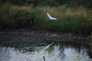
Just two miles south of downtown Phoenix, where the Salt River once flowed, a former dumping ground has been transformed into a thriving 595-acre oasis in the desert. With the cooperation of the Army Corps of Engineers, the Flood Control District of Maricopa County and droves of volunteers, tons of waste were cleared out of the Salt River channel and replaced with ponds, waterfalls and tens of thousands of indigenous plant species. Although the 5-mile-long strip of riparian habitat looks as if it occurred naturally, it’s actually a “demonstration wetland” that was created by tapping into the groundwater beneath the river channel and pumping more than 2.65 million gallons of water per day to sustain the habitat. Stretching from 19th Avenue to 16th Street, the project is a work in progress. The Central Avenue gateway is currently the most complete segment and there’s parking, interpretive signage, restrooms and drinking water. Trail segments are organized to feature specific desert habitats such as Cottonwood-Willow, Lower Sonoran, Mesquite Bosque and Palo Verde. Although just a few years old, the plants—which were harvested from seeds or cuttings within a half-mile of the Salt River—are already flourishing and attracting wildlife. Snowy Egrets, raptors, toads and dozens of other species have settled in. Future plans for the project include adding more gateways to access the more than 10 miles of paved and dirt trails and an Audubon Nature Center.
LENGTH: about 10 miles of paved and dirt trails are planned. As of 0506, about 3 miles of established trails are open.
RATING: easy and informative
ELEVATION GAIN: 50 feet
GETTING THERE:
From Phoenix. Drive south on Central Avenue through downtown. Just past the I-17 underpass, look for the obvious parking area on the leftAlternate routes:
From the east Valley, take Highway 60 west and connect to I-17. Exit I-17 at 7th Street. Go south on 7th Street to Broadway Road. Turn right (west) on Broadway Road and continue to Central Avenue. Turn right onto Central Avenue and head north for about 1 mile to the gateway.
From the west Valley, take I-10 to I-17 and exit at 7th Avenue. Go south on 7th Avenue to Broadway Road. Turn left (east) onto Broadway Road and go to Central Avenue. Turn left (north) onto Central Avenue and continue for about a mile to the gateway on the right.


 Posts
Posts


 HARQUAHALA PACK TRAIL Harquahala Mountain Wilderness Area An abandoned solar observatory on top of the 5,691-foot summit of Harquahala mountain, the highest point in southwestern Arizona, is but one of many points of interest atop this desert peak. Stunning views of the sprawling farmlands near Wickenburg, a healthy desert tortoise population, skulking Gila monsters and ruins of an abandoned mine camp provide hours of visual interest along the narrow pack trail that spirals skyward from the desert floor. Just below the summit, there’s a mountain pass with good views of a precipitous dirt road that snakes up the massive south slopes of the mountain. In addition to being a favorite destination for brave 4 x 4 enthusiasts, the bumpy route also is used by Central Arizona Project workers to access the array of solar-powered equipment on the apex which regulates the flow of water in the CAP canals that criss-cross the Metro Phoenix area. LENGTH: 11.5 miles round-trip RATING: difficult ELEVATION: 2320' - 5691' GETTING THERE: From Phoenix, take US60 (Grand Avenue) west towards Wickenburg. From Wickenburg, continue on US60 for about 14 miles past the little town of Aguila. Between mile markers 70 and 71, look for a gate on the left and a small brown “trail” sign and turn onto the dirt road. You’ll need to open the latched gate and close it behind you. Follow the generic “trail” signs for 2.2 miles to the trailhead where there’s an interpretive sign and a restroom. Information: Arizona Bureau of Land Management, http://www.blm.gov/az/st/en/prog/recreation/autotour/harq_summit.html


