Find A Trail. Start Your Search Here:

Monday, November 27, 2023

Cloudburst-Cone Mountain Loop

CLOUDBURST-CONE MOUNTAIN LOOP

Storm view from the Cloudburst trail

IMPORTANT NOTE: Please stay off wet trails to avoid damaging them. These photos were taken before the storms hit --on dry trails. 

 Funny thing about mountains; they’re rain makers.  The phenomenon isn’t unusual or magic, it’s something called orographic precipitation which is basically rain produced when warm moist air rises and cools over mountain ranges.

Granite boulders on the Cone Mountain trail

The process is fascinating to watch, it rolls out as if trapped in a sort of real-time time-lapse. Clouds rapidly build over peaks to the break point when they drop their payloads.
Granite sculpture on the Hackamore trail

This amazing weather event is easily observed in the mountain ranges that circle the Valley where the massif-borne rain flows down foothills into ephemeral streams and washes in gentle sheets or roiling deluges.  
Storm brewing over the Cloudburst trail

Higher elevations around the Valley like in North Scottsdale and Cave Creek where mountains reach to a cloud-summoning 4,000+feet get the lion’s share of water.
Preserve trails are well marked and maintained

 
Phoenix gets the dregs.  While Phoenix is situated at around 1,100 feet, north Valley locations like Scottsdale’s McDowell Sonoran Preserve rise to over 2,500 feet, and that makes all the difference in terms of taking the edge off city heat islands and soaking up residual mountain rain.  
Brown's Mountain viewed from Upper Ranch trail

The extra height also accounts for the occasional coating of winter snow that frosts saguaros in picture postcard splendor.  The fascinating workings of elevation and mountains on the desert landscape beg to be ogled, and the Cloudburst Trail feels like a purpose-built platform for the mission.

The aptly named hiking trail in the McDowell Sonoran Preserve gives front-row-style access to the spectacle of rain-making mountains in action. 

Early morning sun on Upper Ranch trail

The 0.9-mile trail coils along the base of 3,061-foot Cone Mountain with flat topped Brown’s Mountain standing at 3,253 feet high to the east.  The twisting singletrack in the preserve’s north region overlooks a gorgeous expanse of desert that abuts the hilly terrain of Tonto National Forest.

Stunning skyscape on the Cloudburst trail


There are numerous ways to access the route but using it as leg in a loop around Cone Mountain adds panoramic vistas and interesting geology to the mix.

Maps available online and at the trailhead show multiple ways to weave the Cloudburst trail into a day hike. 

Unobstructed views on the Cloudburst trail

One option is to create a loop hike using Upper Ranch, Cone Mountain, Hawksnest, and West Express trails for a moderate 5.3-mile trek.  Each leg of the route works a different facet of the preserve’s many characters.  The West Express and Hackamore trails bump up against bizarre granite formations and cross paths with powerlines that oddly mimic wiry tendrils of ocotillo cactus.
Loop hike circles Cone Mountain

The Upper Ranch and Cone Mountain trails showcase the preserve’s two distinct peaks and views of iconic Pinnacle Peak and western ranges. 
Looking west from Cone Mountain trail

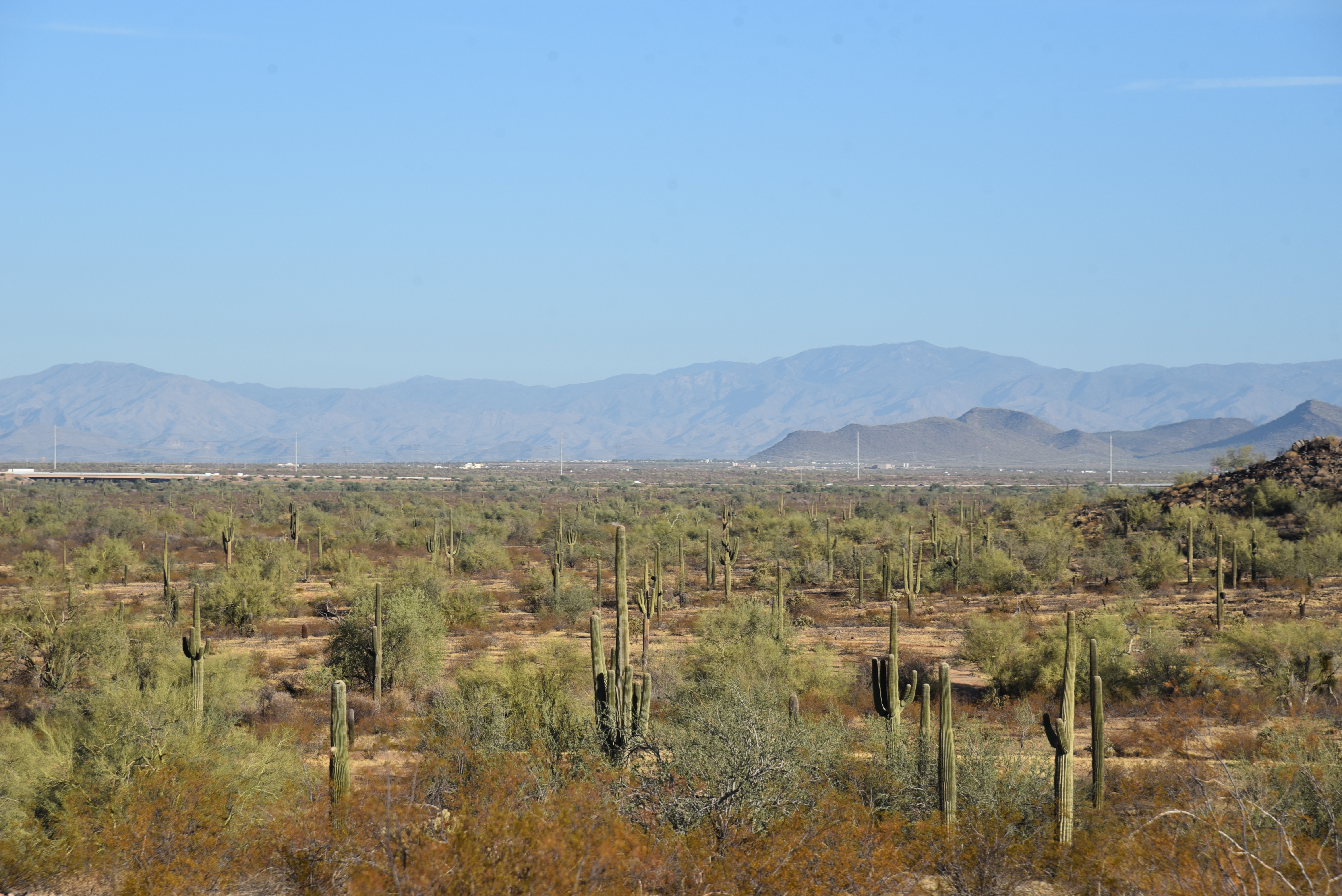
But, on days when rain is in the forecast, it’s Cloudburst that outdoes itself.  Traversing a shelf-like edge hanging over acres of saguaros, the trail has unobstructed views of churning clouds rising among layers of misted ridges and peaks.
Powerlines flank the West Express trail

The route is easy to pick out or customize using maps available online or at the trailhead. Here’s one option. From the Brown’s Ranch trailhead, begins with a short walk on Brown’s Ranch Road to the Upper Ranch Trail.  Follow Upper Ranch 1.2 miles to emergency marker UR5 and turn left at the Cone Mountain connector.
 

Gathering storm on Upper Ranch trail

Hike 0.2-mile, turn right onto Cloudburst at emergency marker CN3. Follow Cloudburst to emergency marker HW33 and continue 0.1-mile to West Express at emergency marker HW35. Follow West Express 0.4-mile to emergency marker WE17 and turn onto Hackamore. Follow Hackamore to the Cone Mountain junction at CN5, hike back to Upper Ranch and backtrack to the trailhead.

CHEAT SHEET emergency marker breadcrumbs: TRAILHEAD, UR1, UR2, UR3, UR4, UR5, CN3, HW33, HW35, WE17, HT3, CN5, UR4, UR3, UR1, TRAILHEAD.

REMINDER: Please stay off wet trails.

LENGTH: 5.3 miles

RATING: moderate

ELEVATION: 2,508 – 2,713 feet

GETTING THERE:

Brown’s Ranch Trailhead

30301 N. Alma School Pkwy., Scottsdale.

From Loop 101 in Scottsdale, take the Pima/Princess exit 36 and go 6.5 miles north on Pima to Dynamite Road.  Turn right and continue 2.7 miles to Alma School Pkwy., turn left and drive 1 mile to the trailhead. The preserve is open sunrise to sunset daily. There are restrooms at the trailhead.

INFO:
McDowell Sonoran Preserve

https://www.scottsdaleaz.gov/preserve


Tuesday, November 14, 2023

Black Canyon Trail: Biscuit Flat Segment

BLACK CANYON NATIONAL RECREATION TRAIL:

BISCUIT FLAT SEGMENT

Wild burros on Biscuit Flat

Wild burros make lots of tracks--and lots of little burros.  That’s a concern for hikers and land managers because overpopulation can lead to problems like overgrazing, negative impacts on native wildlife, and public safety issues around roadways. 

New River Mesa viewed from Biscuit Flat

With few natural predators and a law that protects them from human hunters, the sturdy African imports that are the descendants of escaped or released pack beasts used by the military, ranchers, Spanish explorers, and miners dating back to the 1500s, the herds can become hordes.

The route follows single and double track paths

The free-roaming, prolific breeders adapted to the Sonoran Desert and other areas in the Western states. Herds quickly grew to the point where they exceed the land’s capacity to support them.  The 1971 Wild-Free Roaming Horses and Burros Act states that the Bureau of Land Management (BLM) and the U.S. Forest Service are responsible for managing and protecting herds and their rangelands as “living symbols of the historic and pioneer spirit of the West.”  

Wild burros cross the Black Canyon NRT

To thin the herds and maintain their health here in Arizona, the BLM uses fertility control and vaccine programs along with periodic “gathers” where burros are helicoptered out of congested public lands and either put up for adoption or transferred to Midwest off-range private pastures where they are taken care of for the rest of their lives.
Biscuit Flat is surrounded by mountains

Cholla line the Black Canyon NRT

The four-legged “spirits of the West” can be observed wandering in several Arizona ranges including the Lake Pleasant Herd Management Area, a 103,000-acre space located 25 miles northwest of Phoenix.  The Biscuit Flat segment of the Black Canyon National Recreation Trail provides non-motorized access into the heart of burro country.

The sandy floodplain of New River


Like the burros that average 400 pounds and 48-inches high, the roughly 100-mile-long historic trail is very much a spirit of Western heritage.

A cactus wren alights on a BCT sign post


It runs from Carefree Highway in Phoenix to the Town of Mayer and has recently been extended into the Verde Valley with new construction.  Following a mashup of ancient travel corridors, wagon roads and livestock tracks that pre-date Interstate 17, the route traverses mountain passes, valleys, sprawling rangelands, defunct mining operations and heritage sites that date back thousands of years.  The 5.9-mile Biscuit Flat segment is, well--flat. 

Signs guide hikers through the New River channel

It’s the first stretch of the route that begins at Carefree Highway and makes a straight shot north to the Emery Henderson trailhead on New River Road just 3 miles west of Interstate 17.
Crossing the New River channel

 
The utterly pancake-level expanse registers like a mood board for a Martian landscape--that is if Mars had cactus, creosote and an ephemeral river running through it.  Resembling images sent back from Mars landers, the place is a massive basin surround by volcanic mountain ranges.
Gavilan Peak (2,980 feet) on near horizon


The thorny plain is dressed in scuffed shades of green muddled with dusty earth and course, dried forbs. Like the Native inhabitants and pioneers that wandered through, this place cut its teeth on surviving in the unforgiving spillway of a desert river.

Green sign posts mark the trail

 
Emery Henderson trailhead on New River Road

Without obvious lures, the vultures come anyway. Riding up drafts, the carrion-eating scavengers make lazy loops and investigative swoops often enough to suggest, something below is dead.  Maybe a javelina, rabbit or coyote. 

An uncommon white burro on Biscuit Flat

What’s alive are the burros, expanding suburbs, a widening interstate, shooting range, prison complex, fairways, a municipal transfer station and the massive semiconductor manufacturing plant rising from desert that surrounds the dusty trail and its relics of the past.
Hikers must watch for toppled signs

Beginning at the north end of the segment at the Emery Henderson trailhead, the path heads south on a mix of singletrack, two-track and dirt roads.  The trail is signed throughout but is crisscrossed with trampled paths made by the burros and fading dirt roads that can be confusing. 

Cave Creek Mountains viewed from Biscuit Flat

Bradshaw Mountains on the north horizon

Hikers must take care at intersections to spot the next sign to stay on track. (Some signs were down at this writing but did not present a navigation problem).  At about the 2-mile point, the trail enters the sandy floodplain of New River and makes a rocky crossing through a tamarisk-choaked channel.
Mountain vistas on Biscuit Flat

 
Old trough on Biscuit Flat

Signs anchored by rock piles guide the way through the weedy waterway.  On the south bank, the trail heads up an embankment, passes a gate and begins a shade less walk through open desert.  The pop-pop of pistol fire from the nearby Arizona Game & Fish Department-managed Ben Avery Shooting Facility grows louder where the trail briefly shares space with the Valley-circling Maricopa Trail and crosses Deadman Wash.  The south trailhead is little more than a dirt pullout and gate along busy Carefree Highway. 
Saguaros on Biscuit Flat

If you parked a shuttle vehicle here, be sure to close the gate behind you to keep the legacy burros from wandering into 21st-Century traffic.

LENGTH: 5.9 miles one-way

RATING: easy

ELEVATION: 1,598 – 1,878 feet

GETTING THERE:

NORTH: Emery Henderson Trailhead: From Interstate 17 in north Phoenix, take the New River Road exit 232 and go 3.1 miles west to the trailhead on the right. The large parking area has space for trailers. There’s a restroom, but it was out of order at this writing.

SOUTH: Bob Bentley Trailhead: From Interstate 17 in north Phoenix, take the State Route 74 (Carefree Highway) exit 223 and go 1.8 miles west to the trailhead on the right. No facilities.

INFO & MAPS: Black Canyon Trail Coalition

https://bctaz.org/

WILD BURRO INFO

https://www.blm.gov/whb

https://www.blm.gov/programs/wild-horse-and-burro/herd-management/herd-management-areas/arizona/lake-pleasant

WILD BURRO ADOPTIONS

https://aci.az.gov/capabilities/wild-horse-burro-training-and-adoption/


Tuesday, October 31, 2023

Hikes, Honky-Tonks and Hangouts

HIKES, HONKY-TONKS & HANGOUTS


Check out my feature in the November-December 2023 issue of PHOENIX magazine: Hikes, Honky-Tonks & Hangouts. 'Nuf said!

On Newsstands November 2nd. PHOENIX magazine is on sale at all major grocery, pharmacy and book retailers in the Phoenix area. The current issue also may be purchased by calling the PHOENIX magazine office at 480-478-8806 or online at phoenixmag.com/shop


Granite-Keefer Hill Circuit

GRANITE-KEEFER HILL CIRCUIT

Paloma Regional Preserve

Saguaros frame mountain views on the Granite Trail

The landscape of Paloma Regional Preserve is defined by a massive, flat drainage basin punctuated with a few minor knolls of volcanic rock.

Volcanic outcroppings in Paloma Regional Preserve

New River, when it runs, spills right down the middle of it in untamed rivulets, muddy channels, and occasional torrents. 
Crested saguaro in the Keefer Hill Trail

Bounded by a crescent of desert hills, terra cotta rooftops and the Westwing and Eastwing Mountain Preserves, the large water scoured expanse interfaces seamlessly with its suburban Peoria location. Trail users may walk in from several adjacent parks and neighborhood access points where family-friendly facilities and cul-de-sacs melt easily into acres of protected Sonoran Desert.
Westwing Mountain viewed from Granite Trail

Paloma Regional Preserve’s trail offerings diverge from those of its climb-centric sister preserves. Instead of abrupt stacked loops that culminate on desert mountain summits, the sprawling flatlands are outfitted with a slew of serpentine routes that take their time rolling out the goodies.

New River basin seen from the Granite Trail

  While the preserve’s Compass Rose Trail does ascend to a minor peak, it's an anomaly in an otherwise level field.  
Granite boulders on the eponymous trail

All preserve trails are linked and connect with Eastwing and Westwing parks, so customizing loops and long treks is easy. 
"Salt & Pepper" basalt and quartz line the trails

A good way to start is to make a lollipop loop using the Multi-Use Path A, Granite, New River, and Keefer Hill trails. The hike begins at the 10-acre Sonoran Mountain Ranch Park at the preserve’s east end.
New River Dam seen from Keefer Hill Trail

The trails are accessed from the park’s paved perimeter path where a trailhead with benches and a map kiosk mark the start point.  A 0.3-mile walk on Multi-Use Path A leads to the junction with the 1.7-mile Granite Trail.  The twisty singletrack makes a mild ascent through volcanic boulders, topping out on a rocky mound overlooking the course of New River.  The mesquite-cluttered intermittent waterway appears as a ribbon of green below the ridgeline of Westwing Mountain. 
Tonto National Forest mountains seen from New River Trail

The trail then winds down passing through creosote-dominated terrain strewn with a salt-and-pepper mix of black basalt and white quartz chips.  To the north, the Cave Creek Mountains and peaks and mesas of Tonto National Forest stand out on a hazy horizon.  The circuit follows the New River Trail a few yards to the Keefer Hill Trail junction. The 0.62-mile path traces the base of a 1,650-foot isolated butte. 
View from the high point on Granite Trail

A few feet in, a crested saguaro hovers above a clutter of Palo Verde trees, its elaborate crown splayed into a contorted, spiny bouquet.
Start point for the hike

Beyond the end of the Keefer Hill Trail that rounds crumbling flanks and boulder passages, the Flood Control District of Maricopa County managed New River Dam tames the tendrils of the freeform desert waterway, intercepting its deluge of the manicured subdivisions below.

Preserve trails are well signed

LENGTH: 5.24 miles round trip

RATING: moderate

ELEVATION:  1,412 – 1,515 feet (604 feet of accumulated elevation change)

GETTING THERE:

Sonoran Mountain Ranch Park, 7098 W. Miner Trail, Peoria.

From Phoenix, go north on I-17 to Happy Valley Road exit 218. Go 5 miles west on Happy Valley Road to 67th Avenue, turn right and drive 2.8 miles (road becomes Pyramid Peak Pkwy.) to Sonoran Mountain Ranch Road.  Veer left and go 0.5-mile to Chalfen Blvd., turn left, continue 0.1-mile to Miner Trail and follow the signs to Sonoran Mountain Ranch Park. Turn left into the parking area signed for Eastwing Mountain Trail. Hike begins at the far west end of the park’s paved perimeter trail.

HOURS: sunrise to sunset daily

FACILITIES: restrooms, picnic ramadas, playground, basketball courts. No fees.

INFO: City of Peoria

https://www.peoriaaz.gov/trails

Monday, October 2, 2023

Calloway Butte-New Tank

CALLOWAY BUTTE - NEW TANK

New Tank in Coconino National Forest

Peaceful, secluded places aren’t too difficult to find along the backroads of Coconino National Forest. 

Weighing in at over 1.8 million acres in size, Arizona’s second largest national forest is ostensibly the most diverse. 

Gambel oaks shade Forest Road 142

The northern Arizona swath of public land encompasses the famous red rock high deserts of Sedona, mountain lakes and streams, aspen glens, and alpine tundra around the state’s highest point in Flagstaff.  
Barbed wire fencing around New Tank

While sandstone phantasms, plunge pools and hypoxic vistas are the hallmarks of the easily accessible land, the B-list stuff in between is quite remarkable as well. 
Mountain vistas from Forest Road 142

When viewed through a lens of discovery, who-knew pockets of forest deliver hikes with generous servings of tranquil beauty.  Wildlife water holes, often created and maintained by Arizona Game & Fish Department, are the unsung gems of back road hiking destinations.
Old corral near New Tank

Gateway to New Tank on Forest Road 142

The weedy stock tanks backed by earthen dams are plentiful along 4x4 roads so they’re easy to find.  It's possible and legal to drive to many of them, but road conditions are not for amateurs. New Tank, one of the most scenic water holes, is a sizable pond choaked with water smartweed and bulrushes. 
A peaceful place in Coconino National Forest

Situated along Forest Road 142 about 27 miles east of Camp Verde, the pond is the focal point of a pastoral scene wrapped in a dilapidated ring of log-and-wire fencing.  The tank sits at the north base of Calloway Butte, a 6,860-foot pine-covered mound south of the West Clear Creek Wilderness. 
Calloway Butte seen from FR 142

Getting to the tank involves an undulating walk on the rough track of Forest Road 142.  Beginning at a dirt parking area off State Route 260 where the General Crook Trail #130 passes under the highway, the hike makes an immediate descent to a 3-way junction. 
Meadow with a view near New Tank

FR 142 heads left, on the first of a sequence of rocky climbs.  The road is shaded by a mix of Ponderosa pines, Gamble oaks and gnarly alligator junipers, passing by several side roads before dipping down into the cut of Meadow Canyon.  A final uphill crawl reveals mountain vistas peeking through thick tree cover and first looks at the green arc of Calloway Butte.  The road flattens out as it approaches the tank and skirts a rustic corral before meeting the tank at the 2.4-mile point.  
Wildflowers and pines along FR142

Massive oaks that blaze in shades of gold in autumn serve as a leafy gateway to the water hole that attracts all sorts of wildlife.  Elk, javelina, water birds and a robust community of woodpeckers skulk its perimeter.  The photogenic site is drenched in sunlight, the air spritzed with earthy notes of mint and grass. 
Pastoral scene at New Tank

It’s a relaxing spot for a lunch break before heading back or continuing another 0.8-mile on the road to Forest Road 142B, which is also signed as FR 9396. The hiker logo on the post indicates that the Calloway Trail, a half-mile strenuous route that descends into West Clear Creek, lies ahead.
FR 142 traverses Meadow Canyon

Well-equipped, adventurous hikers may follow the narrow, rough road 3-miles the trailhead.  But to stick with the theme of enjoying the pleasure of an unassuming little place between highway and wilderness, New Tank makes for a good turnaround point.
The FR 142B turnoff for the Calloway Trail


LENGTH: 4.8 miles round trip (to the tank and back)

RATING: moderate

ELEVATION: 6,146 – 6,718 feet ( 1,501 feet of accumulated elevation change)

GETTING THERE:

From Interstate 17 in Camp Verde, go 27 miles east (toward Payson) on State Route 260 to Forest Road 142 located past milepost 245 on the left.  Immediately past the cattle guard and turn left into a dirt parking area for the General Crook Trail.  A high clearance vehicle is recommended.