Find A Trail. Start Your Search Here:

Tuesday, April 11, 2023

Amerind Trails

NEW TRAILS COMING TO DRAGOON

Newly constructed trails at the Amerind Museum

Right around the turn of the century, I took a break at the Texas Canyon rest stop during a road trip from Willcox to Phoenix, looked out over the gorge below and thought, “Cool rocks. I wonder if there are any hiking trails in there.” 

Granite formations in Texas Canyon

Turns out, that particular slice of Chihuahuan Desert along Interstate 10 an hour east of Tucson where restaurants and roadside services are sparse, was on private property with no way for curious hikers to explore the wonderland of weathered igneous stone.
Trail designer Sirena Rana in Texas Canyon

That’s about to change, though.

Cottonwoods surround a pond on the Amerind Trails

 
This October, a 5.7-mile trail system is set to open in Texas Canyon on the Amerind Museum property in the community of Dragoon.

“Texas Canyon is so amazing,” says Sirena Rana founder of Trails Inspire and designer of the Amerind Trails. “ There’s so much interesting geology and a lot of people have wondered what it looks like inside.  Up until now, there were no public trails.”

Sirena Rana on the trail to whale rock

The stony parcel of Texas Canyon sits in the shadow of the Dragoon Mountains between the towns of Benson and Willcox. Nearby attractions like the Chiricahua National Monument, Cochise Stronghold, Willcox Playa Wildlife Area, Tombstone, Southern Arizona wineries and acres of Coronado National Forest are big draws for tourists and locals alike.

The tafoni rock in Texas Canyon

But Dragoon and the Amerind Museum remain comparatively under the radar.  The Amerind Museum is a sort of hybrid museum, art gallery and research facility dedicated to archeology, Indigenous cultures and Western art that’s been around since 1937.
Whale rock is a highlight of the Amerind Trails

Seeking to extend its reach, enrich visitor experience, and build interest in the area, museum officials contacted Rana after seeing her presentation on how trails can benefit communities to explore adding hiking trails to their property in Texas Canyon.

“When designing trails, the first thing I do is find the people who know about the land. Locals, neighbors, hikers and experts who know what’s special about the terrain,” Rana says.  “To me, the most important thing is to make trails accessible to all. I like a series of stacked loops that allow for a lot of options and are customizable for all levels of difficulty and lengths.”

Routing the 5.7 miles of trails through the dramatic, boulder-strewn terrain was tricky, but extensive site scoping and design research paid off.

Windmill with Dragoon Mountains on horizon

The whale trail departs from a picnic area

“We found routes by using the grasslands in between the rocks and natural granite passages while keeping close to interesting control points like cliffs, dramatic rock formations and ponds,” Rana shared. The careful planning has yielded unique pathways into some of the area’s standout geological wonders including a naturally sculpted tafoni rock and the (soon-to-be Instagram darling) whale rock.

Dragoon Mountains seen from Amerind Trails

The stone pillars, balanced rocks, slabs, grottos, spires, and fractured joints within the trail system are the result of millions of years of geological activity and weathering of quartz monzonite (aka granite) that crystalized underground.  As the land surface slowly eroded, the harder granite intrusion was exposed to the elements that would shape them into the bizarre forms seen today.
Golden corydalis color the grasslands Feb - Jun

For trail construction, Rana selected an Arizona company that specializes in building sustainable recreational trails that respect natural landscapes and cultural resources.

“For construction we used Flagline Trails, a Flagstaff-based contractor,” Rana says.  “They are incredibly talented and the crew did an amazing job. They took my design and made it as good as can be. The system has three access points, north and south loops plus an out-and-back trail to whale rock. There will be benches placed along the routes and signage and painted paw prints to mark the trails where they cross bedrock will be installed over the summer. The trails will be open for day use only .  There’s no camping at the site, but there are plenty of places to camp and stay in neighboring towns and in Coronado National Forest.”

Trail construction began on January 3, 2023 and wound up in April. 
Painted paw prints will mark the trail where it crosses bedrock

Using “Amerind Trails” as a working title, official naming of the trails is in the works. “We handed off the naming of trails, and signage placement with our recommendations to the Amerind Foundation,” Rana says. “I’m thrilled with how the trails turned out and they are sure to be a great contribution to the community.”
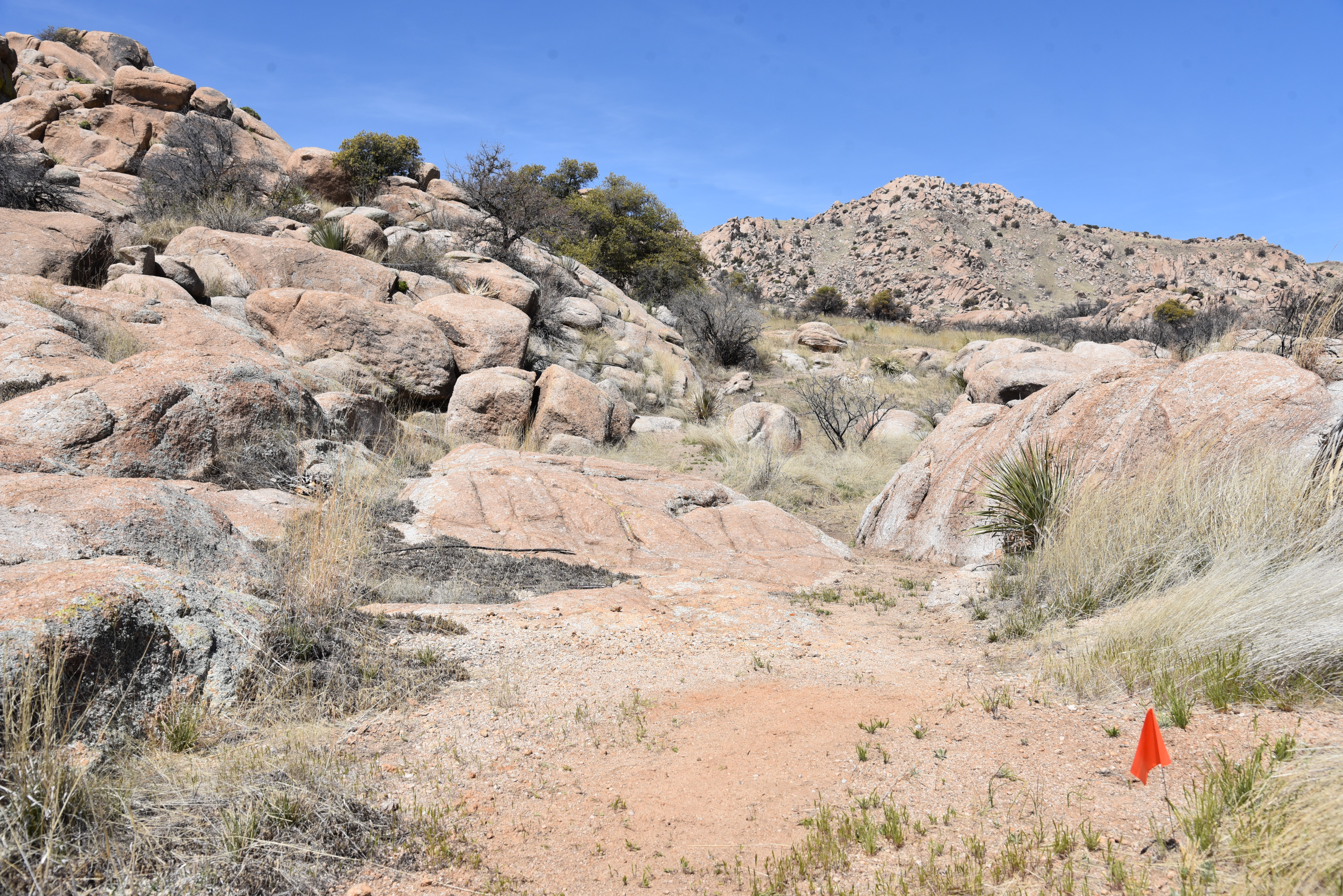
Interesting geology dominates the landscape

A grand opening event will be scheduled for October and if all goes as planned, the community of Dragoon is going to need a restaurant.

LENGTH: 5.7 miles

RATING: easy-moderate

ELEVATION: 4,643 - 4,873 feet

GETTING THERE:

Amerind Museum

2100 N. Amerind Rd., Dragoon, AZ.

From Interstate 10 south of Tucson, take the Dragoon Road exit 318 and follow the signs 1 mile south to the Amerind entrance on the left.  

HOURS: The museum is open Tuesday – Sunday 10 a.m. – 4 p.m.. Closed on major holidays. Trails will be open for day use only.

There’s no camping on the property, but there are nearby campgrounds and lodging.

FEE: $10 - 12

FACILITIES: picnic tables, restrooms, museum exhibits and events

INFO:

TRAILS WILL OPEN OCTOBER 7, 2023.

Amerind Museum

amerind.org

Trails Inspire LLC

trailsinspire.com

Flagline Trails LLC

flaglinetrails.com


Thursday, April 6, 2023

Johnson Wash Road

JOHNSON WASH ROAD

Snow on Mingus Mountain viewed from FR96

Largely shade-less and hemmed in by a grey sea of prickly cat claw, Johnson Wash Road reads like a not very interesting dirt two track.

Big sky vistas are the hike's hallmark.

At first glance, it clearly lacks the “Three Ws” of hiker catnip: woodlands, water and wildflowers. But what there is plenty of is air. Big, restless eddies unobscured by trees, landforms and botanical distractions propel ravens, turkey vultures and hawks skyward to glide in loose, lazy loops. A walk on this dusty back road earns its hike-worthy credentials on big sky vistas alone. 
Isolated cottonwoods in Johnson Spring Wash

Johnson Wash Road, which is also known as Forest Road 96, is part of the Great Western Trail, a 4,455-mile route that runs from Mexico to Canada.  Purpose built for vehicles outfitted for rough conditions, long stretches of nothingness and rutted dirt far removed from the nearest service station, the road runs through Arizona, Utah, Idaho, Wyoming and Montana.
Hance Spring Road crosses Johnson Wash

 
The Arizona section wanders through over 800 miles of spectacular deserts, mountains, forests, canyons, creeks, grasslands, heritage sites, defunct mining camps and historic town sites.  
Junipers, scrub oak and cat claw on FR96

Open to motorized vehicles, hiking, biking and equestrian use, the Great Western Trail is at its heart, an off-highway vehicle (OHV) destination.  Motorized users typically venture out with several spare tires, tool kit, a few days’ worth of food, fuel and water and a convoy of similarly equipped companions, lest they find themselves up the wilds without a winch.

Yucca and granite outcroppings decorate FR96

Hikers, on the other hand need only pack the essentials, park and walk. And this stark slice of Arizona is well worth a closer look on foot. Located just a few miles west of Interstate 17 in Prescott National Forest,  the hike begins at a dirt turnout along Old Cherry Creek Road. The easy-to-follow route heads west on a rocky course that unwinds in a roller coaster style that dips and rises over the scoured channels of Sour Water, Racetrack and Johnson Wash. All told, the “flat” hike accumulates over 600 feet of elevation change.

Manzanita color an otherwise muted landscape

With nothing but scrub, cat claw, cacti and spotty stands of juniper and cottonwoods, there’s nothing to obstruct the viewscape spectacle. The muted silhouettes of the Bradshaw Mountains and Pine Mountain Wilderness rise on the far horizons while nearby knolls, bluffs and granite outcroppings interrupt sprawling high desert grasslands and yawning valleys. 

FR96 is part of the Great Western Trail

Among the scrub oak and manzanita shrubs, skulking coyotes, rodents and lizards scurry under shadows cast by turkey vultures and ravens circling overhead in search of a meal. The dead quiet and open-to-the-elements flavor of this place can be either joyful or frightening--sometimes both, simultaneously.

At the 2.2-mile point, the road comes to a major intersection.  The Great Western Trail veers southeast, while Forest Road 9604S spins off to the northeast, brushing the base of 5,725-foot Onion Mountain before fading away. The junction makes for a good turnaround point, but  several other unsigned offshoots may be used to extend the hike.  One to try is Hance Spring Road, also known as Forest Road 9011D.

There's plenty of air on the Great Western Trail

The unsigned junction is on the north side of Johnson Spring Road, 0.2 mile before the FR9604S junction.  It’s a primitive road with many unmarked spurs that weave around Johnson Spring Wash as it climbs uphill about 3 miles toward Cherry Creek.
Horehound grows under juniper trees on FR96

 
With a Prescott National Forest map and compass, hikers can enjoy an unscripted trek up the wilds without a worry.  

LENGTH: 4.4 miles round trip

RATING: moderate

ELEVATION:  4,703 – 4,859 feet (650 feet of elevation change)

GETTING THERE:

From Interstate 17 about 8 miles south of Camp Verde, take the Dewey-Humboldt exit 278 for State Route 169. Go 5.5 miles west (left) on SR 169 to Cherry Creek Road just past milepost 10 on the right. Follow Cherry Creek Road 1.3 miles to the Great Western Trail sign at Forest Road 96 (Johnson Wash Road) on the right. Park in the dirt turnouts. Roads are paved up to the trailhead.

INFO:

https://www.azbackroads.com/gps-track/the-great-western-trail-arizona-route/

https://www.gwt.org/


Monday, April 3, 2023

Little Rock-Rabbit Ears Loop

LITTLE ROCK-RABBIT EARS LOOP

Creek crossing near thebeginning of Rabbit Ears Trail

Rerouted and revamped in 2021, the routes formerly known as the Pine Valley and Dairy Springs trails are the Rabbit Ears and Little Rock trails are the rising stars of the Big Park Loop Trails system in the Village of Oak Creek. 

Boulders line the undulating Little Rock Trail

The two single track paths were moved off areas that had become heavily eroded.
Milkvetch color the Little Rock trail

The rehabilitated routes now include an extra mile of scenic trail at the base of Lee Mountain southeast of the uber-popular Big Park trails that wind around iconic Courthouse Butte  and the Bell Rock vortex site. 
Rehabilitated trails add a mile of hiking near Big Park

Combined with a short stretch of the Big Park Loop, the Rabbit Ears and Little Rock make a moderate-rated 5.7-mile loop with lots of variety. The hike begins at the Jack’s Canyon trailhead, which essentially serves as the less crowded “back door” to Big Park. 
This hike uses a short section of the Big Park Loop

After passing a gate and crossing Jacks Canyon Road, the trail hops an ephemeral creek which may be difficult to cross during heaving spring run off season.
Mesa and valley views from Rabbit Ears Trail

Once over the creek, Rabbit Ears ascends a sun-drenched mesa dotted with catclaw, yucca and cacti.
White arrows point the way on Little Rock Trail

There’s little shade along the first 0.7-mile which means unobstructed views of Lee Mountain and the Munds Mountain Wilderness, Horse Mesa and the distant Bradshaw Mountains. At the first junction, the loop splits.
Rabbit ears formation at the loop's high point

To get in the climbing part first, follow Rabbit Ears as it ascends a stepped mesa to the loop’s high point beneath the eponymous bunny ears rock formation. Tucked into cleft below Lee Mountain, the ears stand out as double sandstone pillars. 
Stiffarm rockcress blooms Feb. - Oct.

The route then makes a gradual mile-long straight shot downhill overlooking a gully where the faint scribble of Little Rock trail is visible on the red ledges below. 
Rubble on the Little Rock Trail

Pinion-pine-framed looks at Courthouse Butte, Cathedral Rock and the skyline of Red Rock Secret Mountain Wilderness roll out all the way down. At the Big Park junction, the route heads left on Big Park Loop for 0.3-mile, then heads left again on the Little Rock Trail.
Cathedral Rock viewed from Rabbit Ears Trail

This lower 2.4-mile  leg of the loop is dodgier than its ridgeline component.
Rabbit Ears Trail descends toward Courthouse Butte

Twisted and undulating, the trail is a combination of woodsy passages and sketchy slickrock traverses.
Rabbit Ears Trail traces the edge of Lee Mountain

Where the trail crosses solid rock, white arrows painted on the slick sandstone point the way.
Fragrant Gregg's ceanothus blooms Mar. - May

While never demanding too much of lung capacity or leg muscles, the trail’s unrelenting dips and climbs add up to over 1,000 feet of elevation change mixing a mild sweat in with sweet vistas and a quieter outdoor space.
Vociferous scrub jays serenade hikers

Snow capped Bradshaw Mountains seen from Rabbit Ears

It’s a recipe for relaxed hiking in Red Rock Country.

LENGTH: 5.7 miles

RATING: moderate

ELEVATION:  4,222 – 4,709 feet (1,022 feet of total elevation change)

GETTING THERE:

Jacks Canyon Trailhead.

From Interstate 17 north of Camp Verde, take the Sedona/Oak Creek exit 298 and continue 6.5 miles on State Route 179 to the Jack’s Canyon Road/Verde Valley School Road traffic circle. Veer right and continue 2 miles on Jack’s Canyon Road to the trailhead on the right. Roads are paved up to the trailhead.

The trail begins at the Rabbit Ears sign at the north end of the huge parking area. There are no fees or facilities at this trailhead.

INFO:

Coconino National Forest

https://www.fs.usda.gov/recarea/coconino/recarea/?recid=72017


Monday, March 27, 2023

Reach 11 Recreation Area

INVASION OF THE POPPY SNATCHERS

Globe chamomile in Reach 11 Recreation Area

It came from South Africa.

Invasive globe chamomile is crowding out native plants

The pretty little weed arrived innocuous enough with delicate, yellow globular flowers and feathery carrot-like leaves and was imported as an ornamental plant and decorative filler for floral arrangements. But with the first rainy season after Globe chamomile or “stinknet” landed in Arizona around the year 2000, the insidious herb proved it had a vicious bite and tenacity that would set it on its way to dominate Phoenix-area deserts.
Mesquite trees on the W210 trail

Granted, I write this after binge watching The Last of Us, the HBO series about a global cordyceps fungus pandemic that turns humans into “infected” zombies bent on sprewing spores while taking down all semblance of civilization.

Reach 11 traces the CAP canal

The story arcs paint a grim future for human survival as there’s no way to stop or slow the accelerating mushroom apocalypse.  On a less fatal scale, Globe chamomile and the fiction-enhanced strain of cordyceps have similar game plans. Except the victims of stinknet are native plants.

Surely there are other invasive species in Arizona. Salt cedar or tamarisk (from Eastern Europe and Asia), filaree or stork’s bill (from Eurasia and North Africa), and buffelgrass (from Indonesia, Africa, and the Middle east) are common along trails, roadsides and in parks. But none of these have the reproductive chops of Globe chamomile.  Resistant to some herbicides, this organic spam is tough to eradicate. Digging out by hand and/or professional chemical control can stem infestations. But there’s no magic bullet.

Fiddleneck along the Cactus Wren trail

While the Reach 11 Recreation Area in north Phoenix cannot be singled out as an “infected” demonstration parcel—stinknet is everywhere—it is a good place to observe how the noxious interloper that smells like an elixir of moldy tea and industrial cleaning fluid is choking out native wildflowers.  Located in a swath of desert bordered by State Route 51, Loop 101 and the Salt River Project CAP canal, the 1,500-acre, half-mile-wide linear park runs east-west, tracing the canal for about 7 miles between Scottsdale Road and Cave Creek Road.

Filaree "stork's bill" is another invasive plant species

In addition to a sports complex, Horse Lovers Park, and Bullfrog Pond, the area has 24 multi-use trails that add up to 18 miles including a barrier-free nature trail.

Mexican gold poppies

Reach 11 trails are wide and mostly level.  The two main routes, 210 and 211, connect with the other park trails for making easy loop hikes. 

Reach 11 trails are wide and level.

Mostly open to the sun, the trails pass among mesquite patches, desert hackberry shrubs and sections where runoff from the canal dike fosters lush greenery that attracts wildlife. 
Purple scorpionweed grows among invasive stinknet

In spring, the open fields rage with wildflower color. Mexican gold poppies, scorpionweed, fiddleneck, plantains, globemallow, bladderpod, brittlebush and popcorn flowers battle to maintain ground in the stinknet stronghold. The tiny gold balls appear to be winning.
A wash crosses the W211 trail

Tenacious globemallow survives the stinknet invasion

Still, the park offers a great way to get in a leg stretch or long day hike without leaving Phoenix city limits.
Desert plantain holds its territory

Easy access and big views of surrounding mountains and the infrastructure that carries power and water to the Metro Phoenix area make this swath of desert trails a convenient stop off for exercise and relaxation.
Stinknet encroaches upon bladderpod

As with all infestations—termites, rats, weeds, lice—getting rid of Globe chamomile now that a wet spring has helped it up its game, can be interminable or futile. Save for some miracle solution (I’m betting on a fungus), we may be  seeing yellow for some time.
Delicate popcorn flower struggles among the stinknet

LENGTH: 18 miles of trails

RATING: easy

ELEVATION: 1,470 – 1,551 feet

GETTING THERE:

There are several access points. This trip uses the Tatum Blvd. west entrance.

From Loop 101, take the Tatum Blvd. exit and go 1 mile south to the Reach 11/Horse Lovers Park entrance on the right.  There are no fees or facilities at this trailhead.

INFO & MAPS:

City of Phoenix

https://www.phoenix.gov/parks/trails/locations/reach-11


Tuesday, March 21, 2023

CALL FOR ENTRIES


Calling All Student Photographers for a Chance to Win Big! The Nature Conservancy, Arizona Highways magazine and Cox Communications are partnering for the 10th annual “Adventures in Nature” student photo contest. The contest was created in 2013 as a way for amateur student photographers to highlight Arizona’s natural beauty, wildlife, and people in nature.

WHAT: 2023 “Adventures in Nature” Student Photo Contest

WHO: Arizona students ages 13-18

WHERE: Submit up to two high-resolution nature photos

WHEN: Now through midnight April 12, 2023

WHY: To connect Arizona’s youth to our beautiful state by highlighting Arizona’s natural beauty, wildlife, and people in nature through photographs Winners will be announced on Tuesday, May 11, 2023, with $10,000 in cash prizes divided amongst the top 10 winners. View OFFICIAL RULES.