Find A Trail. Start Your Search Here:

Monday, February 27, 2023

Painted Hills Trails Park

PAINTED HILLS TRAILS PARK

View from the "false summit" on Bactrian Summit Trail

Described as a happy medium between urban parks and more remote mountain trails, Pima County’s hybrid “trails parks” fill the need for easy access to natural outdoor spaces. 

Painted Hills Trails Park is a 289-acre slice of desert space located in the far northeast corner of Tucson Mountain Park, just west of Interstate 10.

Lush desert vegetation on the Mosaic Trail

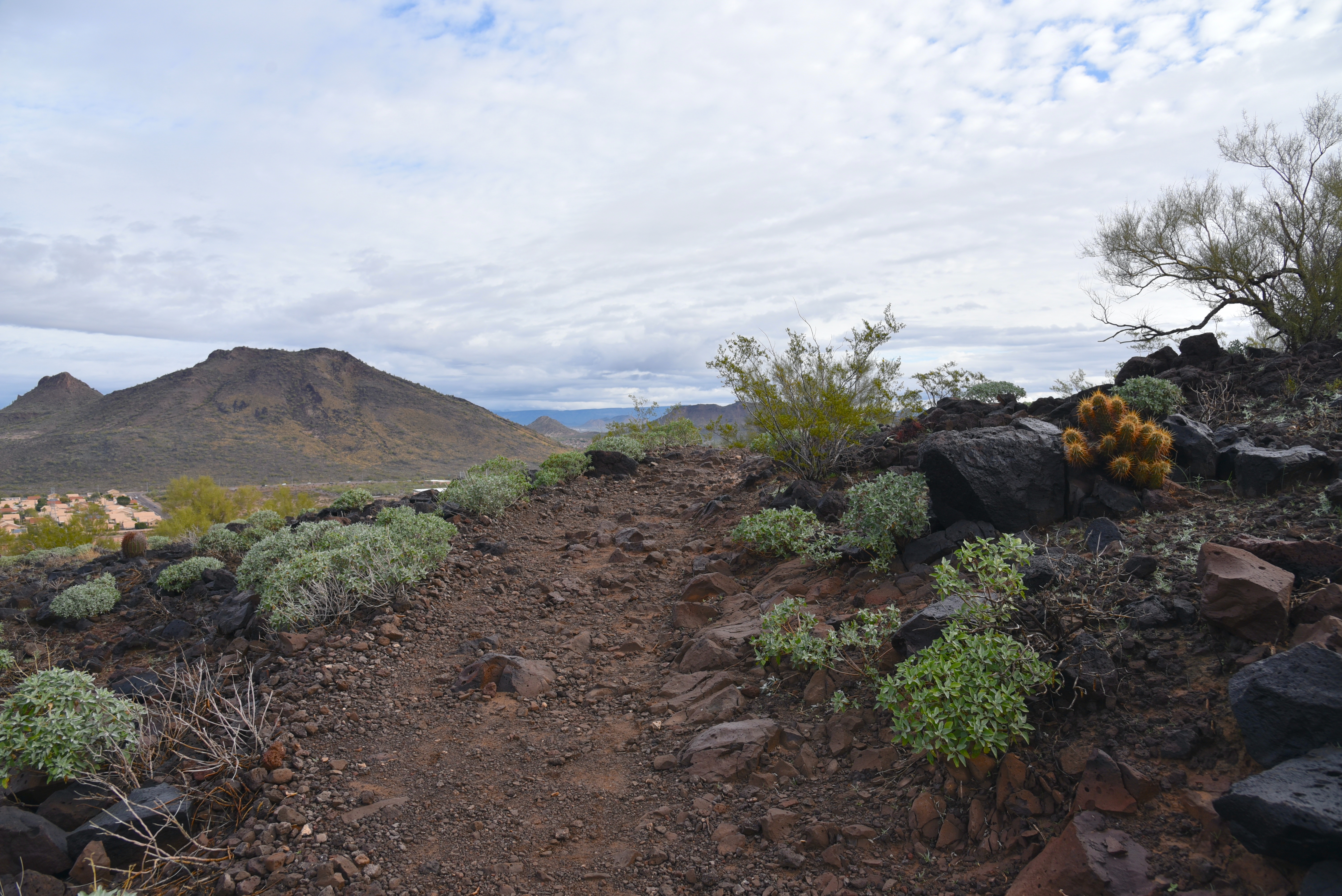
The mini but mighty park has seven interconnected trails that include two short mountain summit up-and-back trips.  All seven well-signed and maintained routes wind through dense saguaro forests with outstanding views throughout. 

Recoil Peak Trail

The in-your-face landscape show begins with the Santa Catalina Vista spur that spins off the 0.9-mile Mosaic Trail. The little loop overlooks a wash that runs between two cactus-encrusted hills. The V-shaped crack frames peeks at the jagged silhouette of the Santa Catalina Mountains that rise to 9,171 feet above the Tucson basin.
Saguaros & mountain vistas are the park's hallmarks

Santa Catalina Mountains seen from Slingshot Trail

Visible on the southwestern flanks, the Pusch Ridge Wilderness makes an abrupt, stony endcap.

The Mosaic Trail traces the southern flanks of Bactrian Summit, gaining elevation easily as it runs through tall saguaros, prickly pear, ocotillo and a rick understory of jojoba, fairy duster and other species of desert shrubs and wildflowers. 
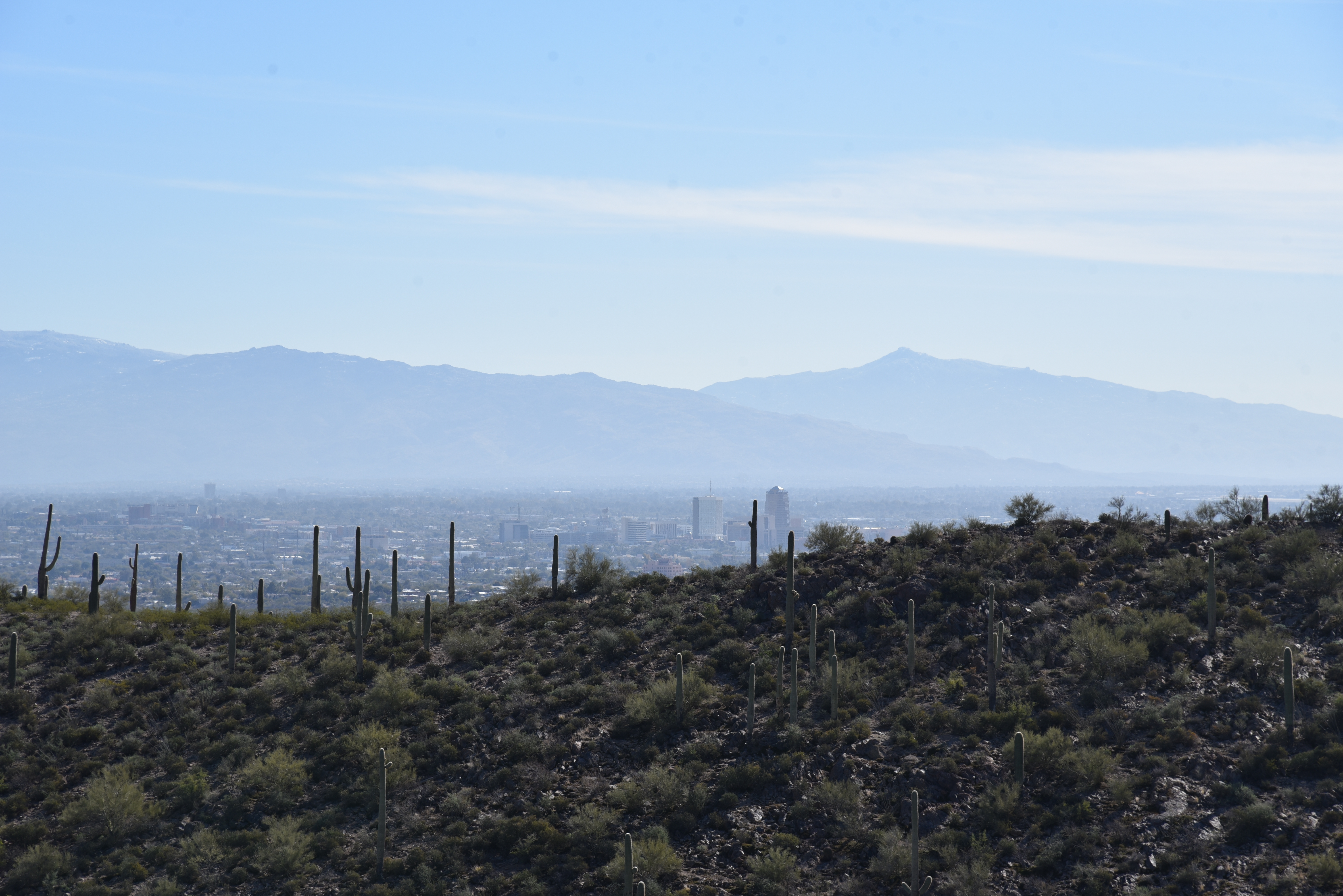
Distant Rincon Mountains viewed from Recoil Peak

Tucson Mountains viewed from the Slingshot Trail

For hikers unfamiliar with the term “false summit”, the Bactrian Summit trail delivers a crash course in the subject.
Desert Hyacinth "Blue Dicks" bloom Feb. - May

The short but somewhat steep path ascends to a knoll, but it’s immediately obvious that the breezy spot is not the true summit, but the false summit. Getting to the actual high point requires a brief downhill dip followed by a final climb to the top. 
Trails are well-signed and maintained

As the highest point in the park, Bactrian Summit is the best visual platform. 
A bench marks the park's high point on Bactrian Summit

Stretching out in all directions, views extend to the Rincon Mountain in the southeast and the Tortolita Mountains to the north.  Under it all, the Tucson cityscape creeps up to nearby Tumamoc Hill, Sentinel Peak (“A” Mountain) and the peaks of surrounding Tucson Mountain Park.  
Desert vistas galore on Slingshot Trail

A second hilltop side trip, Recoil Peak departs from the Slingshot Trail near the Monsoon Loop junction.
Slingshot Trail crosses a desert wash

Recoil Peak hovers over busy Speedway Boulevard and a maze of cul-de-sac communities.  Slingshot Trail does what it says, it boomerangs around the park’s colorful hills, jumping washes and dodging rock outcroppings on its way back to the trailhead.
View from the Santa Catalina Vista trail

LENGTH: 4 miles of trails

RATING: easy-moderate

ELEVATION:  2,508 – 2,770 feet

GETTING THERE:

3590 W. Anklam Rd., Tucson.

From Interstate 10 in Tucson, take the Speedway exit 257.  Follow Speedway 2.2 miles west (go right) to Greasewood Road, turn left (south) and continue 0.8-mile to Anklam Road. Turn right and go 1.2 mile to the trailhead on the right.

The lot accommodates about 19 vehicles but there’s no room for equestrian staging.

HOURS:  dawn to dusk daily

FACILITIES:  none

DOGS: unlike most of Tucson Mountain Park, leashed dogs are allowed in Painted Hills Trails Park provided owners clean up after them and pack out waste.

INFO & MAPS:

Pima County Natural Resources Parks & Recreation

https://webcms.pima.gov/government/natural_resources_parks_and_recreation/parks/


Tuesday, February 21, 2023

Table Top-Airport Loop

TABLE TOP-AIRPORT LOOP

Pyramid and Bradshaw Mountains from Airport Loop

Great Red Rock Country views take flight on this Sedona urban trail circuit.  Also, aircraft take flight from the prominent mesa that acts as the hub of the loop hike.

Englemann's prickly pear cacti in Airport Loop

A riff on the urban trail systems weaving among Sedona’s suburbs and strip malls, this one ramps it up a notch with a swing around Table Top Mountain (a.k.a. Airport Mesa).

View of Bear and Doe Mountains from Table Top Trail

The Airport Loop Trail has been a staple outing for visitors to the Sedona Airport and hikers in search of a close-to-town route with panoramic vistas and just moderate challenge.  While the traditional access point is a parking lot near the airport, several other trailheads provide backdoor options.
Cathedral Rock seen from Table Top Trail

Once such alternative uses a mini interpretive trail in Sunset Park as a launch pad.

Looking east on Airport Loop


The 0.10-mile Lollipop Trail takes off from the parking area of the 7.46-acre park that packs picnic ramadas, shaded playgrounds, sports courts and a seasonal kiddie splash pad into its grassy, pocket-sized space. The left leg of the loop leads hikers to a road crossing where the Sunset Trail picks up on the opposite side.

Aircraft takes off from the Sedona airport

The 0.4-mile connector trail makes a mild uphill climb, leaving Sedona city limits and entering Coconino National Forest. At the Sunset-Airport Loop junction, it’s best to veer left and take on the ascent to the highpoint early in the hike.
Table Top land form seen from Airport Loop junction

The edgy uphill segment gradually unpacks classic Red Rock County vistas. First teasing with peeks at iconic Capitol Butte (a.k.a. Thunder Mountain) and Coffeepot Rock before rolling out the showstoppers. It’s only a 400-foot ascent, but views gain in scope with each yard gained. 
Snow on the Bradshaw Mountains 2-17-23

In less than a mile, the route rounds a bend over Carroll Canyon where see-forever looks stretch to the northwest where the elongated profile of the Bradshaw Mountains rise above more classic Sedona landforms including the Cockscomb and the Pyramid. 
Hike begins in Sedona's Sunset Park

This penultimate scene sets the stage for the main attraction---an up-close encounter with Airport Mesa. The high-elevation, non-towered airport (KSEZ) sits at 4,830.5 feet and was opened in 1955.  Its 5,130-foot runways and 50’x50’ helipad serve small aircraft, executive jets, and air tour services.  The compact mesa-top site is busiest on the weekends hosting about 96 daily aviation operations.  The best chance of being buzzed happens on the Table Top Trail that peels off the loop’s southwest side. The 0.4-mile side trip ascends an ancillary mesa that juts out below the end of the airport runway. 
Cockscomb formation with Red Rock Secret Mountain Wilderness in background

Along with the intermittent air shows, the trail offers aerial views of Courthouse Rock, Bell Rock and Cathedral Rock that hover above the winding course of Oak Creek.

Yucca, agave and prickly pear cacti line the path as it works its way toward the nose of the isolated land jetty.  A slim footpath circles the scenic lookout point serving up some of the most spectacular 360-degree visual overviews of Sedona that do not require a long, difficult trek to attain. The loop then continues along the southeast flanks of Airport Mesa for more deep looks at Oak Creek and juniper fleeced canyonlands before circling back to the start point along Sedona’s urban-forest interface.

Courthouse Butte, Bell Rock and Cathedral Rock seen from Table Top


LENGTH: 5.1 miles

RATING: moderate

ELEVATION: 4,317 – 4,719 feet

GETTING THERE:

Sunset Park:  655 Sunset Drive, Sedona.

From the State Route 179/89A traffic circle in Sedona, go 1.9 miles west on 89A (toward Cottonwood) to Sunset Drive. Turn left and continue less than a mile to Sunset Park on the right. Hike begins at the Lollipop Trail near the first parking spaces.  

Park hours are dawn to dusk daily. No fees.

INFO:

Coconino National Forest

https://www.fs.usda.gov/recarea/coconino/recarea/?recid=71905


Monday, January 30, 2023

V Lazy Y Cabin

V LAZY Y CABIN

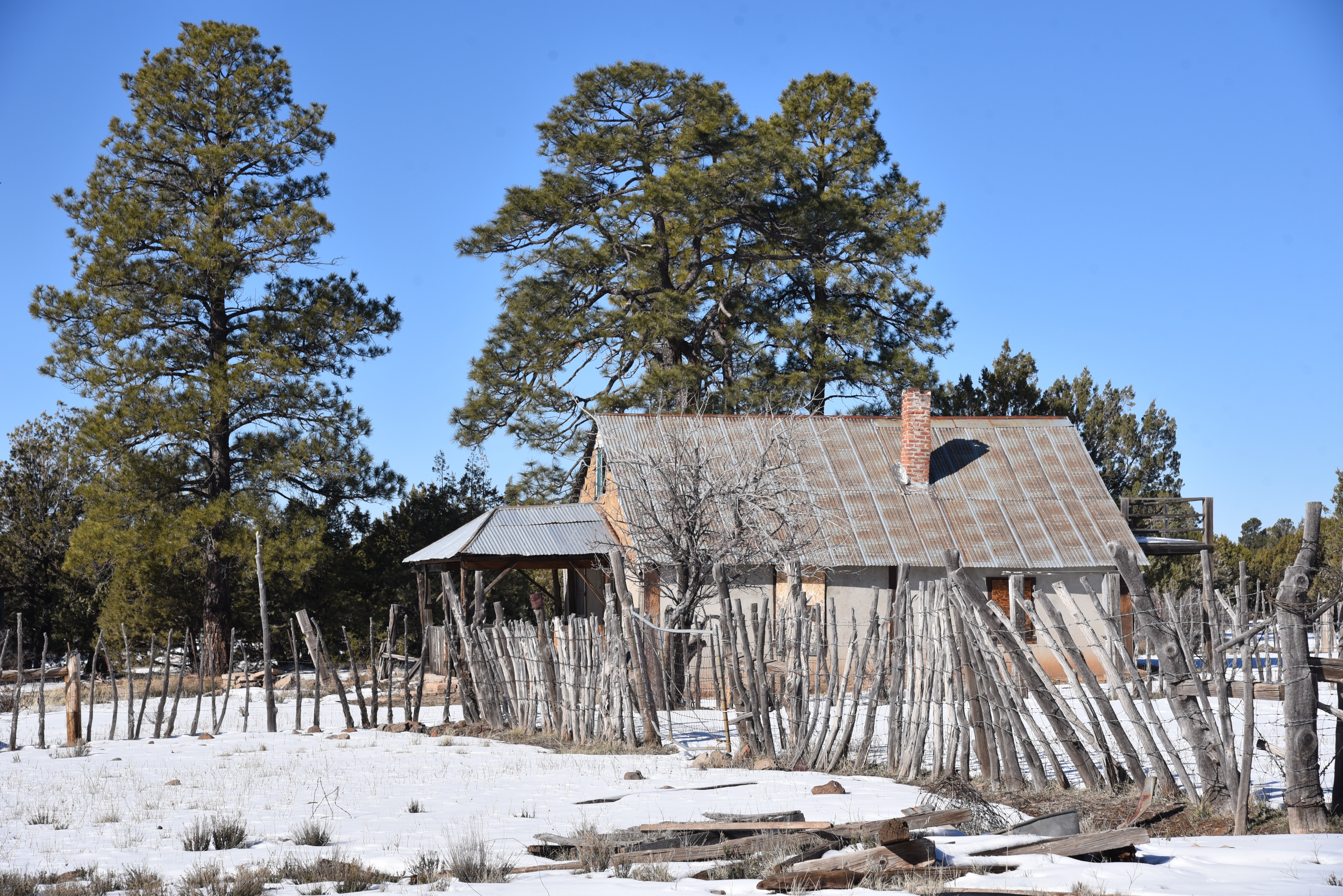
V Lazy Y Cabin in Coconino National Forest

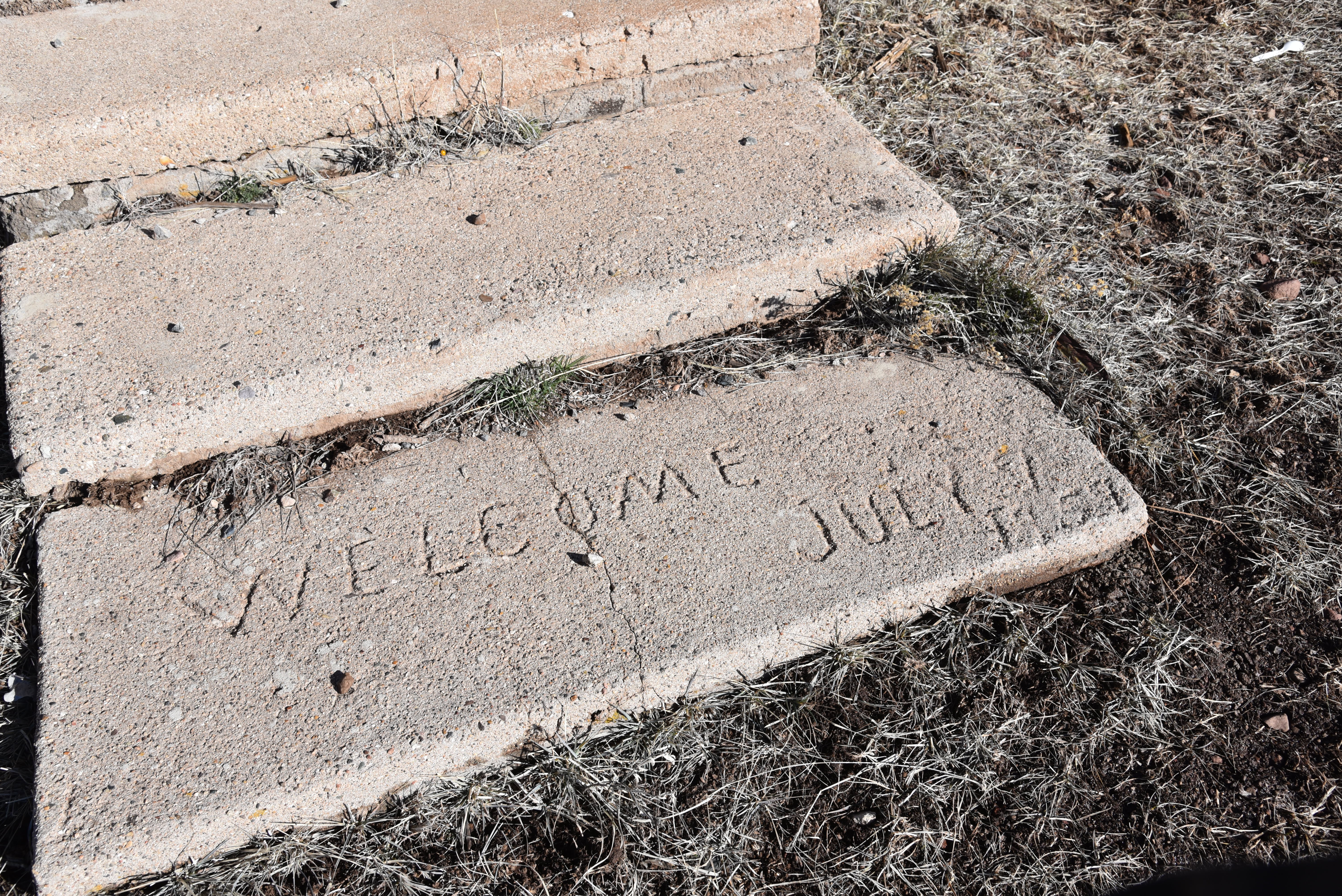
Welcome. July 1959.  The words etched into a concrete step at V Lazy Y Cabin place the now dilapidated homestead in Coconino National Forest squarely in an era of souped-up Chevys, sock hops and television as the big new thing.

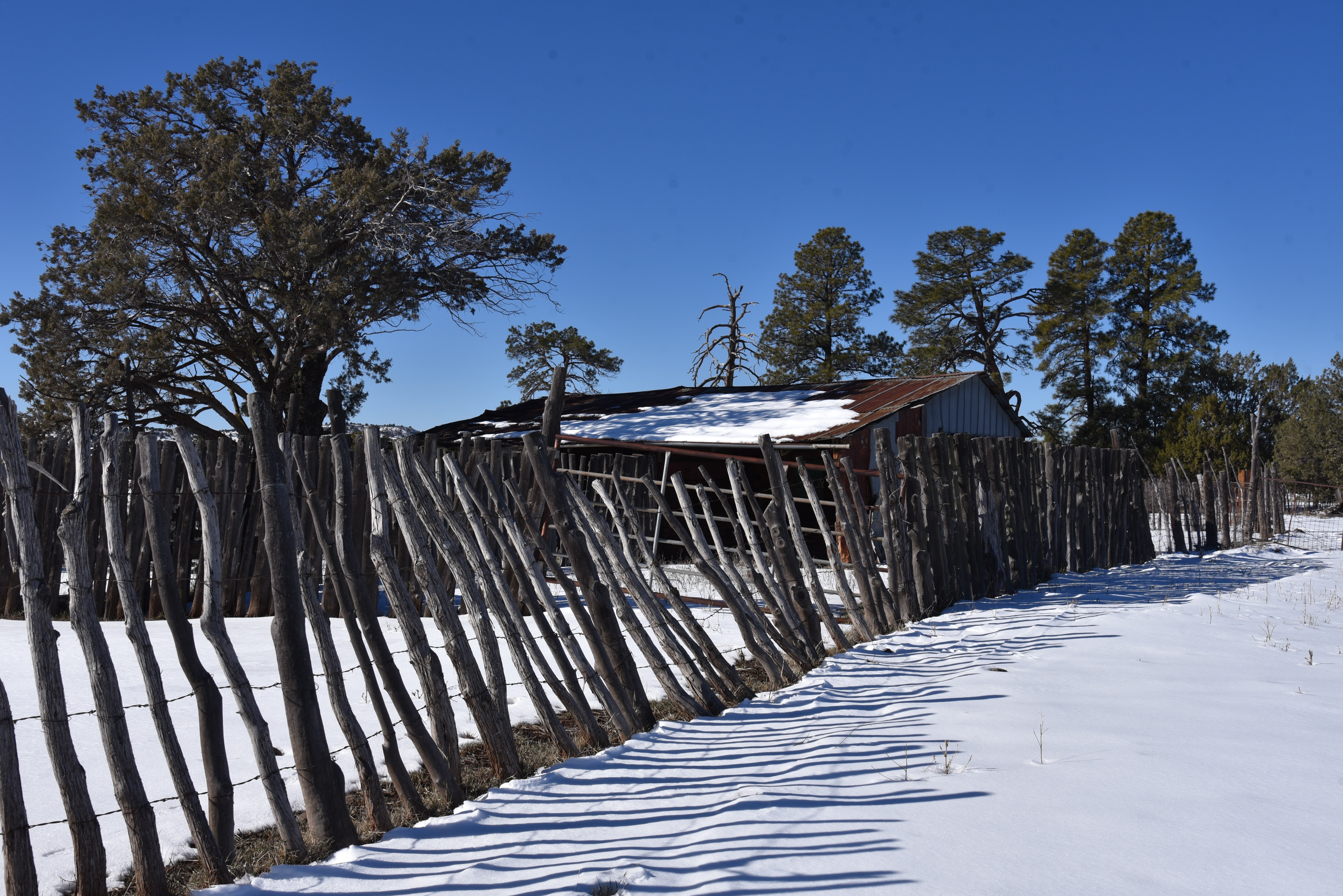
Rustic fence along FR 142G

The structure, which is the centerpiece of a rickety ranch spread with barn, well, corrals and an outhouse, remain standing by the courtesy of decades of patch jobs, its corrugated metal roof sagging over boarded up windows and asphalt shingles slapped on in willy-nilly style.
Icy pool in a draw along FR 142G

What looks like a fruit tree, near the end of its lifecycle, grows by the front porch.
Coyote tracks in snow on FR 142G. Jan. 28, 2023

Shaded by a stand of tall Ponderosa pines, the site is located 1.5 miles north of State Route 260, 23 miles east of Camp Verde. Forest Road 142G, one of several rough dirt roads that wander among the juniper-studded terrain, runs by the cabin complex and can be used for an easy, scenic hike.

Stick-and-wire fence surrounds the cabin site

Barn at the V Lazy Y Cabin site

The cabin is situated in open rangeland between West Clear Creek Wilderness and Fossil Springs Wilderness. 

Decades of repair work visible on V Lazy Y Cabin

Compared to the jaw-dropping scenery of the water-carved wilderness areas that buffer its north and south edges, the grassy pastures, shallow draws and low hills around the cabin site embody a stark beauty, the kind that needs time to bloom in the brain—the kind that only blossoms with a long walk and immersion into the quiet mysteries of the remains of a Mid-Century home on the range.
A message from the past at V Lazy Y Cabin

The trek into the past begins where the unsigned forest road crosses a cattle guard. The road  passes by the junction with the General Crook Trail before heading north through scrubland with hazy mountain vistas peeking out over the horizons. A stick-and-barbed-wire fence line runs the length of the road, meeting up with a major corral complex about a mile in. 

FR 142G crosses General Crook Trail

Cabin site viewed from FR 142G

Beyond the corrals, the ranch appears on the west side of the twisted two-track.  It’s easy to envision the weather-ravaged structures in their prime as purpose-built: unfussy and utilitarian. 
Corral near V Lazy Y Cabin

Snow in Coconino National Forest. Jan. 28, 2023.

Bales of wire, rusted gates and a smattering of broken furniture lie about in disuse.  What can sound sort of like rustling livestock is only wind pushing through open doors and cracks in walls.
Well pump and water tank at V Lazy Y Cabin.

Around the back, a large, rusted water tank and well pump speak to the self-sufficiently required of a place like this one.  Less than two miles from the highway, yet more than a half-century removed from the present, the cabin stands as a reminder of simpler times, livestock roundups and a working life in the outdoors.
The trailhead on FR 142G

LENGTH: 3 miles round trip

RATING: easy

ELEVATION: 5,870 – 5,960 feet

GETTING THERE:

From Interstate 17 in Camp Verde, take the State Route 260 exit 287 and continue 23 miles east (toward Payson) to Forest Road 142 G on the left between mileposts 241 and 242. Forest Road 142 G is not signed, but there’s a stop sign and a cattle guard a few yards up the road. Park in the dirt turnouts along the road.


Tuesday, January 24, 2023

Rawhide Wash

RAWHIDE WASH

Hiking in Rawhide Wash is tougher than it looks

The sandy gap between the Axle Grease and Hawknest trails attracts a lot of horses.  The north-south running ribbon of soft stuff in Scottsdale’s McDowell Sonoran Preserve is a perfect substrate for hoofed travelers. But, for bikers and hikers, not so much.

View of Cave Creek Mountains from Rawhide Wash

That is, unless the goal is to get the outdoor equivalent of a stair stepper gym workout. Even though the 4.2-mile route is mostly flat, wide, and easy to follow, its shifting grains put extra pressure on leg and foot muscles, including some that ordinarily don’t protest. 
The first mile of Rawhide Wash is on standard dirt trail

The drag of the sand slows the pace, which in this case is a good thing because there’s plenty to see along the ephemeral desert spillway.  Beginning at the Pima-Dynamite trailhead, the first mile is a normal dirt singletrack that swings among some spectacular saguaro specimens. The work begins where the trail touches a walk-in gate on Pima Road before bending east following the natural corridor of velvety grit.
Avoid desert washes during and after rain storms

The impact of sand versus compact dirt is felt right away. The rhythm of wash walking is one of shallow sinking, pulling, and wobbling that, unlike hiking regular trails, demands more attention to what's underfoot.  Flood debris, hidden stones and uprooted trees and shrubs are common encounters that douse the trail with a wild flavor.
Rawhide Wash seen from Basalt Ridge Overlook


The ragged edges are also reminders of the power of running water.
Buckwheat blooms February through June

That’s why it’s smart to avoid desert washes like this one during and immediately following rainstorms.  Lined with Palo Verde, mesquite, hackberry trees, and wolfberry shrubs the wash meanders in a northeast arch on the Preserve’s far north west edge. 
Desert Wishbone blooms March through October

Springtime brings a plethora of colorful wildflowers that thrive in the loose, disrupted soils.  Ubiquitous Mexican poppies, desert lavender, brittlebush, desert marigolds, buckwheat, and globemallows are easy to spot while the tiny blooms of Red Maids, Desert Rock Pea and Desert Wishbone are rarer sightings.

Wolfberry shrubs bear orange fruits in late spring

The wash trail ends at Browns Ranch Road below the Basalt Ridge Overlook where hikers may consult preserve maps to either backtrack or return via one of several intersecting trails that dial down the quad-burning demands on tired legs.

LENGTH: 4.2 miles one way

RATING: easy-moderate

ELEVATION: 2,310- 2,613 feet

GETTING THERE:

Pima-Dynamite Trailhead

28777 N Pima Rd. Scottsdale

INFO:

Scottsdale’s McDowell Sonoran Preserve

https://www.scottsdaleaz.gov/preserve

Thursday, January 12, 2023

Cholla Loop

CHOLLA LOOP

View from near the summit of Cholla Loop


No stranger to hikers in search of a summit, the Arrowhead Point Trail in Glendale’s Thunderbird Conservation Park gets plenty of love.

An edge-hugging section of Cholla Loop

The 1.5-mile route crushes its way up to a familiar mountaintop cairn and American flag by way of compressed switchbacks.
Brittlebush bloom profusely in the park

It’s a great way to get a quick workout and enjoy the company of other hikers. But for those who prefer a longer, slightly less strenuous, and crowded alternative--there’s a flip side. 
A gentle descent on the trail's western leg

The Cholla Loop is located across 55th Avenue which bisects the 1,185-acre park in the Hedgpeth Hills.  One of 8 paths that make up the park’s 15-mile non-motorized trail system Cholla Loop may be accessed two ways from the Pinnacle Peak Road  trailhead. 
New River Mesa on the horizon

For direct access and to get most of the steep climbing done early in the hike, walk a few yards west from the parking area, cross 55th Ave and follow the trail signs. After a short warmup section, the trail takes on the hill in zig-zag format, climbing steadily among volcanic boulder fields, rockslides, and acres of blooming brittlebush.
Scorpionweed is a bright early bloomer

Several level spots on the way up  afford excellent views of the north Valley, surrounding suburbs, distant mountain ranges and parade of hikers scaling Arrowhead Point. The saguaro-ringed high point is attained about a mile in. 
Use Coach Whip trail to tie up the loop

Here, vistas extend to include the skyline of Downtown Phoenix and the long profile of New River Mesa. 
View of Arrowhead Point from Cholla Loop

Shaded only by an occasional Palo Verde tree, the trail departs the highpoint on a series of edge-hugging, but less severe switchbacks, swinging along the hill’s northeast face in an in an undulating style that adds to the hike's over 700 feet of accumulated elevation change.
Thunderbird Park is an island of natural space.

A quick slingshot turn takes the trail over to the west face for its final descent where it meets a pedestrian bridge where hikers can pick up the Coach Whip Trail for return leg of the trip.
Looking west from Cholla Loop

LENGTH: 3.9 miles

RATING:  moderate - difficult

ELEVATION: 1,353 – 1,812 feet (771 feet of accumulated elevation change)

GETTING THERE:

Pinnacle Peak Road trailhead:

From Interstate 17 in Phoenix, take the Pinnacle Peak Road exit 217 and follow Pinnacle Peak Road 3.7 miles west to the park entrance on the left just before the traffic light at 55th Ave.

FACILITIES: picnic ramadas, wildlife observation areas

HOURS: sunrise to sunset daily

INFO & MAP:

City of Glendale

https://www.glendaleaz.com/live/amenities/parks_facilities_trails/regional_parks/thunderbird_conservation_park