Find A Trail. Start Your Search Here:

Wednesday, March 2, 2022

Latigo-Sidewinder Loop

LATIGO-SIDEWINDER LOOP

View from the Sidewinder Overlook


Immersion into the assorted levels of awesomeness of the Sonoran Desert is as easy as stepping off the pavement and into the Scottsdale McDowell Sonoran Preserve.

Creosote shrubs grow among occotillo stems

With over 200 miles of non-motorized trails, the northeast Valley preserve is a major draw for hikers, bikers and equestrians of all levels of expertise. 
Chuparosa plants grow from cracks in granite


With winter visitor season in full swing, it’s smart to have a go-to selection of short and easy treks that showcase the amazing beauty and diversity of our Valley trails.

A crested saguaro is a highlight of the hike

Approachable and enlightening, the Latigo-Sidewinder loop offers a quick trip that’s packed with botanical, geological and scenic wonders. 
Tiny desert rock peas thrive in sunny spots

It’s the perfect hike to do with those who may not be regular trekkers or acclimated to desert conditions. 
Scientists aren't sure how crested saguaros form

Kid’s love it, too.
The route passes through a boulder corridor

The tour begins at the new Pima-Dynamite trailhead where restrooms, shaded seating areas and interpretive signs add welcoming amenities as well as a sense of anticipation.

Stop and smell the lavender on the Latigo trail

An easy half-mile walk on the wide, sandy Latigo trail enters the preserve’s far west edge, passing under powerlines that curiously mimic look the long, slender stalks of native ocotillo cactus.

A phainopepla bird feeds on mistletoe

Along this introductory leg, a veritable botanical garden of blooming native plants vie for attention.  Look for sulfur-yellow desert marigolds and brittlebush, red chuparosa shrubs, fairy dusters,  delicately fragrant desert lavender and the golden desert rock pea. Fruit bearing thornbush, wolfberry and invasive mistletoe attract birds like cactus wrens, phainopeplas, mockingbirds and doves while rabbits, squirrels and lizards surrey among jojoba bushes and many species of cholla cacti. 
Fairy duster shrubs are common on the hike

At the Sidewinder trail junction, head right and follow the signs to the main botanical event—a magnificent crested saguaro.  A sign near the rare specimen presents theories on how the contorted fan-like crests of these desert curiosities might form. 
Desert hyacinth "blue dicks" have edible roots

Desert marigolds add spots of gold to the hike


Just beyond the  crested saguaro, the trail enters a boulder-lined corridor with an optional short detour to the Sidewinder Overlook where Valley mountain ranges my be viewed from a platform of granite shelves.  Newcomers are often stunned by the variety and profusion of desert plant and animal life and the juxtaposition of a low, arid environment with a ring of mountain peaks that might be snow-capped in winter.  

Doves are easy to spot along the trails

A Northern mockingbird sings from atop a saguaro

From the overlook, follow the signs back to the Latigo trail and swing back to the trailhead for a satisfying 2.7-mile loop.

This swift dive into a family-friendly corner of Scottdale McDowell Sonoran Preserve is one to keep in mind for entertaining visitors or just wallowing in local flora and fauna without a lot of fuss.    

LENGTH: 2.7-mile loop

RATING:  easy-moderate

ELEVATION: 2,339 – 2,450 feet

GETTING THERE:

Pima-Dynamite Trailhead:

28777 N. Pima Road, Scottsdale

There are two access roads near the corner of Pima ad Dynamite Roads and the other is on Pima just north of the traffic signal and one a few yards east on Dynamite. There are restrooms at the trailhead.

HOURS: sunrise to sunset daily

INFO:

Scottsdale McDowell Sonoran Preserve

https://www.scottsdaleaz.gov/preserve


Tuesday, March 1, 2022

Dynamite Trail

DYNAMITE TRAIL

Dynamite Trail passes through a leafy desert wash

San Tan Mountain Regional Park in Queen Creek is a 10,198-acre mountain-bound property that anchors the far southeast reach of the 10 Maricopa County Regional Parks that circle the Valley.  The park’s 9 non-motorized trails plus a short interpretive loop, provide options for trail users of every level of experience. 

Big valley views on the Dynamite Trail saddle

Situated in a hilly expanse bolstered by Goldmine Mountain in the north and the Malpais Hills in the south, the park’s 20+ miles of trails wander among lush desert vegetation, scoured washes and scenic high points with excellent valley vistas. One moderate route to try uses parts of the Littleleaf, Goldmine and San Tan trails to connect with the park’s northwest classic—the Dynamite trail.

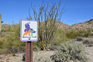
The route is part of the 315-mile Maricopa Trail

Fragrant creosote shrubs cluster around the trails

Ocotillos frame mountain views on the Dynamite Trail

All three trails are also part of the 315-mile, Valley circumnavigating Maricopa Trail.
Mountain vistas begin on the Littleleaf Trail

The 2.5-mile path may be accessed by way of connecting routes from either the main park trailhead or the Goldmine trailhead located at the park’s northwest end.  With extra amenities like real restrooms and a visitor center, the main park trailhead is a good place to start.
Mountains close in on the Dynamite Trail

Begin with an easy  0.7-mile walk on the Littleleaf trail. While it gains only 85 feet in elevation, it’s enough to serve up appetizer vistas of distant Tonto National Forest and Mazatzal Wilderness mountain peaks.  This warmup segment is followed by a 0.4-mile hike on the Goldmine trail which undulates through drainages and cholla forests before arriving at the junction with the San Tan Trail where Goldmine begins its strenuous uphill haul.  For this trip, head left on the San Tan trail and continue 0.4-mile to link up with the destination route—the Dynamite trail.  It’s along this segment where the mountainous nature of the park becomes headily apparent.  The Malpais Hills jut abruptly on the near horizon while the green valleys of the Gila River Indian Community peek out to the southwest.

Goldmine Mountain seen from the Littleleaf Trail

The Dynamite trail starts out by tracing the western foothills of Goldmine Mountain ducking through ironwood-cluttered washes, acres of creosote shrubs and many impressive stands of saguaros and cholla cacti.
Junctions are well signed in the park

At 2.4 miles from the trailhead, the route takes on a series of switchbacks that ease the climb to a mountain saddle.  On the breezy divide, a fresh set of views open up over sprawling east Valley suburbs that stretch into the Superstition Mountains and, on clear days, all the way to the New River Mountains to the far north. 
Dynamite Trail descends from the high saddle

Viewing benches placed at scenic overlooks throughout the route, including on the saddle, invite trail users to sit awhile and soak up the beauty.  From the saddle, the trail spirals downhill over long, lazy curves, passing by historic grave sites before reconnecting with the Goldmine trail near the Goldmine trailhead on Wagon Wheel Road.
The route crosses several sandy washes

Switchbacks ease the climb to the Dynamite saddle

Unless you parked a car-shuttle vehicle there, return the way you came. Or, for a more difficult return route, loop it up with the 2.5-mile Goldmine trail for a challenging climb to the park’s highest point and even more outstanding viewing opportunities.

LENGTH: 4.1 miles one-way or 8.2 miles round trip, as described here.

Use the Goldmine trailhead for a car shuttle hike

RATING: moderate

ELEVATION: 1,617 – 1,894 feet

GETTING THERE:

South: San Tan Mountain Regional Park main trailhead:

6533 W. Phillips Road, Queen Creek.

From U.S. 60 in Mesa, take the Ellsworth Road exit 191. Go south on Ellsworth to Hunt Highway and continue east to Thompson Road. Go south on Thompson Road to Phillips Road and follow the signs to the main park entrance. The park has restrooms, water, a visitor center, equestrian staging area and picnic tables.

North: Goldmine trailhead:

From Hunt Highway north of the main park entrance, go 1.2 miles west on Empire Blvd. to Wagon Wheel Road, turn south and follow the road 1.0 mile to the Goldmine trailhead.

If no attendant is on duty, pay the entry fee in cash to the “iron ranger” (metal kiosk with payment envelopes). Follow the Goldmine trail 0.2-mile to connect with the Dynamite trail.

There are portable restrooms at the trailhead but no other amenities.

FEE: $7 daily fee per vehicle or $2 per person walk-in/bike-in fee.

HOURS: the park is open for day use only from 6 a.m. to 8 p.m.

INFO & MAPS:

San Tan Mountain Regional Park

https://www.maricopacountyparks.net/park-locator/san-tan-mountain-regional-park/


Monday, February 14, 2022

Black Canyon Trail Races Toward the Verde River

CROOK TRAIL No. 64 to BLACK CANYON TRAIL

Red flags mark a fresh cut segment of the BCT south of SR 169

Steeped in scenic beauty, geological diversity and human history, the Black Canyon National Recreation Trail continues to evolve and grow. 

BCT climbs a rocky hill near Ash Creek

The core of the historic 80-mile route which runs from the Carefree Highway north of Phoenix to State Route 69 outside of Prescott, has been expanding northward into the Prescott National Forest. 
BCT is extending into Prescott National Forest

The latest effort involves adding 37 miles of non-motorized trail between the Russian Well segment located near the town of Mayer along Orme School Road to the Verde River at Camp Verde. The new stretch of trail incorporates parts of the General Crook National Recreation Trail, old stock driveways, and sustainable social trails with segments of new construction. It will pass under State Route 260 by way of existing culverts near the Hayfield Draw OHV trailhead.
Cacti cling to rock outcrops on BCT

A rocky ledge overlooking Ash Creek

One fresh-cut section to explore uses the General Crook Trail No. 64 to connect with part of the new trail segment south of State Route 169.

New extension of the BCT will end at the Verde River near Camp Verde

From a roomy trailhead along S. Cherry Creek Road, the hike begins across from the parking area where Trail No. 64 heads east through scrubby rangeland backed by distant mountain vistas.

Switchbacks ease the climbs on BCT

The first few yards of the trail pass through a wash and drainages. The sketchy path soon becomes clear where cairns mark the way.  The undulating historic wagon road glides through largely shade less territory replete with cat claw, yucca and cacti.

A pastoral scene on the BCT


Disrupted by washes and isolated rock outcroppings, the stark expanse was once the realm of sheep flocking from winter grazing lands around Bloody Basin to their summer pastures near Flagstaff and on the Mogollon Rim.  While sheep still pass through this backcountry, hikers these days are more likely to encounter domestic cattle, coyotes and javelina. 
Cairns mark the way on Trail No. 64

At the 1.2-mile point, the route meets the Black Canyon Trail. 

BCT passes through historic livestock driveways

Trailhead on S. Cherry Creek Road

As of this writing, trail signs are not yet installed, and construction is still active in the area.  Trail users should not disturb trail flags, build cairns, or get in the way of workers who may be present. From the junction, head south (go right) and follow the newly forged single track as it bends westward through grasslands and juniper forests. 
Cottonwoods in Ash Creek seen from BCT

Hike begins on Trail No.64 across from the parking lot

The trail swings through and around scoured drainages and sandy washes before it meets a gate at Cherry Creek Road at the 3.3-mile point.  A loopy combination of rough-hewn wood, barbed wire and green-painted metal, the gate has a bike rollover and easy-open access for foot traffic. Be sure to close the gate behind you.  The trail then begins a smooth descent to the cottonwood-lined course of Ash Creek. 
The scrubby course of Crook Trail No. 64

Just ahead, the trail cut is visible ascending a rocky mound.  While it look steep, series of long switchbacks mitigate the effort of climbing the hill’s grassy flanks.  As the close-cropped trail ascends among amazing rock formations and cliff-hanging cacti, bigger and better views unfold in huge panoramic style. At just over 3.5 miles, the trail encounters a scenic overlook above the creek.
Close all gates behind you when hiking the BCT

 
Surrounded by lichen-encrusted outcroppings with scrub oaks clinging to cracks in the eroding stone, the breezy high point offers a fresh look at a pristine landscape just a few miles west of Interstate 17 and a perfect spot to take a break before heading back to the trailhead.  
The point where Trail No.64 meets the BCT

Open range land dominates the hike

LENGTH: 7.3 miles round trip as described here

RATING: moderate

ELEVATION: 4,219 – 4,435 feet

GETTING THERE:

From interstate 17 about 8 miles south of Camp Verde, take the Dewey-Humboldt exit 278 for State Route 169. Turn left onto SR169 and continue 5.5 miles to the Cherry Creek Road intersection past milepost 10. Turn LEFT onto the dirt S. Old Cherry Creek Road/County Road 168 (not signed and shown on some maps as Hackberry Wash Road) and continue

0.4-mile to the trailhead on the right.  Hike begins across the road at the “64” trail post.  Roads are paved up to Old Cherry Creek Road which is good dirt suitable for all vehicles.

INFO:

Prescott National Forest

www.fs.usda.gov/recarea/prescott/recreation/recarea/?recid=67417&actid=24

Wednesday, February 2, 2022

Legends of Superior Trail: Queen Creek Canyon

LOST: QUEEN CREEK CANYON SEGMENT

Boulders line the upper part of the Queen Creek Canyon hike

Imagine the trip from Phoenix to the Copper Corridor towns of Globe-Miami taking all day. That was the reality back in the early 20th century before U.S. 60 replaced the old Apache Trail route. While the annual Renaissance Festival traffic might still make the trip feel like a lurching marathon, the highway shaved the 88-mile drive time down to about an hour and a half.

Inside the defunct Claypool Tunnel

The highway’s original, “million-dollar-a-mile” sinuous alignment opened in 1922.  

Ruins of mining equipment visible on the hike

Convicts were used to build parts of the route, including the Claypool Tunnel near the town of Superior, which was blasted from solid rock in the rugged cliffs above Queen Creek Canyon.
Hike follows the 1920s alignment of U.S. 60

 
The current U.S. 60 bridge spans Queen Creek

While known for its fabulous views, the narrow, edge-hugging road with hairpin turns and queasy drop-offs proved just too dangerous for modern travel needs.  So, the route was retooled in 1952 to its safer, current alignment which includes the slick (yet claustrophobic) Queen Creek Tunnel. 
The rough-blasted interior of the Claypool Tunnel

A 1920s-era bridge crosses Queen Creek

But the decommissioned U.S. 60 didn’t just disappear. Its crumbling course, which is now on Resolution Copper property, has been repurposed into a recreational trail that’s part of the Legends of Superior Trails (LOST) system.
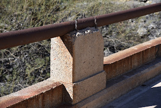
Early 20th century masonry work

Picketpost Mountain and the Superior water tank

 
Located roughly 65 miles east of Phoenix, the 11.65-mile  LOST system is divided into 5 segments open to hiking, biking and equestrian use.
Sycamores grow in the riparian zone around Queen Creek

Each segment explores a unique slice of Superior’s history and environmental diversity. There’s the stunning riparian corridor of Arnett Canyon with connectivity to the Arizona National Scenic Trail, a walk through the abandoned town of Pinal and an interpretive in-town stroll among artifacts from the area’s rich mining and ranching heritage.  But it’s the Queen Creek Canyon segment that gives a boots-on-the-ground tour of the defunct highway.
Close up of the 1952 Queen Creek Bridge


The 4.2-mile out-and-back hike begins on the outskirts of the historic downtown business district.  Following the disintegrating substrate of pavement and gravel, the old highway traces the bed of Queen Creek where bits of old mining equipment and barred-off prospects teeter over the usually dry waterway. 

The Claypool Tunnel was blasted from solid rock

Throughout the hike, a palpable push-pull of old and new defines the mood, beginning with the crossing of a 1920s-era concrete bridge that stands below the gargantuan span of its metal-riveted replacement bolted into vertical cliffs soaring above the sycamore-lined creek. Among eroding culverts, barriers and drainage systems, interpretive signs augment the trek with information on local wildlife, geology and history.  About halfway through the hike, the road swings around a water tank and begins a winding ascent through a geologically complex zone of quartzite, limestone and volcanic tuff--an amazing display 540 million years in the making.
Mineral-rich geology in Queen Creek Canyon

Interpretive signs augment the hike

On its way uphill, the trail unpacks views of 4,377-foot Picketpost Mountain and the remote, chiseled landscape of Alamo Canyon and Tonto National Forest to the southwest.

Abandoned mines are dangerous. Stay on the trail.

The crumbling foundation of old U.S. 60

The trail tops out at the old Claypool Tunnel.  It’s a short, sort of creepy, walk through the rough-blasted stone tube that lands hikers just yards beyond its replacement on the new U.S. 60.  For average-paced visitors arriving from Phoenix, the hike takes about as long as the drive to the trailhead, Fair traffic notwithstanding.

LENGTH: 4.2 miles roundtrip

RATING: moderate

ELEVATION: 2,807 – 3,485 feet

GETTING THERE:

Magma Avenue Trailhead:

From U.S. 60 in Superior, take the Kearny/Winkelman exit 227 for State Route 177. At the top of the offramp, go left and merge onto Magma Ave. (toward the business district) and continue 0.2-mile to the intersection of Magma Ave. and Heiner Dr. where there’s a dirt parking area. Hike begins at the gate at the north end of the lot.

INFO:

Legends of Superior Trails

https://superioraztrails.com/