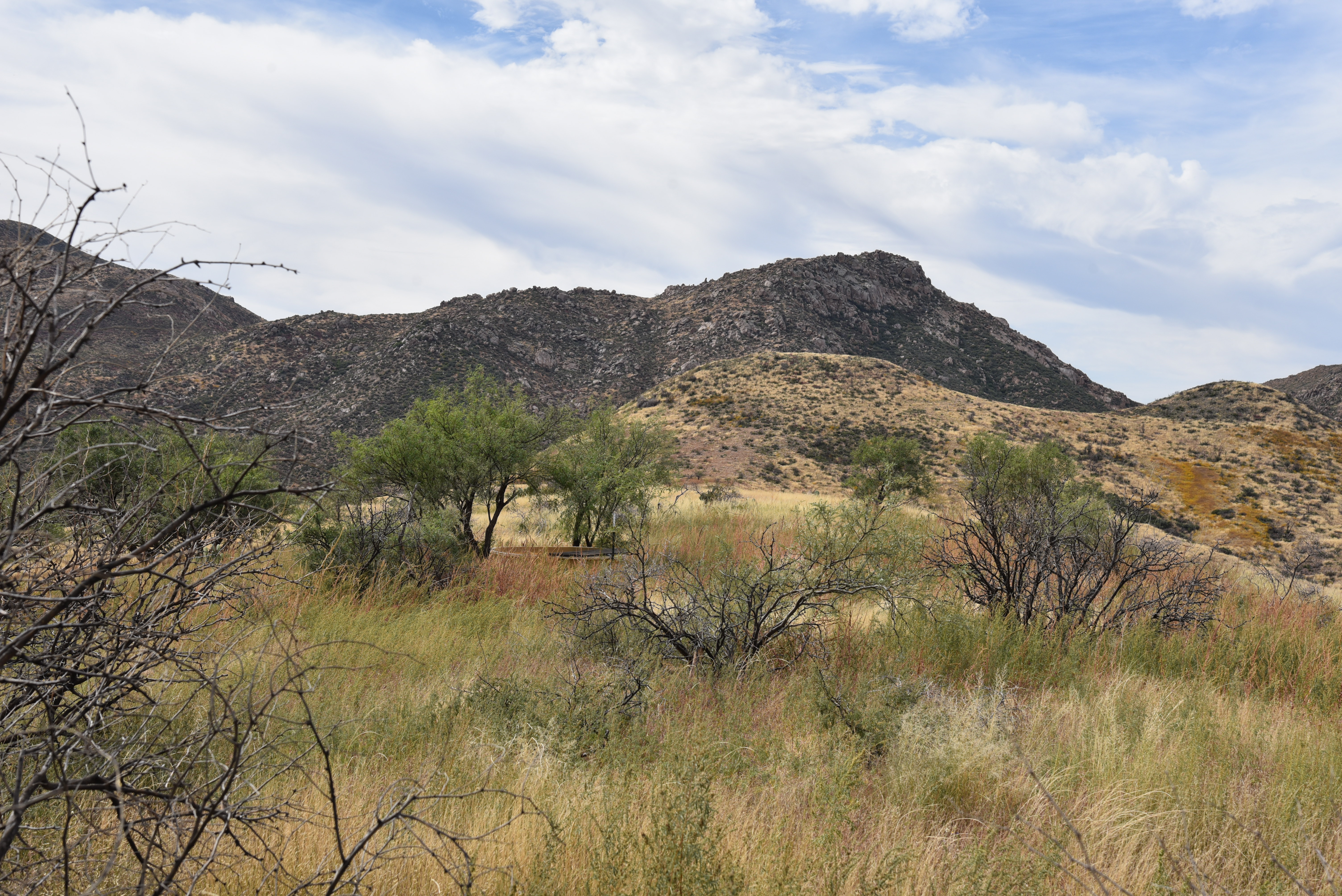
Find A Trail. Start Your Search Here:

Monday, November 22, 2021

Pass Mountain Trail

PASS MOUNTAIN TRAIL

Goldfield Mtns & Four Peaks seen from Pass Mtn

In terms of sensory overload, the Pass Mountain Trail works sort of like an old-style 5-disk CD changer to deliver a cycle of ever-changing delights that once engaged, just keeps on spinning.

Approaching the east flanks of Pass Mountain

The 7.5-mile route that loops through both Usery Mountain Regional Park in Mesa and the urban-wildland interface of Tonto National Forest, packs in the hiking equivalents of mellow slow dance vibes, sultry tangos and pounding hip-hop rhythms. 

Mountain and valley vistas abound on Pass Mtn

An edgy section of the Pass Mtn Trail

Accessible by way of convenient trailheads in the park, the rocky single track blends low desert strolls, a carousel of vistas and just enough raw mountain exposure to serve up one of the most diverse, close-to-town hikes in the Metro Phoenix area.
A close-to-town hike with wilderness vistas
  Park rangers recommend taking on the loop from either the Wind Cave or Horse Staging trailhead in a clockwise rotation (begin by going left) for a longer but milder ascent to the hike’s scenic saddle.  For those who just want to get to the high point vista and then double back, that’s the ticket, however full-loop hikers should consider a counterclockwise (go right) approach.
Tangles of Sonoran Desert vegetation on Pass Mtn

It’s harder that way, but it gets the difficult climbing over quicker and eliminates the chore of negotiating a steep, slippery down climb on tired legs.

Pass Mtn viewed from the park side of the trail

  Heading right from the Wind Cave trailhead, the trail almost immediately exits the park boundary and enters Tonto National Forest. 
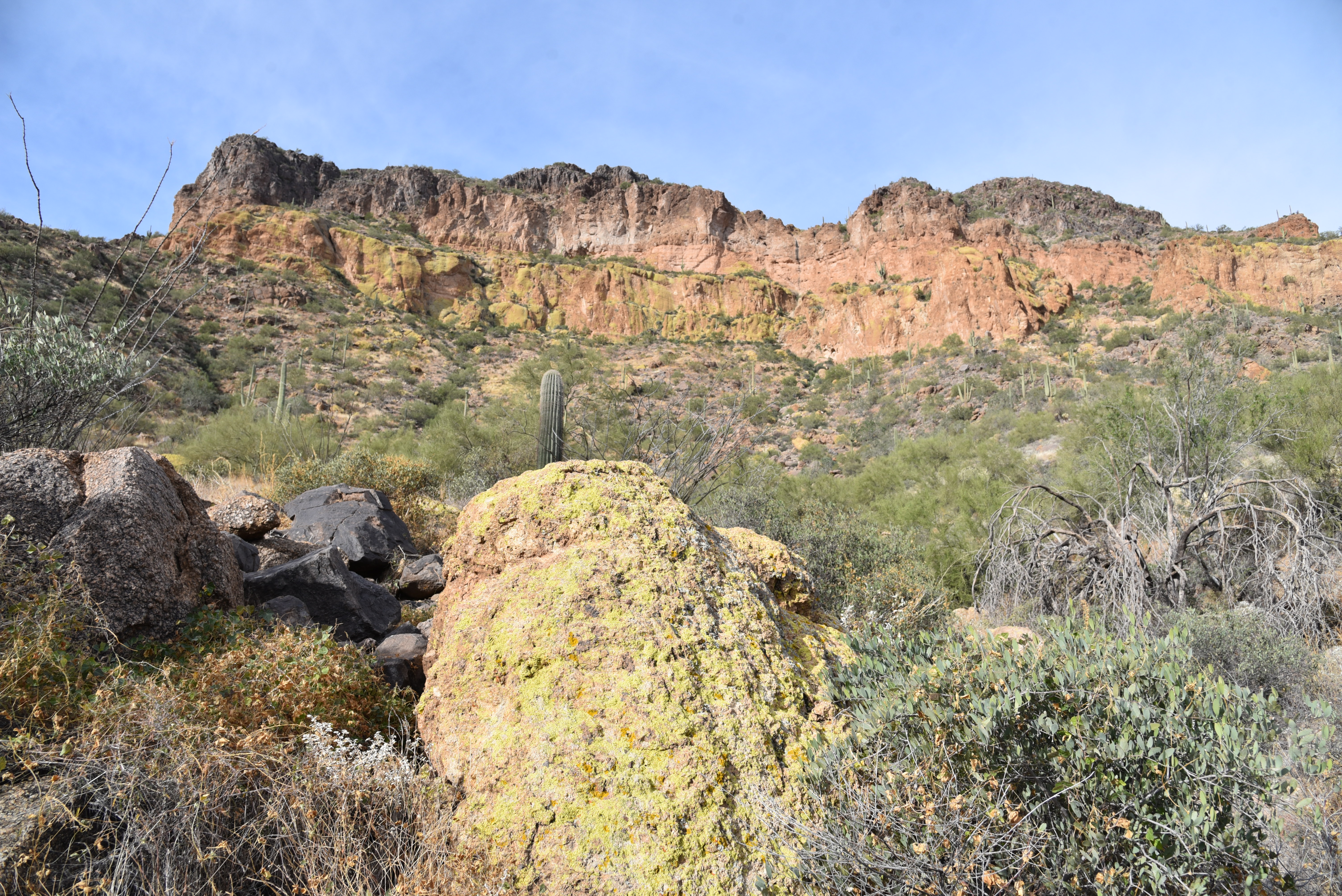
Lichens color the cliffs of Pass Mountain

The first relatively flat half-mile runs through classic desert vegetation and ruffled washes in the shadow of the pyramid-shaped Cat Peaks.  
A slickrock passage leads to a scenic saddle

Over the next mile-and-a-half, views of the Superstition Mountains rising above the town of Apache Junction command the eastern horizon as the trail makes a northward bend and a barely noticeable ascent toward on the mountain’s east face. 
Approaching the U-shaped saddle on Pass Mtn

Residual glimpses of rooftops and roads are soon swallowed up in the folds and drainage cuts of the mountain’s wild side. 
Stunning views from the Pass Mtn saddle


A valley flush with saguaros sits below the destination—a U-shaped pass visible on the north ridgeline.  The climb to get there isn’t too difficult until about a half-mile from the top where the route hangs on precipitous edges and a slickrock ledge for an appetizer of adrenaline before the trail emerges on the prize. 
The trail heads north from the saddle

Bam!  The wind-in-your-face jolt of stepping onto the 2,593-foot saddle is a jaw-dropping experience.  With a single bend in the trail, the vistas make an explosive transition from saguaros and suburbs to layers of mountains and river valleys.
A saguaro-cluttered valley precedes a steep climb

Mesquite and Palo verde trees shade the lower trail

 
In the foreground, the blocky, colorfully-layered Goldfield Mountains rise above a scoured divide.  Behind them, are the iconic Four Peaks and rows of wilderness peaks stand over the Salt River Valley.  
Another view of the saddle approach

View of the saddle on the right ridgeline

Save for some minor drainage crosses and exposure the remainder of the trail is just a moderate trudge that hugs the mountain’s eastern flanks, unspooling views of the Usery Mountains and hazy peeks at the McDowell range near Scottsdale before it swings south and descends to the base of Pass Mountain for the final 2-mile walk back to the trailhead.
Superstition Mountain views


LENGTH: 7.5-mile loop

RATING: difficult

ELEVATION: 1,866 – 2,598 feet

GETTING THERE:

Usery Mountain Regional Park,

3939 N. Usery Pass Rd., Mesa.

From U.S. 60 in Mesa, take the Ellsworth Road exit 191. Go 6.7 miles north on Ellsworth (which will turn into Usery Pass Road) to the Usery Mountain Regional Park entrance on the right.  The tail may be accessed from the Wind Cave and Horse Staging Area trailheads.  There are restrooms at both trailheads.

FEE: There’s a $7 daily fee per vehicle payable at the park entrance. 

INFO: https://www.maricopacountyparks.net/usery-mountain-regional-park-um/


Friday, November 12, 2021

Verde Valley Wheel Fun

Verde Valley Wheel Fun

A student and coach take on "the Dump"

Verde Valley Wheel Fun gets young people off cell phones and onto mountain bikes in Arizona's beautiful Verde Valley.  VIDEO:

Check out one of the program's week-long training camps here:

https://www.youtube.com/watch?v=chnnngWWc8Q

Learn more about the program:

https://wheelfun.org/

Wednesday, November 10, 2021

Take the Trails Survey!

 What does outdoor recreation in Arizona look like in the next five years? 


The answer is up to you! Arizona State Parks and Trails is currently seeking public input for the Statewide Comprehensive Outdoor Recreation Plan (SCORP), and it's so easy to get involved. The SCORP provides a shared vision for all public outdoor recreation in communities across Arizona for the next five years. Learning what Arizona residents want helps identify priorities and distribute grant funding to get projects done and make outdoor recreation in Arizona even better. There are a variety of ways to participate, and varying levels of engagement to fit your busy lifestyle. CLICK HERE to learn more. Plus, you could win some cool outdoor recreation prizes!  

Survey is open through Dec. 31, 2021.

Monday, November 8, 2021

Blowout Canyon Trail

BLOWOUT CANYON TRAIL

Mingus Mountain rises over Blowout Canyon


The new Blowout Wash community trail system in Cottonwood continues to evolve with several miles of new routes added to its menu in the past few months. 

The loopy system that winds through foothills below Mingus Mountain in Prescott National Forest broke ground in 2019.

A new trail climbs to Blowout Butte (L) summit

The first trails opened in 2020 and additional routes rolled out in 2021 with plans in the works for an ambitious trail corridor that will link with the Black Canyon trailhead. 
Cacti frame Verde Valley vistas


Noteworthy among the class of 2021 additions is the Blowout Canyon Trail No. 511 which makes a crawl through the innards of the eponymous gorge by way of a wavy single track cut from the slopes of craggy knobs and buttes. 

Trail passes a crumbling rock wall at the head of Blowout Canyon

The nicely varied 3.2-mile fresh-cut route links up with several other trails in the core of the Blowout Wash system for easy hike customization.  One to try uses the Bullseye Trail No. 557 for a 4-mile loop.  From the trailhead, follow trail No. 557 a short distance and veer right onto trail No. 551 at the first fork.  The first of a relentless sequence of ups-and-downs swings around juniper-studded mounds revealing excellent views of Sedona’s red rock landscape.  Passages through spike-stemmed crucifixion thorn trees and golden grasslands hang over sheer feeder canyons and jumbled drainages fringed with yucca, cactus, and high-desert shrubs.
Near the head of Blowout Canyon

Sparse tree cover allows for unobstructed viewing of a stunning mix of mountain peaks, red rock formations and expansive river corridors and agricultural  plains.  As the route zigzags over and around weather-worn bluffs, glimpses of the San Francisco Peaks in Flagstaff appear as hazy silhouettes out on the horizon.  Roughly 2 miles in, the trail spirals down into the cloistered head of Blowout Canyon following carefully designed switchbacks that mitigate the descent and aid in proper trail drainage and sustainability. 

See-forever vistas dominate the hike

To keep the trail from degrading, never cut across switchbacks.
Near the high point on Blowout Canyon trail

Stay on established paths.  The descent passes by a wall of broken stone where loose rocks spill into a slot canyon rife with low-growing trees that benefit from extra post-storm water that rushes through the sliver-thin ravine. 
Yucca thrive on sunny slopes

Switchbacks make for sustainable trails. Don't cut them!

The trail bottoms out, then

boomerangs up onto a red-rock incline where ocotillos join the mix of a drier micro-climate vegetation. 
A brief, edge-hugging climb tops out on a scenic ridge with the biggest views of the trip.  Hundreds of feet below, glinting roofs in the town of Cottonwood and a grid of vineyards along Oak Creek sit in a yawning valley backed up by mountain views that stretch from Prescott to Flagstaff. 

Mesquite trees frame views of Sedona red rocks

From this point, the trail descends on long hairpin switchbacks to meet up with the Bullseye trail No. 557.  To complete to loop, hang a right and hike just under a mile back to the trailhead. Or go left to add on a few miles and climb up the prominent limestone slopes of Blowout Butte on sister newcomer, trail No. 556.
Blowout Wash trail system continues to grow.


LENGTH: 4-mile loop

RATING: moderate

ELEVATION:  3,790 – 4,280 feet

GETTING THERE: From Interstate 17 north of Camp Verde, take the Cornville Road exit 293 heading west (go left). Continue 17.7 miles on Cornville Road (aka County Road 30) which will turn into Mingus Avenue and then Forest Road 493 to the large Blowout Wash trailhead.  For reference, the trailhead is 1.5 miles south of the Cottonwood Municipal Airport. Roads are paved up to the last half mile where FR 493 is a dirt/gravel track suitable for all vehicles.


Monday, November 1, 2021

Hike Books for the Holidays

REI EVENT: HIKE BOOKS FOR THE HOLIDAYS


Join hike Arizona book authors Sirena Rana and Mare Czinar at the Maricopa Trail + Park Foundation table at REI Paradise Valley on Sunday Nov. 14th.  We’ll be on hand to sign books (available for purchase inside REI) and will have free Maricopa Trail maps for you. 

Mare will also be at the Chandler REI on Saturday Nov. 20th.

Get your holiday shopping done early and learn about the 315-mile Maricopa Trail while you’re at it!

SUPPORT AZ BUSINESSES--BUY LOCAL!

REI PARADISE VALLEY:  12634 N Paradise Village Pkwy, PV

Sunday, November 14, 2021

REI CHANDLER: : 870 N 54th St, Chandler

Saturday November 20, 2021

BOOKS ARE AVAILABLE ONLINE, TOO:
https://cities-west-publishing.square.site/product/HikeBook/295?cs=true&cst=custom

Monday, October 25, 2021

Bushnell Tanks Road

BUSHNELL TANKS ROAD

First crossing of Sycamore Creek is sort of tricky

Sometimes, surprisingly fine escapes can be found just steps from busy byways in right-under-your-nose places.  Bushnell Tanks Road, located off the Beeline Highway roughly halfway between Mesa and Payson is one such find.

Rustic corral site is a highlight of the hike


Much of the road parallels part of the course of the Pine Mountain Passage 21 of the Arizona National Scenic Trail using backroads above and through the corridor of Sycamore Creek and Colcord Canyon.

Sprawling grasslands dominate the high ridges

 
It’s a rugged, undulating road hike in Tonto National Forest that’s packed with creek side sycamores, a rustic corral, stunning desert vegetation and huge mountain vistas. 
Buffalo gourds dangle from a mesquite tree

The moderate hike is also a great who-knew way to view breath-taking late autumn foliage. 
The rocky second crossing of Sycamore Creek

The hike plan is simple, although roads and junctions are not signed, so paying attention to landmarks is key to staying on track. 
A mix of riparian and desert trees shade the hike

From the trailhead, hike down the main gravel road which is Bushnell Tanks Road, Forest Road 22.  At the 0.3-mile point, the road meets the turn off for the Arizona Trail connector. 
Devil's Claw blooms through October

Stay on the main road as it descends to the first of three gorgeous crossings of Sycamore Creek.  The first crossing is a little sketchy. 
Mount Ord stands out over rangelands

The road goes straight across the braided and bent waterway, but getting through requires some creative rock hopping over the flow which varies in depth and speed with the seasons. 
An old corral complex in Ram Valley

The creek crossing is shaded with enormous sycamores and a few cottonwood, willow and alder trees that show off in shades of yellow and russet browns from late October through December. 
Hikers follow an unsigned road in Tonto NF

Once over the water, the road shimmies through a mixed bag of live oak patches and golden pastures bolstered with views of Mazatzal mountain peaks including Mount Ord, Crabtree Butte and Cypress Peak.  The road continues through a continually-changing landscape bright with wildflowers and native food plants.
Hikers approach the third crossing of Sycamore Creek

Lots of ups-and-downs and two more leafy creek hops land hikers at an unsigned road junction on the right at the 2-mile point near a rusty corral complex. 
The hike has lots of ups-and-downs

The corral makes for an interesting exploratory side trip.  Encroached with weeds, tangles of buffalo gourds and bits of frayed ropes, the maze of metal fencing, feed troughs and a newish-looking water tank sit at the core of scenic Ram Valley.  When done investigating the corral, backtrack to the road junction and follow the steep, rutted path up a catclaw-riddled ridge. Long pants, folks.
Hike gives an alternative look at AZ fall foliage

 
Concrete tank marks the hike turnaround point

The unforgiving haul unpacks spectacular views with every foot of elevation gained.  Peaks and buttes circle an environment of sprawling rangeland, deep valleys and tree-lined creek channels. 
Hikers on one of the hike's high ridges

At the top of the first rise, the road begins a relentless series of ascents and descents through open grasslands.  At the 3.9-mile point, on a bald high-point, a concrete stock tank off to the right sits among a ring of mesquite trees and low-growing cacti.  This makes for a good turn around point. 
Sycamore seed pods

For a longer trip, consult the Tonto National Forest map to scope out other routes that wind through the hills and connect with the Arizona Trail.
Extend the hike on AZT or other forest roads

Better yet, check out the Arizona Trail website (aztrail.org) for more ways to experience this beautiful slice of Central Arizona. 

FR22 traces the course of Sycamore Creek

Arizona Trail association members also get special access to maps, data and privy to dozens of loop hike options using the 800+-mile, state-traversing trail.
Desert hackberry shrubs clutter in a wash

LENGTH: 7.9 miles roundtrip

RATING: moderate

ELEVATION: 3,320 – 3,817 feet (1,720 feet of accumulated elevation change)

GETTING THERE:

From Loop 202 in Mesa, take the State Route 87 (Beeline Highway/ Country Club Road) exit 13.  Go 41 miles north on SR 87 to the turn off for Bushnell Tanks near the community of Sunflower.  Park in the gravel lot near an “area closed” sign and a large Arizona Trail kiosk.  The area is open to non-motorized use.

INFO:
https://aztrail.org/explore/passages/passage-21-pine-mountain/