Find A Trail. Start Your Search Here:

Thursday, February 18, 2021

Brown's Mountain

BROWN'S MOUNTAIN

Brown's Mountain seen from the Brown's MtnTrail


The can’t-ignore centerpiece of Scottsdale’s McDowell Sonoran Preserve is a magnet for hikers.  When viewed from the miles of trails that weave around its base, the prominent mound might appear slightly intimidating, but if you’re like most trekkers, sooner or later you’ll climb it.

Switchbacks on the Brown's Mountain Trail

Whether you use a direct approach or long loop to access the preserve’s loftiest perch, the effort rewards with outstanding views and if you’re lucky, a peek at an aerial bird show.

Ravens soar around Brown's Mountain

The distinctive flat-topped mountain with colorfully-layered flanks sits in the preserve’s north sector among acres of yucca, cacti and desert trees.  Hikers aren’t the only ones that are attracted to this place.  Ravens have claimed the craggy cliffs below the mountain’s summit as prime nesting territory.

Ocotillo and cholla on the summit spur trail

The large, croaking and glossy jet-black birds are easy to hear and see against ocher cliffs and blue skies along the hike up the mountain.

A rocky section on the summit spur trail

While common ravens sometimes build nests in trees, they tend to favor jagged rock walls like those on Brown’s Mountain.  February through May is the best time to observe the birds’ dramatic mating rituals that include aerial dances with males and females swooping, diving and roosting to preen before building platform nests in stony cracks. 
Ravens mate for life and share parenting chores.  Females incubate eggs for 3 weeks while males provide care and feeding.  Chicks take flight about five weeks after hatching.

View of Pinncle Peak & Cone Mtn from summit

The most direct route to view the ravens in action and get to the summit begins at the Brown’s Ranch trailhead with an easy 0.6-mile walk on Brown’s Ranch Road.  Take a left onto the Brown’s Mountain Trail, and follow the moderate route as it ascends 0.7-mile along the mountain’s geologically-complex flanks where the ravens play around the rugged stone jetties that protrude from the mountain’s northeast slopes.  Once through a bare-rock chute, the route meets a saddle with a scenic overlook where the summit spur heads up the hill’s east face. 

The rock chute on Brown's Mountain Trail

The 0.2-mile summit spur ascends in tight, steep switchbacks with a short segment of blocky rock scrambling near the top.  All but the shortest hikers can get through this jumble without the need for a handhold.  The small, rocky summit offers unobscured, 360-degree views of the Valley, the preserve layout and distant mountain peaks. 

Hikers on the scenic overlook below Brown's Mtn

Several artifacts including concrete slabs inscribed with names from 1958 and a chopped wood power line pole add elements of history to the isolated peak that stands 550 feet above the desert floor.  From this high platform, the air antics of ravens take center stage. 
The saddle below Brown's Mountain

Sometimes swooping closely overhead or croaking from nearby outcroppings, they serve as loud, convincing reminders to stay on trails and not disturb nesting habitats and fragile terrain. 
Nearing the saddle below Brown's Mountain

View from the summit of Brown's Mountain

While on top, review the preserve map to scope out your return route or simply retrace your steps for a second look at the cliff-side raven drama.

LENGTH:  3 miles round trip to the summit and back

RATING: moderate

ELEVATION:  2,703 – 3,253 feet

GETTING THERE:

Brown's Ranch Trailhead: 30301 N. Alma School Pkwy., Scottsdale.

From Loop 101 in Scottsdale, take the Pima/Princess exit 36. Go 6.5 miles north on Pima to Dynamite, turn right and continue 2.7 miles to Alma School.  Turn left and go 1 mile to the trailhead. There are restrooms, water and maps at the trailhead.  The preserve is open from sunrise to sunset daily. No fees.

INFO:

https://www.scottsdaleaz.gov/preserve


Thursday, February 11, 2021

Poston Butte Preserve

POSTON BUTTE PRESERVE

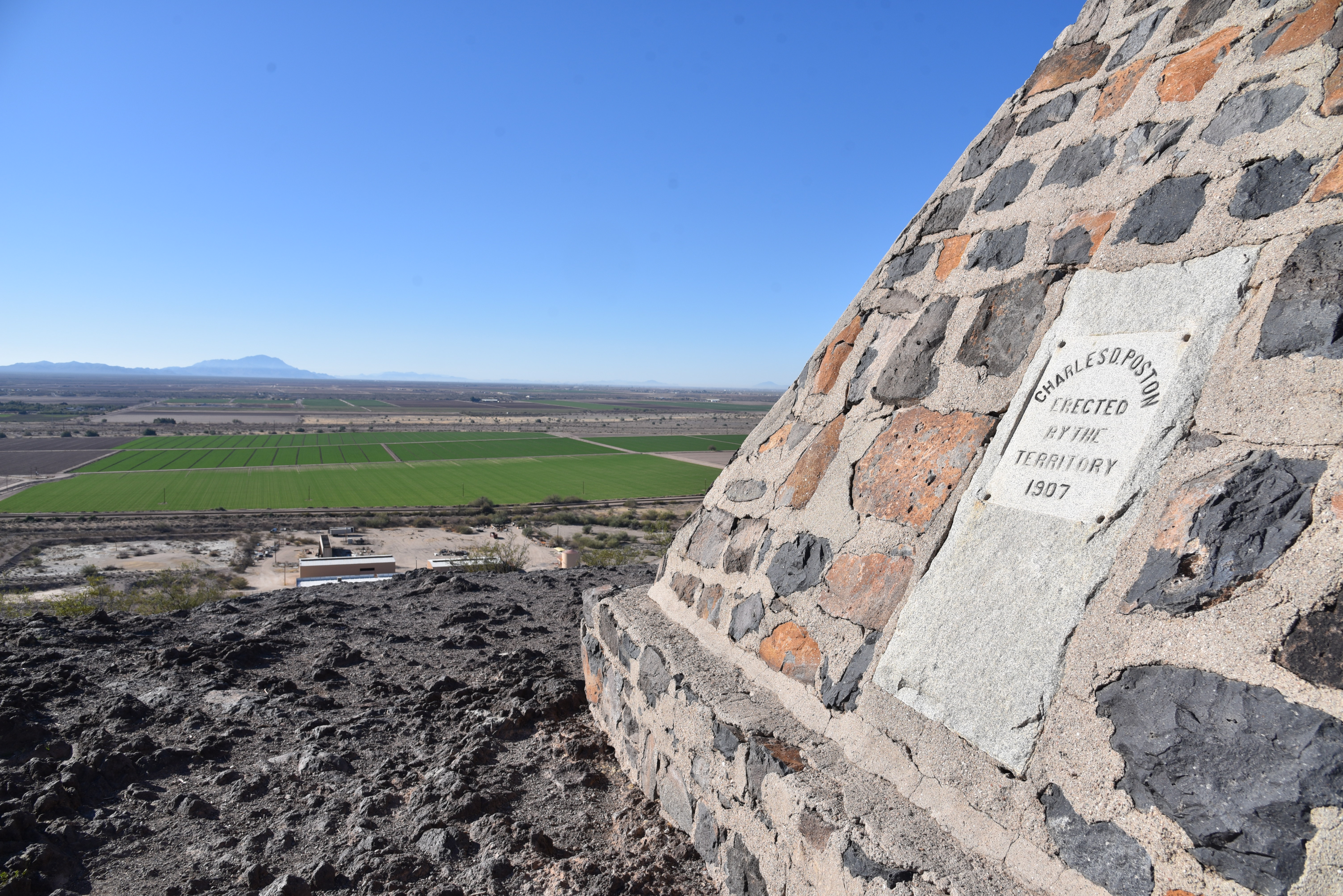
The monument on the summit of Poston Butte


Renaissance man or odd ball?  It can be argued that Charles Debrille Poston (1825 -1902) was a little of both.  The man who became known as the “Father of Arizona” lived a storied and colorful life before being laid to rest (in a roundabout way) on a volcanic mound beside the railroad tracks outside of historic downtown Florence.

Poston Butte was known as F Mountain


Over the course of his life, he was a Republican Congressman, world traveler, explorer, writer, mineral entrepreneur, follower of Zoroastrianism-- a monotheistic Persian religion founded in 6th century B.C.--and register of the U.S. land office in Florence from 1877 to 1879.  During his tenure in Florence, he constructed a Zoroastrian temple on a prominent local hill that went by the names of Primrose Hill and F Mountain before gaining its current moniker of Poston Butte. 

A short steep section isn't too difficult

The trail up Poston Butte is rough but moderate

The preserve is undergoing upgrades

Poston earned his “Father of Arizona” designation by successfully arguing for an Arizona Territory separate from the Territory of New Mexico and in 1864 he was elected as the new territory’s first delegate to the U.S. House of Representatives.  He spent his career moving in and out of Arizona before passing away, nearly penniless, in Phoenix. 

Today, almost 200 years after Poston’s birth, a roadside monument in his honor is getting some renewed love.  Travelers and locals alike have long enjoyed the short hike up Poston Butte.  Recognizing the site’s significance and potential as a recreation hub and tourism draw, the Town of Florence recently officially designated it Poston Butte Preserve with plans to expand, protect and enhance it with hiking trails and amenities. 

Superstition Ridgeline seen from Poston Butte

While it undergoes improvements, the preserve is open to hikers from sunrise to sunset daily.

Volcanic outcroppings on Poston Butte

A dirt pull out on Hunt Highway north of the Gila River serves as a trailhead. To reach the summit trail, walk under a wood railroad overpass and follow the well-worn, but as yet unsigned route.  At first glance, the preserve is kind of a desolate place.  Anchored by a lone hill in a sprawling desert valley cut with dirt roads, railroad tracks and grazing cattle, the property becomes more interesting when viewed from the high slopes of the butte.

Approaching the top of Poston Butte

The inky black, ash-infused knobs of Poston Butte are barren save for a few scattered palo verde trees, some scraggly creosote and dry tufts of grass.  Rough and unswept, the wide path makes a half-mile uphill plod.  There’s a short segment where the trail gets steep but it’s nothing vertical enough to knock the wind out of you.  On the way up, vistas include a mix of flat desert valleys, farmlands, distant mountain ranges and a full-frame look at the Superstition Ridgeline bolstered by the iconic Flatiron formation in the Superstition Wilderness near Apache Junction.

Green fields below Poston Butte

Nearby, the footprints of the Arizona state prison complex, mining operations and historic downtown Florence round out the sights.  Situated among several geological survey markers and mounds of ragged basalt boulders, a stone-masonry pyramid marks the summit.  Beneath the artful structure, lie the bones of Charles D. Poston.
Flatiron on the left horizon.


Despite the 1907 date on the monument, Poston’s body was exhumed from a paupers grave in Phoenix and re-interred here in 1925, exactly 100 years after his birth.

It’s going to be fun watching this quirky Pinal County roadside attraction with a heavy Arizona territorial lilt evolve into a genuine hiking destination. 

Fittingly, the Town of Florence plans a 2025 observation of the 100-year anniversary of Poston’s post-mortem return to one of his favorite Arizona destinations.

LENGTH: 1.2 miles to the top and back

RATING: moderate

ELEVATION: 1,450 -1,748 feet

GETTING THERE:

From Interstate 10 south of the town of  Sacaton take the State Route 187/387 exit 185.

Go left at bottom of off ramp and connect with State Route 387. 

Follow SR 387 to SR 87, go right and continue (SR 87 turns into 287 Florence-Coolidge Hwy) to the major intersection at Main St in Florence.  Veer right and then left to pick up Florence Heights Dr.  Continue less than a mile to SR 79, turn left (north) and go to Hunt Highway at milepost 136. Turn left and continue to the trailhead on the right to the trailhead on the right.

As of this writing, there are no facilities at the trailhead.

HOURS: sunrise to sunset daily

INFO: http://www.florenceaz.gov/parks-and-recreation/

Monday, February 1, 2021

Enchanted Peak

ENCHANTED PEAK

Rincon Peak (center) seen from ElGrupo Trail

From the Enchanted Hills Trails Park trailhead in Tucson, Enchanted Peak, a prominent, 2,795-foot hill, stands out to the northeast.  From this vantage point, its steep slopes appear insurmountable, yet the trails that lead to its summit are surprisingly manageable.  

The summit of Enchanted Peak

Occupying a 356-acre natural area within the east side of Tucson Mountain Park, the tiny parcel at the edge of suburbia packs in 7 miles of non-motorized use trails. 

A crested saguaro on the El Grupo Trail

Winding around the eponymous Enchanted Hills Wash, the interconnected network of trails showcases rich Sonoran Desert vegetation and huge mountain vistas. 
Tecolote Trail circles the base of the peak

There are many ways to enjoy trekking within the park, but, if you’re like some hikers, that peak will be an irresistible destination.  To get to the prize, begin by hiking east on the park’s arterial El Grupo Loop. 
The slopes of Enchanted Peak appear insurmountable

While the trails are well-designated with map posts, some junction signs are offset from the turnoffs, so pay attention.  Numerous shortcut trails and add-on loops lend themselves to customized treks, but if you just can’t get that peak out of your head, here’s the quickest route.

Fire 7 Trail approaches the base of the peak

Follow El Grupo to 1-mile through wide open country and boulder passages where an impressive crested saguaro stands just north of the trail.  Turn left onto the High Noon Trail, hike 0.3 mile, turn left and pick up the Fire 7 Trail which switchbacks up to the base of the peak. 

Tumamoc Hill seen from High Noon Trail

Where the trail meets the peak-circling Tecolote Trail, head right and hike 0.2-mile to the Enchanted Peak Trail.  This final, 0.3-mile path makes a sinuous ascent over bare rock and edgy clefts with outstanding views of high mountain ranges to the east. 

Stone passages are common on the route

For experienced hikers, the climb is only moderate in difficulty until the last few yards where it makes an abrupt and very vertical assault on the summit.  
Summit sign names prominent peaks

On top, an interpretive sign mounted on the small, rocky pinnacle shows the names, distances and heights of prominent mountains in the Tortolita, Santa Catalina and Rincon ranges visible on the near and far horizons.  Look for Mount Kimball (7,258 feet), Mount Lemmon (9,157 feet), Mount Bigelow (8,450 feet), Rincon Peak (8,284 feet) and nearby Tumamoc Hill (3,108 feet), all destinations near trails that get some serious height and present inspiration for more ambitious mountain adventures.
Tortolita Mountains seen from the summit trail


To complete this trek, descend and hike the opposite way around Tecolote Trail and El Grupo Loop or use the excellent signage to wander at will.

Park trails are well signed

LENGTH:  4.1 miles as described here

RATING:  moderate

ELEVATION:  2,479 – 2,795 feet (717 feet of accumulated elevation change)

GETTING THERE:

From Interstate 10 in Tucson, take the Starr Pass Blvd. exit 259.  At the bottom of the offramp, turn right, follow Starr Pass Blvd. 0.5 mile and turn right on Mission Road.  Go 1.3 miles on Mission Road to 36th Street, turn right and continue 2.1 miles to the trailhead.

HOURS: the park is open daily from dawn until dusk. No fees.

INFO:

Enchanted Hills Trails Park

3280 W. 36th Street, Tucson

https://webcms.pima.gov/cms/one.aspx?portalId=169&pageId=578991


Thursday, January 28, 2021

Pima Wash Trail

PIMA WASH TRAIL

South Mountain Park

Hohokam petroglyphs on the Pima Wash Trail

Classic Arizona trails earn their reputations by being stalwart passages into some of our most beloved parks, forests and wilderness areas

Whether they are feral and remote or tame paths just steps from suburbia, these legacy routes (think: Humphreys Peak in Flagstaff, Cabin Loop on the Mogollon Rim and Bell Rock near Sedona, Peralta Canyon Trail in the Superstition Mountains and the Thumb Butte trail in Prescott) never get old.  Pima Wash Trail in South Mountain Park in Phoenix falls into the tame, nearby category and serves up a delightful trek for homegrown hikers and visitors alike.

View from the Dirt Road Trail

Located in the park’s eastern edge adjacent to a golf course and rows of trim homes and shopping centers, the trail is a mainstay in the Pima Canyon trailhead mix of routes.  Newly renovated and outfitted with restrooms, picnic tables and interpretive signs, the trailhead has plenty of parking and is designed to blend in with the surrounding desert hills. 

CCC structures on the Dirt Road Trail

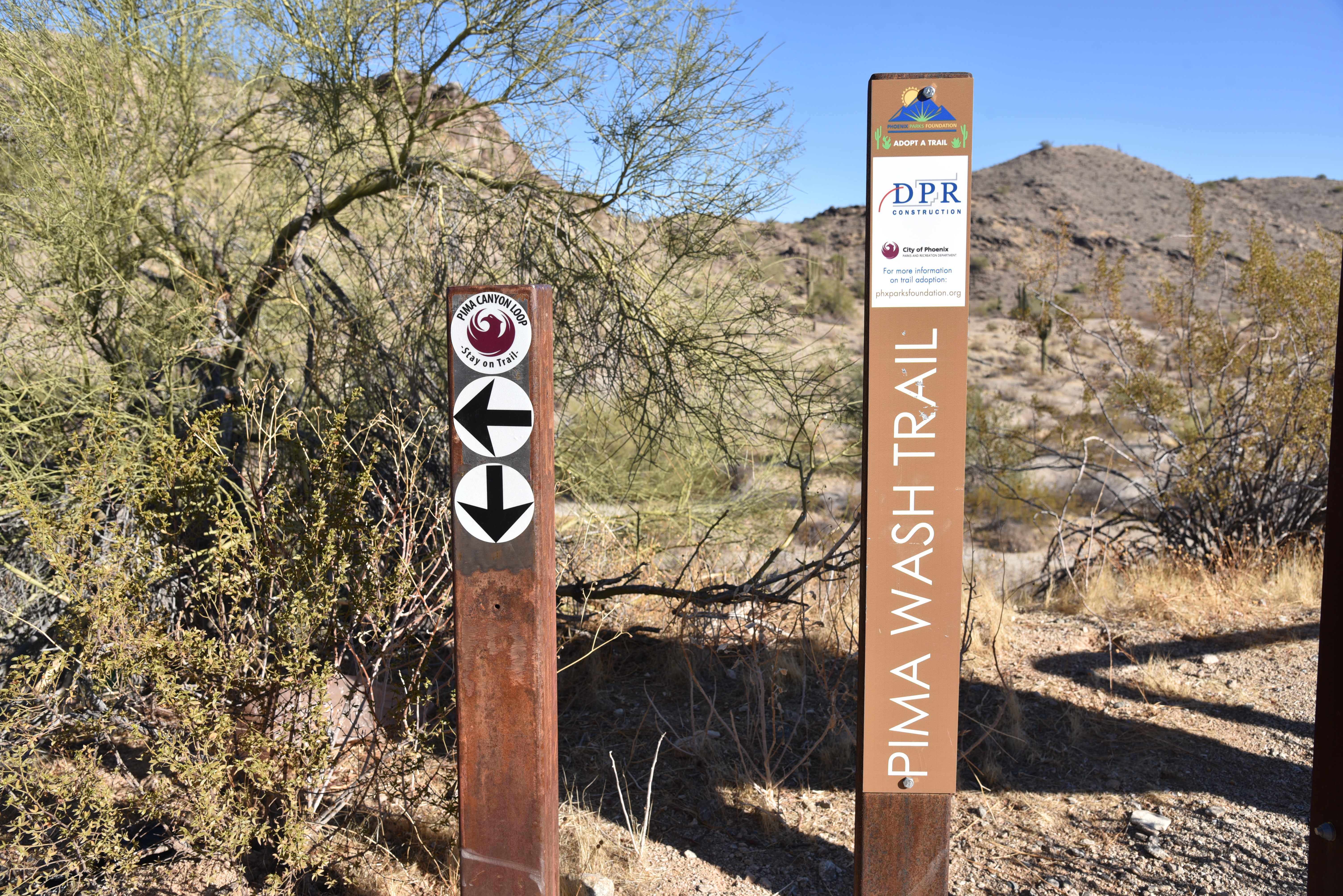
Pima Wash Trail is often done as a loop hike using the Dirt Road and National Trail to tie it together.  To better appreciate the hike, start by reading the trailhead signs that describe the wildlife, vegetation and history you’ll encounter along the route. 

Petroglyphs above Pima Wash 

The short, easy loop is packed with interesting sites and is an ideal choice for keeping young kids engaged.  Begin on the Dirt Road Trail which starts at the trailhead ramadas.  The wide route heads up the edge of Pima Canyon overlooking a rugged wash.  Views of East Valley landmarks including Red Mountain and Four Peaks emerge on the horizon as the trail climbs higher into the canyon.  At near the mile point, a set of native stone buildings sit off to the left of the road.
Desert vegetation on Pima Wash Trail

These were built by the Civilian Conservation Corps (CCC), a government work program established by President Roosevelt in the 1930s.  The intricate masonry walls and arches blend easily into the natural environment and are fine examples of the many CCC-built structures, trails and other features within the park. 
Pima Canyon trailhead blends into the landscape

Just beyond the stone buildings, the road meets the National Trail junction.  Veer right and follow the trail a few yards to the Pima Wash Trail where the route ducks into a sandy, water-ravaged corridor.  Alternately staying in the cliff-bound wash and the ledges above it, the return leg of the loop tops out at a scenic point with a bench where Hohokam petroglyphs are etched into boulder outcroppings and views of the jumbled channel of Pima Canyon give cause for pause.  Vegetation in the wash is dominated by mesquite trees, brittlebush and cacti, but if you have a keen eye, you might spot a rare Elephant Tree.  While they resemble Palo Verde trees (Parkinsonia aculeata), the Elephant tree (Bursera microphylla) is a frost-sensitive tropical species in the torchwood family of plants that produces and aromatic sap similar to frankincense and myrrh. 

A petroglyph panel on Pima Wash Trail

Found in northwestern Mexico and American southwest deserts, Central Arizona, where the tree is a protected species, marks the northern limits of its habitable zone.
The route is signed and easy to follow

The squat trees are characterized by its serpentine, branching trunks that resemble elephant legs.

Young branches and bark are smooth and reddish in color but turn dull green and flaky grey with age.  Because of its close proximity to suburbia, the Pima Canyon recreation area draws the crowds, especially on weekends when many people use the Dirt Road Trail as an outdoor treadmill for speed hiking or power walking.

Interpretive signs enrich the hike experience

However, for those who prefer a more leisurely walk off the beaten path, the Pima Wash Trail offers a less busy meander through classic Sonoran Desert terrain inhabited by myriad critters including Harris Antelope Squirrels, rock squirrels and Turkey vultures. 

LENGTH: 3.2-mile loop as described here

RATING: easy-moderate

ELEVATION: 1,338 – 1,566 feet

GETTING THERE:

Pima Canyon Trailhead. 4800 E. Pima Canyon Road, Phoenix.

From Phoenix, go east on Interstate 10 to the Elliot Road exit 157. Turn right at the bottom of the offramp and continue a few blocks west to 48th Street (major stop light intersection). Turn right onto 48th St and continue to Pima Canyon Road on the left and follow the signs to the trailhead.

FACILITIES: restrooms, water, covered picnic ramadas.

Dogs must be on leash at all times and owners must clean up after their pets.

INFO & MAPS:

https://www.phoenix.gov/parks/trails/locations/south-mountain

Wednesday, January 20, 2021

Huckaby Trail

HUCKABY TRAIL

There are three things to know before stepping out on the Huckaby Trail.

The leafy corridor of Oak Creek on Huckaby Trail

One, that as-advertised 280 feet of elevation change? You’ll do it 4 times.  Two, there are some moderately steep sections that hang close to precipitous drops offs. And, three, the hike is worth sucking up one and two.  

Part of the hike parallels SR89A in Sedona

While it’s located just inside the boundary of Coconino National Forest and within sight of busy hotels and businesses, the classic hike southeast of uptown Sedona delivers a satisfying outdoor experience. 
Midgely Bridge & Oak Creek seen from Huckaby

The hike begins on the sunny rock shelves above Bear Wallow Canyon gradually dipping downhill on a wide dirt road. At near the half-mile point, the trail crosses the bottom of the canyon and begins its unrelenting cycle of ups-and-downs in the drainage-riffled cliffs above Oak Creek.
A scenic overlook on Huckaby Trail

 
Twisting through an airy high desert ecozone of yucca, cacti and blooming shrubs, the narrow trail features continually changing vistas of both wilderness peaks and the streams of traffic moving through a bustling resort hub.  
Midgely Bridge towers over Huckaby Trail

Huckaby Trail crosses Bear Wallow Canyon

Midway through the hike, the route traverses a high ledge above the creek. First glimpses of the waterway glint 200 feet below before the trail makes a hard eastward bend and several more swings around crumbling red rock escarpments to land on a scenic edge with views of Midgley Bridge and the iconic Steamboat Rock and Mitten Ridge formations.

Pinon pines shade parts of the trail

 
The trails crosses Oak Creek below the bridge

From this point, the path spirals downhill along edgy clefts, entering a forest of Arizona cypress and oak trees.  At the 2-mile point, the route meets the floodplain of Oak Creek, but the climbing is not yet over. 
Trail traces cliffs above southeast Sedona

There’s another half mile of trail that hangs on uneven rock shelves that parallel the creek. Here, water-loving sycamores and cottonwoods enter the botanical mix shading an under story of tangled brambles and vines. 
Manzanita is a common shrub on the trail

View of Wilson Mountain from Huckaby Trail

The damp, earthy atmosphere is magical year-round--icy grey in winter, green and vibrant in spring and a canopy of golden foliage in autumn.
View of Mitten Ridge from Huckaby Trail

The cliff hike dissolves into a sandy walk through a small meadow that leads to the banks of the creek beneath Midgley Bridge. 
Oak & sycamore trees line Oak Creek

Steamboat Rock & Wilson Mountain on horizon

For those inclined to rock hop over the water, the trail picks up on the other side and heads uphill again where it ends at the Wilson Mountain trailhead along State Route 89A.
The distinctive seeds of Arizona cypress trees

A winter scene along Oak Creek

LENGTH:  5.6 miles roundtrip

RATING:  moderate

ELEVATION:  4,211 – 4,492 feet (1,157 feet of accumulated elevation change)

GETTING THERE:

From traffic circle located at the Oak Creek bridge on State Route 179 in Sedona, turn right onto Schnebly Hill Road and go one mile to the trailhead on the left.

Roads are suitable for all vehicles. There is a restroom at the trailhead.

FEE: A Red Rock Pass or equivalent is required at the Schnebly Hill trailhead. There is a permit kiosk at the trailhead.

https://www.fs.usda.gov/detail/coconino/home/?cid=stelprdb5416207

INFO: Coconino National Forest

https://www.fs.usda.gov/recarea/coconino/recarea/?recid=55322