Find A Trail. Start Your Search Here:

Monday, August 3, 2020

Buck Mountain

BUCK MOUNTAIN 
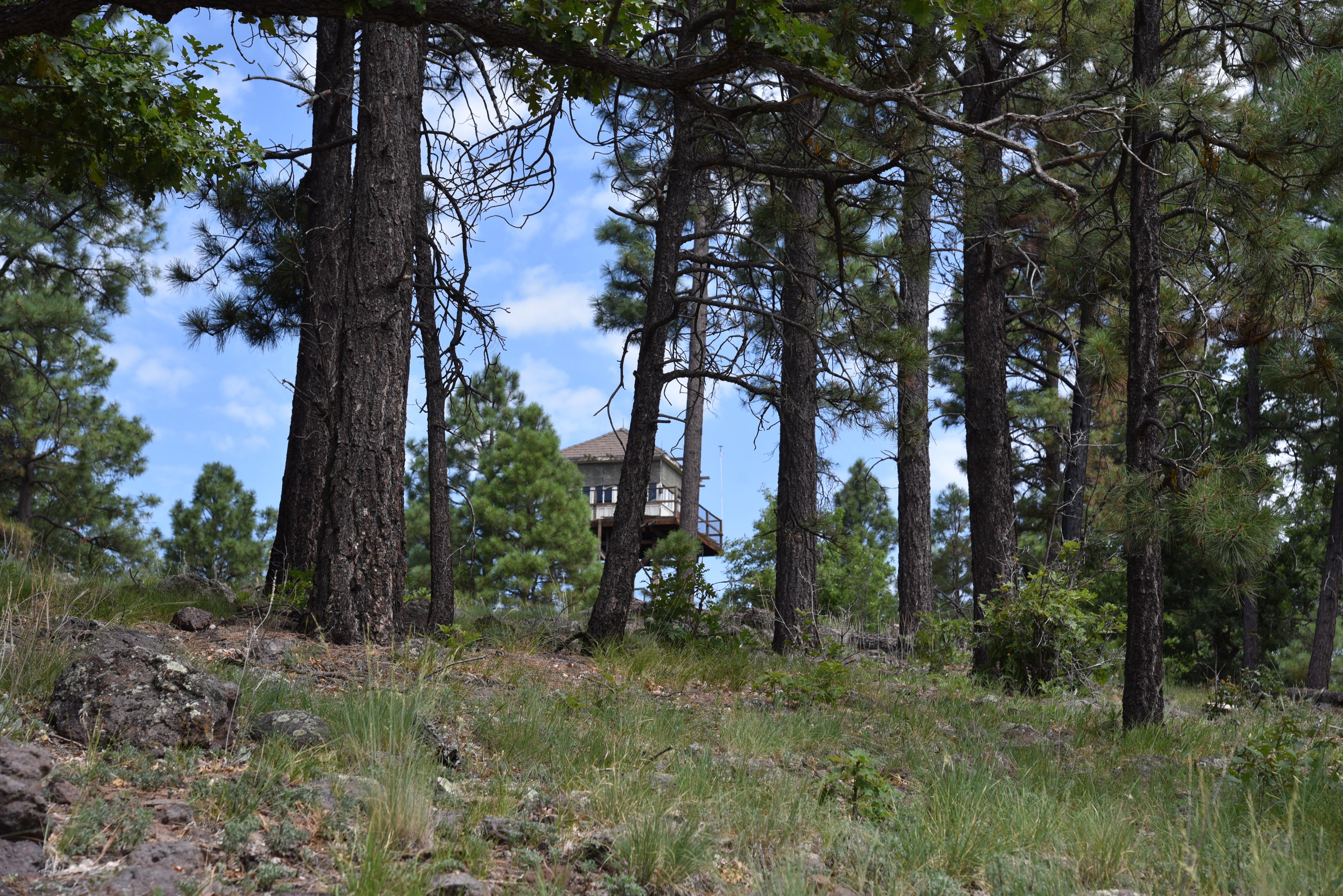
Buck Mountain fire tower
Remember 1973? The year was rife with high-tension world events, political controversy and noteworthy bright spots. There was the Watergate scandal and the resignation of President Richard M. Nixon, the opening of the World Trade Center and U.S. involvement in Vietnam was winding down with the Paris Peace Accords.
View from the summit of Buck Mountain.
On the home front, tennis great Billie Jean King beat Bobby Riggs in a match hyped as “the battle of the sexes” while the Supreme Court decision in Roe v. Wade spurred debate over women’s reproductive rights that’s still roiling today. But all this was overshadowed by two events that got personal.
The hike's last mile is open to foot travel only
First, the Organization of the Petroleum Exporting Countries (OPEC) oil embargo caused angry confrontations at the gas pump, price gouging and fuel shortages. Next, in an ominous precursor to 2020, there was a run on toilet paper. Ostensibly, Led Zeppelin’s North American Tour moored an otherwise utterly confusing year. Turns out 1973 was a reminder that just when things seem to be going great, disruption comes to bite us on the posterior with historic regularity. Decades before the Great Toilet Paper Crisis of 2020 wreaked havoc at the onset of the new coronavirus lock down, other world events lead to shortages of an array of crucial (albeit less personally distressing) materials. Perhaps your great-grandparents shared stories about deprivations brought on by the Great Depression or World War II rationing and how patriotic citizens organized collection drives for tires, scrap metal and even rags and paper to help in the war effort.
The hike follows Forest Road 229B
Or maybe you or your parents recall the chaos of 1973 when rumors spread by late night comics—on the pre-Twitter platform of TV-- about unsubstantiated toilet paper shortages caused people to freak out and raid store shelves of the precious commodity. In the words of legendary Yankees catcher Yogi Berra, 2020 echoes, “It’s like déjà vu all over again.” While there may never be a monument erected to the potty paper panic, a couple of relics of past scarcities are preserved on Arizona mountaintops.
A blueberry elder tree blooms on Buck Mtn.
Perched atop a knoll halfway between Happy Jack and Clints Well, on the Mogollon Rim 40 miles south of Flagstaff, Buck Mountain fire lookout is one of only a few surviving CT-2-type towers in American forests. Arizona has two of the rare wooden lookouts; the other is East Pocket near Sedona, also in Coconino National Forest and both towers are listed on the National Register of Historic Places.
View from Forest Road 229B.
Mock pennyroyal grows along the route.
If it seems weird to construct a fire tower from combustible materials, consider that at the time it was built, construction staples like metal, the usual choice for lookouts, were simply unavailable or were being diverted to war manufacturing while wood could still be harvested from forests near construction sites. You make do with what you have. The 30-foot high structure which is capped with a 14’x14’ cabin and catwalk was originally constructed in 1939, rebuilt in 1943, fixed numerous times and restored in 2003 using materials and processes that retain its historic character.
Buck Mountain lookout was built in 1939.
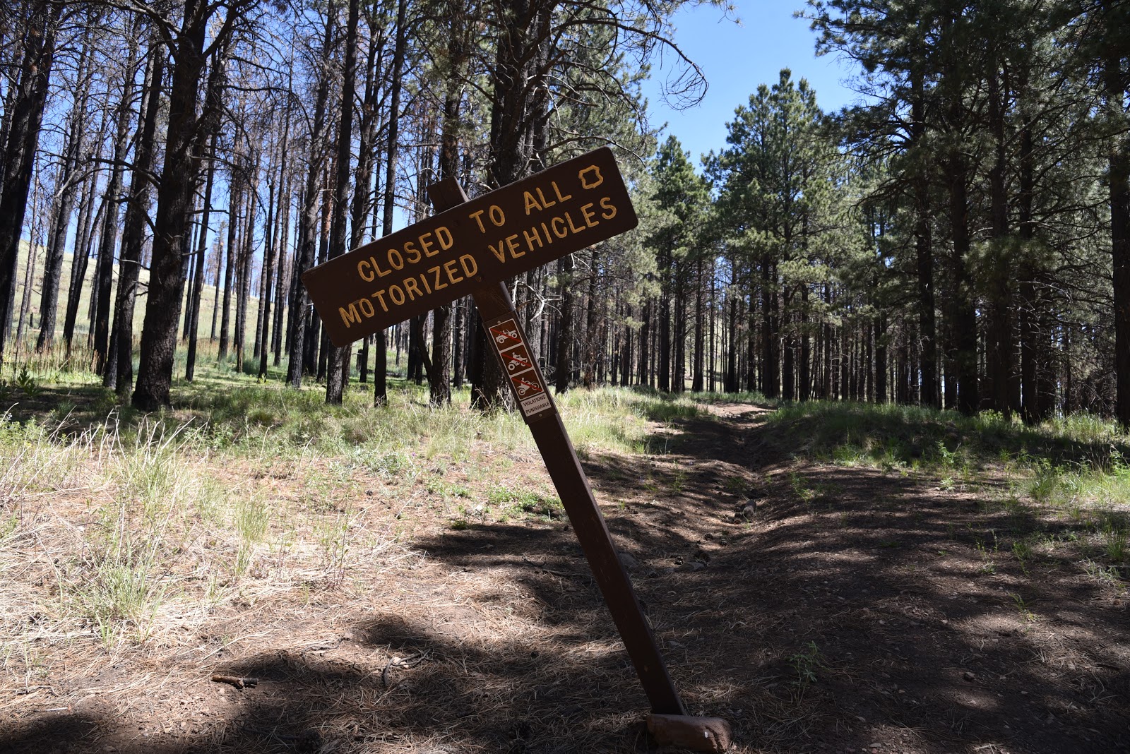
For safety and preservation, the tower is not open to the public. The hike to the tower follows FR 229B, a scenic forested dirt route that makes a mild uphill climb. The road is open to motorized travel up to the 1.5-mile point where a gate blocks the way and only foot travel is allowed on the final mile to the tower.
The route cross a cattle guard on FR 229B.
Slightly steeper than the lower road, the summit walk segment passes among shady stands of pines, oaks and flowering shrubs. Judging from the chatter in the treetops, this area appears to be a haven for birds.
Buck Mountain is a haven for birds.
I observed woodpeckers, ravens, Stellar’s jays, hawks and dozens of other species that swooped by too quickly for me to identify. Roadside log piles and fresh stumps from recent thinning operations for forest health in the area have revealed views of the surrounding landscape that grow in spectacle as the dusty two track ascends the mountain’s southwest flank. Near the top, the forest opens up to allow peeks at the mound of Apache Maid Mountain, Sedona’s red rocks to the northwest and the rugged gorges of West Clear Creek and Fossil Creek Wilderness areas to the south.
View of Sedona from Buck Mountain.
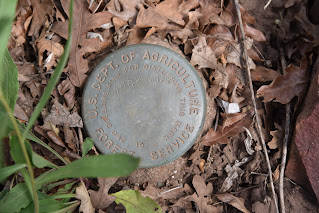
Summit marker below the fire tower.
The road tops out on a small clearing where the tower, the remains of what looks like an outdoor grill and a newish restroom building are spread out on the mountain’s high point. A dirt path that makes a loop around the complex serves as tour guide a for enjoying far-reaching vistas.
White prairie aster blooms Aug - Oct.
At the base of the tower (again, it is closed to public visitation) a concrete slab inscribed with Civilian Conservation Corps initials, a brass summit marker and a tiny sandstone memorial add tidbits of discovery to the hike. On the way down the mountain, my curiosity got the best of me and I decided to check to see if the restroom had any toilet paper. It was locked. 
Ponderosa pines shade the summit of Buck Mtn.
LENGTH: 5 miles roundtrip 
RATING: moderate 
ELEVATION: 6,794-7,571 feet 
GETTING THERE: From Flagstaff, go 42.5 miles south on Lake Mary Road (County Road 3) to Forest Road 229 on the right past milepost 302. Go 2 miles on FR 229 to FR 229B on the left. Park in the dirt turnouts. There are several dispersed campsites along FR 229 but there is no camping allowed at the tower. 
INFO: http://nhlr.org/lookouts/us/az/buck-mountain-lookout/ 
ABOUT FIRE HISTORIC TOWERS: 
https://www.fs.fed.us/eng/facilities/documents/1938_USDA-FS_StdLookoutPlans.pdf

Monday, July 27, 2020

Interstate Trail

INTERSTATE TRAIL
Canyon view point on Frog Tank Loop

If there has been an upside to the global pandemic, it has been in discovering hiking destinations that are far from the hordes. After listening to a recent radio program in which a public health expert stated that coronavirus will probably be with us “forever”, I resolved to actively knock off the outlier trails on my ever-expanding “someday” list.
Lichen and cacti grown on boulders on Interstate Trail
While many unknowns swirl around when we might once again be able to safely que up for that Instagram moment atop Sedona’s notoriously crowded Devil's Bridge, what is known is that there are plenty of areas to hike that do not require jockeying for space. One good place to find room to roam freely is in the section of Coconino National Forest that surrounds Interstate 17 near Munds Park 20 miles south of Flagstaff.
Rose hips ripen in a drainage area
Within this who-knew plot, the short, easy paths of the Munds Park Trail System serve as a launch point into the meandering routes of the 100+-mile Kelly Motorized Trail System.
Frog Tank is an important wildlife water source
The divergent shared-use routes are made up of long airy roads, repurposed railroad beds and dirt single tracks that swoop through spaces far removed from the masses and the Interstate Trail makes for a good segue into the maze.
To reach this pleasant outlier, begin at the Janice Place trailhead. Follow the access path 0.2 mile to a “T” junction at Frog Tank Loop. Before heading left to continue the hike, look for an informal footpath behind the trail sign that leads a few yards to an overlook above a drainage gorge. A peek into the stony corridor that’s cluttered with willows and brambles, is a not-to-be-missed diversion. About 0.2 mile farther down Frog Tank Loop, the trail crosses a spillway at the mouth of the mini canyon for a close up look at the water-loving riparian vegetation.
Beyond the spillway crossing, continue hiking the road to the 1.3-mile point at Frog Tank where a connector trail that leads to Forest Road 78A veers off to the left.  Take a few minutes here to check out the tank which serves as an important water source for waterfowl, deer, elk, myriad little critters and a vociferous flock of mountain bluebirds.
From the tank, follow the signs 0.1 mile to Forest Road 78A, cross it and pick up the Interstate Trail which is marked with a Kelly Motorized Trail System sign.
Gambel oaks arch over Interstate Trail
The route is open to motorized use, but its narrow cut appears only wide enough to accommodate dirt bikes. This simple north-south route makes a twisted course that runs parallel to Interstate 17 for roughly 7 miles ending just south of the Kelly Canyon area.  Although the trail is located only a mile east of the freeway, the hilly terrain and thick tree cover muffles most of the noise. 
Hike begins at the Janice Place trailhead in Munds Park
 
It’s a mostly easy walk that ducks among ponderosa pine and exposed spreads of alligator juniper and high desert cacti with intermittent mountain vistas.  But the most underappreciated and fascinating sights along this trail can be found growing on outcroppings of volcanic rocks.  Lichens, crusty-looking composites of fungi and algae, form a sort of natural art gallery of colorful splatters, leafy medallions and web-like masses that cling to rock surfaces like layers of old paint.
Beginning of the Interstate Trail
Sometimes found growing alongside mosses, the microscopic organisms that exist through a symbiotic relationship of creating and sharing nutrients are also essential to forest and environmental health.
Redroot buckwheat is a common summer bloomer
The odd organisms contribute to soil building by helping break down rock and absorb pollutants from the atmosphere.  Although they may appear “dead”, lichens have remarkable survival skills and can spring back to life after rains. Growths of the blue-green, gold and rust-colored curiosities are abundant along the trail.  No two are alike.
Winged buckwheat blooms July - October
Interstate Trail is a twisting single track route
Willows, wild grapes and roses thrive in a drainage
Lichen clings to a boulder on Interstate Trail
Because an incoming thunderstorm was moving in from the north, I decided to turn around after just 3 miles on the Interstate trail. But, with several more miles left to explore, I will return after a few good storms wet the area enough to coax the lichen back to life. 
Interstate Trail is accessed via Frog Tank Loop
LENGTH: 8.6 miles roundtrip (as described here)
RATING: moderate
ELEVATION:  6,446 – 7,000 feet
GETTING THERE:
Janice Place trailhead:
From Interstate 17 in Munds Park, take the Pinewood Blvd. exit 322. Turn right and follow Pinewood Blvd. 0.1 mile, turn left on Fairway Drive (which will turn into N. Lodge Dr.) continue 0.3 mile to Janice Place, turn right and go 0.2 mile to the trailhead on the left.
INFO & MAPS:
ABOUT LICHENS:

Monday, July 20, 2020

Porter Mountain via Flume Connector

PORTER MOUNTAIN via FLUME CONNECTOR
White Mountains views from the summit of Porter Mtn.

Anchoring the heart of the 200+-mile White Mountains Trail System (TRACKS), the Timber Mesa and Panorama loop trails offer easy access, moderate workouts and abundant scenic beauty.
Exposed cinders along the road to Porter Mountain
The popular, close-to-town loops are tethered by two lesser-used connector routes: Sawmill #626A and Flume #636B. While enabling seamless travel between the two big circuits, the auxiliary routes also demonstrate that, like a crèam-filled sandwich cookie, the best stuff is in the middle.
Porter Mountain seen from the Panorama trailhead
Prickly poppies bloom April - November
Of the two, the Flume Connector is the easiest to reach. Beginning at the Panorama trailhead, the shady single track moves through the woody space between Flume and Porter Mountains before making a mild ascent to the top of Timber Mesa. But to add some extra punch to the hike, a detour up Porter Mountain delivers the goods.
See-forever vistas from the scenic lookout point
From the trailhead, follow Flume Connector 0.4-mile to where it crosses Forest Road 223, the summit road. Make a mental note of this spot as it’s easy to miss on the way back. Head right and begin hiking uphill, veer left at the first fork and get ready for amazing displays of bizarre geology and White Mountains scenery. Within a few yards, the road makes a hairpin turn through a broken flank of the extinct cone volcano. Below, a gaping cinder pit sits below volcanic outcroppings and disintegrating slopes of russet and black cinders. Farther up the road, views of Scott Reservoir, Show Low Lake and the wetlands of Jacques Marsh sparkle through acres of pine forests and rangelands. This area is particularly beautiful in late summer when  sunflowers paint the landscape brilliant yellow.
At the 1.1-mile point, a dirt turnout serves as a scenic lookout for enjoying see-forever views of the Mogollon Rim and pockets of civilization surrounded by a patchwork of trees, plains and isolated peaks. To get to the summit proper, hike past the vehicle gate and make the final 0.4-mile climb toward an array of communication towers. This final section showcases glimpses of Mount Baldy (11,403 feet) to the southeast and dozens of lumps, bumps and prairies of the  Apache-Sitgreaves National Forest. In between ogling the sights, don’t forget to look down to see the potpourri of plant life protruding from the disturbed road margins and mountain escarpments. Wax current shrubs, prickly poppies, globe mallow, rare Graham’s tick-trefoil and the ubiquitous sunflowers sprout from seemingly inhospitable volcanic scree.
Flume Connector is part of TRACKS 
Prickly poppies are abundant along the route
Distant Mogollon Rim viewed from Porter Mountain
Black cinders spill from a break in Porter Mountain
Wax current shrubs grow near the summit of Porter Mtn.
Scott Reservoir (left) & Show Low Lake from Porter Mtn.
The ponds of Jacques Marsh viewed from Porter Mtn.
Mt. Baldy seen from Porter Mountain
Graham's tick-trefoil is a rare sight along the route
Beginning of the Flume Connector at Panorama trailhead
Flume Connector toggles Timber Mesa & Panorama trails
At road’s end, wander around on several dirt paths that lead to photogenic vantage points to cap off the show. When done exploring, descend back to the Flume Connector and hike 2 miles west on the pleasantly shady, sparsely traveled route to where the trail joins the Timber Mesa loop, the turnaround point for the hike.
LENGTH:
Porter Mountain: 3 miles up-and-back
Porter Mountain with Flume Trail: 8 miles out-and-back
Flume Connector alone: 5 miles out-and-back
RATING: moderate
ELEVATION:
Porter Mountain: 6,961 – 7,584 feet
Flume Trail #636B: 6,961 – 7,184 feet
GETTING THERE:
From State Route 260 (White Mountain Blvd.) in Pinetop-Lakeside, turn left on Porter Mountain Road (Forest Road 45) and go 5 miles—watch for a sharp right turn-- to the Panorama trailhead on the left. Roads are 100% paved.
INFO: White Mountains Trail System

Monday, July 13, 2020

White Horse Hills


White Horse Hills
The mouth of the north pass at White Horse Hills
Within the pass that cuts through the pyramid-shaped pinnacles of the White Horse Hills, voices carry. But, voices are rare in the barren cluster of vertical mounds located below the north face of the San Francisco Peaks 20 miles north of Flagstaff in Coconino National Forest.
This is not the kind of place hikers drool over visiting, it’s allure draws more curiosity seekers than hard-core trekkers, especially since it competes with nearby Passage 34 of the Arizona Trail.   Inquiring minds might well find amusement on the obscure dirt road that shows up on topographic maps as a oversimplified line connecting Forest Roads 514 and 418.
A storm brews above Saddle Mountain (left)
Kendrick Mountain seen from FR 9219M
Painted Desert views stand out on the route
But the reality of hiking the deceptively straight forward course of Forest Road 9219M, which runs down the center of the lumpy conglomerate, is a bit more complicated.
The section of FR 9219M that ascends the mountain pass is now closed to motorized traffic and its point-to-point length is only 2.8 miles, yet for those without a good sense of direction, picking out the overgrown path can be a challenge. Still, with two options to explore the area, expert and novice hikers alike can experience this unusual landform.
Ponderosa pines shade segments of both routes
The North Route
View from the high pass of White Horse Hills
The easiest route begins at Forest Road 514. From a trailhead that’s shared with the Arizona Trail, follow Forest Road 9006R for a half-mile to Forest Road 9219M. Veer right and hike the dirt two-track as it makes an mild 400-foot climb through patches of pines and shadeless meadows. Views along this nondescript backroad are astonishing. Dozens of volcanic landforms including 8,880-foot Saddle Mountain and 10,418-foot Kendrick Mountain fill the horizons while hazy glimpses of the Painted Desert and the rim of the Grand Canyon roll out to the northeast.
The route shares a trailhead with the Arizona Trail
Straight ahead, Arizona’s highest peaks that top out at 12,643 feet, cast shadows on the destination: the White Horse Hills. Also known as Marble Mountain, the geological curiosity is a dome laccolith, a volcanic feature that forms when subterranean magma pushes up layers of older rocks from below, sort of like a blister that never breaks the surface.  Described by geologist John V. Bezy in A Guide to the Geology of the Flagstaff Area, the multi-peaked massif formed around 850,000 years ago. 
There's lots of solitude in the White Horse Hills
A faint trail ascends to the top of the pass
Thousands of years of erosion and recent wildfires have shaped the terrain into a desolate yet oddly appealing pocket of stark rhyolite hills and exposed layers of ancient sediments, previous volcanic flows and ragged outcroppings of Redwall limestone that were changed into marble by the heat of rising magma. At the 1.5-mile point, the road hike ends in a patch of Ponderosa pines at the mouth of the mountain pass where a barbed wire fence and a toppled sign bar motorized travel into the hills. There’s no gate and no easy way to get through the fence. As it’s important to never cut or alter fences on forest lands, I called this scenic spot the turnaround point and set out to explore the hills from the south.
Thistle are plentiful along the routes
White Horse Hills is a dome laccolith volcanic feature
The South Route
Although hiking the hills from the Forest Road 418 access point is more difficult, it gets you into the guts of the laccolith. A short but steep and slippery climb on a disintegrating road leads to a landing where the road seems to disappear entirely. To find the fading track, look ahead to spot a barely discernable road cut between two conical peaks, the highest of which reaches 9,065 feet. Follow this path 300 feet uphill to the highpoint saddle—a dizzying perch surrounded by sheer bluffs, broken clefts and boulder-filled ravines. Through the V-shaped gap in the pass situated at 8,738 feet, flatlands dotted with cinder cone volcanoes and the contrasting green pastures of Kendrick Park are visible 1,000 feet below. From this point, the path becomes clearer, but still tricky in places, and can be spotted snaking across the eastern (to the right) slopes below. Carefully work your way down the incline and walk toward the barbed wire fence (8,062 feet) at the 1.3-mile point. Again, unless you can squeeze under the wire without causing damage, return the way you came.
Common mullien thrive in meadows below the hills
White Horse Hills sit at the base of San Francisco Mountain
Wildfires and erosion have shaped the White Horse Hills
Southern access point to White Horse Hills
The eroded innards of White Horse Hills
LENGTH:
From the North to the fence:  3 miles round trip
From the South to the fence: 2.6 miles  round trip
RATING: easy or difficult depending on route
ELEVATION:
North access: 7,647 – 8,062 feet
South access: 8,062 – 8,738 feet
GETTING THERE:
North Access FR 514:
From Flagstaff, go 21 miles north on U.S. 180 to Forest Road 514 (Kendrick Park Road). Turn right and continue to just past the 3-mile marker at Kelly Tank and park in the dirt lot on the right at the beginning of Forest Road 9006R. This is directly across from an Arizona Trail gate.
South Access FR 418:
From Flagstaff,  go 19.5 miles north on U.S. 180 to the north access for Forest Road 151 (Hart Prairie Road) located past milepost 235. Turn right and continue 1.6 miles to Forest Road 418, veer left and go 2 miles to a small dirt turnout just past a 2-mile post where there’s a “closed to motorized use” sign on the left. Parking is limited to turnouts along the road. Do not block private driveways.
Access roads to both trailheads are rough dirt suitable for all carefully driven vehicles.
INFO: