Find A Trail. Start Your Search Here:

Monday, June 22, 2020

Brandis Trail

BRANDIS TRAIL
Survivor pines near the Deer Hill Trail junction

Ten years ago this month, the Schultz Fire was ravaging the eastern slopes of Flagstaff’s San Francisco Peaks.
Trailhead gate on the Brandis Trail
The human-caused blaze, ignited from an abandoned camp fire on June 20, 2010, went on to burn more than 15,000 acres of Coconino National Forest before being contained 10 days later. The fire was followed by one of the wettest monsoon seasons on record which lead to devastating flooding. Without trees and other vegetation to stabilize and absorb runoff, heavy rains created rivers of debris that further eroded the landscape leaving behind a charred moonscape of sludge and an eerie wilderness of torched tree trunks and ashen gullies.


Evidence of the 2010 Shultz Fire come early in the hike
Extend the hike on the Deer Hill Trail
Mountain gromwell sprout tiny white flower heads
Sunset Crater (left horizon) seen from Brandis Trail
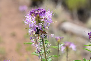
Pollinators swarm around Rocky Mountain beeplants
Pine sprouts grow among casualties of the Schultz Fire
O'Leary Peak (right horizon) viewed from Brandis Trail
Schultz Fire scar on eastern slopes of San Francisco Peaks
Frothy Apache plume shrubs color the trail.

Borne of volcanism that began shaping the area millions of years ago, this mountainous parcel in Northern Arizona is no stranger to fire. Whether brought on naturally by lighting or lava or by human carelessness, fire drives uneasy cycles of destruction and resurgence that’s aren’t going away anytime soon.
Brandis Trail access point 
Ten years removed from the blaze, the area is in recovery mode, transitioning from what had been a place of thick coniferous woodlands, alpine meadows and forested foothills into a much different, starkly beautiful destination. The blaze damaged several popular hiking trails including the Little Elden, Little Bear, Sunset, Heart and parts of the Arizona Trail. But two outlier routes that suffered the kind of odd, patchy damage to vegetation that melds islands of old growth survivors with resurgent sprouts provide enlightening walking tours of an emerging landscape.
Skunk bush--one of many blooming shrubs on the trail
Even before the fire, the Brandis and Deer Hill trails weren’t big-name attractions but instead offered less crowded, easy treks at the base of San Francisco Mountain with no difficult climbs or confusing junctions. The Brandis Trail, located at the edge of a residential area less than a mile from U.S. 89 north of Flagstaff, wanders through the fire scar and is a good path to follow to see how the forest is regenerating.
The 1.4-mile, straight-shot route heads due west toward the peaks beginning with a short hike among unscathed pines. Within a quarter mile, though, views of charred tree trunks that hover precariously over acres toppled logs deliver a gut-punch to those who recall the woodsy pre-fire environment.  The upside is that the near treeless terrain is now replete with unobstructed views of nearby O’Leary Peak, a 8,916-foot  lava dome volcano and Sunset Crater a young, 8,042-foot cinder cone and focal point of Sunset Crater Volcano National Monument. Interestingly, the now dormant volcano turned tourist attraction was the source of a curtain of fire that disrupted life here about 1,000 years ago.
Brandis trail roughly traces a drainage gorge where resurgent shrubs, wildflowers and saplings are encouraging signs of life regaining its hold. Healthy swaths of silvery rabbitbrush, mountain gromwell, penstemons, Rocky Mountain beeplant and Apache plume add color and sink stabilizing roots into the fragile soils while intermittent stands of survivor pines, oaks and junipers stand in testimony to the sometimes bizarre movements of wildfires.  The trail gets a little sketchy where it crosses the winding drainage several times. To stay on track, know that at the crossings, the trail picks up directly on the other side, not down the wash as random footprints might suggest.
At the 1.3-mile point, a livestock gate stands near one of the few shady areas on the trail. Pass through (close it behind you) and continue on to the turnaround point at the Deer Hill trail junction. For an optional, longer hike, the left leg heads 4 miles south to connect with the Little Elden and Arizona Trail while the right leg goes 1.5 miles north to its terminus at Schultz Pass Road.
The trail traces a scoured drainage 
A Yellow salsify flower gone to seed
Yellow salsify is a common bloomer along the route
LENGTH:  3 miles roundtrip (Brandis Trail only)
RATING: easy
ELEVATION:  6,840 – 7,212 feet
GETTING THERE:
From the Interstate 17/40 interchange in Flagstaff, go east on I-40 to exit 201 for U.S. 89 north.
Continue 8.2 miles north on U.S. 89, turn left on Brandis Way and go 0.8-mile to a parking apron at the corner of Brandis Way and Ostrich Lane.  The trailhead is located at the end of a fenced easement at the end of Brandis Way. Please respect private property in the area by not blocking driveways or attempting to drive on the easement.
INFO:

Monday, June 15, 2020

Gooseberry Springs

GOOSEBERRY SPRINGS
The old trough at Gooseberry Springs
Since prehistoric times, the fertile forests around Mormon Lake have served Native peoples, wildlife, commerce and recreationists. The geologically complex area of volcanic landforms and natural lakes is situated among historic travel corridors that have been used for centuries by early inhabitants, loggers and ranchers. Gooseberry Springs, which sits at the base of 8,532-foot Hutch Mountain 30 miles south of Flagstaff, offers a glimpse into a time in the late 19th and early 20th century when homesteaders ran sheep and cattle in the forests and meadow on the Mogollon Rim.
Arizona honeysuckle grow near Gooseberry Springs
Aspens and pine trees shade the road to Gooseberry Springs
Water lingers in a catchment at Gooseberry Springs
Mountain vistas peek through dense tree cover
Today, the area is a prime destination for outdoor enthusiasts interested in camping, riding and hiking opportunities.  Passage 30 of the Arizona Trail, an 800-mile route from Mexico to Utah, wanders through this beautiful territory and offers hikers, bikers and equestrians a sweet backcountry experience. While the Arizona Trail passes a few miles to the west of Gooseberry Springs in Coconino National Forest, the site may be visited by way of two under-the-radar routes. The traditional path begins near the summit of Hutch Mountain.
Trailhead kiosk has information on the area's history
There are two potential downsides to that option, though. First, a high-clearance vehicle is needed to reach the trailhead and second, the hike descends 600 feet, so all the steep climbing is done on the way back. But the deterrents can be overcome by taking an alternate route that begins at the Arizona Trail Gooseberry Springs trailhead where a kiosk showing historical information on the area’s geography, early inhabitants, railroads, logging, wildlife, settlers and ranchers enhances visitor experience.
The bucolic environs of Gooseberry Springs
New Mexico locust bloom through mid summer
 Fire tower on Hutch Mountain
From the kiosk, continue hiking east on Forest Road 92 (the road you came in on) past a large dispersed camping area and meadows full of wild roses, irises and lupine.
Pollinators congregate on a Gregg's ceanothus shrub
The rough road soon ducks into thick pine-oak woodlands with smatterings of fir and spruce and begins a mild climb along a ridge above Fulton Canyon.  At the one mile point go left at a major road fork to continue on to the springs.  The road to the right is Forest Road 92A which leads down into the Seven Anchor Spring area--a nice side trip for the way back, if you like. 
The eponymous gooseberry shrub
Through the dense vegetation, sporadic views of distant mountain peaks break up the tree-centric scenery.  After about a mile and a half of hiking, the road dips into a green, bowl-like depression where Forest Road 135C veers off to the right. Motorized traffic is not allowed beyond this point, but hikers can use this closed road to get to the springs.
Lupine are common summer bloomers on the Mogollon Rim
Continue 0.3-mile to a “Y” junction where a faint path heads left. Marked only by a “road closed to motorized traffic” post, this final leg of the hike passes through a large sunny meadow fringed with aspens and dozens of gooseberry shrubs with views of the lumpy backside of Hutch Mountain overhead. At the 2.6-mile point, the road meets the springs.  A dilapidated concrete trough wrapped in metal bars and rusty wire rests a few yards downhill from a stonework catchment at the head of the springs.
The hike follows Forest Roads 92 and 135C
On my June 13, 2020 visit, a few inches of water lingered in a masonry box protruding from a hillside, but the trough was bone dry.  Nearby, a patch of rare, moisture-loving Arizona honeysuckle thrive where groundwater seeps to the surface—just one example of the many micro climates visible to the attentive eye in this little pocket of paradise.  The springs mark the hike’s turnaround point and it's all downhill on the way back.
View from the trail that starts on Hutch Mountain
Deers ears grow in dappled light beneath pine trees
The last leg of the hike is open to non-motorized use only.
LENGTH:
5.2 miles round trip from Gooseberry Springs or
4 miles round trip from Hutch Mountain
RATING: moderate
ELEVATION:
Gooseberry Springs route: 7,452 – 7,934 feet
Hutch Mountain route: 7,934 - 8,535 feet
GETTING THERE:
GOOSEBERRY SPRINGS TRAILHEAD as described here:
From Flagstaff, go 32 miles south on Lake Mary Road (County Road 3) to Forest Road 92. This is past mile post 313 on the left and signed for Gooseberry Springs. Continue a short distance to the trailhead on the right. Roads are okay for all vehicles.
HUTCH MOUNTAIN TRAILHEAD:
From Flagstaff go 33 miles south on Lake Mary Road (County Road 3) to Forest Road 135 at milepost 311. Continue  2.6 miles on FR 135, bear left at an unsigned junction and then left again onto Forest Road 135B.  A high clearance or 4-wheel-drive vehicle is required on FR 135B. 
Those with low clearance vehicles should park along FR 135 and hike 1.5 miles uphill on the rough dirt road to the parking area on a mountain saddle. Pass through the gate and hike 0.12 mile to where the road makes an abrupt turn to the right. Look for a faint, unsigned path heading downhill off to the left. Follow this trail 2 miles to Gooseberry Springs. 
To visit the fire tower, follow the road a half-mile beyond the gate. 
INFO:

Monday, June 8, 2020

Mount Baldy Crossover Trail


MOUNT BALDY CROSSOVER TRAIL

Mount Baldy Wilderness.
Mt.Baldy Crossover trails moves through forests & meadows
Tethering the West Baldy and East Baldy trails that make grueling ascents to a saddle near the 11,403-foot summit of Mount Baldy at the edge of the White Mountain Apache Indian Reservation, the Mount Baldy Crossover trail No. 96 is much more than a means to an end.
Crossover Trail is in the Mt. Baldy Wilderness
The woodsy 3.5-mile connector route is often used as part of the 16.7-mile three-trail loop that traces the slopes of the extinct stratovolcano that’s been silent for 2 million years, but it also delivers a classic White Mountains experience when done alone as an out-and-back trek. It’s a great way to get acquainted with the high country terrain and acclimate before taking on the mountain.
Although this trail trifecta isn’t especially difficult in terms of technical challenge, the thinner, high elevation air can cause huffing and puffing that slows down progress. That’s a good thing, though, because you’ll want to take this one at a leisurely pace to enjoy the variety of scenery and rich biodiversity.
Delicate prairie smoke sprout feathery plumes in summer
Brilliant magenta American vetch flowers stand out underfoot
Forest and meadows collide on Crossover trail
Orange gooseberry shrubs are common on the route
Ferns grow hip-high in sunny spots
Marsh marigolds grow in moist areas on the Crossover trail
A feeder stream cuts through a meadow on Crossover trail
Many-flower stickseed is a fun find on the trail
Aspens flourish in sunny glens on the Crossover trail
False hellebore grows in wet meadows along the route
Rocky Mountain irises thrive in wet meadows
The quickest access to the Crossover trail is from the East Baldy trailhead where the route follows the East Baldy trail for 0.2-mile to a junction where it swerves north and away from the channel of nearby East Fork of the Little Colorado River.  Bouncing among various ecozones within the Mount Baldy Wilderness area in Eastern Arizona, the trail kicks off with a stroll through aspen glens with glimpses of mountain foothills. Soon, the aspens are swallowed up in mixed conifer woodlands of Douglas firs, Ponderosa pines and Engelmann and Blue Spruce. 
There's lost of scenic variety on the Crossover trail
Cloaked in a crisp atmosphere tinged with the smell of moss and damp earth, the forest is so thick in some places that sunlight barely lights the way, while in other spots, gaps in the tree cover let in enough sunshine to sustain spreads of ferns, wild strawberries, Canada violets and spotted coralroot--a complex and odd-looking ground dweller in the orchid family.  Interspersed throughout the hike are open-to-the-sky wet meadows replete with their own community of moisture-loving plants. Where the ground is mushy and damp, look for frilly bundles of false hellebore that sprout head-high flower stalks in summertime and the delicate blooms of marsh marigolds, aquatic buttercups, prairie smoke and berry-laden shrubs.
Spotted coralroot grow among pine needles on the forest floor
The route begins with a short hike on the East Baldy trail
A segment of mixed conifer woodlands  on the trail
Except for where fallen trees slumped over the trail require some mild scrambling to get over, the trail is easy to follow and, even with the diluted oxygen, not too much of a challenge. The trail ends at the junction with the West Baldy trail. Turn around here, or if you parked a shuttle vehicle at the West Baldy trailhead, head right and hike a half-mile to complete the journey.
LENGTH: 7.4 miles round trip
RATING: moderate
ELEVATION: 9,275 – 9,400 feet
GETTING THERE:
From Pinetop-Lakeside, travel 20 miles east on State Route 260 to State Route 273 which is just past mile post 377 and signed for Sunrise Ski Area. Turn left and go 11 miles south to the East Baldy trailhead on the right.
INFO:

Monday, June 1, 2020

Deep Lake

DEEP LAKE
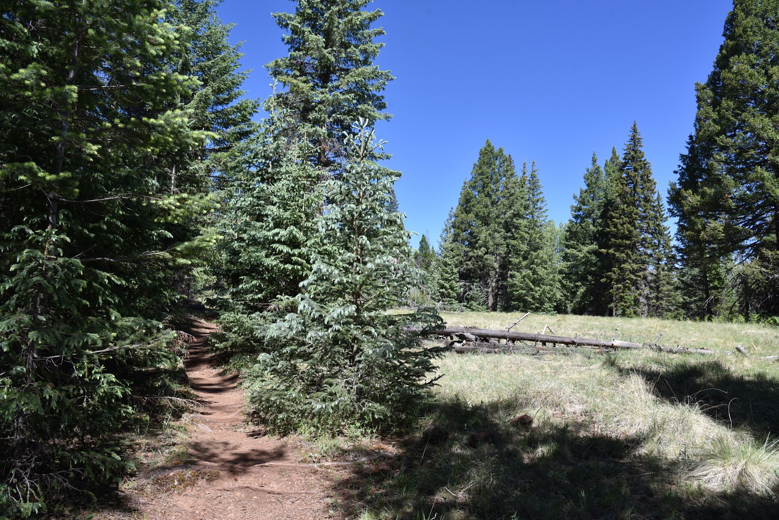
The woodsy approach to Deep Lake
Located roughly 20 miles southeast of Flagstaff, the windy plains of Anderson Mesa are home to a cluster of Arizona’s rare natural lakes. Conspicuous among the bodies of water that are collectively known as the plateau lakes are Ashurst, Kinnikinick and the massive, yet sometimes dry Mormon Lake—the state’s largest organic puddle. Along with nearby Upper and Lower Lake Mary, these high-county lakes are popular with anglers, boaters, campers and hikers trekking the adjacent Arizona Trail Passage 30.
A residual puddle in Als Lake attracts wildlife

Besides the obvious behemoths, dozens of smaller much less crowded lakes are scattered across the dynamic landform in Coconino National Forest.
Storm clouds build above Anderson Mesa
These secluded natural basins formed between 1 and 5 million years ago when subterranean hollows caved in to form surface depressions that fill with snowmelt water during high-precipitation years.
Turkey vultures and ravens soar above Als Lake
A livestock exclosure protects Post Lake
Vacillating between shallow ponds and mucky swales these ephemeral wetlands serve as important nesting habitat for waterfowl. 
If you’re lucky enough to have snagged a campsite in the area during the busy summer season, and want to escape the masses, take a stroll to one of the most impressive and surprising of the mesa’s lesser-known lakes.
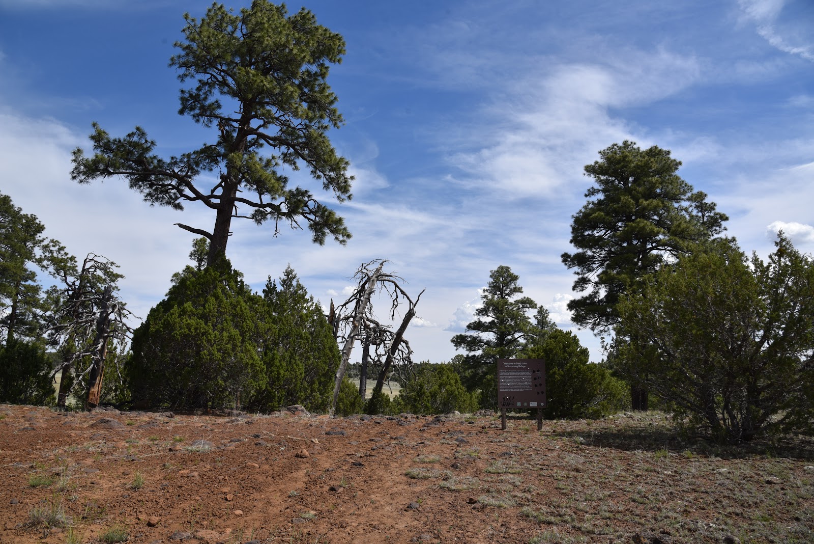
Snags on the rim of Deep Lake
The out-and-back hike to Deep Lake is actually a three-fer because the route, which follows Forest Roads 9117F and 82D, passes by three plateau lakes.  The trip begins with a half-mile walk on a rough two-track with great views of the San Francisco Peaks to the north before the road bends east. Here, where FR 9117F becomes FR 82D, the first of several livestock exclosure fences installed to protect the sensitive ecosystem from marauding cattle surrounds the reedy, birdy marsh of Post Lake.
Butter & eggs bloom in sunny meadows
After tracing the lake’s wildflower-rimmed perimeter, the road swings north through an airy, open-to-the-sky landscape with standout views of 8,449-foot Mormon Mountain peeking out over golden flatlands. At the 1.1-mile point, the road begins its fly-by of Als Lake.
Field bindweed grows along the roads on Anderson Mesa
A favorite haunt of turkey vultures and ravens, the elongated swale usually harbors a few residual pools where waterfowl and resident pronghorn can sometimes be seen lurking among clumpy grasses.
The impressive crater-like depression of Deep Lake
The next mile is a simple walk through fragrant juniper woodlands where rabbits and deer might dart by as you work your way to the junction with Forest Road 9484D at 2.3 miles.
For an optional side trip, FR 9484D leads to Potato Lake, another sizeable yet moisture-challenged natural lake. (NOTE: I did not take this side trip, but my map program indicates the road to the lake is about a half-mile long).
Continue another quarter mile north on FR 82D and soon the gated entry to the Deep Lake exclosure area comes into view. To preserve the terrain and minimize wildlife disturbance, travel beyond the gate is open to foot traffic only.  A few steps beyond the gate, the trail enters the enchanting realm of Deep Lake.

Junipers provide sparse shade and wildlife habitat
San Francisco Peaks seen from Deep Lake
 Surrounded by Ponderosa pines, Gamble oaks, volcanic outcroppings and a community of snags (dead trees used by wildlife for food and shelter), the crater-like depression of the lake takes your breath away. Even without water, as it was on my recent visit, the yawning bowl that provides refuge for over 100 bird species is a standard-bearer for an increasingly rare and fragile ecosystem.   A short footpath leads down the lake’s edge for a close-up view of a tenacious landscape that continually adapts to unpredictable, sometimes harsh conditions.
While visiting the lake, please tread lightly and quietly. Leave no trace and respect efforts being made to protect this fragile, natural treasure.
Ponderosa pines shade parts of the hike
A gate marks the entrance to the Deep Lake exclosure area
Approach to Deep Lake
LENGTH: 6 miles round trip
RATING: easy
ELEVATION: 6,964 – 7,131 feet
GETTING THERE:
From Interstate 17 just south of the Interstate 40 interchange, go right on Lake Mary Road (County Road 3). Continue 17 miles south and turn left on Forest Road 82E for Ashurst Lake just past mile post 327 across from the turn off for Pinegrove campground.
Drive 1.7 miles on FR 82E to Forest Road 9117F on the left. Park in pull outs along the road.
Forest Road 82E is washboard gravel suitable for all carefully driven vehicles.
MORE INFO:Audubon Arizona https://www.audubon.org/important-bird-areas/anderson-mesa-coconino-national-forest