Find A Trail. Start Your Search Here:

Monday, October 28, 2019

Kel Fox Trail

KEL FOX TRAIL
The highpoint saddle on Kel Fox trail

Kel Fox trail, quelle surprise. 
The under-the-radar outlier route located on the southern fringes of the Village of Oak Creek suffers from bland 2-star ratings. Its scenic qualities are often besmirched by online trail reviews because it shares space with a gas pipeline.

Kel Fox trail begins near Fuller Tank
View along FR 9500N near Fuller Tank
But those who buy into naysayers cracklings and visions of noxious fumes will be deprived of a perfectly fine trek with epic vistas and a pleasing backcountry mood.
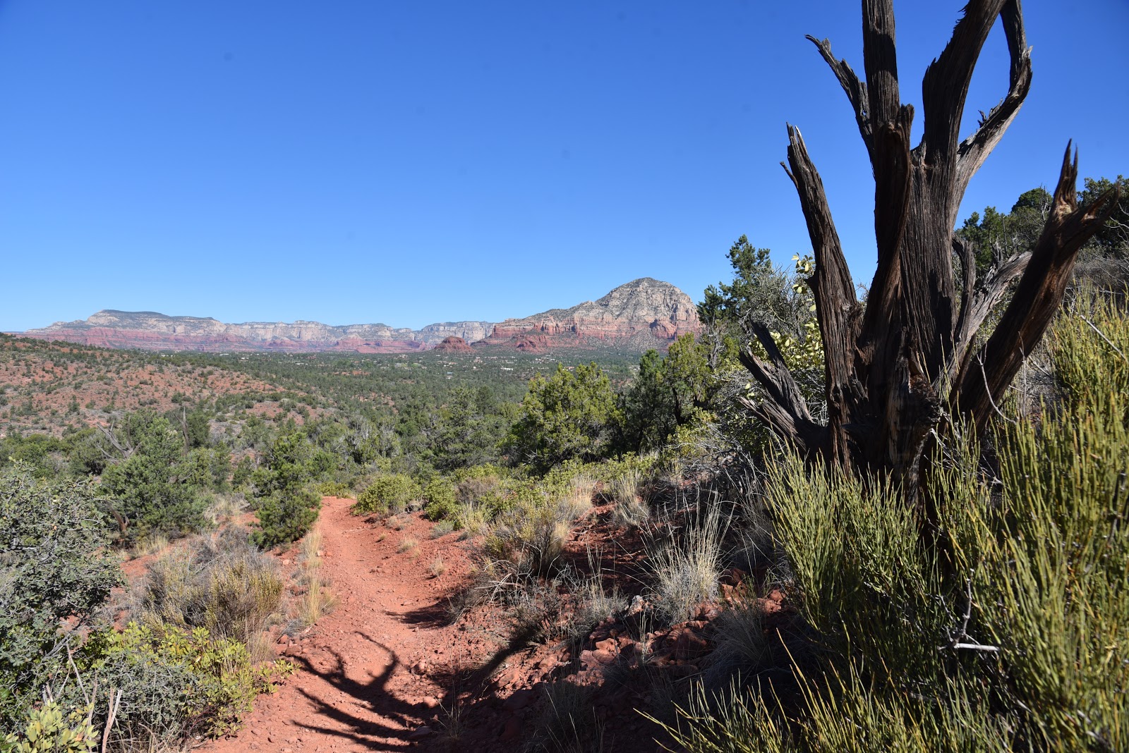
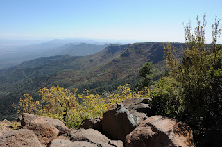
View from the highpoint of Kel Fox trail
Truth be told, the moderate out-and-back trail does follow the course of an underground natural gas pipeline, but the only evidence of the buried utility feed are blaze-yellow posts placed every hundred yards or so along the two-part hike.  
The first part of the hike follows FR 9500L
Eroded FR 9500L leads to the Kel Fox trailhead
The first segment of the trek follows Forest Road 9500L, a rugged, 1.4-mile track that leads to Fuller Tank and the official Kel Fox trailhead in Coconino National Forest. 
Cacti-studded slopes on Kel Fox trail
Although the road is open to motorized travel, washouts, sandy sections and deep ruts require at least a high clearance vehicle.  Hikers will do better to park and walk the road instead.  Forest Road 9500L parallels Beaverhead Flat Road--a busy byway between State Route 179 and the communities of Cornville and Cottonwood--for roughly a quarter-mile before it swings north leaving the road rumble behind.  Wide and easy to navigate, the road plows north on an undulating course through yucca-studded rangeland and scoured gullies.
Only yellow posts betray the maligned pipeline location 
Directly ahead, colorful sandstone mesas and volcanic peaks dominate the landscape. At the 1-mile point, veer left onto Forest Road 9500N that traces the contours of the massive stone formations on its way to Fuller Tank and the start of the second leg of the hike.  
Approaching Fuller Tank
Built into a cleft at the foot of a mountain pass, the tank sits behind a weedy, earthen dam where a small patch of cottonwood trees soak up water that ebbs and expands with precipitation and snowmelt. 
Kel Fox trail ascends a scenic mountain pass
A sign points to the Kel Fox trail, but during times when the tank spills over the main entryway, the route may also be accessed by crossing the dam, passing through three metal posts and following the workaround path back to the main trail.  Beyond the tank, the route becomes a slender singletrack that heads up the pass through abundant cacti, ocotillo and mesquite trees.  In several spots where game trails and drainages muddle the way, the maligned gas pipeline posts redeem themselves as handy directional beacons. 
Fuller Tank (dry on 10-27-19) near the Kel Fox trailhead
As the trail climbs along forested edges and rocky cliffs, terrific views of the Verde Valley and Prescott National Forest mountain ranges open up to the south.  Just under a mile above the tank, the route emerges from the narrow canyons and enters a high meadow where views of Sedona-area rock formations begin to peek out over a grassy saddle. 
The breezy, grassy saddle on Kel Fox trail
Soon, the trail tops out on the hike’s premier attraction, a breezy mountain pass slung between high-desert plateaus with surprising, breath-taking vistas.  It’s here where the trail reveals its hidden charms and earns absolution from its ho-hum reviews.
FR 9500N leads to Fuller Tank
From the rewarding high point, the trail heads downhill swallowing up the views as it descends on a fairly steep and slippery path.  The trail ends at a nondescript gate in a residential community where very limited parking squashes any idea of making this a car-shuttle hike. That’s why many hikers prefer to call the scenic saddle the turnaround point for the hike.
Mesas and peaks along FR 9500L
Approaching the scenic pass on Kel Fox trail
LENGTH: 6.8 miles roundtrip
RATING: moderate
ELEVATION:  3,780 – 4,235 feet
GETTING THERE:
From Interstate 17 north of Camp Verde, take the Sedona/Oak Creek exit 298 for State Route 179. Go 4 miles northwest on SR 179 (toward Sedona), turn left on Beaverhead Flat Road (County Road 78) and continue 0.8-mile to Forest Road 9500L on the right.  Cross the cattle guard and park in the pullouts along the road.
INFO: Coconino National Forest
-->

Monday, October 21, 2019

GO JOHN TRAIL

GO JOHN TRAIL:Cave Creek Regional Park
View of the Cave Creek Mountains from Go John Trail

Situated in a hilly slice of desert just a few miles east of Interstate 17, Cave Creek Regional Park is bordered by an eclectic brew of subdivisions, strip malls, nature preserves and national forest. 
West leg of the Go John loop is part of the Maricopa Trail
Somehow, the seemingly miss-matched adjacencies blend into a sort of extended back yard for North Valley outdoor recreation. Replete with the standard amenities of suburban patio life, the family-friendly park has a nature center, frequent workshops and events, picnic ramadas, restrooms, water, playground, horse staging area and camping. 
Flaky metamorphic rock outcroppings line the route
But beyond the grills and easy interpretive trails, there are also plenty of ways to escape into the wild end of the 2,922-acre site.
Of the eight trails in Cave Creek Regional Park, Go John is the deep-cut classic. As the core loop in the Maricopa County park’s 14-plus-mile trail system, the moderate-rated hike explores some of the most remote and scenic corners of the property.

Elephant Mountain in distance
Downtown Phoenix visible on the distant horizon
Scaly rock formations at Gunsight Pass
The beautiful thing about loop hikes like this one are the continually-changing views and Go John delivers the goods in far-reaching vistas, cloistered passages, a variety of geological features and rich plant communities. To get the major climbing done first, begin the loop at the north trail sign where the route dives right into the zig-zagging western leg of the loop that’s also part of the Valley-circumnavigating Maricopa Trail that connects all 10 county parks.
Long switchbacks mitigate the climb on Go John Trail
Quartz deposits appears along the route
The ascent is mitigated by long switchbacks cut from foothills that swing around desert trees and saguaro-cluttered bends. The first big views are revealed after less than a mile of uphill trudging. Sloping canyon walls frame hazy patterns of Downtown Phoenix and the jagged silhouettes of the Hieroglyphic Mountains west of the Valley.  The west leg tops out at a saddle where the first of several benches offers a place to enjoy glimpses of the Cave Creek Mountains and the distinctive pachyderm profile of Elephant Mountain appear to the north.
Continually-changing vistas are key features on Go John Trl
A large clearing on the saddle makes for a good spot to regroup and take a breather before continuing on the less steep segments that complete the loop.  The route dips and climbs through shaded drainage areas, washes and ridges lined with outcroppings of vertically-tilted metamorphic rocks that shed in thin sheets, coating the ground in glinting tile-like scales. 
Palo verde and mesquite trees thrive in drainage areas
Creosote is a common shrub along the trail
Adding to the park’s interesting geology are deposits of white quartz that show up as scattered pebbles and artfully-veined boulders near defunct mining operations.  About halfway through the hike, Gunsight Pass, a high point with bizarre blade-like rock pinnacles on the loop’s east leg, hovers above golf communities and ranches backed by the commanding form of Black Mountain and the distant Superstition Mountains. 
Part of theeast leg of the hike traces a drainage gorge
A final swing on cliffs above a deep gorge leads hikers through sunny rangeland where the Quartz and Jasper Trail spin off for optional geology-themed side trips or a shorter loop for young kids.
Cholla cacti frame views of the Cave Creek Mountains
LENGTH:  5.8-mile loop
RATING: moderate-difficult
ELEVATION:  2,088 - 2,520 feet
FEE: $7 daily fee per vehicle
GETTING THERE:
37900 E. Cave Creek Parkway Cave Creek.
From Carefree Highway in Cave Creek, go 1.5 miles north on 32nd Street to the park entry gate.  Follow the main park road to the Go John trailhead.
INFO:
-->

Monday, October 14, 2019

Ridge-Sketch Loop

RIDGE-SKETCH LOOP
Framed view of the Pyramid rock formation on Sketch Trail
Sketch Trail traces the edge of Carroll Canyon
The trails pass among junipers, yucca and pinion pines
A merry-go-round style of scenic vistas, varied terrain and a little bit of mild exposure combine for a pleasant high-desert hike in southeast Sedona. Tucked in a hilly pocket of territory in the Carroll Canyon area of trails north of the Crescent Moon Picnic Area on Oak Creek, the Ridge-Sketch circuit offers a quick, 4-mile tour of a slice of Coconino National Forest that’s close enough to town to be convenient yet provide a quiet out-there feel. 
An edgy bend in the Sketch Trail
From the obscure trailhead on Chavez Ranch Road, begin by hiking 0.3-mile west on the Ramshead Trail, hang a left at the Ridge Trail junction and follow the signs and basket cairns 0.7-mile to the beginning of the loop section at the Ridge-Sketch junction.  The 2.1-mile loop portion may be tackled from either direction, but to get the climbing over first, go right and continue on the Ridge trail.  
Sacred datura plants bloom along the route
The east leg traces the scrubby foothills below 4,680-foot Table Top--a jetty-like extension of Table Top Mountain which is home to the Sedona airport.  After a few high-step maneuvers, the trail arrives on a sunny crest with ocotillo-framed views of Courthouse Butte and Bell Rock, two of the area’s most famous sandstone formations.
View of Sedona from the Ridge Trail
Farther up the trail, profiles of the distant Bradshaw Mountains and the distinctive triangular shape of the 4,498-foot Pyramid rock formation stand out over the leafy floodplains of Oak Creek.
  Where the circuit meets the Sketch Trail, make a hard left and get ready for a whole other experience.  As the route heads downhill, the rounded, buff-colored mound of Capitol Butte dominated the horizon before the knotted path dips and bends on the lip of Carroll Canyon.  The trail passes among twisted junipers and breezy grasslands to a vista point at a precipitous drop off above the canyon’s sheer limestone walls. 
Courthouse Butte and Bell Rock seen from Ridge Trail
Beyond this keynote photo opp spot, the trail swerves south clinging to a slender ledge pinched between contorted boulder-riddled escarpments and beveled drops offs. 
Sketch Trail has Bradshaw Mountains vistas
Although it’s close-to-the-edge and quite rocky, the last mile of the loop portion isn’t too difficult as long as you aren’t afraid of heights and also keep an eye out for mountain bikers approaching from behind blind curves. 
Capitol Butte dominates the horizon on Sketch Trail
As you inch your way back to the loop junction-- using honeycomb patterns in the limestone as handholds—take a moment to scope out the many miles of trails that wind through the surrounding hills that may be used to build upon this sampler loop. 
LENGTH: 4-mile loop
RATING: moderate
ELEVATION: 3996 - 4422 feet
GETTING THERE:
From the State Route 179/89A traffic circle in Sedona, go 4.2 miles west (toward Cottonwood) on SR 89A to Red Rock Loop. Turn left and continue 1.8 miles to Chavez Ranch Road (Forest Road 788) turn left and go 0.6-mile to the trailhead on the right.
INFO:

-->

Monday, October 7, 2019

Fall Color Over Jerome


Fall Color Over Jerome
Find colorful oaks on these mountain trails
Looking for an under-the-radar alternative to Sedona’s West Fork of Oak Creek and Flagstaff’s Inner Basin for fall color hiking?  Try a few of the trails that explore the lofty summits of Mingus and Woodchute Mountain. The mountain top recreation destinations that hover over the arty community of Jerome are popular year-round for hiking, camping and day-trip picnicking. Located between Prescott and Jerome the airy trails wander through woodlands and meadows with fantastic viewpoints at precipitous edges. In autumn, forests of Gamble oaks and Big-tooth maples that drench the slopes in warm shades of crimson and gold adding spectacular color to an already amazing set of trails. Here are three to try.

WOODCHUTE MOUNTAIN TRAIL
Woodchute Wilderness Area
Golden oaks on Woodchute Mountain
Cooler temperatures and shorter days of autumn work together to paint the oak trees on Woodchute Mountain in a palette orange and gold. The mountain is really more of a long ridgeline with Prescott Valley on one side and grand views of the red cliffs of Sedona and the peaks of Flagstaff on the other. Easy-to-follow, trail No. 102 meanders 3.7 miles up the mountain on a  moderate slope that swings from east to west showcasing vistas of much of northern Arizona.
View of Prescott Valley from Woodchute Mountain
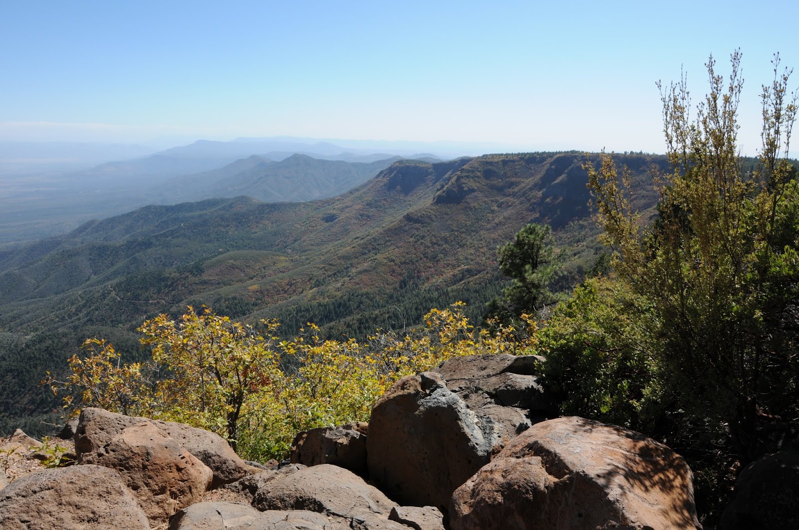
Beginning at 7,000 feet, the hike culminates with an easy stroll across a breezy high prairie that dead-ends at the 7,600-foot east face of the mountain. Here, blood-red maples and honey-colored scrub oaks frame views of Jerome and the Verde Valley.
Epic vistas on Woodchute Mountain
GETTING THERE: From Jerome, go 7 miles southwest on State Route 89A to the turn off for Potato Patch Campground. Turn right and continue .3 mile to the signed road for the Woodchute trailhead on the left and follow it to a parking loop with restrooms. Those without a high clearance vehicle should park here. To find the trailhead, head right (east) and hike or drive (high clearance needed) up Forest Road 106 (also signed as FR 102/106) for a half-mile to the wilderness sign and trail register. If you opt to hike the road, add 1 mile to the trip length above.

VIEW POINT TRAIL
Prescott National Forest
An oak archway on the View Point Trail
A traipse through an archway of toasty golden oaks sets the stage for the hallmark mountain vistas and brilliant foliage of the View Point Trail No. 106. Beyond this “grand entrance” the slender path begins its gradual, 2-mile descent along the east face of Mingus Mountain weaving through a mixed bag of terrain including exposed juniper-agave high desert and pine-oak forests fringed with Big-tooth maples.
See-forever views on the View Point Trail
From the trail’s high vantage point, the towns of Jerome and Cottonwood appear like scribbles on a map far below while the course of the Verde River paints a lazy swath of green on a brown landscape. Just past the 1.3-mile mark, at the junction for trail 105A, the route makes a severe dip into the canyon. It’s here where the hike rating goes from moderate-to-difficult as the path clamors roughly 700 feet downhill on loose rocks to the turnaround point at Allen Springs Road. Casual hikes can opt to stay on the high road and make the junction their turnaround point instead. Elevation range is 7,800 - 6,000 feet.
Gambel oaks frame color views on the View Point Trail
GETTING THERE: From Jerome, go 7 miles southwest on State Route 89A to Mingus Mountain Road (Forest Road 104). Turn left and continue on FR 104 for 2.4 miles to where it ends at a “T” intersection in the campground. Take an immediate left and park in the circular turnout near the “106” trail sign.

NORTH MINGUS TRAIL
Prescott National Forest
Pine-oak woodlands dominate the scene on N. Mingus Trail
An eclectic mix of scenery and forests are the highlights of the North Mingus Trail No.105. Although there are two trailheads for this route, most hikers choose to start at the top of Mingus Mountain and hike downhill. That’s because the route is easier to follow when hiked in this direction. Right from the start, this popular trail will “wow” you with magnificent views from 7,800 feet atop a pine-shaded hang glider launch pad.
Summit of Mingus Mountain--N. Mingus Trail
Here, the rugged Verde Valley rolls out 1,600 feet below. The 8.5-mile roundtrip hike begins with a pleasant stroll across the mountain summit under a canopy of warm gold Gambel oaks huddling beneath enormous conifers. After this short “warm up” section, the trail dips downhill along the north face through colorful corridors of Big-tooth maples, boxelders and velvet ash.
A stony passage on N. Mingus Trail
Soon, the path enters an enchanting passage where a mass of volcanic boulders cascade down a slender slot canyon where vertical stony walls and a stand of aspens thrive in the cooler microclimate. Past the aspen grove, the trail enters a more arid clime with intermittent sections of grasslands, fields of agave and ridgelines studded with wispy mountain mahogany. An abandoned mine marks the point where the trail merges with an old Jeep road that leads downhill to Mescal Spring at 6,000 feet, the turnaround point for the hike. This trail also can be hiked one-way using a car shuttle at each trailhead.
GETTING THERE: Mingus Mountain trailhead: From Jerome, go 7 miles southwest on Highway 89A to Mingus Mountain Road (Forest Road 104). Turn left and continue on FR 104 for 2.4 miles to where it ends at a “T” intersection in the campground. Turn left here and go uphill to the trailhead near the hang glider launch pad. Mescal Spring trailhead: From Jerome, go 4 miles southwest on Highway 89A. Just before sign for Prescott National Forest, between mileposts 339 and 338, turn left onto an unmarked dirt road (Forest Road 338). FR 338 is a very rough 4x4 road so those without appropriate vehicles should park in the turnouts along the highway. Continue down FR 338 for a half-mile to the cement tank that marks Mescal Spring. From here, veer right (southwest) and go uphill. Bear left at all unmarked junctions until you reach the signed turn off for trail No. 105 on the right. This route adds one mile to the hike description above.
-->

Monday, September 30, 2019

LATIGO-ROCK TANK- HAWKNEST LOOP

LATIGO-ROCK TANK-HAWKNEST LOOP

McDowell Sonoran Preserve
Palo verde trees shade the Latigo trail
Black Mountain seen from Rock Tank Trail
Outdoor recreation opportunities continue to expand in the McDowell Sonoran Preserve.  The permanently protected swath of Sonoran Desert in north Scottsdale that has over 220+ miles of trails that wind through more than 30,000 acres of pristine territory recently gained a new trailhead. 
WAPA power lines on Powerline Road
Located in the preserve’s northwest corner, the Pima-Dynamite trailhead that opened earlier this year, is part of the City of Scottsdale’s Phase 3 Trail Corridor Plan. The roomy access point is bordered by Pima Road and State Trust Land, Dynamite Boulevard and Stagecoach Pass and has parking for more than 200 passenger vehicles and special spots for horse trailers. While still under development, several trails in the Phase 3 project which involves 3,000 acres of land just west of the Brown’s Ranch trailhead are open for use by hikers, bikers and equestrians. Like all preserve trails, the new cluster of sustainably-designed, multi-use routes offer safe, non-motorized access while protecting native plant and wildlife habitats.
To get a quick look at the Phase 3 sector, make a loop hike on the Latigo, Rock Tank, Hawknest and Powerline Road trails. 
New trails in Scottsdale's McDowell Sonoran Preserve
A map kiosk at the trailhead shows the system layout as well as its connectivity with old-favorite preserve trails to the east.  The circuit begins with a short walk on Powerline Road to the Latigo Trail junction. The 1.1-mile Latigo leg is dominated by views of the Western Area Power Administration high voltage powerline.  Not exactly anybody’s idea of a perfect hiking visual experience, the looming spider-like metal structures have an odd, other-worldly presence.
A stony passage on the Hawknest Trail
When framed by the gangly arms of ocotillo and the gnarly branches of dead ironwood trees, the towers embody technology imitating nature. The juxtaposition of wires and wilds elicits mixed responses from trail users. Is the high-voltage canopy a necessary co-existence or an omen of doom?  It’s a dialectic best not explored when disparaging the juice conduits while pulling up trail apps on your phone. 
Bizarre granite rock forms are common site along the trails
Creosote shrubs line the Rock Tank Trail
Granite boulders on the Hawknest Trail
Wires and wilds on Latigo Trail.
Desert Senna blooms April - October
Hawknest Trail swerves around a granite rock garden
An old mesquite tree on Hawknest Trail
The hike isn’t all power lines, though.  As the route dips and bends, the wires are swallowed by big desert vistas of surrounding mountains and the distinctive forms of Cone Mountain, Pinnacle Peak and Black Mountain.  Hang a left at the Rock Tank trail junction where acres of saguaros, shrubs and hilly terrain mark the transition into a maze of mountain bike routes to the north. 
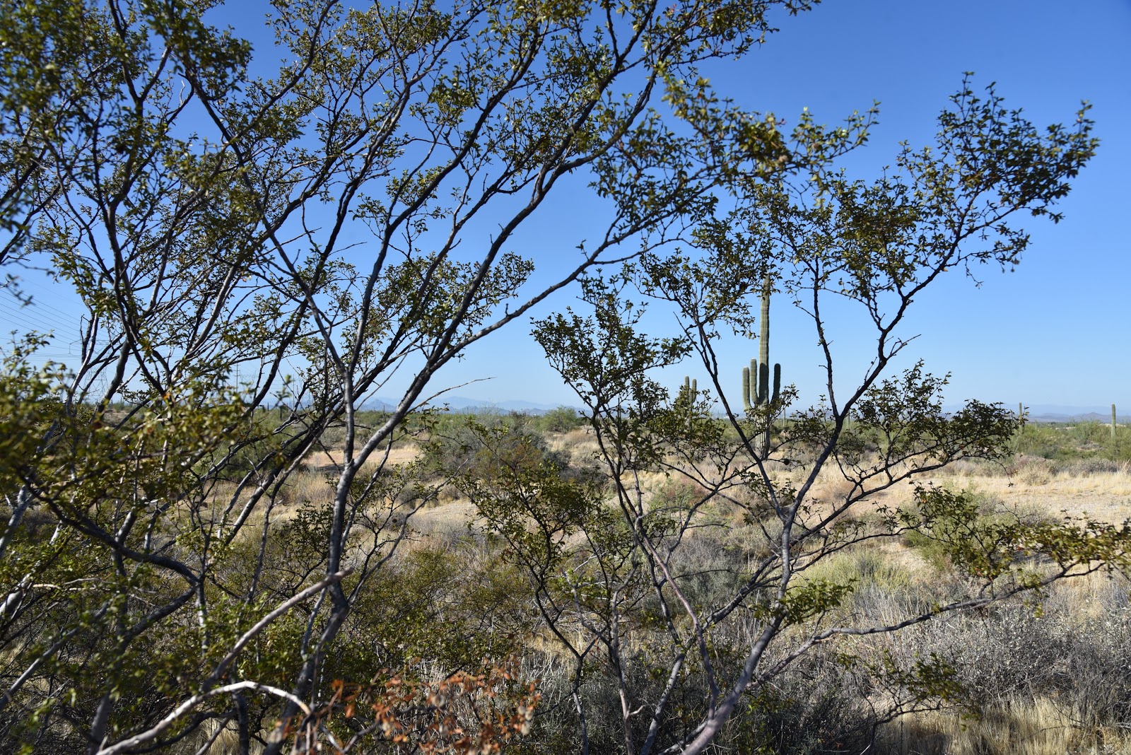
Sonoran Desert vegetation of Rock Tank Trail
The twisted paths of Dare A Sarah, Scorpion and Snake Eyes trails form a loopy challenge course in an area that, as of this writing, is signed to advise users to use caution because the area is not yet mapped. The trails are indicated on the trailhead kiosk, though. Continue on to the Hawkneck trail junction, turn left and get ready to hike though some narrow stone corridors with bizarre granite outcroppings. Although this leg of the hike also parallels the power lines, Palo verde, ironwood and mesquite trees do a good job of hiding them from view. 
Technology imitates nature on the Latigo Trail
The final miles back to the trailhead meld swerving singletrack paths with the straight-shot, bulldozed power line road that is both a backbone trail for pristine back country hikes and an access route for maintenance crews that tend the wires that send power to mobile devise charging stations.  The paradox abides.
LENGTH: 3-mile loop
RATING: easy
ELEVATION: 2,339- 2,453 feet
GETTING THERE:
Pima-Dynamite Trailhead: 28777 N. Pima Rd., Scottsdale.
From Loop 101 in Scottsdale, take the Pima/Princess exit 36, go 6.5 miles north on Pima Road to Dynamite Blvd., turn right and continue 0.1-mile to the trailhead on the left. No facilities at this time. The preserve is open daily from sunrise to sunset.
INFO: McDowell Sonoran Preserve