Find A Trail. Start Your Search Here:

Monday, July 22, 2019

See Spring

SEE SPRING
Water rushes from a crevice at the head of See Spring
On the jagged cliffs below the Mogollon Rim, dozens of springs dispense water that filters through the porous limestone escarpments.
The hike begins with an easy crossing of Christopher Creek 
The springs range in flow from steady trickles that drain into green seeps to icy founts that gush from solid rock, carving gullies and fostering thick forests.
  See Spring is one of the later. Its location half-a-mile off the See Canyon Trail along Christopher Creek in Tonto National Forest twenty miles east of Payson makes it a popular choice for a short day hike or add-on to the 2.5-mile mile artery route that climbs over 1700 feet to the top of the Rim.
There’s a local hiker adage that claims when trekking See Canyon, all you see is the canyon. This is mostly true, but, oh, what a canyon it is to behold. 
New Mexico locust grow in dense thickets on the trail.
Dense woodlands shade the See Canyon Trail
Right out of the chute, the trail delivers a rich palette of sights and sounds plus enough challenge (or not) to satisfy a full gamut of hiking styles. You don’t have to walk very far before becoming immersed in the perennial flow of Christopher Creek and the lush woodlands that thrive in its moist environs. 
Christopher Creek is a main feature of the trek.
Boxelder trees love the moist environs near See Spring
The journey begins with a brief walk on the Highline Trail. From the trailhead, follow the footpath to where a pair of white diamond symbols tacked to trees indicate where the route makes an easy crossing of the creek. On the opposite bank, walk a few yards and veer left at the See Canyon Trail junction. The next half-mile traces the stream through a mix of meadows and forests of New Mexico locust, boxelders and Ponderosa pines. Beneath the leafy canopy, healthy tangles of canyon grape vines mingle with insidious clumps of poison ivy--leaves of three, let it be.
Canyon grapes flourish in moist areas on the trail.
It’s smart to wear long pants on this hike to avoid getting an itchy rash.
Mountain vistas are sparse, but water features are plentiful
The path crosses several rocky drainages as it gently gains elevation to reveal glimpses of Promontory Butte, a major Rim land feature.  At the 0.8-mile point, head right at the See Spring Trail junction where the half-mile spur path swerves away from the creek and begins a moderate climb.  
Bigtooth maples filter sunlight on See Spring Trail
The “all you see” adage really hits home here as thick stands of Bigtooth maples, Gamble oaks, Alligator junipers, Arizona walnut and soaring Douglas and white firs choke the trail into a shady, slim passage obscuring all but sky and vegetation.  A few sets of switchbacks mitigate the 400-foot ascent that lands hikers in an enchanting natural water park setting.
Tree cover on the See Spring Trail
Roughly 1.3 miles from the trailhead, the first signs of the See Spring conglomerate of waterworks appear as jumbled ravines funneling crystalline streams.  Follow the faint footpaths another 0.2-mile and you’ll arrive at the spring source where water pours from rock crevices all around.
Golden-beard penstemons add brilliant color to the trek.
The splashy rhythms of water rushing over mossy boulders and flattened ferns complemented by bird calls and rustling leaves combine for a calming culmination of short trek with much to see. 
Scampering lizards are constant companions on the trail
See Canyon-See Spring junction
You're never far from water on this Mogollon Rim classic
See Canyon Trail traces Christopher Creek
Icy water spills from See Spring
Poison ivy. Leaves of three, let it be.
LENGTH: 2.6 miles roundtrip (5 miles with See Canyon Trail)
RATING: moderate
ELEVATION:  6106 – 6725 feet (7860 feet with See Canyon Trail)
GETTING THERE:
From Payson, go 20.2 miles east on State Route 260 to the Christopher Creek Loop exit, turn left and continue 1 mile to Forest Road 284 (across from the Tall Pines Market), turn left and go 1.6 miles to the trailhead. Access road is good dirt/gravel suitable for all vehicles. There’s a restroom at the trailhead.
INFO:


Monday, July 15, 2019

Little Elden Trail to Schultz Tank

LITTLE ELDEN TRAIL TO SCHULTZ TANK
FIRE NOTICE: August 6, 2019. This area is now back OPEN for use following the Museum Fire closure. Wildflower season is in full bloom in Flagstaff’s Dry Lake Hills area.
San Francisco Peaks dominate the northern vistas.
Yellow Columbine bloom in moist areas on Little Elden Trl.
Recent forest logging and clearing operations that had closed many of the trails that meander through the diverse terrains of the Coconino National Forest north of 9299-foot Mount Elden are gradually finishing up and several paths are now open.
Stormy San Francisco Peaks reflected in Schultz Tank.
One particularly productive wildflower trail that’s outside of the closure area is the Little Elden Trail to Schultz Tank.  This multi-faceted gem traces the north flanks of 9018-foot Little Elden Mountain through a mix of deep, mixed-conifer woodlands, aspen glens, sunny meadows and a variety of blooming plant communities.
Western blue flax grows in sunny meadows along the route.
From the trailhead, follow the 0.3-mile access path to the Little Elden Trail which doubles as part of the Arizona Trail Passage 32. The route heads right (west) at the sign and begins with a shady walk among pines and firs with a smattering of aspens tucked into clearings. Where the trail crosses drainages, plots of rich-green ferns swaying over the narrow footpath gently brush the shoulders of passing hikers. Roughly 0.8-miles in, reminders of the 2010 Schultz Fire begin to appear in the form of charred logs and gangly snags.
The spur path to Schultz Tank.
Ripe berries on a Fendler's ceanothus shrub.
A woodsy corridor near the beginning of the hike.
Soon, the devastating effects of the human-caused blaze that burned 15,075 acres over 10 days and also caused massive, monsoon-driven erosion come into full view.  Although only a short section of the trail passes directly through the fire scar, evidence of its havoc on the landscape  are clearly seen in the surrounding hills. The formerly dense pine-oak forests that defined the trail’s mid-section were toasted down to ash. Nine-years removed from the fire, this section is now a sprawling meadow flush with wildflowers and brambles that have taken root among blackened, matchstick-like stumps. The loss of the tree cover has revealed previously obscured views of O’Leary Peak and Sunset Crater to the northeast and the scorched edge of the Kachina Peaks Wilderness to the northwest.  The recovering meadows of hip-high grasses foster a botanical garden of blooming plants and shrubs.
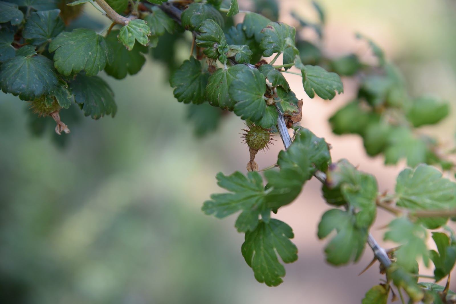
Thorny fruits on a gooseberry shrub.
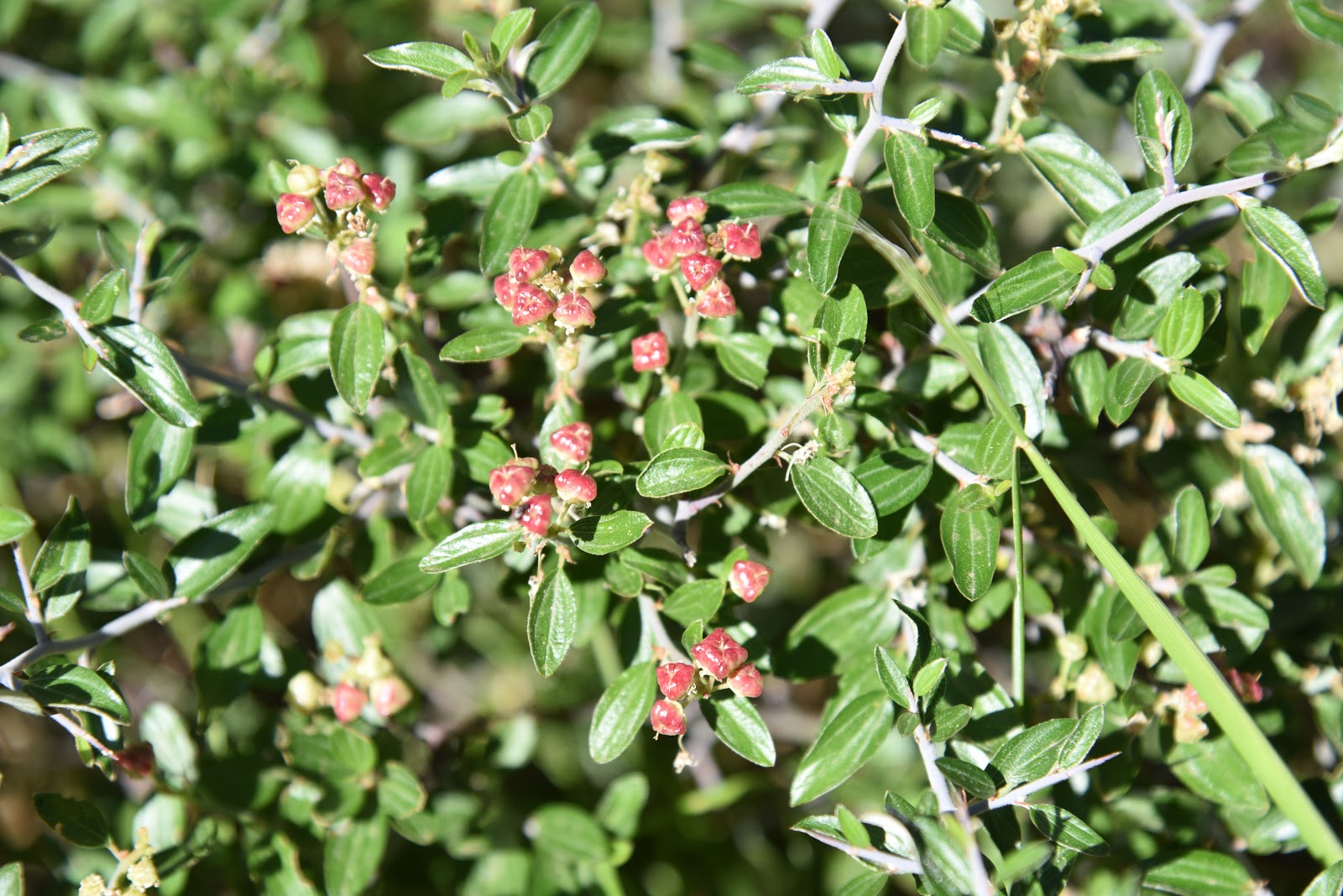
Look for fruity raspberry shrubs and the frothy cream-colored blooms and dark fruits of blueberry elder tree that grow sporadically in bright fields.  Delicate Western blue flax twines around Fendler’s ceanothus bushes and acres of paintbrush, butter and eggs, thistle, mountain parsley, common mullien, lupines, purple locoweed, gooseberry shrubs and other sun-loving varieties splatter vivid colors on the forest floor.
O'Leary Peak and Sunset Crater on the northeast horizon.
Richardson's geranium pokes through a bramble.
New Mexican vervain thrive in exposed meadows.
Dense coniferous forests near Schultz Tank.
Pollinators are attracted to Fendler's ceanothus shrubs.
Silver lupine add splashes of color to alpine meadows.
After about a mile of exposed grassland hiking, the trail heads uphill and ducks into moist, canyon-bound woodlands in the drainage areas near Schultz Tank. This beautiful segment features slopes with sprouting aspen saplings as well as ravines cluttered with old-growth conifers draped in moss. The wetter micro climate here supports a whole other type of wildflower habitat.
Purple locoweed is a common plant along the trail.
An understory of spreading dogbane, yellow columbine, Richardson’s geranium, curly dock, wild roses and fragrant wild geranium grow profusely in damp slivers of space among roots, boulders and gigantic trees. 
Little Elden Trail is part of the 800+-mile Arizona Trail.
Immature blueberry elder fruits follow frothy white flowers.
The Little Elden Trail ends at a signed junction where several classic Dry Lake Hills routes take off in all directions.
Ferns grow shoulder-high along the Little Elden Trail.
If you want to create a longer loop hike, check with the forest service before heading out to be sure your selected trails are open for use.
Fire damage visible on the edge of Kachina Peaks Wilderness
Schultz Tank is the turn around point for the hike.
Otherwise, follow the signs 0.2-mile to Schultz Tank, meander around the peak-reflecting pool and popular recreation hub then return the way you came.
Wild bergamot grows in moist pine woodlands.
Pale lavender aspen fleabane attract insects.
The 2019 Schultz Fire burned over 15,000 acres of forest.
Aspen saplings take root in the burn scar of the Schultz Fire.
Juicy wild raspberries grown in drainage areas.
LENGTH:  5.6 miles out-and-back
RATING: 7180 - 8000 feet
ELEVATION: 7320 – 8000 feet
GETTING THERE:
In Flagstaff, go north on U.S. 89 to Forest Road 556 (Elden Spring Road, just past mile post 429) turn left and continue 2.4 miles to the Little Elden trailhead on the right. The hike begins at the trailhead kiosk.
INFO: Coconino National Forest
-->

Monday, July 1, 2019

Perkins Tank and JD Dam Lake


Two Tank Trek: Perkins Tank and JD Dam Lake

Kaibab National Forest
Perkins Tank attracts myriad wildlife.
Southeast of Williams, a string of fishing holes hiding on the north rim of Sycamore Canyon Wilderness attract anglers, wildlife watchers, birders, runners and day hikers in search of atypical forest treks. 
Alfalfa blooms around Perkins Tank
Watch for dragonflies darting among reeds at Perkins Tank.
Clustered among pine forests and sunny prairies along scenic backwoods roads 20 miles south of town, Perkins Tank and JD Dam Lake comprise a water-centric tour of the Kaibab National Forest’s southern sector.
A hiker photographs birds at JD Dam Lake.
Although both ponds are stocked occasionally with rainbow trout, neither is a very productive fishery. Light visitation along with their locations off main roads make these secluded alcoves excellent places to view the myriad critters that come to their shores to drink and wallow. This two-stop circuit combines short walks around waterholes with a sweet scenic drive for a day of easy exploring. We begin at the northern most site and work our way south.
A 0.25-mile trail flanks Perkins Tank.
Trees and lush aquatic vegetation in JD Dam lake.
Perkins Tank is a 3.5-acre catch-and-release trout fishery that averages 10 feet in depth. Sitting at a summer-comfortable 6800 feet in elevation, the tiny pond has been adopted by the Northern Arizona Flycasters (http://nazflycasters.com/naf-history/), a non-profit organization dedicated to the conservation of fisheries in the Flagstaff and Williams areas.
Acres of water smartweed cover JD Dam Lake
The organization worked with land management agencies on projects to remove destructive sediments and install structures that both improved wildlife habitats and fishing access.  Although the tank can be reached by way of a rough dirt road, a better option for hikers is to park along the main artery access road and walk 1.4 miles to the trailhead. Because the lakes are located just far enough away from major recreation sites (White Horse Lake and Sycamore Canyon Rim Trail) and heavily travelled roads to offer wildlife sanctuary, you’re almost guaranteed to spot elk splashing about in the reeds if you arrive early in the morning. One of the first things you’ll notice here is a cacophony of singing bullfrogs and squawking birds. The ubiquitous croaking and screeching of the amphibious chorus makes an apt soundtrack for the clouds of dragonflies that dance among shoreline vegetation.
Bullfrogs (center) serenade at both lakes.
 
Perkins Tank dam makes for a great viewing platform.
Penstemon and other wildflowers bloom near the ponds.
A quarter-mile, out-and-back trail traces the tank’s north shore and crosses the earthen dam that contains the water.  Find a secluded spot camouflaged by a tree or rushes, sit awhile and be amazed at the dozens of species of local fauna whizzing past.
A dragonfly darts among reeds at JD Dam lake
The marshy backwaters of JD Dam Lake.

Hikers spot a group of elk wallowing at Perkins Tank.
Two walk-able peninsulas jut into JD Dam Lake.
A few miles down the road, JD Dam Lake is roughly twice the size of Perkins Tank.  The six-acre trout pond features two walk-able peninsulas that jut into the lake’s weedy waters. Whereas Perkins Tank is surrounded mostly by pine-oak woodlands, this pond swells with willows and aquatic plants including acres of water smartweed and emerald green marshes.  Because of its drive-up access, this little gem is a popular stop-off for fishing, floating a pontoon, wildlife watching and enjoying a picnic lunch.  Pack a pair of binoculars to view the waterfowl, frogs and wild turkeys that thrive in the marshy perimeters where shoreline footpaths are sometimes obliterated by flattened reeds, soggy backwaters and hip-high grasses. Explore with care and steer clear of anglers casting lines and gaggles of marauding geese.
A beautifully stripped dragonfly at Perkins Tank.

LENGTH:
Perkins Tank:  4 miles out-and-back
J.D. Dam: 1.2 miles out-and-back
RATING: easy
ELEVATION: 
Perkins Tank: 6925 - 6815 feet
JD Dam Lake: 6458 feet
GETTING THERE:
Perkins Tank:
From Williams, go 8.2 miles south on 4th Street (County Road 73/ Perkinsville Road) to Forest Road 110 (White Horse Lake Road). Turn left (east) and go 4.6 miles to Forest Road 3281 on the right. Park along the road and hike the road to the lake. Those with high-clearance vehicles may opt to drive the narrow, bumpy road 1.4 miles to the lake. There’s a restroom at the trailhead.
JD Dam Lake:
From Perkins Tank, return to Forest Road 110, turn right and continue to Forest Road 109 (signed for White Horse Lake and JD Dam). Turn left and go 2 miles to Forest Road 12 then follow the signs 5 miles to JD Dam.  There’s a restroom at the trailhead.
INFO:
-->