Find A Trail. Start Your Search Here:

Tuesday, May 28, 2019

ARIZONA TRAIL HAPPY JACK PASSAGE 28 GETS A REBOOT

ARIZONA TRAIL HAPPY JACK PASSAGE 28 GETS A REBOOT
Shawn Redfield at a super gate on AZT Passage 28
At a recent Arizona Trail Association (ATA) volunteer vacation work event on the Happy Jack segment of the trail on the Mogollon Rim, a reoccurring mantra drove the mission. “The trail doesn’t build itself.” Although the goal of constructing the 800-mile Arizona National Scenic Trail that runs from Mexico to Utah has been achieved, the route will never really be “finished”. Now, efforts have shifted from bridging the holes in the contiguous route to improving and maintaining trail conditions and enhancing user experience.
AZT steward Tasha Pontifex works on reroute of AZT
“When the Arizona Trail was originally planned, early trail advocates and land management agencies identified existing trails that could be designated as the Arizona Trail,” said Matt Nelson, Executive Director of the Arizona Trail Association.
Wendy Lotze demonstrates tool safety protocols
AZT volunteers hike to the construction site
“Connecting the gaps between existing trails was done by utilizing existing dirt roads. Then, the gaps that still existed necessitated trail construction,” Nelson explained. “The approximately 20 miles on the Coconino National Forest south of Mormon Lake (Happy Jack Passage #28) is a prime example. Since the forest contains hundreds of miles of dirt roads, it was easier to use existing roadways and build trail where there wasn’t already a “path.” However, the National Scenic Trail Act requires National Scenic Trails be non-motorized pathways, and a “desired condition” is to minimize motorized interface between non-motorized trail users and motorists. The Happy Jack Passage has consistently been commented on as the least desirable for AZT users, and receives no day use hikers, runners or mountain bikers because it’s not a pleasant trail experience.”
The new and improved trail takes shape
Project leads: Shawn, Wendy (AZT)  & Brady Vandragt (FS)
Thru-hikers (trekkers who hike the entire trail) have long maligned the 29.4-mile passage as “a boring road hike” (or as Nelson described it; “a numb experience”) and scratched it off as a means-to-an-end. Even with its scenic pine woodlands and many stock tanks that serve as water sources and wildlife magnets, the passage has wallowed in its “middle child” status. The Happy Jack Singletrack Project seeks to bring the woodsy segment on the Mogollon Rim up to par. The three-year project, now in its second season, will result in a major reboot.
“The ATA has long desired a better alignment for this section, acknowledging that forest roads—badly eroded ones at that—are not ideal for a National Scenic Trail,” said Shawn Redfield, Trail Director, Arizona Trail Association.  “The new alignment was devised by U.S. Forest Service staff, based on topography, water sources and scenic features, and avoiding endangered species habitat.”
Volunteers rallied during a trail-building event held from May 26 – 30, 2019, one of several efforts that will augment the heavy-lifting done by American Conservation Corps workers and hired heavy equipment.
AZT Volunteer Coordinator Wendy Lotze
Volunteer Vacation base camp on the Mogollon Rim
“The volunteer vacation is part of a much larger, 3-year project to reroute the AZT off of 18 miles of old forest roads and on to newly-built singletrack trail,” Redfield said.
“The project is funded by a Recreation Trails Project grant from Arizona State Parks, Forest Service contributions, significant donations from REI, and funds from the ATA.  
Wendy Lotze guides a volunteer trail builder
American Conservation Experience youth corps from Flagstaff is doing a lot of work with hand crews and machines. ATA will hire additional machine work later this year.
In addition to the 18 miles of new trail, the project includes several kiosks at trailheads, 15 AZT super gates, 5 bike rollovers, a horse hitching rail, and numerous signs and markers placed along the new route.”
Volunteers are always needed for construction and maintenance projects and no special skills are required.
AZT workers plan the new route
“Can we say it again? The trail doesn’t build itself,” said Wendy Lotze, Arizona Trail Volunteer Coordinator and Happy Jack project lead at the May event.  During her on-site training demonstrations, Lotze explained safety protocols and proper use of tools while repeating the project goals and acknowledging that ongoing volunteer contributions are crucial to the trail’s future. “Our priorities are safety, fun and productivity. In that order. It’s more important that you stay safe and enjoy your experience here rather than burn out trying to build a lot of trail,” she said to project participants. “We want you to come back.” Even those who are not able or willing to get their hands dirty can still help out.
Orange flags denote the reroute location
“If swinging a pick isn’t possible for an interested volunteer, there are numerous other opportunities to help. We always need help with preparing lunches and shuttling volunteers. The ATA is continually raising funds to offset our share of the considerable project costs, so if you can’t make it into the field and still want to support the Happy Jack Singletrack Project, consider writing a check”, said Matt Nelson.
Volunteers got some nice swag
The reroute will improve user experience
Volunteers prepare to hike out to the construction site
So far, several miles of the reroute have been completed and updated maps are posted on the AZT website. No longer a soul-deadening trudge, the new route is now located away from roads. “The improvement in the scenic nature of the trail and the user-experience is dramatic,” Redfield said.  Day hikers will now find that the passage is an approachable way to step out into the forest without having to dodge motorized traffic.
“The best thing that could happen to this trail is to get a bunch of [foot] traffic over it as soon as possible to pack it down and harden the surface. If this thru-hiker season and social media “buzz” is any indication, getting traffic over the new trail is not going to be an issue,” Redfield added.
ARIZONA TRAIL PASSAGE 28:
LENGTH: 29.4 miles
RATING: moderate
ELEVATION: 6733 – 7618 feet
EXPLORE, VOLUNTEER, DONATE:


Monday, May 20, 2019

BAKER BUTTE

BAKER BUTTE
Lilacs frame Baker Butte fire tower on the Mogollon Rim
A hike up to Baker Butte culminates at an idyllic, pine-shaded pinnacle. Swarms of hummingbirds whip through lilac-scented air and masses of ladybugs cling to trees, shrubs and knee-high wildflowers.
Fire lookout Shirley Payne and her horse Rameses.
Nearby, a horse chomps hay in a makeshift corral while a friendly black Labrador retriever noses a tennis ball. Perched on a knoll at the edge of the Mogollon Rim, the mood surrounding the Baker Butte fire tower is as calm and pastoral as a romantic passage in a Victorian novel.

Pine thermopsis (golden pea) bloom April - July
But this enviable life removed from city heat, traffic and noise belies a very serious purpose.
“Are you coming up?” The voice of fire lookout Shirley Payne broke the silence as she called down to me and my hiking partner from the catwalk of the 30-foot-high tower. “Oh, yeah,” was my no-brainer answer.  Payne, who has worked in the tower for 23 years, welcomed us with a plate of fresh-baked poppy seed muffins.
Payne's dog Jeffrey takes a break near the corral.
The tower is located near the western edge of Rim Road (Forest Road 300)--a 51-mile dirt route that runs between State Route 87 south of Clints Well to State Route 260 near Forest Lakes. Rim Road makes for an iconic scenic drive for anybody with a high-clearance vehicle and the fortitude to endure some queasy, edge-hugging sections. Of the many Coconino National Forest fire lookout towers that dot the Rim, Baker Butte is one of the easiest to reach on foot. For a moderate 3-miler, park at Baker Lake (usually not more than a soggy bog) at the junction of FR 300 and SR 87 and hike 1.2 miles on FR 300 to Forest Road 300B (the road to the lookout) where there’s a parking area for the General Crook Trail, then continue 0.4-mile uphill to the summit. The summit road passes through archways of Gambel oak trees, pines and Douglas firs. Fringed with ferns, raspberry brambles and colorful spreads of Canada violets, Pine thermopsis, sandwort and wild strawberries, the road twists uphill in long loops landing at the base of the fire tower.
Views from tower catwalk stretch from Flagstaff to Tucson
The tower, which earned a spot on the National Historic Lookout Register in 2006, wears its heritage well. Constructed with a not-so-subtle blend of original, repurposed and new building materials, the practical yet homey loft is softened by Payne’s collection of quilts, plants and mementos.  Neatly arranged instruments, radios, binoculars and maps speak to the intense, sometimes harrowing, work of fire spotting and coordination of incident response teams—the daily grind of a fire lookout.
Thick tree cover on the summit road hike.
The long-gone original tower cabin that was built in 1921 was replaced in 1937 with the present 12’ x 12’ model that’s perched on a metal skeleton with wooden stairs. The catwalk was added in 2009 and various upgrades to walls and windows surround a floor covered in speckled, cracked linoleum that smacks of mid-century utilitarianism.
Copies of Payne’s book, Baker Butte Journal 2010, sit near the guest register. Well worth its $20 sale price, the photo-rich volume presents a slice-of-life account of a season in the tower. It's packed with play-by-play descriptions of wildfire response, turbulent mountain weather, recipes and the misadventures of “cidiots” (visitors from cities with irresponsible forest habits) who litter, cause damage, raise hell and sometimes need rescuing.  A stroll around the catwalk reveals see-forever vistas. On most days, the peaks of Flagstaff, Williams and the White Mountains can be seen with the naked eye standing over seas of Ponderosa pines. On the best days, Picacho Peak and Mount Lemmon in Tucson show their silhouettes 200 miles to the south. 
Jeffrey is always ready for a game of fetch
Payne offers fresh-baked muffins to tower visitors.
Below the tower, a tiny cabin serves as Payne’s home for six months (usually May – October) each year. Draped in lilac bushes that were planted in the 1980s, the ad hoc abode has been expanded, adapted and upgraded over decades of use.
Hummingbirds gather at feeders placed around the tower
Tools of a fire lookout's trade.
The sunny kitchen was salvaged from a Depression Era Civilian Conservation Corps camp at Mormon Lake and repurposed into a compact, fully-equipped work space (with hot and cold running water to boot) where Payne cooks up her culinary specialties like the yummy muffins she serves visitors.  Some of her recipes use wildflowers and berries harvested from the forest.
Payne's book describes her experiences working in the tower
Outside, an array of hummingbird feeders attract several species including the Broad-tailed, Rufous and Magnificent. During summer, flocks of the glinting little birds can drain a feeder in just hours, which keeps Payne busy with refill runs up to three times a day. In addition to the elk, chipmunks, turkeys, western tanagers and deer that hang out around the tower, Payne keeps two special four-legged helpers at her mountain top work environment. Rameses, a 21-year-old Missouri Fox Trotter--a gaited breed (horses with a sure-footed, rhythmic stride) who loves mint candy treats, and Jeffrey, a friendly  3-year-old black lab with a fetch fetish and boundless energy provide companionship and assistance. 
Raspberry brambles produce fruit in late summer
During fire season, the Baker Butte tower is open to the public between 8:00 a.m. and 4:30 p.m. when Payne is on duty and closed for lunch between noon and 1 p.m.
The cabin kitchen was salvaged from a CCC camp
Canada violets bloom April - September
As Arizona heads into another fire season, forest visitors should respect fire restrictions and safety protocols. The last thing any fire lookout wants to see is a plume of smoke drifting skyward from a human-caused blaze.  When visiting a fire tower, please observe proper etiquette.

• Respect visiting hours. Do not attempt to enter a tower when no lookout is present.
• Wait to be invited. Lookouts may not allow visitors when monitoring an active fire incident.
FR 300B begins across from a General Crook trailhead
• Lighten up. Leave bulky packs and trekking poles behind. Tower stairs are narrow and space is tight inside.
• Ask permission before taking photos or approaching companion animals.
• Listen up. Follow the lookout’s instructions and don’t touch instruments. 
• Learn something. Ask questions. Most lookouts are veritable founts of knowledge about the forests they watch over.
Begin at Baker Lake (bog) for a 3-mile hike to the tower.

LENGTH:  3 miles roundtrip from Baker Lake or 0.8 mile roundtrip from the General Crook trailhead.
RATING: moderate
ELEVATION:  7430 - 8074 feet from Baker Lake or 7866 – 8074 from General Crook trailhead.
GETTING THERE:
From the State Route 87/260 junction in Payson, go 28 miles north on SR 87 to Forest Road 300 (Rim Road) located just past milepost 281.
Option 1: Park in the dirt turnouts on Rim Road near Baker Lake just a few yards in from SR 87.
Option 2: Follow FR 300 (make a sharp left at a Y junction at  0.1-mile)  1.2 miles to the Baker Butte Summit Road (FR 300B). There’s parking directly across from the summit road in the General Crook trailhead. Forest Road 300 is bumpy dirt but passable by passenger cars.
INFO:
Fire Management Coconino National Forest
-->

Monday, May 6, 2019

WALNUT CANYON RIM

WALNUT CANYON RIM
Vista point on Passage 31 of the Arizona Trail
Arizona Trail Passage 31 runs for 17.9 miles between Marshall Lake and Interstate 40 southeast of Flagstaff.  Because it’s one of the shorter of the 43 passages that make up the 800-mile, state-traversing route, strong hikers can complete it in a day. Blasting through the entire section in a day makes for an epic trek, but numerous access points along the route provide ways to create abbreviated hikes that sample some of the most gorgeous slices of this high-country path.
Arizona valerian grow on moist slopes
The hike traces the rim of Walnut Canyon in Flagstaff
One to try begins at dirt parking apron along Old Walnut Canyon Road.
The moderate trek in Coconino National Forest links wildflower meadows, pine-oak woodlands, a dip into a tapered canyon and amazing vista points overlooking Walnut Canyon National Monument-- a 3600-acre site that protects archeological and natural resources--for a varied, moderate hike. 
The trek begins on a wide, flat path that weaves among pine groves and meadows with glimpses of antenna-cluttered Mount Elden (9298’) to the north.  
The rich soil and sun exposure foster acres of colorful wildflowers like stemless daisies, lupine and paintbrush.
At the 0.4-mile point, turn right at the Campbell Mesa Trails sign and continue on a mild uphill path. Just beyond a wildlife water hole, the trail meets a set of switchbacks carved from limestone escarpments that mitigate a descent along the canyon walls.  Hanging close to the edge, the slim trail passes among rock overhangs and clusters of yucca that cling precariously to cracks in the stony substrate. As the trail dives deeper into the canyon, enormous “yellow bellies” (mature Ponderosa pines that have developed a scaly, yellowish-brown bark) filter sunlight while rangy snags (dead, standing trees) attract insect-seeking birds and nesting critters. While passing through this enchanted forest, be sure to stop and smell the yellow bellies. 
A lupine about to bloom on the Arizona Trail
Their sap has an aroma that’s been described as butterscotch, vanilla and cherry. (My personal take on this fragrance is a top note of sugared cedar, a heart of moss and a base note of patchouli.)   In moist areas under the trees, look for tiny pink Arizona valerian flowers.  The tubular clusters can be seen poking out from blankets of pine needles through early summer.
Brilliant paintbrush are common bloomers along the AZT
Several spur paths lead to scenic points above Walnut Cny.
The short canyon section ends with a climb back up to the rim where the first vista point junction appears at 2.2-miles. To visit the scenic ledge, head left and hike the 0.2-mile spur to a promontory at the western edge of the national monument. Here, a fringe of conifers frame views of a heavily-forested bend in the meandering canyon. It’s a 300-foot drop from the breezy rim to the canyon floor with no guardrails to stymie a stumble.
Stemless daisies bloom in sunny meadows
So, explore carefully before retracing your steps back to the junction and continuing 1.1 mile on to the next vista detour where a 0.6-mile spur leads to more big sky panoramas and impressive canyon views. 
A pine shaded meadow along the route.
If you’re up for more, there are two more vista points before the trail moves off the rim.
Switchbacks mitigate a descent into the canyon
A wildlife water hole on the Arizona Trail
One is located another 1.1 miles down the trail while Fisher Point, the most famous of them all, marks the end of the tour 6.4 miles from the trailhead.
Stop and smell the yellow bellies
Yucca sprout from the craggy canyon walls
Limestone slabs and overhangs line the route
The trail hugs the canyon edge
LENGTH:
To the first vista point and back: 4.8 miles
To the second vista point and back: 7.8 miles
To Fisher Point and back: 12.8 miles
RATING: moderate
ELEVATION: 6613 - 6920 feet  to second vista point, (7033' to Fisher Point)
GETTING THERE:
From the Interstate 17/40 junction in Flagstaff, go 5.4 miles east on I 40 to exit 201 (Country Club Road). Turn right and  go 0.9-mile south to Old Walnut Canyon Road (Forest Road 303, turn left and continue 2.7 miles to the parking area on the right.
Snags (dead, standing trees) attract wildlife
The hike begins at the small Arizona Trail sign on the south side of the road. The last 0.3-mile is on rough dirt best suited for high-clearance vehicles.
INFO: Arizona Trail Association

Monday, April 29, 2019

Kendrick Park Watchable Wildlife Trail

Kendrick Park Watchable Wildlife Trail
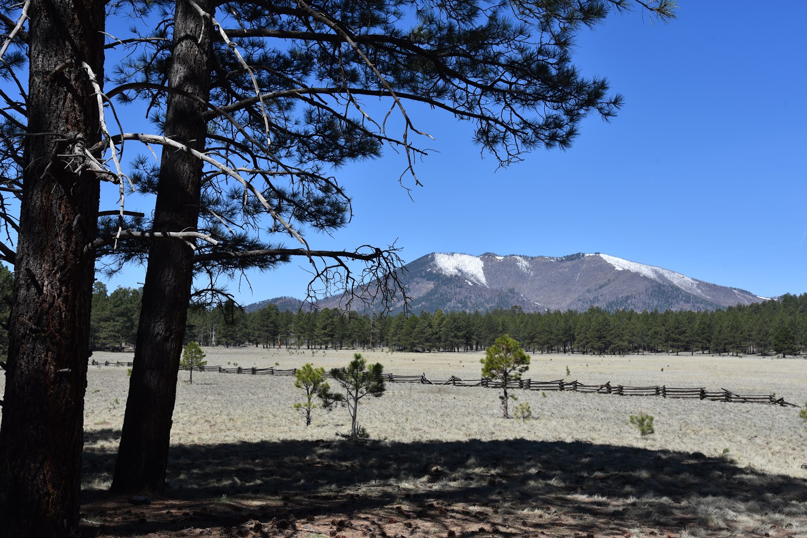
Kendrick Peak seen from Kendrick Park
To young children, traveling the stretch of U.S. 180 that runs between Flagstaff and the south rim of the Grand Canyon can feel like being trapped in a careening container with few sights that appeal to kiddie sensibilities.
A  Ponderosa pine tree provides cover for wildlife viewing
Electronic devise-enabled distractions only last so long before cries of ‘are we there yet’ and ‘I have to go potty’ demand a break from the drive that flows between pine forests and the desert plains of the Colorado Plateau. 
Aspen regeneration project along the outer loop.
The fix is a stop at Kendrick Park Watchable Wildlife Trail.  Complete with walking paths and a restroom, the site that sits on 2000 acres roughly 20 miles north of Flagstaff offers a chance to stretch legs, decompress and maybe learn a thing or two.   The U.S. Forest Service property has two short loop trails that explore biologically diverse spaces in alpine meadows, pine woodlands and aspen glens with excellent views of the San Francisco Peaks (12,633 feet) and Kendrick Peak (10,418 feet).  The quarter-mile short loop is paved and suitable for strollers and wheelchairs while the 1.2-mile outer loop follows a flat dirt trail. 
The San Francisco Peaks soar to 12,633 feet.

Many teaching moments punctuate the hike.
Both paths are outfitted with interpretive signs that describe fascinating facts about the area’s plants, animals and history. 
Two easy loop trails explore the property.
The compact system is packed with points of interest. An abandoned potato field, corral and campsite document some of the surprising ways people have used the land in the past.  Along the outer loop, an aspen recovery area at the edge of sprawling grasslands and signs that explain how wildfires have impacted the landscape illustrate the complex forces that continually shape the delicate ecosystems.  Of course, the big draw here is the opportunity for real-time wildlife viewing.  To optimize your chances of seeing animals wandering in their natural habitats, experienced viewers recommend the following tips.
Fremont barberry grows along the trails.
The outer loop passes through a beautiful aspen grove.
The family-friendly 0.24-mile short loop is barrier-free.
Signs invite visitors to immerse in the experience.
Interesting relics at an abandoned camp site.
• Plan your timing. Wildlife is most active at dawn and dusk.
• Be invisible. Stay quiet, wear neutral colors and avoid using scented products like perfume, lotion and strong laundry additives.
• Be patient.  Sit quietly behind a tree or rock and wait for animals to appear.
• Observe from a distance. Keep wildlife wild by giving them their space. Never harass, feed, or handle wildlife.
When explored quietly and with respect, the trails at Kendrick Park extend a rest stop into an entertaining, educational tour of a northern Arizona wildlife stomping ground with tantalizing backstories and myriad mini lessons built in.
LENGTH: 1.5 miles for two loop trails
RATING: easy, the short loop (.25-mile) is barrier-free
ELEVATION: 7862 - 7915 feet
GETTING THERE:
From Flagstaff, go 20 miles north on U.S 180 to the trailhead located between mileposts 235 and 236 on the west side of the road.
There is a restroom, but no water at the trailhead.
INFO:
Arizona Watchable Wildlife Experience:
Coconino National Forest:
--> -->