Find A Trail. Start Your Search Here:

Sunday, September 3, 2017

SUNFLOWER FLAT & J.D. CABIN EXPLORATION

SUNFLOWER FLAT & J.D. CABIN EXPLORATION

Kaibab National Forest
J.D. Cabin site on the Kaibab National Forest
Literature is rife with tales of creatures both real and imaginary. Books like J. K. Rowling’s "Fantastic Beasts and Where to Find Them" and the 1963 classic "Where the Wild Things Are" by Maurice Sendak introduce readers to magical places and whimsical creatures. These fanciful tales might inspire you to explore the equally enchanting real-life critters and locations of Arizona. There’s an easy way to indulge your curiosity and step back in history along the dirt roads and prairies southeast of Williams.  This two-part outing begins at Sunflower Flat Wildlife Area. Situated in a high-country wet meadow surrounded by mountain peaks of Kaibab National Forest, the site is unique in that its condition varies with rainfall, and visiting wildlife responds accordingly. When there’s lots of rain, the 160-acre Arizona Game & Fish property is a shallow lake that plays host to myriad waterfowl and shorebirds like ruddy ducks and mallards.
Many varieties of sunflowers bloom in the marshes
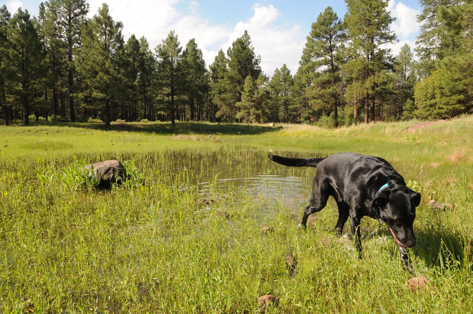
As the water wanes, look for cinnamon teals, herons and northern shovelers poking around in the marsh. Even during the driest times, residual puddles and reflecting ponds draw hawks, elk, pronghorn, black bears and deer and there are always plenty of frogs, lizards and gartersnakes enjoying muddy bogs. Exploring this ephemeral wetland begins at an information kiosk where you can learn about the site and its special place in the landscape. Because the objective of this peaceful enclave is to protect and enhance wildlife habitats, please read and respect the trailhead sign that has tips about how to view the local fauna responsibly.  Spot any bald eagle nests along the way? The majestic birds nest here in winter. Also, look for areas where tall grasses have been flattened into circular beds. These are animal wallows--places where elk, deer and other beasts sleep and rest.
Bill Williams Mountain over Sunflower Flat
The hike follows the perimeter fence and takes roughly two hours.
A favorite spot for waterfowl at Sunflower Flat

Sitgreaves Mountain & the San Francisco Peaks on horizon

Corral at the J.D. Cabin site
The second destination is the J.D. Cabin and grave site. To get there, hike back up the wildlife area access road, turn left and follow the road 0.7-mile to a turnoff on the right marked "no camping here". This is the historic homestead of James Douglas. An array of rustic buildings with metal-roofs and rough-hewn log construction is remarkably well preserved and gives an idea of what life on the prairie must have been like back in the 19th century. A walk around the deteriorating bunkhouse, cabin, corrals and crumbling foundations takes about an hour.  Ol’ J.D. is buried nearby among soaring pines and wildflower meadows.
a wallow
KA Hill looms over the wetlands
LENGTH:
Sunflower Flat: 3.7 miles
J.D. Cabin: 2.2 miles
RATING: easy
ELEVATION:
Sunflower Flat: 6620' - 6640'
J.D. Cabin: 6640' - 6680'
GETTING THERE:
Sunflower Flat:
From Flagstaff, go 27 miles west on Interstate 40 to exit 167. Turn right and go 3.8 mile south on Forest Road 141 and veer left at a fork. Continue another 4 miles to Forest Road 109, turn right and go 3.3 miles to Forest Road Road 14. Turn right and continue 1 mile and turn left on Forest Road 14A. The trailhead is 0.4 mile down this road.  Roads are good gravel and passable by passenger car up to FR 14 where high clearance is recommended. Forest Road 14A is rough dirt and requires high clearance.
INFO:

Monday, August 21, 2017

INDIAN SPRINGS TRAIL # 627

INDIAN SPRINGS TRAIL # 627
Indian Springs Trail
Late summer in Arizona’s White Mountains is prime time for wildflower viewing. Cooler evenings take the edge off daytime heat and mornings break in a crisp dewy dampness that hints of autumn and nurtures a colorful spectacle of blooming plants. Fields of sunflowers dress roadside pastures making the annual bloom frenzy accessible to anybody willing to take a drive and pull off onto a random dirt road.
Apache Lobelia
But if you want deeper access to high altitude botanical treasures, lace up your hiking boots, strap on a backpack and hit the Indian Springs Trail near Big Lake.
Paintbrush and ferns
The 2011Wallow Fire roared across this classic trail of fir-spruce woodlands taking out some segments while leaving others mostly intact.
Richardson's Geranium
The upside to the loss of coniferous canopies is a sunlight-generated surge in wildflower proliferation. The best part about loop trails like this one is its mix of sun, shade, hydrology and micro climates that produce a wide variety of flowering plants.
The blossom bonanza begins right from the get go in a bud-dotted meadow. Here, sun-loving fleabane and harebells bob in mountain breezes. Beyond the trailhead, the path moves into a section of survivor pines and the filtered light domain of species like Richardson’s Geranium, Pleated Gentian and brilliant orange Paintbrush.
Indian Spring suffered damage from the 2011 Wallow Fire
A passage of wild red raspberries and ferns culminates at the junction for the optional half-mile spur trail that leads to Big Lake Lookout. Although the fire tower that stood on this rocky knob succumbed to the blaze, there’s an upside. Lake views are now easier to see through toasted stumps and resurgent shrubs.
Wild Raspberry shrubs and ferns
The next section of the hike passes through an old growth forest of fir, spruce and mature aspens. This darker, wetter space favors Canada violets, mushrooms and  Blue-eyed grass. At the 1-mile point, the reliable trickle of Spillman Spring creates a water garden of clovers and Seep Monkey Flowers that grow in bright clumps in and around the rustic wooden troughs set up to catch the flow. Fire damage is much more visible throughout the remainder of the hike. Thickets of aspen saplings account for much of the regrowth.
Seep Monkey Flowers
In these areas, look for Common mullein, Apache lobelia and Spurred Gentian.
Indian Spring appears as a mucky pond at the 2.5-mile point.
Red Raspberry
The swamp’s fringe of Rocky Mountain irises that bloom May thru June, are  long past prime by mid-summer.
Harebells
Beyond the loop’s halfway mark, marshy areas define the trail’s lowest elevation.  Runoff collects in soggy bogs and funnels into streamlets that feed the tributaries of the Black River. These swales are the habitat of False Hellebore, horse mint, New Mexican checker mallow, lupine and penstemones. At 5-miles there’s an option to add on the 6-mile round trip West Fork of the Black River Trail #628 before the route curves back to the start point. 
False Hellebore
Water Hemlock

LENGTH: 7.5-mile loop (8.5 miles with lookout side trip)
RATING: moderate
ELEVATION:  8600’ - 9415'
Pleated Gentian
GETTING THERE:
From the Hon-Dah casino in Pinetop-Lakeside go 19.6 miles east on State Route 260 to State Route 273, just past milepost 377 and signed for Sunrise Ski Area. Go 19.2 miles south on SR 273 (turns into Forest Road 249 past the Big Lake turnoff) to Forest Road 249E, turn right and continue 0.4 mile to the trailhead on the left. Roads are paved up to FR 249E which is good gravel.
INFO & MAP: Apache-Sitgreaves National Forest
https://www.fs.usda.gov/recarea/asnf/recreation/recarea/?recid=45143&actid=24

Sunday, August 13, 2017

DEVIL DOG LOOP #117

DEVIL DOG LOOP #117 
Stump Tank along Forest Road 108
The year 1926 marked the birth of two American icons---Route 66 and Devil Dogs snack cakes. That year, the Mother Road, which runs from Chicago to Los Angeles, received its official numerical designation and the Drake Baking Company rolled out the chocolate cream-filled treats. So, how do these bits of trivia distill into a story about hiking? Easy—the subject route begins at the Interstate 40 Devil Dog exit and follows two decommissioned sections of Historic Route 66.
Although it’s more likely that the Devil Dog Loop #117 was named for the World War I moniker for U.S. Marines instead of the kiddie lunch box staple, the trail makes a name for itself as a history-steeped walk in the forest.
1922 alignment of Route 66
For much of the 20th century, Route 66 served as a major highway through northern Arizona. Its demise came with the construction of Interstate 40 which gradually replaced the scenic road with a modern freeway.
Walter (not a devil dog) on the 1932 alignment
The section near Williams was completed in 1984. Except for preserved segments that run through places like Flagstaff and Winslow, all that remains of Route 66 are weedy tracks and patches of cracked asphalt. But our nostalgia for artifacts of simpler times motivates us to preserve historic transportation corridors by repurposing them into recreational trails.   And, that’s what was done with the decommissioned 1922 and 1932 realignments of Route 66 west of Williams.
The woodsy circuit  isn't too difficult to navigate as long as you pay attention.  There are a few strategically placed bike emblem trail markers, but they are easy to miss. From the trailhead kiosk, continue hiking south on Forest Road 108.
Trail marker on the 1922 alignment
At 0.4 mile, the road meets the grassy swale of Stump Tank. Go left at the next junction, hike to the 0.7 mile point and veer right. At 0.9 mile the road meets the loop portion of the route, go right at the Hat Ranch sign (the left fork is the return route). After a short distance, a rough dirt road veers off to the left---this is the 1922 alignment (a.k.a Forest Road 45). Follow this road to the 2-mile point and go straight at the junction.
Mushrooms thrive along the route 
At 2.4 miles, the trail loops back on the 1932 alignment (a.k.a. Forest Road 9217E) and is easy to follow.
Remnants of pavement and stonework culverts conjure images from John Steinbeck’s depression-era novels and pre-digital days when folks cruised in Model Ts, Studebakers and souped up Chevys.  
Stump Tank
To get your fix of axle grease and chrome, the town of Williams hosts several classic car shows each year and you can almost always spot a few restored beauties parked near the mid-century-themed diners that line downtown streets.
Get your kicks on Route 66
1922 alignment of Route 66
For those who enjoy hiking to music, won’t you get hip to this timely tip: download one of the many iterations of the tune (Get Your Kicks On) Route 66. The 1946 Nate King Cole version is a master class in rhythm and blues, but if you prefer a rock spin, try the one by the Rolling Stones. Either one will put a hop in your step as you trek through history.
Wild geraniums are a familiar sight in summer
LENGTH: 5-mile loop
RATING: easy
ELEVATION: 6236’ - 6800'
GETTING THERE:
From Interstate 40 in Williams, go 6 miles west to the Devil Dog exit # 157 for Forest Road 108. Follow FR 108 to the first "T" junction, go right then make a left at the next "T" and continue to the kiosk and parking loop on the right.
INFO & MAP: Kaibab National Forest

Monday, August 7, 2017

RED MOUNTAIN TRAIL

RED MOUNTAIN TRAIL
Hiking among hoodoos
Few things in life are certain but what we know for sure is; wet dogs stink, Star Trek is great, some hikers think beer is the fifth food group and Red Mountain is one of the most magical places on earth.  Okay, those first three might be dubious, but the last one---an atypical volcano north of Flagstaff--- offers a singular hike that supports the claim.  If you’re looking for a mind-boggling, surreal experience, forget theme park attractions--Red Mountain is the real deal.
View of Red Mountain from the access trail
Located just off Highway 180 north of Flagstaff, the 740,000-year-old cinder cone offers a rare opportunity to walk inside the guts of a formerly explosive geological wonder.  Although the mountain’s fractured and fabulous form is a sight to behold, geologists aren’t certain about what caused its northeast face to slump away exposing the internal structure.
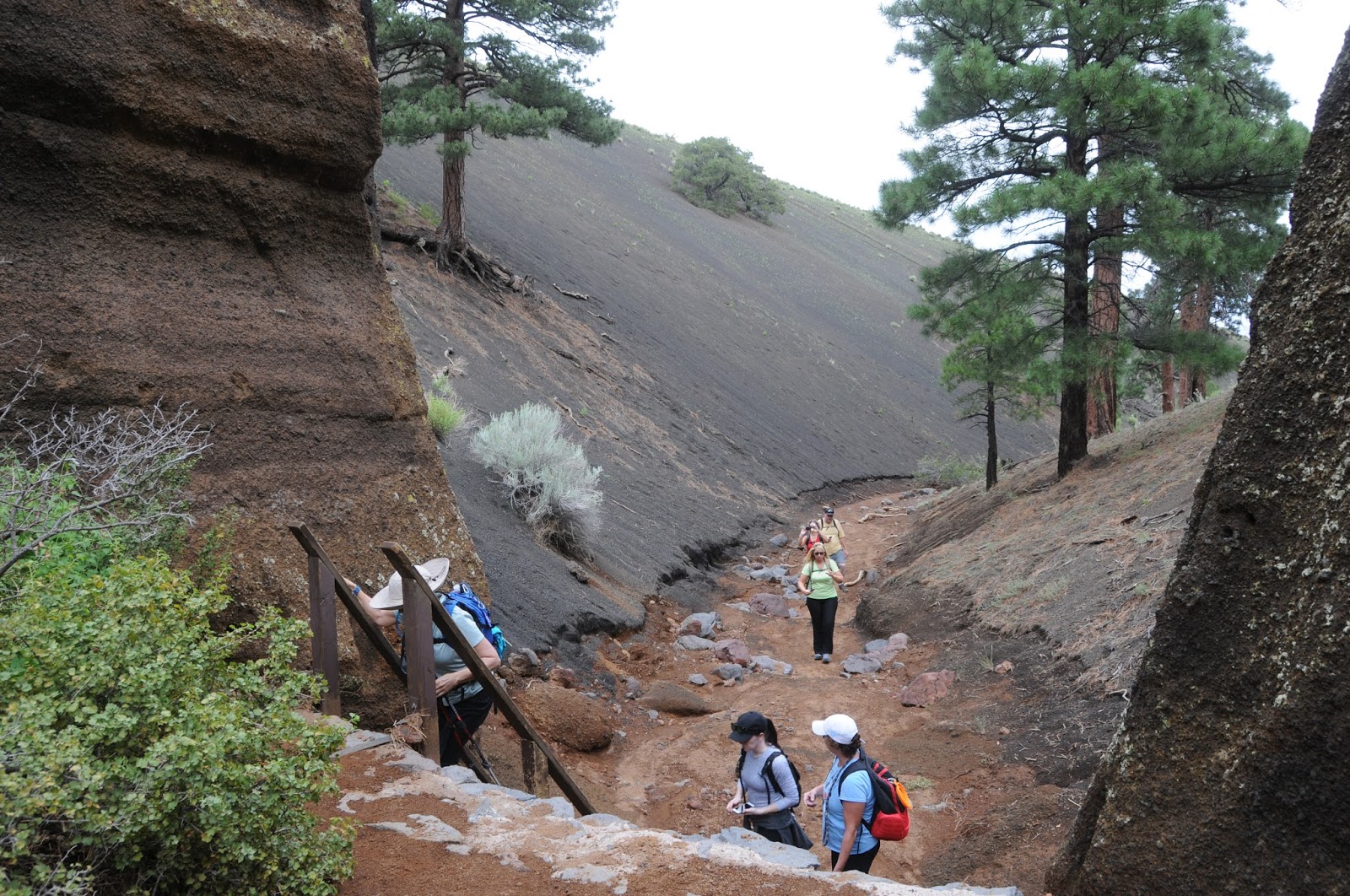
Inside the volcano
Thousands of years of wind and water erosion have sculpted the mountain’s multi-colored layers of volcanic ash and cinders into craggy pillars and honeycomb walls. Along the short, family-friendly access trail that winds through a pinion-juniper forest, views of the gaping U-shaped collapse give a taste of what’s to come. 
The ladder 
At the 1.24-mile point, the trail meets the inky black cinder slopes at the base of the volcano where a wooden ladder must be climbed to get to the good stuff.
Bizarre pillars of ash
Once inside the volcano, hikers are surrounded by 800-foot escarpments, stony passages and wildly contorted rock columns called “hoodoos”.
Hikers explore a stony passage
Footpaths wander among weather-blasted pinnacles, crevasses and pine trees and shrubs that somehow took root in the cracks.  There’s even a short trek through a tight passage where ongoing erosion washes out bits of shiny black hornblende minerals (often mistaken for obsidian) that collect in glinting streams underfoot. Look overhead to see chockstones (boulders caught in cracks) and lava caps that teeter atop grainy spires like fancy hats. Be sure to bring a fully-charged camera or phone to document the adventure in case you’re asked to prove what you know for sure about this Arizona natural treasure.

A hiker emerges from a tight spot
LENGTH: 3 miles roundtrip
RATING: moderate
ELEVATION: 6700’ – 7000’
GETTING THERE:
From Flagstaff, go 30.5 miles north on US 180 and turn left at the sign for Red Mountain Trailhead near milepost 247. Dirt access road is passable by passenger vehicle when dry.
INFO: Coconino National Forest


Sunday, August 6, 2017

SLATE MOUNTAIN TRAIL #128

SLATE MOUNTAIN TRAIL #128
View of San Francisco Volcanic Field from Slate Mountain
There are a couple of curious things about Slate Mountain. First off, there’s no slate and second, the mountain is much bigger than it appears.
Stansbury cliff-rose shrubs grow to 8 feet high
Part laccolith (a mushroom-shaped blob of magma that formed underground) and part volcano (you know: BOOM), the 8215-foot mountain measures only 853 feet from its base to summit, but geologists estimate that the lava dome that makes up the mountain extends to 5000 feet below the surface.
Cliff-rose scents the trail
So, all things considered, Slate Mountain is a considerable beast. The complicated hill is composed mostly of a pinkish-gray igneous rock called rhyolite which is exposed along its flanks.
Heading up the trail
Kendrick Peak
The “slate” misnomer comes from the flaky appearance of some of the sedimentary and igneous rocks that were contorted during the mountain’s eruptive phase that occurred between 1.5 and 1.9 million years ago.
The "slate" is actually rhyolite 

True slate is a metamorphic stone not found in the area. The trail that climbs to the summit of this unassuming little mound north of Flagstaff doles out gratifying treats at a leisurely, constant pace. One of the first points of interest visible from the trail is the scar from the June 2017 Boundary Fire that swept up 10,418-foot Kendrick Peak. The lightning-caused blaze burned more than 17,000 acres, stopping just short of the Slate Mountain trailhead.
Near the top, the trail makes a sharp swing around the high point for a 360-degree visual smorgasbord. To the north, the San Francisco Volcanic Field rolls out over colorful plains dotted with hundreds of cinder cones and eroding craters. This arc of volcanism stretches from Williams to the area around Sunset Crater. Geologist say this hot spot is still active and predict the next eruption will occur near the Little Colorado River.
It could be years, decades or centuries before the next magma breaks the surface, so until then, the summit of Slate Mountain is a great place to contemplate the emergence of a new volcano amidst the quiet beauty of the Painted Desert, the South Rim of the Grand Canyon and the hazy silhouettes of the Hopi Buttes. 
LENGTH: 5 miles roundtrip
RATING: moderate
ELEVATION: 7360’ – 8215’
GETTING THERE:
From Flagstaff go 26 miles north on US 180 to Forest Road 191 located just past milepost 242.
Turn left and continue 1.9 miles to the signed junction for Slate Mountain, turn right and go 0.3 mile to the trailhead. Forest Roads are rough dirt and gravel. High clearance vehicles recommended. Mat be impassable in wet conditions.
INFO & MAP:

Saturday, July 29, 2017

RIO SALADO HABITAT RESTORATION AREA

RIO SALADO HABITAT RESTORATION AREA

Phoenix
Dragonflies live in the riparian corridor
Just two miles south of downtown Phoenix, where the Salt River once flowed freely, a former dumping ground has been transformed into a thriving oasis in the desert.
Hiking in The Rio Salado Habitat Restoration Area is like taking a step back in time to an era before dams placed along the Verde and Salt Rivers in the early 20th century dried up the channel leaving behind a parched corridor of debris.  Landfills and quarries moved in and the area became blighted. 
The site attracts myriad birds and waterfowl
In 1993, the City of Phoenix began efforts to restore a portion of the river to improve the urban landscape, help in flood management and provide recreation and educational opportunities.  The $100 million project was completed in 2005.
With the cooperation of the Army Corps of Engineers, the Flood Control District of Maricopa County and droves of volunteers, tons of waste were cleared out of the Salt River channel and replaced with ponds, waterfalls and tens of thousands of indigenous plant species.
Watch for herons, egrets and ducks in the secluded coves
Although the 5-mile-long riparian corridor looks as if it sprouted on its own, it’s a “demonstration wetland” that was created by tapping into the groundwater beneath the river channel and pumping more than three million gallons of water per day to sustain the habitat. Stretching from 19th Avenue to 28th Street, the linear greenway can be accessed via numerous parking areas and trailheads.
Desert Senna
Trail segments are organized to feature specific desert habitats such as Cottonwood-Willow, Lower Sonoran, Mesquite Bosque and Palo Verde Forest.
Desert Willow
Over 76,000 native the plants were harvested from seeds or cuttings within a half-mile of the Salt River are flourishing and attracting wildlife. Snowy egrets, raptors, toads and dozens of other species have settled in. The site has over 14 miles of paved and dirt trails and an Audubon Nature Center.
Audubon Center
When hiking here, remember that this is a sensitive area. Please stay on trails, do not enter the water, leave everything as you found it and keep wildlife wild by observing at a distance and never feed them. Leashed dogs are allowed on the paved trails and handlers must pack out pet waste.
Seventh Avenue Bridge
LENGTH: 14.7 miles total
North Overbank Trail: 3.7 miles one way, paved
South Overbank Trail: 3.9 miles one way, Paved
North Terrace Trail: 3.9 miles one way, dirt
South Terrace Trail: 3.2 miles one way, dirt
RATING: easy
ELEVATION: 1010' - 1070'
TRAILHEADS:
2439 S. Central Ave. (Northeast corner)
3212 S. 7th Ave. (Southwest corner)
2801 S. 7th Ave. (Equestrian Staging)
2875 S. 7th St. (Southeast corner)
3203 S. 16th St. (Southeast corner)
HOURS: open daily sunrise to sunset or 7 p.m. whichever comes first
INFO & MAPS:

Monday, July 24, 2017

PINE LAKES TRAIL #316

PINE LAKES TRAIL #316

Thumb Butte North Trails
Pine Lakes Trail flanks Willow Creek 
Pick a day following a good monsoon soaking to hike Pine Lakes Trail #316.  That way, you’ll have the best chance to see the tiny waterfalls that tumble over logs and rocks in Willow Creek.
Canyon grapes grow along the creek
Arguably the most ecologically diverse route in the north segment of Prescott’s Thumb Butte Recreation Area, trail #316 packs a lot of interesting elements into its short length. The first half-mile of the trek moves through an exposed landscape of juniper and oak under the imposing pinnacle of Thumb Butte.
The trail climbs easily to a point where the Bradshaw Mountains peek out from behind the butte before beginning its descent into the riparian corridor of Willow Creek. 
A post-monsoon mini waterfall
As the trail switchbacks down into the gorge, the vegetation makes an abrupt shift from sparse scrub and cacti to rich greenery shaded by arching oaks and soaring Ponderosa pines. The creek trickles in lazy bends with multiple drainages emptying into its course. Over the next mile, the trail stays close to the water crossing it several times. A pleasant mist laced with the earthy aromas of pine needles, wildflowers and mushrooms drifts through the air. The creek itself is a mix of rapid flows, mini waterfalls, standing pools and rivulet-carved sandbars decorated with critter footprints.
Mushrooms thrive in the moist creek corridor
This is an excellent place to take in the wonders of nature's ecosystems and micro climates. 
A crossing of Willow Creek
Plants found within this moist passage couldn't survive well just a couple hundred feet above on the dry chaparral. And although the distance from ridgeline to creek is minimal, temperatures along the waterway are noticeably cooler. The trail makes one last creek crossing before heading back up to the lip of the gorge where the bare rock mound of Granite Mountain can be seen in the distance. From this point, you can retrace your steps for an out-and-back trip or use the map available at the trailhead to create your own circuit.
Thumb Butte
LENGTH:  1.5 miles one-way
RATING: moderate
ELEVATION: 5800’ – 5600’
Granite Mountain in distance
GETTING THERE:
From the courthouse in downtown Prescott (Gurley St. and Montezuma), travel 3.4 miles west on Gurley Street (turns into Thumb Butte Road) to the Thumb Butte Recreation Area. To find the trailhead, hike or dive another 0.1 mile up the paved access road and look for the sign across from the restrooms. 
HOURS: Summer hours (May- Sept) 6 a.m. to 8 p.m. daily.
FEE: There’s a $5 day use fee per vehicle. Bring exact change for the self-serve pay station.
INFO & MAPS: