Find A Trail. Start Your Search Here:

Tuesday, April 5, 2016

SOLDIER PASS-BRINS MESA LOOP

SOLDIER PASS-BRINS MESA LOOP
Sedona
View from Soldier Pass
Simply put---there's hardly ever a bad time to hike in Sedona. It's scenic beauty and myriad trekking environments are unparalleled. But, of all the months in the year, April stands out as one of the best to hit Red Rock Country trails. The climax of spring in the high desert brings fresh leaves, blooming shrubs and the emergence of flowering stalks on yucca and agave. It's nature's last hurrah before settling in for summertime heat and monsoons.
For hikers with limited time, the area's multitude of options can be overwhelming. That's why the Soldier Pass-Brins Mesa Loop is an oft recommended route. Along this moderate excursion, you'll be treated to samples of everything that makes Sedona such an outdoor recreation hot spot. Right out of the chute, you'll encounter Devil's Kitchen sinkhole. An interpretive sign at the site explains the complex geological forces that created the impressive gap. At the 0.6-mile point, a chain of natural water tanks known as the Seven Sacred Pools reflect russet pinnacles and attract hordes of birds and thirsty critters. After 1.25 miles, the trail enters the non-motorized use cloister of Red Rock Secret Canyon Wilderness and the sound and fury of swooping bikes and Jeep tour crowds are soon vanquished. Roughly halfway up the trail, look for a set of arches-in-the-making weathering out of sandstone cliffs on the opposite side of the canyon.
The hike's glory note resonates at Soldier Pass--a breezy, high point vista where cliff-rose blossoms perfume the air and bees collect nectar from Feather Dalea bushes and tiny buds on Sugar Sumac trees. Here, far-reaching mountain views will have you conjuring your best "Singing Nun in the Alps" happy twirl. Beyond the pass, spotty stands of cypress and juniper provide welcome shade before the route moves onto sunny Brins Mesa. In the summer of 2006, a wildfire torched some of the vegetation on this 2-mile traverse over a wide plateau. The area is recovering nicely and the damage has not sullied the experience at all. Be sure to check out a short spur trail that leads to a lookout pinnacle. The hike down off the mesa requires some big step maneuvers and route finding. Watch for log blockades and basket cairns to stay on course in the dodgy bits. The final short segments on Cibola Pass and Jordan Trail weave in and out of wilderness, slick rock mounds and flood scoured drainages before coming full circle.
Hike Directions:
From the trailhead, hike 0.2 mile to Devil's Kitchen. Turn left, hike 1.7 miles on Soldier Pass Trail and veer right at the Brins Mesa Trail junction. Hike 2 miles to Cibola Pass Trail, turn right and follow it 0.6 mile to Jordan Trail, turn right and go 0.3 mile then turn left and hike 0.2 mile back to the parking area.
LENGTH: 5-mile loop
RATING: moderate
ELEVATION: 4,140' – 5,075'
GETTING THERE: Use the FREE SEDONA SHUTTLE: 928-203-5252, SedonaShuttle.com
From the traffic circle at State Routes 179/89A in Sedona, go 1.20 miles west on 89A to Soldier Pass Road. Turn right and continue 1.5 miles to Rim Shadows Drive, turn right and go 0.1-mile to the trailhead on the left.
The parking lot is open 8 a.m. to 6 p.m. daily.
INFO: Red Rock Ranger District, Coconino National Forest
MORE PHOTOS:

Monday, March 28, 2016

TAVASCI MARSH

TAVASCI MARSH
Clarkdale
Peck's Lake and Tavasci Marsh

This place is for the birds---and the hikers who love them.
Designated an "important birding area" by the Audubon Society, Tavasci Marsh occupies a placid strip of green bounded by Tuzigoot National Monument, Dead Horse Ranch State Park and Verde River Greenway State Natural Area. The 96-acre, spring-fed wetland hosts a colorful cocktail of winged beasts chipping among reeds, roosting, wading or gliding over the waters in feathered flotillas.
Access is via a free parking area near Tuzigoot or at DHSR ($7 fee per vehicle). Both entry
points funnel hikers into a network of trails that wind among enormous cottonwood trees, mesquite forests, cattail choked bogs, sandy flood plains and riverside riparian corridors. Another way to enjoy the site and tag on some educational benefits is to enter through the Tuzigoot monument. There's a $10 fee per person, but you'll get to explore a Sinagua pueblo and learn from visitor center displays and interpretive signs along short, barrier-free walkways. The hiking paths are mostly old dirt roads marked with lathe-style posts. The Tavasci March Trail explores the site's east flank, culminating at a wooden observation deck at Peck's Lake---an oxbow pond that's a remnant of a former channel of the Verde River. The Tuzigoot trails meander west and south along the stream.
It's not necessary to be a birding expert to spot some of the more than 245 species that call the marsh home for all or part of the year. Sightings of Red-winged Blackbirds, Cardinals, Wood Ducks and Osprey are almost a given, but a pair of binoculars (and a substantial dose of patience) will aid in scoping out the more illusive Lesser Nighthawks and Peregrine Falcons.
If you're lucky, you might also spot river otters and beavers where the marsh drains into the Verde River.
LENGTH:
Tavasci Marsh Trail: 0.9 mile one way
Tuzigoot Trails: variable, we hiked 3.6 miles along the loops.
RATING: easy
ELEVATION: 3,130' – 3,410'
GETTING THERE:
From Interstate 17 in Camp Verde, go west on State Route 260 to Cottonwood and follow the signs to either Dead Horse Ranch State Park or Tuzigoot National Monument.
INFO:
MORE PHOTOS:

Monday, March 14, 2016

WILD MUSTANG LOOP

WILD MUSTANG LOOP
Tortolita Mountains, Marana
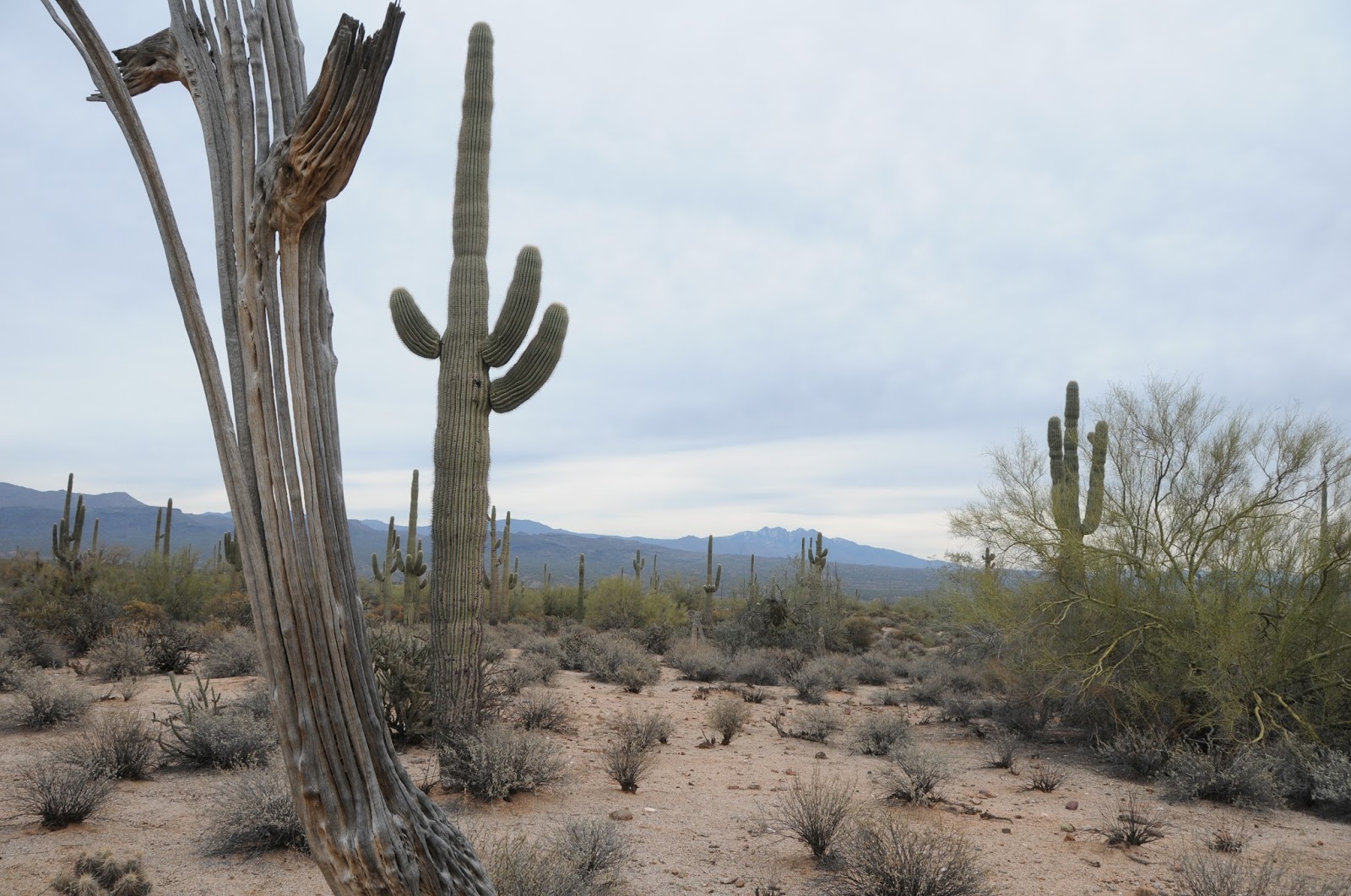
Yucca on Wild Mustang Trail frames Santa Catalina Mtns.
If you dig deep enough into the barrel of misunderstood hiking routes, you just might discover a gem like the Wild Mustang Trail. Because it snuggles up to the Ritz-Carlson Dove Mountain property in Marana, access to the trail requires a stroll past groomed gardens, posh casitas and a golf course. Not exactly the stuff of hardcore hiker dreams. But hold on to your horses--the scenery quickly transitions from fancy to fierce. Getting to the Wild Mustang Trail requires the use of connecting routes that are signed with color-coded posts. The trail can be hiked as an out-and-back or tied into several loop options. We decided to try the West Rim Loop as described on the Dove Mountain Hikers website (link below). The first 1.4 miles of the hike follows a wash in full view of the resort. After that, it ascends 1,250 feet into the raw beauty of the Tortolita Mountains, where crested saguaros can be spotted at nearly every turn. At one time, there were 43 documented in the area. A recent freeze culled the count to about 30 specimens. Some of them are located along the trails while others hide out in distant clefs and gullies. With patience and a keen eye, you can see 9 contorted cacti on this loop. When hiking here, it's important to respect the terrain and know your limits. Despite the various springs shown on maps, there's no water and very little shade. While the lower trails are simple strolls, the mountain routes are rough, so you'll need lots of H2O, sun protection and power snacks. What the hike lacks in terms of feral equine sightings it more than makes up for at a 3,850-foot saddle with views of a dozen mountain ranges jutting over the Tucson area. The site is outfitted with interpretive signs and a bench that makes for a perfect spot to take a break and scope out the profiles of Mt. Wrightson, Kitt Peak and a patchwork farmlands of the Santa Cruz and Avra Valleys.
At 3.8 miles, the Wild Mustang Trail is the longest leg of the loop and exudes a primitive, remote feel. At one point, its cactus population rivals that of nearby Saguaro National Park, accented with a plethora of blooming yucca and sotol growing among granite boulders and metamorphic slick rock. The trail's highpoint features dizzying vistas of the Santa Catalina Mountains and Pusch Ridge without an aqua pool or putting green in sight. After the long climb, the route makes a steep, rocky dive onto Wild Burro Canyon. You'll pass Alamo Spring, two historic line houses and several scenic lookouts before landing in sandy washes for the final trudge back to the trailhead.
HIKE DIRECTIONS:
From the trailhead, follow the short access path, and turn left (north) on Wild Burro Trail (purple). Go 0.5 mile north and turn left onto Upper Javelina Trail (red) and follow it 0.9 mile to Wild Mustang Trail (orange). Turn right and hike 4.2 miles to Wild Burro Trail (purple), turn right (south) and follow it 2.7 miles back to trailhead. 
Crested saguaro on Wild Mustang Trail
LENGTH: 8.7-mile loop
RATING: moderate
ELEVATION: 2810'- 4060'
GETTING THERE:
Wild Burro Trailhead,14810 N. Secret Springs Drive, Marana. From Phoenix, go south on Interstate 10 to Tangerine Road exit 240, go 4.9 miles east to Dove Mountain Blvd. turn left and continue 4.5 miles to a traffic circle. Turn right through the circle and and pass the Ritz-Carlton gatehouse. Trailhead is less than a mile up the road. There are no fees.
INFO & MAP: Town of Marana
Dove Mountain Hikers:
MORE PHOTOS:

Wednesday, March 2, 2016

HOUSTON LOOP

HOUSTON LOOP
Payson Area Trails System
View of the Mogollon Rim from Houston Loop
For a short, moderate-rated trail, this one really packs a punch. It's wide, well-signed and within shouting distance of suburbia, but what's not advertised about Payson's Houston Loop is its unrelenting ups-and-downs that can catch the first-timer off guard. The quad burning workout pays off with
high point vistas of the Mogollon Rim hovering above the metal rooftops of woodland retreats. Where the trail dips into the canyons around Houston Creek, Ponderosa pine trees throw shade over moist drainages imprinted with elk tracks. Elk rarely venture more than a quarter mile from water sources, so keep an eye out for them where the trail hops over rivulets and puddles. The trail's bonus attraction is a Cold War Era curiosity known as a seismic bunker. The metal structure built into a hillside has been abandoned for years and is now under siege by local graffiti rebel forces. It's a dank, creepy place (mind the Bud Light cans underfoot) that you'll want to observe from the outside only. Beyond the den of debauchery, the trail redeems itself as it ascends an exposed ridgeline and heads into the woods. The route follows deeply rutted, dodgy 4x4 roads that are popular with bikers and ATV riders. In my experiences on this trail, the wheeled users have been responsible and courteous around hikers. With its carousel of changing scenery, history side show, challenging dips and climbs and close-to-town access, this trail makes for an entertaining Rim Country trek.
LENGTH: 4.5-mile loop from the Chaparral Ranch trailhead OR 9.6 miles roundtrip from Houston Mesa trailhead
RATING: moderate
ELEVATION:
4,800’ – 4,950’ (Chaparral) OR 4,800’ – 5,200’ (Houston Mesa)
GETTING THERE:
Chaparral Ranch Trailhead: From the intersection of State Routes 87/260 in Payson, go right (east) onto 260 and continue 2.4 miles to Chaparral Pines Drive. Turn left (north) and go 1.2 miles to the Chaparral Ranch Trail access turnout. There's parking for about 3-4 vehicles. Do not block private driveways in the area. Large groups should access this trail via the Houston Mesa Trailhead. Houston Mesa Trailhead: From the intersection of State Routes 87/260 in Payson, go 1.7 miles north on 87 to Houston Mesa Road. Turn right (east) and continue 0.8 mile to the trailhead on the right (past the “horse camp”). From here, follow Houston Trail 3 miles to the loop.
Cold War Era bunker
INFO & MAPS:
http://media.wix.com/ugd/5b27be_ac107b0dfb5e48689a45387e775aa37f.pdf

Monday, February 29, 2016

BOOTLEGGER LOOP

WILDFLOWERS on the BOOTLEGGER TRAIL
McDowell Sonoran Preserve, Scottsdale
Bootlegger Trail

Despite abundant winter rains and mild temperatures that raised our expectations for a banner wildflower season, this year's showing of desert blooms has turned out to be a more low-key event. The hype may have fizzled, but there are still plenty of flowering plants to enjoy along Valley trails.
One of the best places to observe a wide variety of specimens is in the far east side of the McDowell Sonoran Preserve. In this area of desert, wildflowers thrive best among boulder outcroppings on the flanks of Granite Mountain
where precious bits of shade and trapped moisture nurse blooms to fruition. When the elements dole out perfect measures of rain, warmth and sunlight, poppies and lupines paint the desert floor in blazing shades of purple and orange. This spectacular but rare event is beautiful to behold but, there's also joy in spotting a lone poppy or colorful patch of brittlebush during less productive seasons.
On a recent hike along the Bootlegger Trail, I compiled a list of wildflowers we observed. There were many bloomers, but you'll have to stay alert to see them. Are you up for a scavenger hunt? Here's a partial list. Happy hunting!
1. Lacepod
2. Mexican Gold Poppy
3. Desert Chicory
4. Desert Wishbone
5. Desert Rock Pea
6. Scorpionweed
7. Filaree (Stork's Bill)
8. Desert Lavender
9. Popcorn Flower
10. Fiddleneck
THE HIKE:
From the Granite Mountain Trailhead, hike 1.3 miles on Bootlegger Trail. Head right on Granite Mountain Loop and continue 1.1 miles to Coyote Canyon Trail. Turn right and hike 1.3 miles (note the crested saguaro at the 0.8-mile point) to Dove Valley Trail. Veer right and go 1 mile to 136th St. Express and follow it 1.3 miles back to the trailhead.
LENGTH: 6-mile loop
RATING: easy
ELEVATION: 2,415' – 2,822'
GETTING THERE:
Granite Mountain Trailhead, 31402 N. 136th St. Scottsdale.
From Loop 101 in Scottsdale, take the Princess/Pima exit #36 and go 6.5 miles north on Pima to Dynamite Blvd./Rio Verde Dr. Turn right and continue 5.9 miles to 136th St., turn left and go 1.8 miles to the trailhead on the left. Trailhead is open sunrise to sunset. No facilities.
INFO & MAPS: McDowell Sonoran Preserve
MORE PHOTOS:

Friday, February 26, 2016

PERMITS REQUIRED: FOSSIL CREEK & FOSSIL SPRINGS

FOSSIL CREEK & FOSSIL SPRINGS moves to RESERVATION SYSTEM

On February 26, 2016, the Tonto and Coconino National Forests announced that access to the Fossil Creek and Fossil Springs Area near Pine-Strawberry will require reservations during high season. In order to park at any of the access lots  from May 1st (April 1st, beginning in 2017) and October 1st, you'll need to secure a permit. This extremely popular recreation area has been negatively impacted by over-crowding that creates pressure on the natural resources, traffic backups, mountains of trash (and worse) as well as safety concerns. The goal of this program is to better manage these problems.
The reservation system will go live on March 1st. You can book online up to 6 months in advance at
www.recreation.gov or by calling 877-444-6777. Permits are $6 and there's a limit of 6 reservations per person per year. 
FULL MEMO & MAPS:
http://www.fs.usda.gov/Internet/FSE_DOCUMENTS/fseprd492908.pdf

Monday, February 22, 2016

MINT WASH-WEST LAKE LOOP

MINT WASH-WEST LAKE LOOP
Granite Basin Recreation Area, Prescott
View of Granite Basin Lake from Mint Wash Trail

As a perennial bucket-lister, Granite Mountain Trail #261 lives up to its hype with a strenuous 1,400-foot ascent on a hulking mound of billion year old rock. It's one of Prescott's most glorious hikes, serving up a wilderness summit experience with a substantial side of sweat. Once you've got that one out of your system, there's plenty more to explore around the base of the mountain. In the shadow of the massif's intimidating brow, a maze of looping paths in Granite Basin Recreation Area offer more than 33 miles of easy and moderate rated hike alternatives. The site is cradled in a craggy, forested pocket lodged between a wilderness area and suburbia. Built out with creature comforts like restrooms, picnic tables and a tiny lake, the area's trail complex is family-friendly, well-signed and designed for either short strolls or day-long treks. Whichever trail or trails you select, you'll be walking through a bizarre landscape of volcanic rock outcroppings weathered smooth by eons of exposure. Water trickling though drainages nourishes a mash up of wild mint and cacti huddled beneath tall Ponderosa pines. Like sister trail #261, there are plenty of spots where views of the sprawling flatlands of Williamson Valley and the cloud-brushing peaks of Flagstaff are framed by  tunnels of arching oak.
A detailed map available for download on the forest service web site shows how the trails connect. Here's one circuit that includes a swing by Granite Basin Lake, lots of shade and a high saddle vista point. From the Cayuse Trailhead begin on West Lake Trail #351 and hike 1.2 miles then veer right onto Mint Wash Trail #345. This junction is located just before a road crossing and is signed but easy to miss. Hike 0.7 mile on #345 and turn left on Mint Wash Connector Trail #352. Continue 1.1 miles to the Chimbley Water Trail #348, turn left and hike 0.5 mile to Willow Trail #347, turn right and follow it 0.8 mile back to the trailhead.
LENGTH: 4.3-mile loop
RATING: easy
ELEVATION: 5,400' – 5,770'
HOURS: day-use gate hours vary by season but are roughly sunrise to sunset daily
FACILITIES: restroom, picnic tables.
GETTING THERE:
Cayuse Trailhead:
From downtown Prescott, go north on Montezuma St. (turns into Whipple St.) to Iron Springs Road.
Go 3 miles on Iron Springs to Granite Basin Road (Forest Road 374), turn right and continue 2.4 miles to the Cayuse Equestrian Trailhead on the right. Parking is 0.1 mile up the road.
FEE: $5 daily per vehicle (free on Wednesdays). Bring exact change for the self-serve pay station.
INFO & MAPS: Bradshaw Ranger District, Prescott National Forest, 928-443-8000
MORE PHOTOS:

Monday, February 15, 2016

LONG CANYON TRAIL #122

LONG CANYON TRAIL #122
Sedona
Oak woodlands in Long Canyon
There's something magical about the way hiking in a canyon can make the stresses of everyday life melt away. After a long week of juggling priorities, chores, shuttling kids and trying to maintain a semblance of work life balance, who couldn't use a good squeeze? In terms of sheer quantity of canyon trails, Sedona offers a pulsating super nova of choices. Boynton, West Fork, and Fay canyons are easy access crowd favorites while Secret and Loy attract those looking for more challenge and solitude. In between, there's Long Canyon. Located near a hub of newer routes, this oldie but goodie is mostly overlooked by hikers seeking fresh dirt. But, to shrug this trail off would be to miss a journey through four types of forests pressed between converging sandstone bluffs weathered into bizarre, russet pinnacles. Stepping out from the trailhead, the path is wide and well worn, passing an upscale resort (golf course, eyes right) before dissolving into the Red Rock Secret Mountain Wilderness. The massive profiles of Steamboat Rock and Maroon Mountain act as sentries at the canyon's entrance. For the first mile, the trail passes through typical high desert scrub dominated by manzanita and yucca. As the canyon walls begin to close in, the trail transitions into a forest of juniper and Arizona cypress trees with their characteristic shaggy bark. Several drainage crossing and a tighter pinch of canyon walls precede the entry into a deciduous woodland of Emory oaks and alders. Here, the trees are so thick they nearly block out views of the soaring stone walls that rise hundreds of feet over head. After a short climb, the first Ponderosa pines and Douglas firs appear, sharing the ever narrowing gorge with an understory of jostled washes and low-growing brambles. Although the official trail is 3 miles long, it's difficult to tell just where it ends and rudimentary footpaths take over. I had hiked to a point where the path became overgrown. When I checked my GPS, I had hiked 4 miles. At this point, a fortress of canyon walls surround a damp, earthy cloister devoid of all the hassles of civilization. Ponder the calming effects of bird calls bouncing off stone escarpments and breezes exhaled from the head of the canyon. It feels like nature hugging you closer.
LENGTH: 3 miles one way
RATING: moderate
ELEVATION: 4,200' - 5,600'
FEE: None. A Red Rock Pass is not required.
GETTING THERE:

From the State Route 89A/179 traffic circle in Sedona, go 3 miles west on 89A (left, toward Cottonwood) to Dry Creek Road (Forest Road 152C), turn right and continue 2.9 miles to Long Canyon Road (Forest Road 152D), turn right and go 0.5 mile to the trailhead on the left.
INFO:  Red Rock Ranger District, Coconino National Forest
http://www.fs.usda.gov/recarea/coconino/recarea/?recid=55340
MORE PHOTOS:

Monday, February 8, 2016

ANTELOPE CREEK SEGMENT: BLACK CANYON TRAIL

BLACK CANYON TRAIL
Antelope Creek Segment
Corral at Hidden Treasure Mine trailhead
Nothing much has been going on in the town of Cordes since about the 1950s. Founded in 1883, the hamlet was once a busy stage stop serving sheep herders, ranchers, mail wagons and weary voyagers traveling between Prescott and Phoenix. Completion of Interstate 17 in the 1970s put the nail in the coffin as the new freeway pulled traffic off the bumpy dirt roads and onto smooth pavement. Business shifted west leaving behind a few hardy families to carry on the Old Arizona lifestyle.
Today, the area is seen mostly by travelers braving the road trip to Crown King and hikers setting out to explore the historic trail that runs through it. The Black Canyon Trail Coalition beckons hikers to "Experience the Arizona Outback" by stepping out on all or part of the 78-mile Black Canyon Trail that stretches from north Phoenix to the town of Mayer.
The northern reaches of the trail especially live up to the "outback" label and the Antelope Creek segment is a prime introduction to the canyon-riddled rangeland lodged between Agua Fria National Monument and Prescott National Forest.
Hidden Treasure Mine Trailhead
Winding around the ranches and ruins of Cordes, the segment's signature features are its endless ups-and-downs, cliff-hugging turns, corrals and stock tanks supplemented with occasional cattle encounters. To get your full dose of boots in the boondocks, try a 10-mile car shuttle hike. Begin at the Hidden Treasure Mine trailhead and hike north on the Antelope Creek segment. Most of the trail is well-signed, but there are a few head-scratcher junctions. At 3.4 miles, pass a gate (leave it as you found it), continue to the 3.8-mile point and turn left onto a Jeep road. An unsigned junction comes up at mile 4.1 where you'll veer right, hike 0.1-mile and pick up the signed single track on the right. At the 5-mile point, the trail crosses Crown King Road (1.2 miles south of Cordes) then connects with a Jeep route that overlooks Black Canyon with majestic views of the Bradshaw Mountains towering above the gaping chasm.
Bradshaw Mountain views.
As the route transitions into the Drinking Snake segment (segments are not signed) you'll see Dripping Spring Canyon off to the left and a functioning windmill just around a bend in the road. Beyond the windmill, the trail turns left past the corral and becomes a single track once again all the way to 9.4-miles where you'll turn left onto a road, hike 0.2-mile, turn right at a junction and hike the last fraction of a mile to the Spring Valley trailhead.
Endless ups and downs
LENGTH: 10 miles one-way for car shuttle described here.
Antelope Creek Segment: 5.0 miles one-way
Drinking Snake Segment: 4.8 miles one-way
RATING: moderate
ELEVATION: 2,656' - 4,192'
ACCUMULATED ELEVATION GAIN: 2,713'
GETTING THERE:
Hidden Treasure Mine Trailhead (south):
From Interstate 17, take the Bloody Basin Road exit 259. Head left (west toward Crown King) on Bloody Basin (Crown King Road, Forest Road 259) and go 3.3 miles to the stop sign in the town of Cordes. Turn left onto Antelope Creek Road (County Road 179), go 2.7 miles and veer left at the Bumble Bee/Crown King fork. Continue 1.3 miles to a stop sign, turn left and make an immediate left into the parking area marked by a rusty water tank and corral. Trail begins by the corral. The dirt road is washboard rough in spots with hairpin turns and drop offs but is passable by sedan.
Spring Valley Trailhead (north):
From Interstate 17, take the Bloody Basin Road exit 259, go 3.3 miles west (Crown King Road, Forest Road 259) to the ghost town of Cordes, turn right (north) onto Antelope Creek Road (County Road 74) and continue 3 miles to the trailhead on the left at Forest Road 9218A. Roads are sedan friendly dirt/gravel.
INFO: Black Canyon Trail Coalition
MORE PHOTOS:

Monday, February 1, 2016

FAIRY DUSTER LOOP & MARIPOSA HILL TRAIL

TWO NEW TRAILS IN SPUR CROSS
Spur Cross Ranch Conservation Area, Cave Creek
Elephant Mountain stands out over fresh-cut Fairy Duster Loop

If you image the trails of Spur Cross Ranch Conservation Area as an ice cream sundae, Fairy Duster Loop and Mariposa Hill Trail are the whipped cream and cherry on the top. Neither trail requires much effort to hike, but they perfectly complement the area's more rough-hewn, difficult routes with soft footing and sweet views. Opened in January 2016, they offer short, pretty detours that connect with backbone route Spur Cross Trail (Maricopa Trail) to explore new territory on the site's east side.
Fairy Duster Loop traces the foothills above mesquite-cluttered Cottonwood Wash where profuse plant life makes the trek sort of like hiking through a mini botanical garden. In addition to the shrub for which it's named, plants you'll find along the flowing path include joboba, buckwheat, filaree, ratany, cholla cactus, brittle bush and dozens of wildflowers, making it a good choice for a springtime bloom snooping hike.
Mariposa Hill Trail is named for a delicate lily that decorates its flanks. This trail follows what used to be Old Cottonwood Canyon Road to a lookout point with big views of Cave Creek and the saguaro-studded mountains of Tonto National Forest.
These fresh-cut routes can be hiked alone or tagged on to old favorites like the Metate Trail, for a longer loop. Here's one trail mix option.
From the trailhead, hike 0.1-mile north on Spur Cross Trail (SX) , turn right onto Fairy Duster Loop. Hike the 0.6-mile loop, then head 0.7-mile north (right) on SX to Mariposa Hill Trail. Hike 0.2-mile to the top and then back down. Continue 0.2 mile on SX to Metate Trail, follow it 0.8 mile back to SX, turn left and go 0.3 -mile back to the trailhead.
LENGTH: 2.9 miles (loop described here)
ELEVATION: 2,200'-2,468' (loop described here)
Fairy Duster Loop: 0.6-mile loop (2,330' - 2,385')
Mariposa Hill: 0.2 one way (2,400' - 2,468')
RATING: easy-moderate
FEE: $3 daily per person. Bring exact change for the self-serve permit kiosk.
GETTING THERE:
From Loop 101 in north Phoenix, exit at Cave Creek Road and drive 15 miles north to Spur Cross Ranch Road. This is an easy-to-miss junction located just before entering the busy main drag of Cave Creek. It is signed and the turn off is on the left. From here, the road jogs north and then makes a tight turn to the left at Grapevine. Continue 4.2 miles to the parking lot on the left. The last mile of the road is good dirt.
INFO:
Spur Cross Ranch Conservation Area:

Monday, January 25, 2016

Y BAR TRAIL # 44

Y BAR TRAIL # 44
Tonto National Forest, near Payson
Y Bar Trail on the edge above Shake Tree Canyon
Woe be to my judgment when I equate a trail's greatness with how much I want to puke while hiking it. I mean that in a good way. Trails that have lots of strenuous elevation gain and dizzying exposure are personal favorites. Heights, cliffs and edge-hugging bends all provide an adrenaline-fueled euphoria that can sometimes muddle decision making skills. While learning to conquer fear and build confidence are perks of the sport, it's important to crank up the brain cells when approaching the thin veil that separates exciting from stupid. Agonizing but ultimately wise hiking choices I have made include missing a summit because of an ear-infection-induced case of vertigo and abbreviating a recent trek on Y Bar Trail #44 when my group encountered more ice and snow than we were prepared to tackle safely. Next time. Although tame in comparison to some other notoriously arduous Arizona hiking trails, Y Bar still has several opportunities to pause for thought. The trail is steep, rocky and requires traversing of talus slopes and narrow, cliff-clinging turns with deep drop offs. On days when it's clear of obstacles, this challenging trail within the Mazatzal Wilderness is achievable by most well-conditioned, adequately equipped hikers. Do not underestimate the slowing power of constant elevation gain and unstable footing. Bring along extra water and food as this hike will likely take longer than you estimate. Even the most athletic hikers will want to allow extra time to soak in the scenery.
The hike begins with a moderate climb through juniper, oak and agaves with big views of the Mogollon Rim and Highway 87 a thousand feet below. After a series of switchbacks, the trail swings west, heading deeper into the wilderness where it dips into Shake Tree Canyon then moves up along the jostled terrain of Cactus Ridge to emerge on a magnificent, windy saddle. Here, 7,903-foot Mazatzal Peak towers above a craggy back country of rock pinnacles, scorched trees and fathomless scoured basins. The trail ends at the Windsor Saddle where it meets up with Mazatzal Divide Trail that's also part of Arizona Trail Passage #23. Unless you've researched and geared up for one of the marathon loop treks returning on either the Barnhardt or Rock Creek Trail, make this your turn around point.
LENGTH: 4.6 miles one way
RATING: difficult
ELEVATION: 4,200' - 7,100'
GETTING THERE:
Barnhardt Trailhead:
From Shea Blvd. and State Route 87 (Beeline Hwy.) in Fountain Hills, travel 51 miles north on SR87 to Forest Road 419. This road is located just beyond the sign for Barnhardt Trailhead roughly 0.25-mile south of the town of Gisela. Turn left and go 4.8 miles on FR 419 to the trailhead. FR 419 is a rutted one-lane track. Although sedans are frequently sighted at the trailhead, a high clearance vehicle is recommended. Trail heads left at a sign a few yards up the Barnhardt Trail.
INFO: Tonto National Forest

Monday, January 18, 2016

FINGER ROCK CANYON TRAIL

FINGER ROCK CANYON TRAIL #42
Pusch Ridge Wilderness, Tucson
Finger Rock Canyon Trail

Commanding the skyline above Finger Rock Canyon is an eponymous stone pinnacle that resembles a clenched fist with its index finger pointing toward the heavens. This is your first clue to the nature of the trail that makes an aggressive, unrelenting ascent of its rugged domain. Finger Rock Trail #42 begins with a moderate walk among massive rock slabs, sheer cliff faces, saguaros and seasonal creeks replete with mini waterfalls and lush greenery. But don't get too comfortable because the party's over at the 1-mile point, where just beyond Finger Rock Spring, the trail begins its assault on your physical and mental fortitude. The route wastes no time gaining elevation. Like a giant staircase, the trail moves uphill via tight switchbacks and high-step maneuvers with few breaks in between. Much of the path clings to the edge of the canyon walls offering both terrific views and plenty of queasy exposure. In some spots, you're hiking just inches from sheer drop offs. The canyon's sharp-edged geology, hardy Upper Sonoran Zone vegetation and unspoiled ambiance are a tribute to its protected status within Pusch Ridge Wilderness.
Although the suburbs and industrial parks of Tucson are visible from the trail, the canyon oozes a strong, untamed character. Embrace the wild by inhaling the brisk mountain breezes, listening for tumbling water and the cries of raptors while keeping an eye out for desert big horn sheep creeping along clefts and ridge lines. (To protect the sheep, dogs are not allowed on the trails within the wildlife management area).
Conquering this delightfully agonizing trail is a feather-in-the-cap for experts, but trekkers of all skill levels can also enjoy the hike by adapting the length to suit. The super-high-octane version of this trek includes a side trip up to 7,258-foot Mount Kimball. To reach the summit, veer left at the junction with Pima Canyon Trail #62 at 3.9 miles and hike a half-mile on #62 to the summit spur. Other landmark-specific turnaround points are listed below.
Turnaround options:
Finger Rock Spring: 1 mile, 3,520' (400' elevation gain)
Wind Cave: 2 miles, 4,500' (1,380' elevation gain)
Linda Vista Saddle: 3.5 miles, 5,700' (2,580' elevation gain)
Mt. Kimball: 4.2 miles, 7,258' (4,138' elevation gain)
LENGTH: 6.3 miles one-way (Trail #42 only)
RATING: difficult
ELEVATION: 3,120' - 6,880'(trail #42 proper)
RULES: dogs are not allowed
GETTING THERE:
From Interstate 10 in Tucson, take the Ina Road exit 248. Follow Ina Road to where it curves into Skyline Drive, continue to the 9.6-mile point, turn left on Alvernon Road and go 0.9 mile to the trailhead parking lot on the left. The trail begins a few yards up the road on Alvernon.
INFO & MAP: Santa Catalina Ranger District, Coronado National Forest
Desert Big Horn Sheep:

Monday, January 11, 2016

TURNBUCKLE TRAIL

TURNBUCKLE TRAIL
Skyline Regional Park, Buckeye
Turnbuckle Trail links to Valley Vista Trail for a summit climb
Buckeye Mayor Jackie Meck was spot-on when he quoted Andy Warhol during the grand opening ceremony of Skyline Regional Park. The 20th-century artist famous for his paintings of soup cans and celebrities said, "I think having land and not ruining it is the most beautiful art that anybody could ever want." Perhaps Warhol's spirit was riding shotgun on the mini track hoe that blazed the trails in this 8,600-acre West Valley outdoor recreation hub that was official rolled out on January 9, 2016. That's one possible explanation as to why the trail layout features so many beautifully framed vistas and organic vignettes. Much like a perfectly executed brushstroke or acrobatic back flip, the system is fluid and comfortable in its skin. The "skin" consists of the pristine washes and foothills of the southern White Tank Mountains. The dirt paths wrap around the terrain like whispers revealing secrets contained within area's natural elements without ever getting in the way. 
Although it's located just 2 miles north of Interstate 10, the blissfully quiet site has a wild yet accessible feel to it.
The 3-mile, moderate-rated Turnbuckle Trail is the longest of the seven Phase I routes. Like most hikes in the park, it begins with a stroll across a graceful, oxidized bridge spanning Mountain Wash. It loops around a prominent mountain peak and connects with Valley Vista Trail for an optional 0.33-mile, difficult climb to the summit. This short hiker-only trek involves some steep, narrow sections with drop offs.
So far, 6 miles of trails for hiking, biking and horseback riding are complete. Eleven more miles are on deck to open by September of this year. Mayor Meck concluded the opening ceremonies by describing future plans for even more trekking routes and enhanced facilities promising the crowds, "You ain't seen nothin' yet."
LENGTH: 4 miles
RATING: moderate-difficult
ELEVATION: 1,500' - 2,300'
FACILITIES: Restrooms, picnic tables, campsites
FEES: None for day use. Camping is by reservation only.
GETTING THERE:
2600 N. Watson Road, Buckeye
From Interstate 10 in Buckeye, take the Watson Road exit and go 2 miles north to the park. Roads are paved and
sedan-friendly dirt.
INFO:
MORE PHOTOS:
https://www.facebook.com/media/set/?set=a.10203790815329582.1073742059.1795269672&type=1&l=d21f7072cf

Monday, January 4, 2016

CHUCK WAGON TRAIL

CHUCK WAGON TRAIL
Sedona
Ice in Dry Creek: Dec. 31, 2015
For hikers of a certain age, the name Chuck Wagon might conjure images of a TV dog food commercial from the 1970s. Remember the miniature horse-drawn wagon racing through a home with the family dog eagerly in chase? That freaky little wagon eventually disappears into a kitchen cabinet where the goodies are kept neatly out of sight. Unlike in the ad, the goodies on Sedona's Chuck Wagon Trail are by no means hidden. The amusingly twisted route on the west end of town rolls through russet cliffs above and through Dry Creek. On the high points, views of Capitol Butte, Mescal, Doe and Bear Mountains, Cockscomb and the Grassy Knolls stand out over gullies painted in a million shades of green by cypress, juniper and yucca. The trail was originally blazed by mountain bikers and was recently adopted into the Red Rock Ranger District system. With the exposure of this swooping beauty-of-a-trail to foot travel, a typical hiking experience includes sharing the path with lots of swift-moving bikers followed by trekkers (some with dogs) in hot pursuit of the goodies.
Another feature of note on this trail is the crowds. But don't despair, most of them are going to Devil's Bridge. In addition to its standalone awesomeness, Chuck Wagon Trail also provides a way for hikers to avoid the kidney-jarring drive on Dry Creek Road to access the immensely popular, 0.8-mile Devil's Bridge Trail. A map at the Dry Creek Vista Trailhead shows how to use spur paths for either a road walk or trail hike to the site.
In addition to the requisite Devil's Bridge pilgrimage, there are dozens of ways to link Chuck Wagon Trail into a day of hiking. Here's one option:
From the Dry Creek Vista Trailhead, follow Chuck Wagon trail 4.8 miles to where it ends at Long Canyon Road. Cross the road and pick up Long Canyon Trail heading left. At the 0.3 mile point, turn left on Mescal Trail, hike 0.2 mile, cross the road and follow the signs to the Chuck Wagon junction. Turn right and retrace your steps back to the trailhead.
LENGTH: 6.6 mile loop (as described here)
RATING: moderate
ELEVATION: 4,480' - 4,680'
GETTING THERE:
Dry Creek Vista Trailhead:
From the State Route 179/89A traffic circle in Sedona, go 3 miles west (left toward Cottonwood) on 89A to Dry Creek Road (Forest Road 152C). Turn right, go 1.9 miles to Forest Road 152, turn right and continue 0.2 mile to the trailhead on the left. Roads are paved and sedan-friendly dirt. No fees.
Alternate access points:
Mescal Trailhead:
From the State Route 179/89A traffic circle in Sedona, go 3 miles west on SR 89A (left, toward Cottonwood) to Dry Creek Road (Forest Road 152C), turn right and continue 2.9 miles to Long Canyon Road (Forest Road 152D), turn right and go 0.2 mile to the trailhead on the right. No fees.
Long Canyon Trailhead:
From the Mescal Trailhead, continue another 0.3 mile up FR152D to the on the left. Trail begins across the road. No fees.
INFO:
MORE PHOTOS:

Wednesday, December 30, 2015

GRAND OPENING of SKYLINE REGIONAL PARK

GRAND OPENING of SKYLINE REGIONAL PARK
Buckeye
This Red-tail hawk was released into the park in June
Hikers, the big day has arrived. Grand Opening ceremonies for Skyline Regional Park in Buckeye will be held on Saturday, January 9, 2016. This West Valley park adds miles of new trails in the area south of the White Tank Mountains. The festivities will include wildlife exhibits, tours, hikes and giveaways. So, come on out and give this amazing project a proper debut.

WHEN: Saturday, January 9, 2016
TIME: 10 a.m. to 2 p.m.
WHERE: 2600 N. Watson Road, Buckeye. From Interstate 10, take the Watson Road exit and go 2 miles north to the park.
INFO:

Tuesday, December 29, 2015

BLACK MESA LOOP

BLACK MESA LOOP
Superstition Wilderness Area
View of Weaver's Needle from Black Mesa Trail
It may be just a stone’s throw from town, but hiking out from the First Water Trailhead at the western edge of the Superstition Wilderness is a surprisingly alien experience. Because the first mile or so of hiking in this area is considered to be easy, the site is a big draw for parents herding a mixed lot of dogs and kids outfitted with Sponge Bob backpacks and spiffy shoes that light up in sync with their stride. A very popular circuit here is the Black Mesa Loop that uses the Dutchmans, Black Mesa and Second Water trails for a continually-changing tour of  this wild pocket in Tonto National Forest.
Easy at first, the route transitions into a twisted collection of dips, climbs and tricky crossings of boulder-clogged washes and creeks. After the first 2 miles, the crowds become noticeably thinner. A sturdy pair of boots and hiking poles for balance will help get you through the rough parts to reap the rewarding views of a volcanic landscape scoured by millions of years of exposure to the earth’s turbulent elements. You'll be swallowed up in a wonderland of oddly-shaped pinnacles, gaping canyons and rugged arroyos. Add to that, the effects of changing light over the course of an afternoon, and it’s easy to feel as if you have been transported to another planet. For an extra treat, hang around until dusk and watch the stars come out for a show that's more brilliant than light-up shoes.
HIKE DIRECTIONS:
From the trailhead, follow the access path 0.3 mile to the Dutchman's Trail #104 junction. Veer right (south) and follow #104 3.9 miles to the Black Mesa Trail #241 junction. Turn left (northwest) here and continue 3.0 miles on #241 to the Second Water Trail #236 junction, turn left (south) and follow #236 1.5 miles back to the Dutchman's junction, turn right and hike 0.3 mike back to the trailhead.
LENGTH: 9-mile loop
RATING: easy-moderate
ELEVATION: 2,200' - 2,750'
GETTING THERE:
From Phoenix, go east on US 60 to the Idaho Road (State Route 88) exit. Turn left and follow Idaho to SR88, turn right and continue to First Water Road (Forest Road 78), which is located about a half mile past the entrance to Lost Dutchman State Park (between mileposts 201 and 202) and is signed for First Water Trailhead. Turn right and go 2.6 miles to the trailhead. Forest Road 78 is on maintained dirt with some potholes and washboard sections passable by carefully-driven sedan.
INFO: Mesa Ranger District, Tonto National Forest
MORE PHOTOS:
https://www.facebook.com/media/set/?set=a.10203717519137223.1073742056.1795269672&type=1&l=61b8878058

Monday, December 28, 2015

Ethical Hiking for 2016

ETHICAL HIKING FOR 2016
Stay on designated trails

During my 2015 hiking adventures, I noticed a disturbing trend. It seems the popularity of off-trail and bush whack hiking has been growing. I've witnessed this firsthand, read endless news reports about off-trail hikers needing rescue and saw hiking clubs promoting these types of outings on their websites. Although cross country travel on some public land is not necessarily illegal; I question the ethics of such use. Land management agencies across the board are embracing sustainable practices for recreational management. These include paying special attention to trail construction, ATV access, group size limitations and educating the public about the damage caused by irresponsible use.
For hikers, the message is simple----stick to established trails. This rally cry encompasses more than the cartoonish cliche of the "militant tree-hugger". It is supported by science (see one good source below) and rooted in maintaining access while preserving irreplaceable resources for future generations.
Don't trample pristine land---use the trail
Here a just a few reasons why hikers should stay on trails:
• Studies have shown that initial, low levels of trampling on pristine land causes the most severe damage.
• Unofficial social trails can cause confusion and lead to hikers getting lost.
• Social trails are built without the benefit of environment impact studies and are largely of poor design making them dangerous for users and harmful to sensitive vegetation.
• Delicate soil crusts that contain organisms essential for forest health take hundreds of years to form are destroyed by one boot print.
• Off-trail exploring can harm fragile archeological sites.
• There are hundreds of abandoned mines in Arizona that are not obvious until somebody gets injured.
• Trail cutting and widening along with carin building cause erosion and encourage others to follow suit.
• Off-trail hikers can trigger higher defense response in wildlife.
• Contrary to popular belief, hiker-blazed routes are NOT automatically adopted into the land agent's scope of official trails. If you have an idea for a new trail---contact the agency.
• Even a short off-trail traipse to find a good lunch spot causes damage. Take breaks on durable surfaces like established camp sites or trail-side logs.
• The seeds of invasive species have been documented to stay lodged in shoes for hundreds of miles. When you cut into soft, untraveled land, these seeds may take root causing devastating disruption of the ecosystem.
• Hiking off trail puts the search and rescue workers who will come to save your butt at unnecessary risk.

As the popularity of hiking for leisure, fitness, healing and personal growth continues to rise, paying attention to sustainability will become more and more important.
My New Year's wish for 2016 is that individual hikers and groups alike adopt and share sustainable trail ethics with a vengeance.
Arizona has a deep bench of hiking clubs that organize events, teach skills, donate countless hours of volunteer work and foster lasting friendships and a love of the outdoors. These same wonderful clubs have a great opportunity to promote stewardship by example.
See you on the trail in 2016!

Leave No Trace Center for Outdoor Ethics


Monday, December 21, 2015

ESCONDIDO TRAIL

ESCONDIDO TRAIL
McDowell Mountain Regional Park
View of Four Peaks from the Escondido Trail

There's a cool virtual tour of the Escondido Trail on the McDowell Mountain Regional Park website. It's a beautiful slide show describing the route's scenic features, elevation profiles and loop options. This is the park's first online tour and it's great for both vicarious thrills and inspiration to hike the trail in real life.
Constructed in late 2013, the trail can be accessed at established trailheads or from its many connecting routes. One option is to begin at the Lousley Hill Trailhead and hike 5.1 miles south to the Four Peaks Staging Area as either an out-and-back or car shuttle trek.
Because of its flowing style, hairpin turns, graceful bends and few obstacles, the trail feels fast underfoot. Located in the park's far east end, the mostly unshaded trail showcases expansive mountain views, a smattering of gigantic saguaros and a twisting walk through the quarry-like mounds and washes around the Lousley Hills.
The trail's fast track nature makes it a favorite among mountain bikers and runners. For hikers, the smooth pathway is perfect for a joint-friendly, swift paced jaunt.
LENGTH: 6.2 miles one-way (10.2 out-and-back as described here)
RATING: moderate
ELEVATION: 1,620' - 1,930'
FEE: $6 daily fee per vehicle
FACILITIES: restrooms, picnic areas, horse staging, visitor center
GETTING THERE:
Lousley Hill Trailhead:
From Loop 202 in Phoenix, take the State Route 87 (Beeline Highway) exit 13. Go 11.5 miles north to Shea Blvd. Follow Shea 0.5 mile to Saguaro Blvd., turn right and continue 3.7 miles to Fountain Hills Blvd. Turn right and go 4 miles to the park entrance.
Follow McDowell Mountain Park Drive 4.8 miles to Lousley Drive South, turn right continue 0.3 mile to the parking area
INFO & VIRTUAL TOUR:
MORE PHOTOS:
Monday, December 14, 2015

SNOW HIKING IN PAYSON

MONUMENT PEAK LOOP SNOW HIKE
Payson Area Trails System
Snow hiking Monument Peak Loop: Dec. 13, 2015

Snow days in Payson are rarer than those in Flagstaff or the White Mountains, but when they do occur, getting to good snow hiking trails is a lot easier than at the higher elevations where deeper accumulations and unplowed forest roads can thwart access and frustrate even the most experienced trekkers. The Payson Area Trails System (PATS) network of routes winds around a through town with easy-to-find trailheads along residential streets so there's usually no need to chain up or kick in the four wheel drive to enjoy a wintery walk.
A good bet for a snow hike is the Monument Peak Loop. Because it runs through a mix of shady pine forests, manzanita scrub and sunny meadows with intermittent streams, you'll get a smorgasbord of deep drifts, gentle dustings, frost-kissed cypress trees and ice capped pools. The trail is well-signed and heavily traveled by locals so chances are the path will have already been packed down by time you arrive. However, it's smart to head out with equipment to keep yourself safe. Hiking poles, layers of technical fabric clothing (ditch the cotton jeans) and boots with good traction are essential. Some hikers insist that a pair of slip on crampons make all the difference. Additionally, keep in mind that snow and ice is most treacherous when it starts to melt. An early start means you'll face colder temperatures, but you'll also have a better chance of avoiding slips and muddy boots. The photos here are from a hike on December 13, 2015 following a storm on the previous day. It was 27 degrees when we started around 9 a.m. and 34 degrees at 10:30 a.m.
LENGTH: 3.3-mile loop
RATING: easy
ELEVATION: 4,630' - 4,795'
GETTING THERE:
From the intersection of State Route 87/260 in Payson, go less than a mile east on SR260 to Granite Dells Road (located just past the Safeway center). Turn right and go 3.3 miles on Granite Dells Road (which will turn into Forest Road 435 after 1.3 miles) to the Monument Peak trailhead on the left.
INFO & MAPS: Payson Area Trails System
MORE PHOTOS: