Find A Trail. Start Your Search Here:

Monday, September 21, 2015

BULLDOG SEGMENT of the MARICOPA TRAIL

MARICOPA TRAIL
Bulldog Canyon Trailhead to Pass Mountain Trail
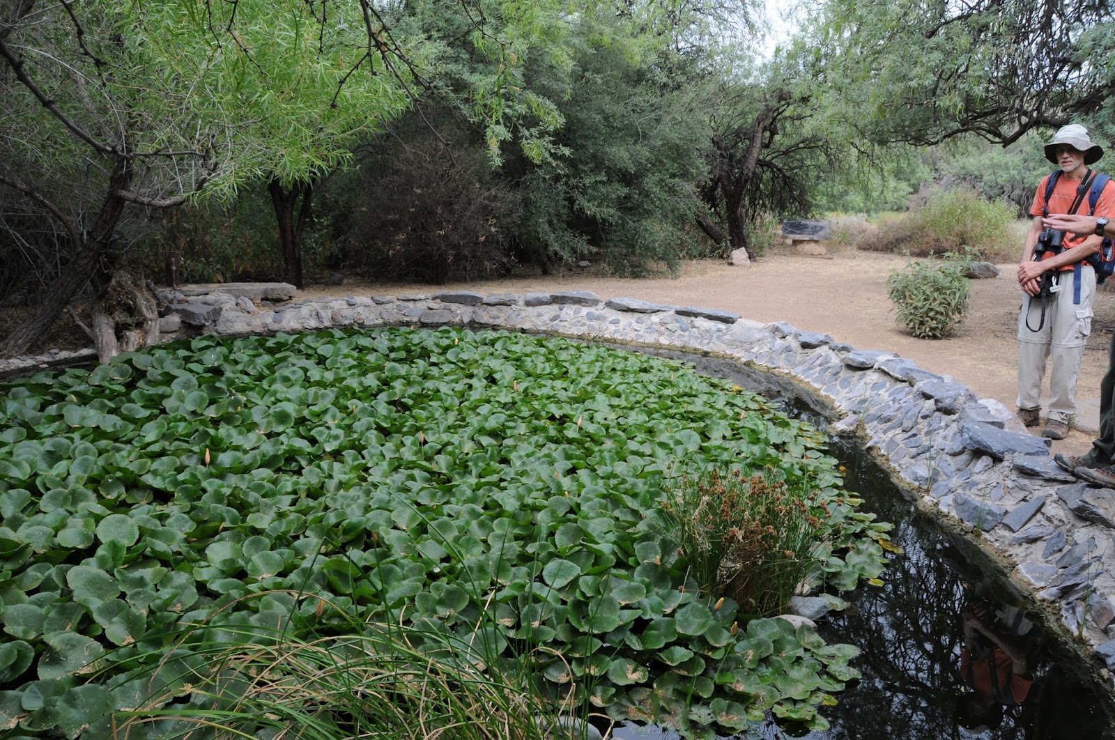
Granite outcroppings on Maricopa Trail

Loop trails are fantastic inventions. Hiking on one feels sort of like a following a cinematographer filming a visually-rich sequence that ends where it began. Arizona has some impressive hiking hoops. Revered for their flowing, long lengths and community-unifying qualities, projects like the Flagstaff Loop Trail (42 miles), Prescott Circle Trail (54.4 miles) and the grand dame of them all--Maricopa Trail-- act as the glue for regional, non-motorized recreation systems. When complete (target 2017), the Maricopa Trail will form a 310-mile loop around Greater Phoenix, connecting parks, suburbia and surrounding cities. The thrill of trekking on fresh dirt is rekindled each time a new segment drifts into pristine tracts or provides an alternate path to familiar hiking haunts. With the recent opening of a 1.4-mile section in the East Valley, there's now another way to approach the popular Pass Mountain (PM) Trail. Previously, access to PM was only though Usery Mountain Regional Park or a lot off Meridian Road in Mesa. This new western approach from Bulldog Canyon Trailhead will eventually tie in with a yet-to-be-constructed corridor to the Granite Reef recreation area near the Salt River. Volunteers are needed to complete the work and you can sign up to be part of this historic effort by visiting the Maricopa Trail + Park Foundation website: http://mctpf.org/.
The "Bulldog" segment makes an easy, 300-foot ascent to the junction with 7.5-mile PM Trail (not signed). Roughly 5.6 miles of the PM loop trail is on the Tonto National Forest and there's no fee to hike on this scenic section. However, if you cross into the part of the trail that's in Usery Mountain Park, be prepared to pay the $2 per person fee (exact change required). You can avoid the fee by heading left at the junction. From here, its just under 2 miles to the saddle overlooking a valley straddling the desert space between the Superstition and Goldfield Mountains. This makes for a good turn around point for those left their wallets at home or are not up to the 10.3-mile circuit.
LENGTH: 1.4 miles one way (trailhead to PM)
or 10.3 miles roundtrip with Pass Mountain Loop
RATING: easy-difficult
ELEVATION: 2,010'- 2,340' (2,740' with PM)
FEE: $2 per person if you enter the park on foot. Exact change required.
GETTING THERE:
From Phoenix, go east on US60 to the Ellsworth Road exit. Go north 8.2 miles north on Ellsworth (turns into Usery Pass Rd.) to the trailhead corral on the right past milepost 22 which is 1.6 miles north of the Usery Mountain Park entrance.
Maricopa Trail:
Maricopa Trail + Park Foundation:
MORE PHOTOS:

Tuesday, September 15, 2015

LONGVIEW TRAIL

LONGVIEW TRAIL to PIONEER PARK
Prescott
Grasslands and mountain views on Longview Trail

The Prescott Circle Trail (PCT) is a non-motorized trail system that works like a 54-mile wagon wheel around the city with spokes radiating to myriad recreational goodies in "everybody's hometown". The route is a master work in trail design with multiple access points  and connectivity to city and county parks,  lakeside recreation areas, campgrounds and wooded paths within Prescott National Forest. This super network layout makes it simple to explore the 54-mile circuit at either a leisurely day hike pace or a more ambitious, multi-day backpack trip.  Downloadable maps and an excellent app for smart phones and tablets are available on the city's website.
Segment #10 of the route links Williamson Valley Road with Pioneer Park via the Longview Trail. This short trek winds through sprawling grasslands and juniper scrub with the hulking mound of Granite Mountain dominating its western flank. From the trail's high spots, hazy glimpses of Sedona's red rock canyons and the peaks of Flagstaff punctuate a landscape of golden prairies. At the 1.78-mile point, the trail enters Pioneer Park. From here, you can continue on PCT or make a customized hike using the park's 9-miles of loop trails. Although Prescott Circle Trail was officially completed in summer 2015, it will continue to evolve with added trailheads, scenic spur loops and ongoing improvements to optimize the outdoor experience for hikers, equestrians and mountain bikers. Whether sampled as an effortless stroll from a kid-friendly park or tackled from its feral fringes, the trail serves up a balanced blend of trekking opportunities. 
LENGTH:
Longview Trail: 1.78 miles one-way
Pioneer Park Trails: 9 miles cumulative
RATING: easy-moderate
ELEVATION:
Longview Trail: 5,419' - 5,547'
Pioneer Park Trails: 5,220' - 5,580'
GETTING THERE:
There are many ways to get to this trailhead. Here's a convenient route when coming from Phoenix.
From State Route 69 in Prescott, go 2 miles north on Prescott Lakes Parkway (across from the Prescott Gateway Mall near milepost 294 ) to State Route 89. Turn right, continue 3.5 miles to Pioneer Parkway, go left and drive 5 miles to Williamson Valley Road. Turn right and make an immediate turn into the lot at the Welcome to Williamson Valley sign.
Maps & Apps, City of Prescott:
Yavapai County Parks:
MORE PHOTOS:

Monday, September 7, 2015

MORGAN CITY WASH

MORGAN CITY WASH
Lake Pleasant Regional Park
Morgan City Wash is open only to ranger-led hikes

From a lookout point near the 10-lane boat ramp at Lake Pleasant Regional Park, an emerald gorge is visible winding through the foothills below. Morgan City Wash occupies an area south of the lake where the high water table and a perennial creek support a dense forest of cottonwood, mesquite and willows. This lush, riparian ecosystem stands out in brilliant contrast to the muted tones of the surrounding desert. Within the 0.75-mile green zone, rare birds, native fish, dragonflies, amphibians and myriad critters like fox, raccoons and javelina thrive amid flood-scoured bends and water-sculpted stone escarpments. To protect the sensitive nature of this rehabilitating site, visiting the wash is only possible through regularly-scheduled, guided hikes. Park Interpretive Ranger Terry Gerber leads the way armed with deep insight (and a rather silly, but effective battery-powered cooling fan) of the area's history, geology and wildlife. The 4-mile treks descend from the lake along exposed saguaro-lined routes before entering the shady canopy of the wash. Along the way, Gerber describes animal tracks, bird calls, plants and interesting features such as Rattlesnake Arch and the “cowboy bathtubs”. If you haven't been out to the park lately, now is the perfect time to enjoy these cool hikes and get reacquainted with this north Valley recreation site.
With over 8 miles of new trails added this past year and an upgraded visitor center slated to open in early 2016, Lake Pleasant Regional Park is a hiker's paradise located less than an hour north of Downtown Phoenix.
Upcoming guided hikes to Morgan City Wash. Check the park website for details:
Sept 19: Hike & Splash
Oct 9: Hike into a Desert Forest
Oct 24: Hike and Splash
LENGTH: 4 miles
RATING: moderate
ELEVATION: 1,740' – 1,440'
FEE: $6 daily fee per car
GETTING THERE:
41835 N. Castle Hot Springs Road, Morristown. 928-501-1710
From Phoenix go north on Interstate 17 to Carefree Highway/State Route 74 exit 223. Head 11 miles west (toward Wickenburg) to Castle Hot Springs Road (milepost 19) turn right and drive 2 miles to the main park entry ( Lake Pleasant Access Road) and follow the "hike" signs to the meet up spot.
INFO: Lake Pleasant Regional Park
MORE PHOTOS:

Tuesday, September 1, 2015

WHITEHORSE LAKE TRAILS

WHITEHORSE LAKE TRAILS
Kaibab National Forest
Whitehorse Lake Trail #33

Due to some very serious competition, the two little trails at Whitehorse Lake don't get the attention they deserve. Located adjacent to several classic hiking destinations on the Kaibab National Forest south of Williams, it's no wonder these lakeside gems live in unheralded obscurity.
Although these mini treks are certainly not in the same league as the nearby Sycamore Canyon Rim Trail, Overland Road or the epic routes ascending Bill Williams Mountain, they are ideal for a warm up leg stretch or educational strolls with kids. Also, they're situated within Whitehorse Lake Campground, which makes the perfect base camp for hitting the aforementioned famous trails.
Whitehorse Lake #33 begins at a parking area near camp Loop F where there's a map sign and a supply of brochures with descriptions for 12 numbered points of interest along the route. The one-way trail ends at a blocked road gate near camp Loop B.
From the "F" trailhead, go left and hike out over a dam built in 1934 to improve wildlife and recreational opportunities in the area. Follow the posts through pine-oak woodlands, marsh areas and reed-choked coves. Features along the way include waterbird habitats, "yellow-bellie" Ponderosa pines, wildflowers, bird and bear feeding sites and mushroom logs. At post #9, the Canyon Overlook Trail #70 veers off for an optional 2.5-mile roundtrip hike to a scenic point over Sycamore Canyon. Both trails have short sections where the route is obscured by deadfall and leaf litter, but finding your way isn't too challenging. Beyond post #12, the trail swings through prime critter country along the southeast shore of the 35-acre lake before ending directly across the water from the start point. Retrace your steps or follow campground roads back to the trailhead.
LENGTH:
Trail #33: 2 miles roundtrip
Trail #70: 2.5 miles round trip
RATING: easy
ELEVATION: 6,600'-6,625'
FACILITIES: restrooms, camping, fishing (fee)
GETTING THERE:
From Williams, go 8.2 miles south on 4th Street (turns into Perkinsville Road, County Road 73) to Forest Road 110 at milepost 177. Turn left and go 7.2 miles to Forest Road 109, turn left and continue 3 miles to the lake. Follow the signs to either day use area nears Loops B or F. There are no fees for day use only. Roads are paved and sedan-friendly dirt/gravel.
INFO: Kaibab National Forest
MORE PHOTOS:

Monday, August 24, 2015

WEST BALDY TRAIL #94

WEST BALDY TRAIL #94
Mount Baldy Wilderness Area
West Fork of the Little Colorado River flanks trail #94

Arizona's second highest mountain* is an ancient stratovolcano that last erupted around 2 million years ago. The genesis of Mount Baldy began roughly 9 million years ago with multiple lava flows that gradually built up the mountain to an estimated 13,000 feet. Although this massif's initial geological history mirrors that of the Ring of Fire volcanos like those found in the Pacific and along the west coast of the Americas, its present form is due to mostly to the work of glacial ice. If you want proof that enormous ice sheets once slid
through Arizona, just take a hike on West Baldy Trail #94. The scoured mounds, gaping scoop-shaped valleys, and fields of errant boulders are actually cirques and moraines that formed during three periods of glaciation lasting hundreds of thousands of years. Today, these ice-born features form the headwater basins of the West and East Forks of the Little Colorado River that continue to shape the mountain's character and feed water all the way to the Salt River outside of Phoenix. Unlike the chiseled peaks of Flagstaff, the chain of bulbous, volcanic mounds that make up Mount Baldy present a tamer alpine experience.
Two trails ascend to near the top. West Baldy Trail #94 follows the West Fork of the Little Colorado River and is the route of choice for those looking for a green, water-themed trek. East Baldy #95 is somewhat less shaded and more exposed. In between, the 3.5-mile Mt. Baldy Crossover Trail provides a handy link to make a 17.5-mile loop hike.
West Baldy Trail #94 starts out as an easy stream side walk. Alpine meadows, thigh-high wildflowers surrounding the river and magnificent views define the hike's first 3 miles. Instead of being smacked with an abrupt vertical ascent, the arduous climbing part sort of sneaks up on you, turning serious near the 4-mile point where the trail enters a tract damaged by the 2011 Wallow Fire. Here, charred tree trunks teeter like fragile matchsticks poised to topple downhill at the behest of summer storms and winter snow. The relatively short haul through the destruction is mitigated by the promise of impending high-point vistas and a sense of accomplishment. The "summit" is actually ridge line with 3 distinct peaks. The tempting one in the middle--11,403' Baldy Peak-- is within the White Mountain Apache Tribe boundary and is open only to tribal members. Please respect this sacred area by not trespassing.
LENGTH: 14 miles roundtrip (up and back)
RATING: moderate-difficult
ELEVATION: 9,000' - 11,200'
GETTING THERE:
From Pinetop-Lakeside, travel 20 miles east on State Route 260 to State Route 273 (signed for Sunrise Ski Area just past milepost 377). Turn left and go 8.4 miles south to the West Baldy trailhead on the right at milepost 386. The East Baldy trailhead, is 2.5 miles farther south on SR 273.
INFO: Springerville Ranger District, Apache-Sitgreaves National Forest
Agassiz, Humphreys, Fremont, Abineau, Rees and Doyle are all PEAKS on San Francisco MOUNTAIN-- AZ's highest. Just as Baldy Peak and Mount Ord (not the one on AZ87) are PEAKS on MOUNT Baldy---AZ's 2nd highest.
MORE PHOTOS:

Monday, August 10, 2015

MORMON LAKE LODGE AREA TRAILS

MORMON LAKE LODGE AREA TRAILS
Coconino National Forest
Wild Bergamot blooms on Navajo Spring Trail

Hiding across the street from the horse corral at the busy recreational hub surrounding Mormon Lake Lodge is a sweet little trail that's packed with interest. If you can get past the multiple distractions near the trailhead (the horses, the cowboys, the saloon, the lake views, the aroma of mesquite), a hike up Navajo Spring Trail offers respite from the commotion and connectivity with the Mormon Lake Lodge Area Recreational Trails (MLL) and Passage 30 of the Arizona Trail (AZT). The hike begins as an easy stroll through meadows and Ponderosa pines.
Arizona Trail

Troughs at Navajo Spring
As the trail ascends along a ridge above a drainage, the woodlands get thicker and the chipping squirrels more profuse before it enters a clearing where wire fencing protects aspen seedings from marauding wildlife. Here, just downhill from a prolific spring area, reliable moisture fosters a bevy of wildflowers. Fields of wild bergamot, Mexican silene, wild geranium and red cinquefoil bloom bright in a boot-brushing color mania. Beyond the aspens, a conga line of concrete water troughs arc around the green pastures of Navajo Spring.
Aspen regeneration area near Navajo Spring
This is a good turn around spot for an easy day hike, however, for those who want a longer trek, the Arizona Trail and the MLL system are just yards away. Mormon Lake Lodge offers a free trails map for resort guests (also posted here). The map, which  was created by David Babcock, Arizona Trail Association Webmaster/trail steward and Larry Snead, Mormon Lake Lodge Environmental Programs Manager (and former AZT Executive Director), shows the layout of roughly 13 miles of linking routes.
View of Mormon Mountain from the road to the lodge

Golden-mantled ground squirrel on the Navajo Spring Trail
Here's one loop to try: Follow Navajo Springs Trail 1.1 mile to the AZT junction, turn right (north) and continue 1.6 miles to Forest Road 90N (not signed, but it's the first big road intersection). Head right (north east) on FR90N and hike 0.4 mile to the Fakowie Trail (Forest Road 90J), turn right and hike 1.7 miles back to the trailhead following the "lodge" directional signs.
LENGTH: 2.2 mile up-and-back or 4.8-mile loop
RATING: easy
ELEVATION: 6,880' - 7,550'
GETTING THERE:
From the State Routes 87/260 junction in Payson, continue 37 miles north on SR 87 to Lake Mary Road (County Road 3) located just past the village of Clint's Well. Turn left, go 27 miles on CR3, turn left onto Mormon Lake Road ( Forest Road 90) and drive 2 miles to Mormon Lake Lodge. Park in the dirt lot behind the reservation office and horse corral. Hike begins at the Environmental Education Center across the road between the pizzeria and the "National Bank".
INFO: Arizona Trail Association
Mormon Lake Lodge

MORE PHOTOS:

Monday, August 3, 2015

WALNUT MEADOWS to WALNUT CANYON

WALNUT MEADOWS to WALNUT CANYON
Flagstaff
Rocky Mountain Bee Plant blooms June-September

Flagstaff's Campbell Mesa Trail System is an 11.3-mile maze of 5 loop routes. It's a popular hub for hiking, biking and horseback riding that wanders among pine-oak forests and open meadows north of Walnut Canyon National Monument. Located adjacent to residential communities on the east end of town, the system is a convenient launch site for casual day hikes, dog walks or more ambitious treks through and around the city. Excellent signage throughout and connectivity with the Arizona Trail and the Flagstaff Loop Trail makes for a wide variety of recreational opportunities. One way to sample the beauty of this area is to step out on the Walnut Meadows Trail, connect with Arizona Trail Passage #31 and hike to the edge of Walnut Canyon. The hike begins at the sign just south of the trailhead where it immediately enters a field of sunflowers then passes a Loop Trail post before ducking into the pines. At the 2.4-mile point, pick up the Arizona Trail, which roughly traces the canyon's ragged brim. Within a half-mile, you'll notice tributary gorges opening up on south side of the trail. Then, at the 4-mile mark, Walnut Canyon proper appears as a precipitous gash in the terrain. This makes for a good turnaround point. But, if you're up for a challenge, continue on as the route descends via steep, hairpin twists then climbs up again to make its way to Fisher Point and Sandy's Canyon.
LENGTH: 8 miles (as described here)
RATING: easy
ELEVATION: 6,363' - 6,882'
GETTING THERE:
From Phoenix, go north on Interstate 17 to the Interstate 40 junction in Flagstaff. Go east (toward Albuquerque) on I 40 to the Country Club Road exit 201. Turn right and go 1 mile south on Country Club Road to Old Walnut Canyon Road (Forest Road 303), turn left and continue 1 mile to the parking lot on the left. Trailhead is locate 300 feet beyond the gate.
Campbell Mesa Trail System
Arizona Trail Passage #31
MORE PHOTOS:

Monday, July 27, 2015

CARR LAKE TRAIL SYSTEM

CARR LAKE TRAIL SYSTEM
Apache Sitgreaves National Forest
Aspen Trail #411

Okay Boomers, sing along with me. Signs, signs, everywhere a sign, blocking out the scenery, breaking my mind. Signs, the 1971 protest anthem by the Five Man Electrical Band would make a fair theme song for the Carr Lake Trail System on the Mogollon Rim. That's because there are a bunch of brain-boggling signs on the trails.
Although the directional markers do not mimic the song's "evils of conformity" theme, they are a befuddling lot. The trail emblems on the Aspen #411, Carr Lake #412, Boulder Hop #413 and General
Crook #140 trails merely indicate where you are instead of where you should go.
Summer mushrooms
Forest Service maps of the area are marginally helpful but don't include the complete lay of the land or distances. Perhaps the most telling sign of all is at the trailhead. It suggests you use gps, map and compass to stay on track. For experienced, well-equipped hikers, getting around the Carr Lake System isn't too tough. The routes are tagged with diamond or chevron-shaped tree markers and most (but not all) junctions are well-signed.
Sego Lilly
Novice trekkers could easily loose their bearings. However, with sound preparation, exploring the coniferous woodlands and wildflower-splattered meadows of this high county hiking hub is worth the extra effort.
Here's a narrative for one long loop option using the Aspen and General Crook Trails:
From the "ABC" sign at the trailhead, hike 0.2 mile to the General Crook #140/Aspen #411 junction. This is the beginning and end spot for the loop. Go right on #411. At 1.3 miles, where the Boulder Hop Trail #413 goes left, continue straight ahead on trail #411.
Stock tank---not Carr Lake
Tricky move---where the trail meets an unsigned road at mile 1.7, turn left, hike a few yards and pick up the faint trail on the left. At the 2.5-mile point, there's a sign marking the junction with Carr Lake Trail #412. (This is a good turnaround point for a casual day hike).
Carr Lake---is just a mucky swale
Go right and follow the trail (it transitions into a primitive 2-track road) to the 3.1-mile point where sign posts mark a sharp left turn.
At 5.7 miles, make another hard left at a somewhat confusing double arrow tree marker. The General Crook Trail #140 junction appears at the 6.3-mile point and is marked by white chevrons tacked to trees. From this point, continue hiking straight ahead following the chevrons. Over the next 3.4 miles, you'll encounter five more signed junctions---just follow General Crook back to the trailhead.
LENGTH: 9.7 mile loop
RATING: easy hiking, difficult route finding
ELEVATION: 7,105' - 7,881'
GETTING THERE:
From the State Route 87/260 junction in Payson, go 29 miles east on SR 260 to Rim Road (Forest Road 300, signed for Woods Canyon Lake). Turn left, go 5.2 miles and turn left at the Carr Trailhead sign (Forest Road 9350) and continue 0.1 mile to the trailhead.
MORE PHOTOS:

Monday, July 13, 2015

GOLD DIGGER TRAIL

GOLD DIGGER TRAIL
Rogers Lake County Natural Area
View of Rogers Lake from the Gold Digger Trail

Located 10 miles south of Flagstaff, Rogers Lake County Natural Area is a 2,250-acre, high-elevation wetland within the Colorado Plateau Region. Since its acquisition in 2010 by Coconino County, the site is being managed for the protection of wildlife habitat, preservation of rare native plants, environmental education and scientific research while allowing for low-impact, non-motorized recreation. Two trails for hiking, mountain biking and equestrian use are in the final stages of construction.
The Gold Digger Trail is a 4-mile, single track path that makes a rocky climb on the foothills around Woody Ridge Wildlife Corridor. Although the trail itself is complete and open to the public, the trailhead, map kiosk, bike rack and metal route markers will be finished up this fall. The 2-Spot Trail, which makes a 2-mile loop near the edge of the ephemeral wetlands will be anchored by a wildlife viewing platform when completed later this year. As sustainability is a core objective for the site, recycled engineer mix and asphalt from ADOT and Flagstaff construction projects are being used to build the trails and parking areas. Another example of this goal appears halfway up the Gold Digger trail in the form of a shade ramada and picnic table made of repurposed timber and a roof that harvests rainwater for birds. Major junction trail markers are already in place, but the balance will not be installed until later this year, so, trekkers must pay attention to stay on track. Although the route is obvious to the experienced hiker's eye, there are a few of things to keep in mind. First, the trail is 100% single track. Where the route meets forest roads, it crosses them---you are never hiking on roads. Next, where wildflowers grow into the path, stop and scope out the trail ahead---you'll see it. And finally, at the ramada, the trail picks up south of the structure, to the left of the road.
While hiking here, you'll enjoy cool pine-oak woodlands with magnificent views and ample opportunity to view wildlife. Please be respectful of this sensitive terrain. Travel quietly, leave no trace and obey all posted regulations.
LENGTH: 5.1-mile loop
RATING: moderate
ELEVATION: 6,878' - 7,650'
DOGS: must be on leash
HOURS: day-use only, no camping
GETTING THERE:
From Flagstaff, go 1.9 miles west on Route 66 to Woody Mountain Road (Forest Road 231), turn left and continue 6.5 miles south to the big Rogers Lake Country Natural Area sign. Continue 1.3 miles past the sign to the trailhead. Parking lot is on the right (west) side of the road and the trail begins at the green gate on the left (east) side (N 35 08.220 W 111 47.239). From the trailhead, hike roughly 50 yards to where 3 metal posts mark the loop junction. Go right for Gold Digger. At the 4-mile point, go left at a post to complete the hike on the east leg of the 2-Spot Loop Trail.
An additional trailhead located at 0.4-mile past the Rogers Lake sign will provide access to the 2-Spot Trail.
Woody Mountain Road is washboard-rough but passable by sedan.
INFO & RULES: Coconino County Parks and Recreation
MORE PHOTOS:

Monday, July 6, 2015

SUMMER HIKES AT SPUR CROSS RANCH

SUMMER HIKES AT SPUR CROSS RANCH
Spur Cross Ranch Conservation Area
The solar oasis is a popular stop on Spur Cross Ranch hikes

With the Valley now fully saturated in triple-digit temperatures, some hikers (you, perhaps?) are having difficulty wrangling enough motivation to hit the trails. Necessary early starts to beat the heat, lack of company or aversion to making long drives to the cooler climes of Arizona's high country are common excuses for July-August hiking slumps. However, there is an easy solution for summer trekking doldrums: the hiking events at Spur Cross Ranch Conservation Area in Cave Creek. Located just 30 miles north of Phoenix where a combination of slightly higher elevations and mountain breezes make for cooler temperatures, the conservation area has seven miles of non-motorized-use trails that wind through a wide variety of terrains and historical sites.
Led by Ranger Kevin Smith, event hikes are presented in an interactive, learn-as-you-walk format. Hikes cover topics such as getting to know the area, riparian biomes, edible plants, geology and prehistoric cultures. A favorite among adults and kids alike are the full moon and nighttime flashlight/ black light tours. Many desert critters are most active after dark and there's always a high probability of reptile, mammal and raptor sightings with fluorescent scorpion exposures to boot.
Here's a partial list of upcoming hikes:
Saturday, July 11: Fruits of the Desert. Harvest saguaro fruits!
Friday, July 17: Exploring the Dragonfly Trail. Hike in a desert oasis and see a rock art gallery.
Saturday, July 18: Life Along the Creek. Amazing plant and animal discoveries.
Saturday, August 29: Full Moon Hike. This must-do, desert classic runs from 7:30-9:30 p.m..
TIME:
Morning hikes begin at 7 a.m. and last roughly 3 hours.
FEE: $3 per person. Free for ages under 16. Bring exact change for self-serve pay station.
REGISTRATION: not required, just show up on time.
GETTING THERE:
44000 N. Spur Cross Road, Cave Creek.
From the intersection of Carefree Highway and Cave Creek Road head north on Cave Creek Road about 2.5 miles to Spur Cross Road. Turn north for approximately 4.5 miles to the public parking area. After 3 miles the road turns to all-weather graded. The last 1.5 miles can be confusing; continue north on the graded road past the green house, through the tall gateposts and on past the horse corrals to the signed public parking area on the right.
INFO: Spur Cross Ranch Conservation Area
480-488-6623

Monday, June 29, 2015

SARDINE TRAIL

SARDINE TRAIL #536
Apache Sitgreaves National Forest
Ponderosa pines shade the trail

Sardine Trail #536 is an unsung hero within the Willow Springs Lake area trail system. Over its 2.5-mile length, it acts as a recreational super highway connecting the popular 7.6-mile Willow Springs Bike Loop with campsites and myriad routes debarking from four trailheads around Willow Springs Lake.
A cove on Willow Springs lake
This shaded route is mostly used as a transit corridor by mountain bikers linking loop trail hubs and by anglers toting poles to the lake's secluded coves. Well-marked by bright orange diamonds, the trail roughly parallels State Route 260.
Summer scene
Although mild traffic noise is ever present, the fact that this path stays close to heavily traveled roads is a comfort to those looking to experience the woodlands and water of the Sitgreaves National Forest without wandering too far from civilization.
A footbridge spans a drainage near the lake
One way to explore the virtues of this trail is to begin at the Willow Springs trailhead. From the parking area, cross FR 149 and pick up the trail heading east toward the lake. The hike twists though classic Ponderosa pine forests with glimpses of water peeking through the trees. The trail makes many goose neck turns that can be confusing so be sure to spot the next orange blaze before moving on. Don't let the minor route-finding, towering green canopies and mountain breezes distract you from noticing the overhead display of ospreys gliding on air currents and brilliant blue Stellar's jays squawking in the treetops. The trail's special feature is two rustic footbridges that span drainages where moisture loving wildflowers run amok among an understory of ferns and fragrant patches of clover.
Mountain parsley blooms along the trail
Beyond the first bridge, an optional short walk along fisherman's paths leads to a cattail-choked finger cove surrounded by limestone ledges. At the 2-mile point, the trail meets the junction for the 7.6-mile Bike Loop and the Horse Trap Trailhead. Tack on the Loop for an 11.6-mile round trip hike or return the way you came to conclude an easy 4-mile walk in the forest.
LENGTH: 4 miles or 11.6 miles (as described here)
RATING: easy-moderate
ELEVATION: 7,045' - 7,623' (7,700' with bike loop)
GETTING THERE:
Willow Springs Trailhead:
From the State Route 87/260 junction in Payson, go 29.6 miles east on AZ260 to FR 149 near milepost 283, turn left and continue 0.4 mile to the trailhead on the left. Roads are paved.
ADDITIONAL TRAILHEADS:
Rim Top Trailhead:
From the State Route 87/260 junction in Payson, go east (right) on SR260 to FR300 (Rim Road) located across from the Mogollon Rim Visitor Center and signed for Woods Canyon Lake. Turn left on FR 300 and continue 0.25-mile to the Rim Top trailhead on the right. The hike begins behind the big General Crook Trail sign near the restrooms.
"Footbridge" Trailhead: 
From the State Route 87/260 junction in Payson, go 30.2 miles east on AZ260 to just before milepost 284 and FR148, turn left into the dirt lot marked by a "day use only" sign and a stone wall.
Horse Trap Trailhead:
From the AZ87/260 junction in Payson, go 31 miles east on AZ260 to the Horse Trap trailhead on the left between mileposts 284 and 285 (across from Young-Heber Road).
INFO:
Black Mesa Ranger District, Apache-Sitgreaves National Forest 928-535-7300
MORE PHOTOS:
https://www.facebook.com/media/set/?set=a.10202914347498434.1073742025.1795269672&type=1&l=a017e6b22f

SARDINE "FOOTBRIDGE" TRAILHEAD

SARDINE TRAIL ACCESS
Apache-Sitgreaves National Forest
Footbridge at the trailhead

For years, I have driven past this no-name dirt lot on State Route 260 halfway between Payson and Heber, never bothering to stop and find out why all the cars were parked there. Turns out, it's an access point for the 2.5-mile Sardine Trail #536 and a finger cove of Willow Springs Lake. Although it's employed mostly by fishermen; hikers and bikers also use this as an alternate trailhead. Hike or ride less than a mile east to join up with the 7.6-mile Willow Springs Bike Loop, or go 2.2 miles west to Sinkhole Campground and access to Rim Lakes area trails. Or, for a short walk, hike a few yards down to the footbridge and follow the path-of-use 0.2-mile to the lake. It's a handy spot to know about.
GETTING THERE:
 From the State Route 87/260 junction in Payson, go 30.2 miles east on AZ260 to just before milepost 284 and FR148, turn left into the dirt lot marked by a "day use only" sign and a stone wall.

Sunday, June 14, 2015

POLE KNOLL TRAILS

POLE KNOLL TRAILS
Apache-Sitgreaves National Forest
Trails are marked with Nordic ski symbols

Conveniently located off State Route 260 near Greer, the Pole Knoll Recreation Area is a year-round destination for outdoor sports. The site's 12 trails combine for 18 miles of both cross-country ski routes in winter and hike-bike-horse paths in summer. Nordic ski symbols mark the trails. Green circles indicate easy trails, blue squares are for moderate and black diamonds mark the most difficult. The trail system loops through a mix of alpine meadows, pine forests and aspen-fir groves. Although most of the trails here offer moderate grades and well-engineered climbs, the diminished oxygen of this high elevation site tends to slow down visitors from the lowlands who may find themselves huffing and puffing even on the easier routes. You may need to suck more air here, but persistence pays off with gorgeous mountain and lake vistas. Having to catch your breath every so often is the perfect excuse to stop and savor views of classic White Mountain peaks like 11,421' Mount Baldy and the 10,133' tower cluttered slopes of Greens Peak---the tallest cinder cone in the Springerville Volcanic Field. (And, yes, you can hike its edge-hugging summit road). Route options include the easy 6.2-mile Pole Knoll Loop that traces the meadowy base of the aspen embellished volcanic hill and the more difficult Summit (2.1 miles) and View Point (1.3 miles) trails that ascend to near the top. Although trails do not go to the actual summit, peak baggers (hikers focused on reaching mountain tops) with GPS skills can easily hike cross country to the high point prize. Whether you trek along the base or trudge high into heavenly hypoxia, this easy to access destination offers a satisfying spectrum of hiking options for all levels of experience.
LENGTH: 18 miles of interconnected loop trails
RATING: easy-difficult
ELEVATION: 8,700'-9,700'
FACILITIES: restrooms, picnic ramadas
GETTING THERE:
From the intersection of State Routes 260/73 in Pinetop-Lakeside (near the Hon-Dah Casino), continue 25 miles east on SR260 to the turn off on the right just beyond milepost 383.
INFO:
MAP:
MORE PHOTOS:

Thursday, June 11, 2015

SKYLINE REGIONAL PARK

SKYLINE REGIONAL PARK GROUNDBREAKING CEREMONY
Buckeye
Area mayors and state legislators break ground
UPDATE: grand opening date will be Jan 9, 2016.
Brace yourselves hikers: a new West Valley hiking destination is on schedule to open in November or December 2015. The official groundbreaking ceremony for Skyline Regional Park was held on Wednesday, June 10th. Mayors and state legislators representing surrounding towns and districts
turned the dirt in view of a crowd of outdoor enthusiasts, members of the business community and homeowners from nearby neighborhoods. In addition to the photo opp ceremony, Wild at Heart native bird rescue was
on hand to release a rehabilitated Red-tailed hawk into her new home.
Located just a half mile north of Interstate 10, the 8,700 acre Buckeye park will initially have 14 miles of non-motorized use trails with more planned as development phases roll out.
Another rich feature of the park will be its connectivity with residential communities, adjacent recreation areas like White Tank Mountains Regional Park and the Greater Phoenix circumnavigating Maricopa Trail.
LOCATION:
The entry gate will be located a half-mile north of Interstate 10 on Watson Road (exit 117) in Buckeye.
INFO: City of Buckeye
MORE PHOTOS:

Monday, June 8, 2015

OCOTE TRAIL

OCOTE TRAIL
White Mountain Grasslands Wildlife Area
Stock pond at White Mountain Grasslands Wildlife Area.

Have you ever wondered where money from the Arizona Lottery ends up? Besides lining the pockets of a few lucky winners, lottery proceeds also support numerous public programs including the Arizona Game and Fish Department Heritage Fund Program for threatened, endangered and sensitive species and their habitats. For the past 20 years the fund has made many positive contributions to the state's wildlife and natural areas conservation efforts while preserving public access and recreational opportunities.
One success story is the White Mountain Grasslands Wildlife Area near the town of Eagar. The 2,850-acre site is comprised of two former ranch properties acquired in 1999 and 2000. The 2.6-mile Ocote trail (named for one of the ranches) wraps around pinion-juniper woodlands, riparian habitat, ponds, a wet meadow, open grasslands, an historic log bunkhouse and rustic ranch house with a windmill.
Interpretive signs placed long the trails give details about the surrounding plants, animals and the how the property's various ecosystems help wildlife thrive. Although the trail is short and can be hiked in about an hour, a better plan is to allow plenty of time to sit quietly at strategically-placed viewing areas to catch sight of the pronghorn antelope, elk, squirrels, fox and dozens of bird species that inhabit this profoundly diverse slice of White Mountain terrain.
While there, kick back at a shady picnic table and contemplate all those bum lottery tickets you've angrily torn up over the years. They weren't losers after all.
LENGTH: 2.6-mile loop
RATING: moderate
ELEVATION: 7,440' - 7,587'
HOURS: sunrise to sunset daily
GETTING THERE:
From Eagar, travel 5 miles west on State Route 260 to County Road 4128 (signed for Springerville Transfer Station). Turn right and follow the paved road 0.6 mile and take the left fork onto a gravel road. Continue 2.4 miles then turn left at a fork and pass over a cattle guard signed for Arizona Game and Fish Department property. Drive 0.3 mile to the trailhead on the left. Gravel road is suitable for carefully-driven sedans.
INFO: Arizona Game and Fish Department
About the Heritage Fund:
MORE PHOTOS:

Monday, June 1, 2015

SPRING VALLEY CROSS-COUNTRY SKI TRAILS

SPRING VALLEY CROSS-COUNTRY SKI TRAILS
Kaibab National Forest
Spring Valley Tank with Kendrick Mountain in the distance.

By time the Sitgreaves Complex Fire swept through the woodlands north of Parks, it was 98 years overdue. Nearly a century of unbridled vegetation growth coupled with drought years had created tinderbox conditions and the forest was ready for a good cleansing. So, when a lightning strike near Sitgreaves Mountain on July 13, 2014 ignited layers of forest litter, fire managers used the incident to effectively treat 11,080 acres of unhealthy land. All but 53 acres of the blaze burned at low-to-moderate levels of severity, creeping along the
ground taking out brush and small trees thus reducing the likelihood of future devastating fires. What was left behind by the fire is a patchwork of forest conditions that benefit wildlife habitats and promote diversity of forest resources.
The site is being rehabilitated and can be explored via the Spring Valley Cross-Country Ski Trails that pass near and through the  footprints of both this event and also the 2010 Eagle Rock Fire. Roughly a third of the 8-mile RS Hill and Eagle Rock Loop system has been impacted by fire. The trailhead is intact as are the first couple of miles, but halfway through the Eagle Rock leg, the trail enters the first of a mosaic of burn sites. As would be expected, heavy damage to the trails requires stepping over snags and dodging scoured gullies. Thankfully, new signs clearly mark the route. Hiking here involves leap-frogging from marker-to-post-to-tree-blaze, so be sure to sight the next sign before proceeding. In between the charred patches, pine seedlings have been planted and fences installed to protect aspen sprouts from browsing elk. Two beautiful stock tanks, plus views of Kendrick Mountain the San Francisco Peaks and the moist green fields of Spring Valley augment this trip through the genesis of a healthier high country forest.
The 2010 Eagle Rock Fire burned parts of the trails.

LENGTH: 8 miles per the forest service map. Our gps readings measured 8.8 miles for the two loops.
RATING: moderate
ELEVATION: 7160' - 7893'
GETTING THERE:
From the Interstate 17/40 junction in Flagstaff, travel 15 miles west on I-40 to the Parks exit #178. Go 0.2 mile, turn right at a stop sign and continue 0.2 mile to a second stop sign on Old Route 66. Turn left, drive 0.6 mile to Spring Valley Road (CR 141), turn right and go 5.5 miles to the trailhead on the left signed for Sanderson Pass Road and FR787B. Roads are paved and sedan-friendly cinder.
INFO: Williams Ranger District, Kaibab National Forest, 928-635-5600
MORE PHOTOS:
https://www.facebook.com/media/set/?set=a.10202779711332614.1073742017.1795269672&type=1&l=db2e64be07

Sunday, May 24, 2015

TELEPHONE RIDGE TRAIL #103

TELEPHONE RIDGE TRAIL #103
Apache-Sitgreaves National Forest
Chevelon Creek flows north on the Mogollon Rim

It's a long, dizzying hike from the top of Telephone Ridge down to Chevelon Creek. The 1.25-mile, cliff-hugging trail plunges 700 feet to reach the pristine waterway coveted by anglers and beloved by hikers seeking solitude in this otherwise congested area of the Mogollon Rim south of Chevelon Canyon Lake. Although the Telephone Ridge Trail #103 was built only as a path from the rim to the creek, it's possible to continue hiking up or downstream. Just follow the water and be prepared for creek crossings and bush
whacking. Even if all you do is trek down trail #103 to the creek and back, the trip is a satisfying adventure. Not recommended for the directionally challenged or faint-of-heart, the narrow route snakes down the canyon wall through a mix of pine-oak woodlands and precariously exposed ridges. In some spots, social trails leave the true route heading straight down the cliffs. The official trail makes much safer, long climb turns, so if you find yourself going dangerously vertical, backtrack and scope out the better (and more sustainable) path. At the bottom of Chevelon Canyon, a field of deadfall from an old wildfire obscures the trail, so make a mental note of your entry point before exploring the alternating patches of open meadows, willow-cluttered bogs and deep pools along the creek.
LENGTH: 1.25 miles one way on trail.
RATING: moderate-difficult
ELEVATION: 6,450' - 7,225'
GETTING THERE:
From Payson, go 29 miles east on State Route 260 to Rim Road (FR300, signed for Woods Canyon Lake). Turn left and continue 8.4 miles to FR 169, turn right and go 7.4 miles to FR 119. Follow FR119 1.5 miles to the FR 180 junction. From here, the road degrades into a very rough, narrow 2-track suitable only for high clearance vehicles. At this point you can park in the turnouts and hike or carefully drive the last 1.5 miles on FR 119 to the trailhead.
INFO:
MORE PHOTOS: