Find A Trail. Start Your Search Here:

Monday, March 16, 2015

ROUND VALLEY TRAIL

ROUND VALLEY TRAIL
Payson Area Trails System
View of the Mogollon Rim

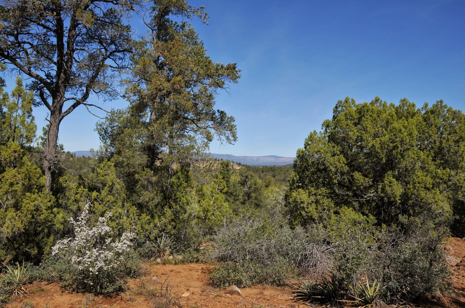
The Payson Area Trails System (PATS) is a collection of routes weaving through the business districts and suburbs of this north-central Arizona town. The trails tie in nicely with nearby Tonto National Forest routes and most are open to hikers, equestrians, bikers and ATV users alike. Round Valley Trail begins in a quiet residential neighborhood with a climb along foot paths and 4x4 roads that leads to scenic high points with far-ranging views of the flat-topped profile of the Mogollon Rim and majestic peaks of the Mazatzal Mountains. Because many unsigned roads bisect the route, be sure to look for PATS signs to stay on track. Even though it's close-to-civilization, the trek offers a genuine outdoor escape as it runs through undulating juniper-pine forests south of town. In springtime, wildflowers like the ground hugging, purple blossoms of the Featherplume dalia and wild carrot pop up from the loose, rocky soils. One of the trail's most prolific spring bloomers is a shrub called Gregg's Ceanothus which sprouts tiny white or pink flowers that release a lilac fragrance from March through May. After topping out at 5200', the trail dips down into Round Valley and curves toward Highway 87 where the sweet wildflower breezes mingle with the aroma of burgers and fries as the path approaches its west trailhead at the Sonic restaurant lot on the Tonto Apache Reservation.
LENGTH: 4.5 miles one-way
RATING: easy-moderate
ELEVATION: 4800' - 5200'
GETTING THERE:
EAST TRAILHEAD:
From Phoenix, travel north on State Route 87 (Beeline Highway) to Payson. Just past the Mazatzal Casino, turn right on Phoenix Street (easy to miss, near the Circle K), drive 1.6 miles to Gibson Court, turn right and continue 0.1 mile to the inconspicuous trailhead on the left. There's parking along the road and in a cul de sac a few yards up the street. Do not block private drives in the area.
WEST TRAILHEAD:
Located at the south end of the Sonic restaurant at SR87 and Green Valley Pkwy. near the Mazatzal Casino.
INFO: Payson Area Trails System
MORE PHOTOS:

Monday, March 2, 2015

SONOITA CREEK STATE NATURAL AREA

SONOITA CREEK STATE NATURAL AREA
Patagonia
Sonoita Creek along the Railroad Trail

The 9,453' summit of Mt. Wrightson is a magnet for winter snow and summer rain. This year-round precipitation is the source of the perennial waters flowing through the Sonoita Creek State Natural Area. Located south of the sky-scraping Santa Rita Mountains near the vineyards of Arizona's southeast wine region, the preserve was established in 1994 to protect the fragile watershed and riparian corridor. More than 20 miles of hiking trails wander through the 9,959-acre site that encompasses seven types of vegetative communities from
semi-desert grassland to moist deciduous forests along the creek. For an overview of the area, begin with the 0.7-mile, 500' climb up the Overlook Trail. On the summit, there are terrific views of adjacent Patagonia Lake and the peaks of the San Cayetano and Patagonia Mountains huddling around ocotillo studded savannah. To the east, the creek appears as a green satin ribbon dressing up the muted hills and gullies that bevel toward the water's twisting groove. A diverse menu of trails offer treks into the arid foothills, the lake dam and spillway, up into the Coal Mine Spring watershed and of course, walks along the creek.
Maps available at the visitor center and ample junction signage make navigation simple. One of the most popular day hikes is the easy, 4-mile Sonoita Creek-Cottonwood Loop circuit which begins with a 1.5-mile walk through high desert and ends with a spindle plunge into the creek channel and traipse through a lush forest of ash, willow, mesquite and walnut trees. For an extended, more challenging hike, continue on along the Railroad Trail which makes a stepping stone creek cross to follow the abandoned bed of the New Mexico and Arizona Railway 3 miles to the confluence with the Santa Cruz River. This section of trail is subjected to the whims of nature, so look for carins where the path gets erased by floods or downed trees. In addition to proper gear and plenty of water, a pair of binoculars will come in handy for viewing the more than 315 bird species--including the impossible to miss, brilliant red, Vermillion Flycatcher--- that inhabit the area.
LENGTH: 20 miles of trails
RATING: easy-moderate
ELEVATION: 3610'-4250'
FEE: $15 daily per vehicle
DAY USE HOURS: 4 a.m. to 5 p.m.
Sonoita Creek State Natural Area is always open, but the Visitor Center is closed during summer. Permits for hiking, hunting and horseback riding in the Natural Area can be obtained from the park gatehouse or by calling (520) 287-6965.
FACILITIES: Primitive, hike-in camping. Major ammenities are available at adjacent 
Patagonia Lake SP
GETTING THERE:
400 Lake Patagonia Road, Patagonia.
From Tucson, go 17 miles east on Interstate 10 to the State Route 83 exit 281. Head 24 miles south on SR83 to the SR83/82 junction in Sonoita, turn right (west) on SR 82 and continue 7 miles to Lake Patagonia Road. Turn right and go four miles to the Patagonia Lake State Park gate. Pay the entry fee and proceed to the visitor center to get a free hiking permit for the natural area. Only a limited number of hikers (and horses) are allowed in the natural area at any time. So, call ahead if you're hiking with a group.
INFO & MAPS:
Sonoita Creek State Natural Area
520-287-2791

Monday, February 23, 2015

SKYLINE REGIONAL PARK

SKYLINE REGIONAL PARK to BREAK GROUND THIS SPRING
Buckeye
Future site of Skyline Regional Park

After years of public meetings, environmental assessments and negotiations with land management agencies, Skyline Regional Park in Buckeye is about to become a reality. Situated in mountainous, geologically complex terrain north of Interstate 10, construction on the the 8,675-acre recreational site will begin sometime in April/May. The park will be developed in phases with long term goals that include expansion of trails, building additional facilities and working toward connectivity with Maricopa County Parks and the Valley-circumnavigating Maricopa Trail. When the park opens this year, there will be paved access roads, gatehouse, developed trailhead, parking, horse staging area, picnic ramadas, restroom and camping sites along with an environmental education programming area. A 133' long by 14' wide bridge will span a gaping desert wash to connect hikers, equestrians and bikers to 14 miles of existing trails. Another 14 miles of trails are in the planning stages. The non-motorized use routes will range in challenge level from barrier-free to difficult and each will be surrounded by breathtaking Sonoran Desert plants and wildlife. Deer, javelina, desert fox, raptors and the Sonoran Desert Tortoise live among the park's rich stands of ironwood, Palo Verde and mesquite trees that shade colorful spreads of wildflowers, native vines and blooming cacti. From the park's high points, big sky views beg to be savored, which is why a special spot perched on a yawning mountain saddle will be designated for interpretive star gazing events.
The park will be open from sunrise to sunset daily. Initially there will be no fees to enter the park, but that may change over time. Check back here for park updates, opening day announcement, location details and trail reviews. Until then, you can read up on the park's history and future plans by clicking on the links below.
White Tank Mountains Conservancy
http://www.wtmconservancy.org/
Sonoran Institute:

Monday, February 16, 2015

SAN PEDRO RIVER TRAIL

SAN PEDRO RIVER TRAIL
San Pedro Riparian National Conservation Area
San Pedro River 

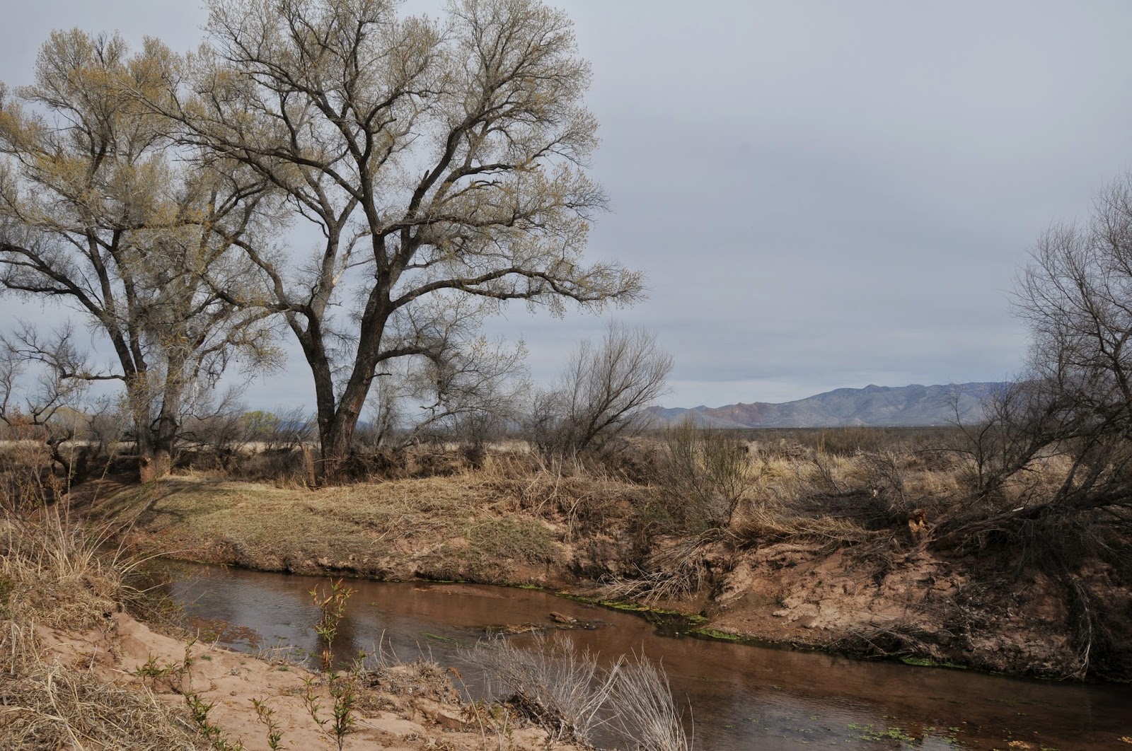
From its headwaters in Sonora Mexico to the confluence with the Gila River near Winkelman, the San Pedro River flows 140 miles north through 57,000 acres of riparian wildlife habitat surrounded by scrub and sprawling grasslands of the Sonoran and Chihuahuan deserts. Cradled between the high peaks of the Huachuca Mountains and the ore-rich hills around Bisbee, the river is one of the last free flowing waterways in the Southwest.

Over its lacy course, the unbridled river unfolds in idiosyncratic oxbows, linear pools, marshes and mesquite-cluttered floodplains giving a glimpse of what the area might have looked like to ancient inhabitants.

The 27-mile San Pedro River Trail runs adjacent to the water and a web a spur paths leading to the muddy banks and pebble-strewn sandbars add myriad opportunities for viewing some of the 350 species of birds, 80 species of mammals, 68 kinds of reptiles and amphibians and 2 species of native fish that reside in a tangled forest of cottonwood, willow and ash trees.

Numerous trailheads and backcountry camping areas are spread long the trail's length making for easy car shuttle, day hike or backpack outings.

The well-signed route is peppered with sites that chronicle the area's human history. There's a Clovis Paleo-Indian culture locale (11,000-8,000 B.C.), petroglyph gallery, mammoth kill pit, remnants of Spanish and Mexican colonial explorations and the foundations of territorial ranching and mining outposts. Taking in the entire scope of SPRNCA is a multi-day venture, but for a quick day trip or to learn more about the conservation area, a good place to start is at the San Pedro House trailhead. Here, knowledgeable volunteers from the Friends of the San Pedro River host guided hikes and are on hand to help optimize your itinerary. This is also the stepping out point for a trek along the San Rafael del Valle section of the route that culminates 8 miles upstream at the Hereford Bridge trailhead.
LENGTH: 27 miles one-way
or 8 miles one-way for the San Rafael del Valle section
RATING: easy
ELEVATION: 3762' - 4071'
FACILITIES: Restrooms, bookstore, picnic tables at San Pedro House. Restroom at Hereford Bridge.
FEES: No trailhead fees. Backcountry camping permits are $2 per person per day.
GETTING THERE:
From Phoenix, take Interstate 10 east toward Tucson. Continue to the AZ90 Fort Huachuca/Sierra Vista exit #302. Follow the AZ90 signs through Sierra Vista, then:
SAN PEDRO HOUSE TRAILHEAD:
From Sierra Vista, continue east on AZ90 to milepost 328 and turn right (south) at the sign just before the bridge.
HEREFORD BRIDGE TRAILHEAD:
From Sierra Vista, continue east on AZ90 to Moson Road (traffic light just past milepost 325), turn right and continue 7.6 miles to Hereford Road. Turn left, go 4.6 miles and turn right at the sign just past milepost 8 before the bridge. Roads are paved up to the 0.1-mile access roads which are good gravel.
INFO & MAPS:
San Pedro Riparian National Conservation Area, (520) 439-6400
San Pedro House Trails System: (520) 458-3559
Friends of the San Pedro River
MORE PHOTOS:

Thursday, February 5, 2015

GOOSENECK TRAIL

GOOSENECK TRAIL
McDowell Sonoran Preserve
Gooseneck Trail

It's fitting that this McDowell Sonoran Preserve connector route is named Gooseneck. That's because over its 7-mile length, it twists and bends in a continuous dance through the desert that dodges among massive granite outcroppings with majestic views of Four Peaks, Superstition Wilderness and the Verde River Valley. More than just a point-to-point journey, this route--which was opened in 2014-- runs from two major trailheads--Fraesfield in the north and Tom's Thumb to the south and is also part of the Maricopa Trail that spans adjacent McDowell Mountain Regional Park. Additionally, the trail ties in with the newly created Saguaro Nest (1.9 miles) and Redbird (1.1 miles) trails. Beginning the trek from the south involves hiking 0.3 mile on Marcus Landslide Trail and 0.2 mile on Rock Knob to the Gooseneck junction. Immediately upon stepping out on this playfully snarled route, a botanical treasure trove of desert plants fills the landscape. You'll walk among gorgeous specimens of wolfberry shrubs, yucca, desert hackberry bushes and glowing clusters of jumping cholla. In spring, blooming wildflowers like red maids, filaree, lupines and poppies sprout from the loose gravel soils. With big views, interesting geology and an understory of colorful blossoms, you'll be glad the trail sweeps out in lazy arcs that revel in the secret finds and secluded niches of this North Valley preserve.
LENGTH: 7 miles one-way
RATING: easy
ELEVATION: 2500' - 2813'
HOURS: sunrise to sunset daily
GETTING THERE:
Parking is allowed ONLY at these Scottsdale trailheads:
FRAESFIELD: 13400 E. Rio Verde Dr.
TOM'S THUMB: 23015 N. 128th St.

Tuesday, February 3, 2015

SILLY MOUNTAIN

SILLY MOUNTAIN PARK
Apache Junction
High Point Trail go to the summit of Silly Mountain 

Sandwiched between the US 60 freeway and the rough-cut mountains of the Superstition Wilderness, Silly Mountain Park straddles the worlds of hot pavement and rugged back country. A web of 11 trails meander along the the mountain's humps, slumps and points of interest including an old grave site and an abandoned mine. The park is the result of a restoration project funded by public and corporate donations and managed through a partnership between the City of Apache Junction and the Superstition Area Land Trust--a non-profit educational corporation created to protect and preserve Arizona State Trust Lands around the southern slopes of the Superstition Mountains. Up until 2008, Silly Mountain was being used as an off-road vehicle playground which took a heavy toll in the terrain. The decimation of native vegetation and deep trackway scars were becoming an eyesore and a public safety concern. Restoration of the site involved stabilizing trails for long term sustainability, re-establishing indigenous plants and restricting travel to non-motorized use. The park's most resent addition is a barrier-free, interpretive Botanical Walk that features 280 species of Sonoran Desert plants.
LENGTH: 3.5 miles of trails plus a barrier free Botanical Walk
RATING: easy to difficult
ELEVATION: 1550 - 2139 feet
GETTING THERE:
From Phoenix, travel east on U.S. 60 and turn left onto Mountain View Road just past milepost 199. Go 0.3 miles on Mountain View, turn right onto 32nd Ave and continue 0.2 mile to Silly Mountain Road. Turn right and go 0.4 mile to the trailhead on the left.
INFO & MAP:
Superstition Area Land Trust (SALT)

Friday, January 30, 2015

CLIFFROSE TRAILHEAD

CLIFFROSE TRAILHEAD
Cottonwood
Cliffrose Trailhead in Cottonwood

In what might be described as the "tip of the iceberg", the Cliffrose trailhead in Cottonwood represents the ongoing efforts of the Verde Valley Regional Trails Concept Plan. This grassroots effort to enhance and maintain the area's multi-use trail systems draws upon the expertise of residents from towns of Jerome and Camp Verde, and staff from the Prescott National Forest, Coconino National Forest, State Parks, City of Sedona, City of Cottonwood, Town of Clarkdale, and Yavapai County.
Together these groups are working to foster a long-range vision for Verde Valley trails and open spaces for the development of interconnected recreational travel systems.
The compact, no-frills Cliffrose trailhead sits near the Verde Valley Botanical Area and provides access to the Lime KilnTrail which in turn provides an established 15-mile travel corridor between Cottonwood and Sedona. At this writing (Jan. 2015), the trails here are unsigned but well defined. A dirt road heading east from the trailhead curves north to meet Lime Kiln in roughly 2 miles while a web of loop trails heading west trace a starkly beautiful landscape of ravines and cave riddled, jagged-edged limestone outcroppings. Beyond the chalk white sediments and high-desert scrub, sweeping vistas of Sedona's angular, vivid, rusty hued sandstone mesas and spires contrast with the hushed tones and rounded slopes of the Bradshaw Mountains. Finding your way around the roughly 3 miles of nicely maintained trails is easy. Just use the lay of the land as a natural compass. The red rocks of Sedona are in the northeast, Cottonwood and Jerome on the western frontier and the hum of Cornville Road to the south provide all the navigation tools you'll need.
LENGTH: variable, our GPS track of the loops read 3 miles
RATING: easy
ELEVATION: 3,089' – 3,353'
GETTING THERE:
From Phoenix, go north on Interstate 17 to the McGuireville exit 293 and go 12.4 miles west on Cornville Road (a.k.a. CR30, Mingus Ave.) to State Route 89A. From here, cross 89A ,continue less than a mile and turn right at the Cliffrose Trail sign.
INFO:

Tuesday, January 27, 2015

JAIL TRAIL RIVER WALK

JAIL TRAIL RIVER WALK
Cottonwood
Verde River

A trip to Old Town Cottonwood just isn't complete without a stroll under the "Gateway to the Verde River" archway that leads to a hike along the Jail Trail. Debarking from the site of a rustic old jail building, which is now home to a quaint tea house, the mile long, easy trail follows the banks of the river through River Front Park and on to Dead Horse Ranch State Park. The trail is shaded by thick tangles of willows and enormous cottonwood trees towering over the running water, cattail ringed coves and rock strewn flood plains. With reliable water and ample nesting spots, this riparian corridor is a productive birding location with hundreds of resident, seasonal and migratory species gracing the property. The hike can be enjoyed year-round as it cycles through the seasons. During the leafless winter months, the riparian corridor is as enchanting as ever with the benefit of bare branches giving clear views of roosting raptors and flocks of red-winged blackbirds. Springtime brings a flurry of chartreuse leaf shoots and fluffy catkins that mature into emerald canopies of cooling shade that last through summer. The balmy days and cool nights of late October turn the leaves into a spectacle of gold and russet. So whether you're visiting Cottonwood for a day of wine tasting, antique shopping or a scenic drive, a walk along the Verde River is de rigueur and the Jail Trail is the easiest path to the water.
LENGTH: 1 mile one-way
RATING: easy
ELEVATION: 3300' - 3290'
GETTING THERE:
From Phoenix, travel north on Interstate 17 to the Camp Verde exit 287. Head 10 miles east on State Route 260 toward Cottonwood and Jerome. When SR260 intersects with Main St./State Rt. 89A/Historic 89A, take a left. When State Rt. 89A separates at the light, stay on Main St./Historic 89A to get to Old Town. Continue through Old Town to where the road makes a sharp left turn just past Yavapai Street. Look for the “Gateway to the Verde River” archway and park in the lot on the right at 1101 N. Main Street.
INFO: Sedona Verde Valley Tourism Council
Birding info:

Monday, January 26, 2015

LIME KILN-BILL ENSIGN TRAILS

LIME KILN-BILL ENSIGN TRAILS
Cottonwood
Bill Ensign Trail

The Lime Kiln Trail is a reclaimed wagon road that was originally used from the 1890s thru the early 1900s to transport building materials and market goods between Cottonwood and Sedona. Today, the 15-mile-long route serves as a recreational trail for hikers, equestrians and mountain bikers anchored by Dead Horse Ranch State park in the west and and Red Rock State Park in the east. Named for a kiln built in the 1880s to produce mortar for the construction of several homes in Cottonwood area, the trail wanders through a landscape of limestone-layered rock formations dotted with Crucifixion thorn, juniper and beavertail cacti with impressive views of the mining town of Jerome, Mingus and Woodchute Mountains and Sedona's House Mountain volcano. Multiple access points and connecting trails provide dozens of day hike and backpack options. One to try is an out-and-back circuit using the Lime Kiln and Bill Ensign trails. Beginning from the Lagoon trailhead at DHRSP, this trip passes by the kiln site where interested hikers can take a short spur trail to the crumbling remains. At the 1.7-mile point, turn right at the Bill Ensign junction and hike 1.5 miles through high desert terrain skirting the boundary of the Verde Valley Botanical Area--a preserve established to protect the endangered Arizona Cliffrose. The trail culminates at a high point overlooking a riparian corridor of willows and cottonwoods along the Verde River.
LENGTH: 7.5 miles (as described here)
RATING: moderate
ELEVATION: 3,300' – 3,590'
FEE: $7 daily fee per vehicle
FACILITIES: restrooms, camp sites, cabins, picnic ramadas, fishing
GETTING THERE:
Dead Horse Ranch State Park
From Interstate 17 go north to State Route 260 exit 287 and head west toward Cottonwood. Continue 11 miles to Main Street in Cottonwood (Hwy 89A) and turn left. Continue through Cottonwood on Main Street, turn right on 10th Street and follow the signs to the park.
INFO:
MAPS:
Lime Kiln-Bill Ensign:
Lime Kiln:

Monday, January 19, 2015

ORACLE STATE PARK TRAILS


ORACLE STATE PARK TRAILS
Windmill Loop connects with the Arizona Trail

Because Oracle State Park is open only on weekends, there's a narrow window of opportunity for hiking the site's 15 miles of trails during the cooler months. Located in a prime wildlife corridor of high desert scrub and savannah grasslands, the park is bolstered by the far northern reaches of Tucson's Santa Catalina Mountains and the sprawling rampart of the Galiuro range looming over the meandering gorge of the San Pedro River to the west. Although there's little shade on the 8 routes that amble among stands of Soaptree yucca, agaves, isolated patches of scrub oak and fruit-bearing cholla, the upside is that the sun drenched foothills display unobstructed, "see-forever" vistas. The best time to hike here is November through April when crisp mountain breezes whipping through hip-high forbs add hair-rustling fun to the trek.  Despite being within a park setting with all the expected amenities, the trails have a nice wilderness feel to them.  Sightings of mammals like whitetail deer, fox, javelina as well as native birds and reptiles are common. Passage 13 of the Arizona National Scenic Trail, which skirts the park's edge, connects with several of the routes.  Excellent signage and soft footing make for easy, pain-free travel on most of the trails. The one exception is the Windmill Loop that begins at the bottom of Kannally Wash with a trudge through calf-cramping sand with few directional signs.  Post hike, visit the park’s Kannally Ranch House.  The 1930s-era, adobe structure with its, multiple levels, twisting staircases, unusual art-embellished spaces and a kitchen with a wall of original iceboxes adds a note of history to top off your day.
LENGTH: 15 miles plus 4 miles of AZT
RATING: easy-moderate
ELEVATION: 3700' - 4600'
HOURS: Saturdays & Sundays 8 a.m. - 5 p.m.
FACILITIES: restrooms, picnic areas, museum, gift shop
FEES: $7 daily fee per vehicle
GETTING THERE:
From Phoenix, take Highway 79 south. At the junction with Highway 77 turn left (east). Turn right off Highway 77 at the Oracle turnoff. Follow the road through Oracle (America Avenue) 2.3 miles to Mt. Lemmon Road. Turn right on Mt. Lemmon Road. Follow it 1.1 miles to the park entrance. The park is located on the left (north) side of Mt. Lemmon Road.
INFO:
Oracle State Park
3820 Wildlife Drive, Oracle, AZ
520-896-2425
MORE PHOTOS:

Monday, January 12, 2015

KING CANYON TRAIL


KING CANYON TRAIL
Saguaro National Park West
Wasson Peak Summit

If you hike along the trails of Saguaro National Park West in any depth, sooner or later, you'll end up on the 4687' summit of Wasson Peak.  Two clusters of trails located at the southwest and northeast ends of the park tie in with arterial routes that funnel to the highest point of the Tucson Mountain Range. King Canyon Trail is the shortest, most direct route to the top.  Although brief, the trek is no walk in the park (ok, well, technically it's in a park).  Over its 3.5-mile one-way course, hikers ascend 1987' along a dirt path that goes aggressively vertical  
on the last mile. Right out of the gate, a tempting, cloud-caressing massif looms ahead.  This is the infamous "false summit" of Wasson Peak. The actual highpoint resides behind it and you won't see it until you've hiked halfway up its deceptive sibling. Advance knowledge prevents the emotional torture of discovering this cruel fluke with exhausted legs. From the parking area located just outside the Saguaro National Park boundary, follow the dirt road at the end of the lot and hike a few dozen yards to the official trailhead.
King Canyon Trail proper ends 0.3-mile from the summit prize. Here, the drool-worthy destination appears as a lone stub at the end of a spur trail hugging a knife-edge ridge hovering over Tucson valley and the Santa Catalina Mountains.  At this point, with just one more uphill haul left to tackle, the physical climbing challenge is mostly complete. Regroup your resolve, take a deep breath and trudge on because mentally---you're already there.
LENGTH: 7 miles roundtrip
RATING: moderate
ELEVATION: 2700’- 4687'
FACILITIES: none
RULES: Dogs, bikes and motorized vehicles are prohibited. Livestock is not allowed on the summit switchbacks.
GETTING THERE:
From Interstate 10 in Tucson, take Speedway Blvd. exit 257 and head 12 miles west (Speedway turns into Gates Pass Road) to Kinney Road. Turn right and continue 2.5 miles to the trailhead located 0.1 mile past the Arizona-Sonora Desert Museum at parking area K24 on the right.
INFO:
MAP:
MORE PHOTOS:

Saturday, January 3, 2015

ROBBINS BUTTE WILDLIFE AREA


ROBBINS BUTTE WILDLIFE AREA
Near Buckeye
Robbins Butte 

Occasionally, some of the best hiking can be discovered where there are no trails. This is true of the Robbins Butte Wildlife Area located south of Buckeye.  The Arizona Game and Fish Commission manage this 1,681-acre swath of riparian-desert upland ecosystem for the preservation of native animal habitats and enhancement of wildlife-oriented recreation.  Except for a short accessible trail built by the Boy Scouts in 2008, there’s not a traditional hiking trail to be found in the astonishingly varied terrain.  Instead, hikers can explore along dirt roads and hunter paths that lead to cattail-lined wetlands along the Gila River, mesquite forests and sandy washes running through expansive rangelands of creosote and cholla. The property is designated an Audubon Important Birding Area and is one site in their annual Christmas bird count. At any given time, thousands of white-wing and mourning doves can be seen feeding on the crops that are planted here to attract and sustain them. Besides the familiar trill of doves taking flight, there are chirping quail, squawking water birds and, in winter, a bevy of raptors like bald eagles and red-tailed hawks inhabit the affluent land. Determined bird watchers may also spot rare species like the Western yellow-billed cuckoo and Lark Buntings.  I was fortunate enough to view a pair of Cooper’s hawks sparing above a rogue cottonwood tree.  This free-form hiking excursion can be experienced from any of the 6 designated parking areas along the 2-mile main access road. Just step out and wander at will. I hiked along the roads and footpaths for 7 miles and barely scratched the surface of sights to be seen in this extraordinary public land preserve.
LENGTH: variable on roads and hunter paths
RATING: easy, exploratory
ELEVATION: 578’ – 820’
FACILITIES: none. No fees.
GETTING THERE:
From downtown Phoenix (I17 and 7th Ave.), go 30 miles west on Interstate 10 to State Route 85 exit 112. Head 8 miles south on AZ85 to the signed turn off on the right for Robbins Butte and follow the dirt road 0.3 mile to the parking area on the right just before the road fork.  The main road (right at fork) leads to 5 additional parking areas and is sedan-friendly dirt, while the road to the Butte (left at fork) is washboard rough, sandy and better suited for high-clearance vehicles.
INFO & MAPS:

Tuesday, December 30, 2014

MARICOPA TRAIL


MARICOPA TRAIL
Anthem-Lake Pleasant

With the New Year comes the anticipated completion of the Valley-circumnavigating Maricopa Trail. Its 240-mile circuit connects county parks, open spaces and suburban communities.  Most of the trail is already cut, signed and ready to explore with the gaps to be bridged in 2015. One interesting, close-to-town section runs for 16.2-miles from Lake Pleasant to Anthem. Beginning at the Agua Fria trailhead that was dedicated in 2011, the route roughly parallels Highway 74, turns north to connect with the Black Canyon Trail then heads east under Interstate 17.  Near the lake, the path scoots around and above the Beardsley and Waddell canals, Camp Dryer Diversion Dam and the massive wall of Carl Pleasant Dam.
The route can be a bit confusing at the beginning.  To stay on track, go east (right) on the dirt path for 0.1 mile to where it comes out on the access road.  From here, continue hiking on the road, cross the canal bridge and look for a Maricopa Trail sign on the right where the road curves to the north at 0.2 mile from the trailhead. From this point on, the route is marked with signs and cairns where it gets sketchy in washes.  In addition to the reservoir features, the trail also passes through an ironwood-lined gully, and crosses a flat plain of creosote and cholla before encountering a RV park near 87th Avenue.  As the trail moves east, the sound of gunfire from Ben Avery Shooting Range heralds the approach to Interstate 17 and a traipse into the Anthem community.
LENGTH: 16.2 miles one way to Anthem
Option: 2.7 miles to 87th Ave
Option: 3.7 to New River Road
Option: 9.3 miles to Black Canyon Trail
Option: 11.5 to I-17
RATING: easy
ELEVATION: 1100' - 1737'
GETTING THERE:
From Phoenix travel north on Interstate 17 to Carefree Highway/State Route 74 exit 223. Drive 9 miles west (toward Wickenburg) to Beardsley CSR, turn right, go 0.1 mile and make a U-turn to the trailhead parking area.
INFO:
MAP:
MORE PHOTOS:

Sunday, December 28, 2014

TORTUGA-SPUR CROSS LOOP


TORTUGA-SPUR CROSS LOOP
Spur Cross Ranch Conservation Area

Spur Cross Ranch Conservation Area is a pristine swath of preserve snuggling up to Cave Creek. It's got everything you'd expect of a Sonoran Desert hiking destination with some unexpected extras to boot. Complementing a community of gigantic saguaros, skulking coyotes, mesquite bosques and  fragrant creosote are a smattering of Native American archeological sites and ruins of mining operations that are best explored via regularly scheduled guided hikes.  With so much to see and do within the Ranch, it can be difficult to decide where to start.  That's where the popular Tortuga-Spur Cross Loop hike comes in handy. Along its 3.6-mile circuit, the trail samples both the rough terrain round the base of Elephant Mountain and the slinky, fresh-cut tread of Spur Cross Trail. A moderate uphill slog on an old 4x4 road leads to a crest overlooking water-scoured gorges, cacti-cluttered cliffs and the riparian wonders of the Jewel of the Creek Preserve. From here, a barely discernable maze of trails braided through surrounding hills and valleys belie a bevy of connecting routes that link the park with adjacent suburbs and the wilds of Tonto National Forest. 
LENGTH:  3.6 miles
RATING: moderate
ELEVATION:  2,200' - 2,800'
FEE: $3 daily fee per person.  Exact change is required for the self-pay station
GETTING THERE:
From Loop 101 in Phoenix, take Cave Creek Road north to Spur Cross Road (on the left just as you enter the downtown area) and go 4.5 miles to the parking area.
INFO: Maricopa County Parks & Recreation
MAP:

Sunday, December 21, 2014

YAVAPAI POINT TRAIL


YAVAPAI POINT TRAIL
Lake Pleasant Regional Park
Yavapai Point Trail

One of three new hiking paths that debuted in November 2014 at Lake Pleasant Regional Park, Yavapai Point Trail adds a moderate climb and sweeping vistas to the park’s 6-trail, 8.3-mile system.  The hike begins at the Cottonwood Day-Use Area with a 0.2-mile walk on Pipeline Canyon Trail to the Yavapai Point junction.  Here the trail swerves toward the water, following the cliffs above the lake.  A scenic viewpoint at roughly the half-mile point serves as an appetizer for what awaits hikers at trail’s end. From here, the hike becomes an edgy, switchback-moderated ridgeline climb with views of Cottonwood Creek, Fireman’s Cove and Pipeline Canyon. The hike’s big payoff is a panorama of the lake and surrounding desert mountains on the breezy summit.  From here, you can return the way you came and pick up the new Cottonwood Trail or connect with Pipeline Canyon, hike 1.9 miles south and step out on the third new route, Wild Burro Trail.
LENGTH:  3.4 miles roundtrip (Yavapai Point out-and-back)
RATING: moderate
ELEVATION:  1,782’ - 2,178’
FEE: $6 daily fee per vehicle
FACILITIES: restrooms, water, picnic ramadas, camping, nature center
GETTING THERE:
From Phoenix go north on Interstate 17 to Carefree Highway/State Route 74 exit 223.  Head west (toward Wickenburg) to Castle Hot Springs Road turn right and drive 5.4 miles to the Lake Pleasant North Access road. Turn right (pay fee at gate) and go 0.4 mile to the turn off for Cottonwood Picnic area, turn right and go 0.4 mile to the Pipeline Canyon trailhead.
INFO: Lake Pleasant Regional Park
MAP:
MORE PHOTOS:

Sunday, December 14, 2014

EAST WING MOUNTAIN TRAILS


EAST WING MOUNTAIN TRAILS
Peoria Sonoran Mountain Ranch Preserve

If you’re new to hiking or looking for a way to build stamina, this cluster of West Valley trails offers three options ranging from easy to difficult. Although none of the trails stray very far from suburban backyards, the difficult-rated summit loop gains enough elevation to provide a good workout backed by excellent scenic views.  The trail is very well constructed with hairpin switchbacks and staircase-like rock slabs that make climbing the steep chutes manageable for even novice hikers.  The trek is a surprisingly quiet journey, and save for the occasional yapping of the local Yorkshire terriers guarding their patios, the soundtrack is one of breezes through Palo Verde trees and the hum of wind-rustled saguaro needles.
LENGTH: 2.4 miles 
RATING: moderate-difficult
ELEVATION: 1,476’ – 1916’
FACILITIES: restrooms, picnic tables, playground, drinking fountains
GETTING THERE:
Sonoran Mountain Ranch Park, 7098 W. Miner Trail, Peoria.
From Phoenix, go north on I-17 to Happy Valley Road exit 218. Go 5 miles west on Happy Valley Road to 67th Avenue, turn right and drive 2.8 miles (road becomes Pyramid Peak Pkwy.) to Sonoran Mountain Ranch Road.  Veer left and go 0.5 mile to Chalfen Blvd., turn left, continue 0.1 mile to Miner Trail and follow the signs to Sonoran Mountain Ranch Park. From the post near the restrooms, hike 0.15 mile south on Chalfen to the official trailhead. Do not park along residential streets.
INFO: City of Peoria
https://www.peoriaaz.gov/trails

Monday, December 8, 2014

PERALTA CANYON TRAIL


PERALTA CANYON
Superstition Wilderness
Weaver's Needle viewed from Lone Pine lookout

A hike up Peralta Canyon Trail #102 in the Superstition Wilderness just might be the longest 2 miles you'll ever trek.  This is because the hike is an unrelenting uphill slog through desert scrub and slick rock chutes that begins immediately after departing the trailhead and does not quit until the trail tops out at the 2-mile point on the Fremont Saddle. Here, up-close views of Weaver's Needle-- the area's most recognizable pillar of rock---deliver a generous ROI for the sweaty haul. The saddle is a popular place to take a break and decide whether to continue hiking downhill another 2.6 miles to the end of trail #102 or back track for a 4-miler.  Another option involves hiking on well-worn social trails to the lone pine tree visible on a ridge to the right (east) of the Needle. This side trip adds 1-mile round trip.  Anyway you hike it, Peralta Trail is an ideal way to burn off those extra holiday calories and a terrific place to introduce out-of-town visitors to the beautiful Supes.
LENGTH TO FREMONT SADDLE: 4 miles round-trip
LENGTH WITH SIDE TRIP TO THE TREE: 5 miles roundtrip
RATING: moderate
ELEVATION: 2,400 – 3,800 feet
GETTING THERE: From Phoenix, take US 60 east to about 8 miles past Apache Junction and look for the “Peralta Trailhead” sign on the side of the road. Turn left onto Peralta Road (Forest Road 77) and drive 8 miles to the trailhead. NOTE: FR 77 is good dirt and passable by sedan. There are nice restrooms but no water at the trailhead. The parking lot fills up quickly on weekends, so plan to arrive early or park in the overflow lot. NO FEES.

Monday, December 1, 2014

VINEYARD TRAIL


VINEYARD TRAIL
Tonto National Forest
Roosevelt Lake 

At the north end of Roosevelt Lake, an elegant suspension bridge that straddles the gap between the Superstition Mountains and Four Peaks Wilderness serves as the gateway to Passage 20 of the Arizona Trail. This 19.5-mile   stretch of rugged roads and narrow footpaths shimmies through of some of the state's most spectacular country.   For a relatively short hike, this one really packs a scenic punch and a grueling climb at the start adds satisfaction to the vistas that unfold on the way up. The heart-pumping initial ascent along Inspiration Point tops out at 1.5-miles with 360-degree views of the lake, Sierra Ancha Mountains and green floodplains of Tonto Basin. From here, the hike is tempered by rolling grasslands as it moves west  toward Four Peaks.
View of Four Peaks
Roosevelt Lake and the Tonto Basin
Next, get your camera ready because the trail curves around a low slung, saguaro-populated ridge where the Salt River gorge and snaking form of Apache Lake shimmer a thousand feet below. This is one of the prettiest places in central Arizona. Beyond the river-and-lake eye candy, the trail dips down though rock fall and cacti to meet Forest Road 429 and the end of trail #131 at the Mills Ridge Trailhead where you can backtrack for a 9-mile day hike or continue 469 miles north to Utah on the Arizona Trail.
Salt River below
The old 4.5-mile Vineyard Trail #131 that was once used to service a reflector on a pinnacle above the lake has been harnessed into this section of the AZT's state-traversing course.
LENGTH: 4.5 miles one way
RATING: difficult
ELEVATION: 2,200' - 3,700'
GETTING THERE:
The trailhead is located on the northeast side of the Roosevelt Dam Bridge and can be accessed via State Routes 188 and 88. There are several ways to get there from Phoenix including the shortest route that's a precipitous drive on the rough dirt mountain grades of SR88.  But the faint of heart should instead take State Route 87 north to the SR188 junction and head 30 miles south to the trailhead parking turnout at the big Arizona Trail sign on the left just before the bridge. The hike begins across the road at the AZ88 junction sign.
INFO: Arizona Trail Association:
Tonto National Forest: Tonto Basin Ranger District, 928-467-3200
MORE PHOTOS:

Sunday, November 23, 2014

SONORAN DESERT (HAWES) TRAIL SYSTEM


SONORAN DESERT (HAWES) TRAIL SYSTEM
Tonto National Forest, Mesa Ranger District
Salt River viewed from Saguaro (aka Mine) Trail

Originally constructed by mountain bike enthusiasts, this intertwining system of trails overlooking Granite Reef Dam on the Salt River in Mesa is just too interesting for hikers to ignore.  In 2005, 10.3 miles of the 20-mile web of social trails were adopted into the Tonto National Forest System. As would be expected of bike trails, these routes offer an entertaining mash up of twists and swooping turns tracing the site’s hills and valleys. The 5-trail maze is also known as the "Hawes System" after the longest route in the mix. As bikers heavily use these trails, hikers should stay alert and share the dirt accordingly. Trail courtesy dictates that bikers yield to hikers and everybody yields to horses---especially the wild mustangs that roam this riverside terrain. However, a bike careening through a hairpin turn at break neck speed won't necessarily be able to avoid you without drawing blood. So, although riders on these trails are generally courteous and careful, be prepared to relinquish the right of way whenever possible---after all, they were here first.
LENGTH: 10.3 miles (maintained trails only)
Hawes Trail #52: 3.4 miles
Ridge Trail #59: 1.7 miles
Granite Trail #54: 0.7 mile
Saguaro Trail #50: 3.1 miles
Saddle Trail #51: 1.4 miles
RATING: moderate
ELEVATION: 1150’ – 1760’
GETTING THERE:
From Phoenix go east on Loop 202 to exit 23 for Power Road in Mesa.  Travel 2.1 miles north on Power Road to the Hawes Trailhead on the left. Trail begins across the road.
INFO & MAPS: Global Bikes
Tonto National Forest
MORE PHOTOS:

Sunday, November 16, 2014

BUTCHER JONES TRAIL


BUTCHER JONES TRAIL
Saguaro Lake
Trail near Camper Cove

Of the sting of reservoirs tethered by the Salt River 30 miles northeast of the Valley, amenity-rich Saguaro Lake is the closest and easiest to find. This is one of the reasons why it's so wildly popular for boating, fishing or simply bonding with a cooler and juicy novel under a lakeside mesquite tree. Hikers can hit the dirt here by way of the Butcher Jones Trail that wraps around a water-piercing peninsula with secluded coves. Most of the route hugs the cliffs high above the lake, but fisherman paths to the shore make nice scenic detours for photography, wildlife spotting or a cozy lunch break. The trail's high points reveal fantastic views of the gaping Salt River Canyon, 1930s-era Stewart Dam and surrounding mountain ranges. Arrive early to get a good parking spot and be prepared to share the trail with pole-toting anglers and gaggles of kids running off their hot dogs and Kool-Aid. If noise and crowds cramp your style, hang in there---the commotion dissipates where the trail makes a hairpin turn around Peregrine Point.
LENGTH: 5 miles roundtrip
RATING: moderate
ELEVATION: 1529' - 1600'
FACILITIES: restrooms, picnic tables
FEE: Tonto Pass is required. $6 daily fee
GETTING THERE:
From Mesa, go 27 miles north on SR87 (Beeline Highway) to exit 199, Bush Highway (FR204), turn right and continue 2 miles to the signed turnoff for Butcher Jones Recreation Area.  Follow the access road (FR116) 2 miles to the site.  Trail begins at far east end of the beach.
INFO: Tonto National Forest
MORE PHOTOS: