Find A Trail. Start Your Search Here:

Monday, March 24, 2014

UPPER RANCH-BROWN'S MOUNTAIN LOOP


Wildflower high season at McDowell Sonoran Preserve
Scottsdale

Brown's Mountain Trail

Standing on the summit of Brown's Mountain, a heart-pumping realization of just how close the desert preserve lapping at its base came to being washed away in a tidal surge of golf properties strikes the senses.   The suburban sprawl tsunami was averted through the persistence and hard work of the McDowell Sonoran Conservancy, hundreds of volunteers and the City of Scottsdale, leaving us with an unspoiled parcel of Sonoran Desert to enjoy in perpetuity.  So, you better darn well get out there and hike! If the spectacular scenery and easy-to-navigate trails are not enough  motivation for you, the months of March and April bring wildflower high season. Even in drier years like 2013-14, strawberry hedgehog cactus, chia, lupines, poppies, buckwheat, chicory, scorpion weed, globemallow and rock gilia add splashes of vivid color to the subtle earth tones of the desert floor.
Mexican gold poppies

The familiar flat-topped silhouette of Brown's Mountain anchors the western end of the parcel. One option to get to the high point is to hike Brown's Ranch Road to Brown's Mountain Trail and take the summit spur trail to the top.
Although this path is narrow, rocky and steep, the climb's ROI is a birds-eye view of the entire trail system and surrounding mountain ranges.  Descend and continue on Brown's Mountain Trail to Upper Ranch Trail and follow its flower-fringed course back to the trailhead.

Brown's Mountain Summit Spur
LENGTH: 4.3 miles
RATING: moderate
ELEVATION:  2710' - 3253'
HOURS: sunrise to sunset daily

GETTING THERE:
Brown's Ranch Trailhead: 30301 N. Alma School Pkwy, Scottsdale.
From Loop 101 in Scottsdale, take the Pima/Princess exit 36. Go 6.5 miles north on Pima to Dynamite, turn right and continue 2.7 miles to Alma School.  Turn left and go 1 mile to the trailhead. There’s restrooms, water and maps at the trailhead.  No fees.
Brown's Mountain
INFO & MAPS: McDowell Sonoran Conservancy
City of Scottsdale:

Sunday, March 23, 2014

ADOBE JACK TRAILHEAD


ADOBE JACK TRAILHEAD
Sedona
Adobe Jack Trail

Since its completion in 2012, this cluster of new trails near downtown Sedona has become quite the hot spot for urban treks. But don't be put off by its proximity to shopping and restaurants---there's quality hiking here.   Seven fresh cut trails-- Crusty, Grand Central, Coyote, Powerline Plunge, Javelina, Ant Hill Loop and Adobe Jack, add seven miles of exploratory routes that blend with the existing Soldier Pass-Thunder Mountain systems. Packed with gasp-worthy Red Rock Country views, these interlaced paths were designed for long-term sustainability and easy access to Sedona's complex geology and high desert flora.  The connectivity of these routes is a wonder---you can plan long day hikes and backpacking trips by linking with Brins Mesa trails to get to the Boynton Canyon and upper Oak Creek Canyon areas. Or, if a casual walk in tennies followed by post-trek noshing and retail therapy is your idea of an excellent adventure, then, this trailhead is your ideal launch pad.
Crusty Trail

LENGTH: 7 miles of new trails
RATING: easy-moderate
ELEVATION: 4250’-4410’


Plenty of shade on Grand Central Trail

GETTING THERE:
From the SR179/89A roundabout in Sedona, go 0.8 mile west (left, toward Cottonwood) on 89A to the trailhead on the right.
FEE: A Red Rock Pass is required
INFO: Red Rock Ranger District, Coconino National Forest, 928-203-2900

Thursday, March 20, 2014

Where's Sirena?

ARIZONA TRAIL TREK 2014 INTERACTIVE EVENTS FOR MARCH!
Sirena Dufault is in the Tucson area this week

From March 14 to May 31, 2014, Sirena Dufault will hike the entire 817-mile Arizona Trail  beginning at the Mexico/USA border. She's doing this to promote and raise funds to support the Arizona Trail Association---the nonprofit organization responsible for building, maintaining and protecting the trail.  During the last days in March, Sirena will be treking  through the beautiful mountains and grasslands of the Patagonia-Tucson area.  Here's a sample of events and hikes YOU can participate in:


MARCH 20: Patagonia, Plaza de Patagonia, 5-8 PM
MARCH 21: Hike with Sirena, Walker Basin to Kentucky Camp
registration required: http://www.eventbrite.com/o/arizona-trail-trek-6059653717
MARCH 23: Hike with Sirena, Kentucky Camp to Oak Tree Canyon
registration required: http://www.eventbrite.com/o/arizona-trail-trek-6059653717
MARCH 28: Tucson, Sky Bar, 7-10pm
MARCH 29:  Hike with Sirena, Gabe Zimmerman TH to Colossal Cave
registration required: http://www.eventbrite.com/o/arizona-trail-trek-6059653717

Sunday, March 16, 2014

SEDONA WETLANDS PRESERVE


SEDONA WETLANDS PRESERVE
Cottonwoods line one of the six ponds

Dedicated on September 27, 2013, this lush effluent management area located halfway between Sedona and Cottonwood is a prime destination for wildlife viewing hikes. Six ponds filled with cleaned and disinfected wastewater are landscaped with native plants to attract myriad waterfowl, songbirds and thirsty critters. A mile long trail circles the 27-acre site, which features several viewing beaches and cattail-choked coves. The Northern Arizona Audubon Society conducts frequent bird watching field trips to this spot, but if you’re visiting solo, you’ll see the most species if you go early or late in the day, move slowly and look for movement at the water’s edge.
Photo opportunities abound

LENGTH: 1.1-mile perimeter trails
RATING: easy
ELEVATION: 3773' - 3978'
HOURS: dawn -dusk daily
FACILITIES: shaded picnic tables, restrooms
DOGS: are allowed but must be on leash, kept out of the water and picked up after.
GETTING THERE: 19655 SR89A, Sedona.
From the SR179/89A roundabout in Sedona, go 8 miles west (left, toward Cottonwood) on 89A to the Wastewater Treatment Plant near milepost 366.  Turn right, then make an immediate left
Fowl flotilla
and continue 0.3 mile to the trailhead.

INFO: City of Sedona, Dept. of Parks & Recreation:
Northern Arizona Audubon Society:
MORE PHOTOS:

Monday, March 10, 2014

Epic, interactive ARIZONA TRAIL TREK kicks off this Friday


Love YOUR Arizona National Scenic Trail by supporting Arizona Trail Trek 2014

Sirena Dufault hikes the Arizona Trail. Photo courtesy Sirena Dufault

Ever dreamed about what it would be like to hike the entire 800-mile Arizona Trail from Mexico to Utah? Here's your chance to see how it's done and sample the thrills with an expert. From March 14 to May 31, 2014, Sirena Dufault will hike the whole route beginning at the Mexico/USA border. She's doing this to promote and raise funds to support the Arizona Trail Association---the nonprofit organization responsible for building, maintaining and protecting the trail. During the trek, there will be many opportunities for YOU to join Sirena for hikes, backpacking trips and party events in communities near the trail.  Events will feature food, entertainment and items for sale including logo merchandise and copies of the brand new book, Your Complete Guide to the Arizona National Scenic Trail. As a tasty extra incentive, Arizona Trail Ale, brewed by That Brewery in Pine, Arizona will be served at the gatherings. One event to try: Tucson area party, camping and day hike from Gabe Zimmerman trailhead to Colossal Cave Park on Saturday, March 29. You must register in advance at: http://www.aztrail.org/azttrek/.

Sirena will be using social media to share on-trail experiences and post updates.  Follow her via an online satellite tracking system on the Arizona Trail Facebook page https://www.facebook.com/Arizona.Trail.Association or Twitter @AZTRAIL#AZTtrek
So whether your Arizona Trail bucket list includes a thru-hike of your own or simply vicarious thrills, come on out, sample the trail and get to know and love our state's most epic trek.

FOLLOW, SIGN UP FOR TREKS & DONATE HERE:

Sunday, March 9, 2014

ANACONDA-SNAKE LOOP


ANACONDA-SNAKE LOOP
Sedona

View from the Anaconda Trail

Blending old favorites with a couple of newly adopted trails, this circuit in the Cockscomb cluster of routes in Sedona is a low-traffic gem.  Located near several of Red Rock Country’s most popular hikes (Boynton Canyon, Bear Mountain, Fay Canyon) these trails offer refreshing serenity under fragrant cover of high desert scrub woodlands. The trek begins on the old Arizona Cypress trail with a traipse through thickets of sage-colored juniper, the eponymous shaggy-barked evergreens and elegant white-trunk sycamores along Dry Creek. A trailhead map shows numerous ways to create loop hikes in the area. I selected the new Snake and Anaconda trails using Girdner trail for the return leg. Anaconda, with its zigzagging mix of easy dips and climbs was an especially enjoyable route with many scenic views and a sprinkling of wildflowers to boot. Choose this trek if you’re looking peace and quiet.

Cockscomb rock formation

LENGTH: 4.2-mile loop
RATING: moderate
ELEVATION: 4400’ – 4678’

Trailhead map

GETTING THERE:
From the AZ179/89A roundabout in Sedona, go 3.2 miles west on 89A to Dry Creek Road. Turn right (north) and continue 2.7 miles to an unmarked dirt road (FR9589) on the left.  This is roughly 0.1 mile before the Long Canyon Road junction.  Go 0.2 mile on this narrow but sedan-friendly road to a large parking circle. Trail access is just before the circle and at the “closed area” sign at the south end of the lot.
INFO: Red Rock Ranger District, Coconino National Forest, 928-203-2900
FEE: a Red Rock Pass is required. $5 daily fee.

Friday, March 7, 2014

Crack down on illegal parking and stopping at Camelback Mountain trailhead


ECHO CANYON TRAILHEAD PARKING RESTRICTIONS TO BE ENFORCED
Camelback Mountain, Phoenix
Hike South Mountain trails instead

Just like the old adage ---"stuff expands or contracts to fill the space allocated for it"---the newly upgraded Echo Canyon trailhead parking lot at Camelback Mountain is once again bursting at the seams. Even with double the parking, traffic congestion continues to be a problem.  The extra spots fill up quickly and hikers have been ignoring posted regulations and illegally stopping and/or parking along McDonald Drive to wait for an open space. Well, according to a press release issued today, the party is over, folks. You can now expect to be towed and/or ticketed because the City of Phoenix in conjunction with the Town of Paradise Valley is stepping up enforcement effective immediately. Remember, if the parking lot is full, you must leave the area and return later---no idling or parking along the street. Additional suggestions to avoid traffic backups are available on the Echo Canyon/Camelback Mountain webpage at: http://phoenix.gov/parks/trails/locations/camelback/index.html
As a side note, I avoid this trail.  It's too crowded, has zero wilderness appeal and adds to my stress levels. Nope---city trails in the Phoenix Sonoran Preserve and South Mountain Park deliver a much nicer hiking experience. 

Monday, March 3, 2014

ROUND MOUNTAIN PARK


ROUND MOUNTAIN PARK
City of Globe

Bull's Eye Loop Trail

In Arizona, where the sun shines almost every day, we really love our public recreational lands.  Nearly every town with a population over 50 has developed its own trail system. Even places like Globe--which boasts close access to Tonto National Forest and the Arizona Trail--have invested in the Grand Canyon State's obsession with the great outdoors.  The 6.7-mile,  six trail system of Round Mountain Park offers pleasant, family-friendly alternatives to the more remote and difficult (think: Sixshooter Canyon and Picketpost Mountain) routes in the "Copper
Pinal Mountains viewed from the Boulder Canyon Trail
Corridor" mining district. Originally designed by the University of Arizona Landscape Architecture program in the 1990s, the 386-acre site has been continually upgraded and expanded by the city, local businesses and volunteers. The well-signed trails wander among boulder-strewn canyons, shallow caves and fascinating geology including a curious hole in a wall of stone known as Bull's Eye Rock. An elaborate seating area at the park's highest point provides 360-degree vistas of the Pinal Mountains and the area's ore pits.
A full complement of amenities including restrooms, water, shaded picnic spots and benches placed at scenic stops along the trails make for a relaxing day of hiking.    
Bull's Eye Rock


LENGTH: 6.7 miles total
RATING: easy - moderate
ELEVATION: 3560' - 4201'

Mountain views on the West Trail

GETTING THERE:
From the US60/AZ188 junction in Globe, continue 4.8 miles on US60 to South Street (Round Mountain Park Road).  Turn left and go 0.5 mile to the park. South Street is easy to miss--it's near the Quality Inn/Express Stop about a quarter mile before the US70 junction.

INFO & MAP:
MORE PHOTOS:

Saturday, March 1, 2014

WATSON DAM TRAILS


WATSON DAM, FLUME CANYON & NORTHSHORE TRAILS
Prescott Mile-High Trail System
 
Bridges over Granite Creek
So many wonderful works of nature are tucked within Prescott's Granite Dells area. And, thanks to the city's Mile-High Trail System, there's no shortage of ways to get to the good stuff. The Watson Dam-Flume Canyon cluster of trails stands out because of its diverse terrain. A network of loopy trails wander through riparian woodlands along Granite Creek and soaring slick rock crests overlooking Watson Lake. Map signs posted at every turn make navigation easy. A particularly beautiful segment makes a footbridge assisted traverse of a precipitous gorge that forges the way to the base of Watson Dam.  Here, cattail reeds and gangling willows living in shallow pools and running currents huddle in a lush, shady cove fortified by vertical granite.
Late winter on the Flume Trail


LENGTH: 2.4 miles total
RATING: moderate
ELEVATION: 5057' - 5642'
GETTING THERE:
From Phoenix, travel north on I17 to the SR69 interchange at Cordes Junction.  Go 30 miles west on SR69 to Prescott Lakes Parkway, turn right and continue 2.1 miles to SR89. Turn right and follow SR89 1.7 miles to Granite Dells Road, turn right and go 0.2 mile to the trailhead
Watson Dam
on the right. No fees at this trailhead

INFO & MAP: City of Prescott

Monday, February 24, 2014

GRANITE GARDENS TRAILS


GRANITE GARDENS
Prescott Mile-High Trail System
Granite Creek

If this new system of four trails were a dog, it would be a Jack Russell Terrier---compact, feisty and righteously entertaining. So, before taking a pass on it due to its short length, consider its attributes. The bite hike begins on the Stairway Loop with an ascent up 38 steps constructed in 2013 that lands hikers on an overlook above Granite Creek.  At the top of the stairs, views of Prescott's Granite Dells area are breathtaking. Here, an overview of what lays ahead nips at your heels. Next up: an exposed meander over slick rock guided by white dots painted on slabs of granite that resemble splayed reptile hide. The route winds up around Castle Rock then descends to meet the Rock Stacker and Grotto Trails. Both aptly named, these two paths combine for a terrier-grade, energetic swoop through a wilderness of stone with steep climbs, narrow passages and a rib-tickling squeeze through the claustrophobic darkness of the "grotto".  Like a speeding carnival ride, this trek is over too quickly, but will have you yelling, "let's do it again".
View of Stairway Loop from Rock Stacker Trail. Note the hikers, left center.

LENGTH: 1.15 miles total
RATING: moderate-difficult
ELEVATION: 5050' - 5150'
GETTING THERE:
From Phoenix, travel north on I17 to the SR69 interchange at Cordes Junction.  Go 30 miles west on SR69 to Prescott Lakes Parkway, turn right and continue 2.1 miles to SR89. Turn right and follow SR89 2.2 miles to Granite Garden Drive (unsigned) located directly across from Granite Gate Senior Living Community between mileposts 317 and 318. Turn right onto this rough dirt road and go 0.2 mile to the trailhead on the right just before the creek. Those with low clearance vehicles may park in the turnoffs before the road gets too rough.

Entering the Grotto

INFO: City of Prescott

MORE PHOTOS:

Monday, February 17, 2014

WILD BURRO TRAIL


WILD BURRO TRAIL
Tortolita Mountains, Marana


A beautifully landscaped drive through groomed communities surrounding the Ritz-Carlton, Dove Mountain resort sets the tone for this posh hike in the Tortolita Mountains north of Tucson. The elegant Wild Burro trailhead is wrapped in colorful plantings and features white-glove clean restrooms, a shaded picnic table and a map kiosk.  Two enormous granite monoliths with mineral-green patinas add a finishing, regal cache to an impeccably designed threshold to pleasant, (but not too wild) hiking.

Access to the Wild Burro Trail--which serves as a backbone for the nine routes of the Tortolita Mountain system—begins with a descent into a wash and a short trek to the trail proper. Turn left here and hike a half-mile north (in full view of resort guests lounging on their balconies)  to a major hub junction.  Here, another map kiosk and a rainbow of color-coded arrows help with navigation. Turn left again to stay on Wild Burro---the "purple" trail--and follow strategically placed signs as the trail skips across grainy substrates into a canyon bend that gradually closes in on filtered shade of ironwood thickets and secret finds such as rock art etched into a jumble of boulders near the junction for the Lower Javelina Trail.  At 2.2 miles, the path makes a sharp left up an embankment, emerging at the ruins of masonry "line shack" and concrete basin. The trail continues by the basin, heading steeply uphill over rocky terrain to a scenic lookout area, another petroglyph site and a short descent to Alamo Spring. The spring is a popular turnaround point for many hikers; however, the trail continues into Tortolita Mountain Park with several loop options for longer return routes.


LENGTH: 2.8 miles one-way to Alamo Spring OR 6.3 miles one way entire trail
RATING: moderate
ELEVATION: 2810' - 3100'/3920'
GETTING THERE: 14810 N. Secret Springs Drive, Marana.  From Phoenix, go south on I10 to Tangerine Road exit 240, go 4.9 miles east to Dove Mtn. Blvd. turn left and continue 4.5 miles to a traffic circle. Turn right through the circle and and pass the Ritz-Carlton gatehouse. Trailhead is less than a mile up the road. There are no fees.
INFO & MAP: Town of Marana

Sunday, February 16, 2014

WAG & WALK DOG ADOPTION HIKE: MARCH 1,2014


FIND YOUR NEW BEST FRIEND ON THE MERKLE TRAIL.
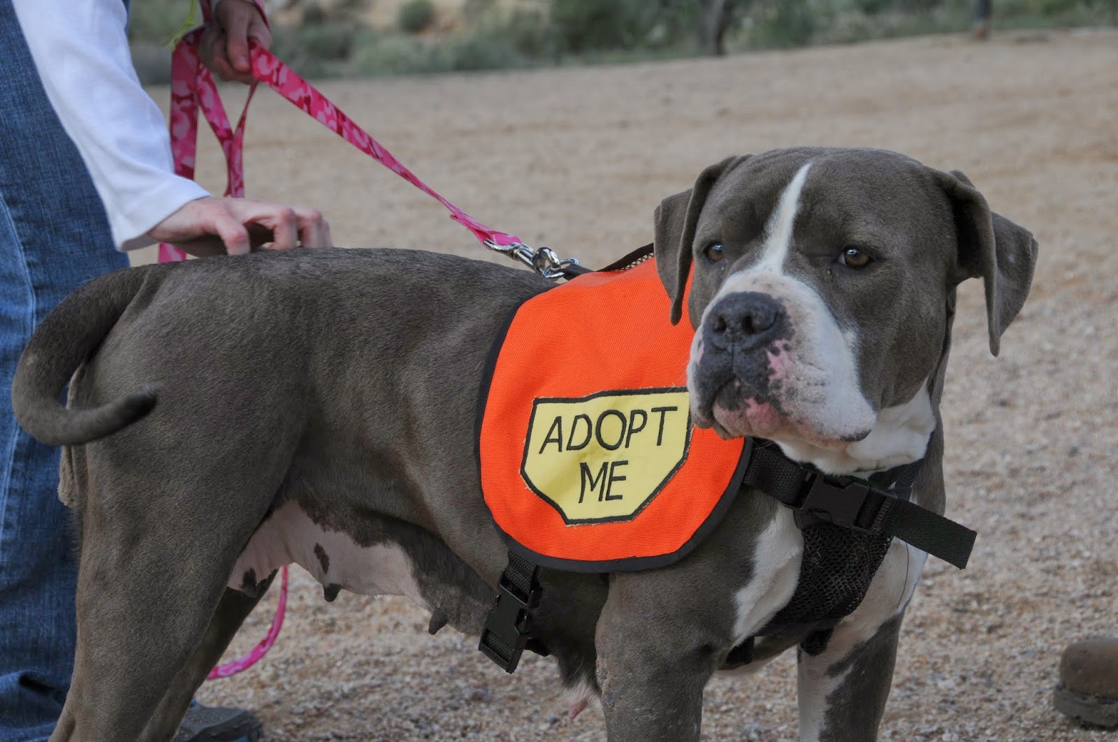
Beautiful Cassiopeia was adopted after the Feb. hike!

EVENT IS CANCELLED: because it will be raining cats & dogs on Saturday---please join us on April 5th!

There are only 2 more Wag & Walk dog adoption hikes to go before we take a break until November.  The next hike  with Maricopa County Animal Care adoptable dogs will be Saturday, March 1,2014.“Wag & Walk” hiker dogs are already spayed or neutered and available to go home on the spot, usually at reduced adoption fees.  Many of the dogs who participated in these hikes have found their "fur-ever" homes, and all of them certainly enjoyed strutting their stuff on the trail. 
The dogs also inspired some (human) hikers to become Day Foster Volunteers.  This special team takes dogs out of the shelter for a day, weekend or a few hours to walk, socialize or just to get some quiet time and extra attention.  Sound interesting?  Sign up here: http://www.maricopa.gov/Pets/help.aspx

Denver the dog works the crowd
Cooper on the February hike

LENGTH: 1-mile loop (Merkle Trail)
ELEVATION: 1950'
RATING: easy, barrier-free
FEE: $6 park entry fee per vehicle
FACILITIES: picnic tables, restrooms, water,
GETTING THERE:
3939 N. Usery Pass Rd., Mesa AZ 85207
From Phoenx, travel east on US60 to the Ellsworth Road exit.  Go north on Ellsworth to the park entrance.
DATE/TIME: Saturday, March 1, 2014 at 9 a.m. at the Merkle trailhead (area 6 parking).
INFO: Maricopa County Parks & Recreation, 480-984-0032

Wednesday, February 12, 2014

MESCAL TRAIL


MESCAL-LONG CANYON-DEAD MANS PASS TRAIL LOOP
Sedona

A relatively new addition to the sanctioned stock of Sedona hiking trails, this one originated as a mountain bike route. As with many wheel-wrangled paths, the Mescal Trail is big on challenging terrain and vertigo-inducing exposure.  Beginning at roughly a mile into the trek, the gaping, U-shaped bend on the flanks of Mescal Mountain known as "the bowl" comes into view. Here, the trail seems to disappear into the russet sandstone making the traverse of the cliffs appear impossible. Within a few yards, a wood sign marks a brief section where the trail splits---one side is "difficult", the other "extreme". Pick your poison. Although these ratings pertain mostly to bike technicality, I chose to err on the conservative side by taking the "difficult" arm and found that, except for some slick rock and edgy narrows, it wasn't too tough. The path soon becomes clear and after another mile-and-change of semi-queasy ledge hiking, the route rounds the mountain to meet Dead Mans Pass Trail at the border of Red Rock Secret Mountain Wilderness and Boynton Canyon.  Straight ahead is the Kachina Woman vortex site---a popular spiritual retreat and platform for musicians who fill the canyons with soulful strains of Native American flute or didgeridoos. Mescal Trail ends here, however, a map at the junction shows how to use Dead Mans Pass and Long Canyon Trails for an optional loop back to the trailhead.


LENGTH: 4.8-mile loop
RATING: easy-moderate
ELEVATION:  4239' - 4723'
FEE: a Red Rock Pass is required. $5 daily fee per vehicle.

GETTING THERE:
From the US89A/AZ179 traffic circle in Sedona, go 3 miles west on 89A (left, toward Cottonwood) to Dry Creek Road (FR 152C), turn
right and continue 2.9 miles to Long Canyon Road (FR 152D), turn right and go 0.2 mile to the trailhead on the right. Trail begins across the road. This route can also be accessed via the Long Canyon trailhead 0.3 mile farther up FR152D.
MESCAL-LONG CANYON-DEADMANS PASS TRAIL LOOP:
Follow Mescal Trail 2.3 miles to Deadmans Pass Trail, turn right (NE) and hike 0.9 mile to Long Canyon Trail. Turn right (S) and hike 1.6 miles back to the trailhead.
INFO: Red Rock Ranger District, Coconino National Forest, 928-203-2900
MORE PHOTOS:
https://www.facebook.com/media/set/?set=a.10200451788696003.1073741918.1795269672&type=1&l=17ead84093

Monday, February 10, 2014

BLUE WASH-CAMP CREEK


BLUE WASH-CAMP CREEK
Tonto National Forest, north of Carefree

Sycamores along Camp Creek

The sandy, canyon-bound courses of Blue Wash and Camp Creek provide an interesting twist on desert hiking. During rainstorms, turbulent sheets of water pummeling off of the Cave Creek Mountains rush through these natural funnels that channel moisture into the Verde River. But, on most days, the rocky corridors are hikable mazes of boulders and rock jams settled in a soft-floored, multi-armed gorge that supports a community of willows, sycamores and bamboo plugged into precious groundwater. There's no "official trail" but well-worn footpaths ambling among house-high blocks of granite are reasonably easy to pick out in this quiet section of Tonto National Forest between Cave Creek Road and Bartlett Dam Road that's off limits to motorized traffic.  From the Cave Creek Road trailhead, the hike begins with a passage through "boulder alley" where there are three tricky spots that require some minor scrambling. At the 1.1-mile point, Blue Wash intersects with Camp Creek at a wide "T" junction. Turn left (northeast) here and hike 0.28 mile to visit Camp Creek Falls---a box canyon grotto with spring-fed water cascades and drop pools. Once done exploring the falls, return to the "T" and hike south down the wash another 3 miles to the turnaround point at Bartlett Dam Road. Actual mileage may vary slightly because there are multiple paths through the canyon.
"boulder alley"


LENGTH: 8 miles roundtrip
RATING: moderate
ELEVATION: 2640' - 3200'

GETTING THERE:
NORTH (Cave Creek Road) TRAILHEAD:
From Loop 101 in Scottsdale, take the Princess/Pima exit 36 and go 13 miles north on  
Camp Creek Falls
Pima to Cave Creek Road (a.k.a. Seven Springs Road and FR24). Follow Cave Creek Road 6.5 miles to the gravel lot on the left just past the "Blue Wash #1" sign. Trail begins near the cottonwood trees across from the parking place.
SOUTH (Bartlett Dam Road) TRAILHEAD:
From Loop 101 in Scottsdale, take the Princess/Pima exit 36 and go 13 miles north on Pima to Cave Creek Road (a.k.a. Seven Springs Road and FR24). Follow Cave Creek Road 4.1 miles to Bartlett Dam Road, turn right and continue 2.8 miles to the trailhead on the left.

MORE PHOTOS:
https://www.facebook.com/media/set/?set=a.10200447108459000.1073741917.1795269672&type=1&l=647804239f

Wednesday, February 5, 2014

South Mountain Park "Spring into Nature" Event, Feb 23, 2014


SPRING INTO NATURE EVENT AT SOUTH MOUNTAIN OFFERS OUTDOOR FUN
Phoenix Parks and Recreation Department Press Release:
South Mountain Park

    Live animal displays, guided nature walks, a climbing wall, and introductory archery clinics will highlight the free “Spring into Nature” outdoor celebration at South Mountain Park Feb. 23 from 10:30 a.m. to 2:30 p.m. The Phoenix Parks and Recreation Department is sponsoring the event in partnership with a host of other outdoor and public land agencies.
     The event is scheduled on the park’s designated Silent Sunday, so participants can park in the parking lot of the Activity Complex, 10919 S. Central Ave., and enjoy the festivities before heading out on bikes on the park’s roadways, which will be closed to motor vehicles. Visitors also can take a spin on a tandem bicycle provided by Syncd-N as well as try hand bikes designed for people with limited mobility or sight impairment, provided courtesy of Daring Adventures.            
     Groups and organizations that will be on hand with games and fun activities include Arizona Game and Fish Department, Arizona Herpetological Society, Liberty Wildlife, Leave No Trace, REI, National Civilian Community Corps, and Phoenix Police.
     More information on the parks, preserves and recreation facilities of the Phoenix Parks and Recreation Department is available online at phoenix.gov/parks. 
http://phoenix.gov/parks/trails/locations/south/

Monday, February 3, 2014

BOX CANYON


BOX CANYON of the HASSAYAMPA RIVER
Wickenburg

For most of its 100-mile course, the Hassayampa River flows only in subterranean channels.  But for roughly 14 miles, bedrock buoys the water above ground. Two of the easiest access points to the wet sections are The Nature Conservancy's Hassayampa River Preserve and Box Canyon.
While the preserve area is a quiet place with beautifully tame riverside trails, "The Box" is an outdoor recreation free-for-all. Hikers and equestrians share the waterway with motorized traffic, gold panners and raucous families with kids and dogs.  From the parking area, a rugged Jeep road descends from the lip of the canyon to the river gorge.  Here, the exploratory trek heads off in both directions.  Turn west to visit the rubble of defunct Mistake Mine, or go east along a water-hopping route that leads through the most spectacular section of the canyon where vertical walls of conglomerate rock pinch the water into lacy rivulets and shifting sandbars before exiting into the spillway of Dinosaur Wash. The canyon narrows are about a mile in length, and water levels vary with rainfall, so, be prepared to get your feet wet.


LENGTH: up to 1.5 miles each way
RATING: moderate
ELEVATION: 2295'-2240'
GETTING THERE:
From the US60/93 traffic circle in Wickenburg, go 4.6 miles north on US93 to Scenic Loop Road at milepost 195.  Turn right, drive 6.8 miles, take the right fork at a BLM "no dumping" sign and go 0.1 mile to the parking area. Scenic Loop is sedan-friendly graded dirt, however, some sections may wash out during heavy rain.

INFO: Bureau of Land Management, 623-580-5500

Saturday, February 1, 2014

EARTH & SKY at USERY MOUNTAIN PARK


MOON ROCK TRAIL & THE STAR IN ORION'S ARMPIT
Usery Mountain Regional Park

Moon Rock Trail

Admit it--this trail's name got you wondering, right? So, is the tread way littered with lunar debris? Sort of.  According to park Interpretive Ranger Brennan Basler "Ranger B", the trail's moniker derives from the fact that both moon rocks and those that line this trail are igneous in origin. So, except for stronger gravity, the foot feel here would be similar to what the Apollo astronauts experienced.  Additionally, the park has much to offer geology and astronomy buffs. On the terrestrial level, the park is situated in the complex volcanic landscape of the Goldfield Mountains. The rugged terrain was created by fiery eruptions, lava flows, churning magma cauldrons and waves of ash laid down layer-cake-style over millions of years. This part of the earth is quieter these days, and although the rock's rough-edges are being smoothed by the elements and adorned by Sonoran Desert life, the area's natural history is preserved in trailside cliffs and gullies.
Above the park, a nighttime canopy of stars and planets is celebrated with an astronomy expert during stargazing events. The final telescope-peeping night out of the season will be held Saturday, Feb. 22, 2014 which is the perfect time to view a waning moon, and the planet Jupiter hovering above constellation Orion--the club and shield-wielding hunter.  Orion dominates the winter sky and includes one of the largest objects in the universe visible to the naked eye---the star Betelgeuse (say: beetle juice) in its armpit. The variable red super giant’s girth is about 1000 times that of our sun and if it were placed at the center of our solar system, it would engulf Mercury, Venus, Earth, Mars and maybe even Jupiter. But, get out there to see it soon--it's nearing the end of its stellar lifecycle and will likely explode in super nova style in the next few thousand years, which in geological time, is tantamount to a wink.
Blevens Trail

LENGTH:  3.5-mile loop
RATING: easy
ELEVATION: 1860’ – 1895’
FEE: $6 daily fee per vehicle
GETTING THERE: 3939 N. Usery Pass Road, Mesa AZ
SUGGESTED HIKE USING MOON ROCK TRAIL:
From the trailhead staging area, hike 0.5-mile west on Blevins Trail (BL), connect to Moon Rock (MR) and continue 1.3 miles to Levee Trail (LV). Follow LV 0.5 mile to Crismon Wash Trail (CR-W), turn north (left), hike 0.9 mile back to BL, turn right and go 0.3 mile back to the trailhead.


STAR GAZING EVENT: Saturday, Feb. 22, 2014 at 7:30 p.m. Group Picnic Area D.  Bring a lawn chair and dress warmly. No registration required.  No pets.
INFO: Usery Mountain Regional Park, 480-984-0032

Monday, January 27, 2014

PUPPY BOWL!


DOG ADOPTION HIKE: SATURDAY FEB. 1, 2014
Usery Mountain Regional Park

"Nazareth" participated in the January hike

With Super Bowl weekend comes your chance to enjoy the big game in a huddle with a new best buddy. This Saturday,  the public is invited to tackle the Merkle trail along with adoptable dogs from Maricopa County Animal Care’s Mesa shelter. “Wag & Walk” hiker dogs are already spayed or neutered and available to go home on the spot, usually at greatly reduced adoption fees. Many of these dogs have been waiting to find their forever homes for a very looooong time.  Could YOU be the hero that carries them the final yards for the "touch down" they've been dreaming about?  Even if you’re not looking for a new fur baby, hiking among a pack of happy tails makes for a memorable morning in the desert.

LENGTH: 1-mile loop
ELEVATION: 1950'
RATING: easy, barrier-free
FEE: $6 park entry fee per vehicle
TIME: 9 a.m.

GETTING THERE:
3939 N. Usery Pass Rd., Mesa AZ 85207
From Phoenx, travel east on US60 to the Ellsworth Road exit.  Go north on Ellsworth to the park entrance. Follow the main road to Merkel trailhead at PARKING AREA 6. 
INFO: Maricopa County Parks & Recreation, 480-984-0032