Find A Trail. Start Your Search Here:

Monday, July 25, 2011

SPRINGS TRAIL

SPRINGS TRAIL # 633
Pinetop-Lakeside

Tricking creeks, manic wildflowers and herds of bellowing bovines wandering among errant blue herons distinguish this high country hike from your standard walk in the park. Short in length and easy on the feet, the trail loops through wildlife-friendly pine groves, dewy cienegas and sun washed pastures. Two creeks contribute to the area’s lush plant and animal life---Billy Creek feeds a swath of swaying grasses while Thompson Creek spawns a ridiculously green and moist riparian corridor.
LENGTH: 3.8-mile loop
ELEVATION: 7,140’ – 7,190’
RATING: easy
DOG RATING: excellent
KID FRIENDLY: yes
DISTANCE FROM PHOENIX: 180 miles 1-way
GETTING THERE:
From Show Low, go southeast on SR 260 (toward McNary) to Bucksprings Road (located 2 miles before the Hon-Dah Casino).
Turn left at the stoplight and continue 0.6 mile to Sky-Hi Road (FR182), turn left and go 1.1 miles to the trailhead on the left.

Friday, July 22, 2011

MOUNT BALDY TRAILS RE-OPENED TODAY

The Apache-Sitgreaves National Forest has re-opened the West Baldy, East Baldy and Crossover trails for hiking and equestrian use effective July 22, 2011. However, rangers warn users to stay alert for downed trees and other damage caused by this year's Wallow Fire.

Wednesday, July 20, 2011

MOENKOPI

MOENKOPI (a.k.a. Jack's Canyon)
Near Winslow

UPDATE JULY 2012:  area is closed indefinitely due to damage from the Canyon Fire.
There’s a whole lot of nothing along AZ 87 between the dusty streets of Winslow and the edge of the Mogollon Rim.  From the highway, this dismal strip of badlands and tumbleweeds appears to hold little opportunity for outdoor recreation.
However, this grit-cloaked backyard of the boondocks holds a secret.  Just a few miles beyond the pavement, a fracture in the landscape harbors a lusty green oasis and some of the best sport climbing routes and exploratory hiking paths in the state. A short spur trail heading west (go left) from the trailhead register through a grove of junipers leads to the edge of Jack’s Canyon, which is also known as Moenkopi, a Hopi word meaning “place of running water”.  From here, a mildly steep trail drops from the sun-parched savanna into a grape vine-laced riparian corridor hemmed in by striated limestone walls. Myriad footpaths on the canyon floor weave among cottonwood trees, junipers and willows forming a maze of hiking options.  Adventurous hikers may choose to venture beyond the beaten paths to bush whack and scramble into the remote reaches of this Garden of Eden in the middle of nowhere. 

LENGTH:  up to 4 miles roundtrip
ELEVATION:  6,245’ – 6,097’
RATING:  moderate, exploratory
DOG RATING: fair
KID QUOTIENT: just okay
DISTANCE FROM PHOENIX: 153 miles one-way
GETTING THERE:
From Payson, go 62 miles north on AZ87 to milepost 313 (roughly 30 miles south of Winslow).  Turn left (west) onto Forest Road 9736F, pass the gate (close it behind you) and set your odometer.  At 0.3 mile, turn left at the fork, continue to another fork at the 0.5-mile point, veer right and continue 0.7 mile to the trailhead.  A high clearance vehicle is required.
FACILITIES: restroom, primitive camping
INFO: Mogollon Rim Ranger District, 928-477-2255

Sunday, July 17, 2011

ARIZONA TRAIL PASSAGE 34: BISMARCK LAKE TO SNOWBOWL ROAD

ARIZONA TRAIL PASSAGE 34: BISMARCK LAKE TO SNOWBOWL ROAD
Flagstaff
one of 3 aspen glens on the route


section of trail above Hart Prairie
One of the most scenic segments of state traversing Arizona Trail, Passage #34 (San Francisco Peaks) is 32.3 miles in length.  However, day hikers in search of a shorter out-and-back excursion can sample the prettiest (in my opinion) part of this passage by trekking from Bismarck Lake to Snowbowl Road.
Bismarck Lake was just a puddle on July 16, 2011
From the lake trailhead, the route heads east through shady fir forests and alpine meadows, meeting the turnoff for the lake at the 1-mile point.  From here, it’s 0.2 miles to the water.  The lake itself is a shallow volcanic crater that fills with water during spring snowmelt and monsoon season ranging in size from a tiny mud puddle to a substantial pond---you never know what you’ll find.  Once done exploring the lake, head back to the junction and continue 0.2 mile east (toward the mountains) to the Arizona Trail (AZT) junction.  Go right (south) here and begin the 2.5-mile trek to Snowbowl Road.  Along this segment, three hauntingly beautiful aspen glens break up wildflower-cluttered fields lined with Douglas fir and limber pines.  Views of the peaks are interspersed with glimpses of Hart Prairie, Kendrick Peak and Bill Williams Mountain to the west.  Near the end of the hike (you’ll know you're close when you pass the “Mexico 610 miles” sign), AZT intersects a two-track where a sign reading “Arizona Trail under construction” is visible across the road.  To get to Snowbowl Road from here, veer left and follow the dirt road uphill. There’s never a dull moment on this breezy, cool, high-altitude hike.
section of trail near Snowbowl Road

LENGTH: 8 miles roundtrip
RATING: moderate
ELEVATION: 8,800 -9,300 feet

GETTING THERE:
BISMARCK LAKE TRAILHEAD:
From Flagstaff, go north on US 180, pass milepost 225 and turn right onto FR 151 (south entrance to Hart Prairie Road).  Follow FR 151 6.4 miles to FR 627 (signed for Bismarck Lake), turn right and continue 0.6 mile to the trailhead. FR 151 and 627 are maintained dirt passable by sedan.
SNOWBOWL ROAD TRAILHEAD:
From Flagstaff, go north on US 180 to milepost 223 and turn right onto Snowbowl Road (FR 516). Continue uphill on FR516 roughly 6.5 miles to the “Aspen Corner” parking area.  Note: this is an unsigned pullout area on a curve in the road surrounded by wood, split rail fencing.  To find the trail from here, hike into the woods following an old dirt road beginning on the west (left) side  of Snowbowl Road for about 0.2 mile to the AZT intersection located just before where the road enters an open meadow.  At the intersection, take a right (north) and follow the signs.  Roads are 100% paved.


Friday, July 15, 2011

PHOENIX MAGAZINE SUMMER HIKING GUIDE

Still available by phone: call 480-664-3960 to order.
July 2011 issue

Costco Display

Hey hikers, pick up the JULY issue of PHOENIX magazine for some great summer hikes---not found on this blog!
All trails have been personally hiked, photographed and reported by yours truly, and, so far, none of these trails are on fire.
Here’s where you can find PHOENIX magazine: Safeway, Fry’s Marketplace, Wal-Mart, Costco, Sam’s Club, Sunflower Markets, Sprouts, Borders, Barnes & Noble, CVS, Walgreens, Sky Harbor Airport, Albertson’s, Fresh & Easy, Lowe’s, Home Depot, Target, Whole Foods, Basha’s, A.J.’s, La Grande Orange, The Kitchen, Area hospital gift shops WEB SITE: http://www.phoenixmag.com/ ORDER BY PHONE : 480-664-3960

ROSE CANYON LAKE

ROSE CANYON LAKE
Santa Catalina Ranger District, Coronado National Forest
With its pleasantly cool, canyon location on Mt. Lemmon, nearby camping, and convenient access to restrooms, drinking water and even a snack shack, Rose Canyon Lake draws the crowds on hot summer days. A 0.4-mile paved trail on the west side of the lake stays close to the water and is suitable for strollers, wheelchairs and walkers while a dirt trail on the opposite bank climbs to scenic rocky perches. Both trails are complemented by seating and plenty of shade making for effortless exploring around this tiny high altitude lake.


LENGTH: 0.7 mile total
ELEVATION: 7,000’
RATING: easy, partially barrier free
DOG RATING: dogs must be on leash and stay out of the water
KID FRIENDLY? absolutely
DISTANCE FROM PHOENIX: 150 miles one-way
GETTING THERE:
From I10 in Tucson, take the Grant Road exit 256 and go 8.7 miles east to Tanque Verde Road. Turn left and continue 3.4 miles to Catalina Highway, go left and drive uphill 17 miles to the turn off for Rose Canyon Lake (FR 9) between mileposts 17 and 18 on the left. Follow the access road to the end. Roads are 100% paved.
FEES: There’s a $5 Catalina Highway daily fee per vehicle and an $8 day use fee per vehicle at the lake.
FACILITIES: restrooms, supply store, camping, picnic area, drinking water
PROGRAMS: interpretive programs, fishing, no swimming or boating
INFO: Santa Catalina Ranger District, Coronado National Forest, (520) 749-8700

Tuesday, July 12, 2011

MOGOLLON RIM TRAILS RE-OPEN

The Tonto-Coconino National Forest closures  on the Mogollon Rim which have been in effect since June 17, 2011 have been LIFTED as of 8 a.m. this morning. This week's rains added sufficient moisture to the forests to prompt the opening. However, fire danger is still high, so, hike respectfully.
View from Rim Lakes Vista Trail

Monday, July 11, 2011

BLUE RIDGE MOUNTAIN

BLUE RIDGE TRAIL 
Pinetop-Lakeside

One of the major loop routes near Pinetop-Lakeside, the layout of Blue Ridge Mountain Trail #107 resembles a wagon wheel with “spokes” that link to the Ice Cave and Springs Trails. This shady, undulating roundabout smothered in oaks and pines, skirts the slopes of the volcanic mountain via old logging roads and tapered footpaths.  As the trail’s high point is wrapped in woodland, there’s no appreciable summit-conquering experience. However, a deteriorating sign at the apex marks the achievement while intermittent clearings reveal views of White Mountain peaks scattered over a misty blue horizon.


LENGTH: 8.7-mile loop
ELEVATION: 6,950’ – 7,656’
RATING: moderate
DOG RATING:  moderate
KID FRIENDLY?: moderate
DISTANCE FROM PHOENIX: 180 miles one-way
GETTING THERE: 
Trailhead #2:  From Show Low, go southeast on SR260 (toward McNary) to Bucksprings Road (located 2 miles before the Hon-Dah Casino).  Turn left at the stoplight and go 0.6 mile to Sky-Hi Road (FR182), turn left and go 1.5 miles to FR 187, turn left again and go 0.3 mile to the large trailhead on the right.
Trailhead #1:  from trailhead #2, continue up FR 187 roughly 3 miles to the parking area on the left.
INFORMATION: Pinetop-Lakeside Parks & Recreation, 928-368-6700 x 3,

Saturday, July 9, 2011

SOME APACHE-SITGREAVES FOREST CLOSURES LIFTED

Hikers, although some restrictions have been LIFTED, access to  hiking trails in the Springerville, Alpine and Clifton ranger districts are still off limits.  Hiking trails  in the Black Mesa and Lakeside ranger districts are now OPEN.


Arizona Game & Fish Press Release:

Good news for outdoor recreationists: Several forest closures lifted

   July 8, 2011
Big Lake


 Access is reopened to Big Lake and other popular areas There’s good news for anglers, campers and others  who like to recreate in high country areas that had been closed due to the Wallow Fire and other area fire concerns. The Apache-Sitgreaves National Forests has reopened several popular areas of the forests to public use. The Sitgreaves National Forest closure order affecting areas, roads and trails in the Black Mesa and Lakeside Ranger Districts and the Promontory Butte area was lifted as of noon yesterday (July 7). Stage 1 fire restrictions are currently in effect across the Sitgreaves portion of the Apache-Sitgreaves National Forests. These restrictions prohibit fires, campfires, and use of charcoal, coal or wood stoves, except in fire grills and grates provided by the Forest Service in developed recreation sites. Use of gas-fueled stoves, lanterns or heating devices is allowed. Smoking is not allowed except within an enclosed vehicle or building. The Apache National Forest closure order for several major recreation areas was lifted at noon today (Friday, July 8), including Big Lake, Crescent Lake and the adjacent developed campgrounds; the Greer lakes and the nearby developed campgrounds; Lee Valley and Winn Campground, Nelson Reservoir, and Luna Lake.   The specific areas opened in the Alpine and Springerville Ranger Districts include:

  • Big Lake and Crescent Lake Recreation Areas including: Big Lake boat ramps and parking areas, Big Lake Visitor’s Center; Big Lake Administrative Site, Big Lake store and marina, South Cove boat ramp and parking area, Railroad Cove boat ramp and parking area. Current access to Big Lake is by Highway 273 only (Sunrise Highway) as Highway 261 is still closed and unsafe for motor vehicle use due to damaged guardrails.
  • Greer Lakes Day Use Area including the following: Greer Lakes picnic area, Greer Lakes boat ramps and parking areas, Bunch Reservoir, River Reservoir, and Tunnel Reservoir. 
  • Lee Valley Reservoir Day Use Area including the following: boat ramp and parking area, and the lake itself. 
  • Rolfe C. Hoyer and Benny Creek Campgrounds and Squirrel Springs Picnic Area, Winn Campground, Springerville Ranger Station, Alpine Ranger Station. 

  • Luna Lake Day Use including the following: boat ramps and parking areas, Luna Lake Store and Marina, and the lake itself. 

  • Nelson Reservoir Day Use Area including the following: north end boat ramp, north end parking area, fishing piers, NFS land underlying Nelson Reservoir, and the lake itself.
Stage 2 fire restrictions will remain in place, which means that no campfires will be allowed, even in developed campgrounds. Lee Valley Reservoir, Luna Lake, Crescent Lake, and the three Greer lakes are for day use only.  Reservations at the Big Lake and Greer campgrounds can be made starting on July 8 by calling 1-877-444-6777 or on the web at www.recreation.gov . The Arizona Game and Fish Department’s Sipe Wildlife Area is also reopened to the public. Access is via the primary road from the north crossing Forest Service lands. Note that the last section of roadway crossing Rudd Creek into the wildlife area may be closed temporarily without notice if a flooding event occurs due to summer rains. This condition is expected to persist through the remainder of the summer.  Please note that the remainder of the Apache National Forest is closed to public entry at this time due to the many safety hazards present in the aftermath of the Wallow Fire. The Clifton Ranger District remains closed to public entry at this time until sufficient rain has fallen. Please check the Apache-Sitgreaves National Forests’ website at http://www.fs.fed.us/r3/asnf/ to view the Wallow Fire Area Closure Order and Public Safety Amendment No. 3 with a list of all roads opened for access on the Apache Forest. Forest Service Law Enforcement officials are concerned that the public may be tempted to venture into closed areas to look at the effects of the Wallow Fire, but they ask the public to please be patient as crews clear hazardous trees near the roads. As the summer rainy season progresses, the threat from high water in certain drainages is very real. Please stay in areas open for public use. Warning: The Forest Service reminds individuals who violate road closures that they could be cited resulting in fines of $5,000 for individuals, and $10,000 for organizations and/or imprisonment for not more than six (6) months.   You can check the 593 Public Information Line for further updates by calling (928) 333-3412, or on the website at http://593info.org , or the ASNF website at www.fs.fed.us/r3/asnf/ .


Thursday, July 7, 2011

HARRY I. DALTON-DRAGONFLY LOOPS


HARRY I. DALTON-DRAGONFLY LOOPS
Jewel of the Creek Preserve, Spur Cross Ranch Conservation Area
Entering the Jewel of the Creek

Riparian area

Relaxing in cottonwood air conditioning

Cave Creek


Don’t you just hate it when the National Weather Service issues a “heat advisory” with an “expiration date” of a few days?  Seriously, folks, if you live in the Valley, you know the “alert” has an annual effective date of May 1st through October 1st.  Given that outdoor recreation in triple digit heat can be deadly, this can be problematic for hikers.  Although driving north to hike in the pines is one way to escape the inferno, there are some sweet summer trails right here in the Phoenix area-- but you’ll need to start early and find a trail with cool cottonwoods. Standing beneath a cottonwood tree on a sweltering summer morning is like being in an air-conditioned room.  The trees suck up moisture at night and exhale cool air during the day, creating shady respites from the heat.

The Dragonfly Trail, which opened in April 2009, was engineered to showcase the desert foothills and thriving riparian environment along the perennial pools of Cave Creek, where lots of cooling cottonwoods grow tall and wide.  We can thank the efforts of the Desert Foothills Land Trust (DFLT) for securing the preservation of this delicate eco-system and for also raising the funds needed to plan for and build the trail.
NOTE: This hike describes only the 1-mile loop section of the Dragonfly Trail.  The entire route (part of the Maricopa Trail) is 2.6 miles in length and makes a great winter hike.
Another early morning summer destination brought to you by DFLT is New River Preserve (see separate blog entry).

LENGTHS: (including access road hike):
Harry Dalton Nature Loop: 0.75-mile
Dragonfly:  1.7 miles
RATING:  easy
ELEVATION: 2,400’ -2,200’
FEE: $3 daily fee per person (exact change is required at the self-serve permit kiosk)
DOGS:  please respect this fragile riparian preserve by keeping dogs on leash, and pack out all waste.
KIDS: excellent choice
HORSES: not allowed
GETTING THERE:
From Loop 101 in Scottsdale, exit at Cave Creek Road and drive 15 miles north to Spur Cross Ranch Road.  Here, you’ll turn left, then right, then left again through a tricky intersection to stay on Spur Cross Ranch Road.  Continue 4.2 miles north to the dirt parking area on the left just past the Spur Cross Stables (SCS) gateway.

INFO:
MARICOPA COUNTY PARKS:
DESERT FOOTHILLS LAND TRUST:

MORE PHOTOS:

Sunday, July 3, 2011

ICE CAVE

ICE CAVE TRAIL
Pinetop-Lakeside
Porter Creek

Porter Creek

Ice Cave

Turnoff for Ice Cave

Scott Reservoir

Although alluring images of icicles and dark, stony passages might come to mind when mulling over the name of this celebrated White Mountain trail, it’s best to approach this hike as a journey instead of a destination. That’s because the signature feature-- “ice cave”--is little more than an anticlimactic side trip on an otherwise striking trail.  Surrounded by chain link for preservation, the cave is actually a lava tube that spews cool air year-round. As a destination, this dusty sinkhole disappoints, but the beautiful journey picks up the slack.  The hike begins on a dirt road that passes by a row of ranch homes before encountering the marshy margins of Porter Creek where profuse clusters of cattails and fragrant grasses populate the dewy cienega that hosts the trail on its way to Scott Reservoir. At the 1-mile point, the route bends away from the water and begins a mild, pine-shaded uphill climb. The ice cave (a.k.a. Blue Ridge Cave) is located a few yards off the main trail near the 2-mile point where the protective fence is barely visible off to the left. The spur path is marked by a low rock wall and two blue diamond markers tacked to a tree.  After visiting the cave, hop back on the main route and continue for another 1.5-miles to Blue Ridge Trail #107 junction, the turnaround point for this hike.
LENGTH:  7 miles roundtrip
ELEVATION: 6,700’ – 7,200’
RATING:  moderate
DOG RATING:  3 paws
KID FRIENDLY?: moderate
DISTANCE FROM PHOENIX:  175 miles one-way
GETTING THERE:
From Show Low, go southeast on SR260 (toward McNary) to Porter Mountain Road (FR 45).  Go left at the stoplight and continue 1 mile to the trailhead on the right. 
INFO: Pinetop-Lakeside Parks & Recreation, 928-368-6700 x 3,

Tuesday, June 28, 2011

DAVENPORT HILL-DOG TOWN LAKE

 Kaibab National Forest, Williams
Davenport Hill Trail

Summit

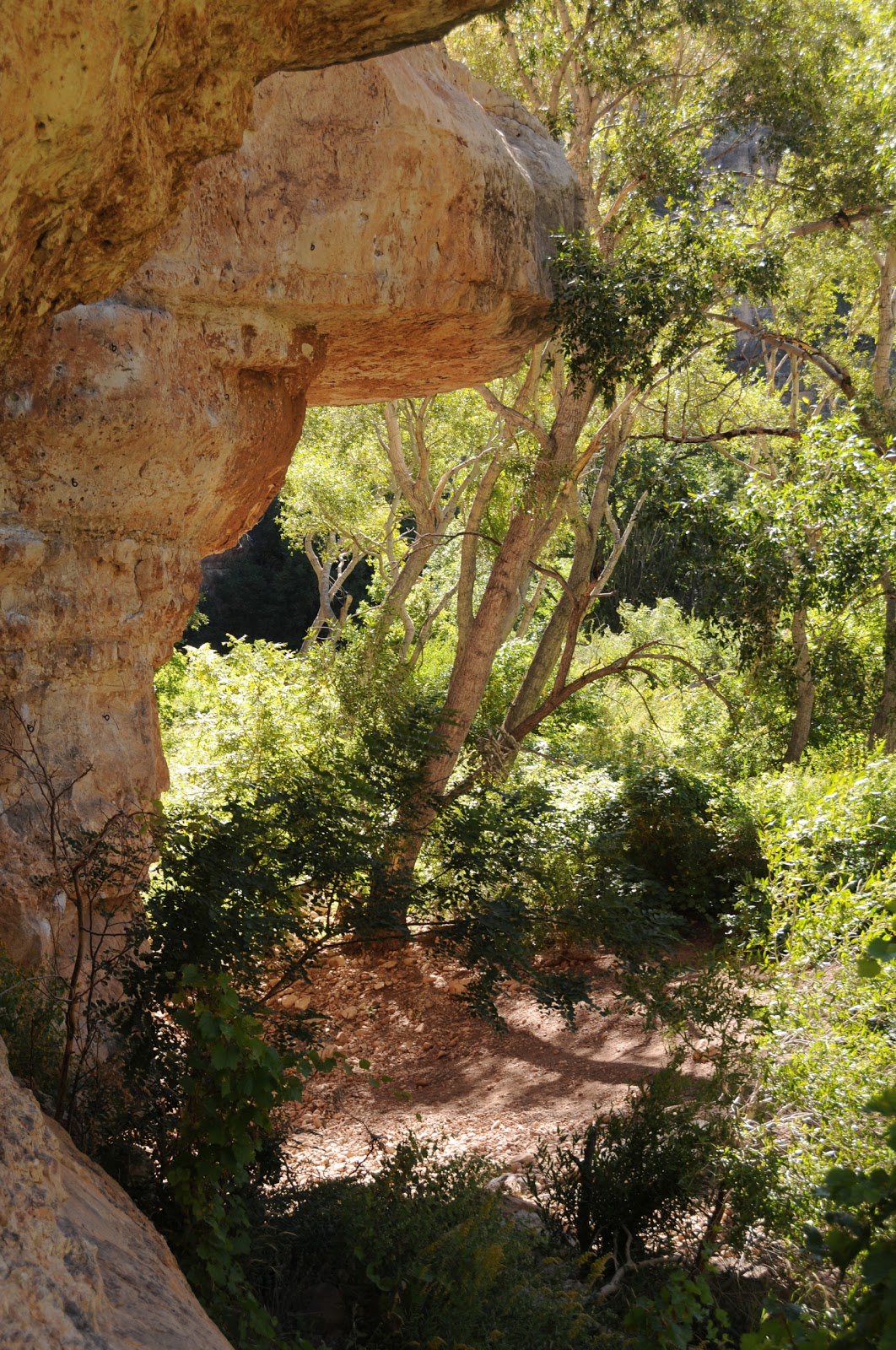
Trainspotting from  Davenport Hill

Dog Town Lake

Train whistles invoke a haunting, mournful yearning for the days when locomotives were the poster-technology of both the new frontier and old west.  Williams Arizona, with its buckskin-and-rail-tie-hybrid persona is one of few remaining places offering a serious locomotive “fix”. Home to a matrix of train depots and a main drag replete with saloons, malfunctioning neon and leather-clad, wandering “cowboys” spewing booze-addled folklore while engaging in mock shoot outs, Williams is a hot spot of activity in the middle of nowhere. Yup—it’s a loud, crowded, hokey-as-all-get-out slice of Americana anchoring the best preserved stretch of the “Mother Road”---historic Route 66.  People who like trains gravitate to this time warp of a whistle-stop (located 35 miles west of Flagstaff) for its perpetual clamber of metal on rails and diesel fumes.
Although it’s pretty easy to spend a day in town noshing at trackside joints like Cruisers CafĂ©, Doc Holliday’s Steakhouse or Pancho McGillicuddy's, a more alluring way to view the trains (and get some exercise to work off the Grand Canyon Brewing Co. beers that will have seduced you) waits 700 feet above town. To get there, just head a few miles south to Dog Town Lake where three shady trails feature easy hiking and high-altitude train spotting.
A hike up Davenport Hill trail offers aerial views of colorful freight cars gliding over expansive prairies below. Whether hauling human cargo or shipping containers bound for Wal-Mart, the trains put on a good show as they snake through town, cross the flatlands and disappear into forests of Ponderosa pines---a sight that’s impossible to see at street level.
In addition to Davenport Hill, two other routes depart from the same trailhead. Dog Town Lake trail is just a flat path used by anglers to access the best fishing spots along the shores of a pine-rimmed lake. The Ponderosa Nature Trail is a short, self-guided educational loop with signposts that correspond to information in booklets available at the trailhead, making it a good choice for kids and those who want a side order of learnin’ with their hike---or one of the amusing local brews.

LENGTHS: 
Davenport Hill: 2.5 miles one-way
Dog Town Lake: 1.8 mile loop
Ponderosa Nature Trail: 1-mile loop
RATING: easy-moderate
ELEVATION:  7,100’- 7,805’
FEES: none for hikers
FACILITIES:  restrooms, picnic tables, camping, fishing, boat ramp, site host and ranger programs
RULES: no swimming, dogs must be on leash

DISTANCE FROM PHOENIX:  184 miles one-way

GETTING THERE:
From Phoenix, go north on I17 to the I40/I17 interchange south of Flagstaff.  Go 30.3 miles west on I40 to Williams exit #165.  At the off ramp stop sign, go left and follow Railroad Ave. 2.6 miles to Fourth Street (a.k.a. Perkinsville Road, CR 73), turn south (left) and continue 3.8 miles to FR 140. Turn left onto FR 140 and go 2.8 miles to FR 132, go left again and drive 1.2 miles to the boat ramp/campground turnoff on the right.  Park in the boat ramp lot. Davenport Hill Trail begins at the Ponderosa Trail sign at the far, east end of the parking lot. Last few miles are on maintained dirt suitable for passenger cars.

INFO:  Williams Ranger District, Kaibab National Forest, (928) 635-5600

WILLIAMS RANGER DISTRICT, KAIBAB NF CLOSURE 2011

TONTO NATIONAL FOREST PARTIAL CLOSURE ORDER & MAP LINKS

East Webber Trail
Here we go folks, due to recent human-caused fires, our National  Forests are going into shut down mode. Major trails impacted by this closure include: Highline, W. Webber, E. Webber, Pine Canyon, Turkey, Geronimo, Pine View, Oak Trail, Redrock, Donahue, Babe Haught, Horton Springs, See Canyon, Derrick and Sinkhole.

Area closures on Tonto National Forest begin June 17, Fireworks prohibited at all times

Release Date: Jun 16, 2011  
PHOENIX(June 16, 2011) – Public safety concerns due to drought conditions, hot temperatures and increased fire danger have resulted in two temporary area closures on the Tonto National Forest beginning at 8 a.m., Friday, June 17--and will stay in effect until rescinded or August 31,2011 whichever comes first.  The two area closures are within the following boundaries:
1. All National Forest System Lands, roads and trails below the Mogollon Rim and North of the Control Road,  bounded by National Forest System Road 708 at the Fossil Springs Trailhead proceeding easterly along National Forest System Road 708 to the intersection with the power line road at the Southwest edge of the town of Strawberry; following the power line corridor southerly then easterly to the intersection of Forest System Road 583 at Tonto Natural Bridge State Park; continuing easterly on Forest Road 583 to State Highway 87; then northerly following  State Highway 87 to National Forest System Road 64 (The Control Road); thence easterly following  the Control Road to the Intersection with State Highway 260;  easterly along State Highway 260 to the Forest boundary at the top of the Mogollon Rim; and westerly along the Mogollon Rim and Tonto National Forest Boundary to the Fossil Springs Trailhead at Forest Road 708. 
2.  All National Forest System Lands, roads and trails within the Mt Ord, Four Peaks and Three Bar Wildlife Area,  bounded by the eastern edge of Highway 87 on the west beginning at the intersection with Forest System Road 143; on the north  along State Highway 87 to the intersection with State Highway 188; on the south along the western edge of Highway 188 to the Salt River corridor; on the west along the north side of the Salt river corridor including the north shores of Apache Lake, Canyon Lake and Saguaro Lake to Cottonwood Creek; northerly along Cottonwood creek to the intersection with Forest System Road 401, continuing northerly on Forest System Road 401 to the intersection with Forest System Road 143 and  westerly on Forest System Road 143 terminating at the intersection with State Highway 87.
Exceptions to this closure are the RV Dump site on the west side of State Highway 188 at Cholla Bay. The Tonto Natural Bridge State Park, highways 87 and 188 are unaffected by this closure, as are all county roads.
Also, most types of fire or fire-causing activities are prohibited across the Tonto National Forest. 
“Because of ongoing drought, dry forest conditions, and exceptionally low relative humidities, fire restrictions are needed to protect forest users, structures and natural resources from the increased potential for wildland fires,” said Tonto National Forest Deputy Fire Staff Officer Helen Graham. “These precautionary measures are intended to enhance our visitors’ quality recreation experiences. Most areas of the Tonto National Forest remain available for recreation activity, including all the Salt River system lakes.” 
Graham concluded:  “We continue to remind the public that all fireworks are prohibited on the forest at all times.”
Violation of these restrictions is punishable by a fine of up to $5,000 for individuals, $10,000 for organizations, and imprisonment for up to six months.  

  Click links below to view closure order and map.

CLOSURE ORDER:


  • CLOSURE MAP:
  • For more information regarding forest recreation sites and fire restrictions, please contact the Tonto National Forest at (602) 225-5200, or check online atwww.fs.usda.gov/Tonto  
    For general information on fire activity and restrictions in Arizona call toll free 877-864-6985, or visit the.Southwest Coordination Center website: http://gacc.nifc.gov/swcc or http://www.publiclands.org/firenews/AZ.php


  • Useful Websites:
    National Incident Information System www.inciweb.org
    Southwest Coordination Center:  http://gacc.nifc.gov/swcc
    National Interagency Fire Centerwww.nifc.gov
    National Fire Plan: www.forestsandrangelands.gov
    FireWise:  www.firewise.org

  • Friday, June 17, 2011

    PHOENIX MAGAZINE SUMMER HIKING GUIDE 2011


    STILL AVAILABLE BY PHONE ORDER 2011--HURRY!
    Hey hikers, pick up the JULY issue of PHOENIX magazine for some great summer hikes---not found on this blog!
    All trails have been personally hiked, photographed and reported by yours truly, and, so far (as of 6-27-11), none of these trails are on fire.
    Here’s where you can find PHOENIX magazine: Safeway, Fry’s Marketplace, Wal-Mart, Costco, Sam’s Club, Sunflower Markets, Sprouts, Borders, Barnes & Noble, CVS, Walgreens, Sky Harbor Airport, Albertson’s, Fresh & Easy, Lowe’s, Home Depot, Target, Whole Foods, Basha’s, A.J.’s, La Grande Orange, The Kitchen, Area hospital gift shops WEB SITE: http://www.phoenixmag.com/ ORDER BY PHONE (beginning 6-15-11): 480-664-3960

    Monday, June 13, 2011

    WALLOW FIRE MAPS

    UPDATE 7-28-11: Now that the maelstrom has subsided,  here's a collection of the BEST MAPS & LINKS for  Wallow Fire stats.
    JULY 1, 2011: Map shows degrees of damage.  Zoom in for excellent details!
    Latest map of the Wallow Fire 6-27-11.